
“Big Sky Country”.
As a history major, all I ever knew of the state of Montana growing up was General Custer and the Battle of Little Bighorn. I had no idea they had mountains. Years later I would come to learn it had mountains, and for some reason, I assumed being so far North from Colorado, that these mountains covered the entire state – like Alaska. In reality, the state is majority plains, as far as the eye can see. Driving up there, it can almost be overwhelming how long the flatness stretches on for. Talk about land locked, sometimes its hard to imagine water exists out there. But within the spine of the Rockies that extends through Western Montana lie peaks so mind bendingly beautiful, it more than makes up for the redneck towns, flat topography and emptiness of the East side.
The first time I spent any time in Montana was a trip to Bozeman to visit some friends. We skied at Big Sky, Moonlight and on the final day skied at Bridger Bowl – which had more inches of snow on the ground that morning (18 inches) than cars in the parking lot (I counted 13). I was immediately struck at the lack of stress with regards to Montana skiing. In the Front Range of Colorado, you have to be on the road no later than 6:00am in the hopes there isn’t a jack knifed tractor trailor or out of towner who thinks 4wd will save him in black ice. In Montana, things move a lot slower, but there is no less chance of a good thrill. In fact, its quite the opposite. There is no ski mountain in Colorado that boasts the type of vertical and acreage of Big Sky. 4700 continuous vertical feet, 375 to 400 inches of low density snow, plenty of acres to play around in for all levels and no crowds. I was shocked when we slept in till 7, went to a sit down breakfast burrito joint and made it to the free parking lot at 8:45 with a friendly old time driving a tractor to tow us to the base area. The lift ticket was 40% cheaper at the time than Vail, I thought they made a mistake. It took me the majority of the weekend to realize there is MUCH more to life than Colorado ski country.
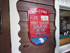
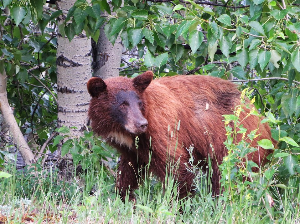
When preparing for this 10 day “vacation”, Kevin and Sarah fed me with ample amounts of stories of Grizzly bears, gore, horror and desolation – yet these were all powerfully intriguing to me. I remember sitting around a fire at the Mill Creek Campground outside Lake City over Memorial Day in 2011, listening to Kevin’s tales he relayed from Stephen Herrero’s “Bear Attacks”. Living in Colorado, there isn’t much to fear with regards to bear confrontations. You could use a prime rib as a pillow and the worst possible outcome would probably be small rodents. Marmots stealing your tent in the Weminuche is a more legitimate fear than a bear attack. One of the stories that stood out the most was the one of a lady car camping at the Many Glacier Campground in the late 70’s. Mary Pat Mahoney and her party did their due diligence making sure their campsite was bear proofed and they all ended up getting through the night with no issues. As morning light dawned, Mary was dragged from her tent and killed by a Grizz. I wouldn’t learn till physically arriving at the campground how amazing a scenario like that was.
After enough cups of coffee, we were able to formulate a rock solid itinerary that wasn’t 100% reliant on peak bagging. Glacier is taylor made for long hikes and loops due to its low elevation and extensive trail system. After reading Herrero’s book, at first I would’ve been fine just driving up and down the Going To The Sun road, but as time drew on, I realized how rare a grizz attack really would be. Whistles, noise, large groups and canisters of bear mace would be the name of the game while exploring Glacier. After a while, you forget nature’s most powerful predator are even around (but its always somewhere there in the back of your mind). By the end of the trip, I was begging to see one (from a distance of course).
The group stood at 5 compatriots, arriving from 3 different parts of the globe, but all sharing a sense of adventure. Svet, my good buddy from back home in Maryland, was flying in from Philadelphia, where he was living at the time. Svet spent the summer of 2009 interning at Dish Network in Denver and we were able to get out on a couple adventures together, most memorable being the climb of Longs Peak. After reading an account of a slot canyon trip in Moab from last Thanksgiving, Svet bought his ticket and was committed. Svet’s buddy Mark (my buddy as well) joined on at kind of the last minute and would be flying in from Seattle, arriving in to Kalispell and joining up with us at St.Mary’s before trying to find a campsite at Many Glacier. Mark usually comes out to ski Beaver Creek each winter, so this trip would be a nice change of pace. Kevin, Sarah and I rounded out the rest of the group and would be making the long haul from Denver.
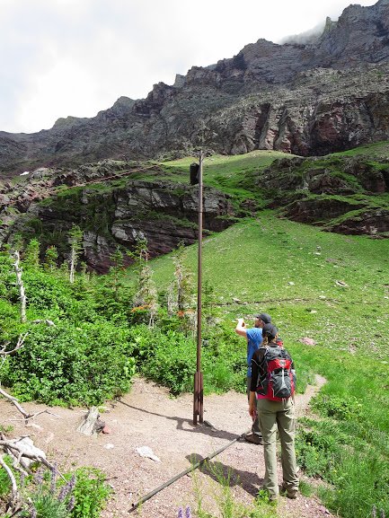
I picked up Svet from DIA late on the evening of the 3rd. We had 2 options : either get some shuteye and leave Denver around 6am, or just start driving and see where the road takes us. We chose the latter and ended up sharing driving responsibilities all the way to around the Montana border before pulling off the road to get a power nap. Half delirious, we drove through the plains of central Montana, with wind mill farms and stuff like this on the side of the road….
If a gaper wants admittance to heaven, they need to get past this guy at the Pearly Gates.
Wanting to experience the local flavor, we ate at the most redneck of diners in Sheridan, Wyoming and somewhere between Billings and Great Falls – we found Ray’s….

Svet feeling “cultured”.
At Ray’s, we decided to stock up on bear mace, imitation cowboy hats, red bulls and various other loose ends. It was apparent right away we weren’t in Colorado anymore. Some of these rest stops made Westcliffe or Kremmling seem pretty cosmopolitan. Just due north of Ray’s began the wind mill farms, which is always a surreal experience, seeing these giants tower over you as you drive through the heartland of America.

Wind Farms south of Great Falls.
This part of the drive was actually quite pleasant. Seeing the wind blow through the grasslands was soothing, there was a unique sequence of events at work with the wind, the grass and the lighting from the sun. It’s hard to put in to words.
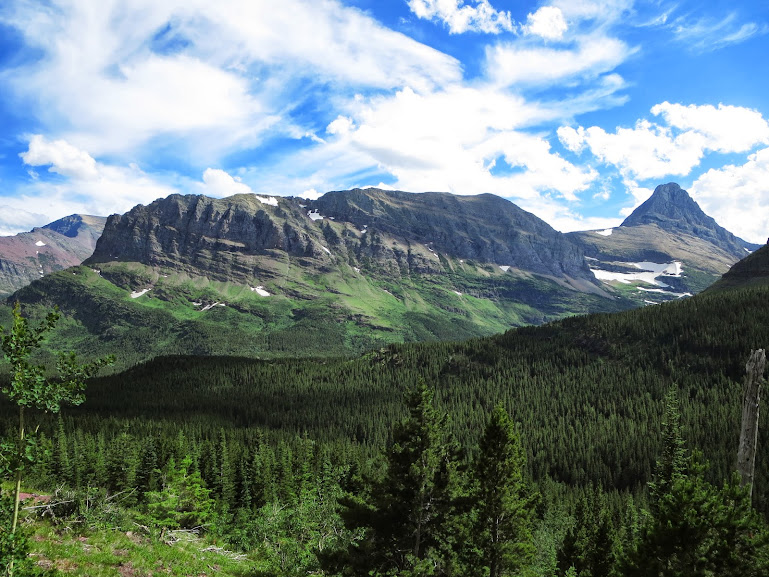
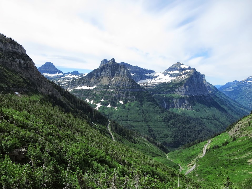
We reached Great Falls soon enough and loaded up on food and supplies at the local market. We were just ignorantly grabbing stuff off the shelves, filling the carts to the brim with pure junk and it was glorious. After a quick meal at the local Mongolian joint, we made way for our final destination – St. Mary’s, the eastern gateway to Glacier. We got our first glimpses of Glacier outside Browning, the main hub for the Blackfeet Indians.

First shot of the park.
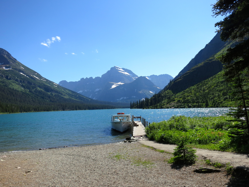
We touched down in St.Mary’s after an initial scenic tour and awaited Kevin and Sarah’s arrival. Ironically enough, the only service that worked in the valley was Verizon and, what do ya know, we both had AT&T. Nonetheless, it was refreshing to shut off the phone for 10 days, but it would initially make contact with Mark, Kevin and Sarah difficult. Pap and Woody arrived not too long after, we regrouped, got some ice and very last minute supplies in town and made way for Many Glacier in hopes of finding Mark and a place to sleep for the night. Within 30 minutes, we found Mark and learned he booked a room at the Swiftcurrent Lodge for the night. We took it in hopes of finding an open spot at the campground in the morning.

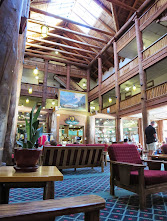
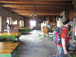
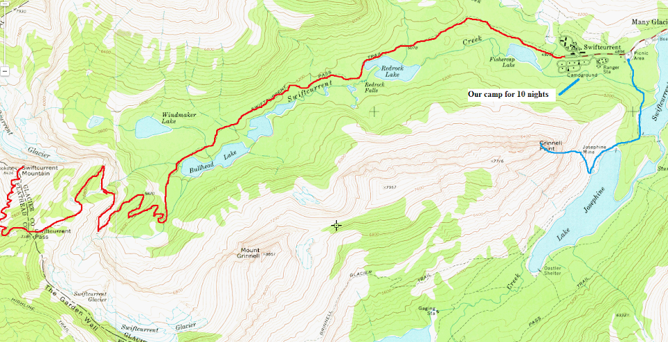
Our base of operations for the next 10 nights.
Svet, Mark and I took a stroll over to the Many Glacier Hotel and enjoyed the evening with a little taste of America
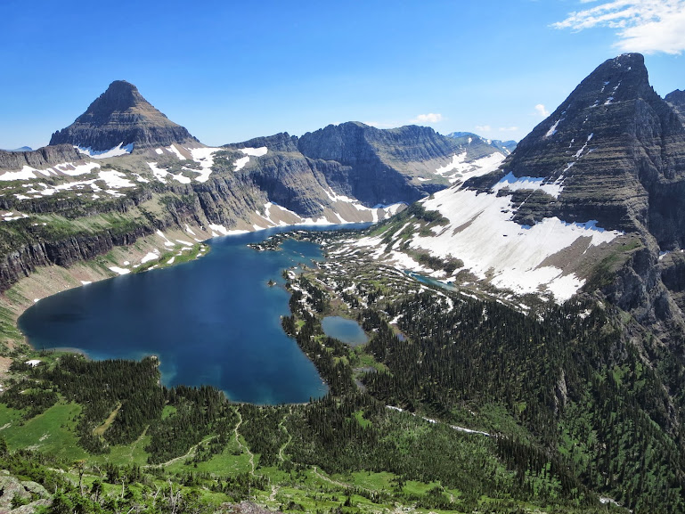
Day 2 – Cracker Lake
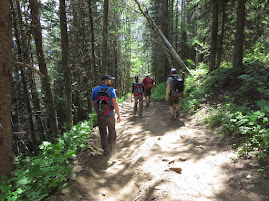
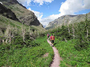
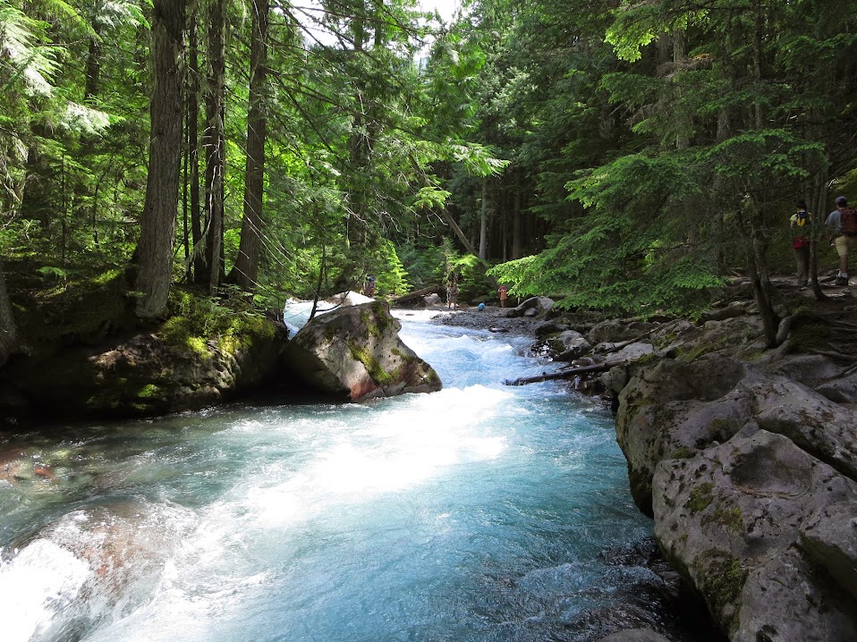
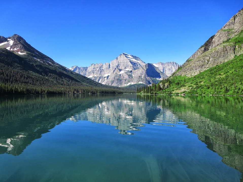
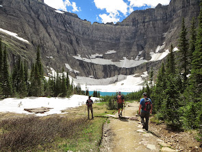
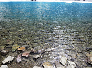
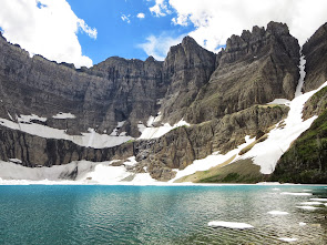
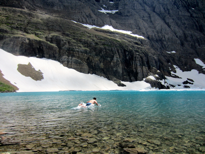
We woke up around 6am and immediately walked across the street to stake down a campsite. Amazingly enough, we found 2 sites right next to one another and claimed them. After checking out of the hotel, staking down our tents and organizing camp, we strapped on the boots for day 1 of hiking. The destination for the day was Cracker Lake, which was the perfect intro to what Glacier had to offer. 13 miles and minimal elevation gain. The hike is done mainly below treeline, with a wild finish to a basin that would give Chasm Lake and the Diamond of Longs a serious run for its money.
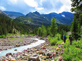
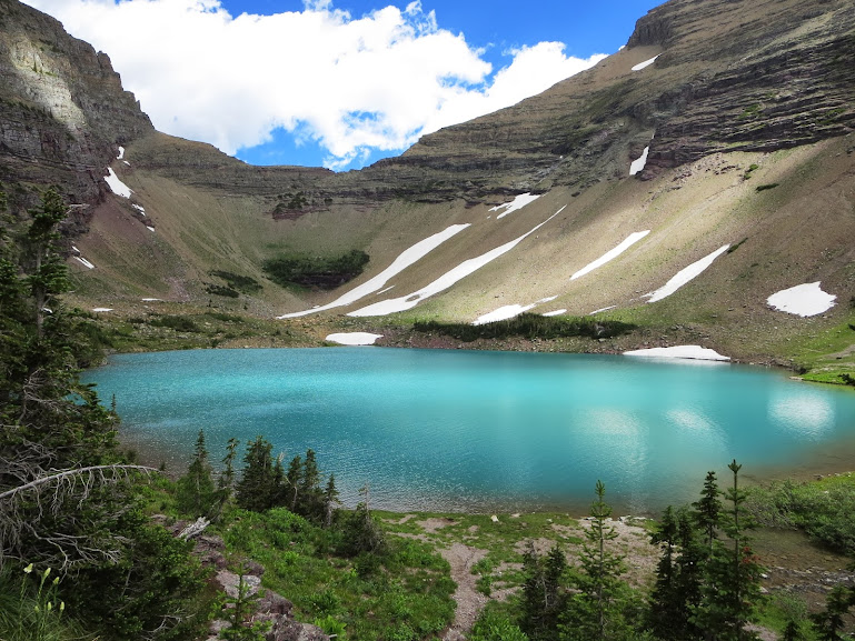
The lake itself is infamous for its unique milky blue color, which is fed by the nearby Siyeh Glacier. The silt (known as “rock flour”) is what gives the lake its turquoise color. Mount Siyeh, a local 10er towering 4,000 vertical feet above the lake, has its fair share of stories. J Gordon Edwards, author of “A Climbing Guide to Glacier National Park” talks about the “class 6” (yes – that’s a six) North Face. He doesn’t really bother with a description, he just lists 2 dudes phone numbers and leaves it up to the reader to determine their fate. For a little perspective, a class 3 route in Glacier contains enough excitement for a couple lifetimes – I can’t even begin to fathom what a class 6 is like, much less a class 4. Maybe I just need to grow a bigger set.
Anyways, Crakcer Lake was good enough for this group. Word on the street is the lake is even cooler in periods of overcast, as the turquoise radiates throughout the basin off the towering walls. We had a sunny day and it was still a fantastic view.

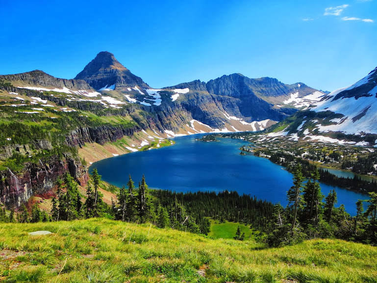
Cracker Lake.

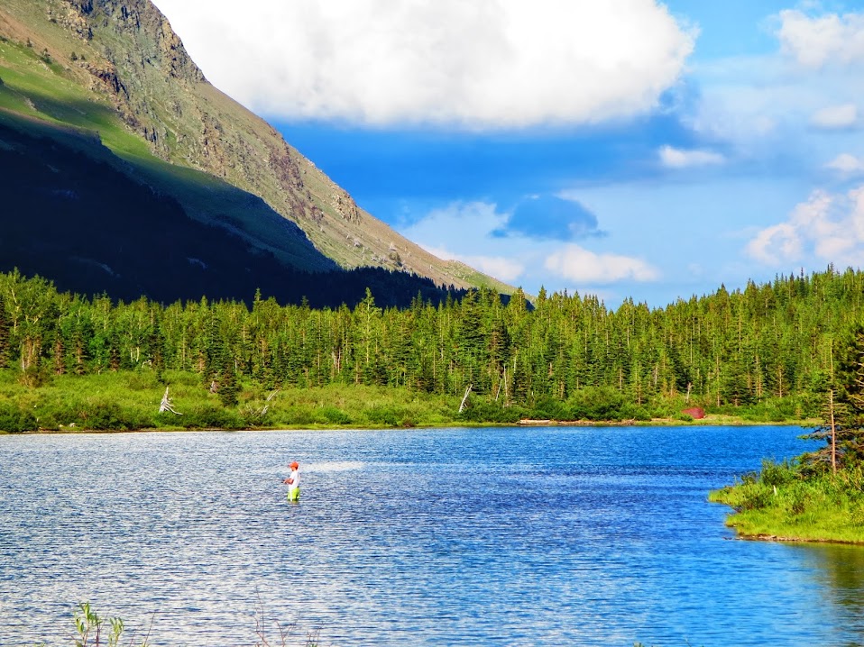
Mark either unaware or unamused of the fishing restrictions in the park.
We explored the rim of the lake, in sheer awe of the place. The lush green, the milky blue, the waterfalls and the towering vertical walls made this place something special. There was even a backcountry campsite that was setup a little differently than your average Rocky Mountain National Park spot. There were things like this….
And this…..
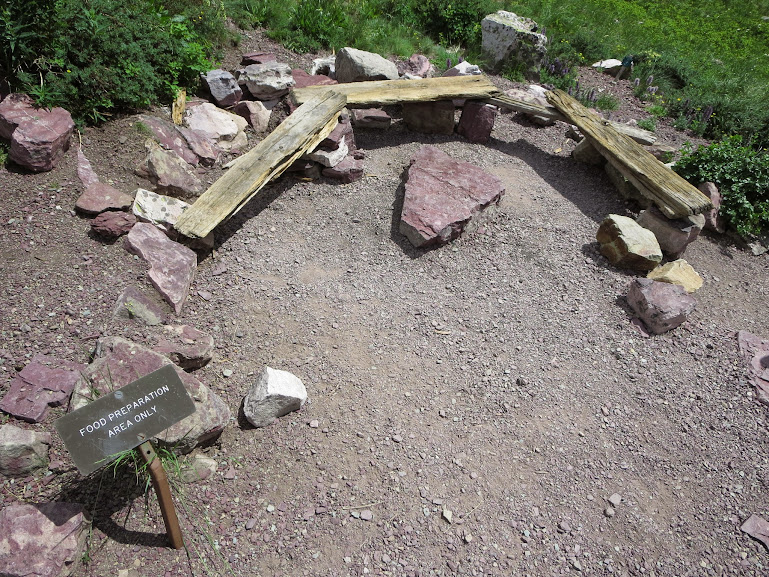
Needless to say – they don’t fuck around at Glacier. Just below the lake, some people hiking out warned of a mama and her cubs in the area. They took off a few minutes before we got to the lake, but it was a sobering reminder that this land does not belong to man, but to the bruins.
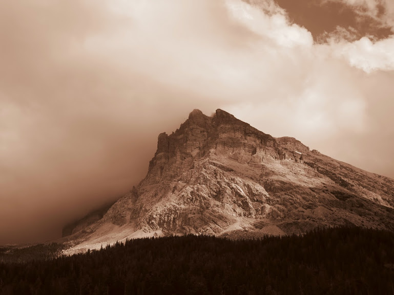
Sepia Mount Wynn.

Lake Sherburne – looks like Hawaii and Colorado, all wrapped in to one.
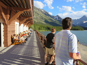
We checked out the Many Glacier Hotel once again after reaching the trailhead :
Historic Many Glacier Hotel.
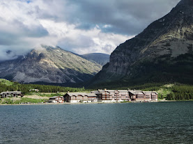
Many Glacier Hotel from trail near campground.
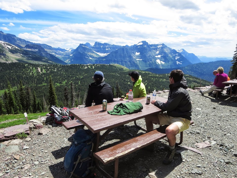
Once we reached camp, feast #1 ensued. The cool thing about being yards away from the Swiftcurrent Lodge were some primitive amenities – such as token showers, bags of ice, firewood and basic provisions in the general store. This allowed us to keep the cars parked in the same spot for the majority of the trip, other than when we drove up to Logan Pass. The access to hikes and peaks right out the gate from Many Glacier was unreal.

Ground Buffalo tacos with all the fixins – along with Waylon, Gordon and some Two Hearteds. Not bad.
That night we contemplated our next day’s itinerary. We were all jones’ing to get high and instead of beating around the bush, we went right for one of the more aggressive peaks on the itinerary – Reynolds Mountain. Around 9pm, the camp host would play “Military Taps” on the trumpet. Very cool. This happened every night. This must have been a cue for the camp to completely shut down, cause each night, we were the only site up with a fire and some tunes. We weren’t disrespectfully loud, just enjoying every minute of the time we had up there. It also stayed light till 10pm or so, which threw us off.
Day 3 – Virginia Falls and Reynolds Mountain
The morning brought some fog in need of burning off. The early afternoon sun would take care of it, so in the meantime we needed something to do. Going To The Sun Road provides an ample amount of plan B’s and we chose Virginia Falls a little down the road. Quick thing of note. Kevin and I had consumed quite a bit of Horsetooth “O Face” the night before and in the morning were making beelines for the men’s room. At one point, I heard the door open and a guy standing there waiting patiently for me to finish. I told him “Sorry buddy, I’m gonna be a while”. Without a verbal response, I hear the door open and shut. I later learned that the Swiftcurrent Motel men’s room was the way to go.
On the drive there, we did run in to this guy CHOWING DOWN on the local berry fields…..

These berries look like they could use a little Horsetooth Hot Sauce “O Face”.
And Logan Pass parking lot looked something like this…..

What to do?
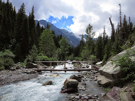
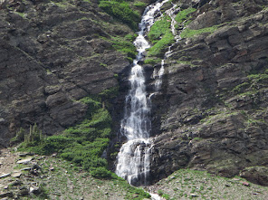
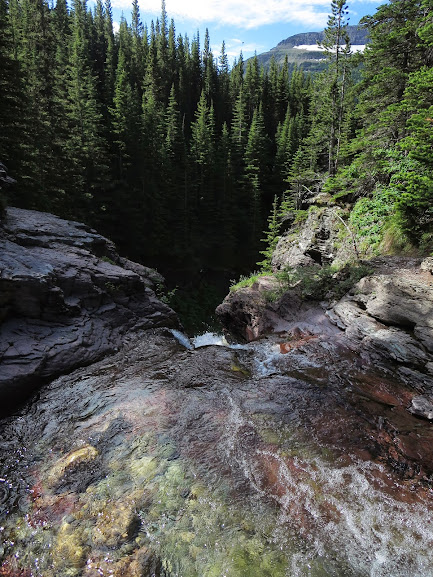
We drove back down the road and found the small parking lot right to Virginia Falls. This was a nice and easy, yet very scenic hike. The forests in Glacier are so insanely green and lush, it made the San Juans seem relatively pedestrian. Some shots of the area….

Never quite seen water like this in the Rockies. So pure.

1st set of cascades falls along the first bridge.

Another falls along the trail.

Virginia Falls.
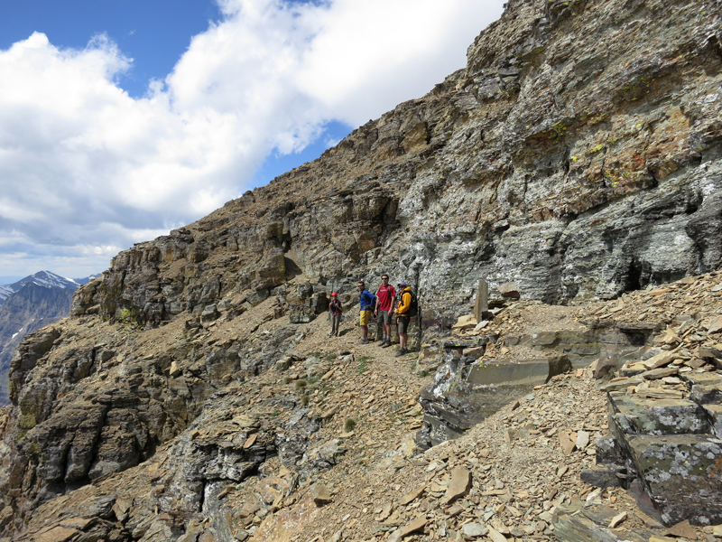
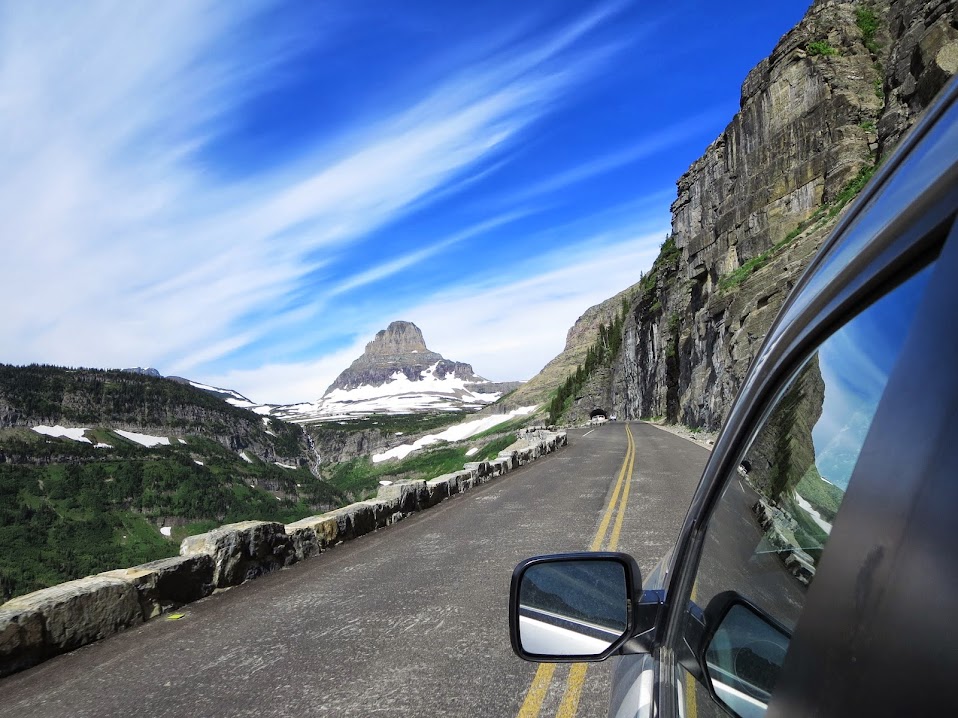
By the time the hike was done, the clouds had nearly burned off and we had blue sky upon reaching Logan Pass. Kevin bought a copy of the, at times, overly detailed “Climb Glacier National Park” by Blake Passmore, but it was more descriptive with color photos – 2 things J Gordon Edwards book did not have. We began right from the visitor’s center and up the Boardwalk (i.e. The “Gaperwalk”) towards the Hidden Lake Overlook saddle. We had to avoid goats and gapers to gain some semblance of solitude, which was gained remarkably not too far off the beaten path.
Going To The Sun Mountain looking East.
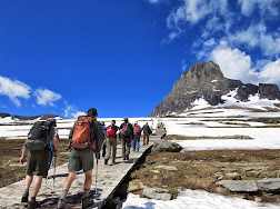
“Gaperwalk”.
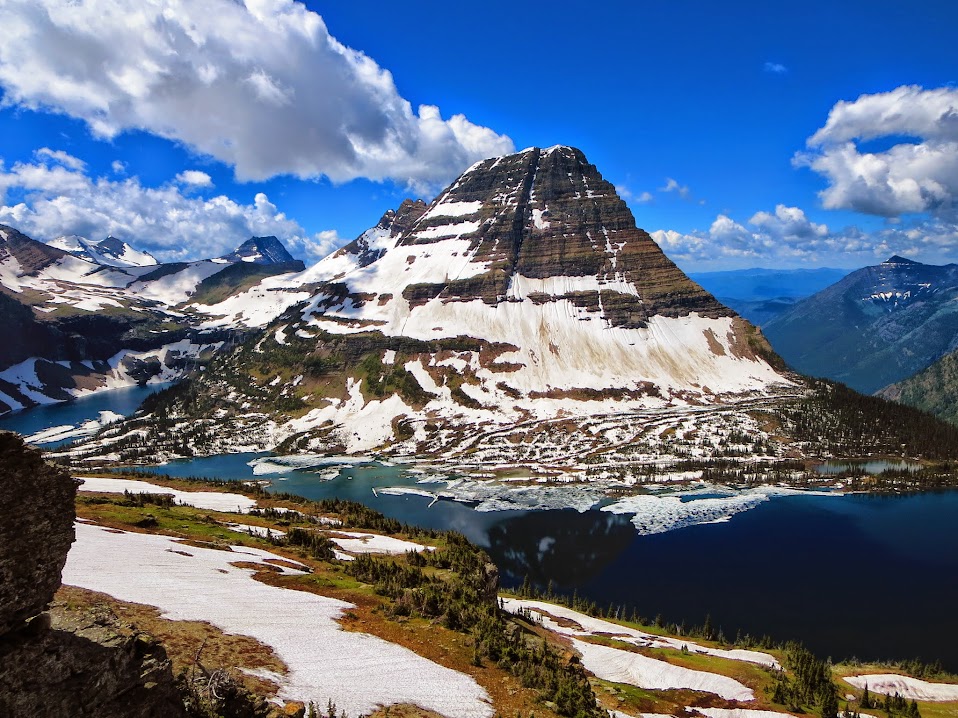
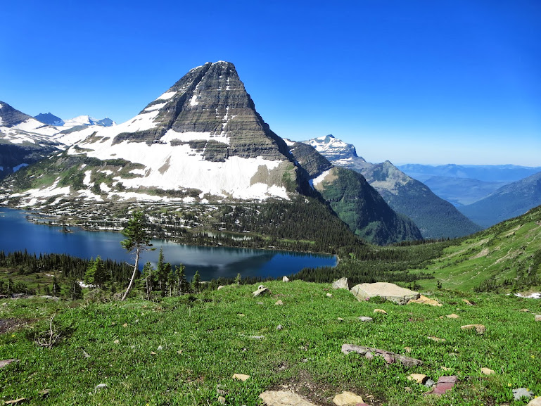
Bearhat and Hidden Lake. One of the many gems of Glacier NP.
The view from a ridge extending South from the overlook floored us all. We actually were so sidetracked, we got off route for 30 minutes or so, but the views were so incredible and the backtracking so trivial – we didn’t really care. Reynolds was towering over us to the South, kind of like Glacier’s version of Pyramid Peak, except the route is like the sidestep ledge section the entire time.

This section on Pyramid doesn’t hold a candle…..

To this…..
Or this (on Clements).
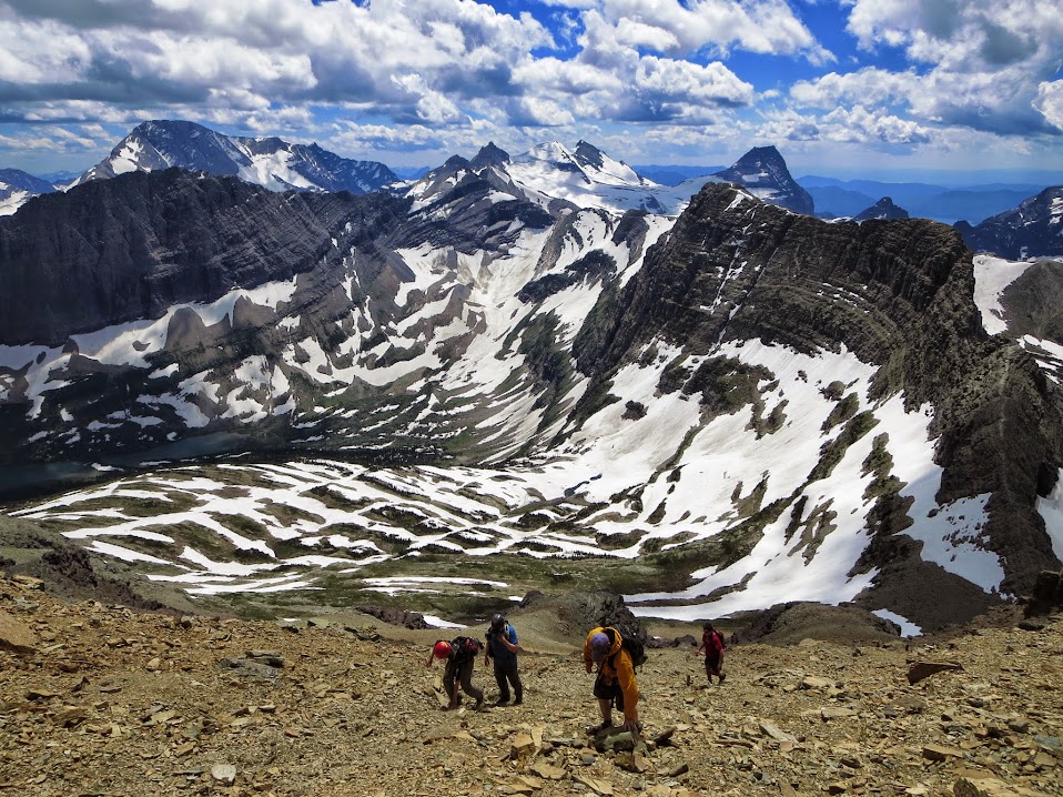
These mountains are freaky and a class 2 felt like an Elk Range class 4 with complex route finding. Class 3 was like taking a short section of tough class 4 in the Elks and lengthening it for sections that seemed like eternity. If you were to compare the 6 10ers in the park to the 58 14ers in Colorado – the 6 10ers accomplishment would be a night and day far superior accomplishment and I don’t think there is a soul on this earth to argue that. Some of the 10ers by themselves are a monumental effort- requiring 35-40 miles roundtrip approaches through the heart of Grizz country. Even the easiest of the class 2 slogs require goat ledge traverses with no fall terrain for hours, requiring your full attention at every step. Very mentally straining. Reynolds was probably the easiest of the 3 peaks we climbed on this trip and it still had some “I can’t believe this is actually the way” sections.

OK with being a little off route.

We encountered a moderate snowfield.
Then some Glacier scree.

And a few stout “class 2” moves (thats all air to the right of Svet).
“How you doin Mark?”
“Scared shitless Miller, but otherwise great!”
“Same here Mark, just don’t look down”
Nice little downsloping over 1000 feet of air goat ledge traverse.
And the views from the summit were something else. We met a local from Kalispell named Rick. The guy was like the Steve Gladbach of Glacier – we every drainage, been up just about every peak, had climbed with Viesturs before in the Cascades and didn’t seem to have an ounce of fear. It was a very welcome occurrence to run in to this guy.
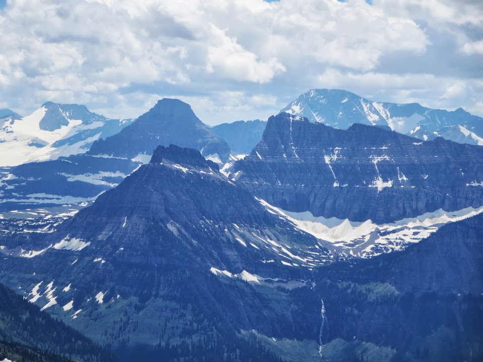
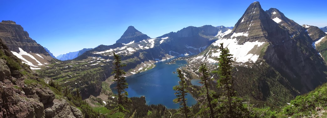
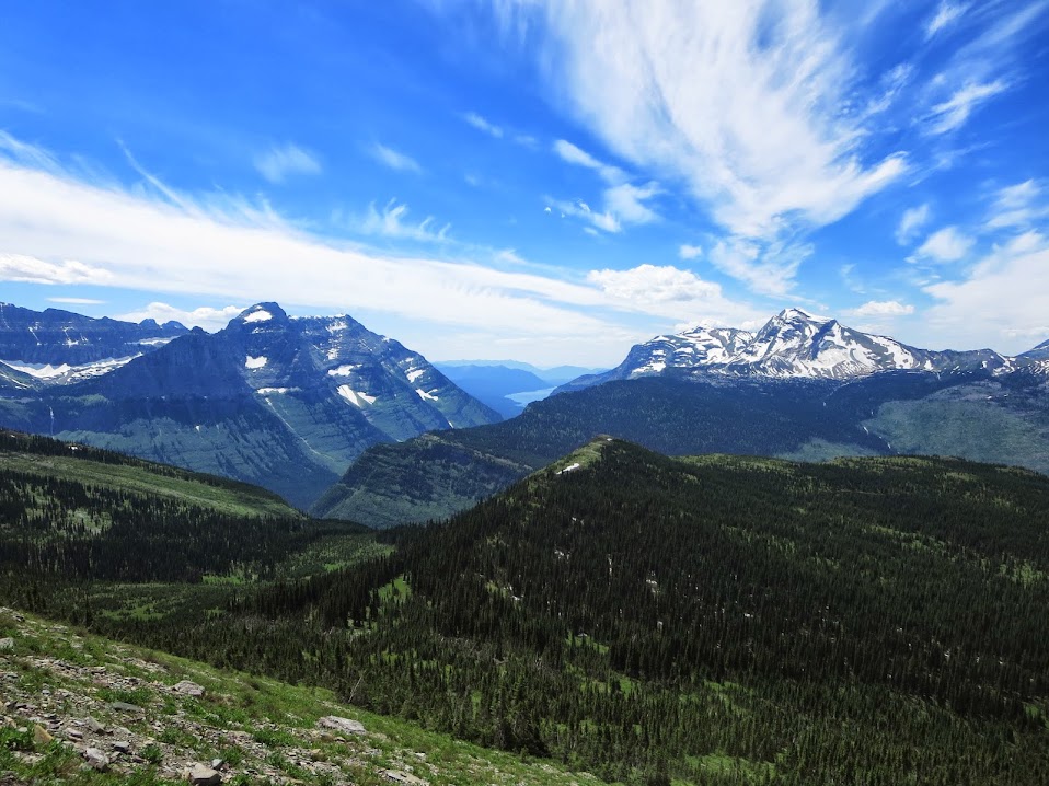
Some panos from Reynolds summit :
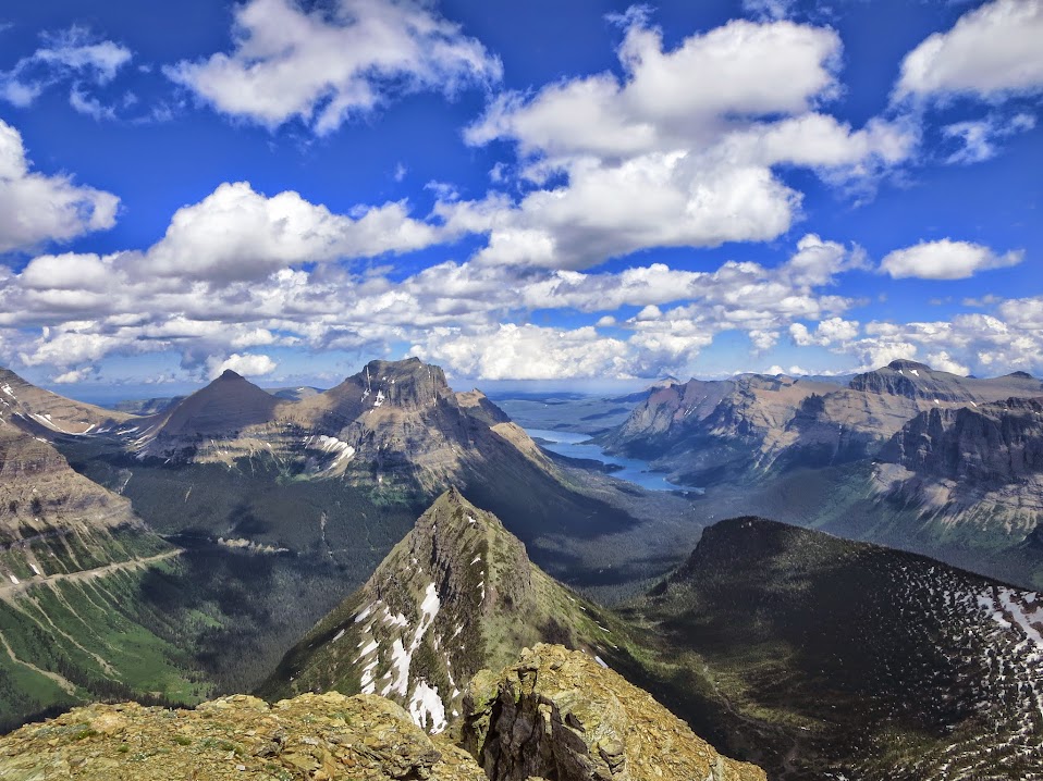
Looking East.

Looking South.
Looking North (Highline Trail and Garden Wall visible).

Looking West.
The descent was no less anxiety riddled as we had to try and navigate the way we came, which was no small task. Once we reached our trekking poles and had a safe trail all the way back to the visitor’s center – that’s when the fist pumps began. Rick accompanied us all the way back with tales of Glacier folklore. Fascinating stuff and a fascinating man – it’s a shame none of us took the time to jot his information down as he’d be a valuable, priceless resource for future endeavors in to the region. Some shots of the hike out :

Northern end of Hidden Lake. Lakes like this existed all over the park. You got spoiled seeing so much of it – sensory overload.

Svet in awe of what he just climbed.

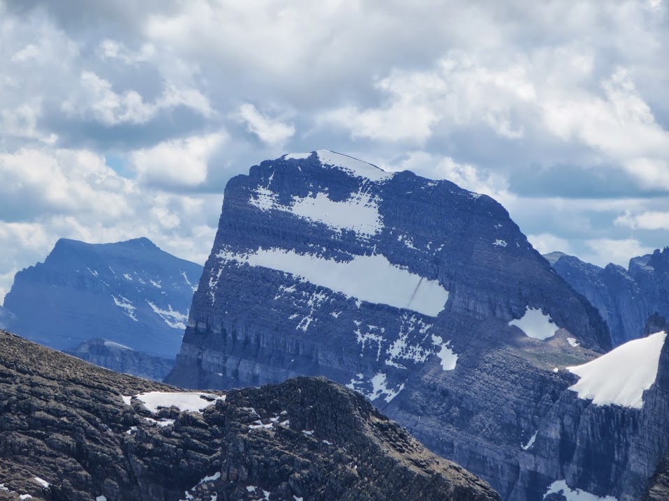
Reynolds close up. Notice that ledge traverse that splits the North Face. That’s a route. Where you go from the way left is beyond my comprehension.

That’s Rick (and Mark).
We sat on a rock before rejoining the herds and all sipped on a couple Modus, feeling proud of our recent summit. It was a unique sense of accomplishment and a sigh of relief, since so much of the route up Reynolds was no fall terrain, even the class 2 ledges. As we were sitting there, we noticed over yonder a group of people hiking up a loose scree slope to obtain the ability to glissade down a permanent snowfield with a rocky runout. Sadistically, a few of us were hoping for some drama, but Glacier gapers seem to have a tad more eye-hand coordination and athletic ability than your average gaper. They could glissade down a snowfield and stop themselves on a dime and they were cognizant of inherent danger – which very well may disqualify them from gaper status. Nonetheless, it was endearing to watch.
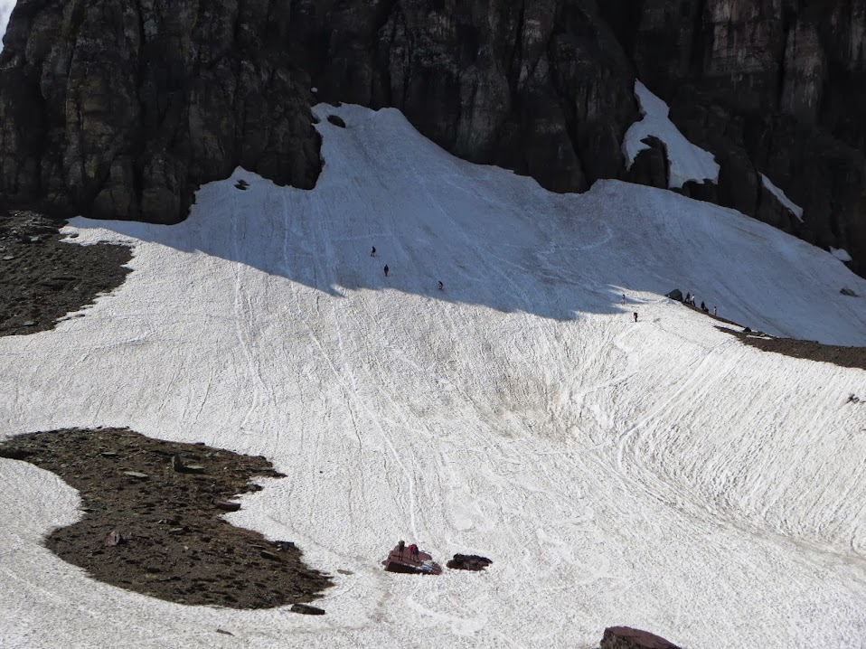
Gapers with skillz.
Before reaching the car, we paid this guy a visit in the Visitor’s Center.

Summitpost’s “The Chief” reincarnated.
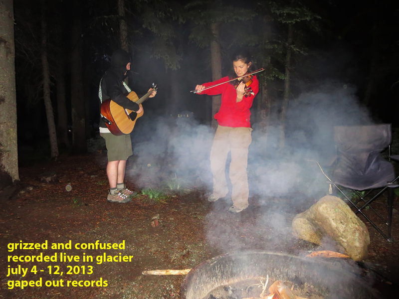
That evening was a special occassion. Still on a high off our unexpected epic day on Reynolds and after listening to another nightcap of “Military TAPS” – the Dogfish bombers started to make circulation and we were graced with the presence of one of Bulgaria’s finest violin players – Virginia Petrova. Virginia was a local park employee working at the Swiftcurrent gift shop. With a fellow Bulgarian in Svet, she came to visit each evening till the fire went out or we passed out. Mark decided to whip out the guitar and they made some interesting sounds as a duet. For having never practiced together – they were pretty damn good!
Day 4 – Swiftcurrent Fire Lookout and Granite Park Chalet
This would unexpectedly be one of the highlights of the trip. The out and back trail to Swiftcurrent Pass/Granite Park Chalet from Many Glacier has got to be one of the most scenic and diverse hikes in all the Lower 48, if not the entire Western Hemisphere. Svet and Mark opted to join Virginia and friends on a day rafting a local river, so Kevin, Sarah and I set out around 10am to start the 16 miles, 4500 foot day. That may seem like a lot for Colorado standards, but when you start around 4500 feet and end at 8600 on a good trail – the miles sure go by fast.

Grinnell Peak from the Swiftcurent trail.
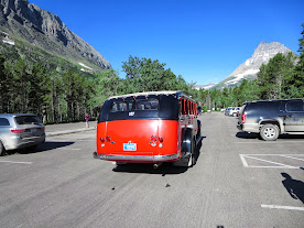
“Red Jammers” – historic Glacier tour buses.

This would serve as a fantastic place to take a dip later in the day after a long hot day of hiking.
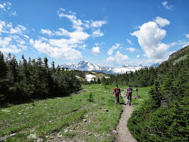
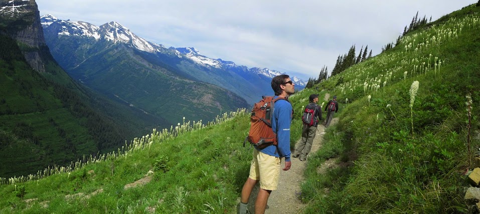
The trail went straight up the valley towards a massive headwall stemming North from Grinnell Peak, lined with numerous waterfalls feeding life in to the basin. There were suspension bridges, wildlife, fields of beargrass and the views got more diverse and aesthetic the further up the trail we went. This was my introduction to beargrass, which looks like it belongs on a tropical island. Due to its genetical makeup, this is the first plant to resprout in burn areas and is found mainly in the Northern Rockies, as well as the Northern Coastal regions from California to the Olympics.

First beargrass encounter.

Crossing a bridge before reaching the switchbacks.
As we reached the headwall at the end of the valley, the trail began to switchback up through fields and fields of beargrass, with numerous lookouts of the Many Glacier area to the East. It eventually turned in to an exciting little goat trail with big drops to our South. All in all, just a classic Glacier hike.

This looks like the Na Pali Coast trail.

“Is this heaven?”

Headwall and narrow trail.

Sarah admiring the view from where we came from.
The goat ledges eventually veered West and shot us straight towards Swiftcurrent Pass, which was marked with two huge cairns side by side each other. We had 2 objectives to visit from this vantage point, first one being the Swiftcurrent Overlook at the top of Swiftcurrent Peak. There was a trail through a burn area all the way to the summit, arguably the easiest summit to obtain in the entire park, despite the mileage.
Swiftcurrent Pass trail junction with Heavens Peak in background.
Swiftcurrent Pass cairns.
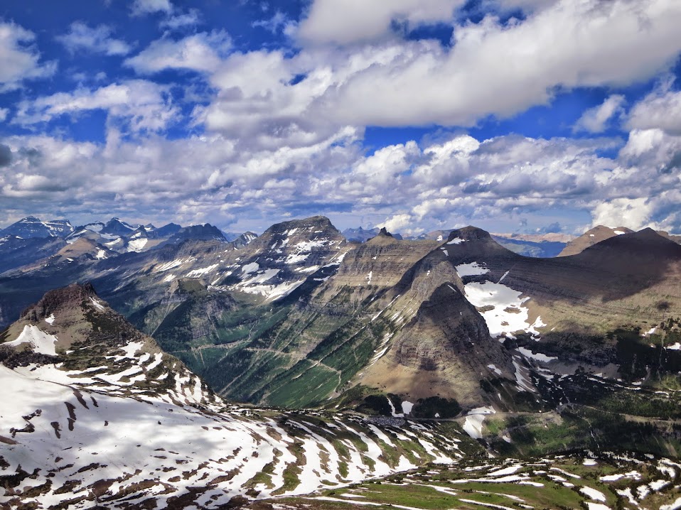
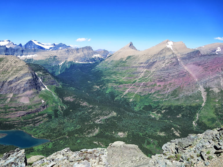
The views on the hike up didn’t get any staler. We were able to see our previous days work to the South on Reynolds, as well as scout out future ops in the immediate area and beyond….
Grinnell Mountain. Note the hanging snowfields (those are considered sections of routes). Kevin said if you came upon that snowfield while trying to work your way up the mountain, you would see a set of footprints, followed by a streak of brown skidmarks in the self arrest path.
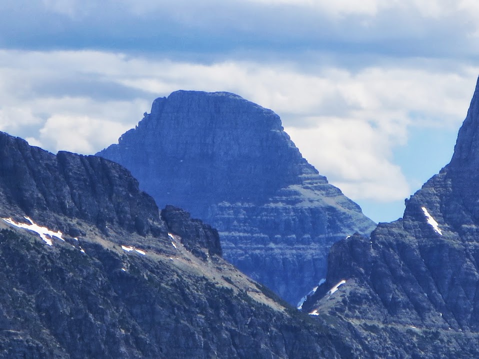
Reynolds, Oberlin and Clements.
Heavens Peak.

The Overlook – would be a nice summer gig. I can imagine the sunsets are something to be desired.
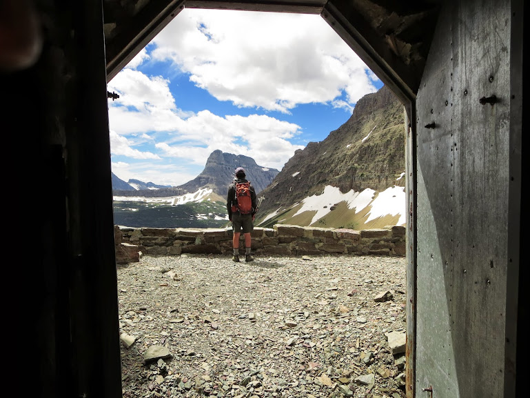
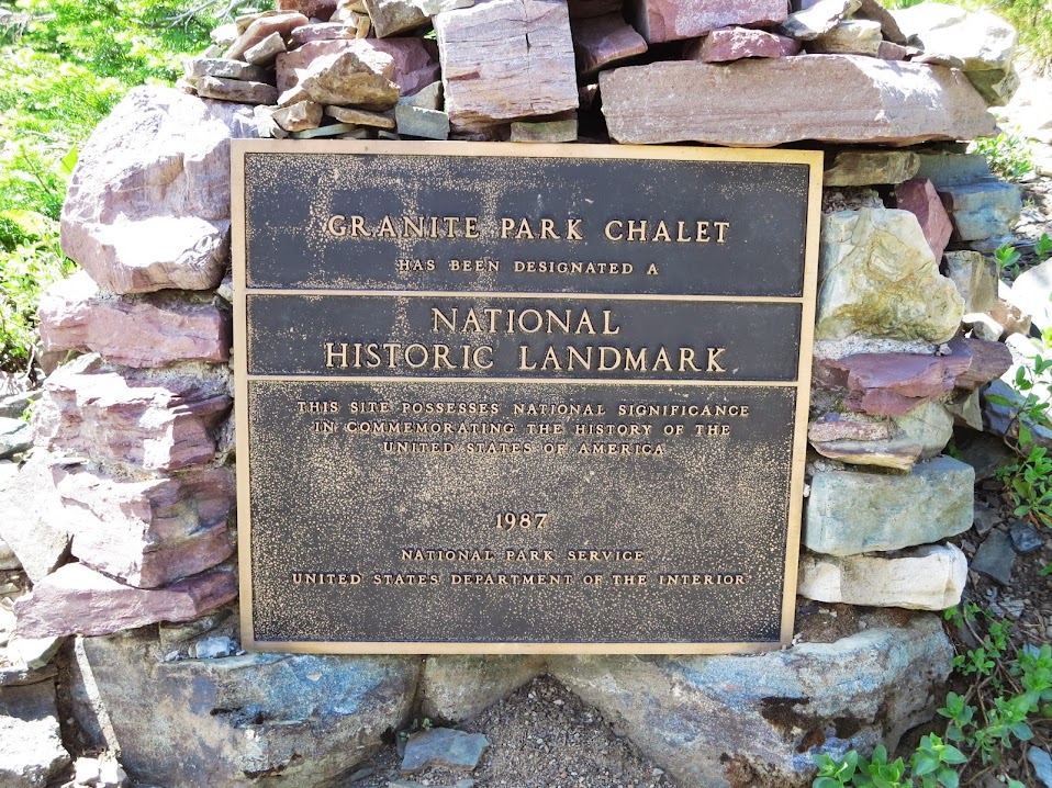
We descended back to the trail junction, took a food break and made way for the Granite Park Chalet a little down the hill. Kevin had lent me a book by Jack Olsen called “Night of the Grizzly” about the first 2 fatalities in Glacier back in the 1960’s. In the summer of 67, on the night of August 13, there were 2 separate fatal Grizz attacks in the park – one near Trout Lake in the valley below Heavens Peak and the other down the hill from the Granite Park Chalet. Back in the day, before bears and humans had any issues co-existing, the Chalet would launch its trash off the deck in to the hillside below. Eventually the local bear population began to congregate around the hillside. On the evening of August 13, a couple were camped yards away from the Chalet in a backcountry site and were both attacked and mauled – the girlfriend getting the worst of it. The victim was carried in to he Chalet mess hall and read her late rite on the dining room table before succumbing to her injuries. A haunting story and the first documented fatality in the park, raising awareness for bear safety and avoidance. Morbid curiosity aside, we were all looking forward to the view from the deck of this historic backcountry building.
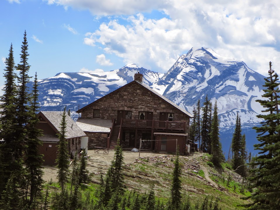
The Chalet wasn’t as crowded as usual, as the standard approach to get there from the Highline Trail was still closed to foot traffic due to snowfields still in place. We putzed around the perimeter, checked out the gift shop, peeked in a few rooms and then lounged on the deck with Heavens Peak looming to the West. You wouldn’t believe me if I told you, but its 94$ a night a person! Nevertheless, it was a perfect location to lounge for a little bit.
Mess Hall.
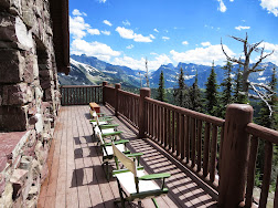
Lounging Deck.

Wildlife along the trail.
We retraced our steps all the way back to the pass, down the goat trail and then to the river and lakes below.
As we veered around a corner, we encountered a moose lying directly in the middle of the trail and were forced to take a little bushwacking detour to avoid him. He didn’t seem pissed off or anything, but he didn’t look like he was all that interested in moving anytime soon either.
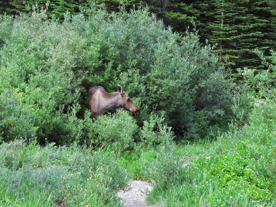
We passed him with no further problems and both went on our merry ways. After a dip in the creek, which was a soul revival, minutes later we were kicking back at camp with a fire and another feast on the books.
Day 5 – Rest Day and Avalanche Lake
After a 15 hour drive and 3 straight days of extensive, intense hiking, we all decided to take a break and do something a little more pedestrian. Our plan was to hit the crowd riddled Avalanche Lake from the west side of the park and then hit Oberlin Peak on the drive back to St.Mary’s from Logan Pass. First off, the drive to Avalanche Lake was delayed by a good hour or so from trail maintenance along the Highline (they were shoveling out a few sections), as well as various delays from Gaper brain farts. We finally got to the Avalanche parking lot, which was, to date, the biggest zoo I think I’ve ever seen in the mountains – national park or anywhere. It was disenchanting almost to the point where I wanted to take a Red Jammer all the way back to Many Glacier, where you could at least breathe. This place invoked clausterphobia.
We eventually found a spot, sucked it up and hiked the measely 2 miles to the lake. It seemed like an amusement park but the lake was cool, albeit crowded. There’s really nothing much else to report on for this day, I don’t mean to sound bitter or spoiled, Avy Lake just isn’t that exciting or worth it, especially if you are situated on the east side of the park. Nonetheless, we were able to capture some cool vistas along the way.

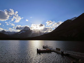
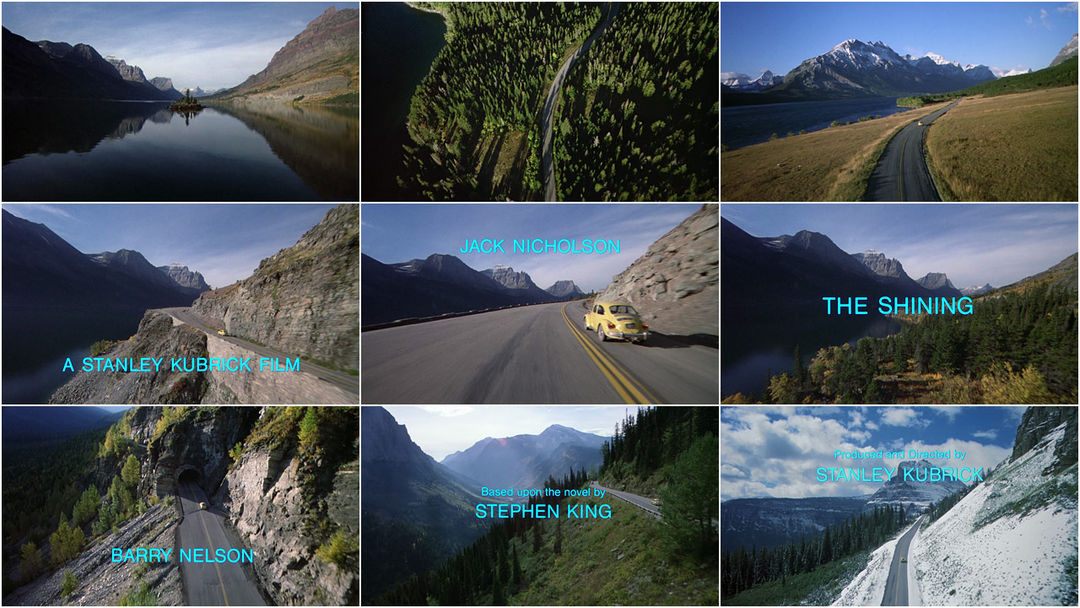
St.Mary’s Lake and Wild Goose Island.
One of the cool perks of driving up and down the Going To the Sun Road was St.Mary’s Lake and Wild Goose Island. For any Stanley Kubrick fans out there, this was the filming location of the infamous opening credits scene where Jack Torrence is driving up the road with the camera doing a flyover the lake and the island.
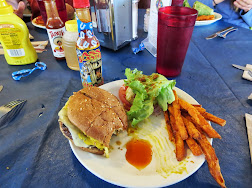
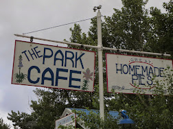
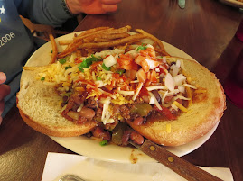
We got back to St.Mary’s and grabbed a burger at the local hot spot – The Park Cafe. While we were waiting for a table, we decided to head in to the general store and takes a looksies around. What resulted in this seemingly innocent reconnaissance was a purchase of a bottle of Ass Blaster hot sauce. I figured “what’s the worst that could happen?” so I threw some on my burger and fries. What ensued was physical pain and a restless spirit within me of biblical proportions. Kevin, who was initially curious as to how it tasted, no longer showed any interest and Sarah wanted no part from the start. The reviews online are priceless as well. This one coming from “MrCan’tSitDown” :
“You’ve got to be kidding me. I thought I could handle hot food but I guess I was wrong. I put a teaspoon in about 2 lbs of chilli and I was pissing out my a$$ for about 3 days. Be careful with this !”
I read another guy was hospitalized and then another thought he heard the song “Ring of Fire” while on the toiletfor the 5 days following his
That puddle of Ass Blaster was WAYYYYY too much.

Don’t Mess with Yuma, Arizona.

This guy was still eating. Fatass.
Day 6 – “Scaling” Grinnell Point
Before I ever stepped foot on Glacier National Park, one of the postcard views that stood out the most to me was the view of Grinnell Point rising above Swiftcurrent Lake and the Many Glacier Hotel. It was the best thing I had for a perspective of the area and I thought maybe some day it would be cool to climb that peak – ranking irrelevant. Many Glacier Campground was at the very bottom of Grinnell’s northern slopes and a short 5 minute walk to the trailhead. This was an interesting route in the sense the approach started up a prime Grizz slope habitat and the most difficult climbing was at the very beginning – right where the Grizz slopes reach the rock. The rock wasn’t very good either, so it created a certain level of unavoidable anxiety for the whole climb, knowing we couldn’t breathe easy till we were completely off the scrambling sections. Josephine Lake provided a nice reprieve though….
With Grizz infested slopes…..
And then the scrambling began…..
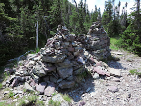
We thought for a while that we were way off route and needed to further right than where we currently were. We had found cairns along the way and hadn’t encountered anything too difficult, but none of the obvious landmarks we had read about in guides were showing up. Finally we found the Josephine Mine, which guaranteed we were on the right route.

Inside the cave.

A room with a view.

Old trinkets of a land that time forgot.
The most complex sections of the day began immediately after the mine, but there were cairns abundant, leading us up this maze of a mountain (it was “easy” class 3).

The “Summit”.
Grinnell Point was the Lone Eagle of Many Glacier in the sense it was the lowpoint of a long, gnarly ridge and it looked menacing and beautiful from certain vantage points, but then blended in from other points higher up. Kevin thought it’d be funny if they placed a massive bell on the end of the summit that you ring upon reaching, alerting the masses below of your location. He also thought it would be nice if there was a continuous, 3000 foot line of soft scree you could surf, all the way down to the valley floor below. In reality, we had a tedious downclimb, but we got through it nonetheless. Another psychological peak on the books and we were sitting pretty at this point.
If only we had a few pairs of skis – this downclimb would’ve been a lot easier.

Almost in the clear.
We reached “safe” ground and let out some big time sighs of relief. The last move wasn’t that hard, but it required a lot of weight on suspect rock over around 40 to 50 feet of air. Only thing worse than falling is falling and surviving, but unable to physically move on a known Grizz slope. Bad vibes aside, it wasn’t as hard as we thought it’d be and we all spotted each other down to our hiking poles where we took a nice long break and admired our surroundings.
The guy driving this boat has the most cake job in the National Park Service, if not the world.
Another feast was in order that evening, with Mark having left us the day before back to Seattle – 4 remained. I found that funny since we had initially sent out feeler emails to a number of parties before the trip to garner interest, and on day 6 of this adventure – 4 stood tall. It was a solid group of 4, though, and it basically would become 5 each night as Virginia religiously hung out as we listened to Waylon Jennings, Gordon Lightfoot and the Travelling Willbury’s each night, with some form of red meat on the grill and a nice selection in the cooler on fresh ice. If I recall correctly, I believe night 6 in Many Glacier was the night of Many Brats, and a subsequent pissing out of the a$$ later that evening. A digestive system can only take that much habanaro I guess. In trying to convince Svet to join us on Clements the next morning, he ended up setting his sights on the Swiftcurrent Overlook hike we did earlier in the week. At the end of the day, it was something that had to be done, despite the aesthetics of climbing Clements – he made the right choice in my opinion.
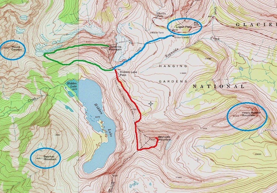
Day 7 – Walking the plank on Clements Mountain
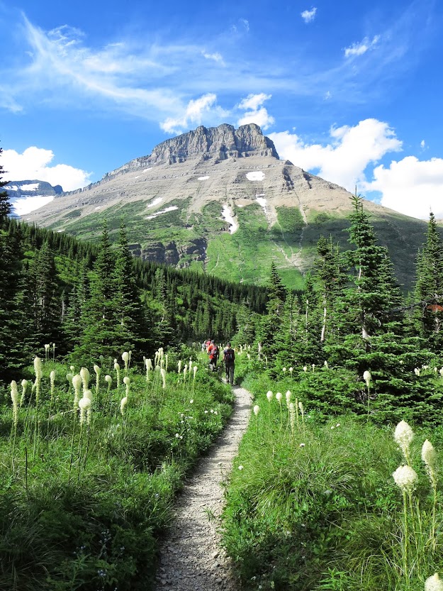
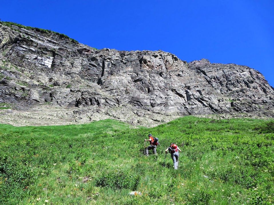
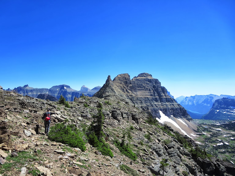
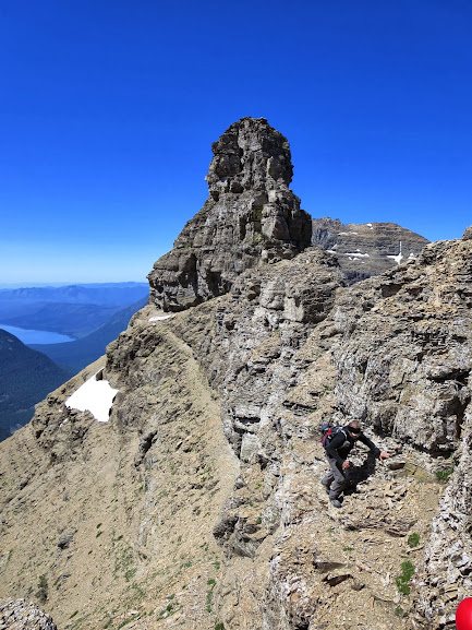
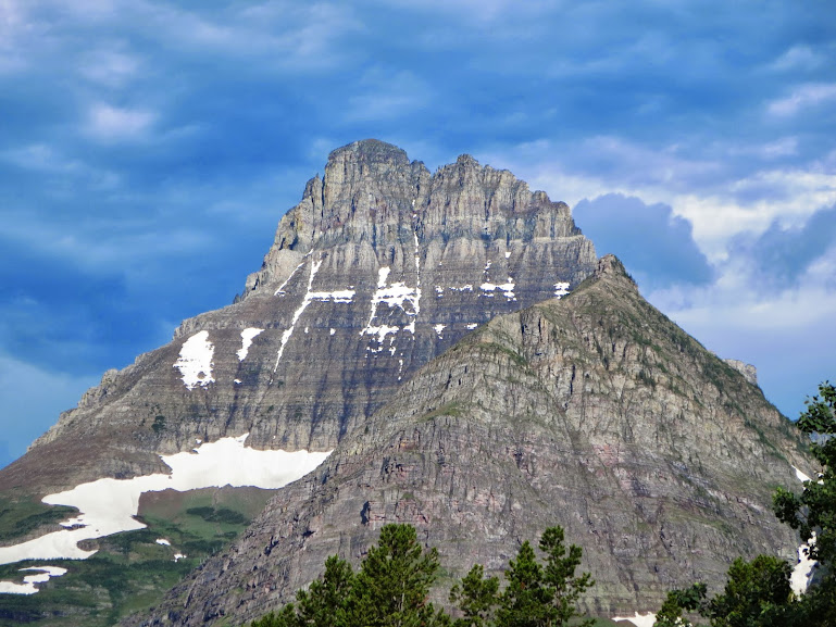
While staring at Clements on the days we hung around Logan Pass earlier in the week, a healthy dose of fear passed through my spine upon each glance. From the visitor’s center, there was no obvious route. From our talks with Rick on Reynolds, he spoke of a ledge system that, when dry, is the “easiest” way up the mountain. I’m not sure if Kevin was feeling lonesome, on’ry and mean after listening to too much Waylon, but somehow the idea to finish off the peak days with a real anxiety riser made its way in to the cards. We didn’t really know what we were in for, but were still willing to explore the unknown (to us at least – hardened Whitefish locals probably climb this peak during their lunch hour). We made the now familiar drive up past St.Mary’s Lake to Logan Pass – with Reynolds and Clements making themselves known, loud and clear. Today would be the day that Bearhat Mountain made itself known. It was on full display from a number of different angles, this being one of them.
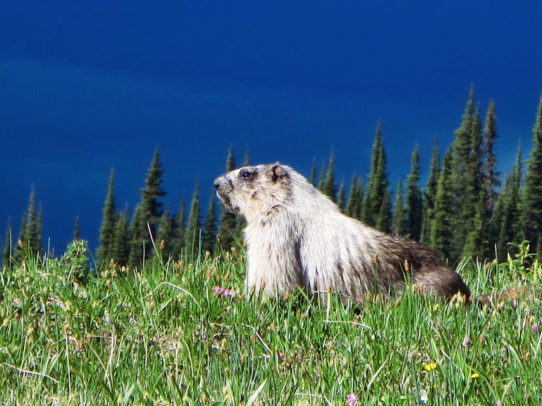
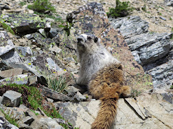
Even the local marmot population were in awe….
And Hidden Lake couldn’t have looked any bluer….

Lots of colors.
Hidden Lake Cirque.
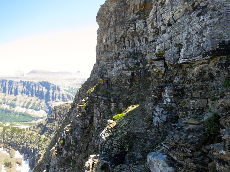
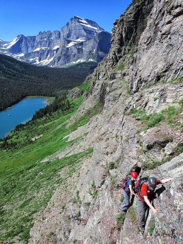
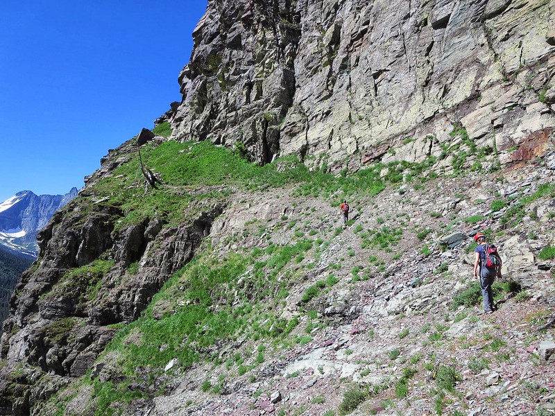
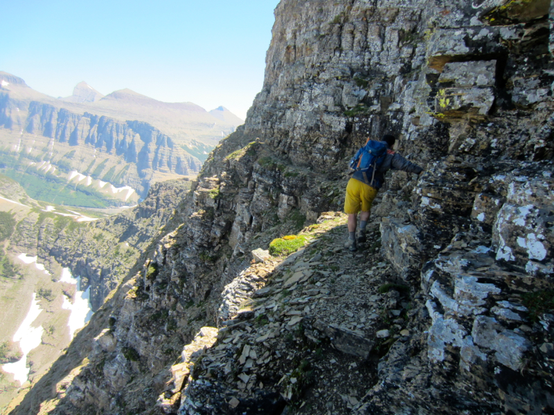
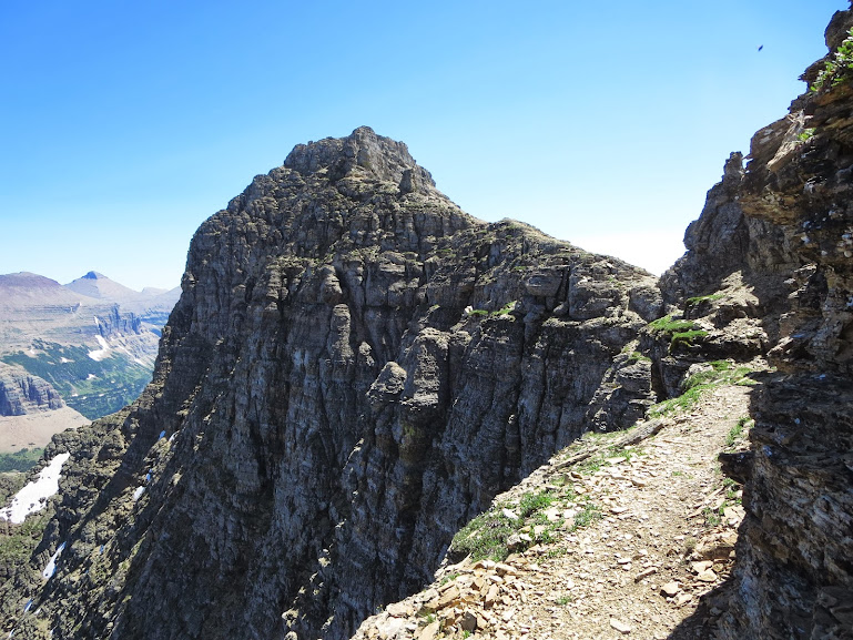
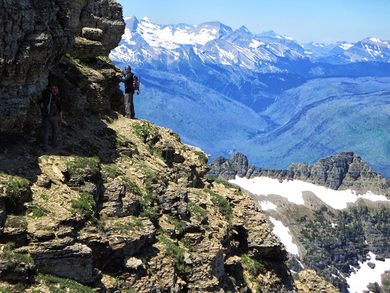
The route up Clements was similar to Grinnell Point with a little twist. The approach started off on the well traveled Hidden Lake trail to just North of the lake, where we found a circuit of climber’s trails leading us to the West Ridge of Clements. Once on the ridge, we headed east, and things got just downright dizzyingly exposed. Downsloping scree sidehill management was the name of the game. There wasn’t a single Colorado class 3 move – it was 100% exposed ledges and goat trails. Arguably the freakiest class 2 you will ever find in the states. Just when you thought you were in the clear, Clements had another bag of tricks for you to figure out.
Just when we thought we had enough, we reached this section….
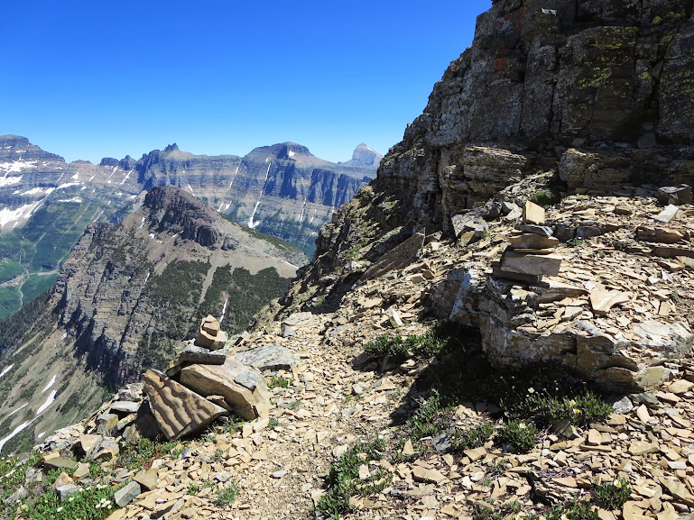
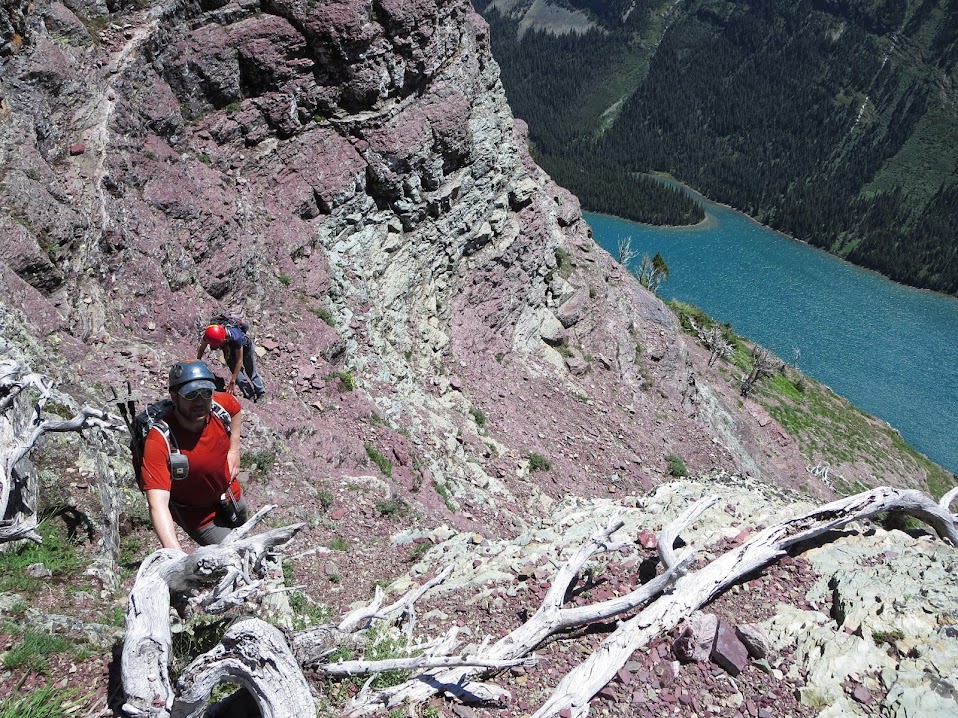
For a solid minute, there was dead silence. I think the initial reaction was an assumed “no way”, but upon further review and the thought of how much better that feast that evening was gonna taste with a peak like this under our belts, we started to find the courage to pursue on. The level of focus was apparent through our heavy breathing. Not a word was exchanged for the next half mile of the ledge traverse. We would all later find out that ledge traverses like this are commonplace throughout the park, some going on for 5+ miles and even greater exposure. This type of climbing is a whole different ballgame.
What seemed like eternity, but was probably 10 minutes, we finally rounded our last bend and saw this glorious view…..
Light at the end of the tunnel.

How can you get too pissed off about scree with vistas like this?
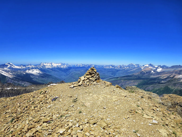
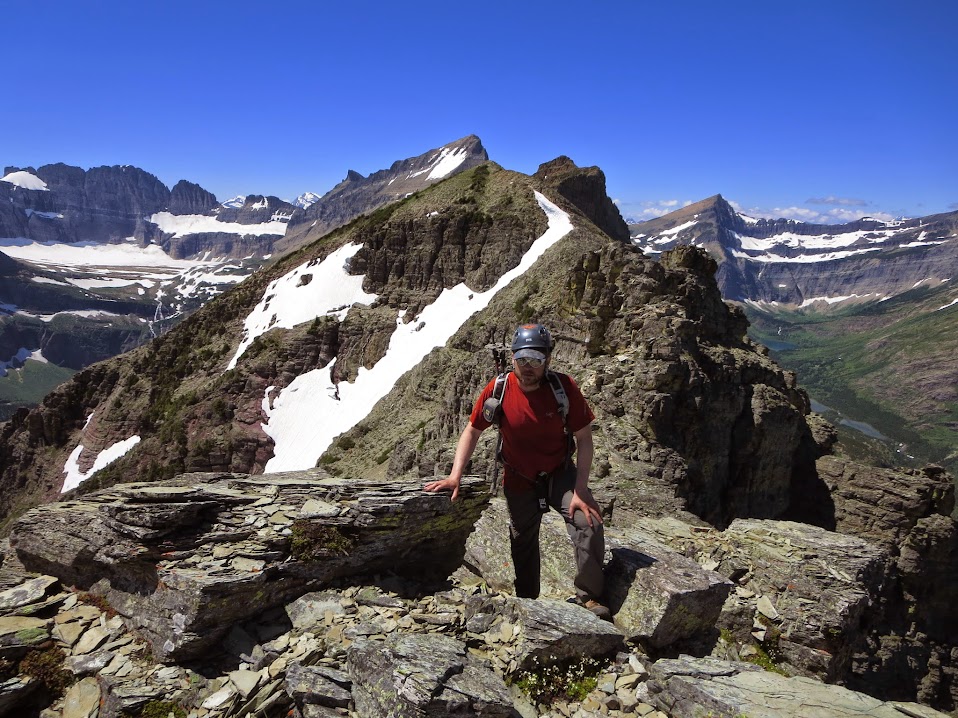
A well earned summit.

Logan Pass visitor’s center – so far away from me…..
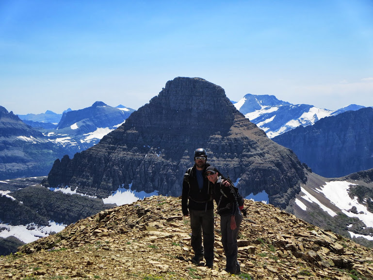
This summit was one to remember, as you can see from the panoramic photos. The visitor’s center, only 3000 feet below, could not have felt any further away. Aside from the vertical distance, we were far from being “in the clear”. For such an uneasy feeling, the beauty of the surroundings outweighed the fear and we were able to enjoy ourselves for at least a little while before deciding to head back to reality. We might as well been on the moon – thats how beautifully isolated the summit of Clements felt.
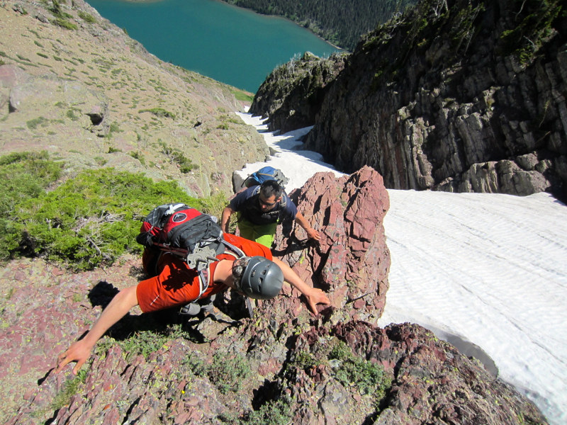
Oddly enough, the goat trail on the descent wasn’t anywhere near as bad, but still required a great deal of care. You had to constantly remind yourself to not look down, but at 2 different sections, you were forced to downclimb short sections to continue on the trail, so looking down became inevitable.
Shortly after this shot, Kevin shat his pants.

In the clear…for now.
Upon our safe passage of the West Ridge of Clements, we were greeted with this view again….
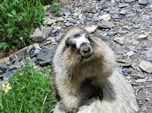
And saw that the locals lie to cool themselves off on this particular patch of snow (we saw a marmot laying on his belly on this exact spot earlier in the day)

Coolin’ off.
And then one last awe inspiring vantage point before heading back to the visitor’s center…..
We joined back up with Svet at Many Glacier later that evening and traded tales. For me personally, this day had to go down as one of the more fullfilling days of my life, for both the views and the experience, and as I sat there that evening around the fire with a Huckleberry ice cream cone in hand with Waylon on the jukebox, I thought for a brief moment that life can’t get much better than this. I figured anything from that point on would just be gravy. Well this gravy sure did a god job keeping the momentum going.
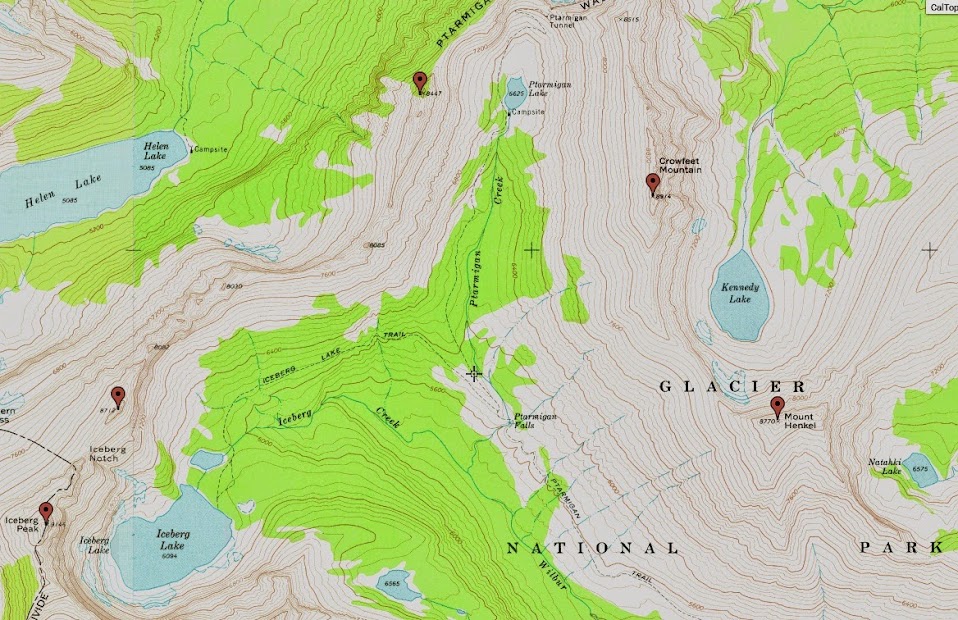
Day 8 – Chasing tail on a twofer : Ptarmigan Tunnel and Iceberg Lake
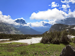
Valley and trail to Ptarmigan Lake/Tunnel and Iceberg Lake from the summit of Grinnell Point.
My expectations for any further outings we had in the park at this point had been chissled down to zero. We had already climbed 3 bucket list type peaks, seen lakes so blue your eyes hurt, seen fauna indigenous only to this part of the world, been surrounded by so much green you think you’d eventually turn in to the Jolly Green Giant, feasted every night – both at the campground and at the local fare in St.Mary’s and Swiftcurrent and anything else in between. I, personally, couldn’t have asked for much more. Well Kevin and Sarah still had plans for the final 2 days we had there. Day 8 consisted of a diverse combo hike, again, straight out of the gates, with long mileage and minimal vert. We were fortunate to be able to experience Ptarmigan Tunnel, as it had just opened up the day before, which was earlier than usual. Cards were just falling in to place at every crossroad for us.
Early on in the hike, Svet and I were distracted with some honey from Ole Miss, strutting down the trail.
I can’t remember her name, I’m sure Svet does, but she was a head turner for sure. She was in shape too, as we tried relatively hard to try and keep up, but she pressed on at a solid pace. Fortunately, we caught up with and passed her throughout the day. A nice little cheap thrill of the day.
Anyways, the natural scenery was pretty sweet as well…..
Ptarmigan Lake was a pleasant surprise. After Hidden, Cracker, Josephine, St.Mary’s and Swiftcurrent Lakes, I thought I had seen it all. Well Ptarmigan, dare I say, topped them all. It had the turquoise blue of Cracker with the added bonus of the tunnel along the trail above. Looking south, you were able to view peaks that look like this…..
Mount Wilbur – one of the toughest peaks in the park.
And this……

Looking down on Ptarmigan Lake from the Tunnel and South.
After a long slog with a blistering pace set by Svet, we finally reached the long awaited tunnel.

Ptarmigan Tunnel.

Mordor.

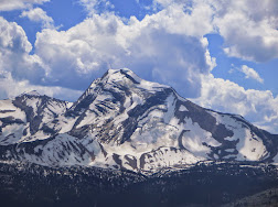
Mount Merritt – 10,004 feet.
The other end of the tunnel brought us to another cliff goat ledge, reminiscent of the Gates of Mordor. From there, we got our first glimpse of 10er, Mount Merritt. 36 miles roundtrip via its shortest route through the heart of grizz country. Sarah sent Kevin and I an account of a guy’s solo mission where he described the idea of sleeping in his tent at Elizabeth Lake with his feet facing where he thought a grizz might attack, thought process being if the grizz gets his feet, that’s better than his head and he’d have, at least, a fighting chance. Amazing the perspective of the Montana climber. Anyways, J Gordon Edwards describes the summit of Merritt containing the finest views in the park and from our vantage point, the views of the peak alone, with the surrounding spires and Old Sun Glacier glistening in the sun, along with the roaring massive waterfall at the base of the glacier (which we could here many miles away), we knew right away how special this peak really was.
Also in the vicinity is one of the parks longer goat trail systems, starting from the end of the tunnel and extending a continuous 4 miles to Ahern Pass. It is known as “Goat Trail #3” and it sounds like something out of an alternate universe. The author of the summitpost page says the major trail maintainers are goats and sheep. He even goes on to say some bear have been spotted along this traverse (I can’t even begin to fathom what a confrontation of that nature would be like).
We hiked back to the trail junction with Iceberg Lake, hung a left and continued on. When I said I thought Ptarmigan Lake stole the show, I was wrong. Iceberg Lake, in my opinion, takes the cake for Glacier NP lakes. Here’s why…..
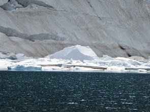
I don’t care how tough you think you are – this was really cold.
On the hike out, you get a sense of what the Grinnell group looks like from the North.
And later that evening, we feasted….
The Beast.
Day 9 – Highline Trail
Our last day in Glacier and we were looking for a nice way to close it out. The evening before, we spoke of nabbing 9ers Piegan and Pollack from along the Going To The Sun Road. When we woke up that morning, we caught wind that the Highline Trail had just opened, so we figured we’d drive up to Logan Pass and if the trail was in fact open, we’d hike that, if it wasn’t, we’d do the peaks.
“Once more unto the breach dear friends”.
When we arrived at Logan Pass for the 4th time this trip, the trail was in fact open, and being such an infamous part of the park, we just had to pounce at the opportunity. We would be hiking 7.5 miles out to Granite Park Chalet with a quick sidetrip to the Grinnell Glacier Overlook. The trail needs no further introduction, as its reputation as one of the most scenic in the world should speak for itself. I, personally, thought that, coupled with the sidetrip to the Chalet, the Swiftcurrent Overlook trail was the most scenic in that area, but the Highline, albeit more popular, is a must do for anyone that ventures in to this area.
Even on day 9 – we were on the constant lookout for Grizz.
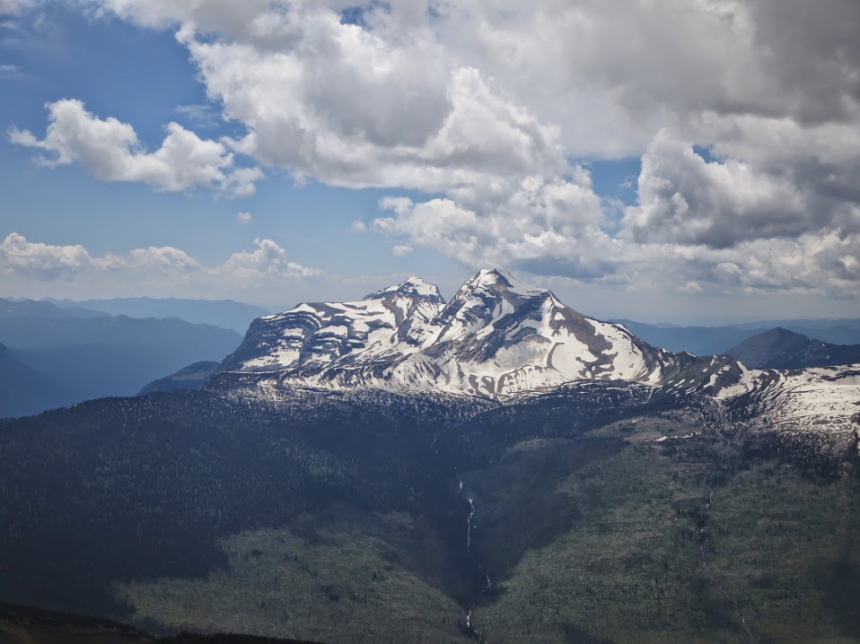
Reynolds, Oberlin, Clements (behind) and Cannon.

Lake McDonald.
Locals.
We reached the Grinnell Glacier Overlook junction and took a quick side trip.

Grinnell Glacier Overlook.
Heavens and Lake McDonald.
We rejoined the trail and made the short last jaunt to the Chalet, where we lounged on a bench for a good long while on another nice day. We had a nice vista as well…..
Nice place to eat lunch for the day.
Reynolds – one last time.
The next morning, we woke up around 6am, loaded up the vehicles and went on our merry ways. I feel 10 days in this special place was sufficient enough for an inaugural outing. Svet appreciated just being out of Philly for a prolonged period of time and had time to recharge and reassess. It was sweet to have Mark sign on at the last minute, and any trip I’ve had with Pappy and Woody have been stellar thus far. For future trips, we have a clearer idea of what to hit, when to hit it and where to set up a base of operations. For instance, we did almost everything there is to do around Many Glacier, so the next trip would be better suited to a Rising Sun campsite right next to St.Mary’s Lake, providing better access to the Logan Pass peaks, which there are a plethora of. Some more goals would be to hit at least 1 long 10er, Merritt or Jackson coming to mind. Cleveland sounds cool as well, with a ferry boat ride in through Canada. Driving to Glacier NP from Denver is not so bad if you plan on staying there for longer than a week. It can get brutal going through Wyoming at times (and Wyoming DOES in fact have speed limits, which they enforce and there IS retroprocity with Colorado – just a FYI).
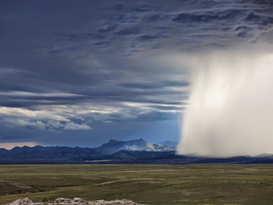
As we crossed the Wyoming/Colorado border, we were presented with a psychadellic pano to the West……
And while we didn’t see a ton of these guys……
We still achieved everything we sought out for. Thanks for reading.
Resources:
http://www.natgeomaps.com/ti_215
http://www.natgeomaps.com/ti_314
^ voted best cross country in-flight reading material by all those in row 28 of United flight 554 to Denver
Dillon – Good to hear this beat out SkyMall for in flight reading material. Thanks for following another post and for the comments friend. Cheers!
Looks amazing! You take really awesome photos. Glacier is definitely on our radar for a trip in the near future. Btw, love the new site!
Becky – thanks for reading and for the comments on the photos, but in Glacier, all you need to do is point and shoot. A potential trip for 2015 is already in the works. You and Jason won’t regret it. Put those international trips on the back burner and check it out.
I didn’t doubt Glacier is a special place after hearing you guys talk about your trip, but seeing is truly believing in this case. Great photos and writeup.
And thanks Dillon and Becky for taking the time to comment!
Stunning. Amazing scenery and now I understand why you and Kevin were still talking about it so much over Labor Day. Those lakes are incredible.