After driving in from Denver and climbing Mt Emma the prior day, I awoke just before 4 and headed up the shelf road to Yankee Boy Basin at 4:15. Right after making the turn onto the YBB road, I passed two hikers who told me they had turned their Toyota Tundra around about a half mile beyond, at a point where running water had rutted out the road and made it more a stream than a road. So I turned the Rav4 around and parked near the junction. (It turned out to be a good call. A few jeeps and two 4Runners made it beyond, but, on the way down, I walked by a jeep trying to get a Chevy SUV unstuck.)
June 25, 2016 – Cirque Mountain
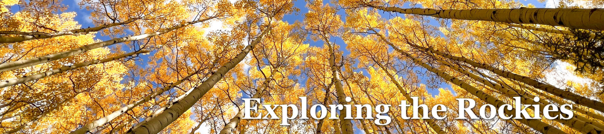
The road from Thistledown CG to the YB turn takes a solid 20-25 minutes. So it was after 5 when I began walking up the road. The road lay in shadow, but the newly-risen sun had brightened the sky, so I didn’t need my headlamp. At 5:29, Gilpin rose before me brightly lit against the blue sky.
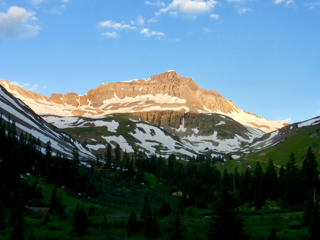
By 5:39, I had passed the familiar outhouse along the road and crossed the stream just a bit west of it. At a point 150 feet or so beyond the stream, I left the road and headed up a green slope covered with grass and California false hellebore, which were still only knee high and a couple weeks from blooming. I wound my way around the hellebores, and eventually ended up next to the stream, which originates from between Teakettle and Cirque.
“CA false hellebores” which I have mistaken for skunk cabbage for several years, until I did some google research. Cirque Mountain is the rocky rounded point to the right.
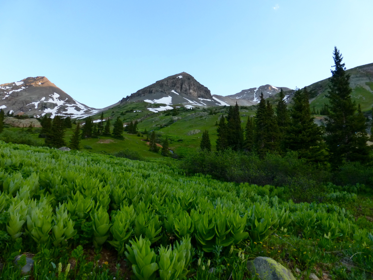
I continued up, keeping the stream on my right. After I reached the trees and the bend in the stream, some inquisitive young deer kept their distance but watched my upward toil. The slopes steepened here.
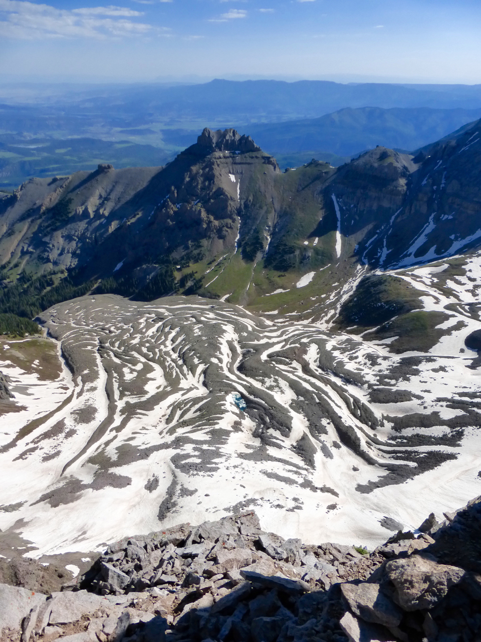
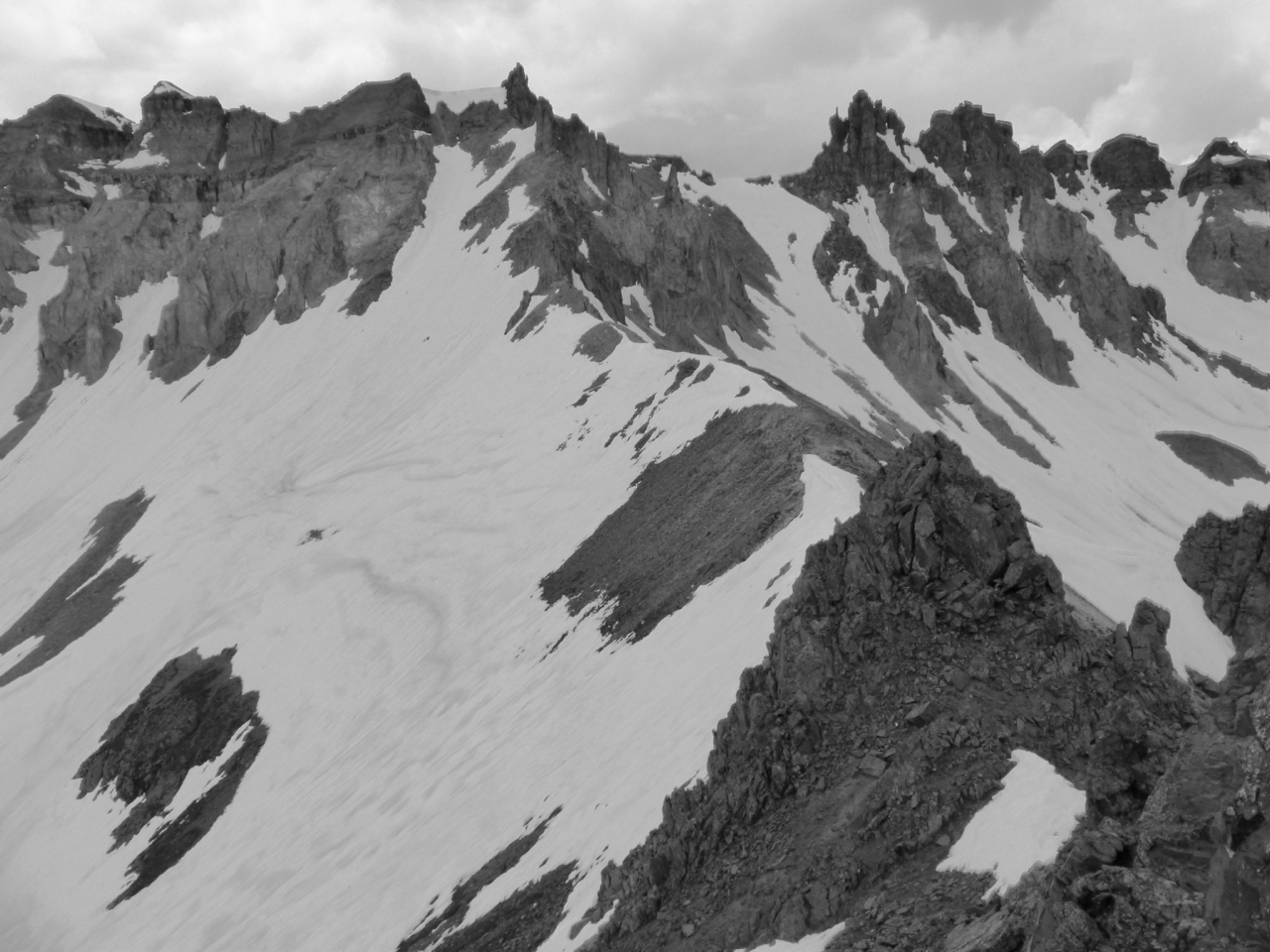
At 6:15, I regarded this view ahead to Cirque. Teakettle towered impressively to my right, but it was backlit by the sun, so no good pictures came of it.
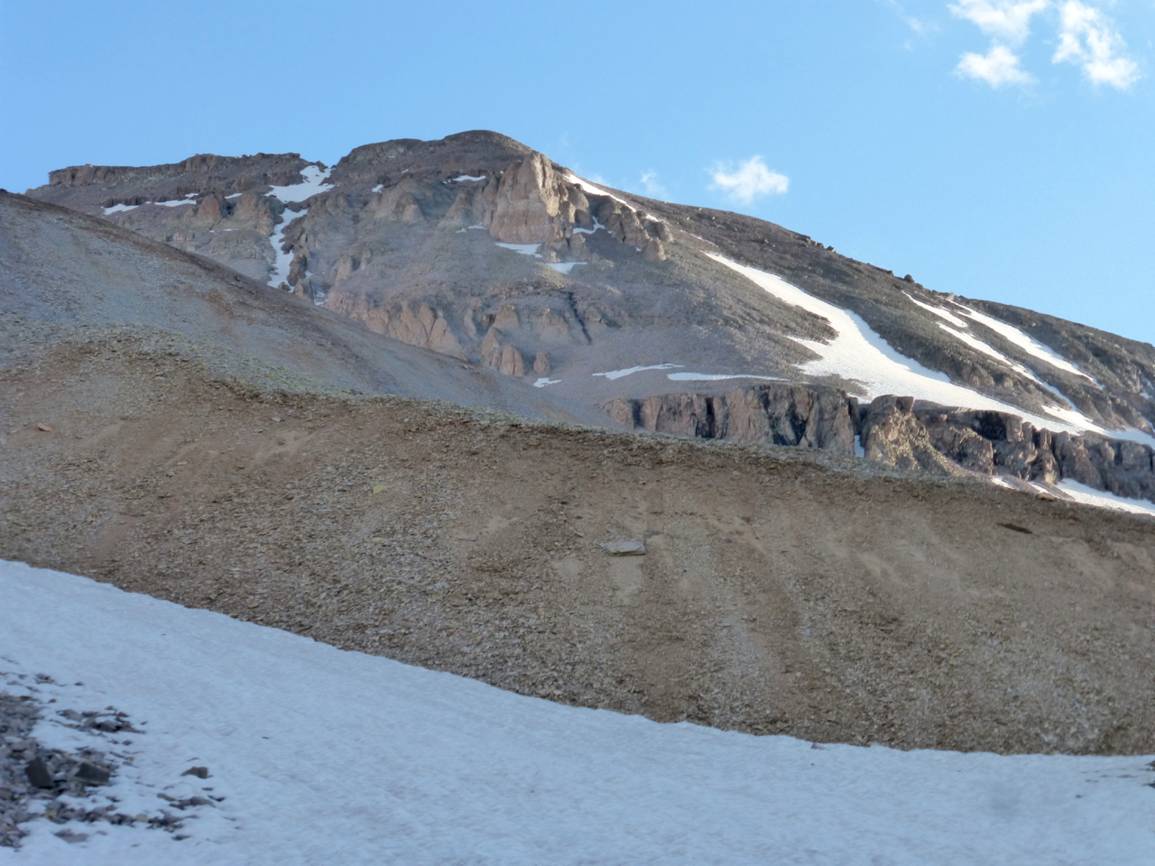
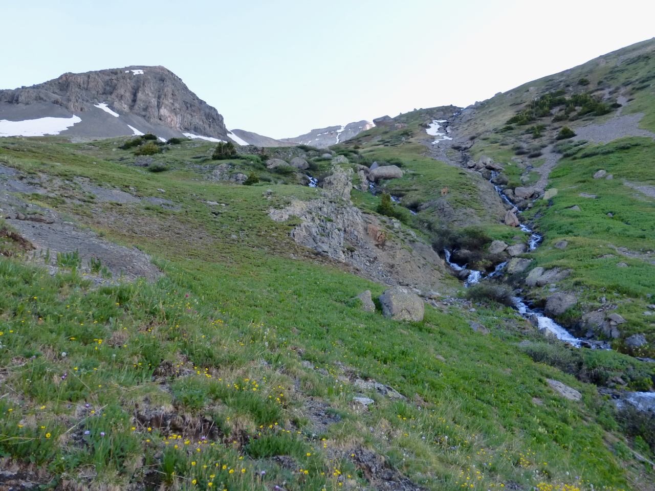
From this point, I headed straight ahead, looking for a weakness in the cliff-band and aiming for the moderate snow slope above. The couloir splitting the top would make an aesthetic route, but at this point it looked to be more of a mixed rock and ice climb. I had decided again to leave the crampons behind, because my mountaineering boots no longer fit well.
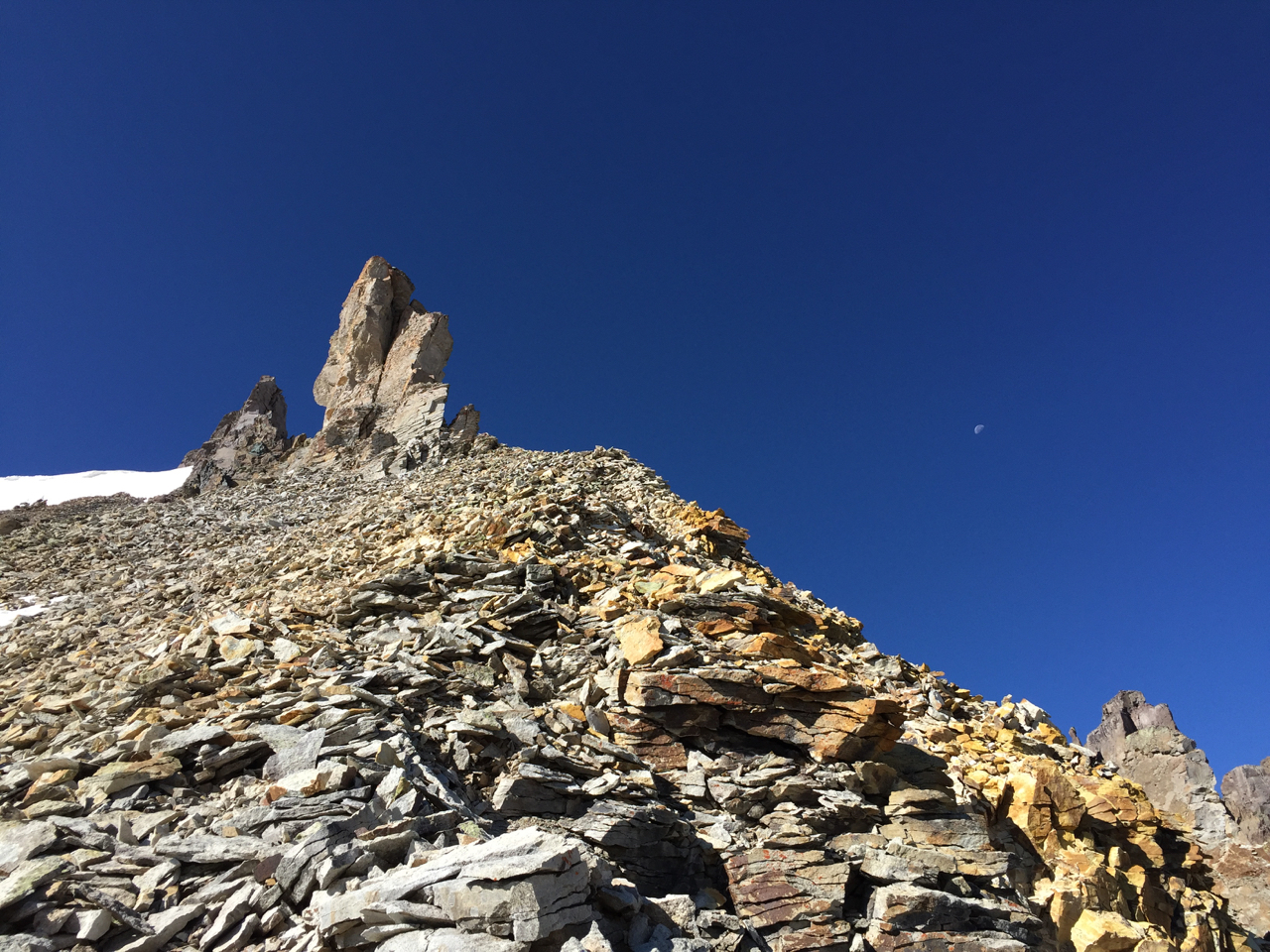
Surveying the cliff band as I approached, I saw likely bypass wide left, but the gap to the right drew my attention. As long as the snow wasn’t too steep and hard, the spikes would do.
Cliff band guarding Cirque Mountain’s upper south slopes, with the gap I’ve coined the Marmot’s Scamper at right.
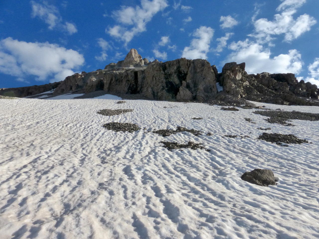
Of course I found a short section where the icy snow steepened and I preferred a rock bypass on the right side of the cleft. After emerging from this tunnel-like passage to the slopes above, I quickly found that none of the rocks above the cliffs were attached to the mountain. I also saw to my dismay that I still had much farther to go than expected:
The slope goes on and on…
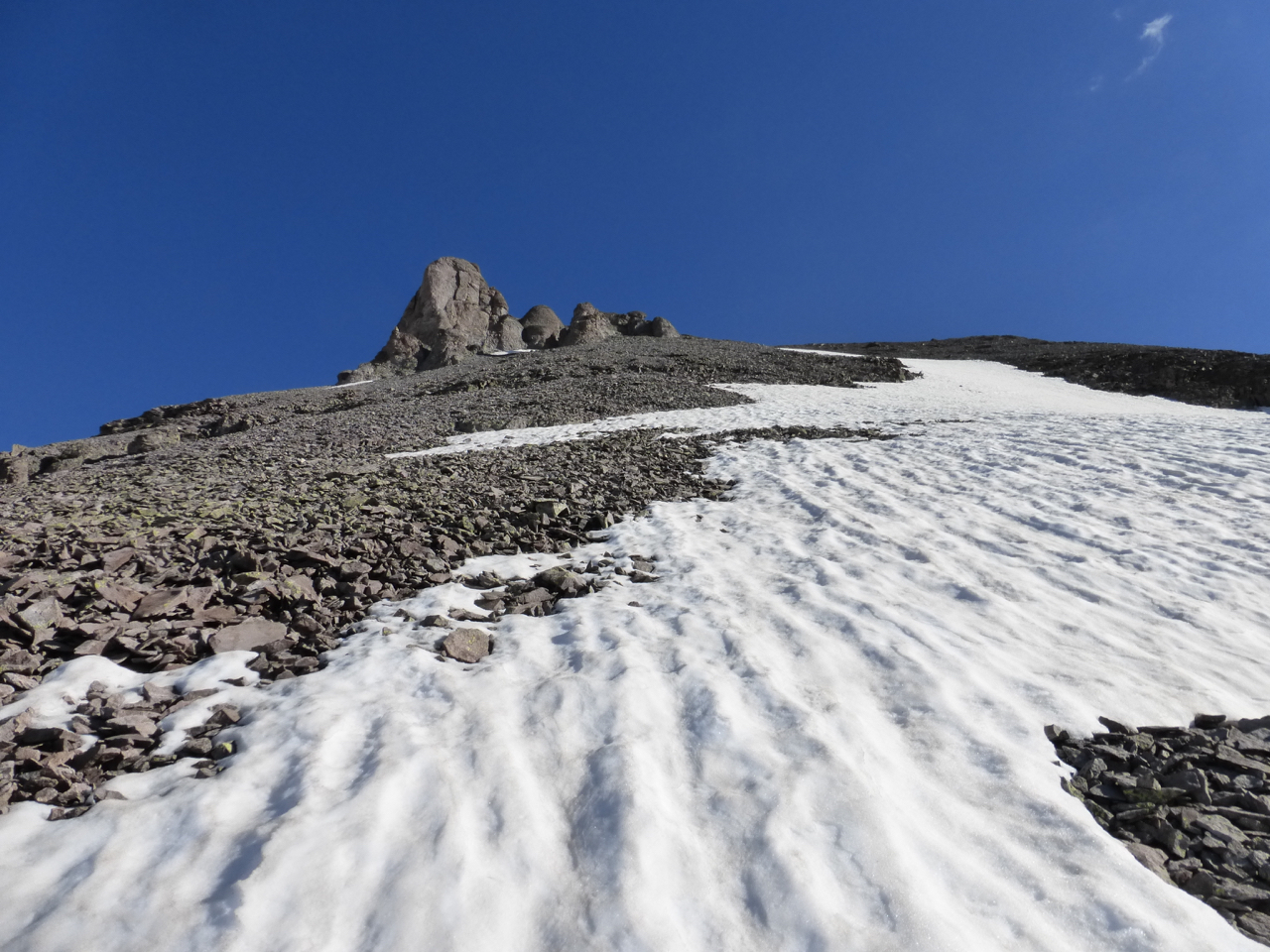
Nothing for it but to slog onward and upward. It had taken me nearly 40 minutes from the prior photo to this one, and another half hour brought me only to this:
I wonder when that block will just skate on down the mountainside?
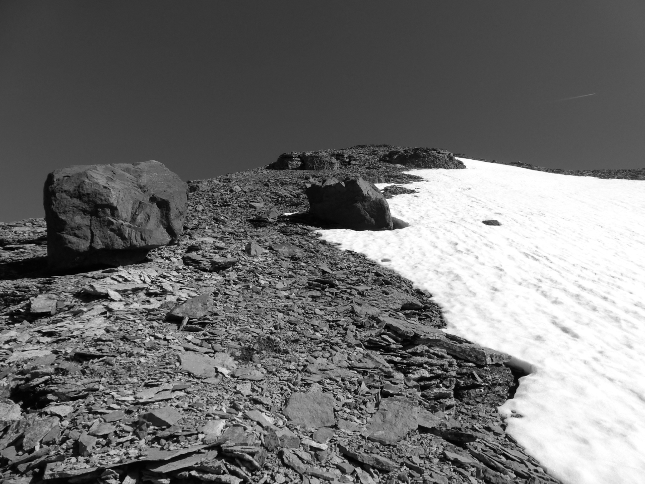
At least now the loose rock had changed to manageable little shingles. It was five minutes to eight; I was nearing the 3 hour mark from the car. I thought I should be to the summit and regretted my lack of adequate conditioning this spring.
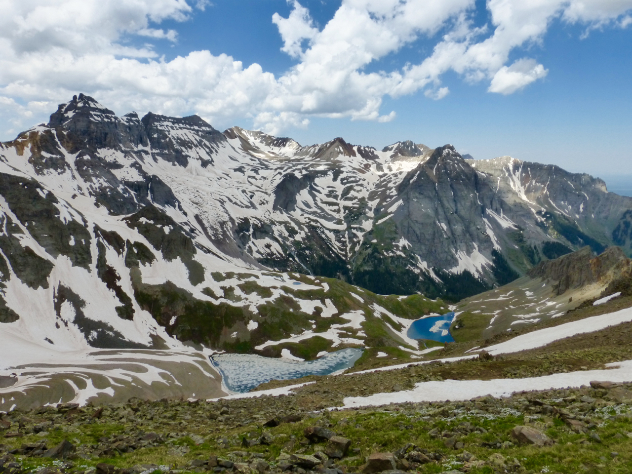
But I was closer than I knew. At ten after eight, I reached the suddenly narrow upper ridge, with this view down to the east.
A sapphire in the rough.
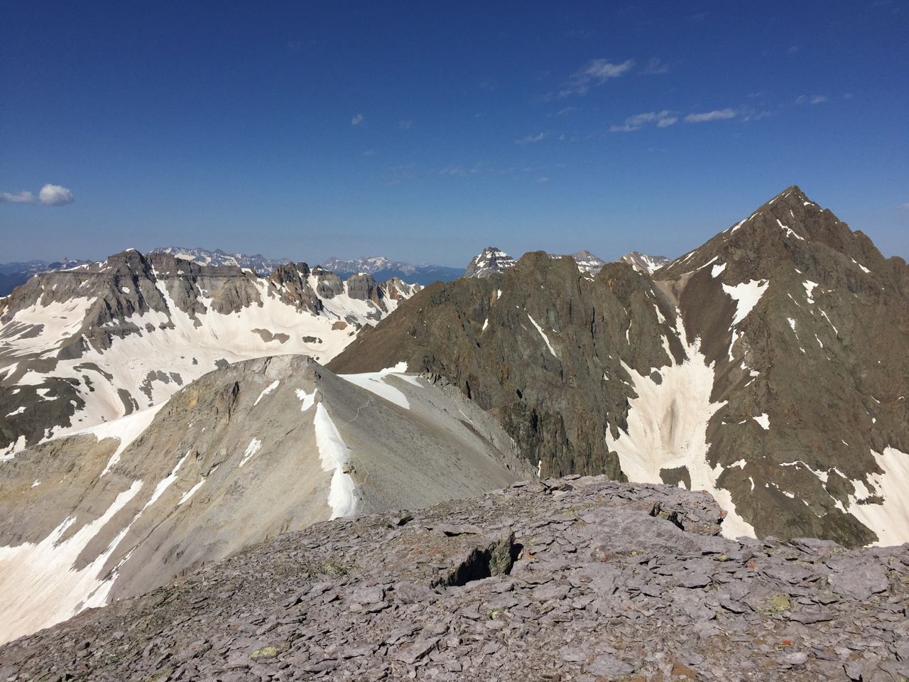
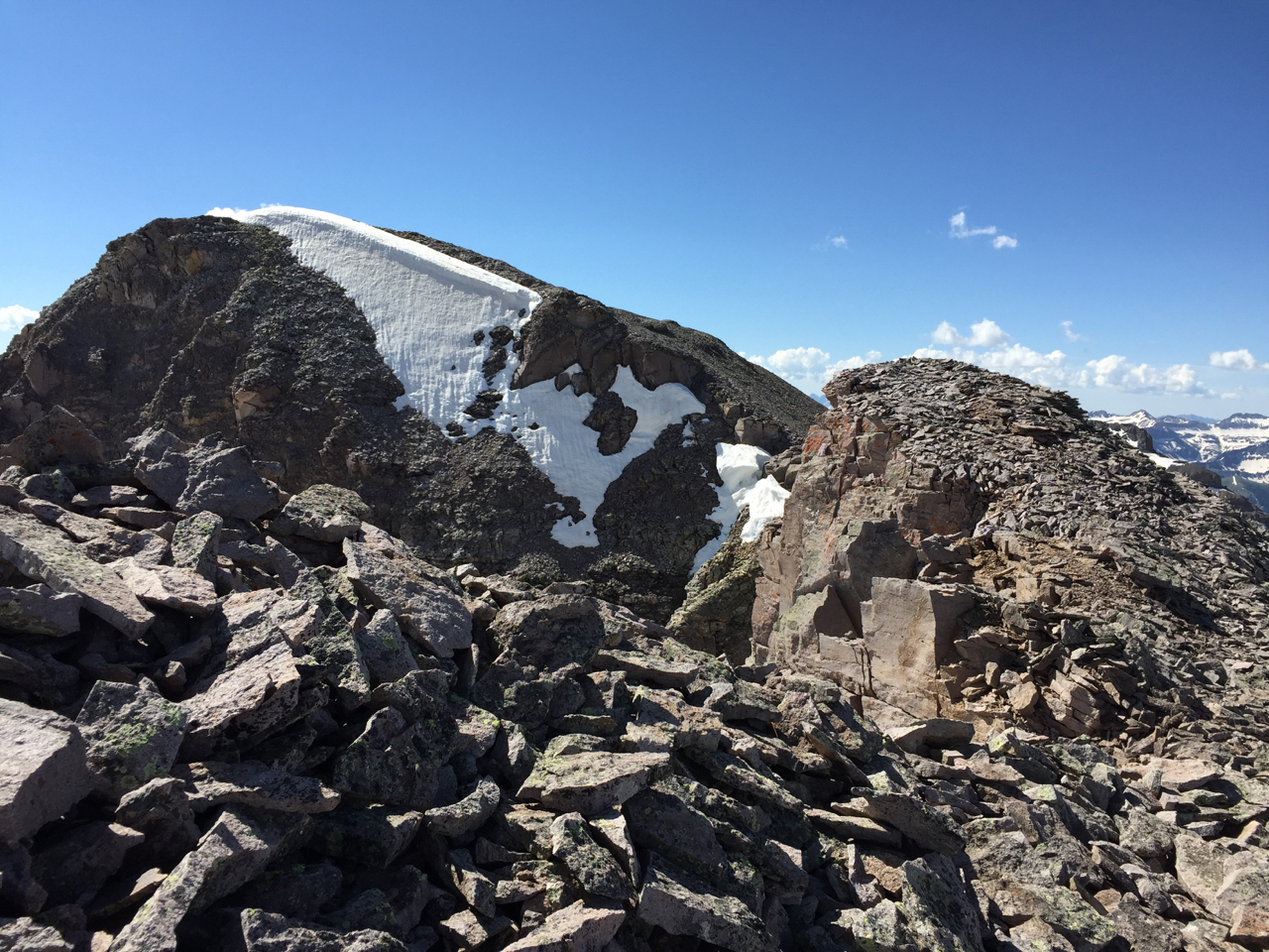
Cirque has twin summits spaced closely together, and I found myself on the southern twin. After reading the summit register, it was apparent some people looking to the south thought it might be higher. Coming over from the south, the northern summit appeared higher to me.
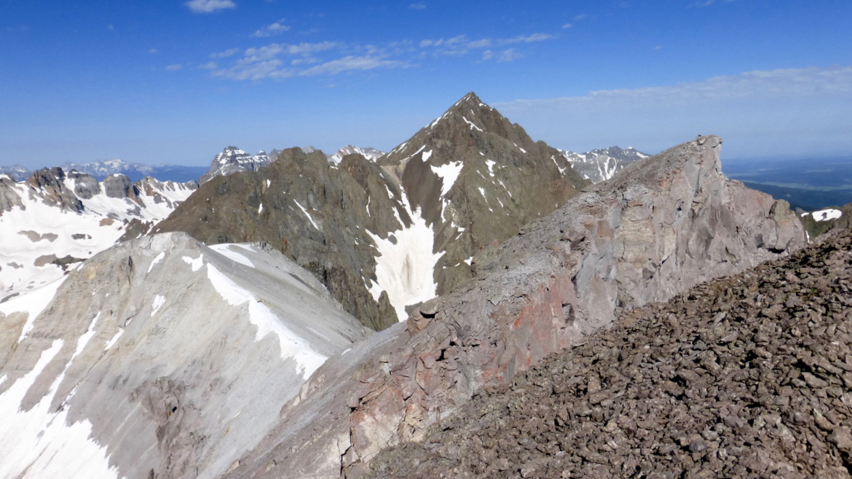
Descending to the low point between summits to get over to Cirque’s official, northern summit. Sneffels behind.
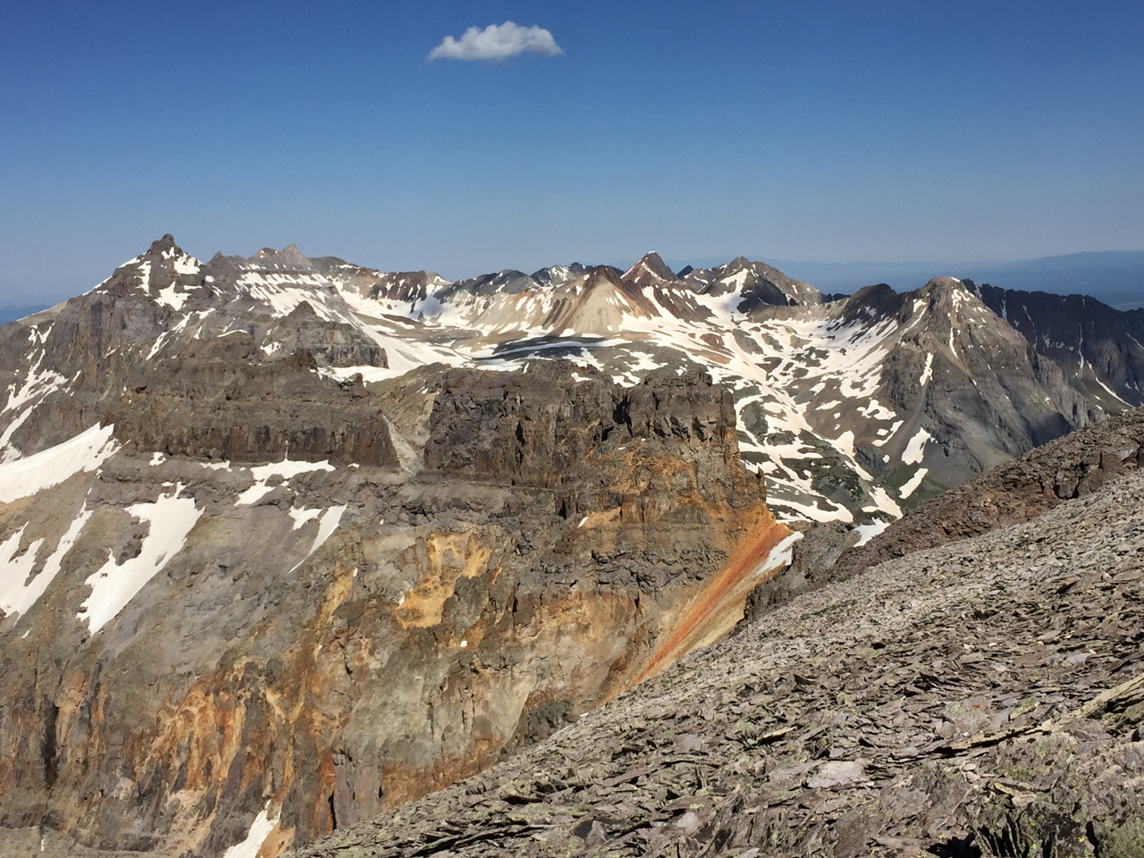
I reached the true summit between 8:15 and 8:20, where I enjoyed the views all around – behind to Teakettle and Potosi, and ahead to Gilpin and Sneffels. I spent about 20 minutes surveying the scenery, looking through the names in the register, and eating.
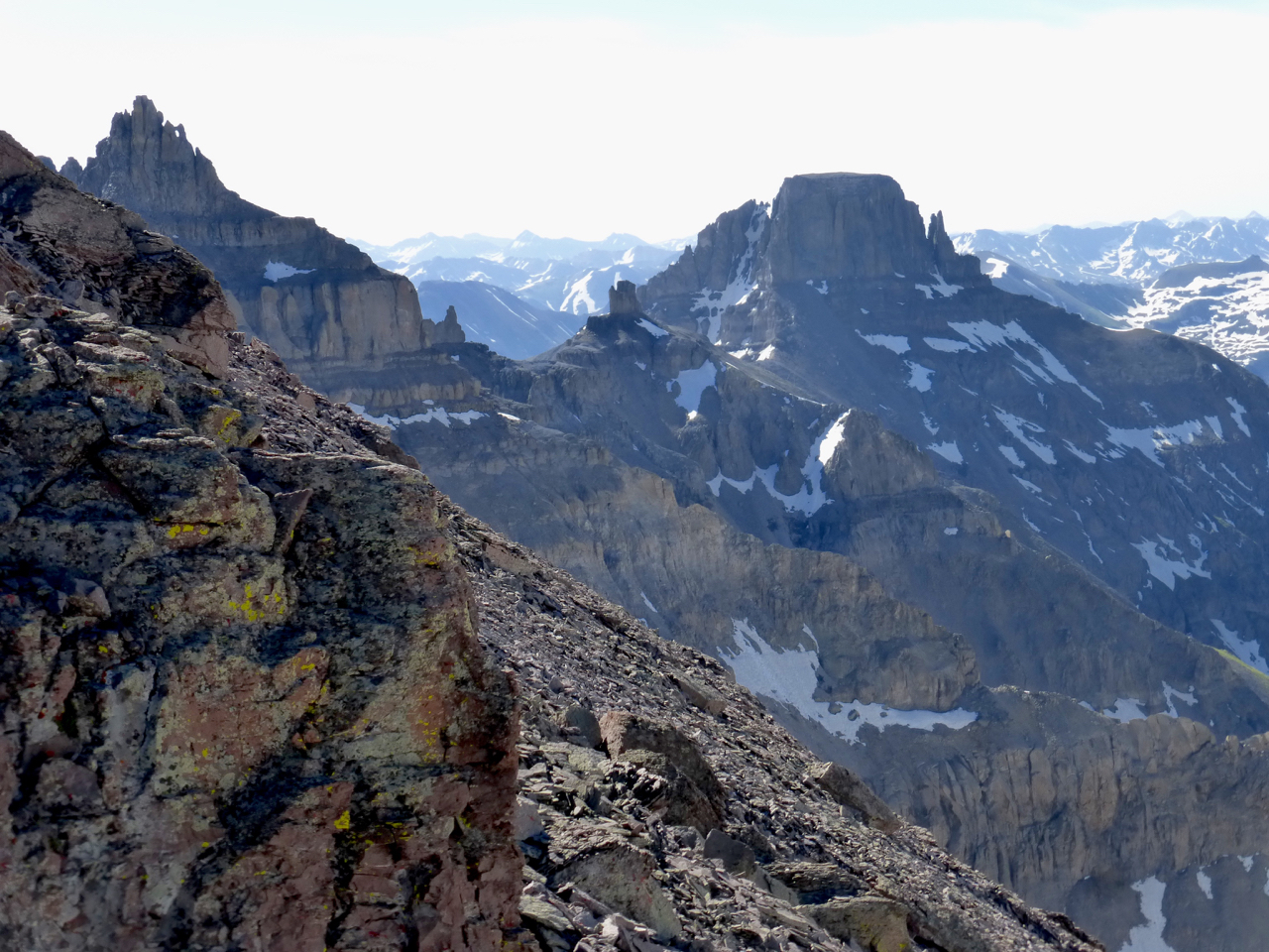
Teakettle, coffee pot, and Potosi from Cirque Mountain, just off the summit.
The descent off Cirque had only one obstacle as I followed the ridge down: a section of fractured white rock. Nothing technical; I’d call it class 2+ or 3-, but the whole thing seems waiting for just the right wind to blow it all over.
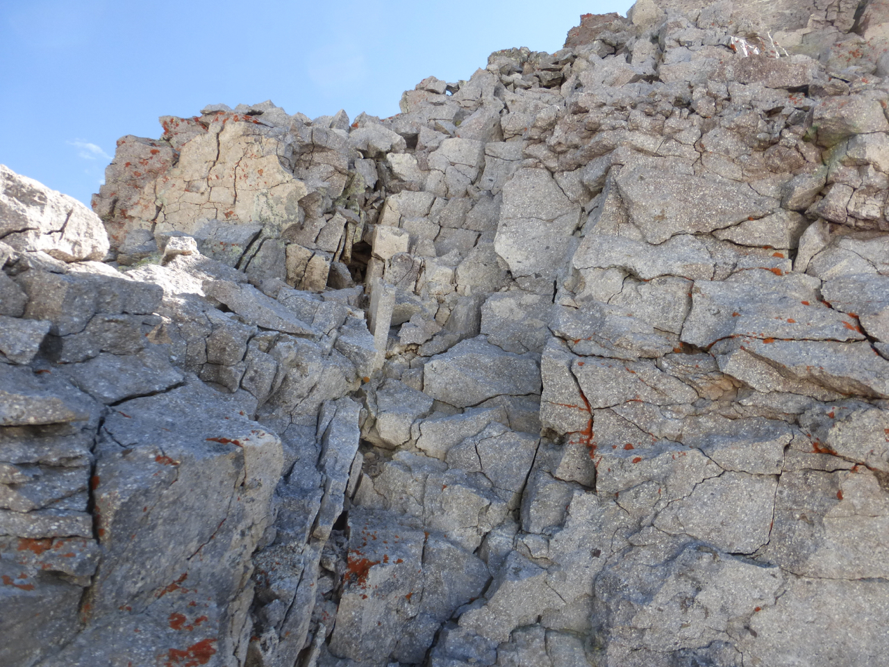
I came down this junk?!
The slopes after this step held typical loose rock, but nothing terrible. Sneffels lorded above the route, as it does from the Blue Lakes to the north, and in contrast to how ordinary it appears from most points in Yankee Boy Basin.
Descending Cirque, with Sneffels right, Gilpin ahead, and Dallas peeping over Sneffels’ ridge line.
It was 9:22 and the weather looked both deal-maker and deal-breaker. With clear skies in all directions, I need not fear a storm, but I also knew the sun would make the snow conditions difficult and perhaps dangerous on Gilpin’s slopes. I resolved to traverse to Gilpin, if nothing else to scout the route for tomorrow.
The descent was straightforward, following the trail on the beige slopes and then down a mellow west face. As I lost elevation, I gradually angled northward to keep close to the base of Sneffels, intercepting the main trail high along its route.
My only beta on Gilpin was to take its northeast ridge from Blue Lakes pass. “A straightforward scree slog,” as per SummitPost. At this time of year, when spring snow is melting away but before summer holds sway, it was not as straightforward.
From Blue Lakes Pass, I took a moment to marvel once more at the namesake lakes.
Dallas Peak, and the upper Blue Lakes, from the pass.
It had taken me just under two hours to get here. Next, I spent almost exactly an hour trundling up the ridge. I love a ridge scramble, but this is not that kind of ridge: it’s junk, like the connector between Matterhorn and Wetterhorn.
Slowgoing on Gilpin’s NE ridge. Summit far left, cornice skyline left of center, and “Black Tops” right of center.
Tiring of this, I found a suitable class 3 downclimb to some snow and enjoyed alternately glissading and walking supportive snow to Wright’s Lake, where I arrived at 12:45 (I’m a slow glissader).
With so much of the day to burn, I drove to Ridgway for dinner at The Colorado Boy, and then enjoyed a scenic drive along the Dallas Divide. The Colorado Boy has been in business since 2009; they brew satisfying beer, carry guest taps, and make good sandwiches and pizzas.
While the Colorado Boy makes an enjoyable lunch or dinner spot in Ridgway, don’t pass up Kate’s Place if you’re there for breakfast. Both restaurants present delicious food with friendly service. I am not related to the proprietors nor am I compensated for these words – I just have visited these spots on a few trips through the area and hope to see them continue.
June 26, 2016 – Mt Gilpin
My final day at my campsite at Thistledown. Peak or no peak, I had to be back to Denver this evening to go to work the next day. Also, since I’d not got Gilpin the prior day, T5 was out of the question. I’d made another peakbagger’s nemesis: an “orphan.”
Assured of a single peak day, I didn’t worry about too early of a start. Taking the familiar steps up the YBB road around 5:45, I paused for several photos of the sunhit on T5 and the Santa Sophia ridge. (The images did not live up to my memory, which is why they aren’t shown.)
I struck a steady pace up the road past the outhouse, across the stream, and past the trail cutoff for Wright’s Lake. Snow blanketed the road in many spots and the many footsteps in the snow made for fast travel. It seemed like very little time at all until I reached the sign for the Blue Lakes trail and I took this for a couple hundred yards until passing a small rise on the left, and then striking off left, toward Gilpin.
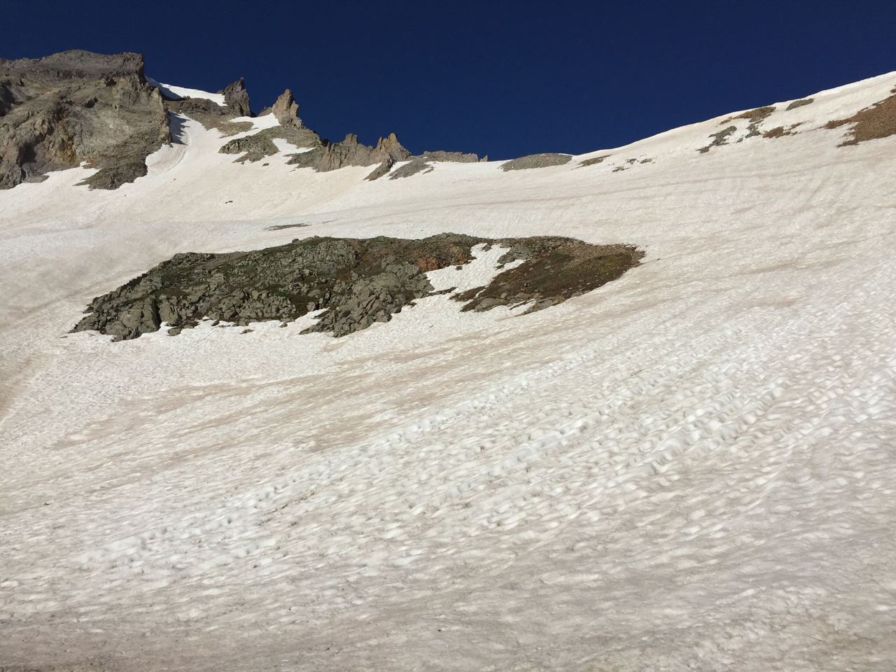
My progress continued swiftly, as the terrain from the trail lay fairly flat, inclining gradually. Thus, at 7:56 – two hours and ten minutes from starting, the remainder of the day looked like this. It would take me almost as long.
I put on the crampons, fetched the ax and walked beneath the rocks and around them on the left, and then struck a bee line for the ridge, reaching it by the lower spires. My view yesterday afternoon seemed to reveal a mostly dry ridge and I figured there would be at least a faint climber’s/goat trail to lend a foot.
I found a bare ridge and a trail in the scree to bypass a tower. Crampons off. Then I found hard snow. Crampons on. I had arrived at exactly the wrong time for this route. A week or ten days earlier and snow cover would have made it easier; a week or two later, and I would only have the loose rock and scree to contend with. In its current state, the patches of snow hindered rather than helped. Thus ensued a tedious repetition with the crampons: on again, off again, repeat.
The longest “crampons off” section of Gilpin’s junky NE ridge.
Eventually, as I reached the upper portion, I abandoned the ridge and struck out in the more moderate snow in the middle. Above this snow stretched a hundred or so feet of rock. Here I made a tactical error that could have cost me dearly. I took off the crampons and shambled up the rock: a steep pile of stacked talus like mine tailings, all rolling down as I moved upward, on all fours at many intervals. I should have kept the crampons on, and moved over into the shadow of the buttress, and climbed steep, but solid snow.
I soon realized this when I got above the rock and looked upward.
Photos so often make terrain look steeper than it is; this one does the opposite. The snow was too steep to walk on, I had to kick in steps. No big deal except there was no flat place to get the crampons on. With my right foot on a small spot of non-shifting rock and my left foot kicked in to snow, I was able to get a crampon on my right foot. But I didn’t have enough space to turn around to shift my body in a way to get the left crampon on.
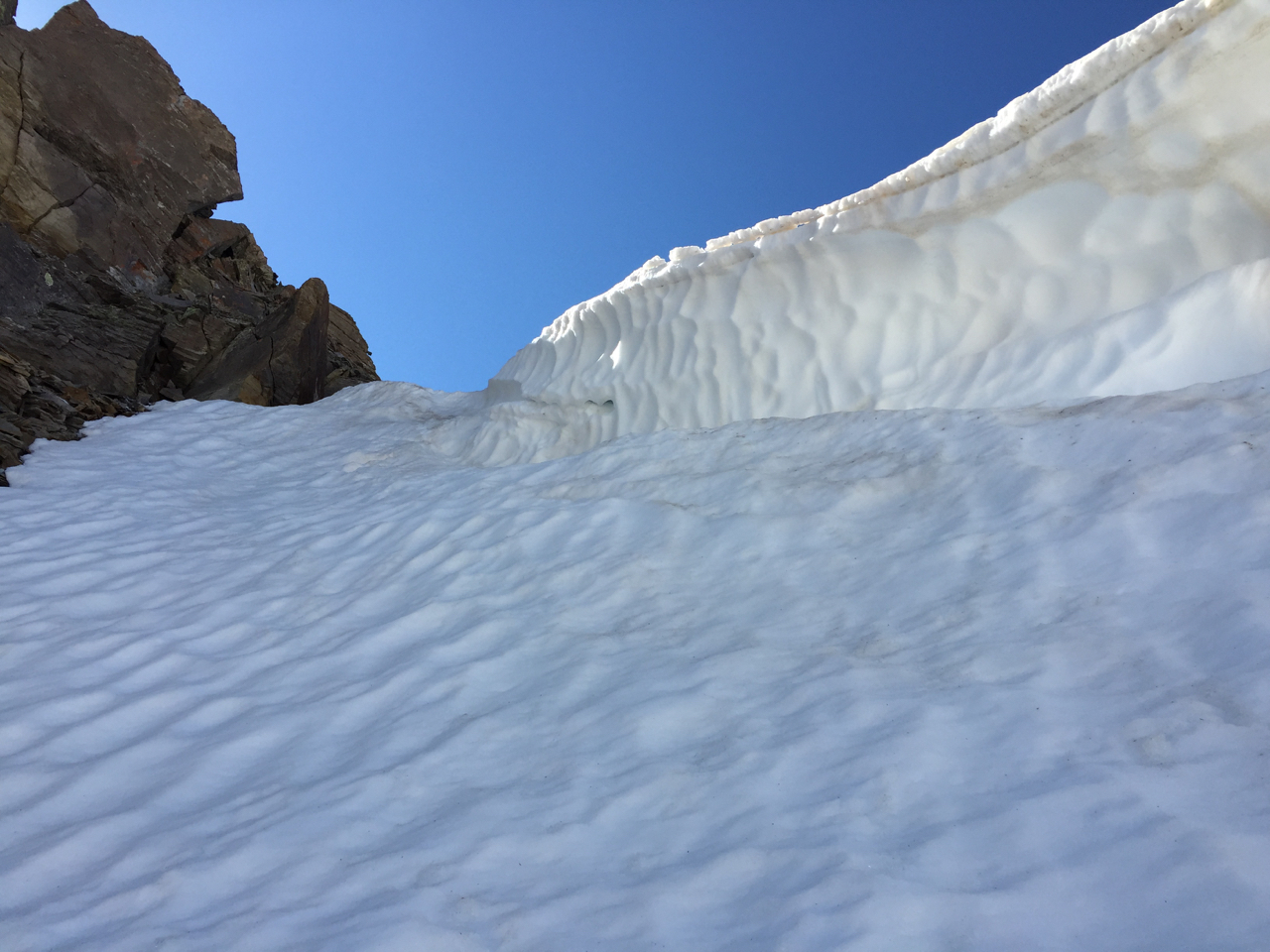
Below the cornice is a shelf about 18-20″ wide. The cornice was over six feet high on the right. Where it seems to end on the left it doesn’t really.
With my ax in my right hand and my other crampon in my left, I made my way up to the shelf. Then I shuffled across the shelf on all fours. Reaching the end of the shelf and around the rounded edge of the cornice in the shadow, I then had a four foot vertical wall to front point into and plunge the ax up over the top.
After those long moments of controlled breathing, I had nothing left to quicken my pulse but the anticipation of the summit. The way to it looked like this:
No nasty notch awaited me on the other side of this little hump of rubble. In just under ten minutes, I stood at last on Gilpin’s summit, admiring the views in all directions, but especially northward to Dallas and the high basin between it and Blue Lakes. My toes have itched to go there for some time, to stand atop T0 and some others, notably S4, the gray gatekeeper in the sun at the basin’s eastern edge.
Relieved to put both crampons on for the way down the cornice, I kept to the snow and found it convenient to remain facing in for all of the upper route. Not until I got below the point where the rock curves away to the south did I feel comfortable to glissade.
I found continuous snow to Wright’s Lake by staying closer to Gilpin’s base and then took the Wiright’s Lake trail. This way made for the most expedient descent, but I still think that staying to the Blue Lakes trail made faster progress up, because it seemed to involve less climbing.
Though I’d seen only three hikers en route for Sneffels on my way up, Yankee Boy Basin was of course by now buzzing with ATVs, jeeps, elongated tour jeep/bus things. Crazy, I thought, how many people were on the road compared to how few on the trails above the road. And I don’t mean to sound harsh, but I noticed amongst several of the tourists, if they would consider walking a trail for two hours versus riding in a vehicle and never walking more than fifty steps at a time, then they wouldn’t look like cardiac arrests waiting to happen.
The human activity did not unduly distract me from the splendor of Yankee Boy Basin, though, and as I walked the road leisurely, I found a couple short trails from it that led to vantages I’d not seen on my trip last year. I end this account with one of those views.
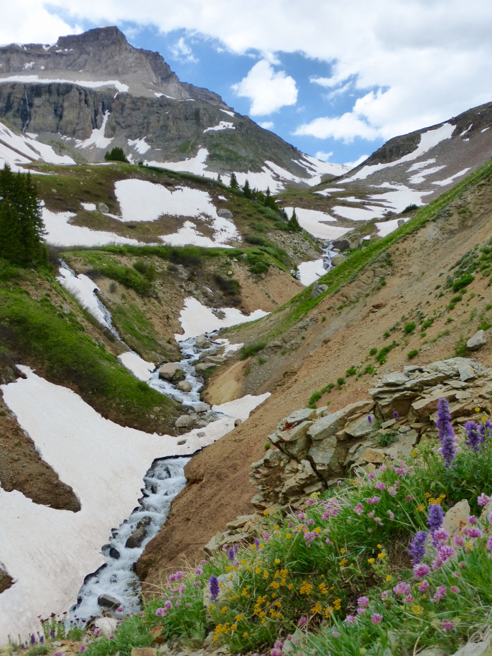
Gilpin and Sneffels Creek from lower Yankee Boy Basin.
Nice part 2, Steve. Congrats on the productive weekend! Looks like Gilpin gave you the most resistance out of all 3 peaks eh? Cool parting shot.
Yeah, Gilpin put up the stoutest resistance….would have been much easier, I think, a few weeks earlier with more snow cover . YBB is a special place, though. I love how serene and wild it feels, just a mile or so and couple thousand feet above the gaper-glutted road.