Fordland! Fiordland, amidst the mountains and the sea!
Cradle of life; a refuge you have been to me.
O lofty heights! Deep mists! Famed land of evergreen;
Comfort to a wand’ring soul you have ever been.
Falling waters! Soaring Peaks! Stars set high in space;
A joy to tread your paths, to feel your sweet embrace.
In all these years of toil, still I have not found
The hope of life, the calm that dwells among the sounds.
O Fiordland, Fiordland! Restore back my heart to me,
Will I find peace outside the mountains and the sea?
Many years ago I came to Fiordland for the first time. A part of me never left. For such is the beauty, the majesty, and the splendor found only at the southern end of the world. Across many lands and many miles have I now walked. But I have yet to find its equal.
Atawhenua. Shadowland. The finest wilderness in all the earth…
Planning for The Milford Track Run
- Route: The Milford Track*
- *Backwards, from Sandfly Point to Glade Wharf
- No Sutherland Falls side-trip this time
- Summits: None en-route.
- High point of McKinnon Pass – 1,154 meters (3,786 feet)
- Runners: Solo
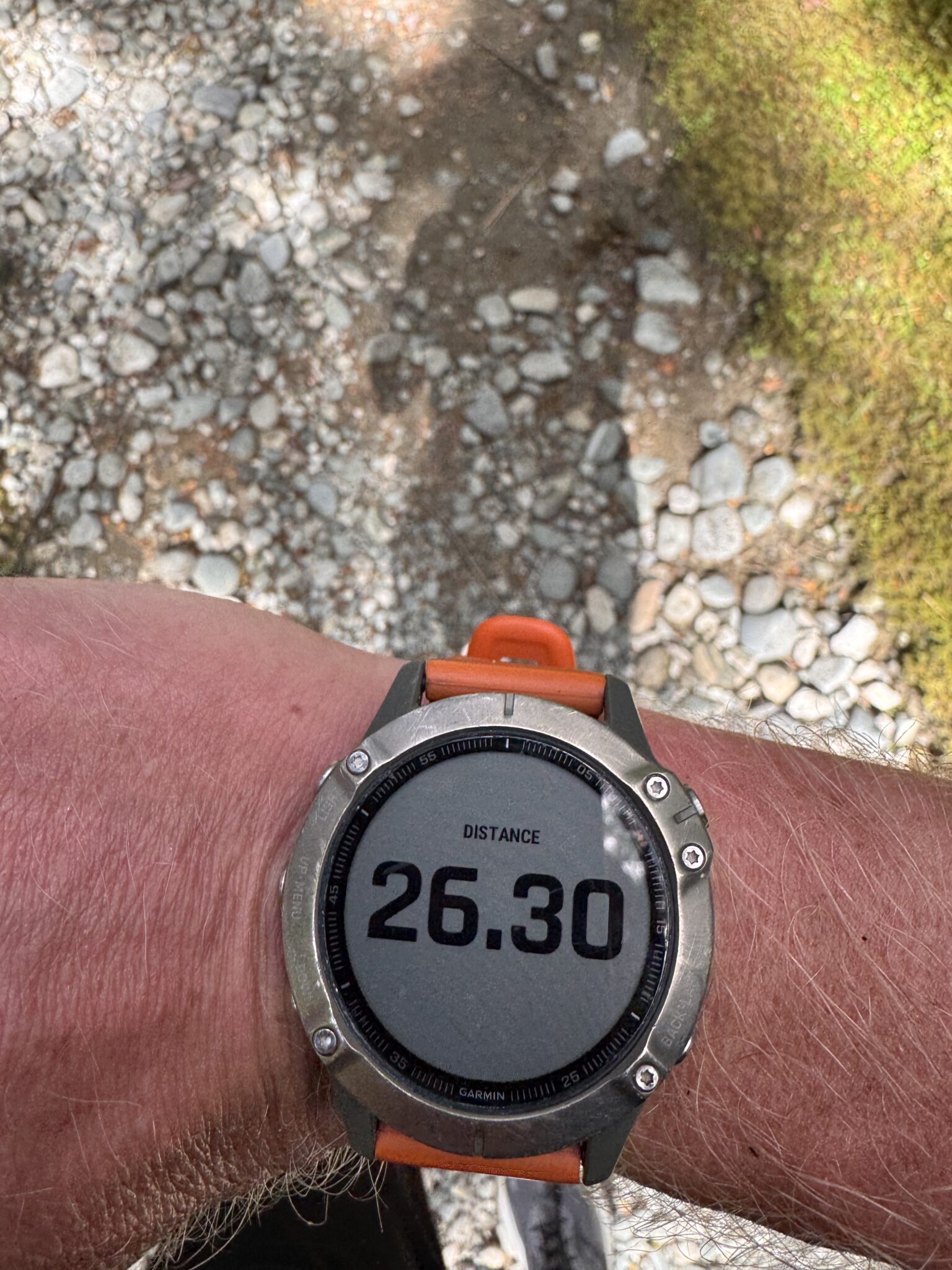
- Distance: 34.64 miles
- Vertical Gain: 5,571 feet
- Date: 3/15/26
- Strava Track: https://www.strava.com/activities/17726617148
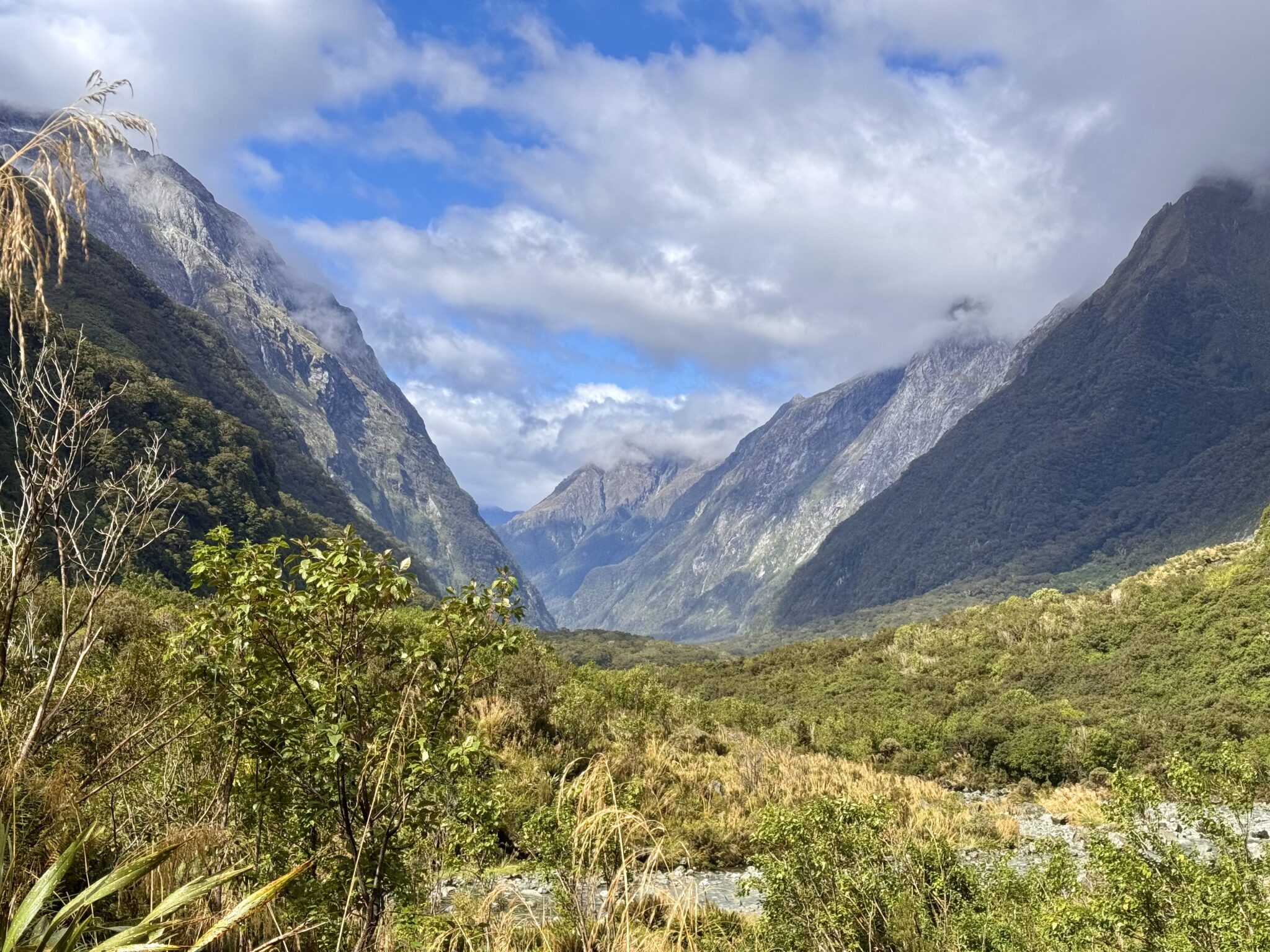
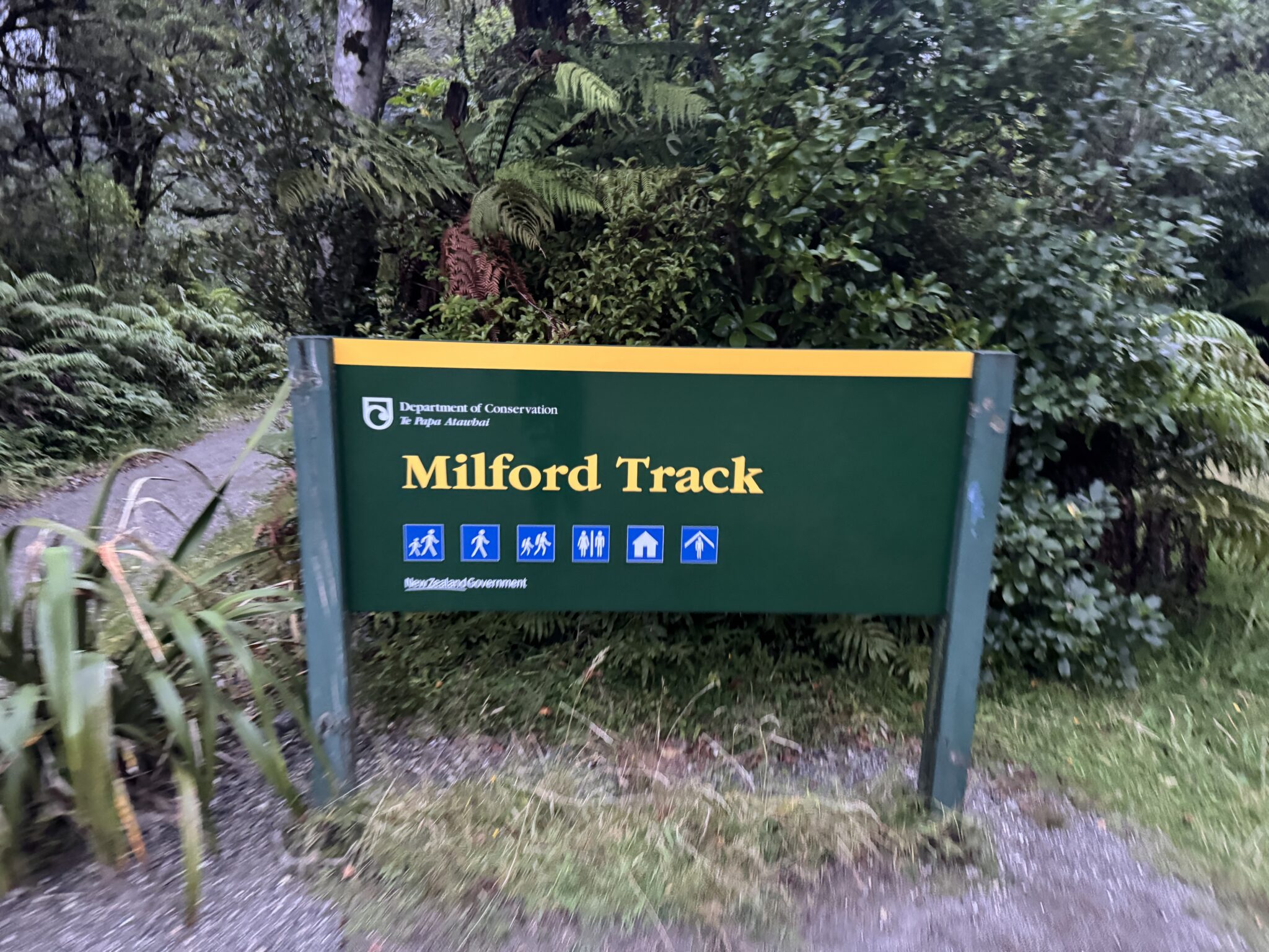
The Milford Track cuts through the beating heart of Fiordland National Park on the South Island of New Zealand. It runs 33.5+ miles across sweeping river valleys, roaring streams, looming waterfalls, soaring mountain passes, and lush beech forests. The trees are thick and the vegetation is dense. The rains are torrential. The streams flood in an instant, cutting off all hope of traversing them (or at least those without bridges). All the while towering peaks rise above; impossibly sheer mountains of granite that offer an endless cascade of waterfalls across their vertical faces. And, as if designed that way on purpose, the track ends at the crown jewel of the entire country: the fabled Milford Sound.
The landscape is as rugged as can be found anywhere on earth. But the Milford Track is a passageway into an otherwise inaccessible space. A window into a forgotten time, ancient and sacred. It is widely considered the finest walk in all of New Zealand. Some say, the world.
Traversing the Milford is no simple feat. The point to point journey is only accessible by boat. And that is required on both ends. Moreover, the only way to legally walk it is via reservations with New Zealand’s famous hut system. Such is the allure of The Milford that public huts usually book up almost as soon as they become available months in advance. The walk is a strictly regulated four day journey. Each night requires a stop at the prescribed hut in order to limit constraints on this fragile environment. There are alternative options to book private treks and private huts, but those are expensive and controlling. Suffice it to say, walking the Milford requires time, patience, money, careful planning, and a good deal of luck.
Unless of course, you choose to run the whole thing in a single day…
When we planned our return visit to New Zealand I made the Milford Track a top priority. I had tramped around Fiordland quite a bit on past journeys, but I had yet to walk here. Knowing our time was limited, I began my research on what a trail run might look like. Thankfully, Fiordland Outdoors – an adventure outfitter based in Te Anau – had outlined the best way to do the Milford Track in a single day via their excellent blog post on the matter. As I researched further, I realized they were basically the only company who offered transport to pull this off anyway.
Over the next few weeks I worked with them to better understand all the logistics required for the crossing. I was impressed by the level of planning, forethought, and professionalism they put into the process. Doing this in a day required not only multiple boats and crew, but also, the assurance that anyone they put out there wouldn’t get seriously lost, injured, or stuck. An all too common occurrence in Fiordland, it seems.
The logistics also necessitate that you run the track backwards from the traditional route. That is, all runners begin at the traditional end point in Milford Sound, working their way back to the standard starting point at Glade Wharf. The reason for this, as best I understand it, is to simply manage the boat times best at either end. Runners will usually share the boat out with day-walkers who go in and out of Glade Wharf after a single day’s walk along the track.
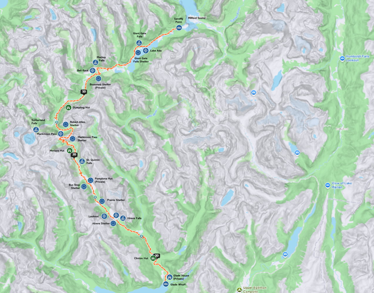
Map of the full Milford Track with most major huts, shelters, and sights marked along the way. The main DOC huts are highlighted in green (click to enlarge).
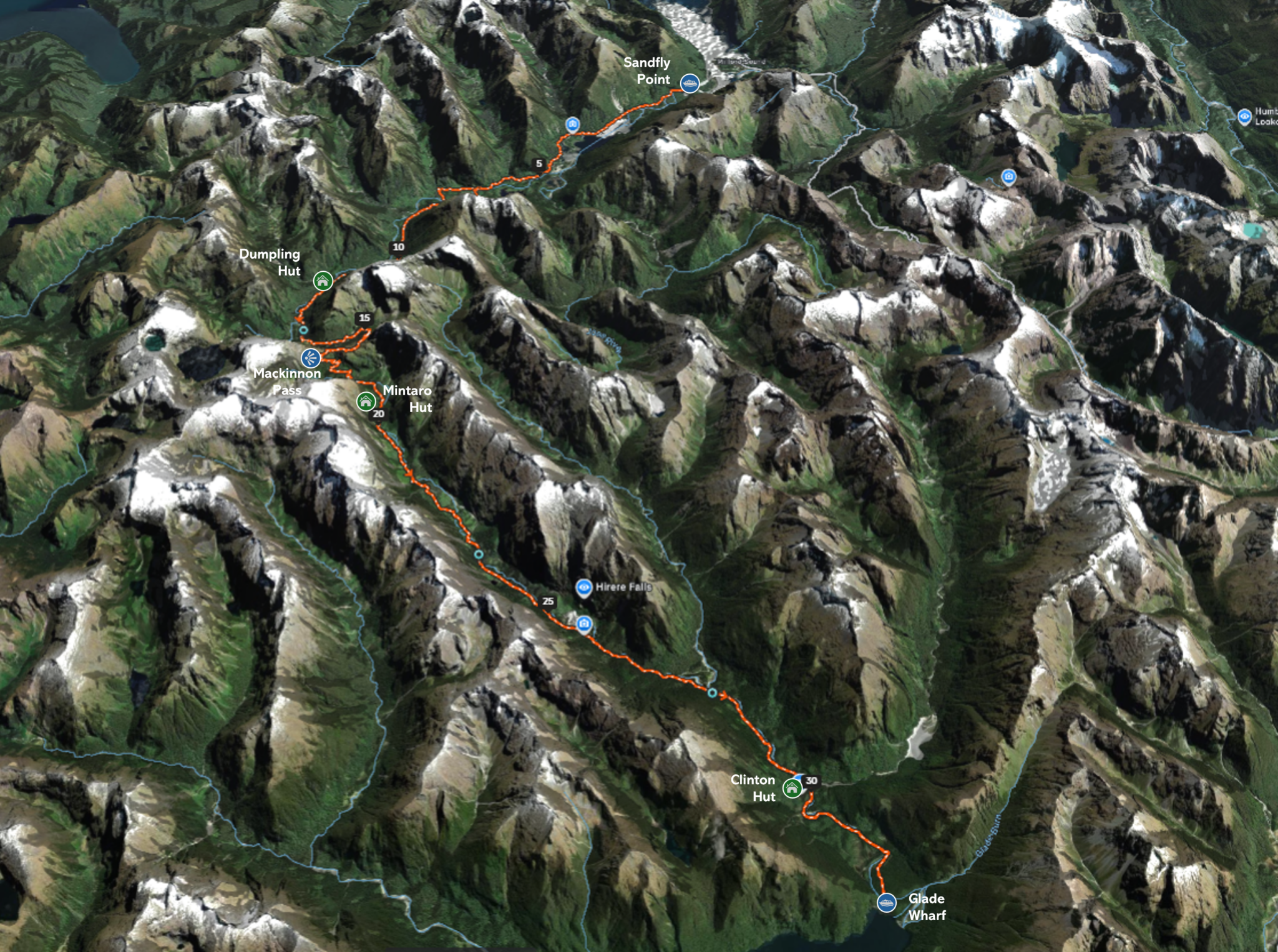
The same map again, but this time in 3D and with just the main huts featured. (click to enlarge)
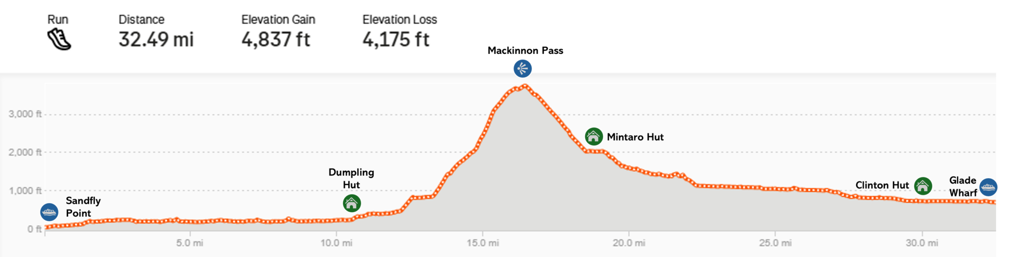
Milford Track elevation profile according to Strava (backwards route) with the main huts marked. The whole thing is essentially one massive climb set between two long, gentle river valleys. The stats above proved to be a bit short of the real life reckoning. (click to enlarge)
Fiordland Outdoors offered a single morning boat for any runners, departing at 7:45 from their dock in Milford Sound. There were two boats available at the end of the day: one at 4:30 and another again at 6:30. The 4:30 boat was the preferred option and at a very reasonable cost. But the latter came with a catch. If they had to make a full return journey just to pick up slow runners, you had to pay for it…literally. The 6:30 boat coast an additional $400 NZD, payable by anyone who didn’t make it out on time. A fact they made abundantly clear before they let you leave. The extra cost is not a big deal when larger parties set out together. But for a solo runner, that was a fee I was quite keen to avoid.
The deadline added to the fun though as it created a bit of a race-like environment all day. There was big incentive to finish on time.
Anyway, after hours of planning, many emails, no small amount of paperwork, a few beacon tests, and thousands of miles of travel, I finally found myself standing on the shores of Milford Sound, ready to depart on a long expected journey.
Sandfly Point to Dumpling Hut
As the pre-dawn light highlighted the grey shapes of looming clouds across the waters of the sound, I remembered why I loved this place so much. This is a fiord like no other. The setting, the scale, and the beauty is simply unrivaled. I was sad to not be able to spend more time here this trip. But the schedule for the day would be quite strict. So, I tipped my cap to Mitre Peak (a mountain I will come and climb again some day) and I hopped onto the boat for our quick shuttle to the accurately named Sandfly Point.
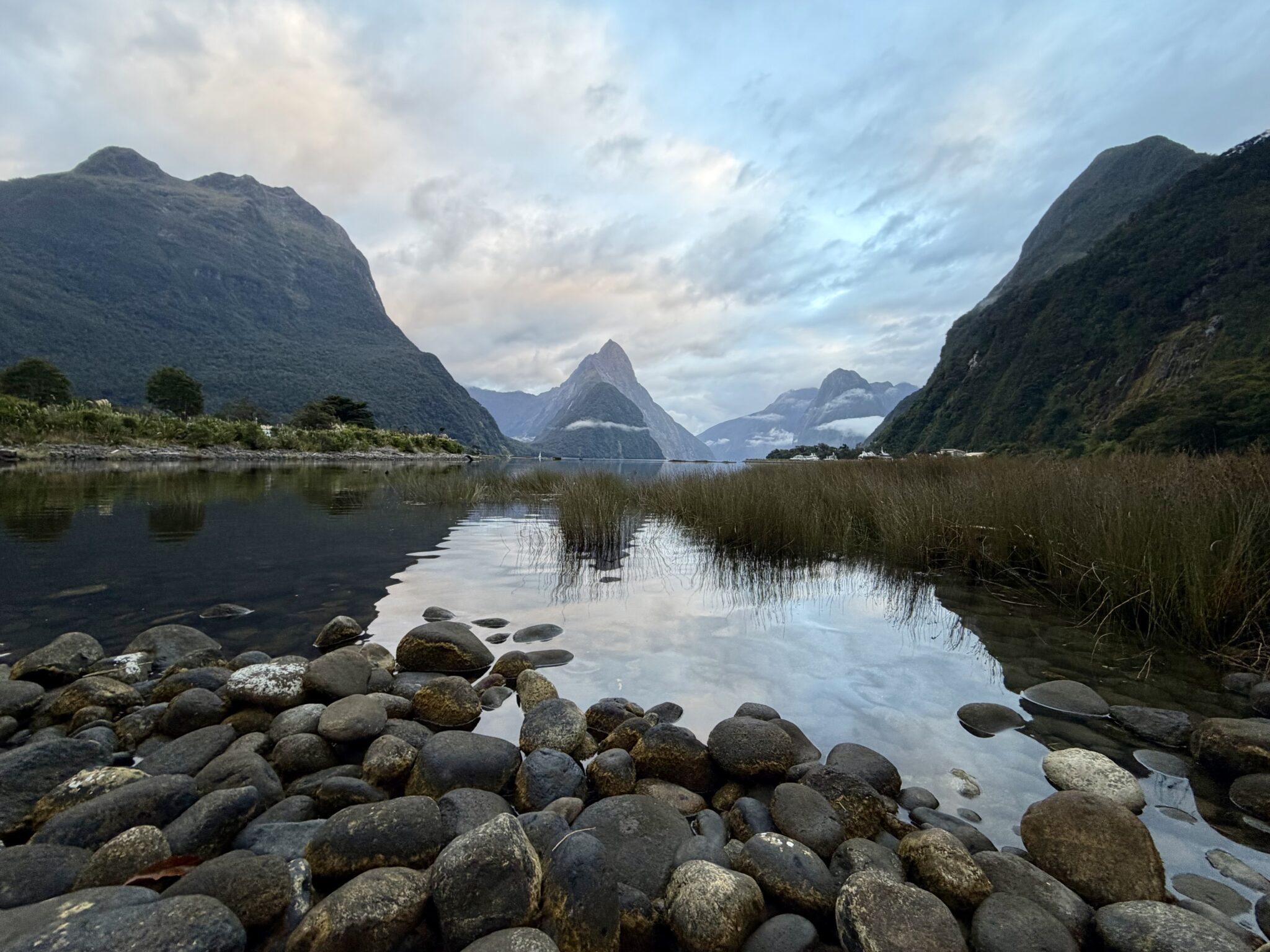
Milford Sound might just be my favorite place on earth. But sadly it was just a gateway today.
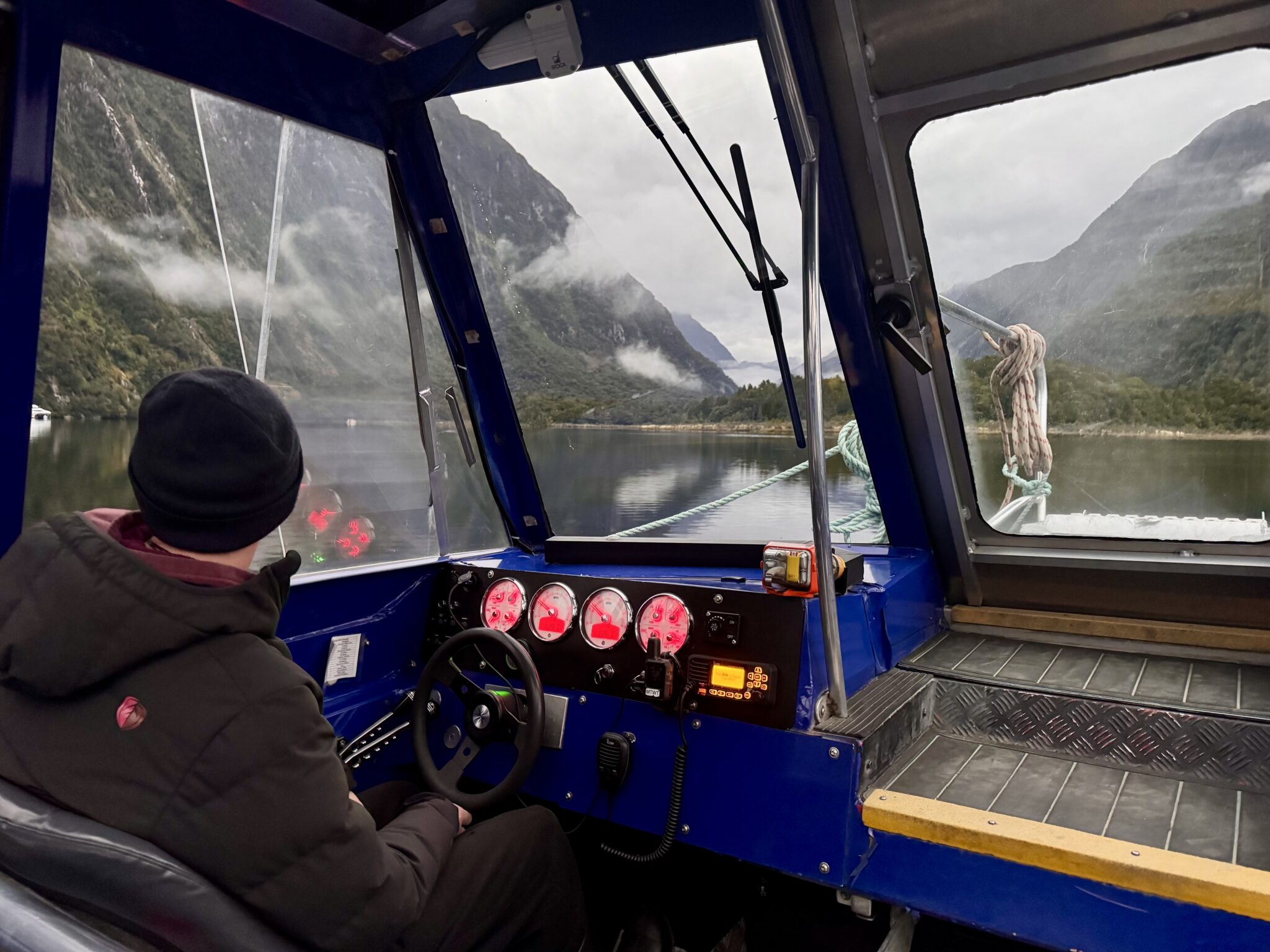
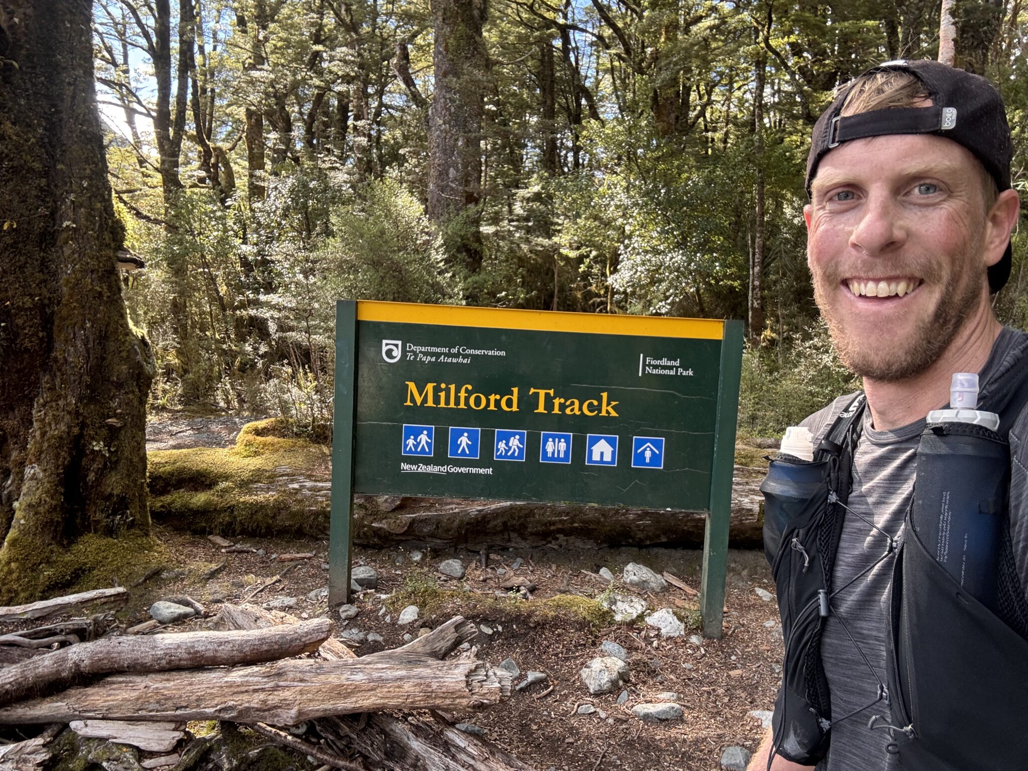
We took a short 5-10 minute cruise over to Sandfly Point before setting off. It was 7:40 when we began, which gave us just under 9 hours to reach Glade Wharf at the other end by 4:30.
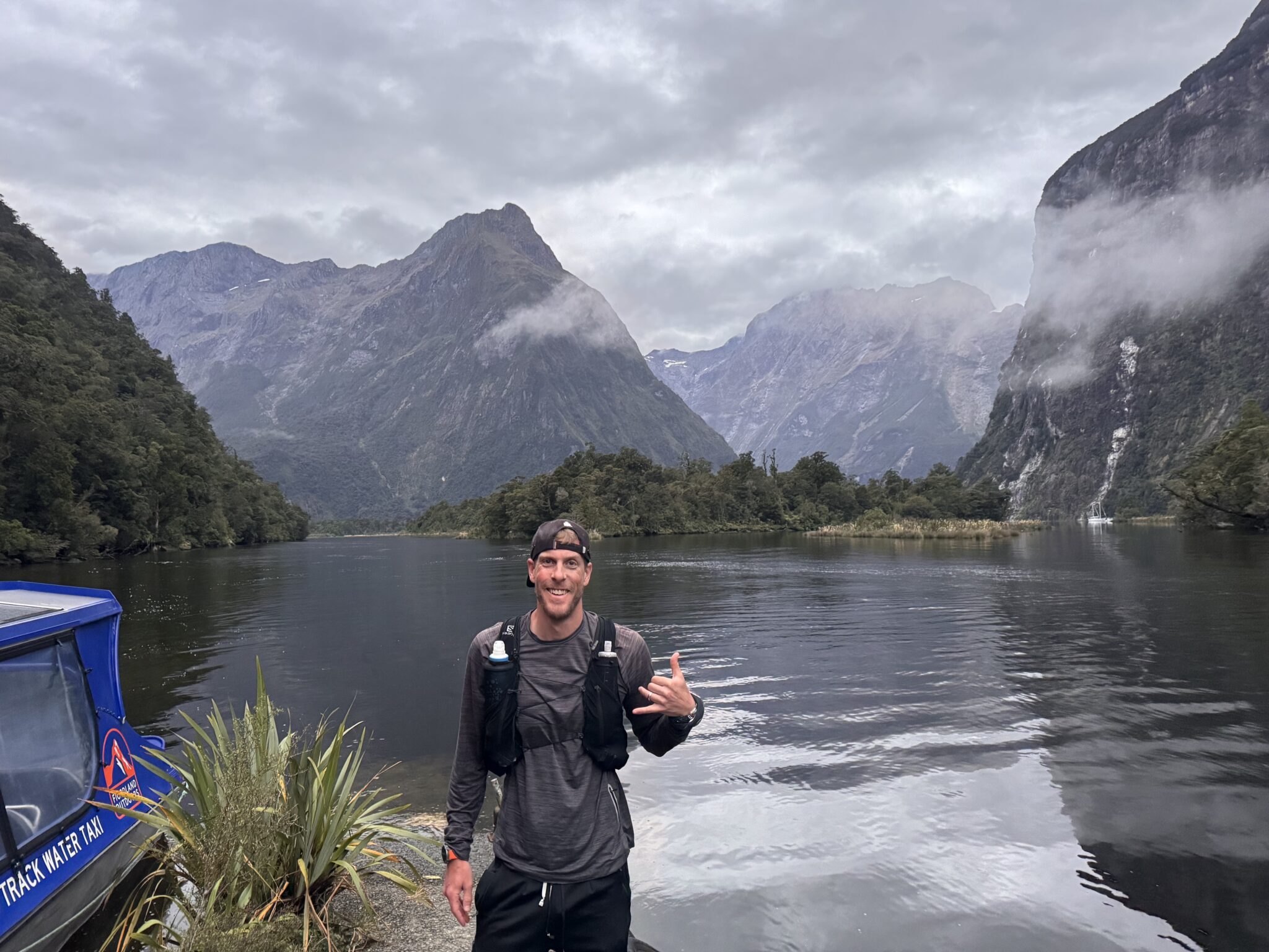
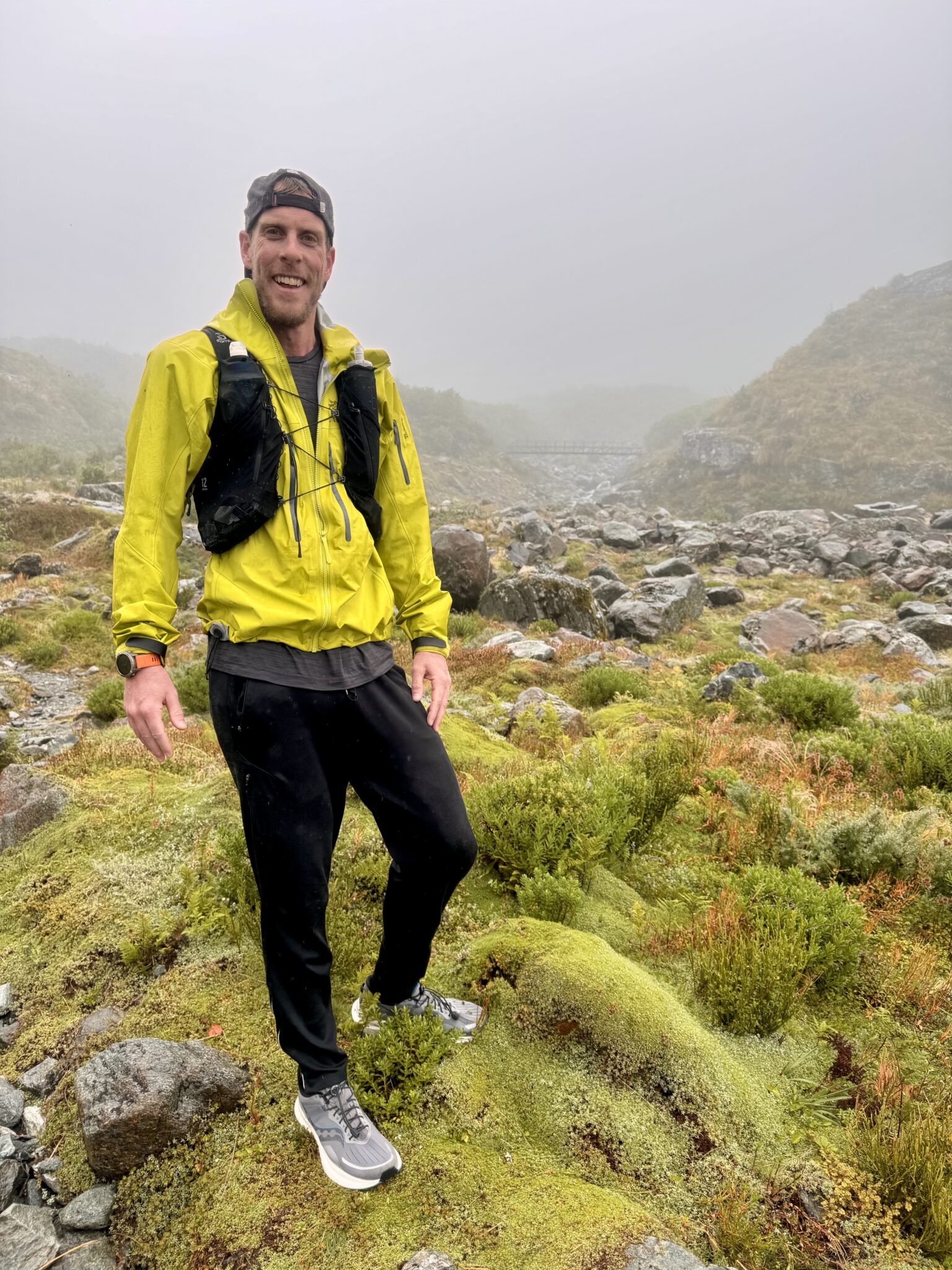
All geared up and ready to embark from Sandfly Point.
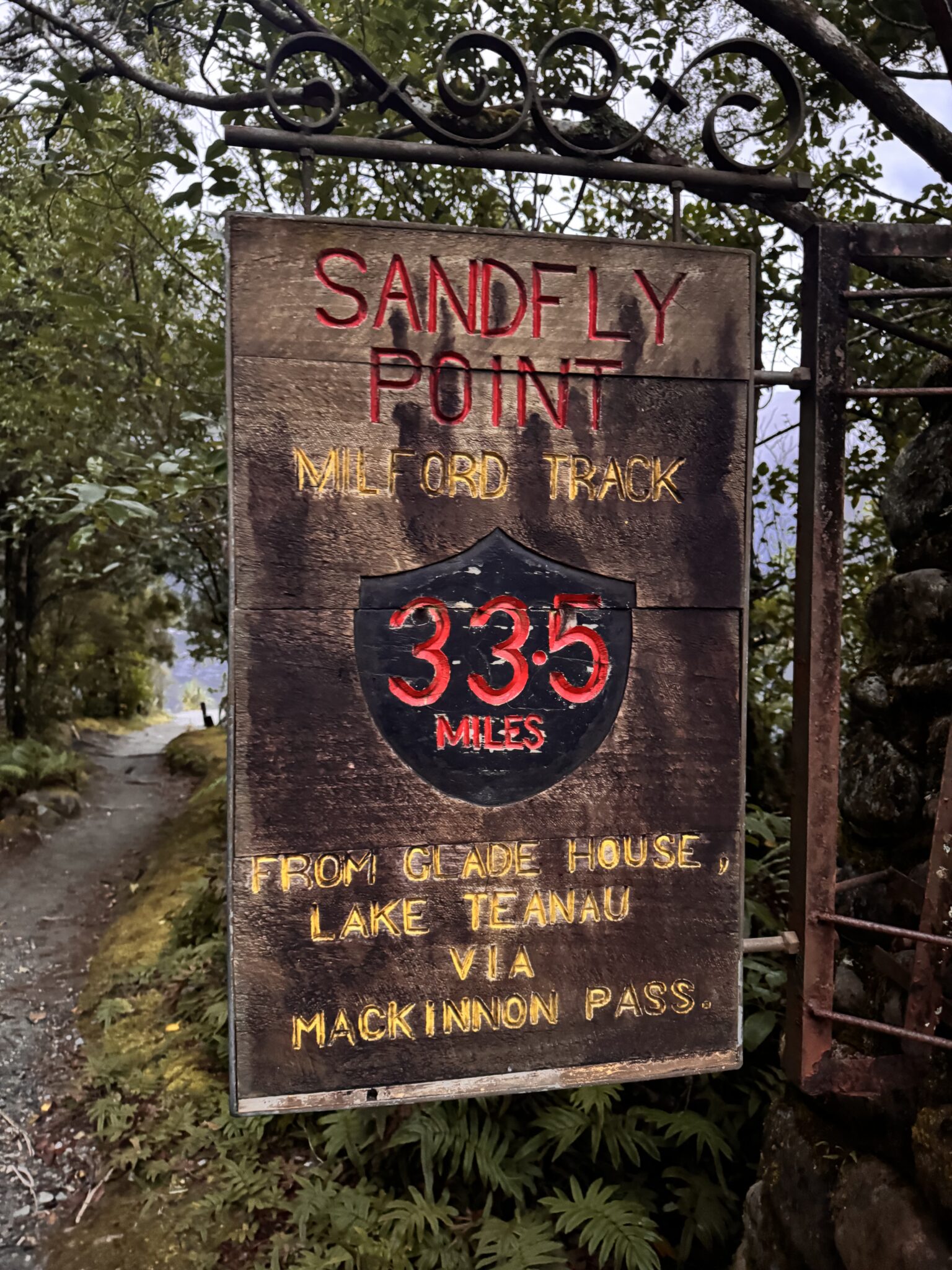
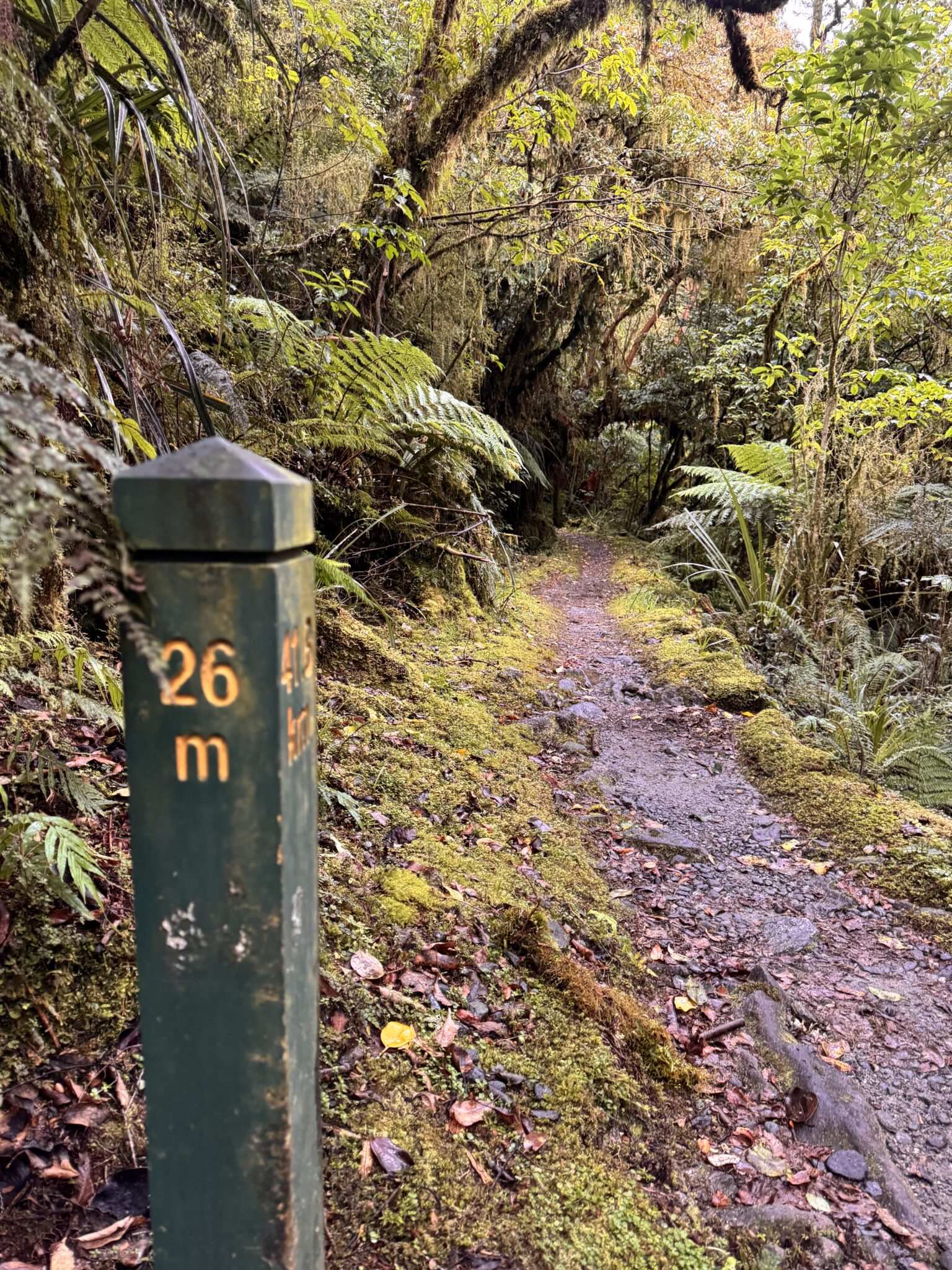
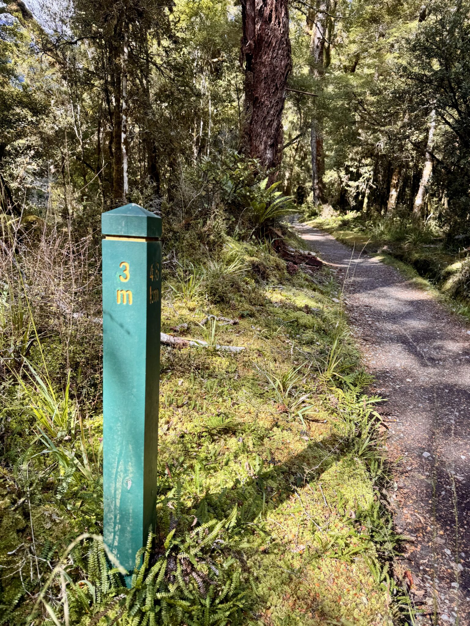
The ending sign for the Milford. The track had mile markers (not kilometer markers, curiously) the entire way. This proved to be exceedingly helpful as I could count them down all day long. A very useful tool to not only know how much distance remained, but also, to help keep tabs on the ticking clock.
There was only one other runner this day – Brian. But I was keen to enjoy the freedom of the wilderness in solitude. So, after we disembarked I bid him farewell as he took off down the track. I started my steady journey up into the forest alone and content.
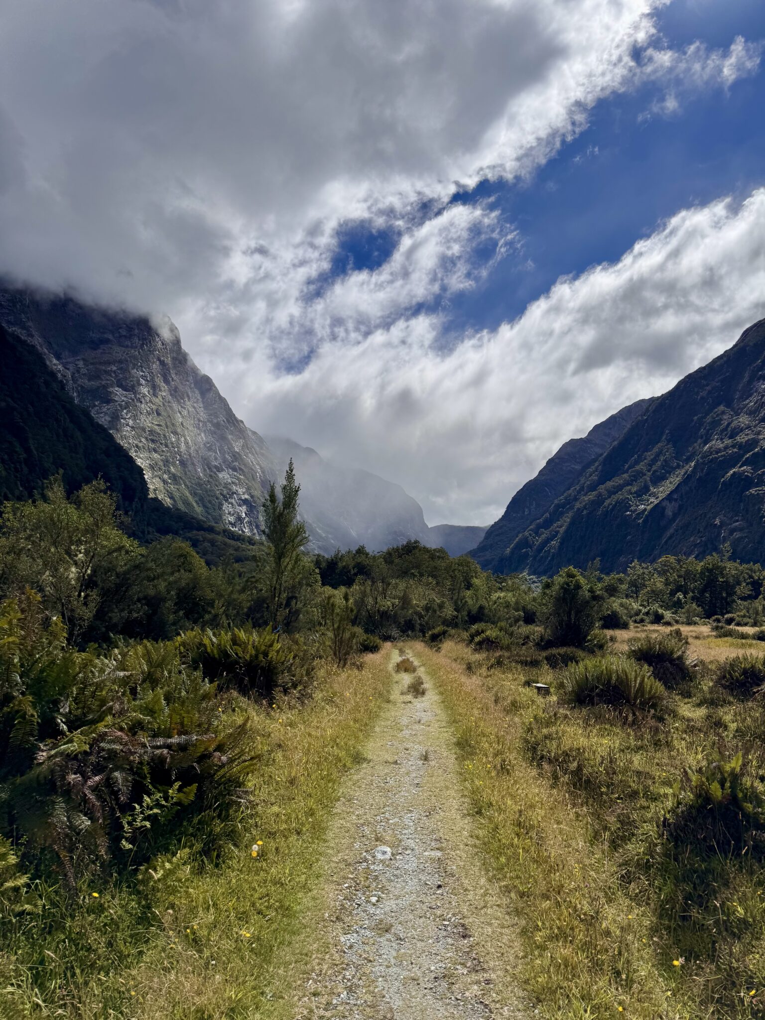
The opening ~12 miles of the track, from Sandfly Point all the way up to Dumpling Hut, were relatively flat and smooth. A slight incline led up into the Arthur River Valley, but not enough to really tire the legs. Which was a good thing. I had completed the New Zealand IRONMAN just 8 days prior. Given that effort + the strict time constraints of the day (not to mention the remoteness), I was content to take a slow, steady pace. Blowing up early was not really an option. Beside, my aim was to spend as much time as possible within Fiordland, not to blitz through it.
Thankfully, my legs responded wonderfully to this. I felt good all morning. The track itself was in excellent condition and in fine form for jogging. All that was left to do was settle in and marvel at the unfolding wonders around me.
This way to paradise.
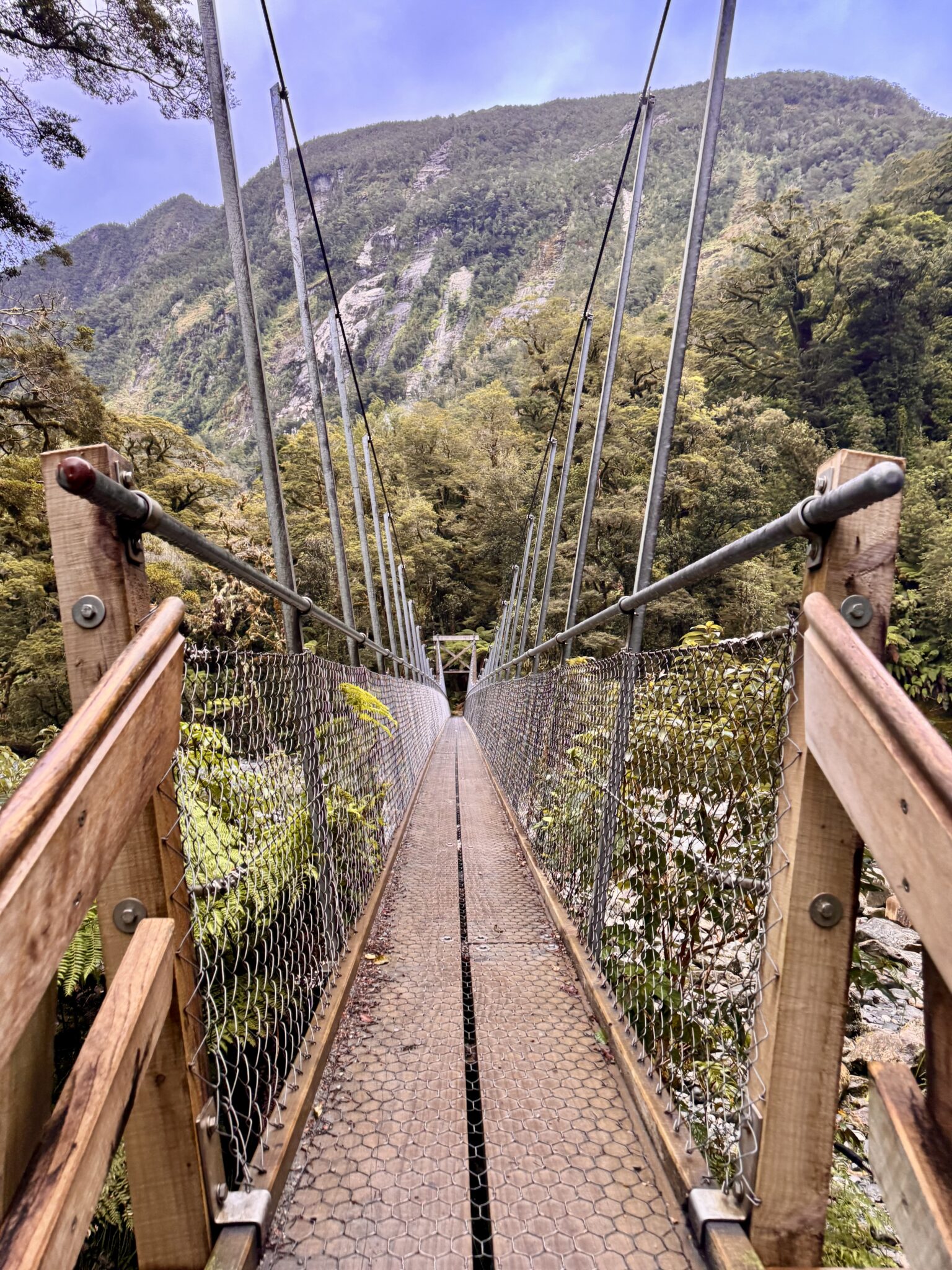
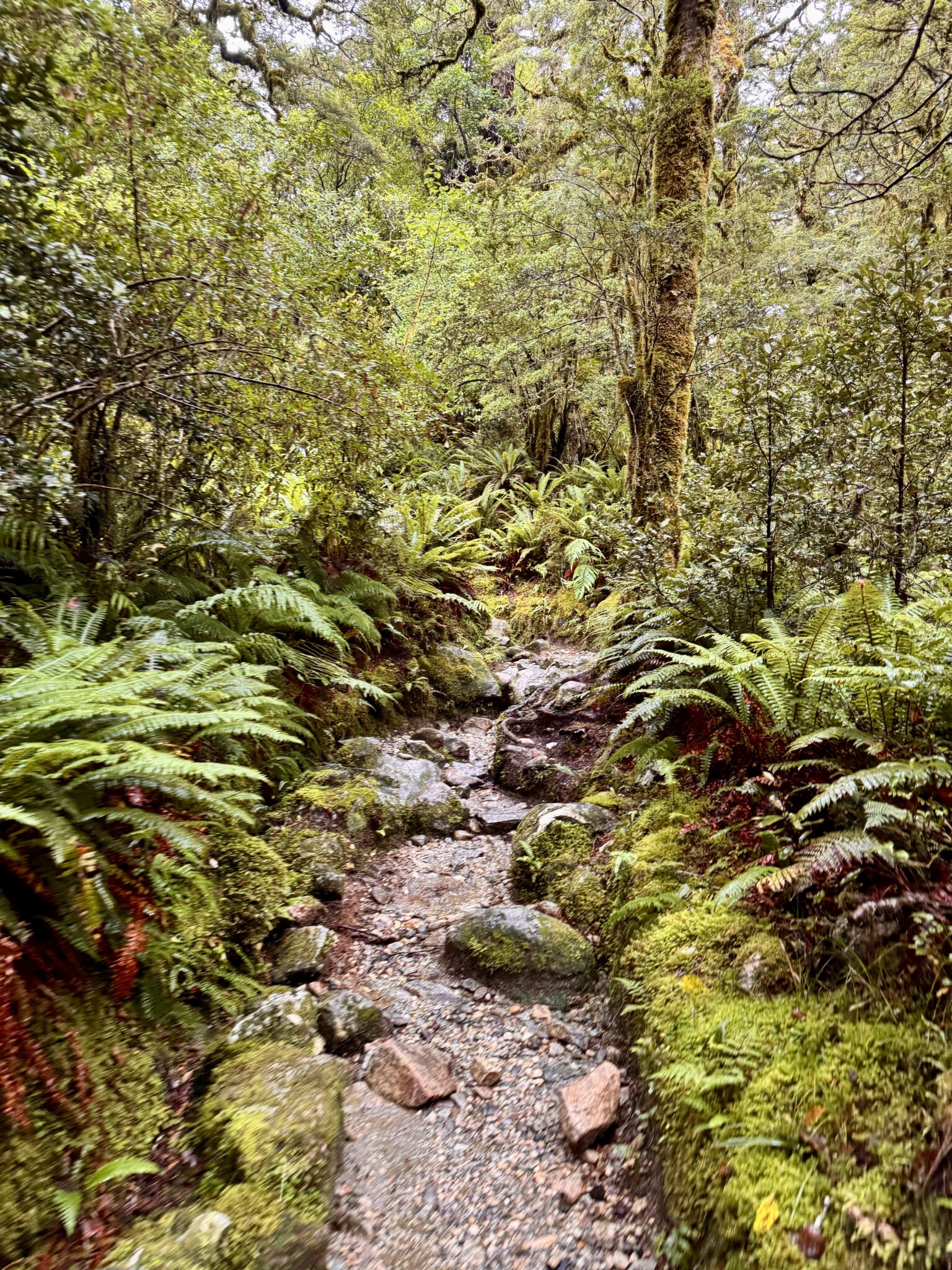
The opening miles followed the Arthur River underneath a thick cover of classic New Zealand fern forests. Sporadic breaks in the tree cover yielded views of towering mountains and mists at every turn. Water is one of the defining characteristics of Fiordland and this was found in no short supply. A gentle rain fell all morning. Creek crossings were common. Thankfully, New Zealand’s Department of Conservation is one of the best organized units of its kind anywhere. The upkeep of the bridges and the trail was top notch. Each swing bridge was as charming as the last, affording some of the best views of the early morning (not mention making all this possible).
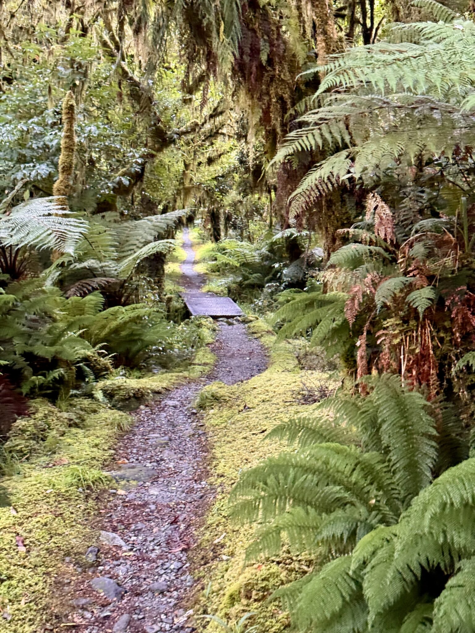
Typical track terrain. The opening miles ran up the Arthur river valley underneath a thick cover of beech forest. Supremely runnable, despite my plodding pace.
Breaks in the clouds led to million dollar views in every direction.
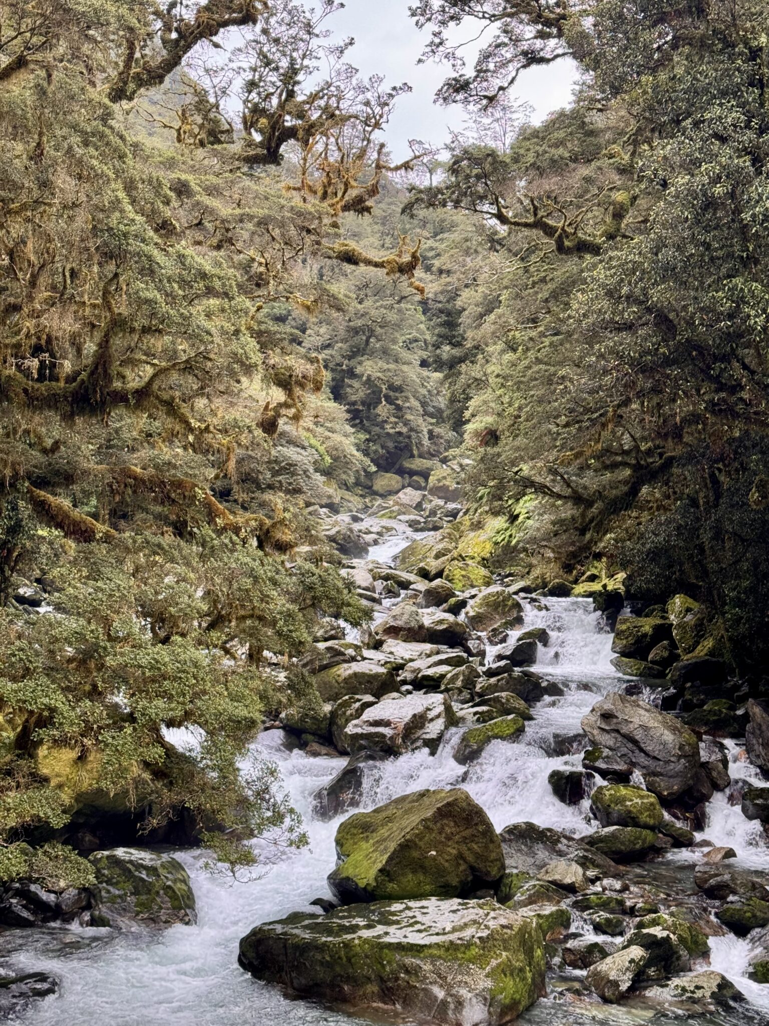
I caught Fiordland on a relatively ‘dry’ day, which made most of the water crossings a non-issue. Nevertheless, the sound of falling, roaring waters is a constant on The Milford.
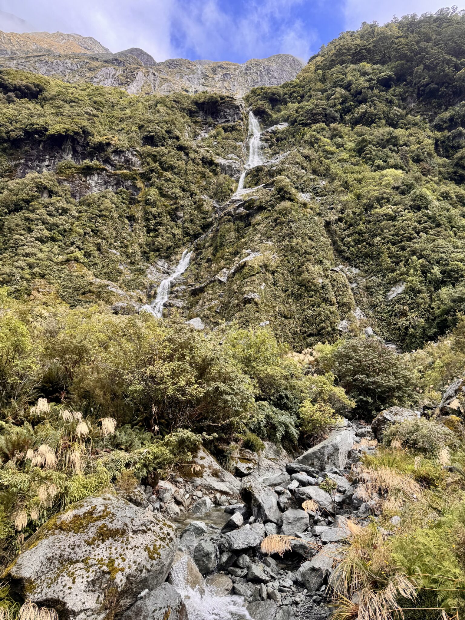
Not to mention the waterfalls, which are virtually everywhere. It’s almost impossible to not become numb to them after a while. Anywhere else each one would be the highlight of an entire day’s journey. But here, they are commonplace.
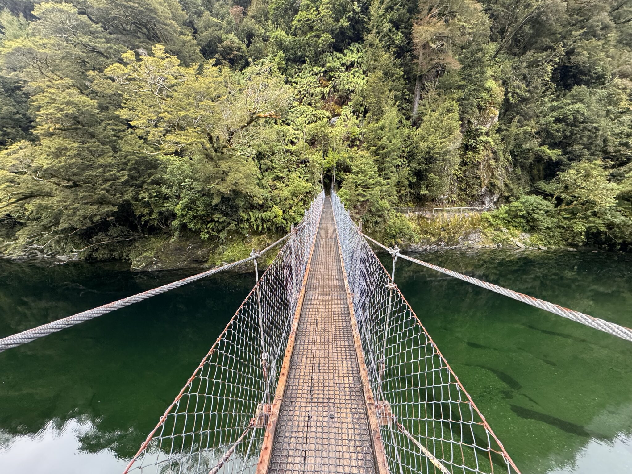
One swing bridge after another as well. It’s easy to forget how remarkable these are. And how they are essentially the only way any of us would ever get to experience these places.
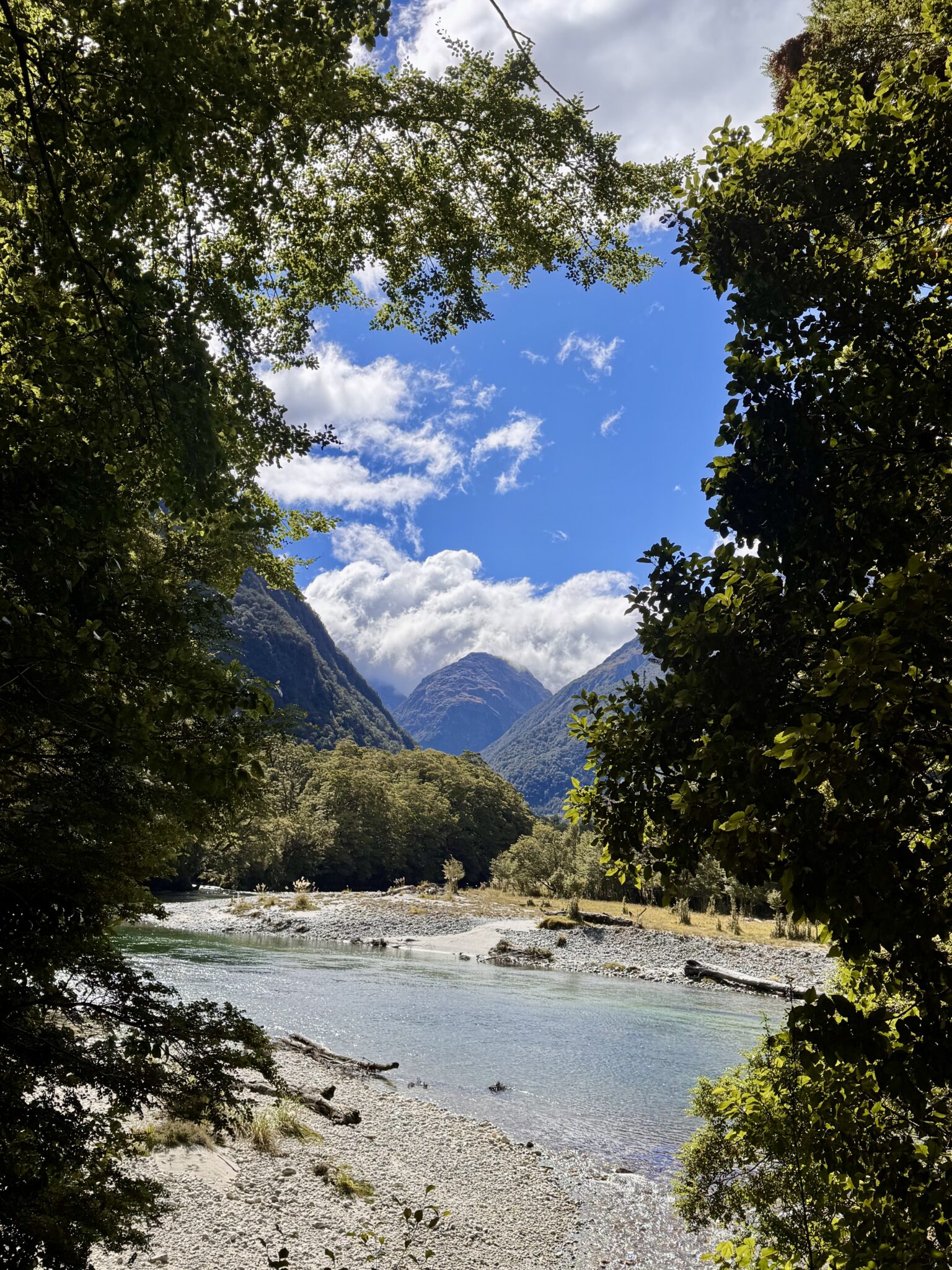
After a few short miles I eventually reached the shores of the first major landmark: Lake Ada. Several side passages led to different rocky beaches along it’s jumbled shores. I lamented not having the time to detour and relax on the lake. One of the major advantages to a four day walking of the track is that it must afford so many opportunities to simply stop and soak it all in. Like Treebeard, I felt I could spend an entire week at Lake Ava “just breathing.”
Being amongst the wonders of this place again felt like coming home. It was as if I was reuniting with that piece of me who I had left behind so long ago. Today I got to walk with him again and be glad. Today I got to tread the paths of peace and wonder at the joys of creation. I can scarcely remember a recent time I felt so wholehearted. I was keenly aware of just what a precious few hours this experience would be. I was resolved to not miss the meaning.
Reflecting on all this and peeking back at the shores of Lake Ada, I smiled. Then I continued my jog further up and farther in.
The Arthur River filtering into Lake Ada. Someday I’ll come back here and properly take my time to enjoy it. Bur for today, it was enough to marvel from a ceaseless run.
More and more swing bridges.
The advantage to which are they provided a break from the trees and excellent views at what was to come.
Just a marathon left to go.
After just under 12 miles and 2 1/2 hours I reached the next major landmark of the day: Dumpling Hut. This was one of the three official DOC huts that trampers must stop at for the traditional crossing. I had encountered my first groups of trampers going the opposite direction en-route.
These walkers had a wide range of reactions to my presence. Some were impressed. Some offered strong words of encouragement. Some were too tired to notice much at all. But most were very surprised and quite confused. I got a LOT of questions about where I’d started from, where I was going, and what my goals were. Most were bewildered and/or shocked once they realized I was day tripping it. I was very thankful for their encouraging words and shaking of heads when it finally clicked that I was tackling this all at once.
Of course, all that pride evaporated entirely when I checked in with the ranger (as instructed) at Dumpling Hut. Not only was he completely unimpressed by my itinerary, but he was thoroughly confused why I was talking to him at all. Fiordland Outdoors had told us to check in at the three main huts. But this first ranger seemed to have missed the memo. He was genuinely confused why I was talking to him.
“I dunno,” I said to him, chuckling, “They told me to check in with you so here I am.”
I think some wires got crossed somewhere. He told me Brian was just a bit ahead. Then he shrugged me off and went back to grumpily mowing the lawn. I felt a bit sheepish as I bid him adieu and kept on trucking uphill.
Dumpling Hut to Mintaro Hut
Shortly after Dumpling Hut the track began to climb in earnest. The stretch from here up to McKinnon Pass would be the crux of the day: ~3,500 feet to gain over 6+ miles through dense rainforest and then an alpine crossing. I was making excellent time to this point and well ahead of schedule. But I knew I was about to slow down considerably as the vert kicked in.
For this reason, I also made the decision to skip the ~3 mile side trip to visit Sutherland Falls, the tallest in all of New Zealand. Evidently Brian had detoured that way in an all-out blitz (which was great for him), but I didn’t want to risk burning out my energy and stressing the arrival time to the boat even more. Instead, I made a promise to return here some day with my boys. We will come and visit the falls together.
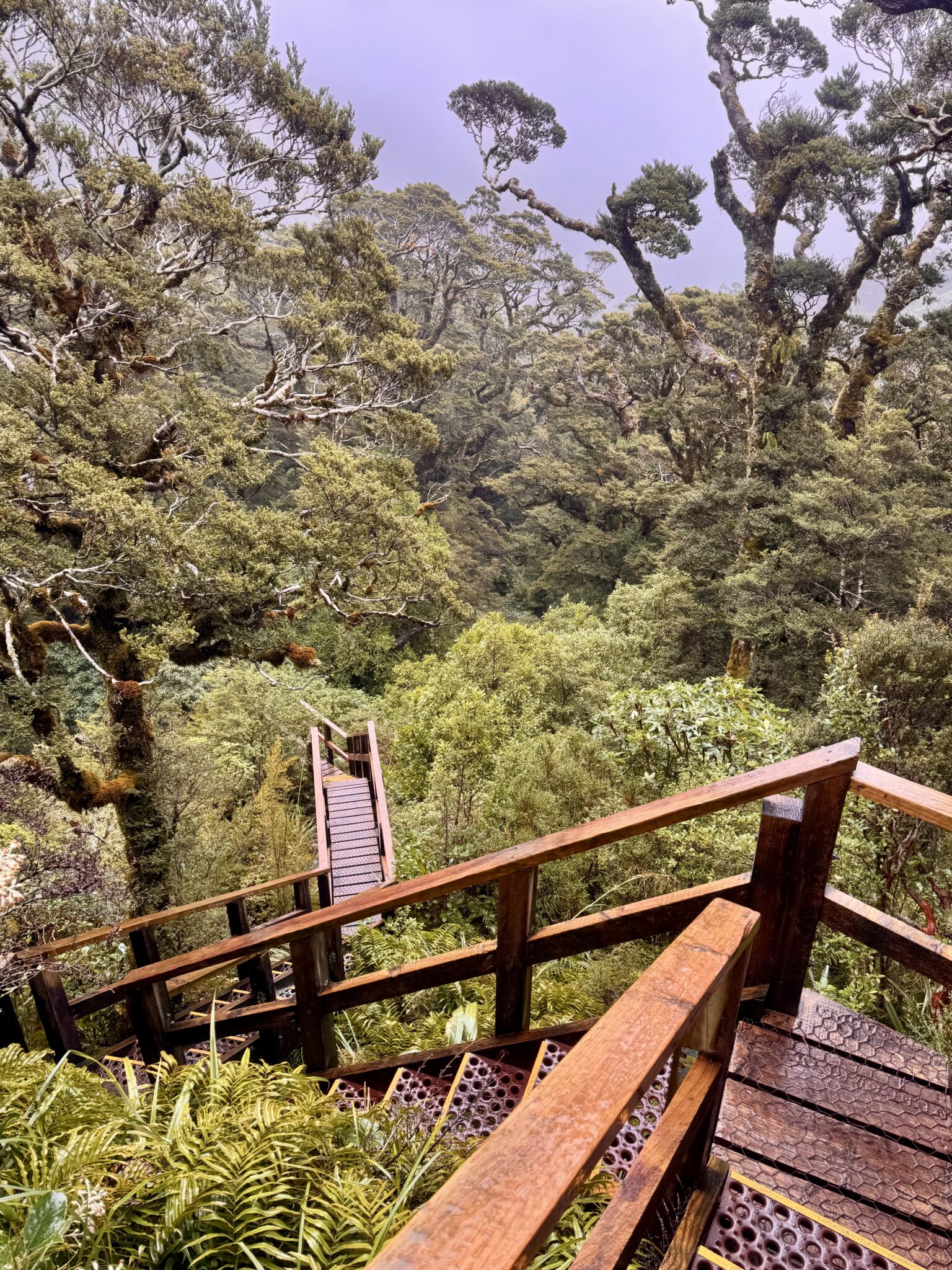
One of the many sections of the meticulously maintained track to help speed along passage. There’s almost no way this would be doable in a day without so much care given to the trail through sections like these.
Soon after Dumpling Hut the trail began climbing abruptly, still through thick beech forests.
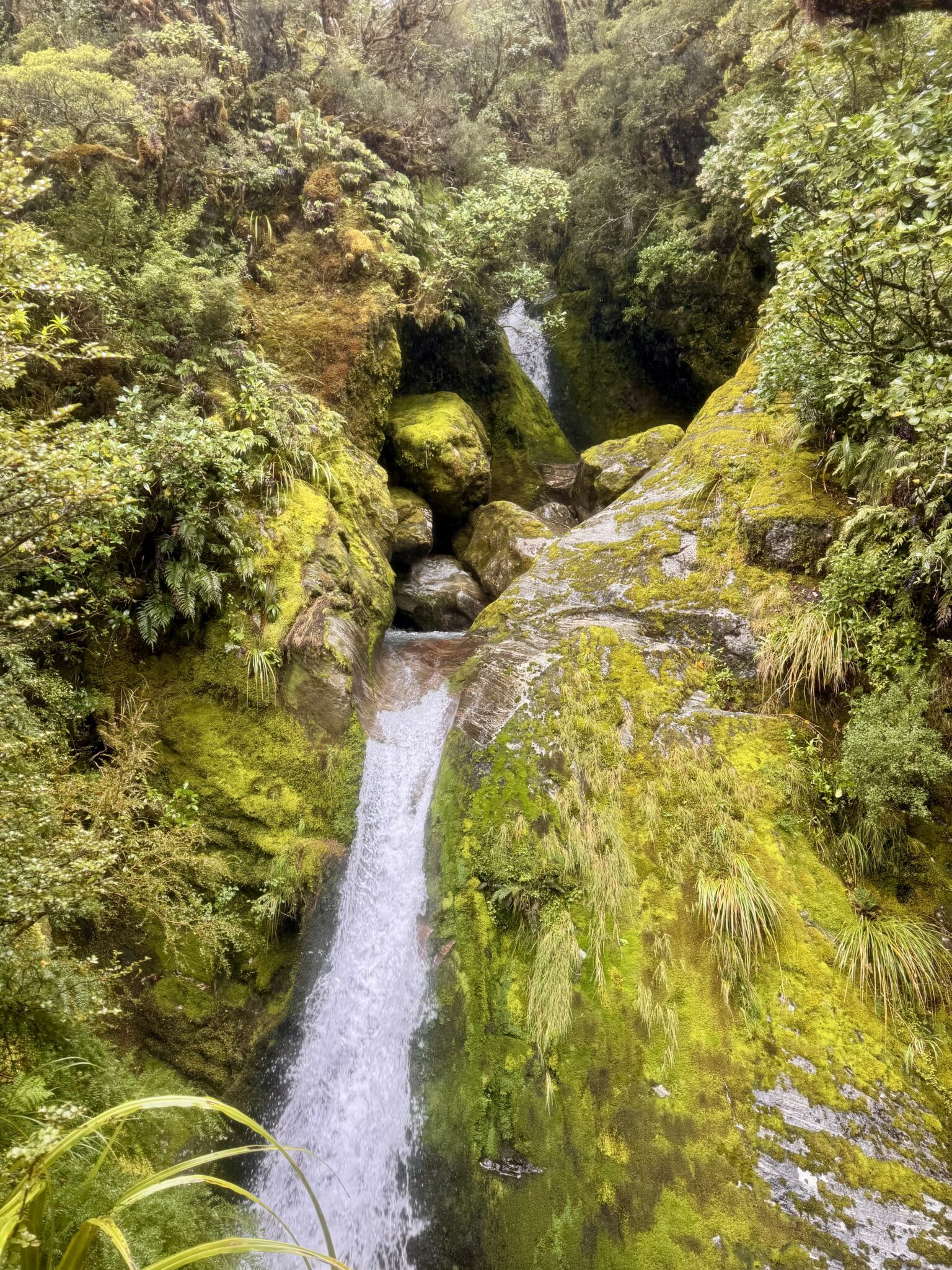
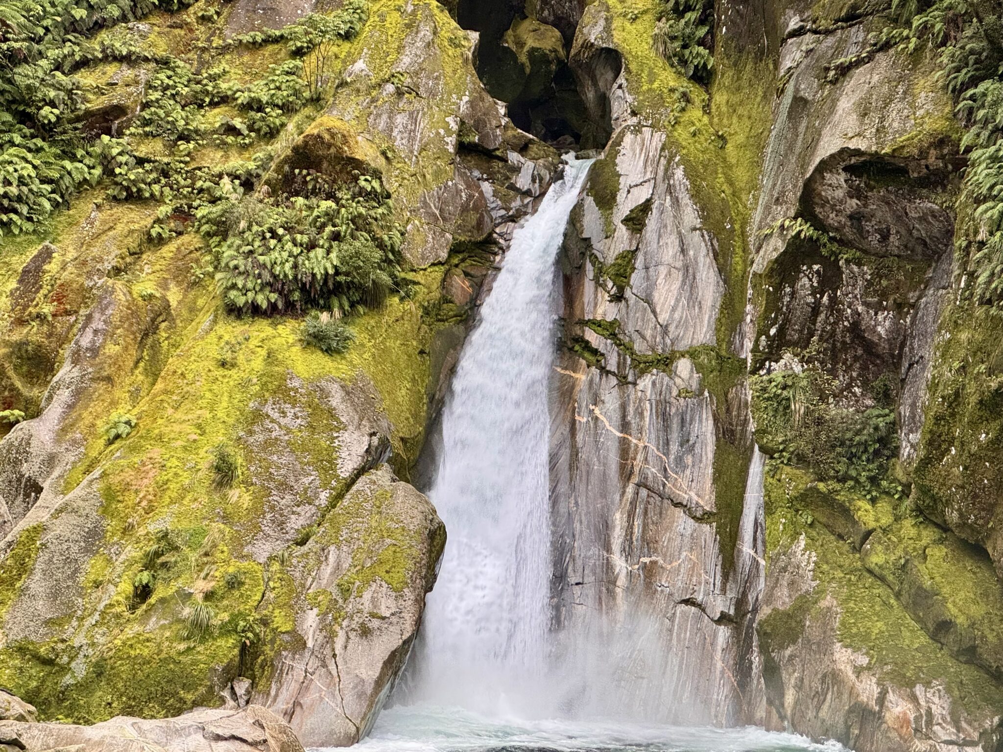
Endlessly charming waterfalls.
Staircases built below Dudleigh Falls.
Dudleigh Falls
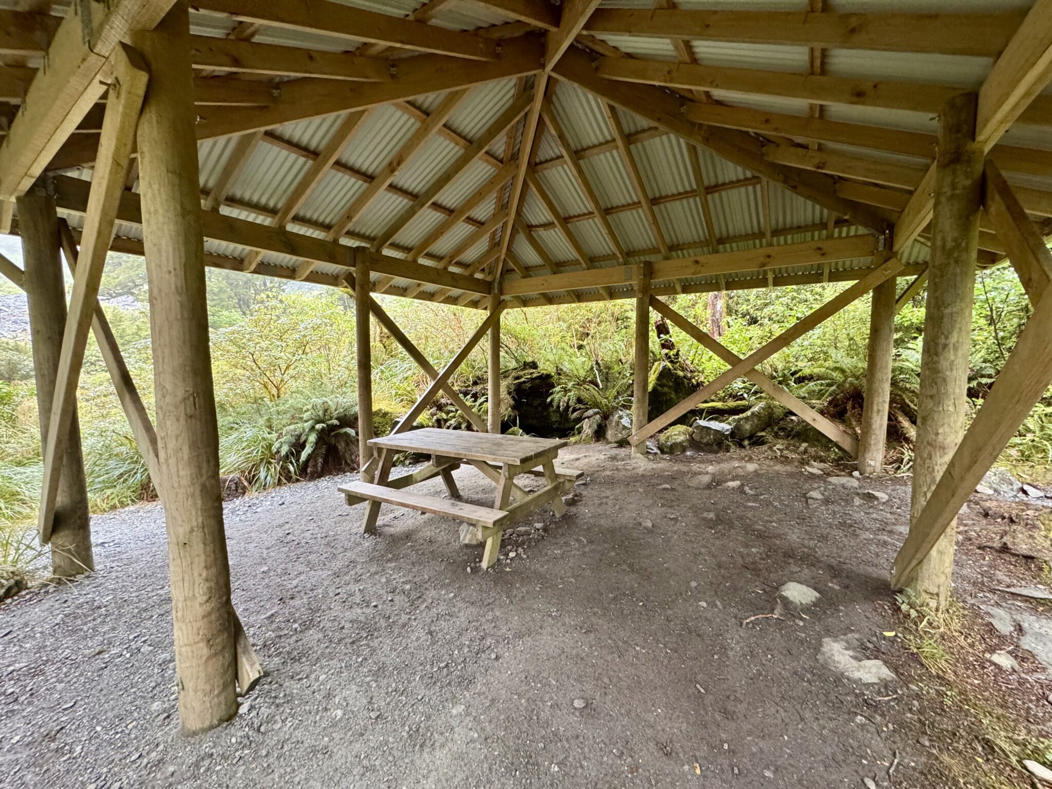
One of the many day-shelters along the route. It was only lightly raining most of my day, so these weren’t really needed. But I got the impression that during times of heavy downpour, these dry shelters would be an absolute godsend.
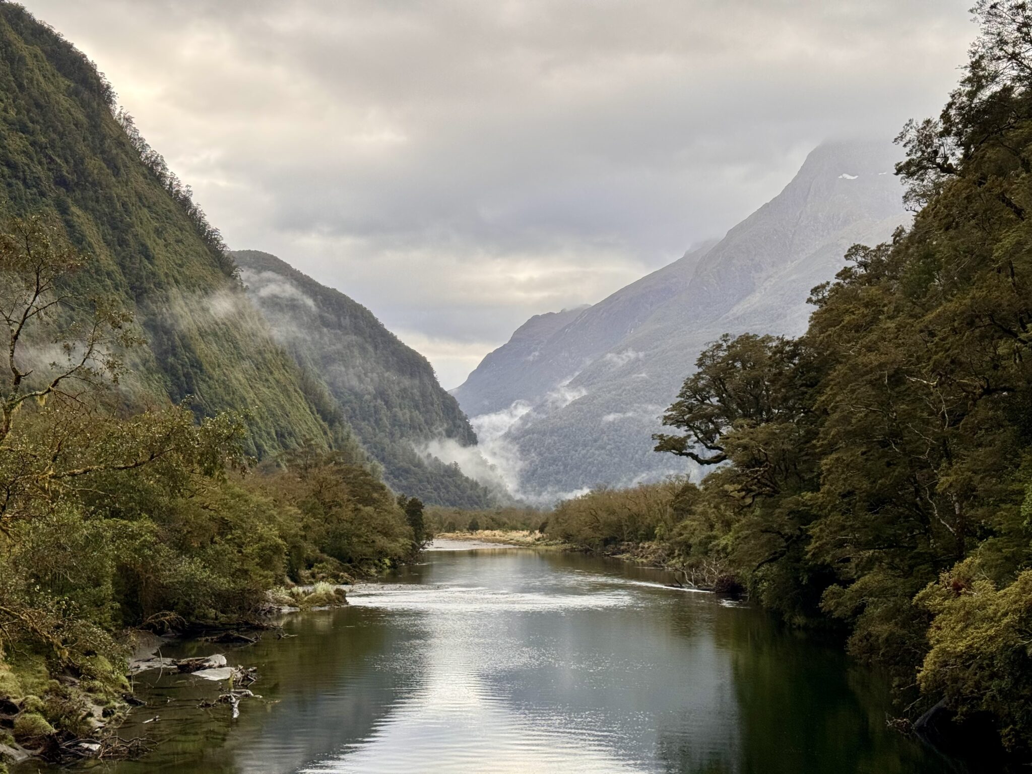
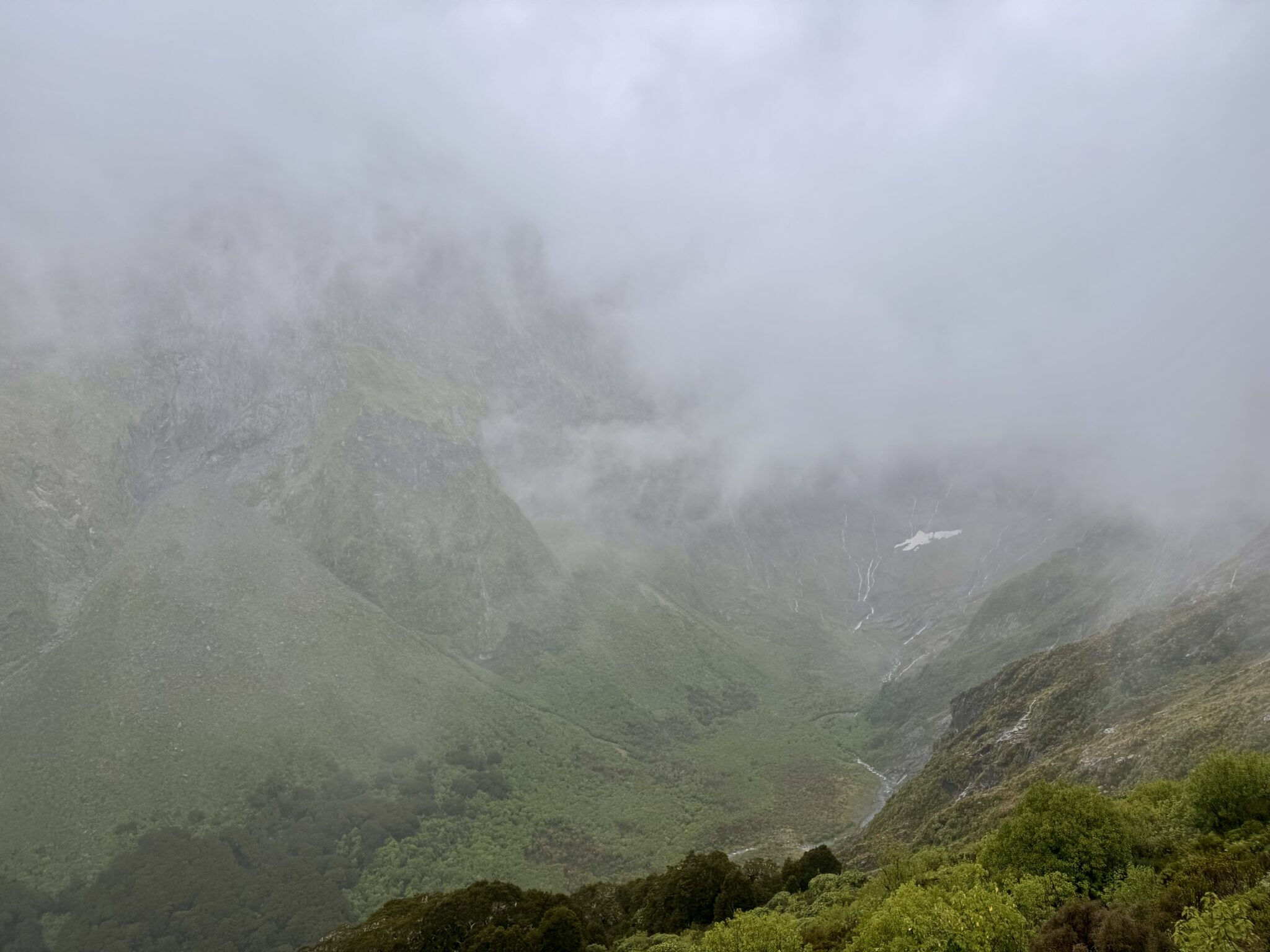
After a while of huffing and puffing my way up through the forest I at last broke tree line. The stretch from here to the top of McKinnon Pass and down the other side is one of the most famous sections of the entire track. The high crossing is a steep, exposed section of true alpine wilderness. Avalanche safety signs and warnings were all around; a common occurrence in the winter. Even in the summer the wind, rain, and cold are very committing above the relative shelter of the river valleys below.
For my day, the weather held at just a gentle rain with chilly temperatures. But the real story was the thick cloud cover. Despite breaking free from the cover of the trees, the clouds held fast. There were no sights to be seen aside from the rising trail a few hundred feet ahead. I crossed my fingers that the clouds might break further up and continued pressing on ahead.
Apparently there are some world-class views behind me in this section of the track. But as I ascended I had naught but grey mists for company.
Whatever grumblings I was tempted to make about the conditions came to an immediate halt when I encountered the next group of trampers. High in the alpine a group of Aussie men saw me jogging up the trail. This group of 8-10 guys were probably in their late 20’s on a boys trip together. As I approached, they flagged me down.
“Mate…are you running the whole thing a day!?” – Their leader
“Haha, yes. Started at Sand Fly Point this morning,” I said, somewhat sheepishly.
In a snap moment the entire group of them erupted with cheers and encouragement.
“Oh you legend…” Mate that’s unbelievable…” “Can I just shake your hand, this is incredible…”
I was so taken aback that at first I thought they might be mocking me. But then I realized these were simply some of the most friendly, genuine hikers I have ever encountered in the mountains. They were 100% authentic with their praise and were just fired up that I was doing my day. They made me take a picture with them (which sadly, I did not remember to get) and then told me all about their crossing of McKinnon Pass. Aussies, man…
After a few minutes of chatting I bid them farewell and all of them broke into a cheer as I began running higher up. I couldn’t help but wave back with a smile. Those guys might be the best folks I’ve ever encountered on a trail. Cheers, fellas!
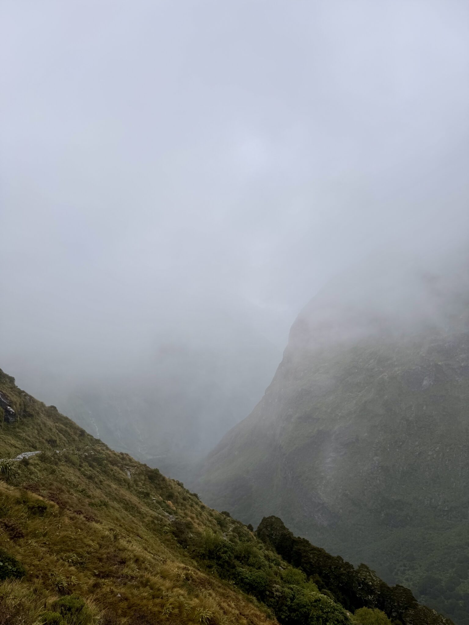
The clouds held firm for the alpine crossing, offering only tantalizing glimpses of the landscapes across the way.
As I climbed higher I anxiously looked for some break in the clouds. I was sad to be missing the sweeping views. The mountains in Fiordland rise like almost none other. From experience, I knew what awesome sights must be all around me. Or at least, I thought I knew enough to know what I was missing. But as it turns out, I had no idea what I was in for.
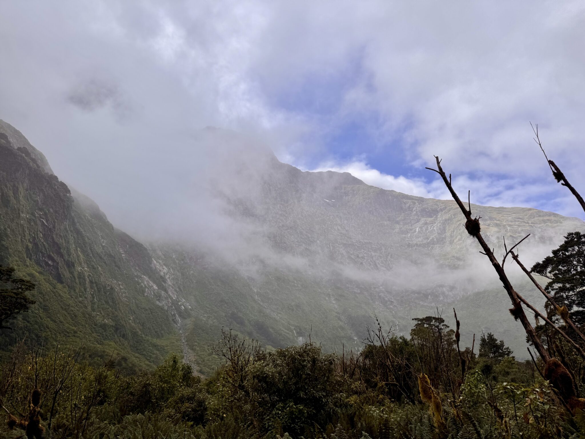
High in the crossing I looked across the way towards the enshrouded mountains. Suddenly, a break in the clouds; a view into what had thus far remained hidden. There, peeping high above, I at last saw the upper reaches of a nearby summit. It took my breath away. It was far taller and loftier than I had reckoned the surrounding peaks would be. It seemed immeasurably high. Impossibly high. Like a sentinel soaring into the air as if to scrape the lower bounds of heaven itself. The beauty of it smote my heart. I stood awestruck in wonder as I recalculated everything I thought I knew about this place. Fiordland was far greater, far loftier, and far more commanding than I had ever imagined.
And then, just as suddenly as they had broken, the clouds shifted. Once again the mountain was hidden from view. I stared dumbfounded, gasping at the realization that something so powerful could be so nearby, and yet, remain so hidden, shrouded behind an impenetrable veil offering enough of a fleeting glimpse to encourage and inspire the hearts of men, yet not so clear and accessible as to tempt us to believe in our own ability to master it.
It is a good thing, I think, to be humbled in this way. We modern men like to fancy ourselves masters of our own universes. Yet nature has a way of sometimes breaking the fallacy.
I pondered how such a moment reflects our experiences with God: almighty, immeasurably powerful, foreboding, wild, and free. Ever present and watching over. And yet, far too often hidden behind the endless folds of a wearisome life. Covered by a veil leaving us searching in vain for see his face.
I reflected on this as I gathered myself and proceeded upwards. I have continued to do so in the days, weeks, and months ever since….
A few minutes later I finally reached the McKinnon Shelter, with the true summit of the crossing shortly beyond. I marveled at the large hut built up in such a commanding perch. Sadly, there would be no time to enjoy it today as the ever-present clock kept ticking. I took time for a quick photo and then prepared to enjoy the long descent down into the Clinton River Valley.
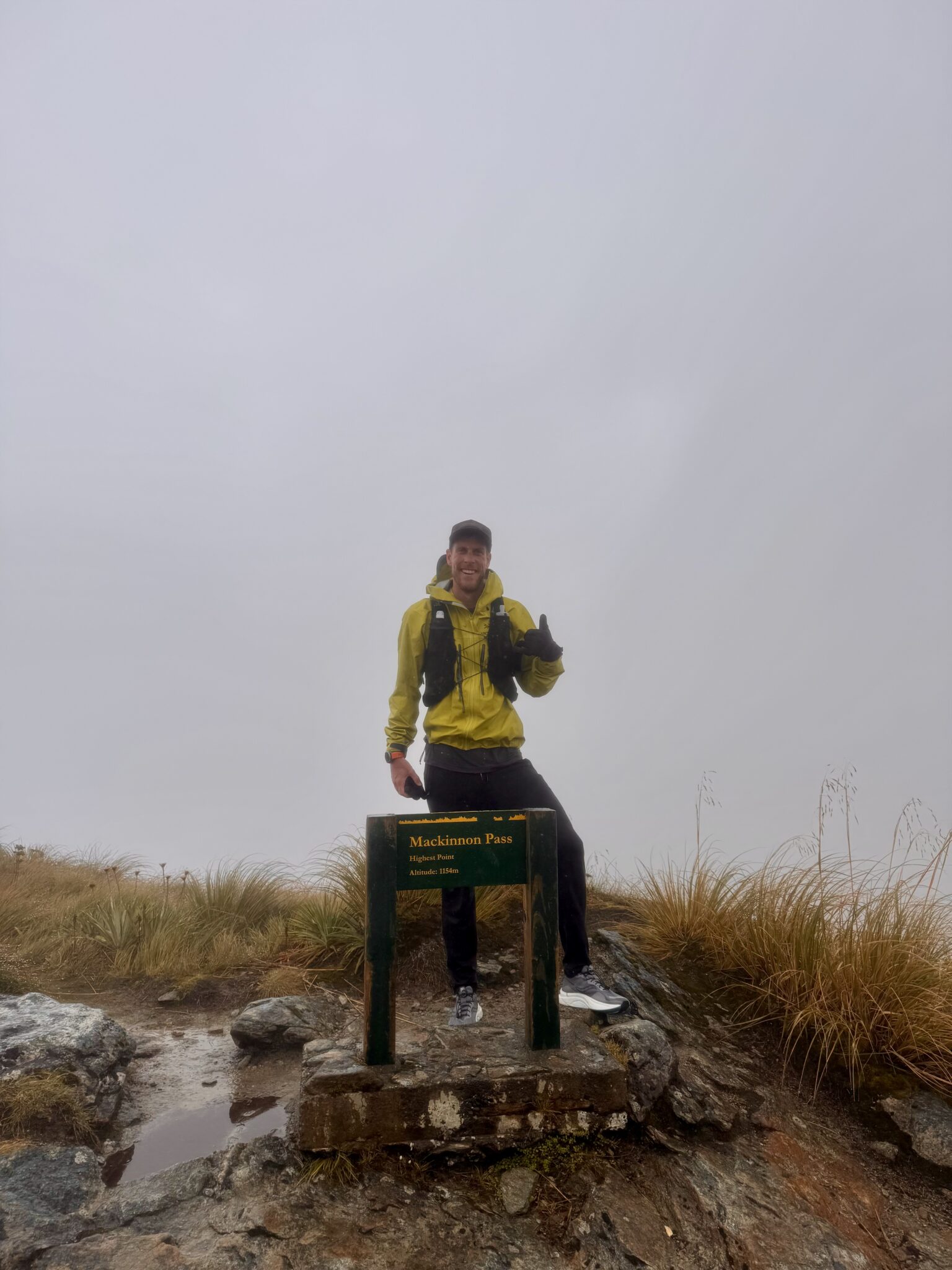
Successfully atop McKinnon Pass. A bit sore and chilled from the effort, but no worse for wear.
As I crested the summit I could sense an immediate change in the air. The weather on this side of the pass was clearing. It was far drier. The clouds were breaking far ahead. And, what was that? A bit of blue sky in the distance? I hurried down the steep, winding trail eager to find the warmth and views of a sunny valley to follow.
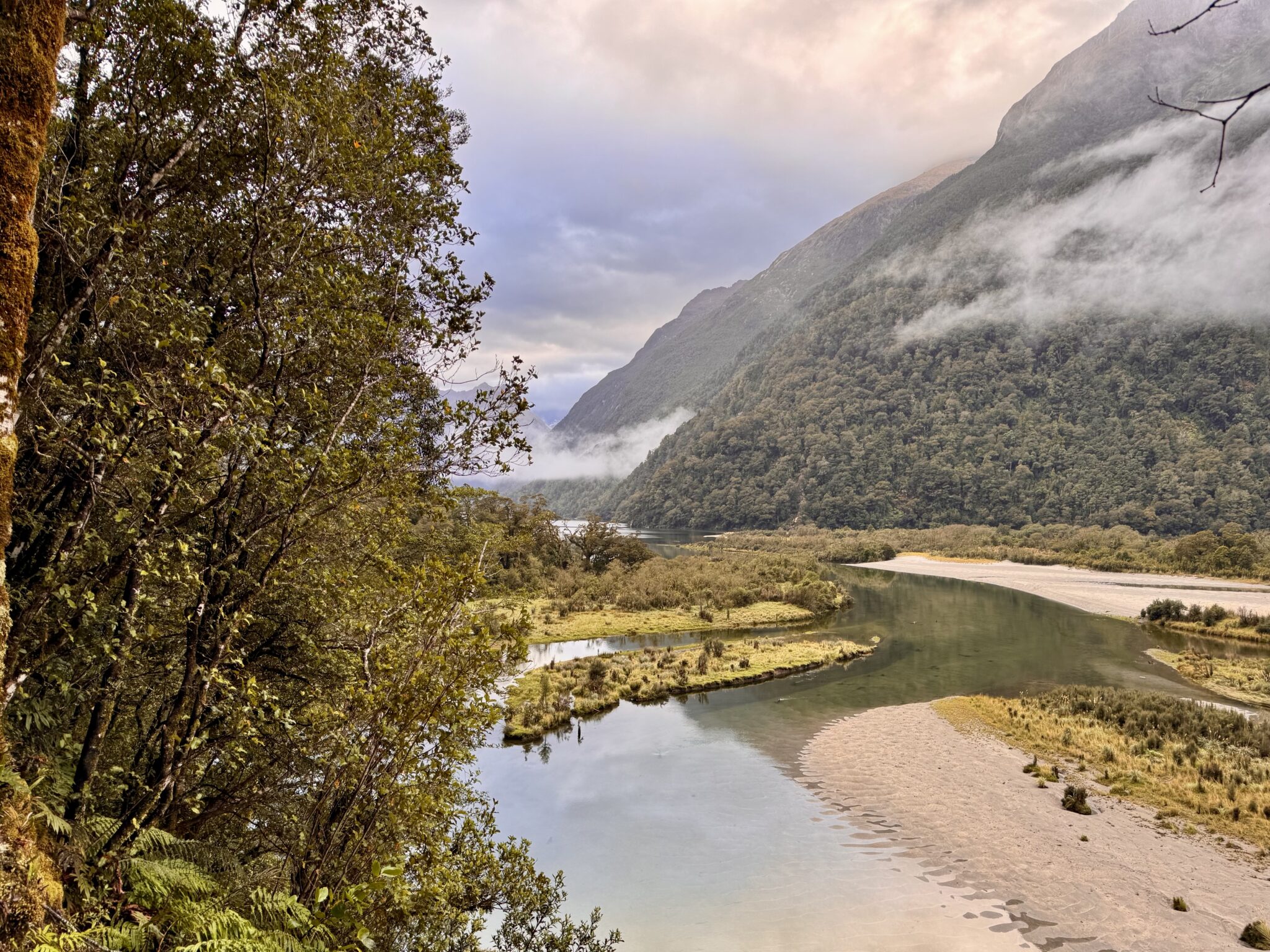
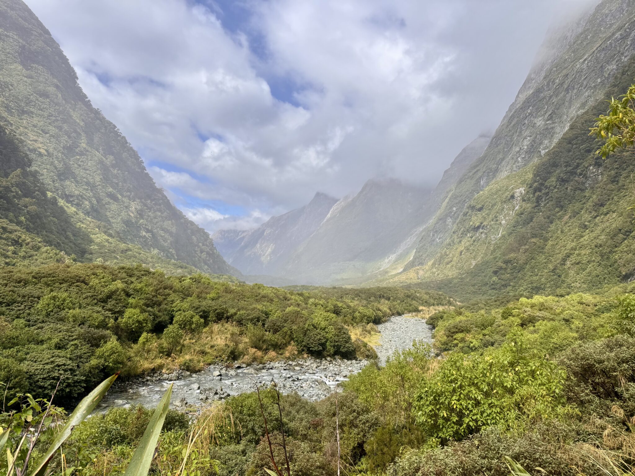
After dropping a thousand feet or so the first hints of the shifting clouds appeared as I marveled at the upper reaches of the Clinton Valley.
The rain lifted as I descended a long series of switchbacks down to the lands far below.
Blue skies in sight!
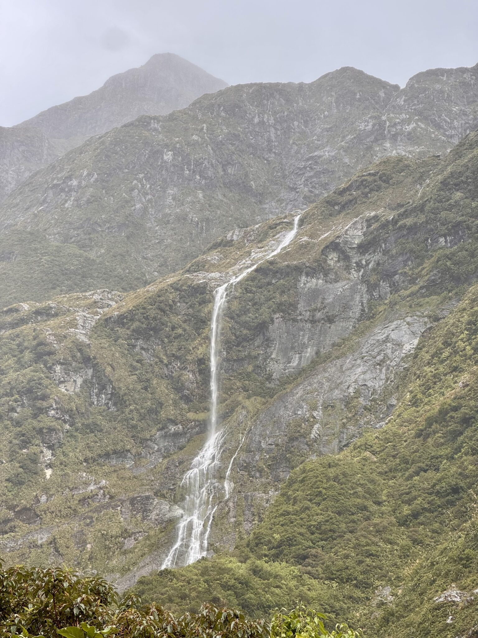
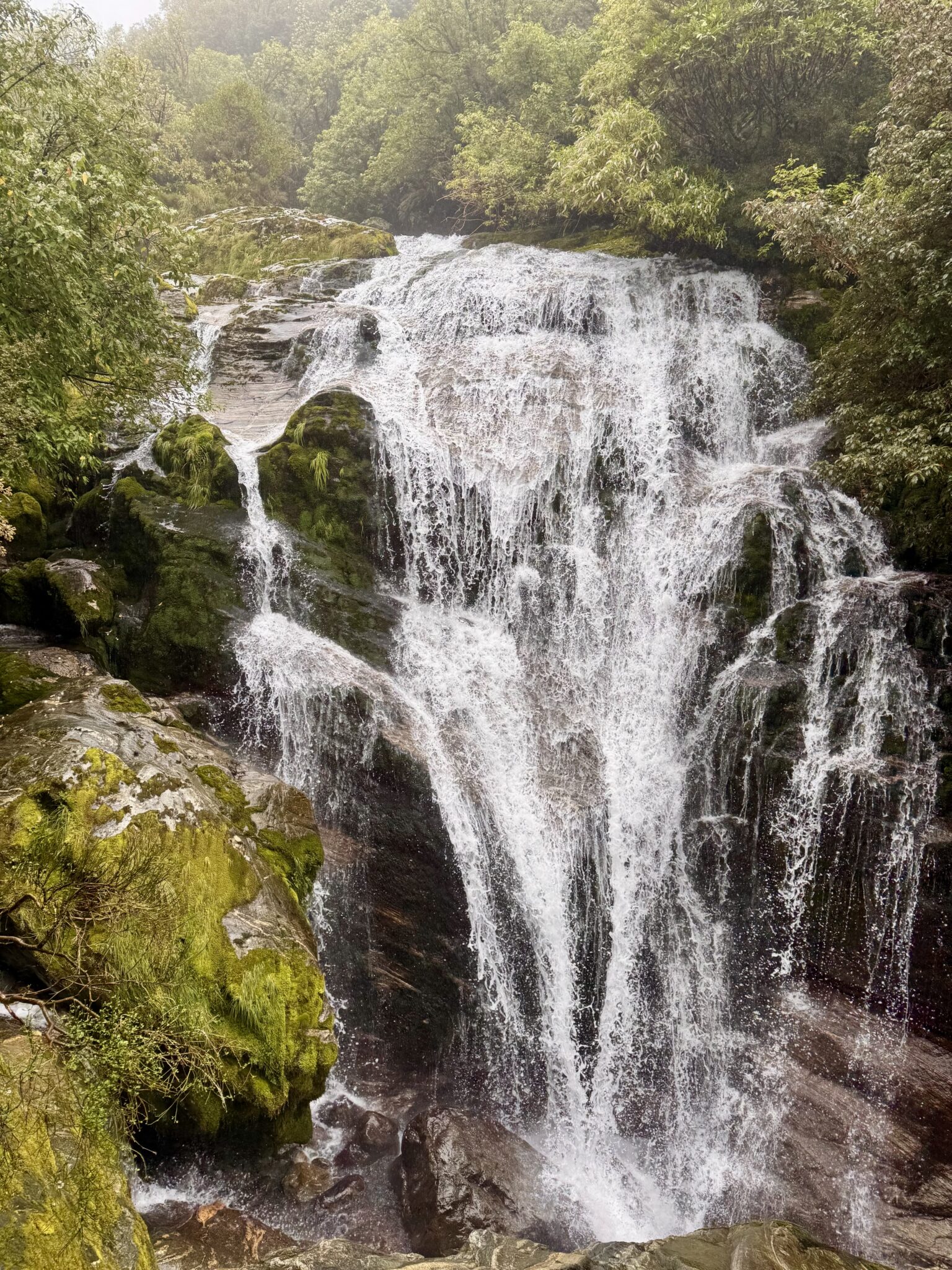
Waterfalls continued to dot the landscape at virtually every turn.
I took a quick detour to check in at Mintaro Hut. But this time the ranger was nowhere to be found. I figured this was for the best. I wasn’t really looking forward to being made a fool of again. Instead of looking for him more, I turned around just as quickly as I came and continued onwards.
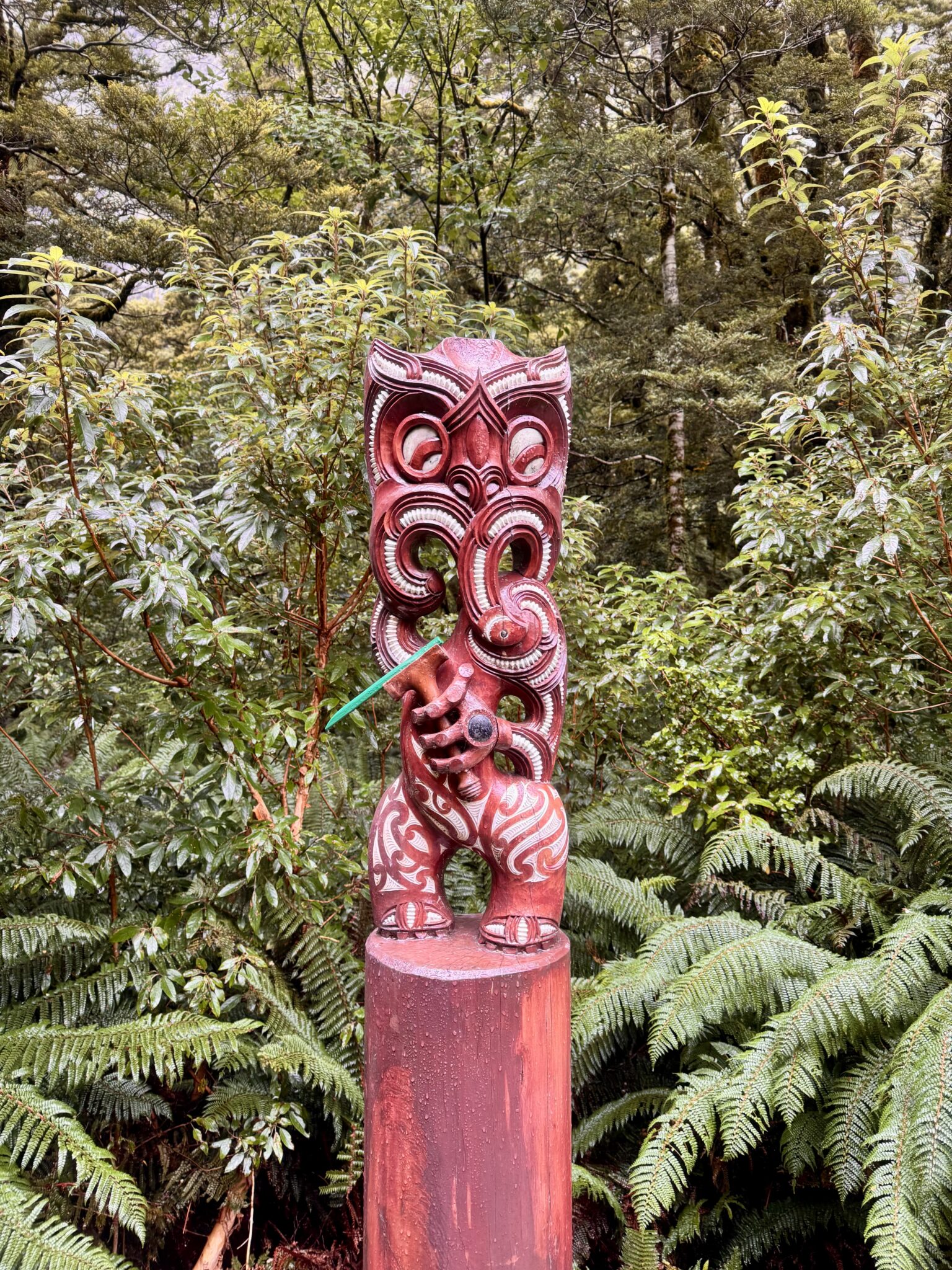
Statues outside of Mintaro Hut.
Mintaro Hut to Glade Wharf
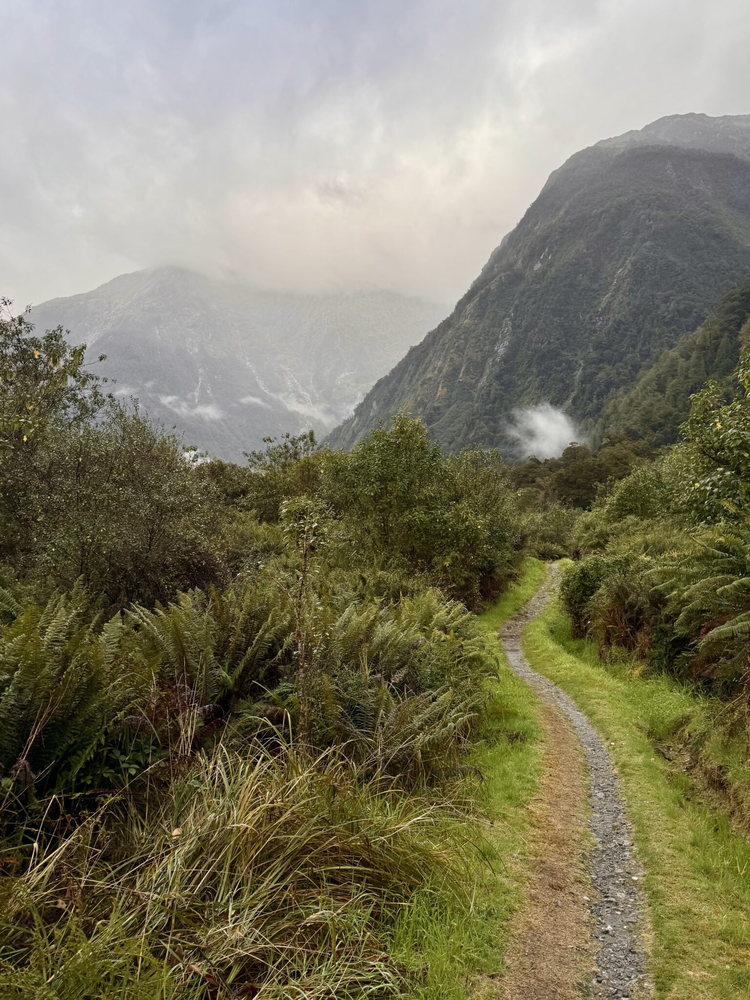
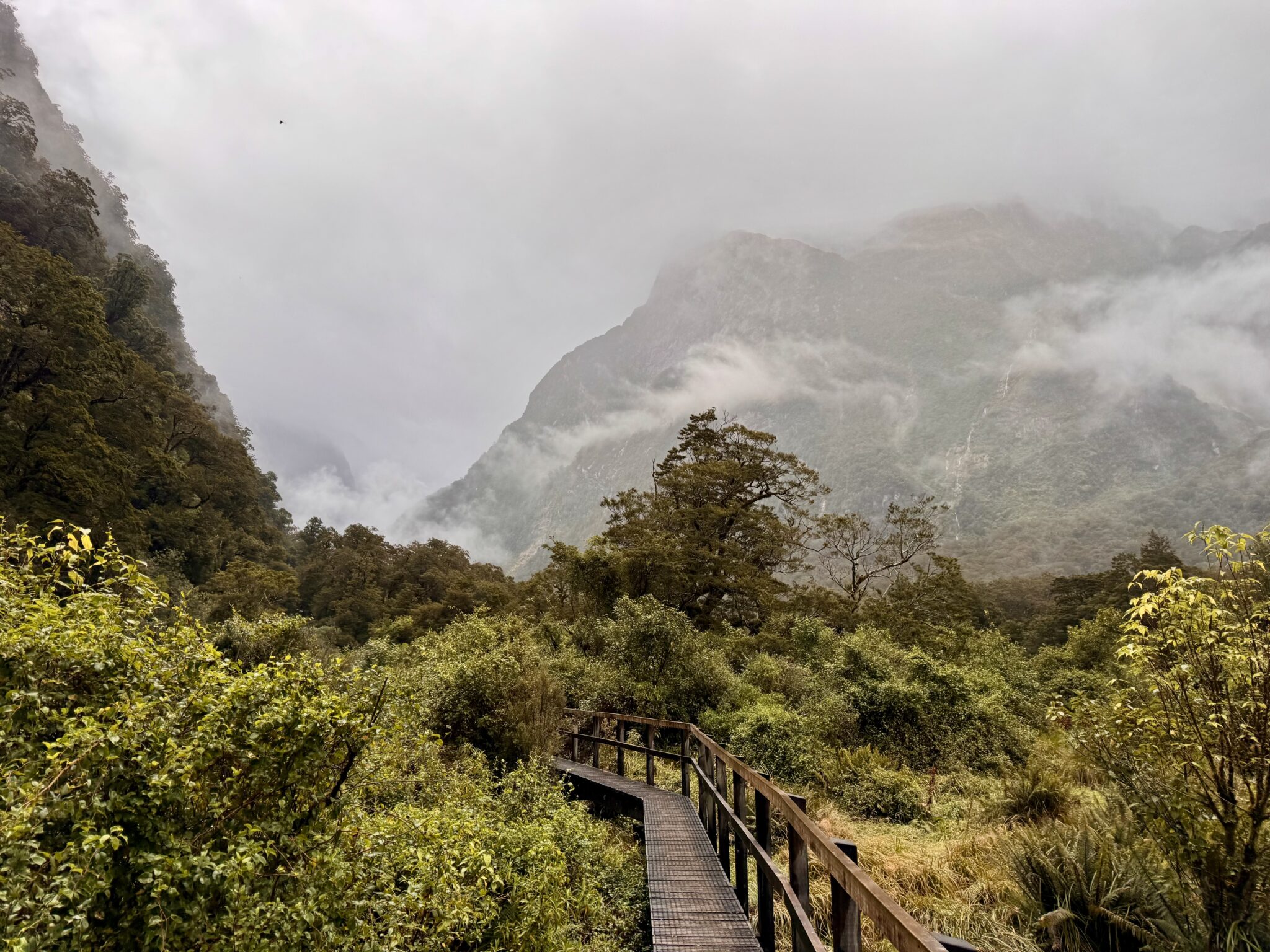
As the sun came out the peace of the valley settled in. The jubilation of my earlier journey was now replaced with a stroll of serenity. The trees were much more sporadic on this side of the pass. Views abounded. The sun was shining. Warmth filled the air and dried away all memory of unpleasant dampness left behind. This was a different kind of paradise, yet no less sweet than the rainforests of the other end.
Looking down the long reach of the Clinton River Valley.
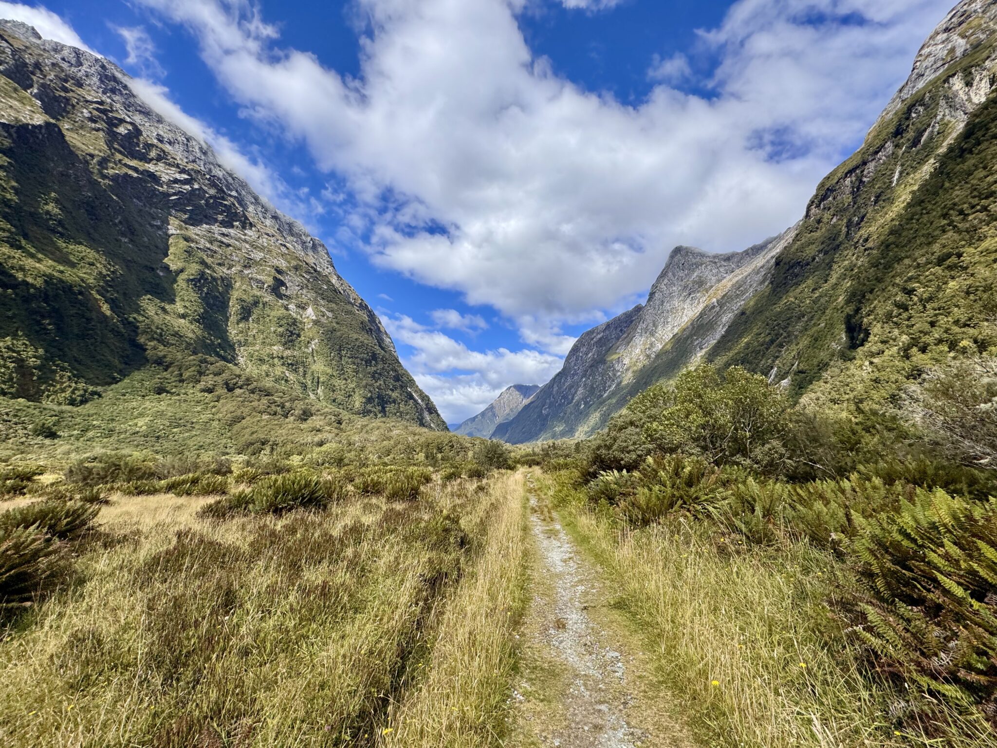
More sunshine and clear skies. The track remained endlessly runnable and full of enticing side trips. Sadly, I still had no time for them.
The almost 12 mile stretch from Mintaro Hut to Clinton Hut was steady and mostly gentle. My legs were starting to feel all the miles accumulating. Thankfully, the track remained true and very passable. I encountered more day hikers in this stretch, who were now sweating under the afternoon sun. My pace eased off as I reckoned the time I needed to reach the 4:30 boat. I was right on schedule and in no hurry to arrive any earlier than I needed to.
Eventually the mighty Clinton River approach on my left. It fit in perfectly with surrounding terrain and made for a nice companion down the valley.
On the shores of the Clinton River.
One of countless unnamed falls overhead.
A marathon down. Just ~8 miles to go.
By the time I reached the Clinton Hut I was finally starting to feel it. The sun, heat, and miles had taken their toll. I was also out of food. Thankfully, the Clinton Hut is a mere 5k away from the finish.
Wanting to still play by the rules, I made one final sweep for a ranger. She was kind, if not still very confused, as I chatted with her. She assured me I “could almost walk to the wharf” in the time remaining. It felt good to finally be free of the pressure of the clock as my journey wound to a close. This was no place to rest, however, as the sand flies were out in full force underneath the afternoon sun. Instead, I rejoined the track and did a slow shuffle to finish out the day and catch the boat.
Just a 5k remaining.

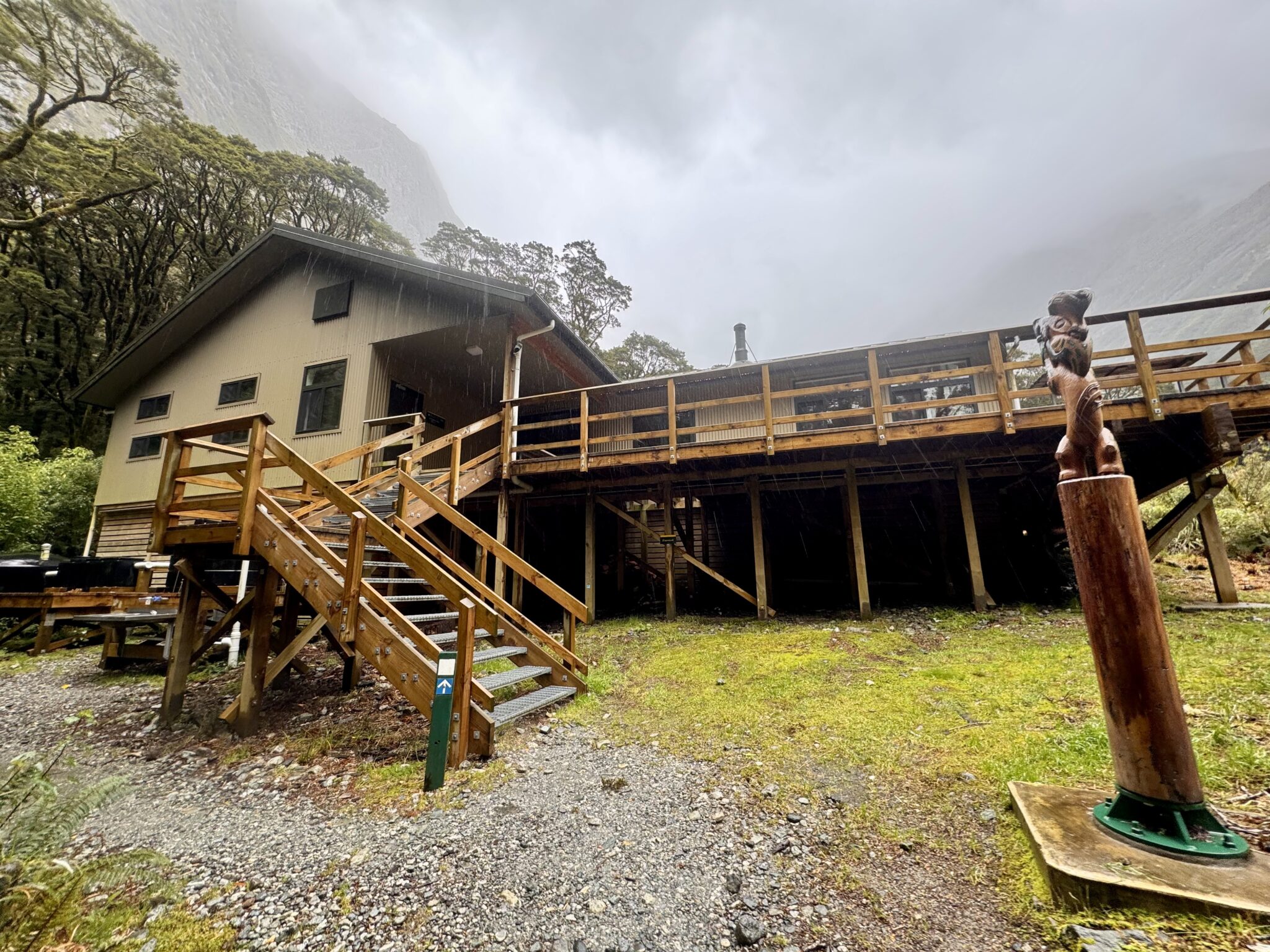
The final hut of the day (a private one) mere minutes from Glade Wharf.
Made it!
All day I had carefully watched the clock in order to make the 4:30 boat. I rolled up to the dock at 4:27. There were no day hikers today, just our boat captain lounging on the dock in the sunshine. In classic kiwi fashion, his short shorts and bare legs seemed impervious to the now swarming sandflies.
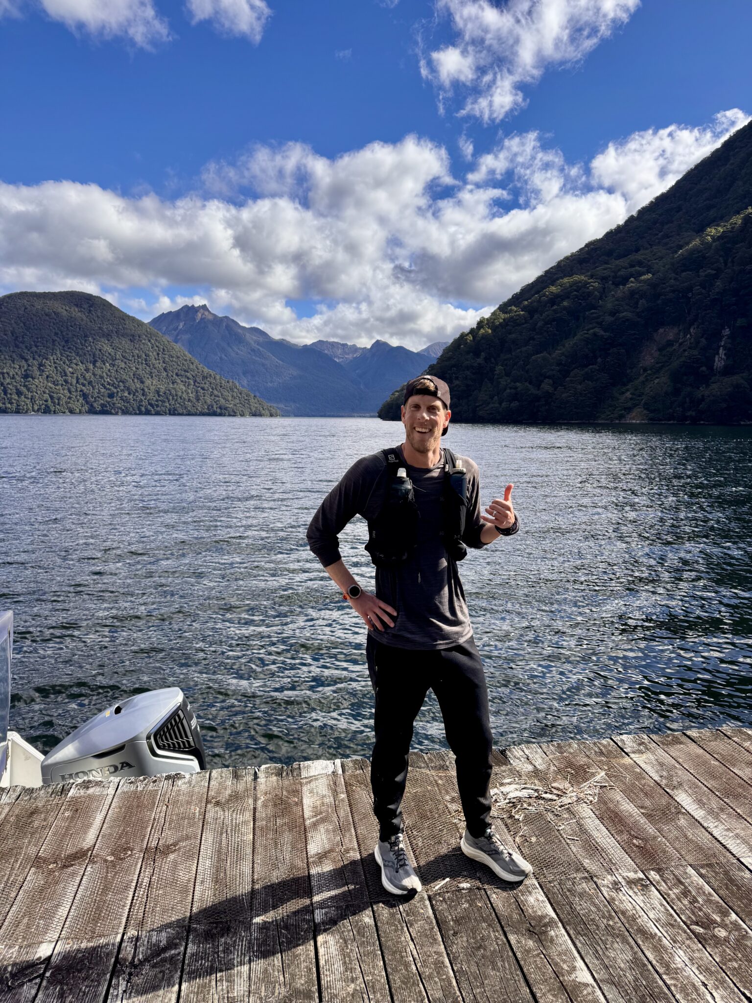
Successfully gaping on the shores on Lake Te Anau.
The only question now was if Brian would make it in time. I lost track of him after he did the Sutherland Falls detour. Much to our amusement, he came sprinting out of the woods a mere two minutes after I did. He looked very beat, but very relieved that he wouldn’t have to pay for the return boat either. He rolled in at 4:29.
As we boarded the boat for the 1 hour trip across Lake Te Anau, I was now glad for the companionship. Brian and I got the chance to know one another a bit and to swap stories from the track. He graciously shared some food with me, which I didn’t hesitate to accept. This was his first ever run longer than a marathon and what a fine choice. Congrats to him on a great accomplishment!
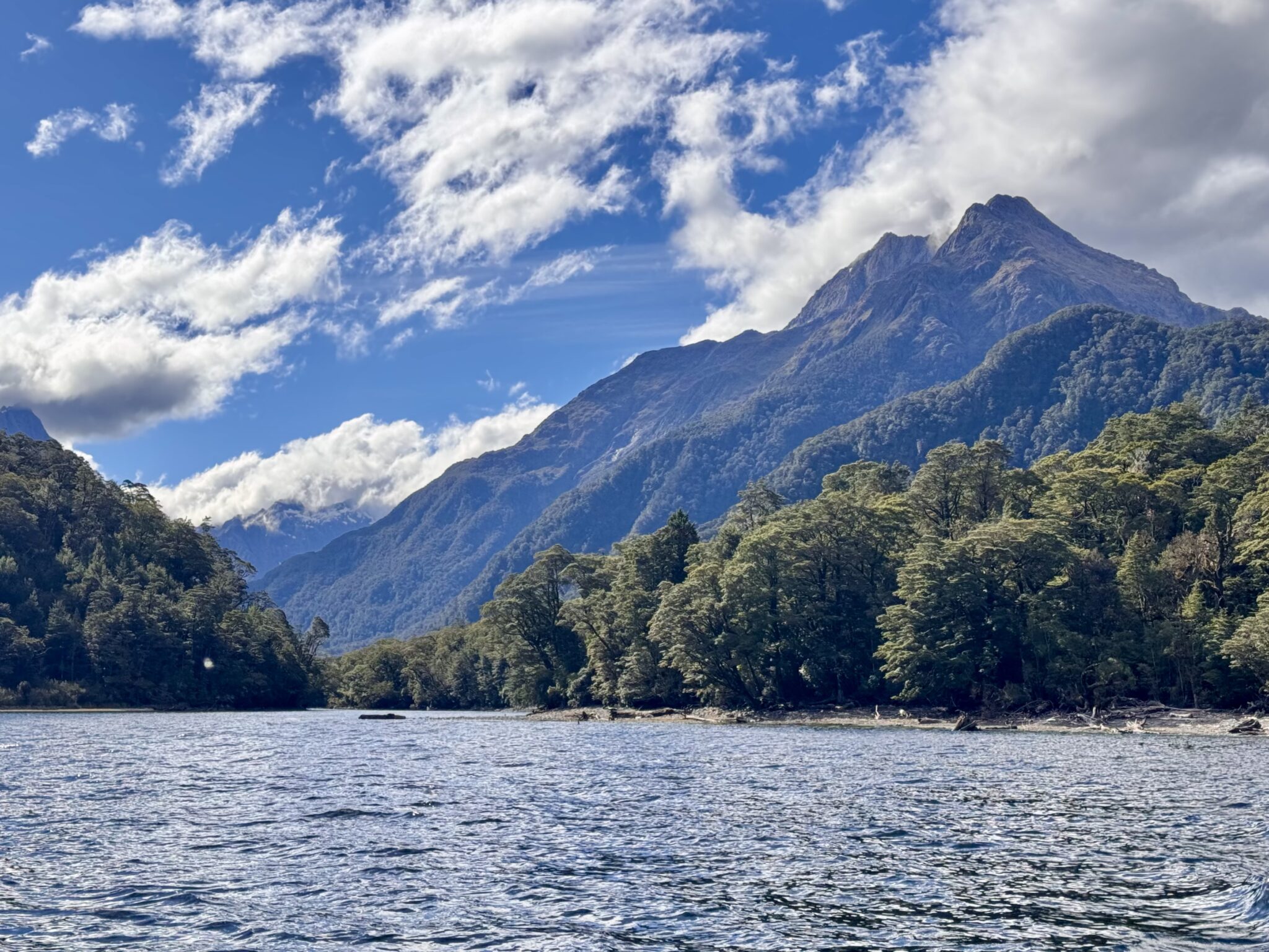
For myself, I leaned back on the sides of the boat in blissful recovery. I basked in the wind and the sunshine as the spray of the water lapped up the sides of the boat. The towering mountains of Fiordland slowly crawled by as I reflected on the adventures of the day.
This one had been special. A chance to romp in my favorite place. To feel wholehearted and to embrace the freedom that only the hills can provide. I was thankful for the safe passage and for all the wonders of the journey. I cannot wait to come and see them again.
Bliss on the shores of Lake Te Anau.
Thanks for reading if you did. And happy tramping!
Epilogue – Some Notes & Beta
Here are a few (hopefully) useful pieces of beta for anyone else who ever considers this undertaking. These notes are a bit of a mish-mash of my track thoughts, but I found each an essential piece of putting together the effort.
- Time & Distance Splits*: See below for my time and mileage splits. Distances are a bit elongated as I shuffled around each hut (and took the detour to Mintaro), but they should give a general sense of things.
- Sandfly Point > Dumpling Hut: 2:30:00 (11.65 miles, 421 ft)
- Dumpling Hut > McKinnon Pass: 2:10:00 (5.46 miles, 3,339 ft)
- McKinnon Passs > Mintaro Hut: 0:56:28 (2.68 miles, -1,704 ft)
- Mintaro Hut > Clinton Hut: 2:33:29 (11.84 miles, -1,362 ft)
- Clinton Hut > Glade Wharf: 37:16 (3.01 miles, 18 ft)
- *NOTE: These times are a bit deceiving. On the one hand, I was not rushing (although I rarely stopped moving). In prime conditions and for a determined individual, this could be run much faster. But on the other hand, in poor and/or flood conditions, this could also take much, MUCH longer. Plan accordingly.
- Water: Abundant everywhere. I took a handheld filter, but not everyone does so in New Zealand.
- Sutherland Falls: I bypassed this detour in favor of a slower pace. But as Brian proved, it can definitely be added to the journey for those who want to hoof it.
- Water Crossings & Track Quality: The track was great and no water crossings presented any issues on my day. But in a flood, all bets are off.
- Surfer Girls: I was quite surprised by the number of all-female groups walking the track. There seemed to be an uncommonly high number of women walking together, which I thought was great. Maybe that’s more common outside of the states (most parties I encountered were not Americans)? Or maybe it’s something unique to the Milford? Whatever the case, I thought it was cool to see so many ladies out there. And worth noting for any mountaineering bachelors ever considering the full journey…
- Outfitter: I can’t say enough good things about working with Fiordland Outdoors. Their crew, planning, and logistics were all top notch. Highly recommended for anyone considering tramping in Fiordland.
An amazing journey in what looks to be a fantastic place. I enjoyed your writing. Way to crush it, Zambo.
Thanks, Steve! You should put it on your shortlist. I think you guys would love it down there.
Dude, so incredible! Loved the bit about the group of Australians being so pumped for you.
Thanks man. Ya those guys are truly unique, lol. Such a fun-loving people.
Looks like a sweet point-to-point, nice work! Adding it to the list for if we ever end up making it down there…
Thanks man. Ya this would be a fun couples hut deal also.
Loved your article and it is a great advertisement for the Milford Track. My son (Brian) was lucky to meet you and be included in your story. I didn’t know he attempted this until he shared me this link. I’m sure it’ll be a great memory for you both.
Hey thanks so much, Richard. Brian was a total stud out there. It was super fun to bask in the day with him at the end of it. Now he’ll have to take you back with him someday! Thanks for the comment.