Welcome to Sand Creek – home of rugged peaks, airy scrambles, big views and long days.
Last weekend Rick, Kyle and I packed into Sand Lake in the Sangres and picked off nine thirteeners over a three day span. The linkups were long, the peaks were rugged, and the weather did its best to make things interesting. We ultimately left the area a bit humbled, but happy to have pulled it all off.
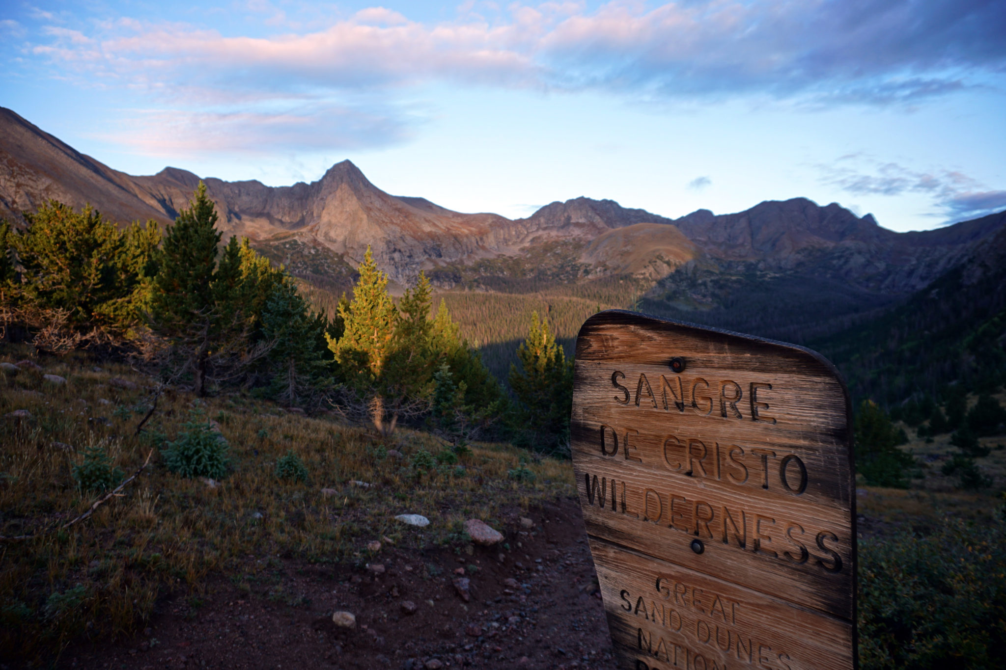
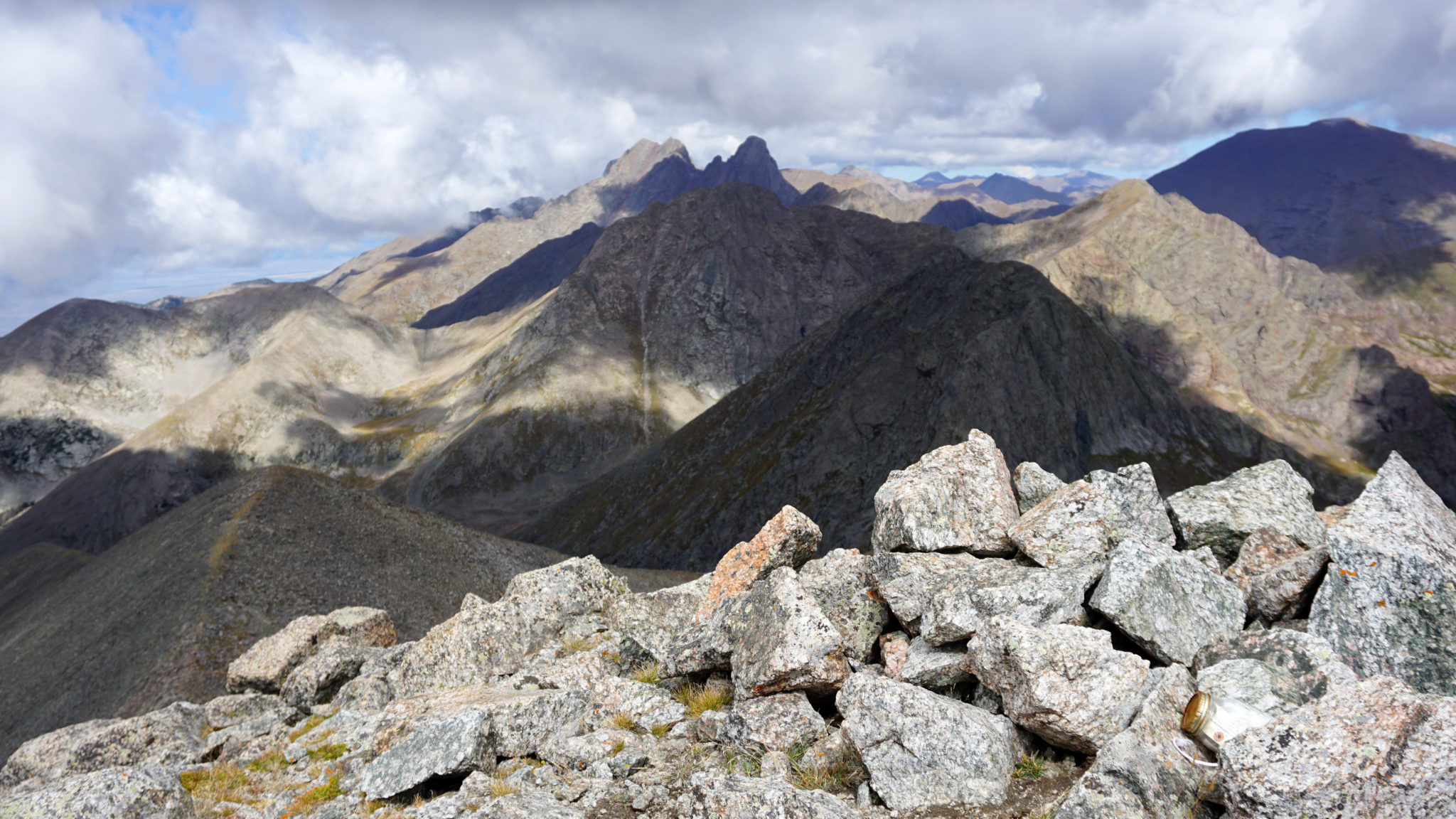
Sandwiched between the Great Sand Dunes and the Crestone Group is a long, curving drainage known as Sand Creek. Best accessed from the Wet Mountain Valley over Music Pass, the two alpine lakes in the upper-drainage are nice places to make camp for a multi-day peakbagging effort. And the mountains themselves are some of the more striking ones in the entire range, we would find. Music and Tijeras are a fun pair with some great scrambling on Music’s south ridge. To the north, the traverse between Milwaukee and Pico Aislado is an exposed ridge run on mostly solid rock. And to the south are the four peaks of the Cleveland Group, which are more benign than their northern neighbors but entail a long day on a high, committing ridge line. Needless to say all of the above had long been on the proverbial wishlist.
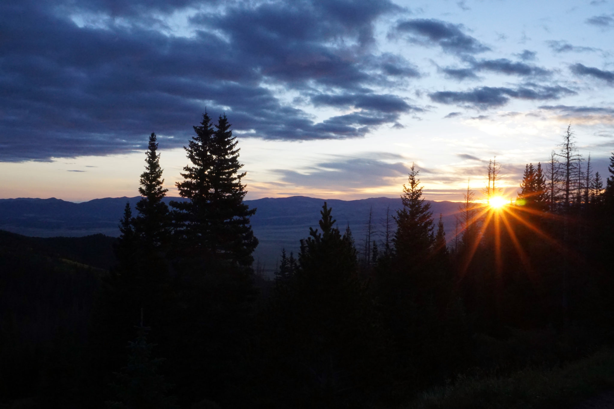
Sunrise over the Wet Mountain Valley near Music Pass.
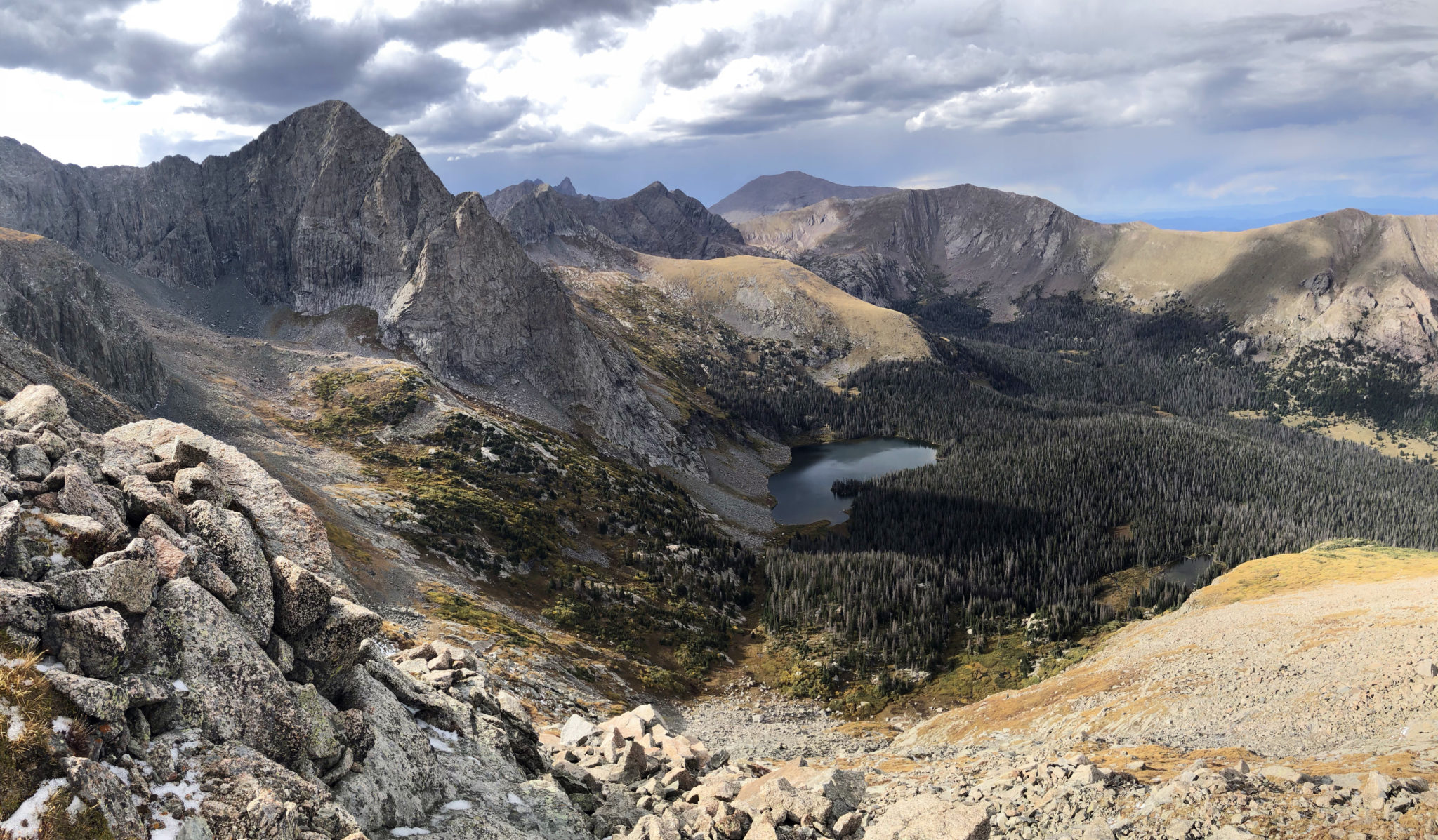
The pack over Music Pass and down to lower-Sand Lake was unique in that it’s one of the shortest pack-ins any of us had done. After setting up camp we shouldered daypacks and contoured around the north side of the lake towards Tijeras Peak. After finding one of the two gullies that grant access to the peak’s upper-slopes, we stepped onto Tijeras’ summmit roughly two hours after leaving camp.
Tijeras Peak and lower-Sand Lake from camp. Click to enlarge.
Summit of Tijeras, looking north.
Then it was on to Music Mountain via its short connecting ridge with Tijeras. This route is a classic scramble, with great rock and a decent amount of exposure thrown in to keep things interesting.
Kyle and Rick on Music’s south ridge.
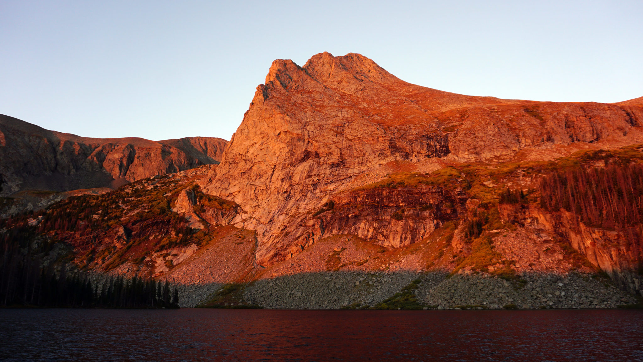
Alpenglow on Tijeras the following morning. Click to enlarge.
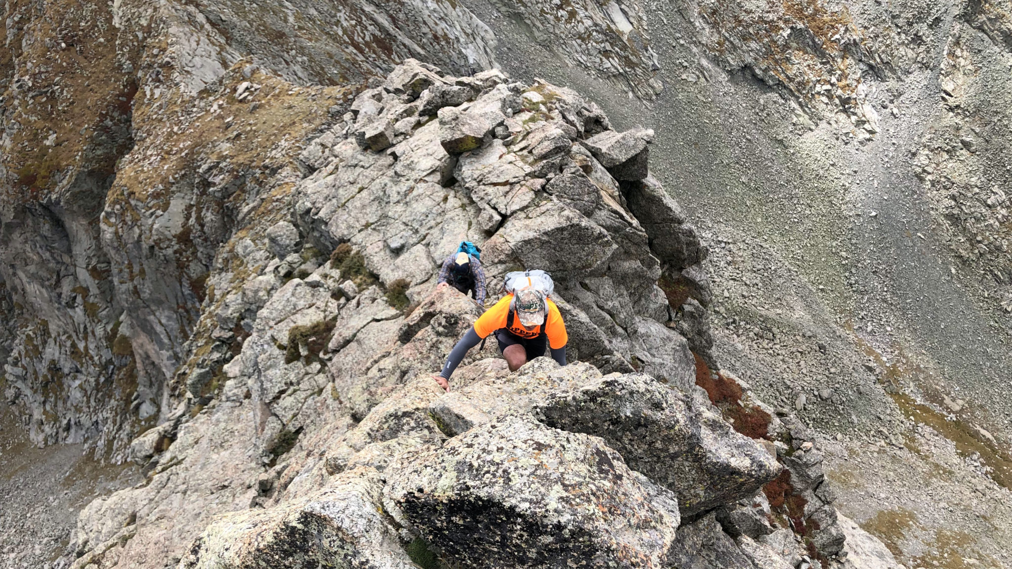
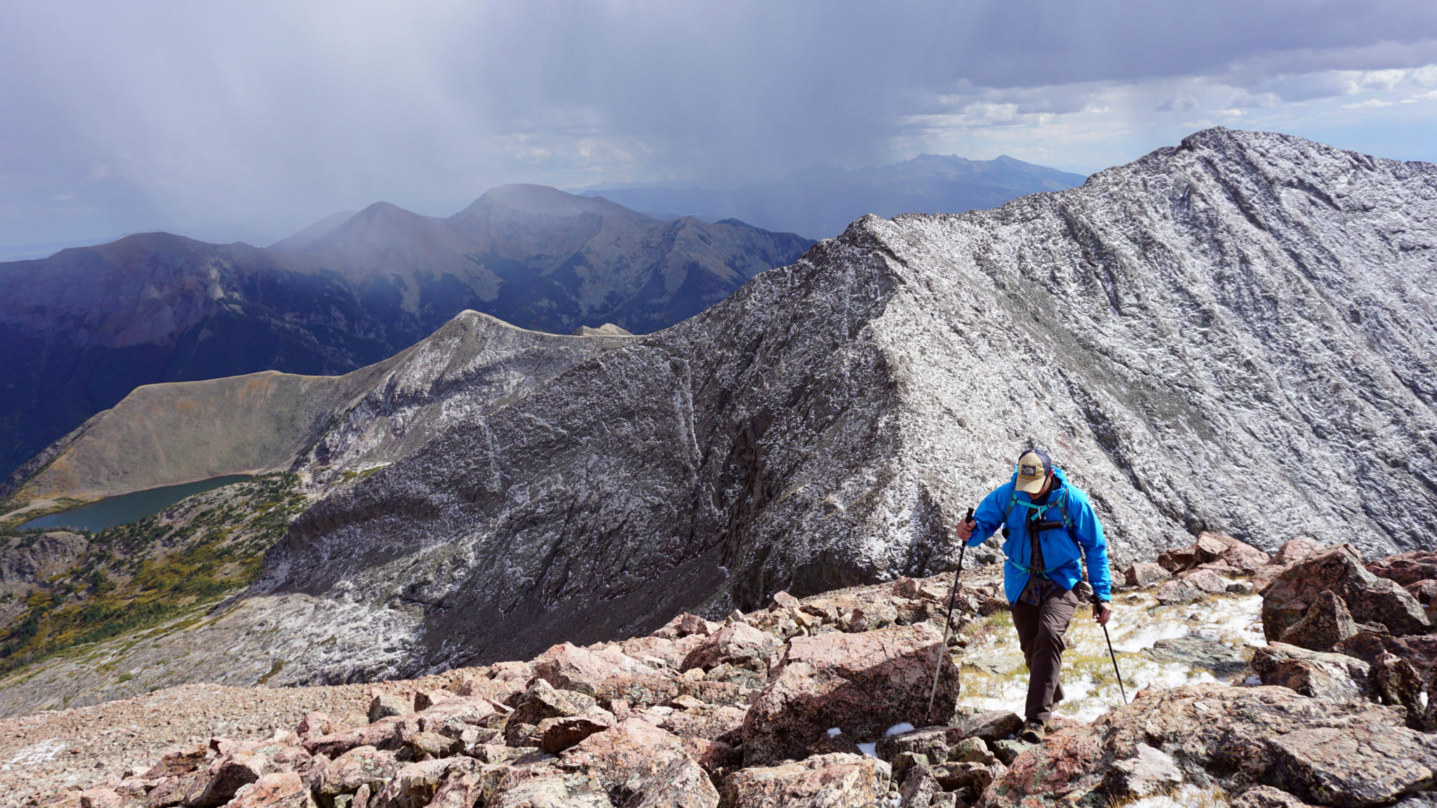
The next day held the best weather forecast of the three so we decided to tackle the Milwaukee-Pico Aislado traverse. We started off by descending a few hundred feet down to a trail split, then hiking northwest up towards Milwaukee Pass. A routefinding snafoo eventually led us into a small mini-drainage to the west of the one we should’ve been in. After scrambling up some slabs we found ourselves back on route and staring at Milwaukee’s intimidating summit block.
Milwaukee Peak. The route follows an exposed ledge out across that face and then up a stiff class 4 gully to the summit ridge.
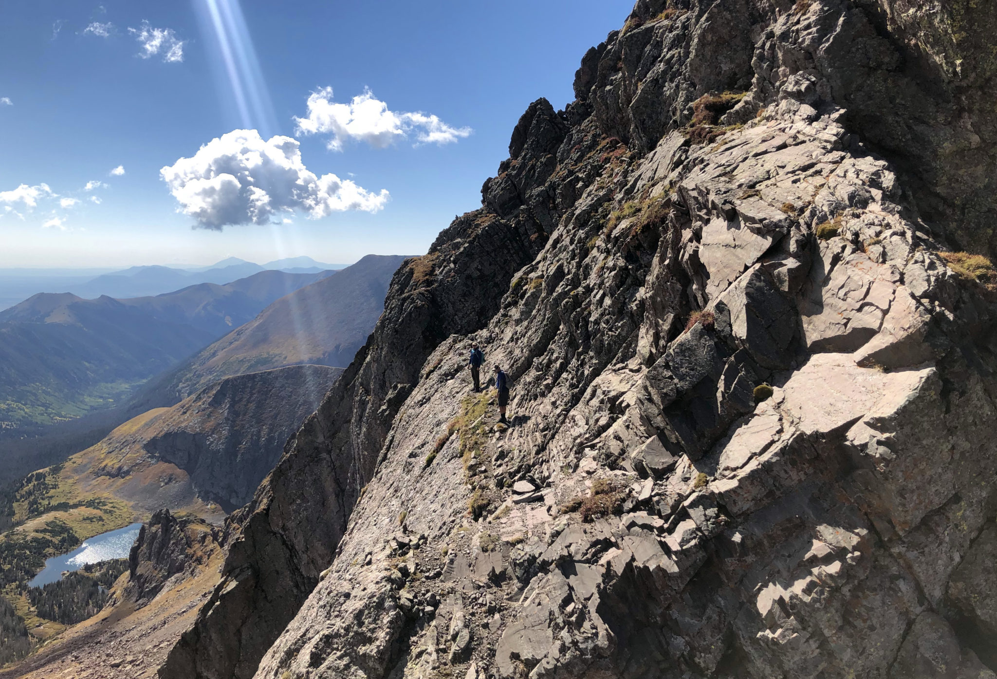
The guys on the ledge. It’s best not to look down here.
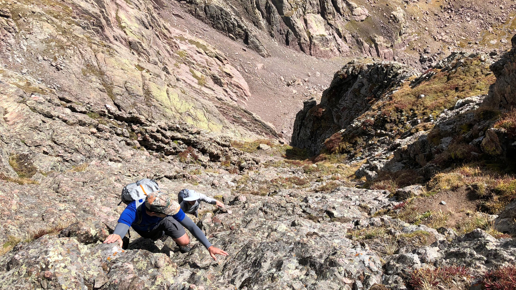
On the class 4 scramble, which was an interesting mix of conglomerate rock and grass ledge as well as one of the more exposed spots I think I’ve ever been in. Photo by Kyle. Click to enlarge.
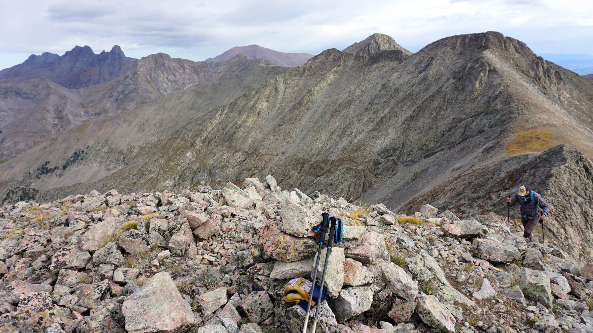
Beyond Milwaukee, we ran the ridge to the base of Pico’s summit block. From there more scrambling up through a series of rock slabs and ledges eventually led to our second summit of the day. After that we continued west and tacked on the lowly Pt. 13,020, the last ranked thirteener summit in the string.
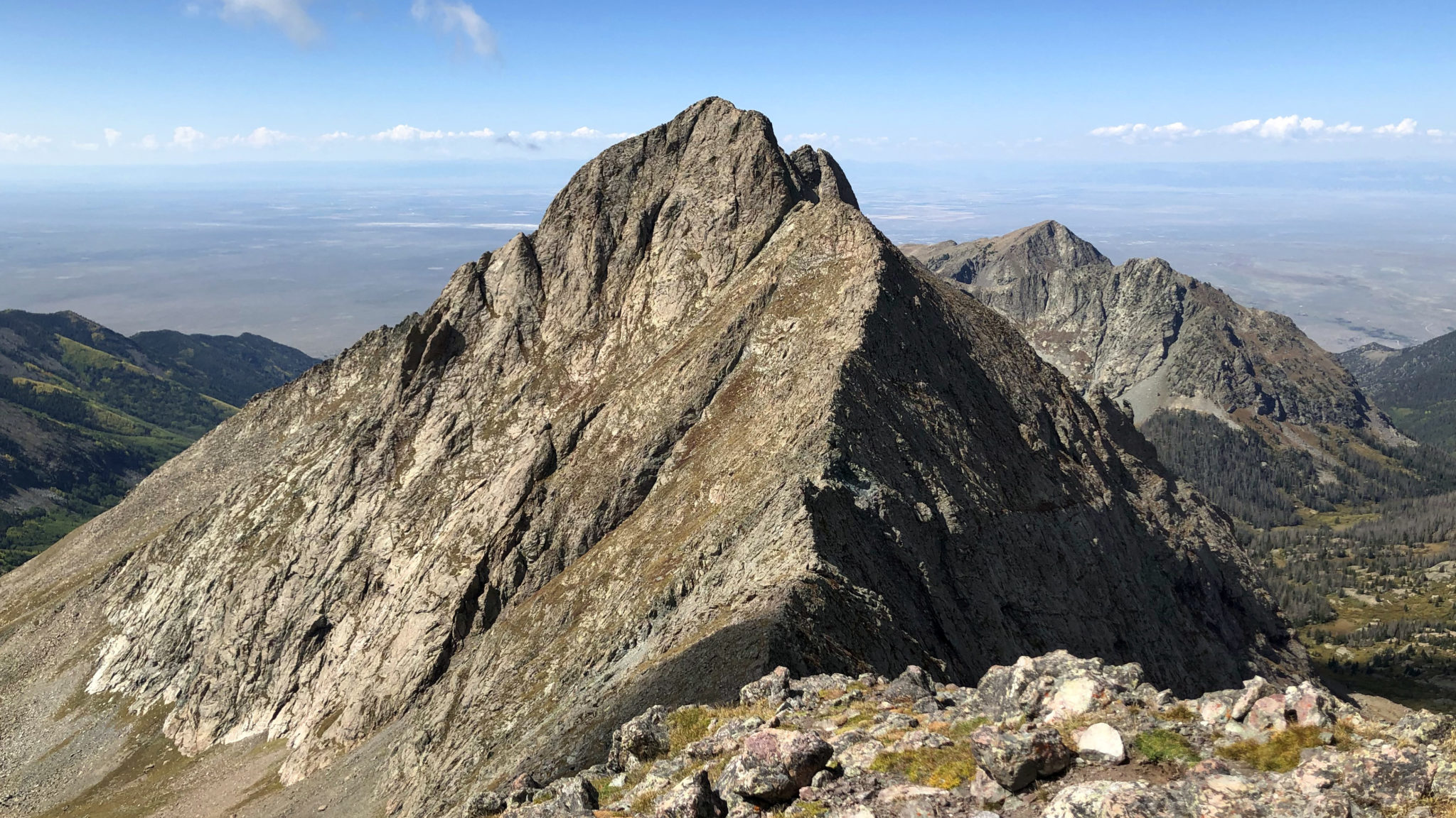
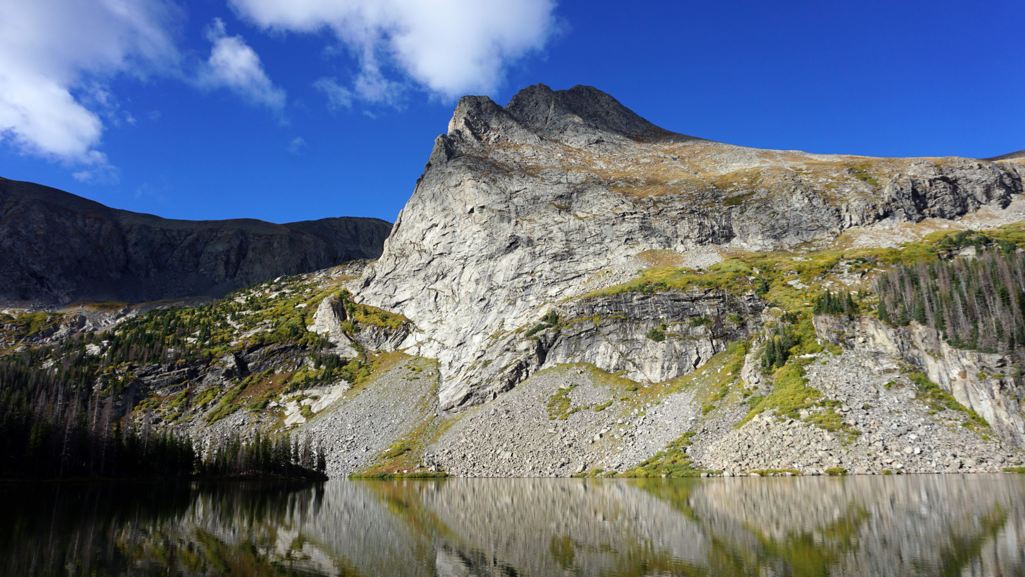
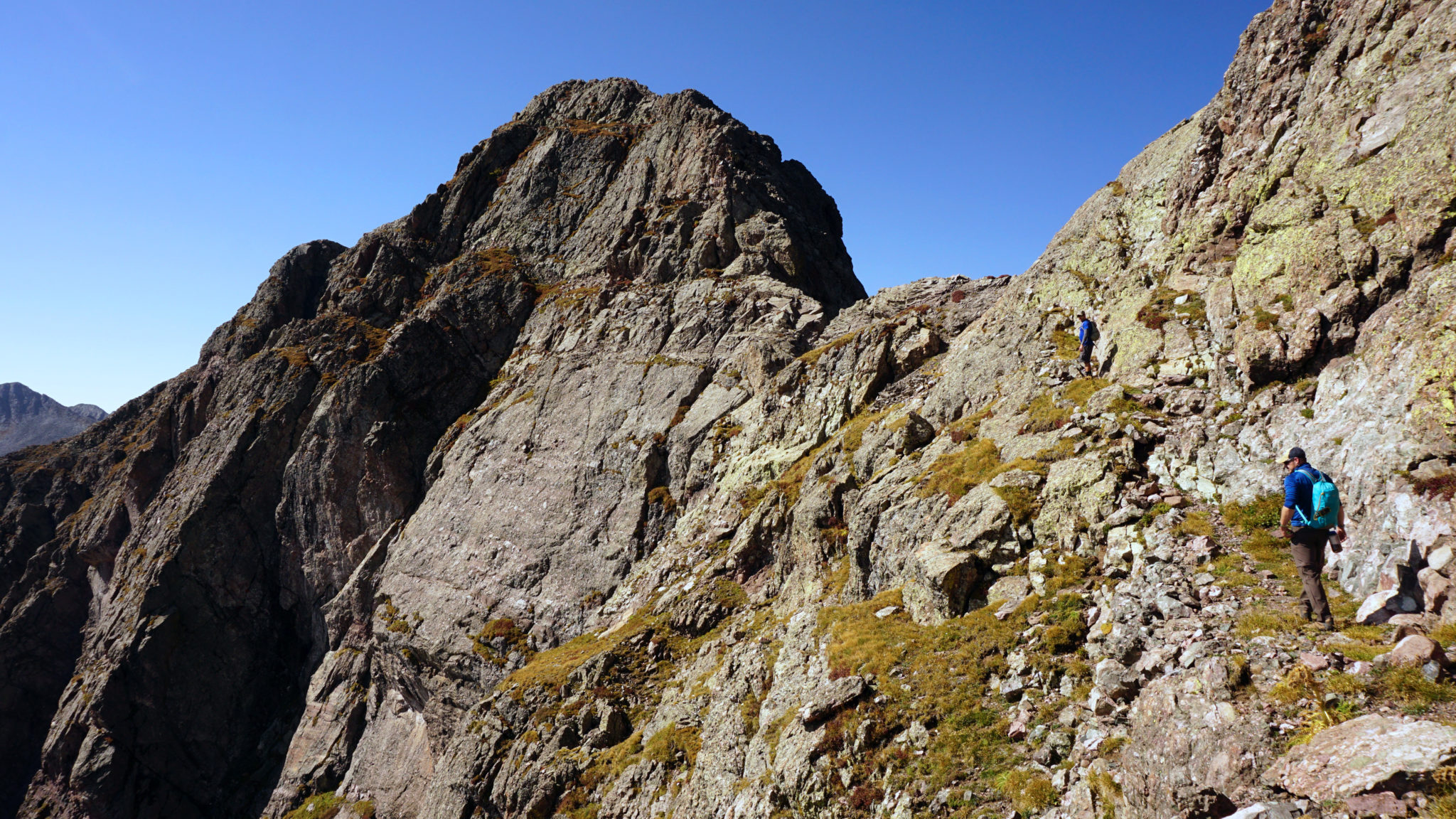
Pico Aislado, seen from Milwaukee. Click to enlarge.
Heading up the east slope of Pt.13,020. That’s Pico Aislado in back.
From Pt. 13,020 we elected to drop into upper-Dead Man Creek and head over the Music/Tijeras saddle. It made for a fairly straightforward and perhaps more direct route back to camp than what we’d seen other parties do in the past (namely drop north and head up and over Milwaukee Pass). Definitely a solid alternative to look into if you happen to be planning a trip into this area.
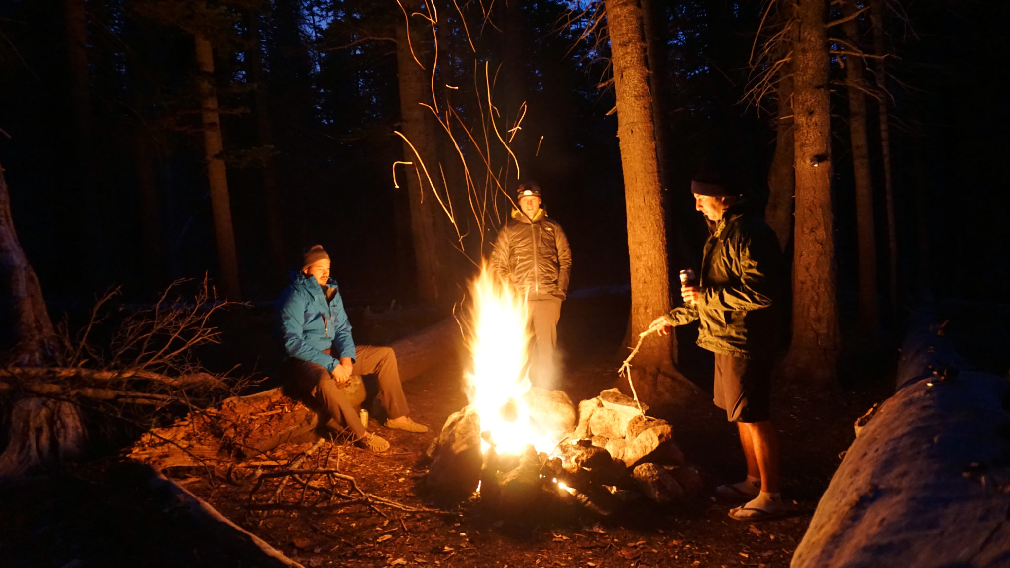
Later that evening.
Next up was the four peaks of the Cleveland Group to the south of the lake. We weren’t exactly looking forward to this group (Rick was looking forward to it so little in fact that he decided to stay at camp and sleep in) as it’s more just a big slog than anything else. Kyle and I got a later start than we would’ve liked and begrudgingly started up the massive slope that grants access to the high ridge line we’d be on for the rest of the day.
Once we climbed high enough to be able to see all the summits we settled into a groove and slowly picked them off one by one. The unique thing about these peaks is after climbing all four of them, you actually have to re-climb two of them before descending back to camp. Nice!
Summit of Pt. 13,401, the first peak of the group.
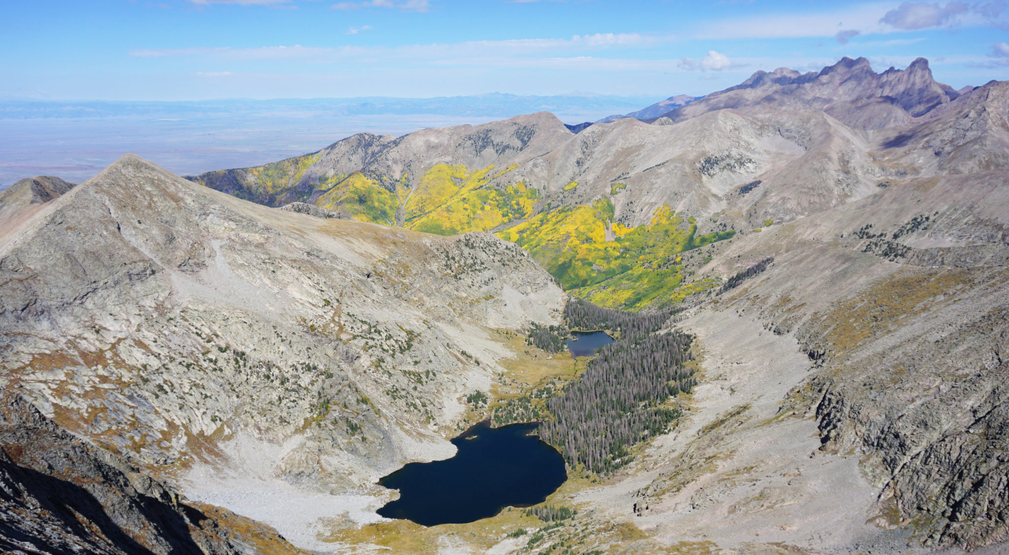
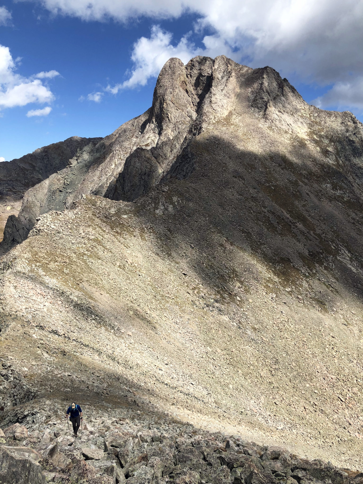
“Dead Man Peak” (left) and Dead Man Lake seen from Cleveland Peak’s summit. Click to enlarge.
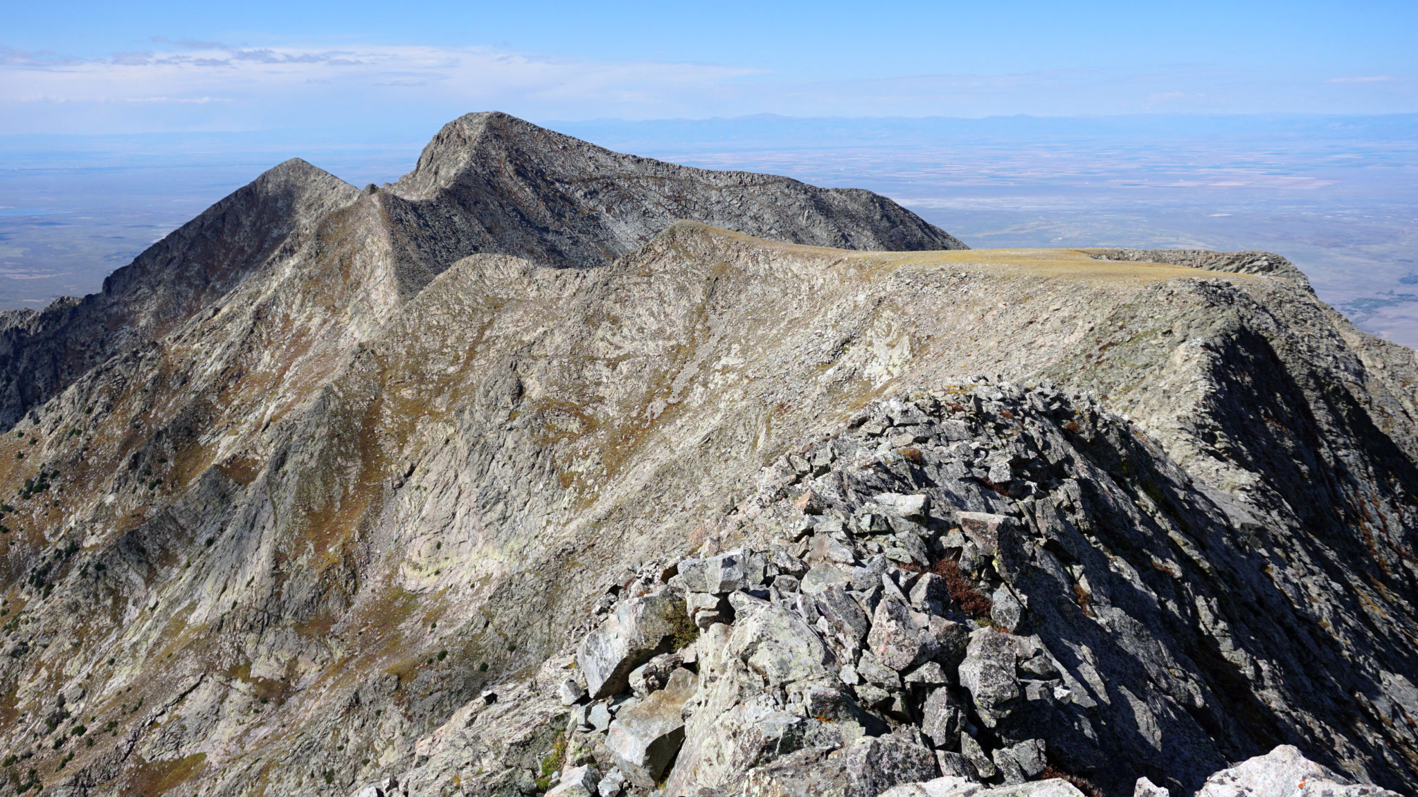
Looking out at Pt. 13,384. To get to 384 and Dead Man you have to hike across that flat spot three times.
Well as you may have guessed, one of the downsides to re-climbing two peaks on the way out is potentially running into trouble with afternoon weather. As Kyle and I were descending Cleveland Peak back towards Pt. 13,401, a big thunderstorm which had been bearing down on us from the north finally moved into the area. As it began to hail we booked it off the ridge and hunkered down in a talus field on the southeast side of Pt. 13,401. For probably 40 minutes we sat there, “assuming the position”, as thunder clap after thunder clap boomed across the sky overhead. Not an ideal situation to say the least.
But eventually the storm passed, having left a solid coating of hail/snow in its wake, and we were able to continue up and over the peak and down to camp.
After the storm with Cleveland Peak in back. Click to enlarge.
We reunited with Rick, packed up camp and schlepped it over the pass back to the car. Being 8pm on a Sunday night there wasn’t much available in the way of food options (damn mountain towns). I did manage to at least track down an Elevated IPA at a biker bar in Salida. Hopefully the other guys found something good to hold them over on their drives home as well…
A parting shot – lower-Sand Lake seen on the descent after the Cleveland Group.
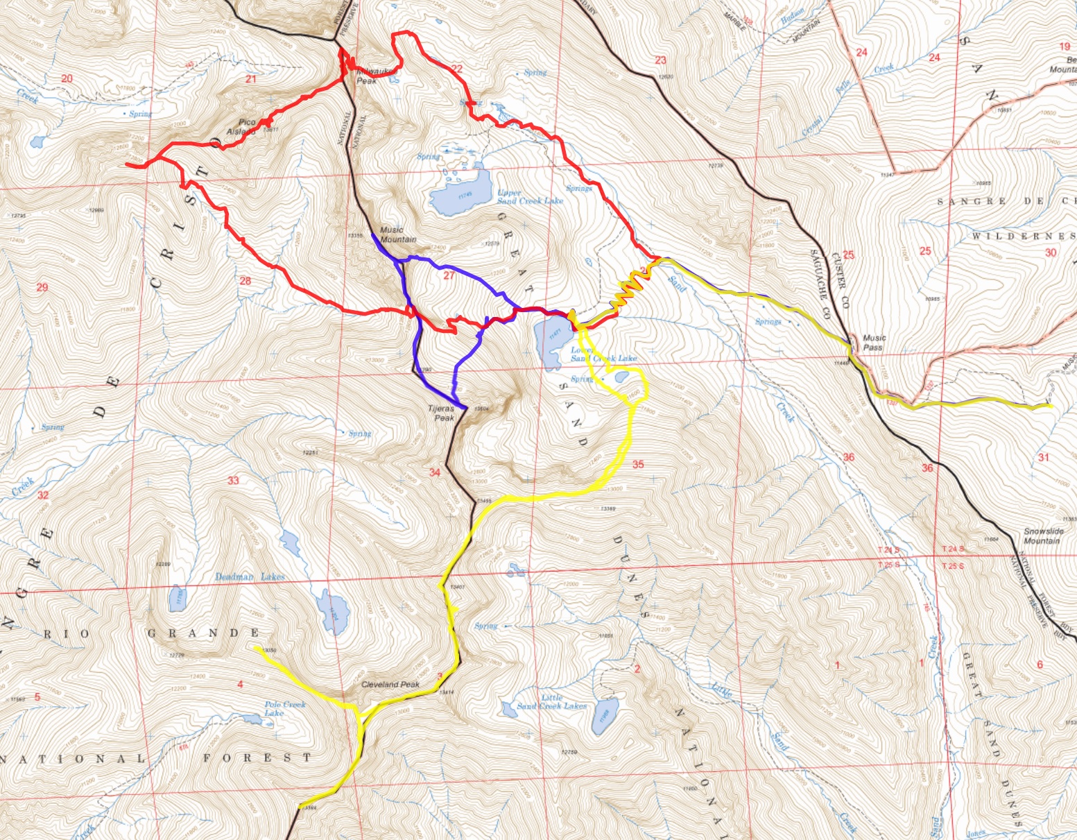
And a map – Day 1: Blue, Day 2: Red Day 3: Yellow. Click to enlarge.
It was a memorable few days out there gents! I’m glad we got this one in before the snow flies 🙂
I would have been with ya, Ricardo! Sleeping in and enjoying coffee by a morning fire. Sweet TR, Conners!
At this point in the summer I’d much rather have slept in at camp as well. Damn lists…
Nuthin like a massive thunderstorm at 13k to go along with your gaper slogging. Sweet area and lots of pucker factor.
Yeah cool area for sure, glad to have finally gotten in there.
Glad you were prepared for that storm. That sound like a bit of a stressful weekend between the exposure and the weather. That is an area that is high on the priority list and I never seem to just pull the trigger. Solid outing guys, and Ben, we need to get together for another hike when you’re not on skis and I’m not chasing my own lists. Lists are jails.
For sure, thanks Scot. Agreed, lists can sure be limiting!
Furthermore. Marsters, Piper14 and I ran afoul of thunder in the same spot, several Junes ago (or maybe Julys). Great pictures, Ben! I like the “Deadman” view with the aspens. Some great views of the Crestones from that group. The Music-Milwaukee-Asilado area definitely forms one of the better playgrounds for scrambling!