- Peaks:
- Mummy Mountain (13,425′)
- Hagues Peak (13,560′)
- Fairchild Mountain (13,502′)
- Ypsilon Mountain (13,514′)
- Mt. Chiquita (13,069′ – unranked)
- Mt. Chapin (12,454′)
- Route: Mummy Mania, the long way. i.e. Start at Lawn Lake TH > ascend Mummy Mountain > traverse the entire range counter-clockwise > exit at Chapin Pass TH > run back down Fall River Road.
- Distance: 26.4 miles
- Vertical Gain: ~8,500 – 9,000′ (Strava miscalculated this for some reason)
- Route Track: https://www.strava.com/activities/4023414555
- Time: 10:06 total time; 9:08 moving time
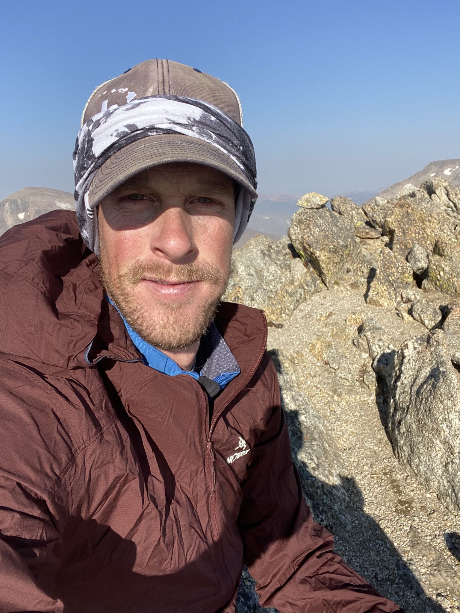
- Climbers: Solo
- Date Climbed: Sunday, September 6, 2020
Prelude – Years of Route Neglect Finally Coming to a Head
The Mummy Mania Traverse (aka the Mummy Kill, aka the Mummy Marathon) is one of those routes that had been on my list for years and years, but I had just never gotten around to actually doing it. I neglected it for so long, in fact, that it sort of took on a life of its own in the time I ignored it. What was once an obscure, all-day challenge in a remote area of the park has turned into somewhat of a classic the past few years.
Today, there are articles about it, established FKTs, gaper write-ups, and a host of other trip reports about the route. As such, I won’t spend much time setting up the particulars of the climb. Basically, you just grab all the 13ers in the Mummy Range (plus a few bonuses) via one long shot.
Long ago, Sarnelli and I had planned to do this one together. This would be advantageous as the typical way to do the Mummy Mania Traverse is to start at the Chapin Pass TH, climb the peaks in a clockwise direction, exit at Lawn Lake TH, and then take a car back up to where you started via Old Fall River Road. The car shuttle saves all kinds of time, distance, and elevation.
But of course, Dillon decided to betray me and do the route without me knowing instead. In classic path-of-most-resistance form, he also reversed the climb. This adds 8.5 miles and 2,500 vertical feet by starting and ending at Lawn Lake TH. I spent years knowing I had to crush his time one day in revenge.
Well, the 2020 summer of COVID had me running like never before, so I finally picked a Sunday and felt as good as ever about doing a huge day in the park. My goal was to also do the route in the counter-clockwise direction and also without the car shuttle.
Finally, I knew that the Cameron Peak Fire had been burning for a few weeks just to the northwest of the Mummies. I had some trepidation about climbing so close to it, but I checked the park website and Fall River Road was still open, as were the Chapin Pass and Lawn Lake Trailheads. Plus, I knew the fire had been burning for a while already and wasn’t too huge. How much could change in just a day?
Sadly, the answer to that question dominated my time spent in the Mummy Range.
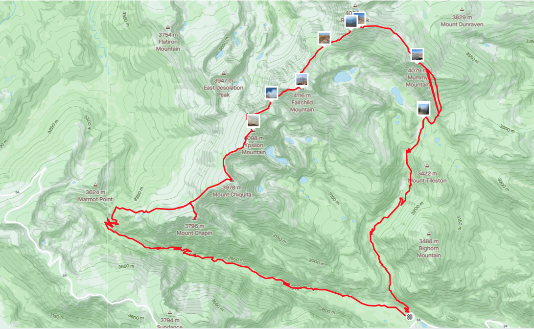
Map of the Mummy Marathon, starting and ending at Lawn Lake TH, going in a counter-clockwise direction. (click to enlarge)
The Mummy Mania – A Smokey Day in the Park
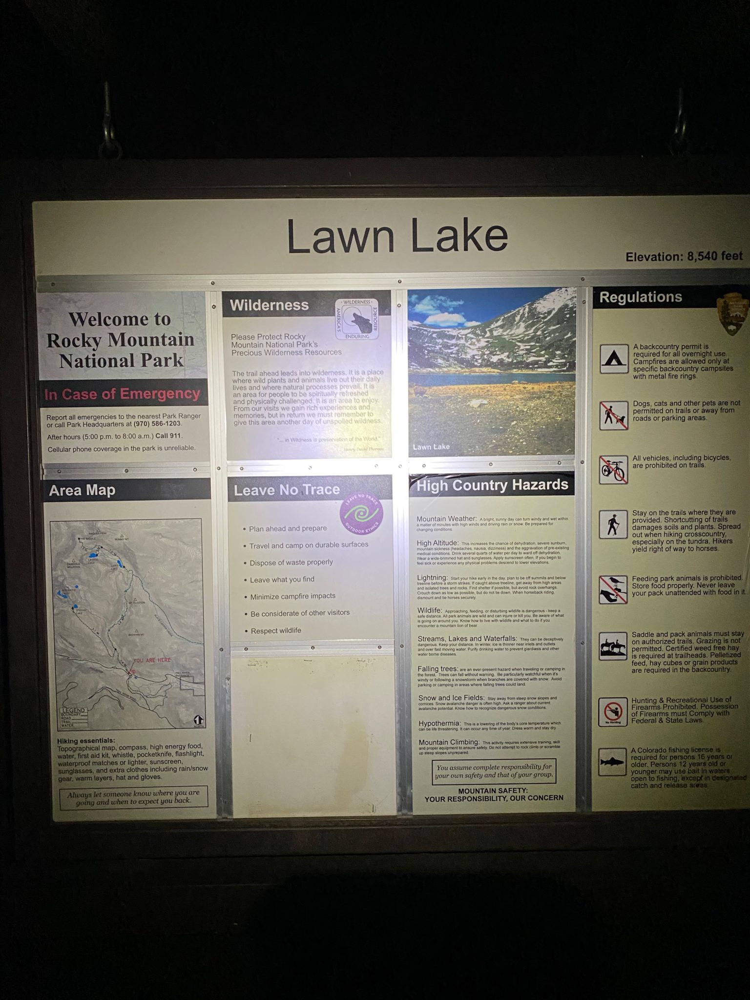
My day got started at the Lawn Lake TH just before 6:00. In a classic response to the COVID controls put in place by the park, there was a run-o-gapers who all descended upon the entrances just before 6:00 am (at which time the Park starts to only allow in those with permits).
Apparently everybody showed up at the same time, because when I went into the Lawn Lake outhouse there was almost no one else there, but when I came out there was a line of shivering flat-landers three humans deep. I couldn’t believe how crowded it was. But as it turns out, I would only see one other person for the next 9 hours.
Anyway, the trail up towards Lawn Lake was nothing short of spectacular. The super gentle grade and classic RMNP rocky path made for some great slow jogging.
Just think, if you do this route with a car shuttle, you could be done right now!
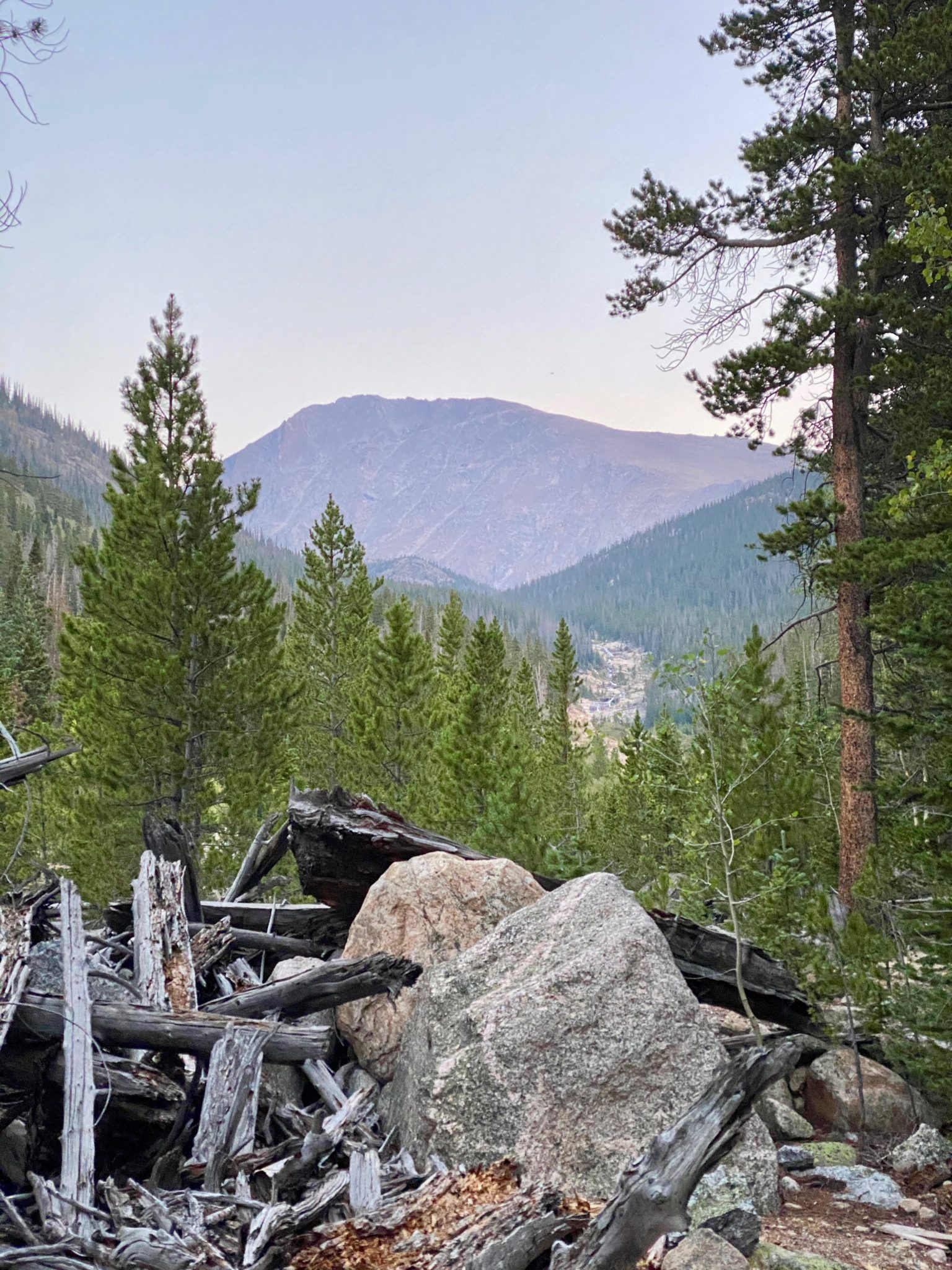
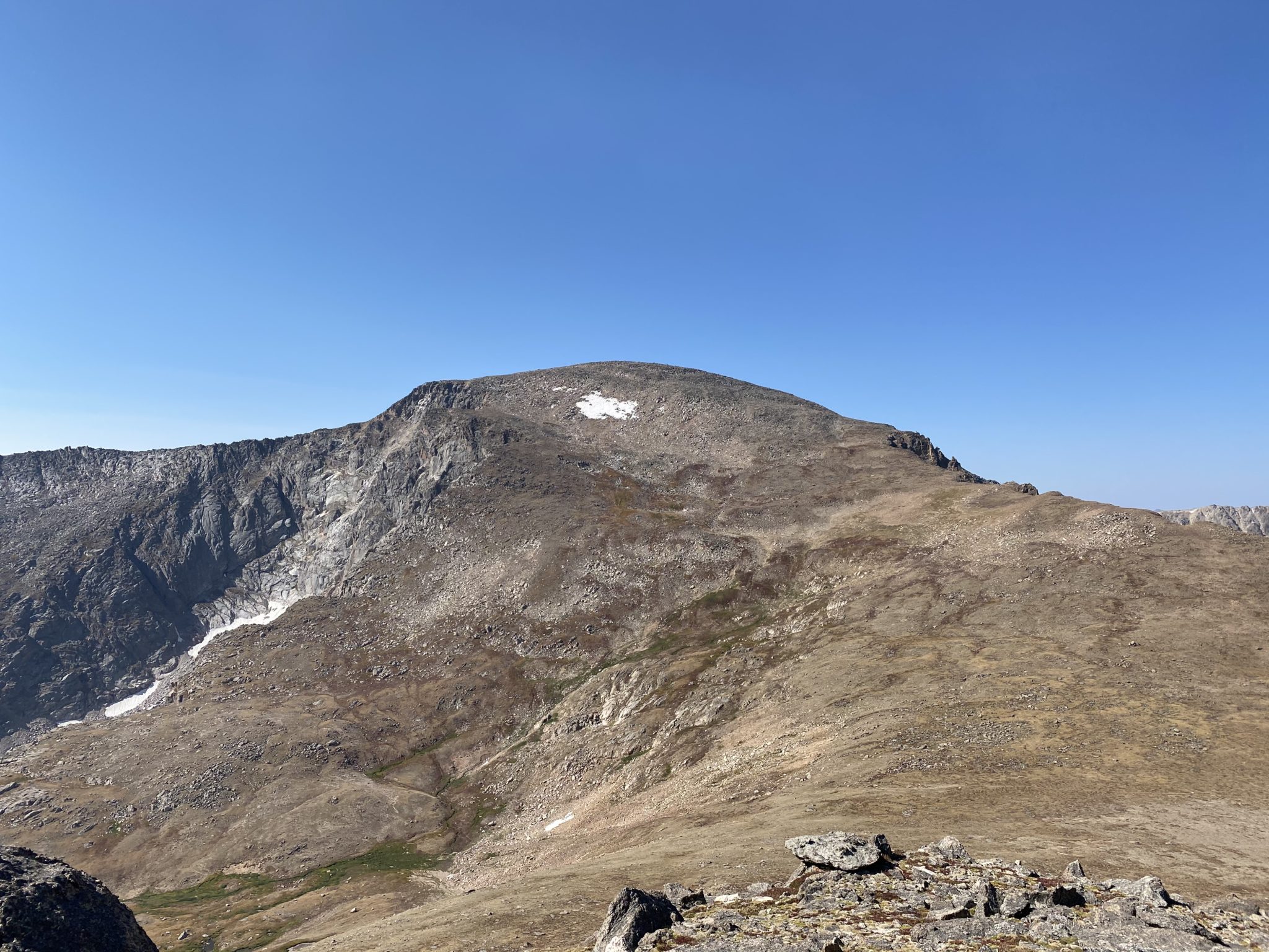
Mummy Mountain – the first peak of the day – finally comes into view approx 5 miles up from the TH. Apart from Bear Lake, the Lawn Lake trail is the flattest I know of in the whole park. Run!
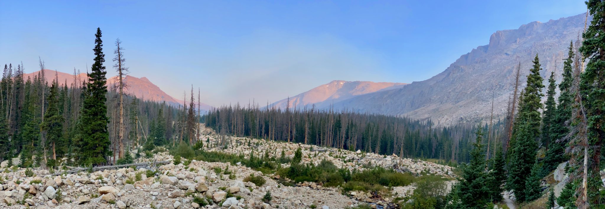
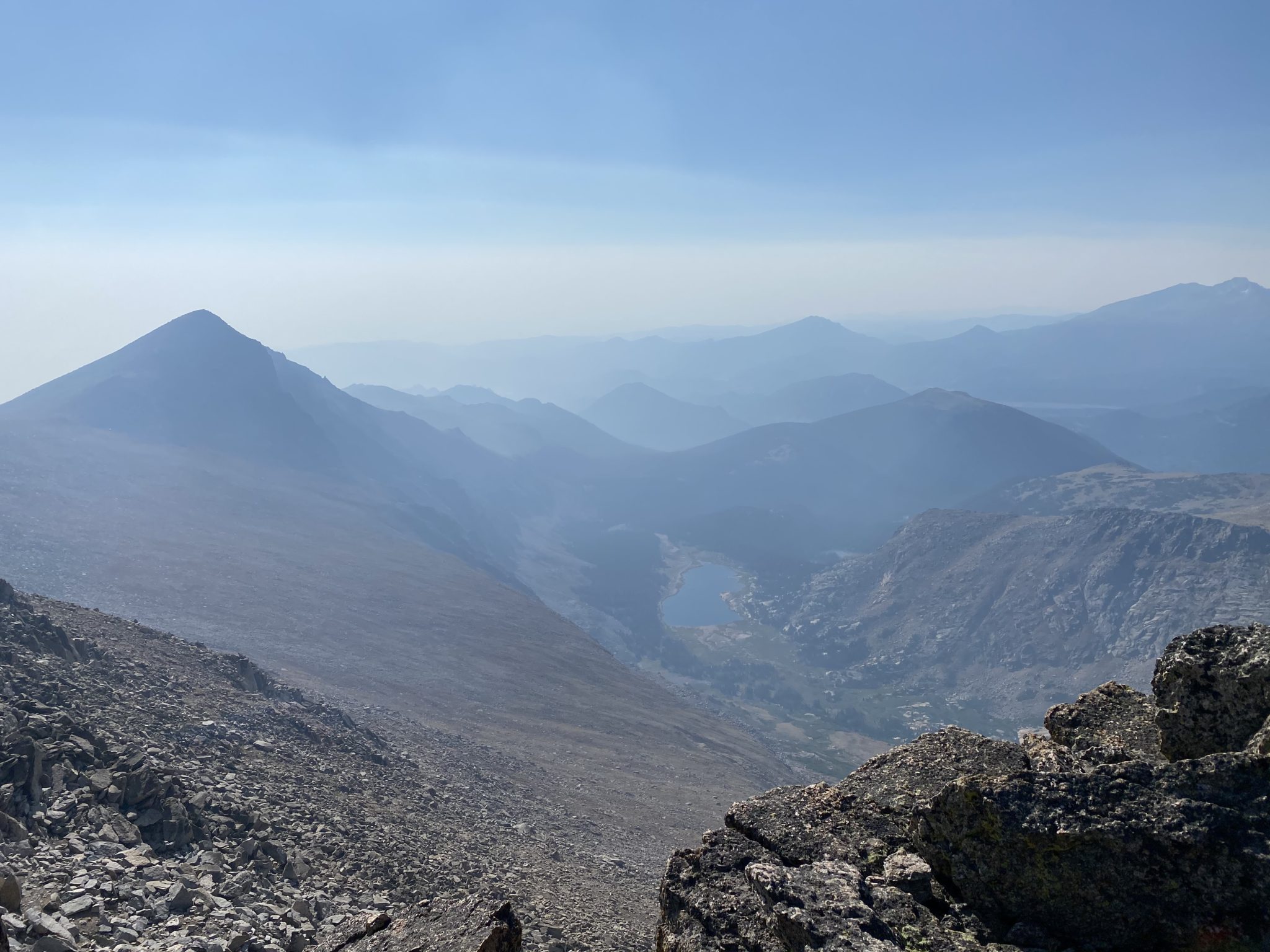
The upper basin cirque, with early morning haze already starting to creep over The Saddle. (click to enlarge)
After an easy ~6 mile warm up on the great approach, everything changed just past the Black Canyon Trail junction. As Roach would put it, “the introduction was over.” I left the trail, did a short bushwhack through the remaining trees, and ascended straight up the steep south slopes of Mummy Mountain.
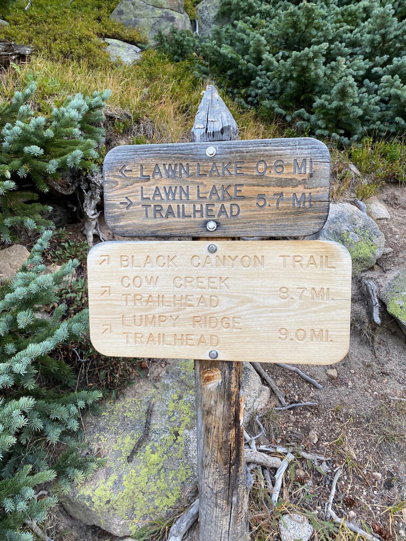
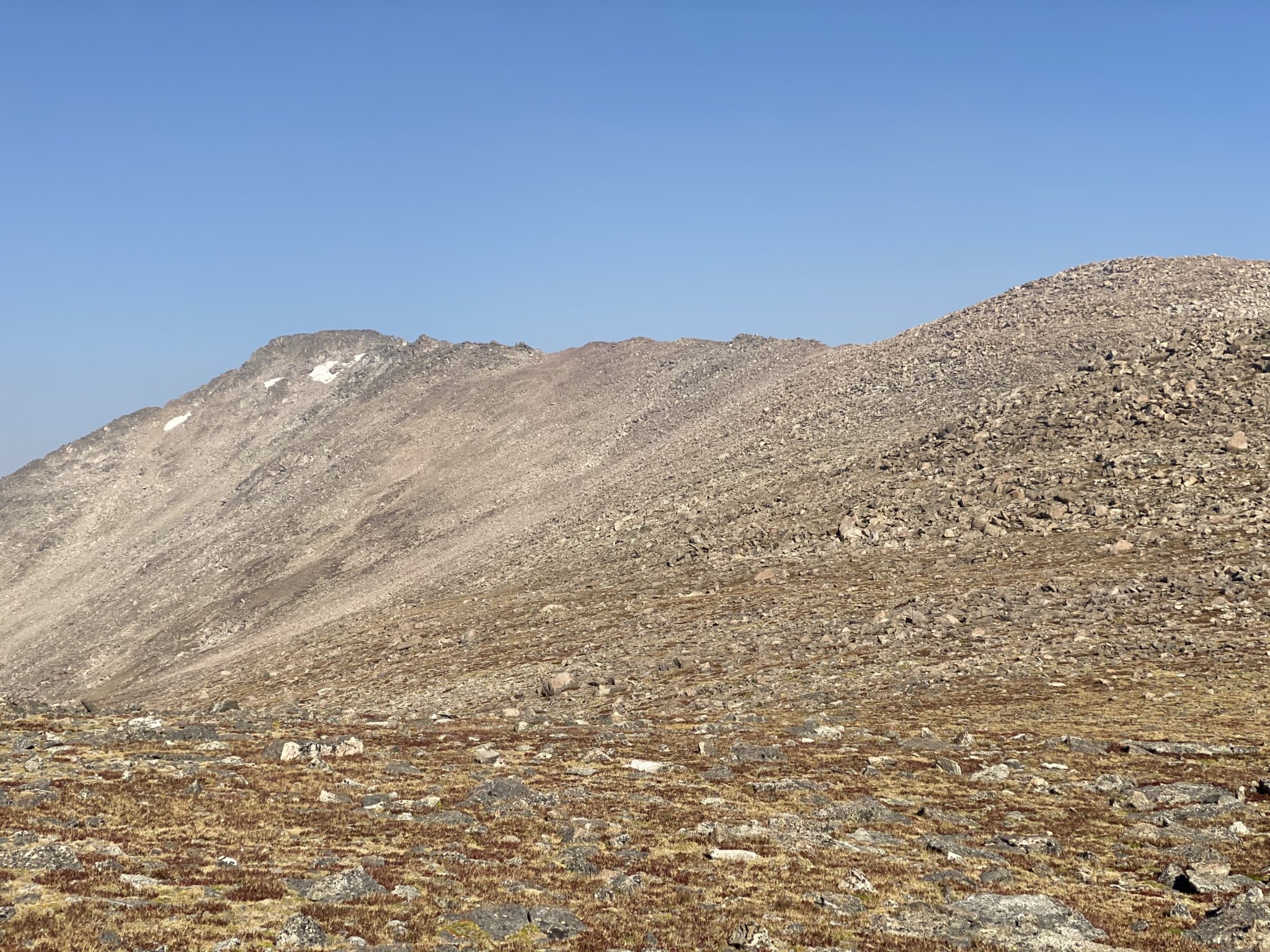
Bang a right here, go a quarter mile, then say sayonara to any trails for a long, long while.
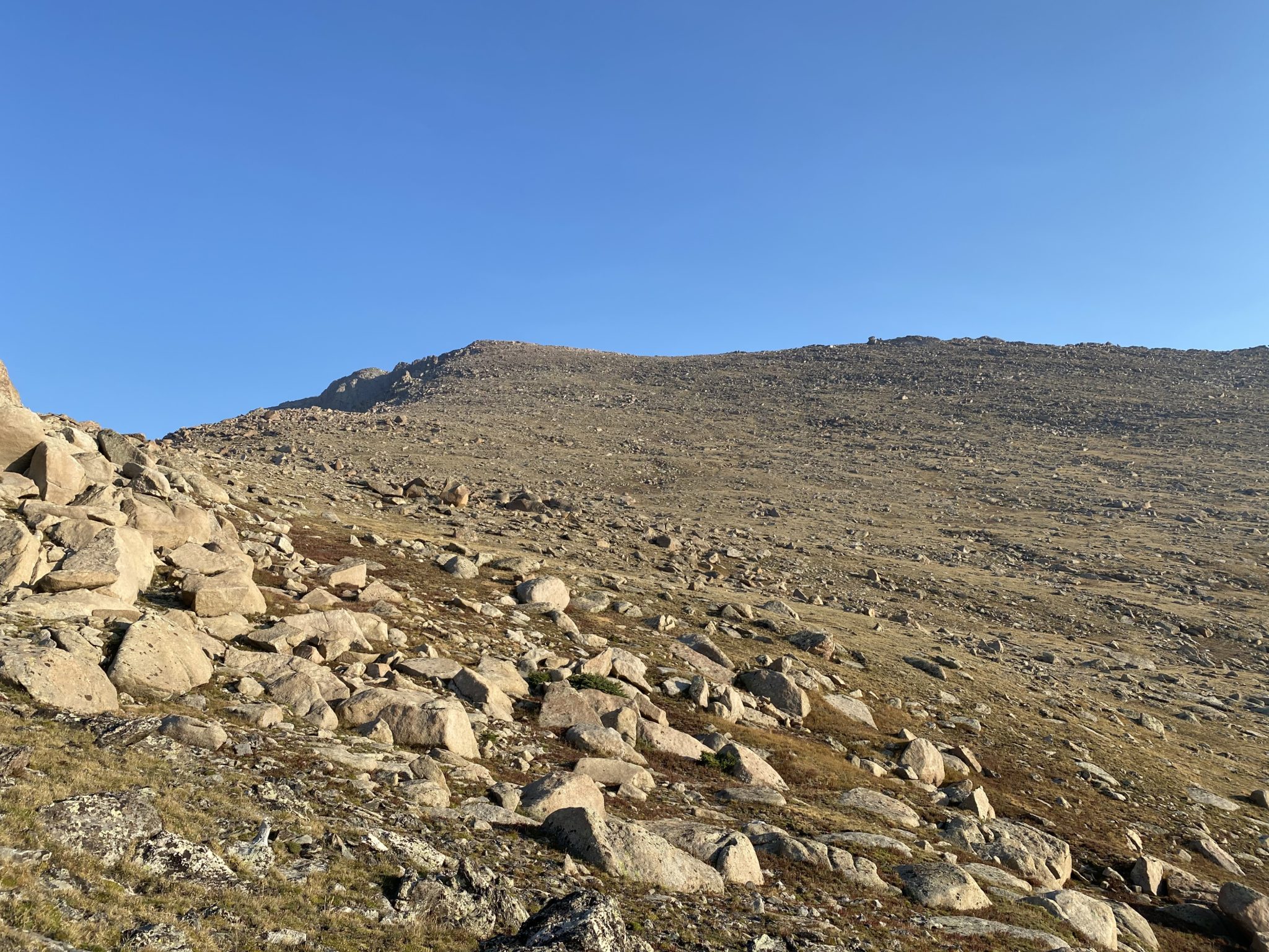
Looking up at the featureless south slopes of Mummy Mountain.
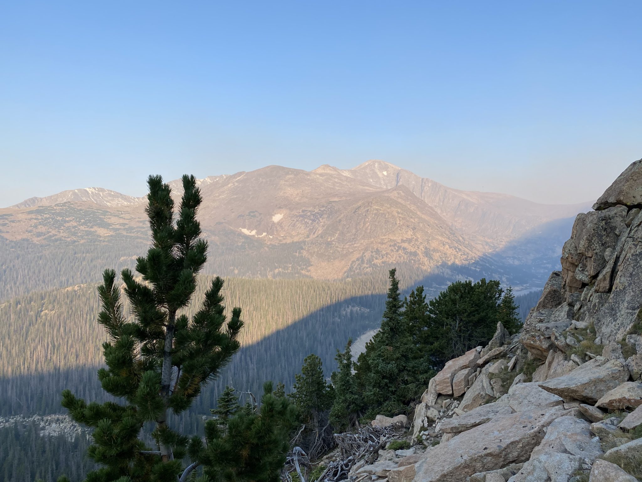
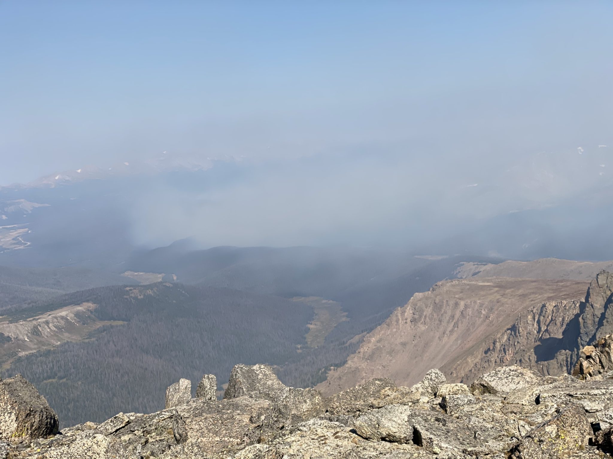
Hazy views over toward Fairchild and the other objectives for the afternoon.
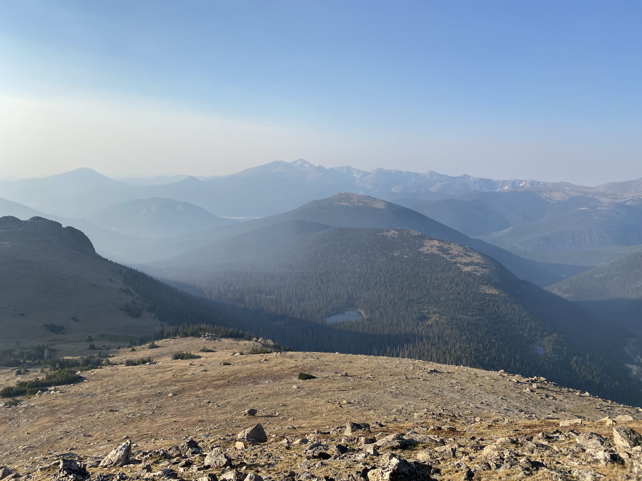
The big daddy in the Park hiding behind the haze.
After 7.5 miles and 5,000 feet, the fun is just getting started.
The smoke to the summit of Mummy hadn’t been too terrible. On the one hand, it was definitely noticeable and a thin line of ash had been blowing in over the Mummies and The Saddle all morning. But on the other hand, being so close to the fire, much of the areas outside of the direct path stayed fairly clear in the early morning.
That said, I knew that the winds were forecasted to really pick up as the day went along. And it was supposed to be yet another hot, dry day. I would later learn that the relative humidity would drop into the single digits and the winds gust over 40 mph. All of these factors were the precursors to the disaster that was soon to come.
Mummy > Hagues: ~1.8 miles, 700 feet
Knowing that a long day was still ahead of me, I made quick work of the north slope down Mummy and began back up the long ridge to Hagues.

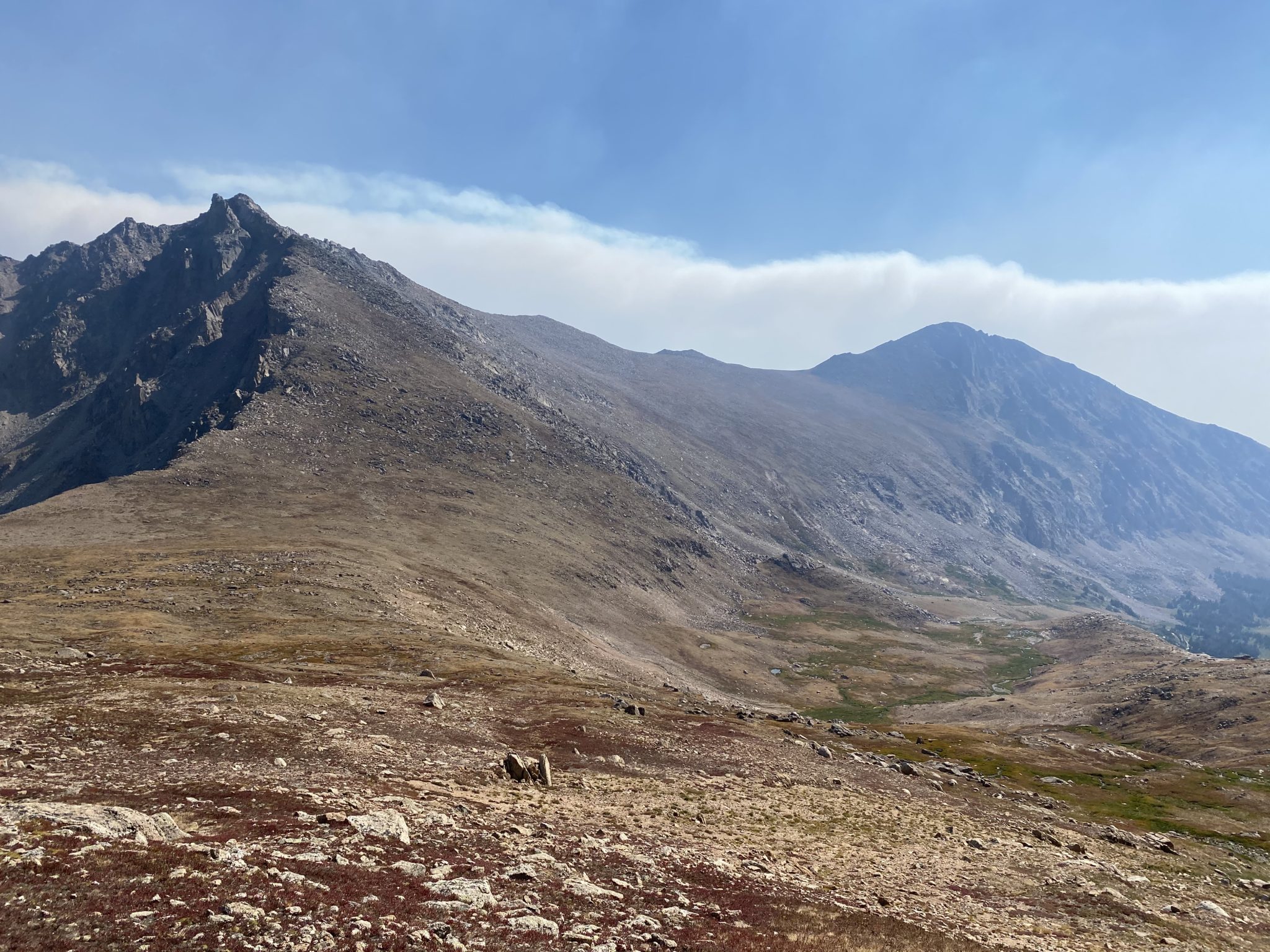
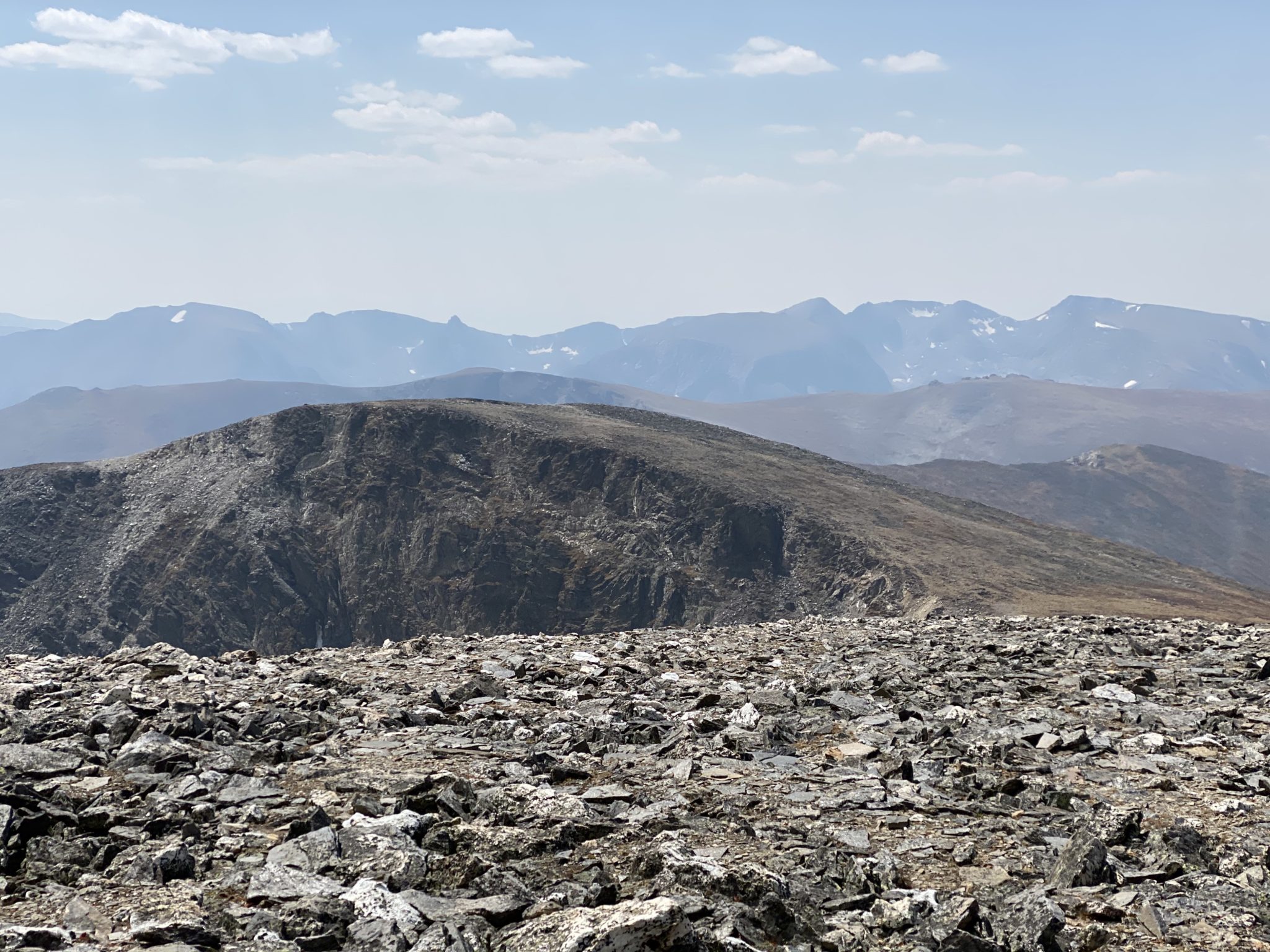
Full view of the route to come ahead. (click to enlarge)
Views of Hagues from the Mummy-Hagues saddle. This one has a face that only a mother could love.
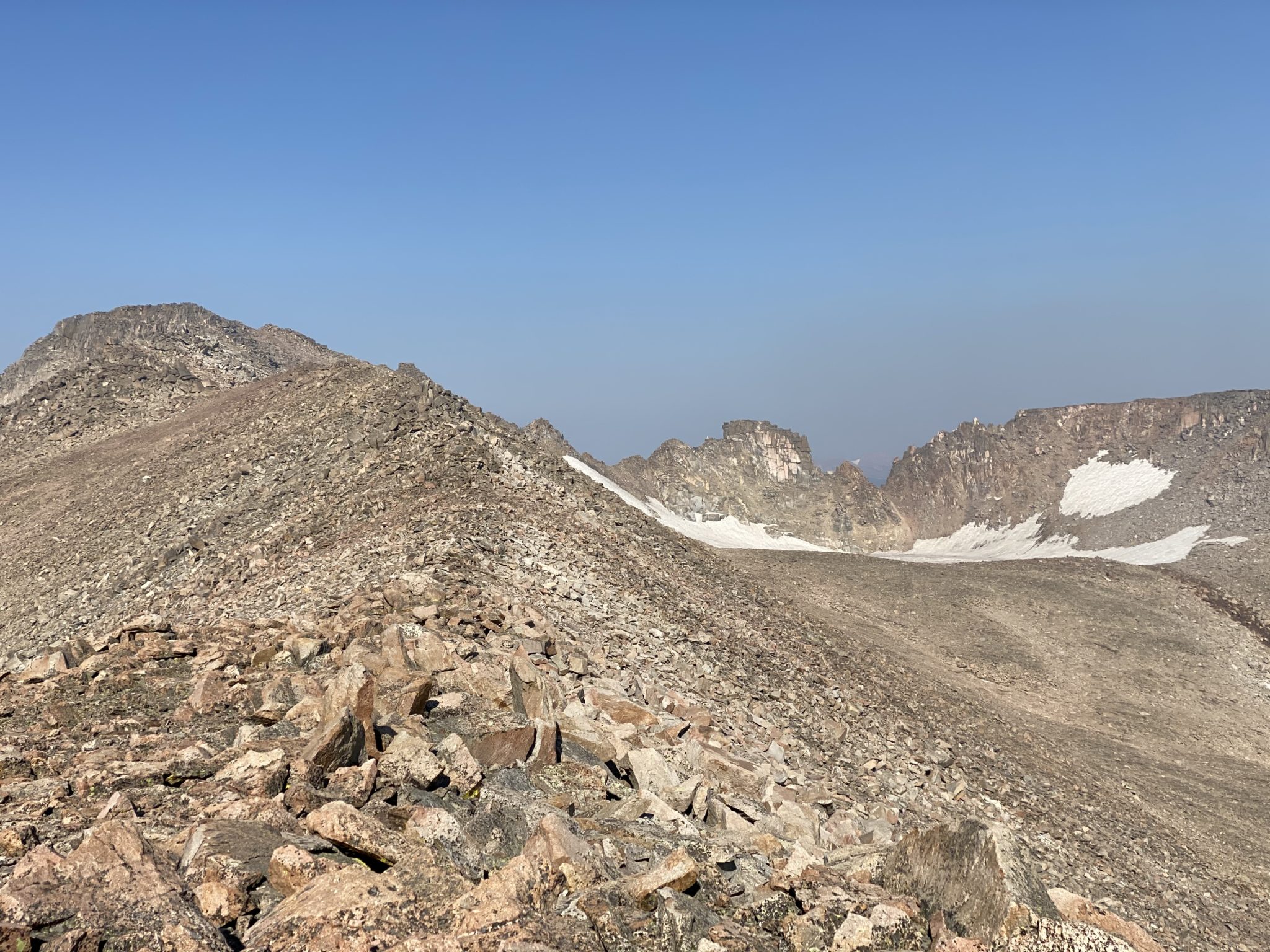
Getting closer to Hagues summit, with the Rowe glacier and the unranked Rowe peaks coming into view. Some folks add these two unranked 13ers to their Mummy Mania day, but I had no such interest. Given the route I had planned already + the unranked nature of the peaks + the generally unappealing aesthetic, I was quite happy to pass them by.
The smoke started to become more of an issue as I got closer to the summit of Hagues. The wind started drifting it right into my face, and I really felt it in my breathing. I pulled my buff up to try to block it out. It did help a bit, but I noticed myself dragging quite a bit due to the limited air flow.
The terrain slowed down quite a bit as well as I neared the top of Hagues, which is really just a big grundle pile. I’ll admit I didn’t research the route as much as I could have, so I’m not sure I took anything close to the optimal line (at this point, or all day, really). There was some scrambling you could maybe call Class 3 near the top of Hagues, but it could have been easily avoided with a cleaner line, I’m sure.
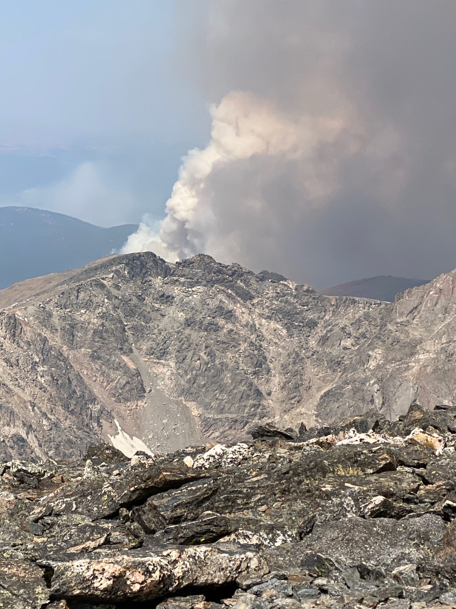
Regardless, I got to the summit and finally had a front row seat directly down into the Cameron Peak Fire burning several thousand feet below.
First direct views down into the fire.
(Pardon the vertical video – this was done for The Gram)
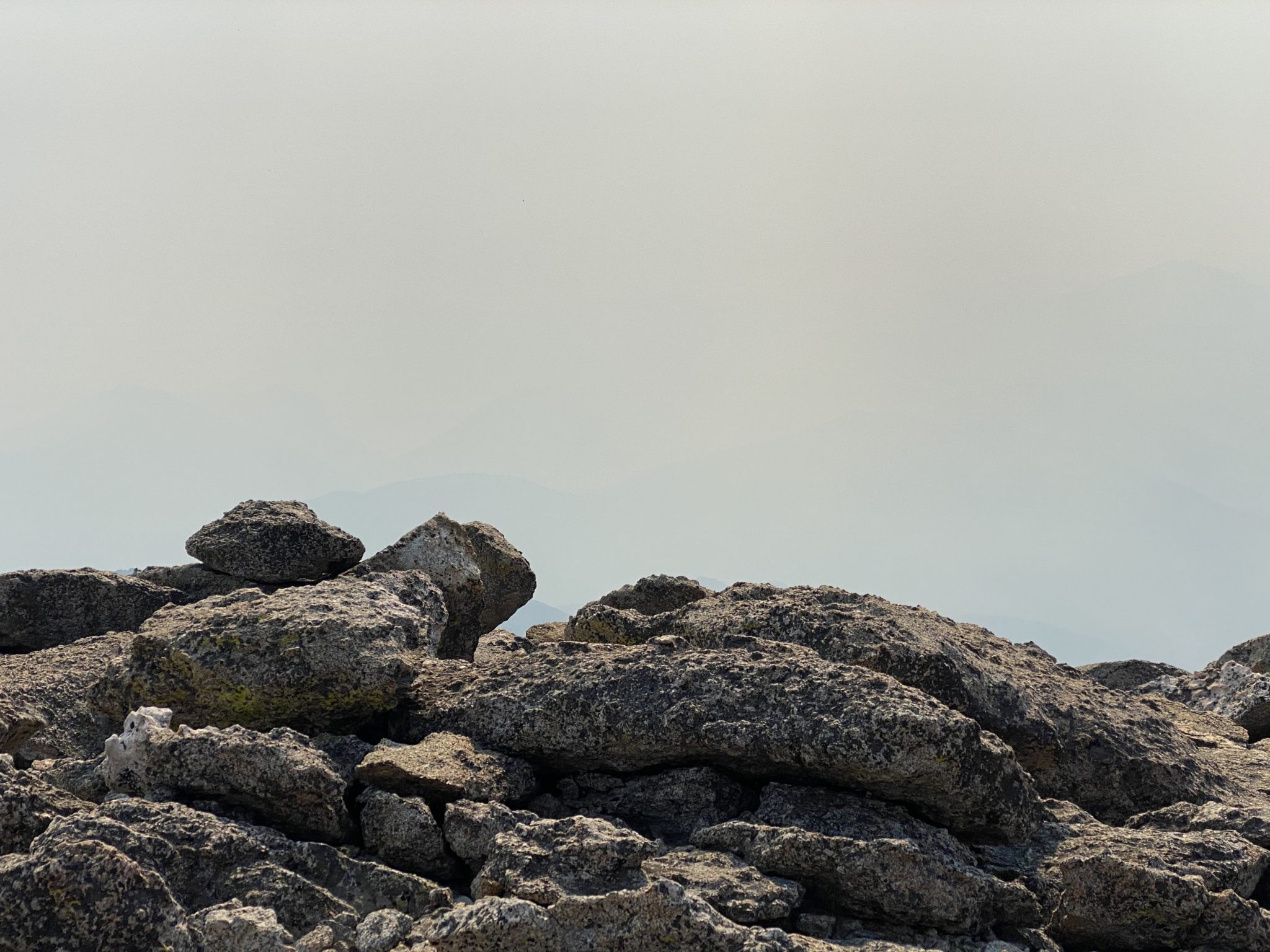
Looking back on Mummy Mountain and the approach, with both getting lost in the choke.
Hagues > Fairchild: ~2 miles, 1,100 feet
Coming off Hagues turned out to be a bit of an adventure. I went direct along the ridge, which I soon learned becomes pretty scrambly. With big drops off to the West and lots of spice near the summit, I quickly migrated more out onto the face, which was a bit less adventurous.
The problem was, this terrain was pretty slow going. In what would become a theme for most of the next few traverses, the steep terrain, loose boulders, and general lack of any sort of established path made for frustratingly slow progress. It was just hard to make good time. I often found myself thinking that a given piece of terrain would have felt a lot easier going the other direction. Maybe that’s why people do it the other way. Go figure.
Anyway, I eventually got to The Saddle (yes, that’s it’s official name) between Hagues & Fairchild, all the while watching the fire below. It was about this time that the winds really started picking up, and so too did the smoke and flames.
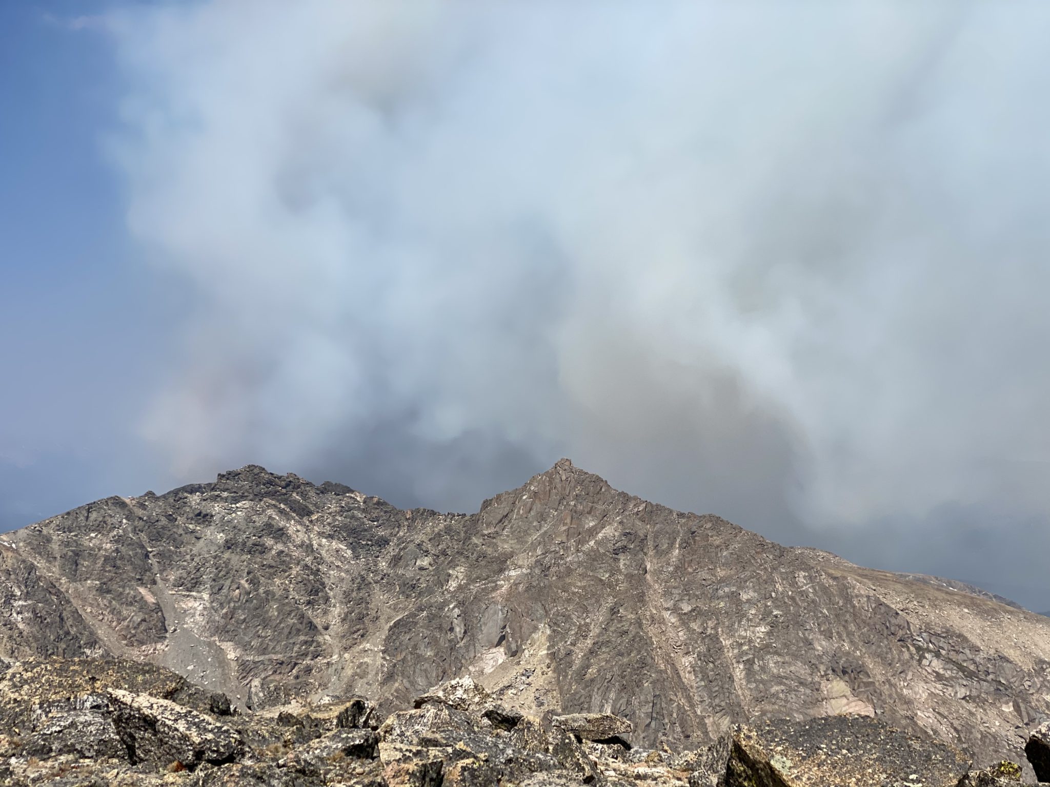
Favorable winds kept The Saddle & Fairchild out of it…for now.
But looking back on Hagues, you can really see things starting to take off. None of that is clouds.
By the time I got on top of Fairchild, the winds were really blowing. Everything was whipping up from the northwest, with a sustained breeze of ~20 mph and gusts much higher than that. From this point on, the fire absolutely exploded.
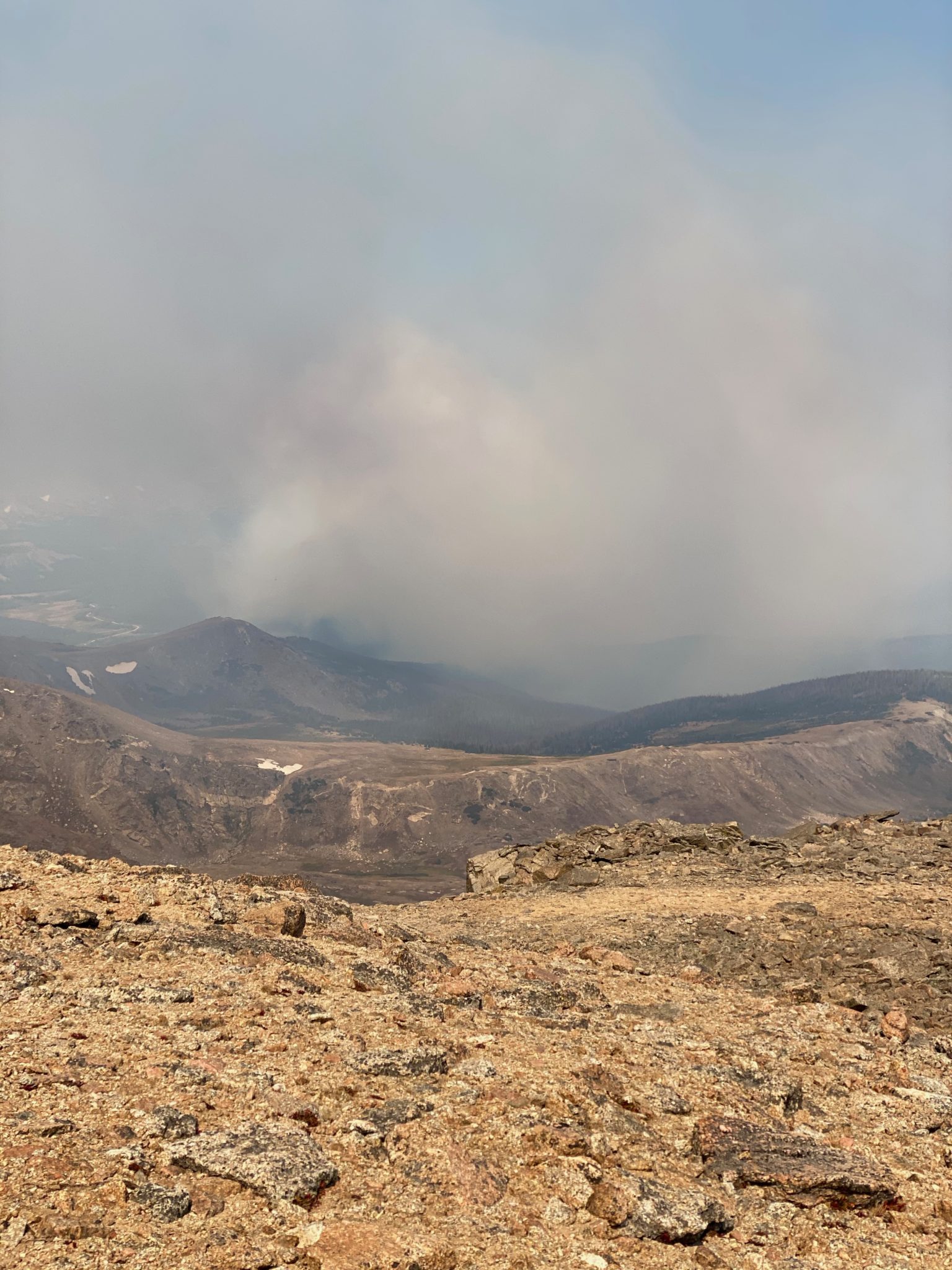
The smoke columns really started to build and grow right along with the winds. It was hot too. Far too hot even above 13,000′.
Looking back towards Hagues.
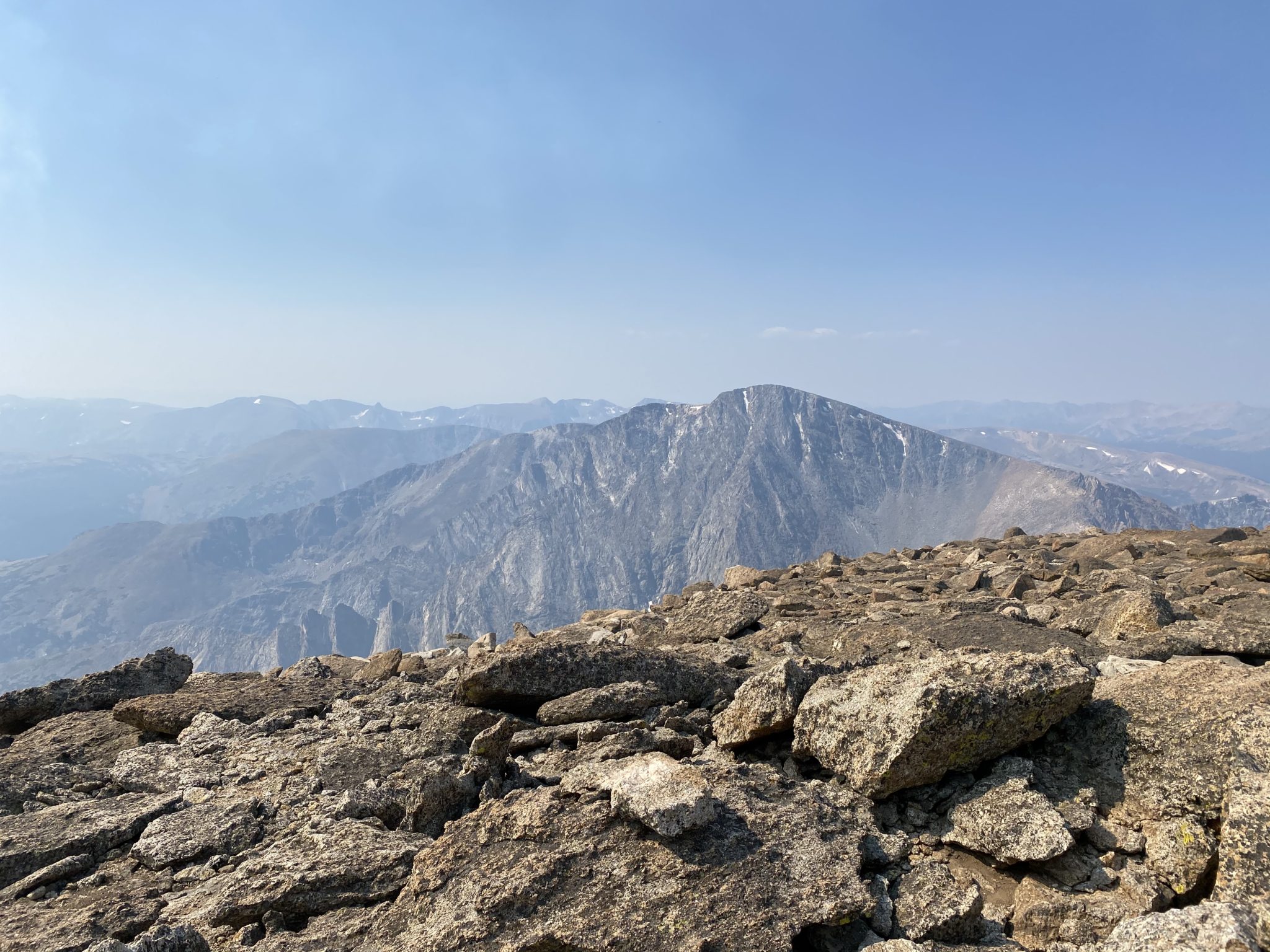
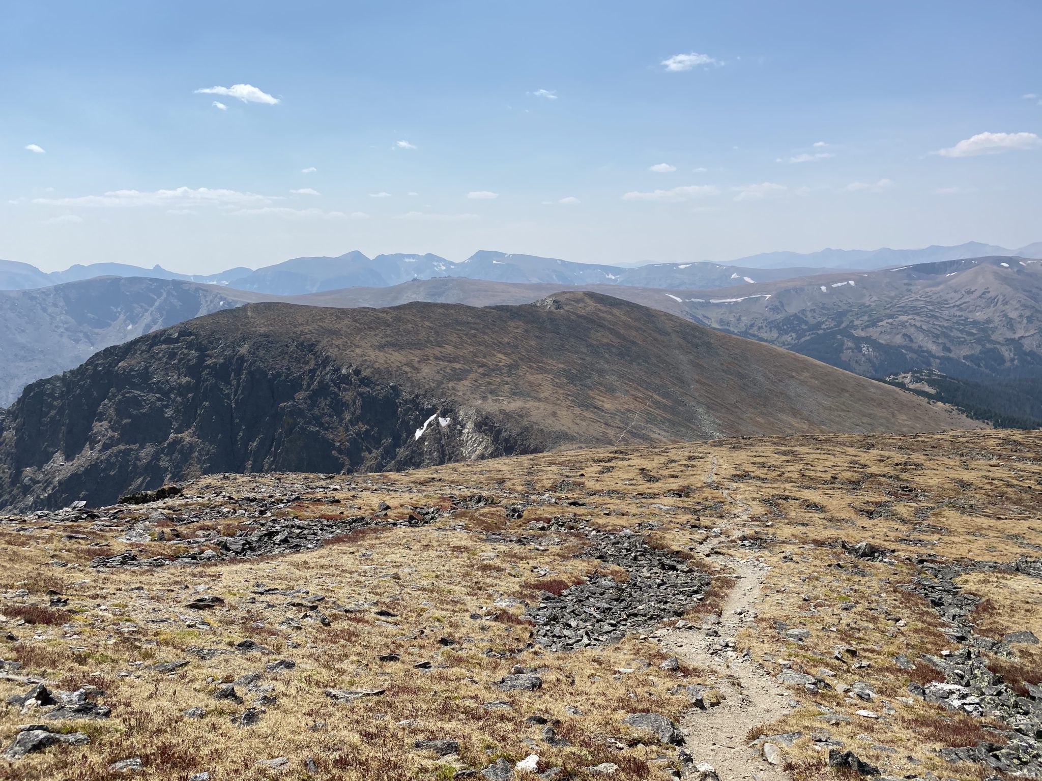
Looking 180 degrees the other direction towards the next peak of the day – Ypsilon.
Looking back towards the fire from the summit of Fairchild
Fairchild > Ypsilon: ~2.1 miles, 1,100 feet
This section of the traverse was, by far, the least enjoyable of the day. I assumed that the traverse stayed on the ridge proper, and maybe it does, but I quickly realized that the ridge was a massive loose knife edge coming off the top of Fairchild. Like I said, maybe there’s a way, but I was in no mood to start tinkering with an unknown loose slab fest of a route whilst solo and with an inferno raging beneath me, thank you very much.
So, I again moved out onto the face. This was hardly better. My line ended up crossing some pretty steep terrain, with an abundance of loose, large boulders throughout. I think this section had some class 3 as well. None of it was particularly hard, just very unpleasant.
Further grossness ensued once making the way back up Ypsilon. The lower portion of the route was as loose as could be. There was somewhat of an established scree-trail here, but it was still a classic two-steps-forward, one-step-back sort of thing. I was (initially) happy to finally regain the ridge above the grundle field.
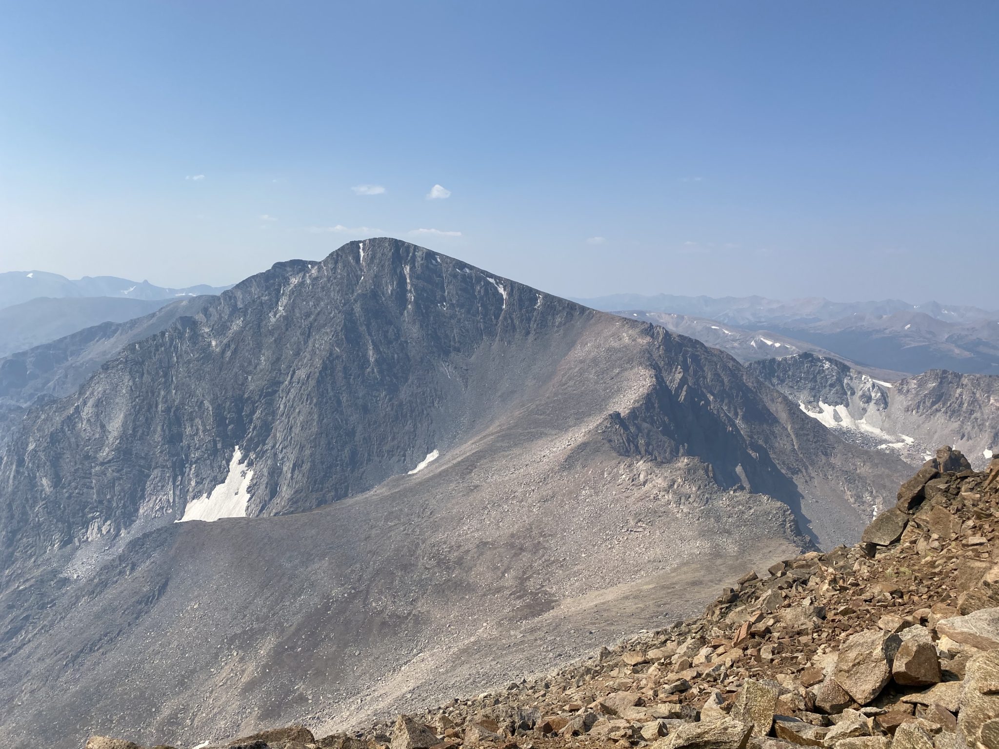
Looking over at Ypsilon from the summit of Fairchild. The big sloping pile was every bit as annoying as it looks. Blitzen Ridge sure looks fun though.
The real awful part about this section though was what the fire did during this time. The columns of smoke became essentially apocalyptic. What was an inconvenient haze in the early morning hours was quickly transforming into a nightmare scenario.
Below me I could see towering columns of smoke rising now thousands of feet into the air. I saw the fire ripping up into a few new drainages, including directly into the park. I later learned that it did indeed cross the boundaries and make its way south. I kept having to assure myself that, “No, the fire was not there just a few hours ago.” Things were moving that fast.
At one point the winds shifted and a mass of smoky clouds crept overhead. I saw it creeping ever so close to the sun, before blotting it out entirely, casting a red glow on the rocks all around me. It felt like that scene in Return of the King where Sauron sends a cloud from Mt. Doom over all the men of Gondor. Not particularly encouraging.
It was completely surreal to witness.
Relentless towers of smoke.
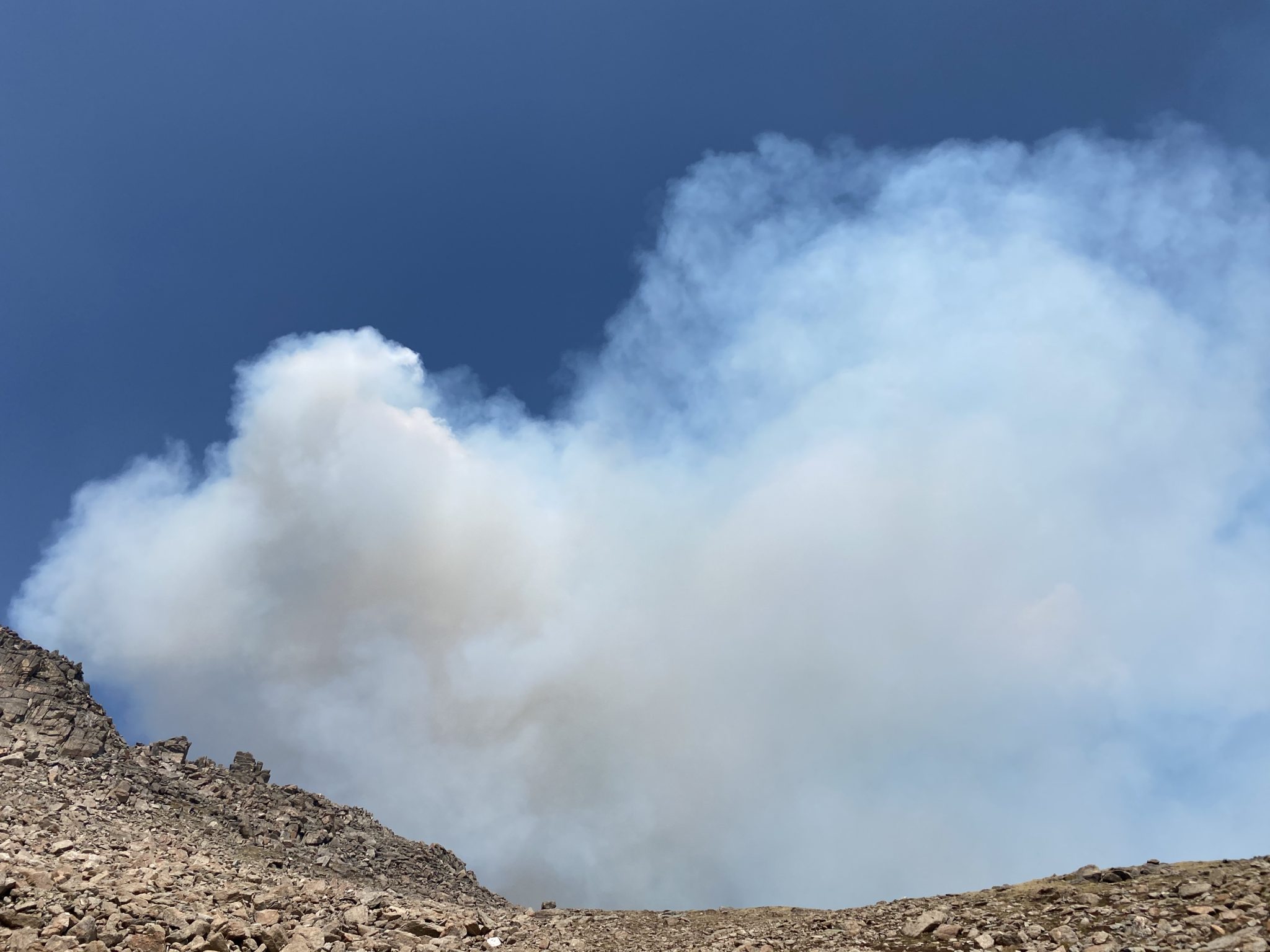
Still not clouds.
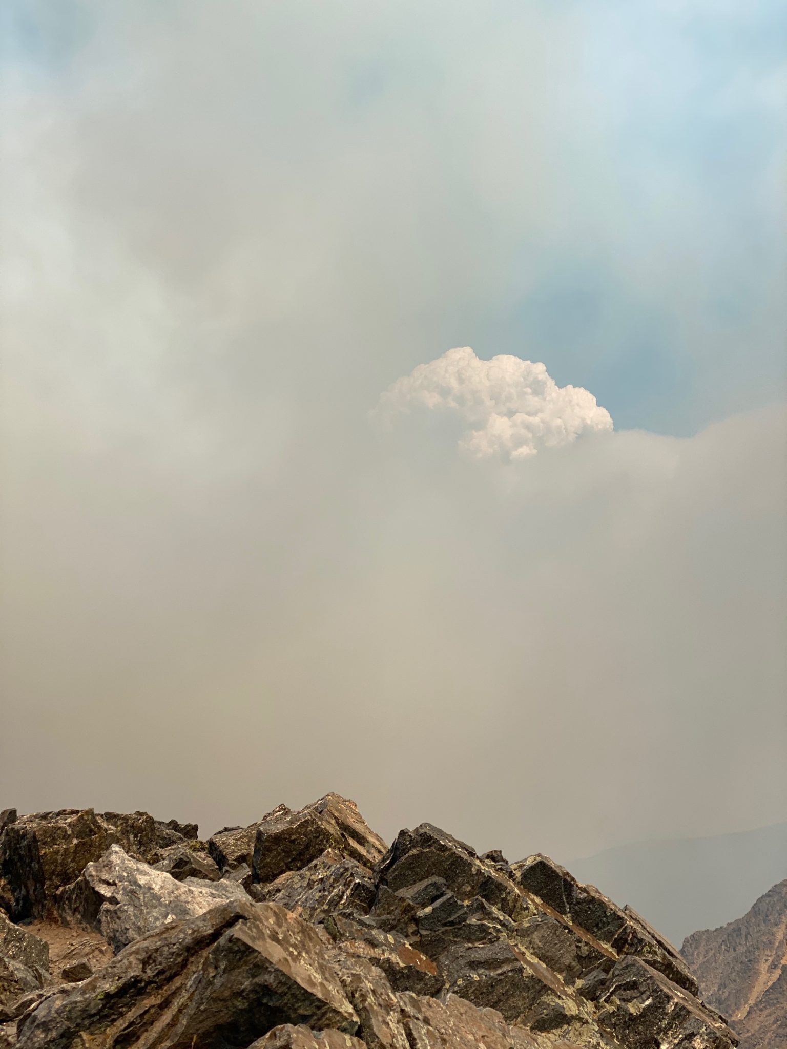
I think I read somewhere that big fires like this can even create their own thunderstorms?? Maybe that’s what this particularly menacing tower is? It looked like it.
🙁
Views from the summit of Ypsilon.
Ypsilon > Chiquita: 1.2 miles, 250 feet
As I mentioned earlier, the good news in all this was that I wasn’t ever in any danger. There was still a hefty buffer of space + 2,500′ of treeless tundra between me and any flames. Nonetheless, I was all too happy to blitz on over to the remaining peaks of the day.
The traverse from Ypsilon to Chiquita finally offered some smoother terrain. Also, Chiquita is ~500 feet lower than any of the other peaks. Plus it’s unranked. All in all, much easier.
The mighty Chiquita.
Chiquita > Chapin: ~1.2 miles, 400 feet
The final ascent of the day was up Chapin. I wasn’t really sure why this is considered part of the Mummy Mania Traverse, but it is. The way up involved a quick out-and-back to grab this ranked 12er.
The good news was, I had a 25 mph tail wind blowing me uphill the whole way. The bad news was, well, that gale was still just feeding the fire.
The trail from the Chapin Pass TH made it all the way to Chiquita’s summit. So, that made for an even faster descent and climb up over to Chapin. It felt great to finally be able to do some real running out there.
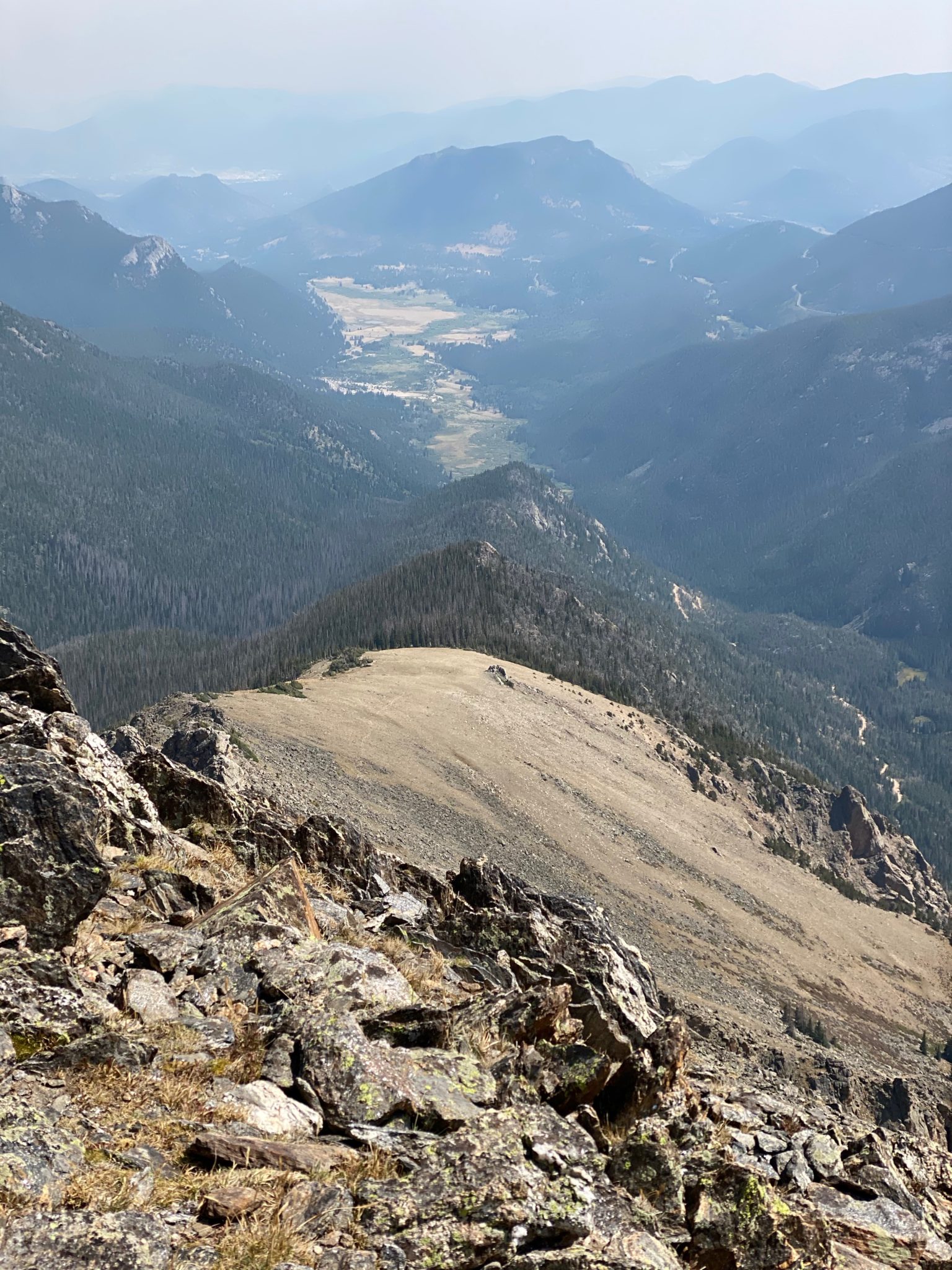
Views back down to the car. Just 10ish miles to go from here. But hey, at least it’s all downhill.
Fall River Road > Lawn Lake TH
As I descended back down Chapin and over towards Chapin Pass, I thought it odd that I still hadn’t seen anyone. This was Labor Day weekend, after all. There was certainly no shortage of gapers in the park, as my morning could attest.
I didn’t see anyone driving on Fall River Road either. I assumed (correctly, as it turns out) that the park had closed the road due to the fires. There was nothing for me to do but run it home.
By the time I finally reached the Chapin Pass TH, there was just 8.5 miles and 2,500 feet of cruiser downhill road in front of me.
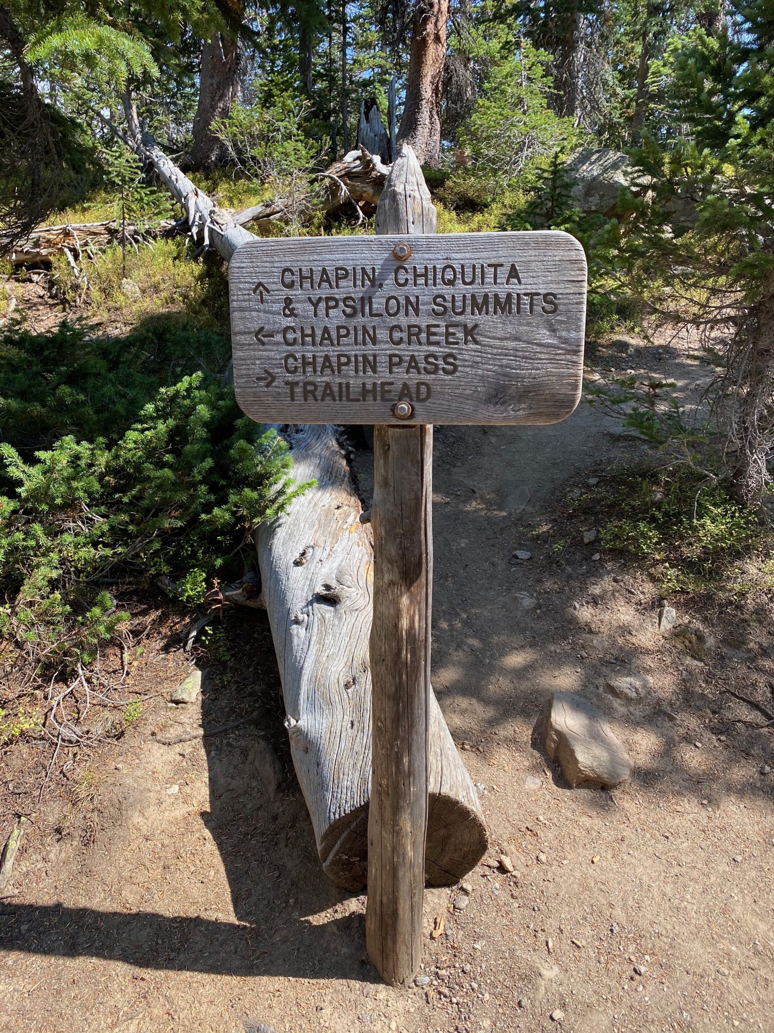
Shoulda started here.
The run out was pretty enjoyable. Although, I did feel bad as it was obvious the road was closed. As it turns out, the Park had decided to do so at 11:00 PM the night before. Given where I came from, I didn’t know this and missed the announcement. Whoops. Thankfully the lack of cars made for a pleasant run out. I did encounter a few other parties (finally) who were hiking the road as I descended.
By the time I made it back to my truck, it was around 4:00. But it looked like dusk. The smoke had turned to black and cast an eerie haze over all of Estes Park. Denver was no better. The entire front range was socked in by the time I got home. When I did, I read news reports about what I had witnessed all day.
The conditions had indeed, made the fire run wild. In just the time I was watching, it grew from 24,000 acres to over 36,000. The next day it would grow to over 56,000. There was still more to come.
Before the freak snowstorm of September 2020, which ended up dropping 12+ inches of snow on the fire, it eventually grew to 102,000 acres. One of the top 5 largest wildfires in Colorado history. And yet, only the second largest of the 2020 season.
I’ll spare this report from too much preaching. But I will say this: all these fires are not natural. Neither is the extreme drought or wicked beetle kill which makes them possible. Neither are the 70 degree temperature swings in 24 hours or freak blizzards in early September. That’s all thanks to human-caused climate change.
Yet somehow, like everything else these days, that has somehow become a controversial, polarizing issue. It shouldn’t be. It doesn’t matter what any of us believe about this, it’s real. Science says things will only get worse. I fear we will not listen.
I also fear my day in the Mummies was just a foreshadowing of what is to come. I’m trying to hold out some hope for the future of our mountains, but after a day like my experience in the Mummies, there just isn’t much there.
And that makes me very sad.
Thanks for reading if you did; enjoy it out there.
Full re-live of the day. I’m not sure I trust any of the stats (or the inexplicable 500 foot descent off of Mummy), but these are always cool to see.
Postscript: Zambo vs. Sarnelli
Oh right….there is still the score to settle between Sarnelli and I. You know, because of that whole, betrayal thing.
So, I decided the best way to handle this was via a good-old fashioned point system to compare our days. After all these years, who had the better day out on the Mummy Marathon????
Let’s take a close look at the stats and see how it all shakes out:
- Precedent: Dillon did this first, so he gets props there. And he documented it for me to copy. And he was pretty original in the approach. Wins all around. +3 points, Sarnelli
- Betrayal-Factor: But of course, he did leave a man behind. Not cool, man. Not cool. -10 points, Sarnelli.
- Time: Zambo with the big ups here. My 9 hours decimated Dillon’s 13 hours. Thats a 4 hour swing! +4 points, Zambo
- Photos: Always better from Dillon. No contest. +5 points, Sarnelli
- Scenic Views: Well, Dillon had a bluebird day followed by a cloud inversion, and I had a close encounter with Sauron’s taint. +8 points, Sarnelli
- Run-Factor: Every one knows running is cooler than hiking. Duh. +5 points, Zambo
- Pedobear Sightings: Not spotted for either party. Zero points awarded.
- Legacy Factor: As I’ve been reflecting on this trip more, it has occurred to me that I was probably the last human to see some of these drainages in their pre-burned state. That makes me sad. But it also makes me special. +5 points, Zambo
- Fire Factor: Well, what can I say on this one? Dillon had a perfect day and I witnessed the apocalypse. -10,000 points, Zambo
Final Verdict: Sarnelli wins in a landslide (damn you!). His day was definitely better. But he didn’t run and that means he didn’t have as much fun. So I got that goin for me, which is nice.
This is nuts. Yikes.
Awesome write-up for a huge day. Glad you made it out ok!
Thanks, Brian!
I just wanted to say I appreciated the humor in this! Good write up!
Haha – good! I’m glad you enjoyed it. Thanks for the comment.
Zambo – its a shame you had these conditions on such a classic area of The Park. That and the Cloud traverse are 2 RMNP classics, as is the Milner Pass to Bear Lake route that splits the park and nabs at least 10 12ers. Such an amazing part of the world, we’re lucky to be able to enjoy it and I’ll just leave it at that. But yeah watching wildfires expand in person is not a trivial event. Good thing it didn’t point too far south or else you would’ve been mummified!
Nice route Zambo! And agreed, all the fires suck to see.