Grand Canyon – Escalante Route
Grand Canyon – South Rim – November 6-10, 2020
Route : Escalante Loop
Trailhead(s): Car shuttle (Start @ Lipan Point; End @ Grandview Point)
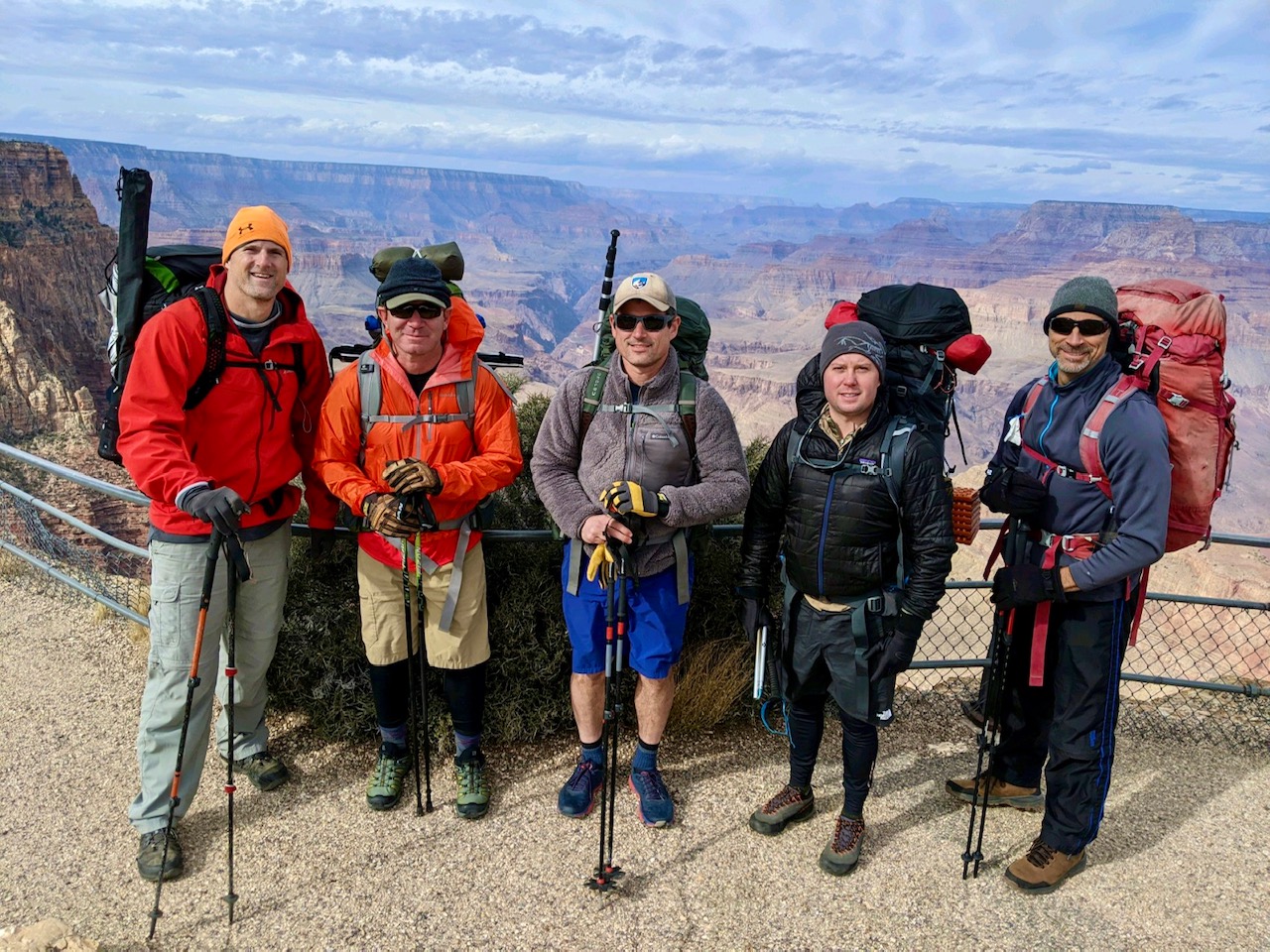
Group: Scot (organizer), myself, Jeff, Kevin and Don
Scot, no stranger to well planned out adventures (he’ll be the first to admit they aren’t always well executed), sent out a feeler email earlier this year for a 4 day loop in the Grand Canyon. With the inevitable kid #2 on the way, I knew my chances of pulling a trip like this off in the near future wasn’t going to be as easy, so I bit. My buddy Jeff, an old friend of at least 30 years, had just moved to Denver (great timing) and was up for an adventure. Kevin and Don, both friend’s of Scot’s, rounded out the group. All of us except for Don flew. Southwest rates, at least when Jeff, Scot and I bought, were almost free (I paid $78 roundtrip). Jeff and I, weary of the Arizona election results, had a side project to see if any of the ballots made their way from the Maricopa County polls, to somewhere at the bottom of the canyon.
We met Kevin at the car rental in Sky Harbor, picked up our classy Dodge Caravan and made way for the HOJO in Flagstaff. The HOJO was right across the street from the train and the bed mattresses were pine wood, so no sleep was had the night before. We enjoyed a breakfast at the local Cracker Barrell in the morning and embarked to the South Rim in hopes the weather forecast wouldn’t come to fruition. Anyone familiar with weather in the West this summer and fall knows its been a massive drought that has caused wildfires of biblical proportion. Of course the exact 4 days we had planned contained wind, overcast and possibly snow. Fortunately this storm never really came to fruition. Jeff and I were wondering how we were going to be able to find any ballots with 55 mph gusts.
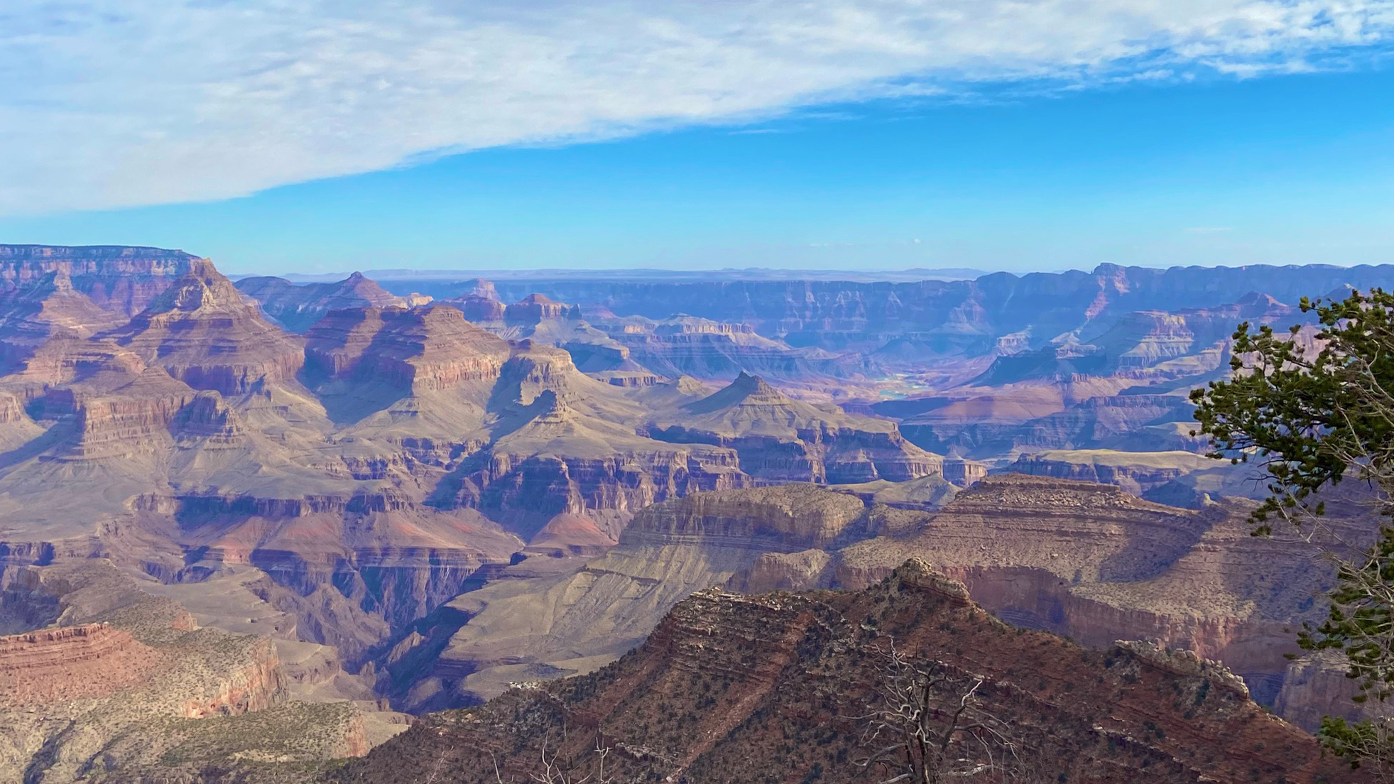
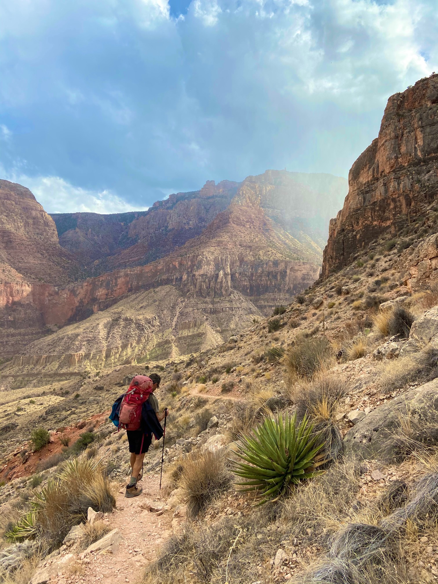
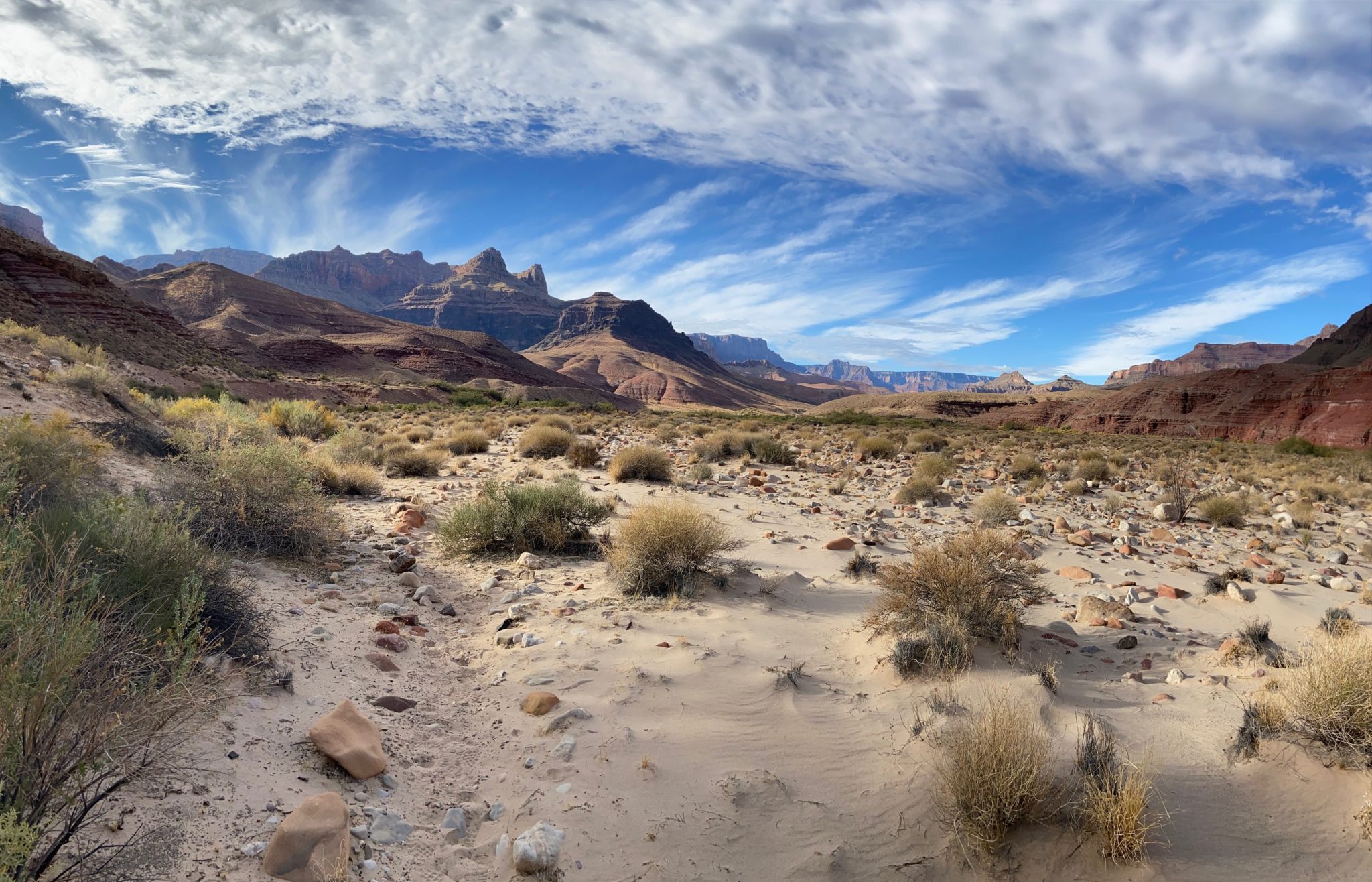
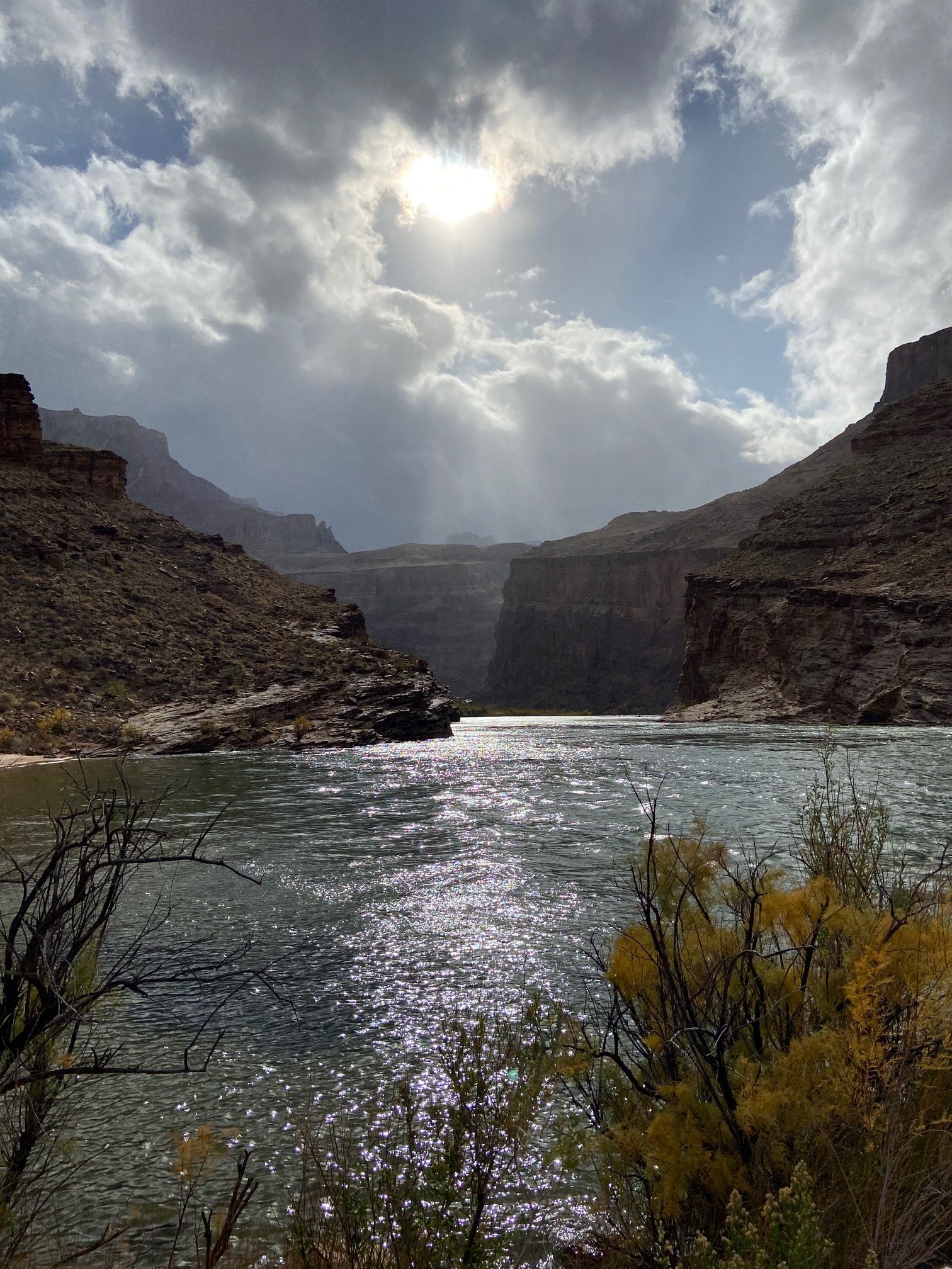
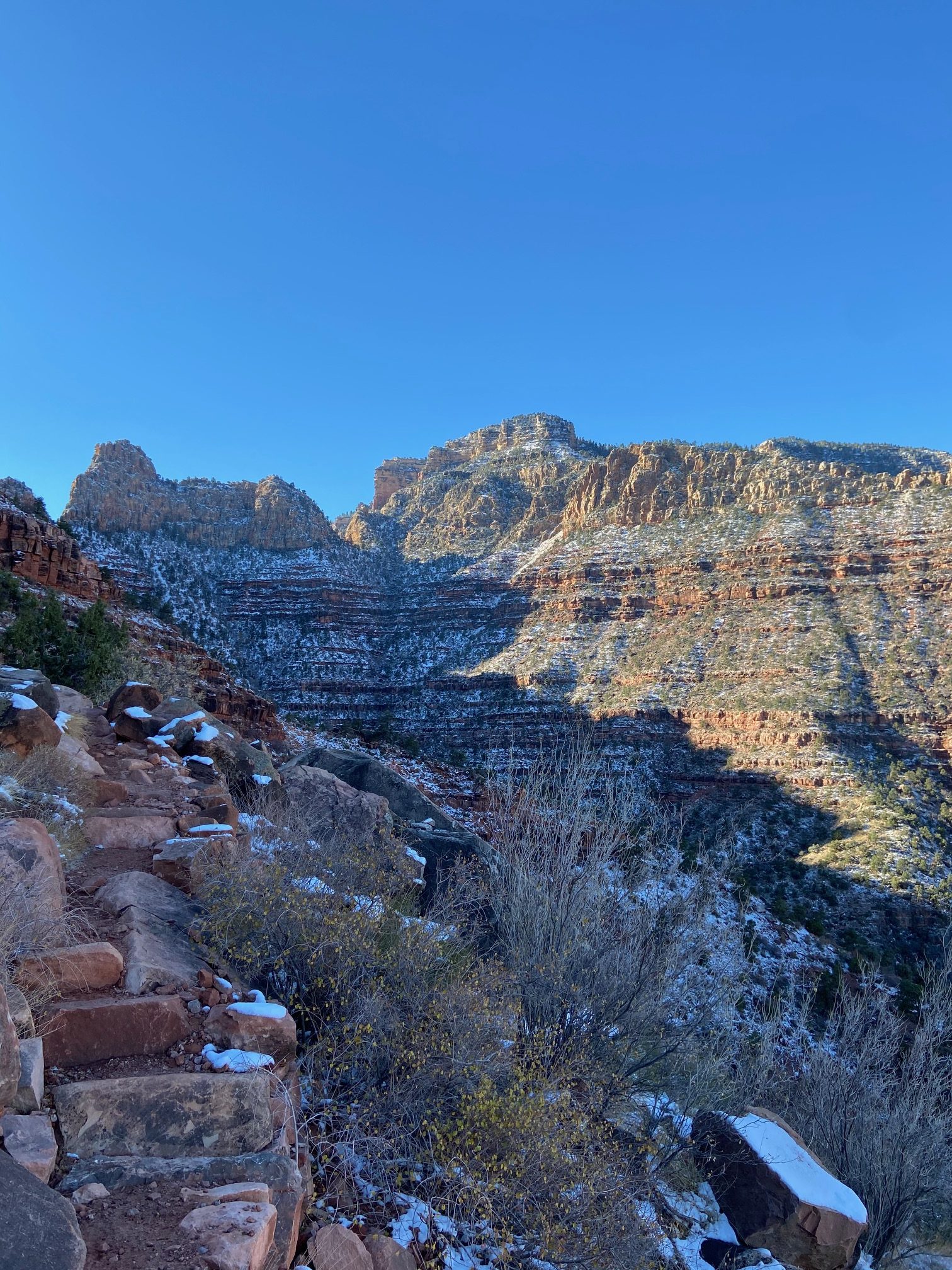
Start of the trip @ Lipan Point
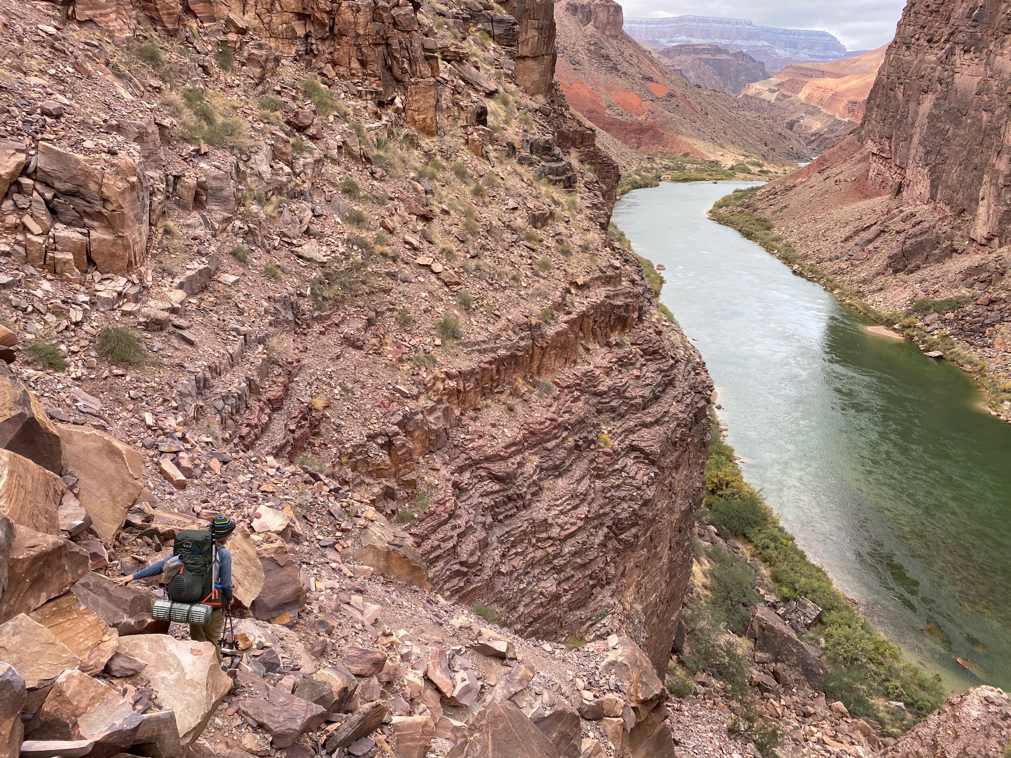
Day 1 – Lipan Point Parking Lot to Tanner Beach – 9.63 miles 446 ft (with around 4,500 feet of descending)
It was windy as shit when we got out of the car. Met a guy from Prescott in the parking lot just getting done the route we were just about to do, and he gave us some decent beta on water sources and good campsites. Within seconds of descending the Tanner Trail below the rim, the wind all but ceased. The first mile or 2 was very steep and made for slow going, until flattening out for a while, but then the wind gusts started to really pick up.
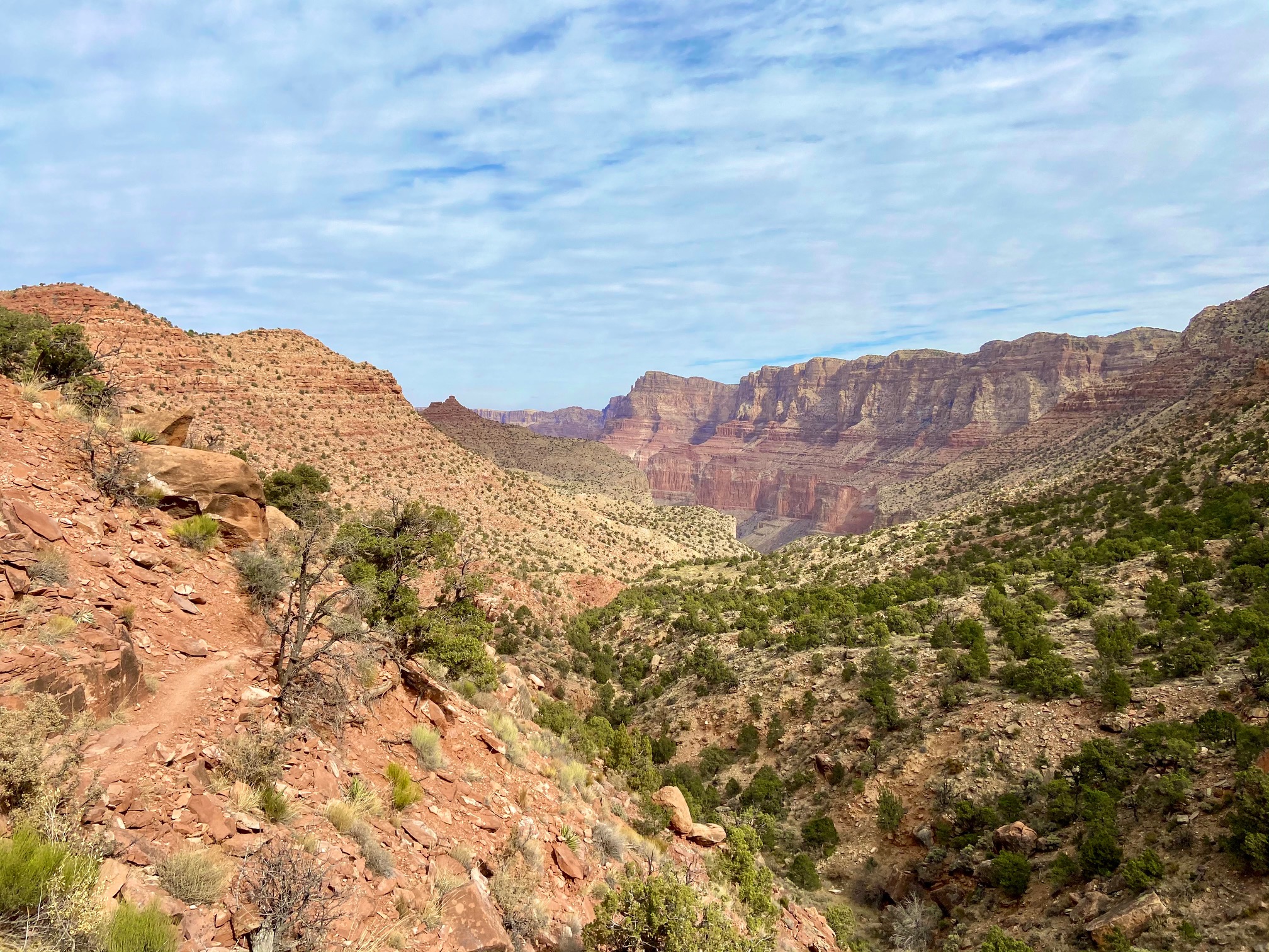
Tanner Trail
Jeff and I had broken off from the group and decided to take a little break just NE of Cardenas Butte. Throughout the trip, we’d whip out the flask and take a little swig here and there of the Bulleit to take the edge off. Since the first day was almost all downhill and large sections of the other days would have prolonged sections of downhill, whiskey would help break up the monotony as well as help reduce the pain in the various muscles that suffer the most when descending for too long. It worked better than Advil, at least for me!
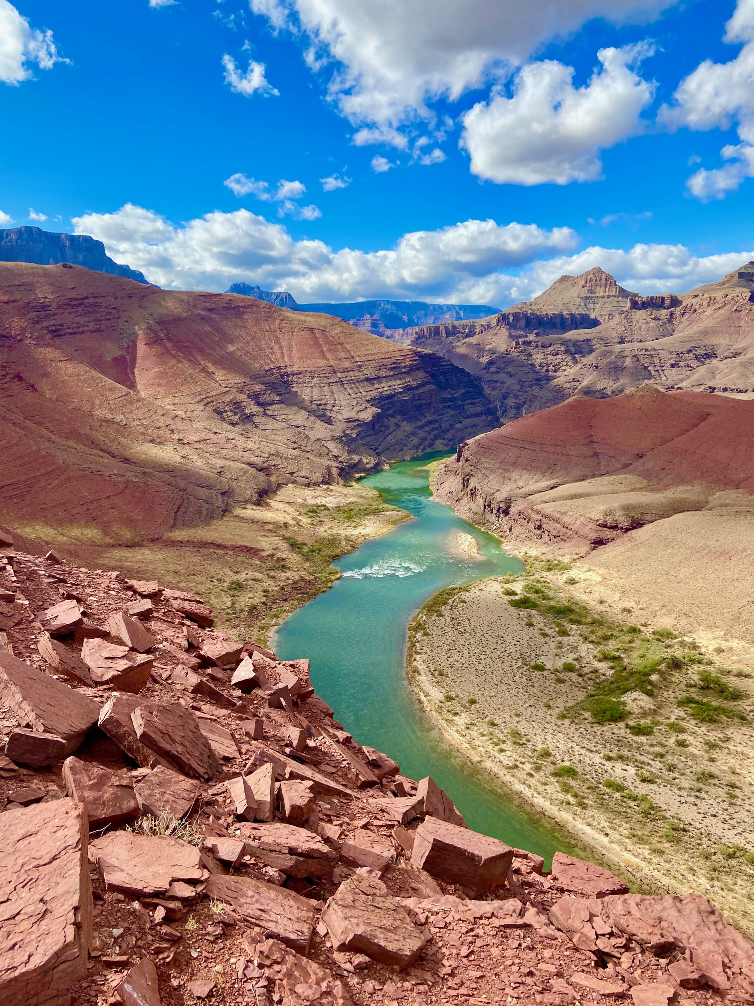
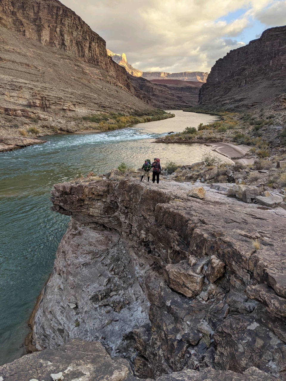
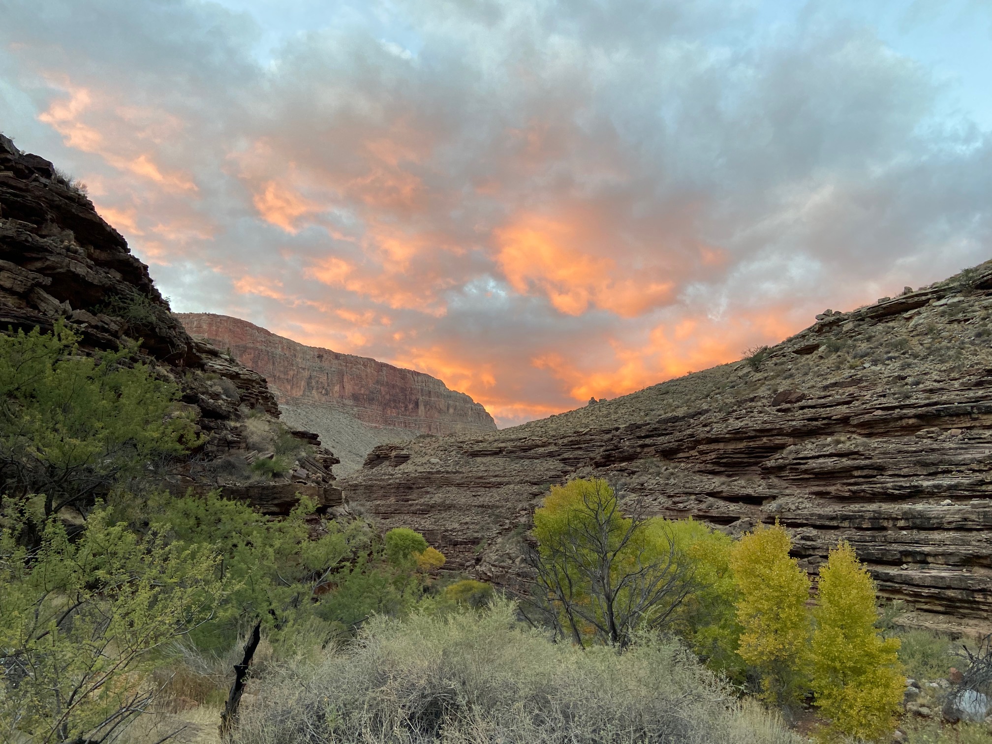
Anyways – the other 3 joined up with us at our rest stop and Kevin provided some incredible Costco granola that would provide the group much needed nourishment throughout the week. At this point, we had finally rounded the bend of Tanner Canyon and had a view straight down to where the Tanner and Escalante routes meet at the Colorado River. With rain going in and out all day, it made for some great shots, especially at sunset.
Rain cell passing through
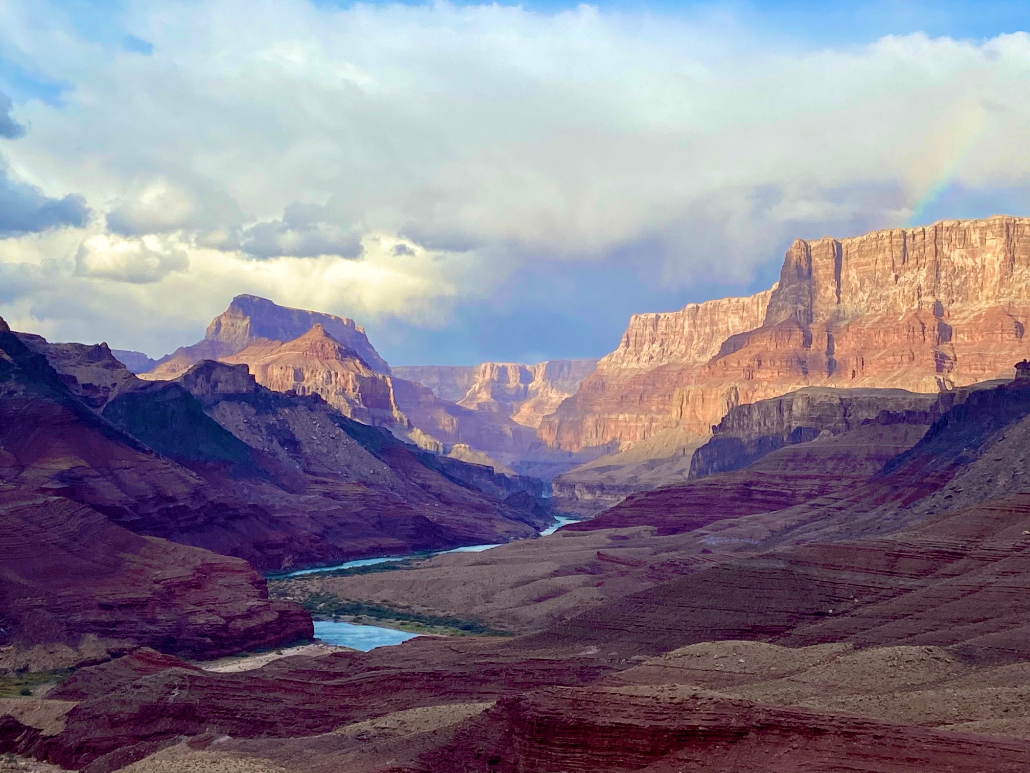
View down Tanner Canyon towards our campsite #1 along the CO River
Tanner Beach was actually more crowded than we thought it’d be. Saw 3 separate groups, 2 which were going the reverse way, and 1 going the same way as us. We got situated further down the river, right on the beach (as far away from the pit toilets), where we had a perfect water pumping and lounging area.
Jeff had brought 2 375’s of Bulleit, myself 1. Had I to do it over again, I’d bring a 6er and a flask. The camp sites in this area demand a cold one after a long day. You be the judge……
View from our campsite along the Ole Colorado.
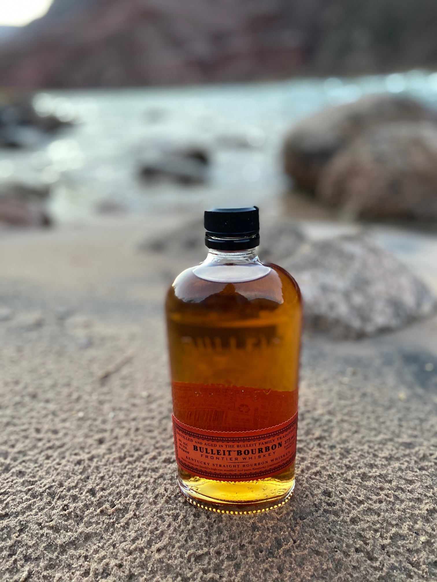
I felt the need to drink straight out of the bottle on this trip.
There was a cool “food ring” setup underneath a tree near the campsite, where we had feast #1. Everyone had some form of Mountain House except me, with my old tried and true 10-pack of tortillas and pound of cheese for Quesadillas. Brought a little squirt bottle of olive oil, salami and tabasco to make things interesting.
Hands down the winner of the Snack Award went to Don, who admittedly said he “packed too much food” (never heard that one before). He whips out a 2 lb bag of Sam’s Club dried mango and 2 lb bag of jerky. He had 2 bags of each, so 8 lb’s worth of mango and jerky. We didn’t starve on this trip
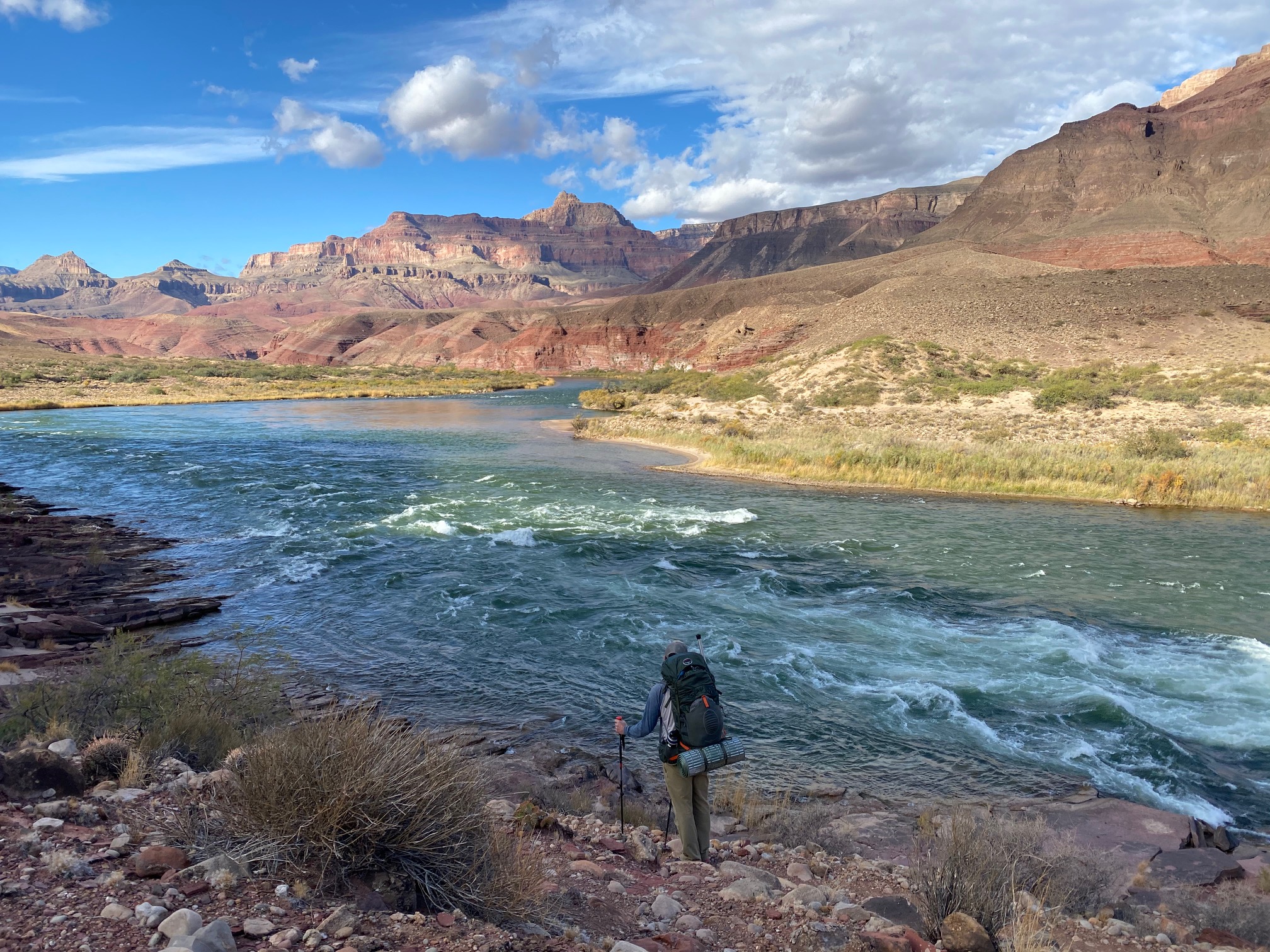
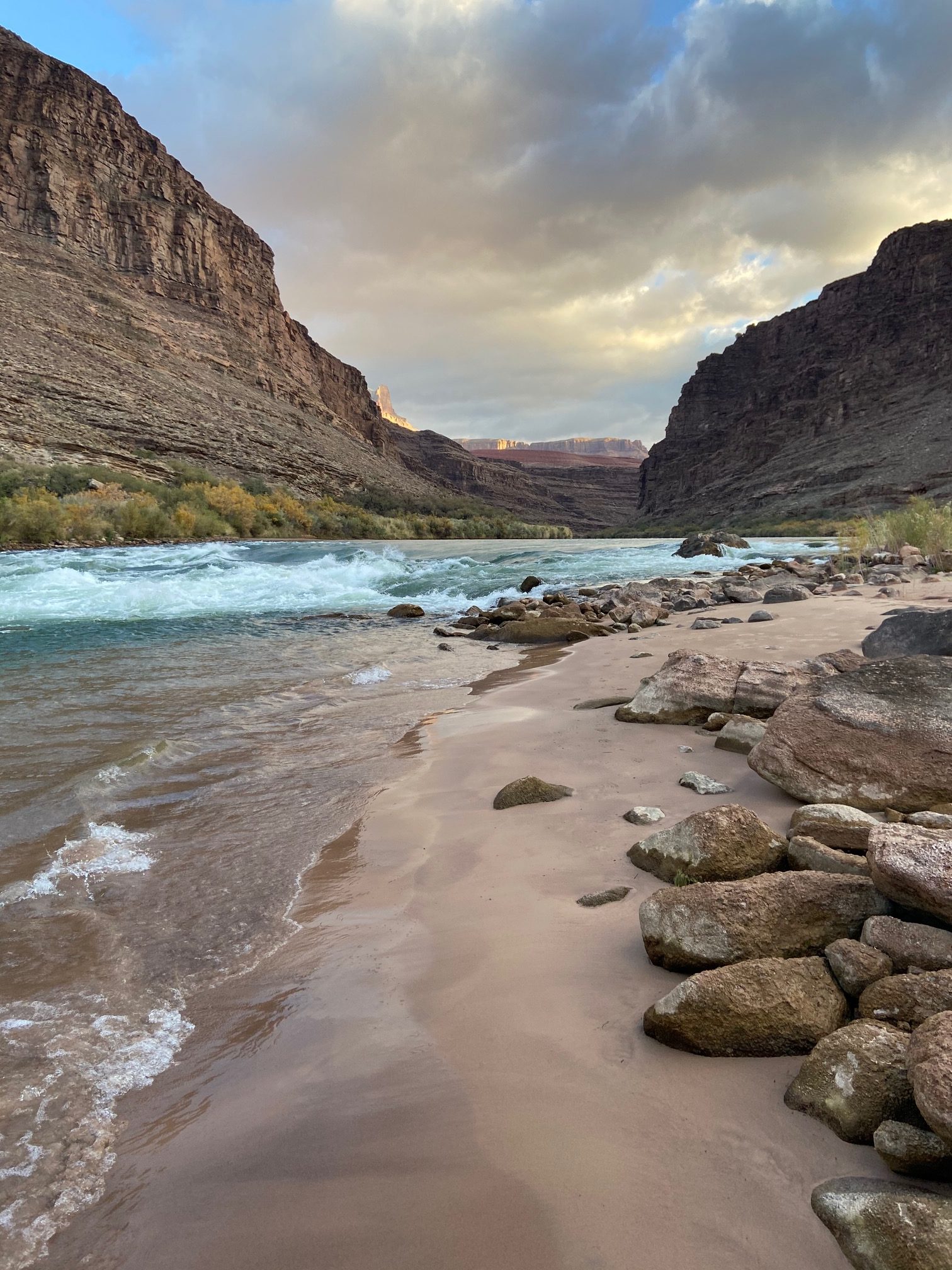
Day 2 – Tanner Beach to Escalante Beach – 8.48 miles, 1,629ft
Sunday morning started interestingly enough. One of the other groups passed through and we said a friendly, cordial hello. After the pleasantries, Scot asks where they are from and one of the guys from the group goes “The great BLUE state of California! Go Blue!”. I’m guessing he either saw my Reagan “Shut up Hippy” sticker on my water bottle, or that’s just how people are from California. After a crack about how we should tax them for pumping water from the CO River (given they seemingly love taxation) we were soon on our way.
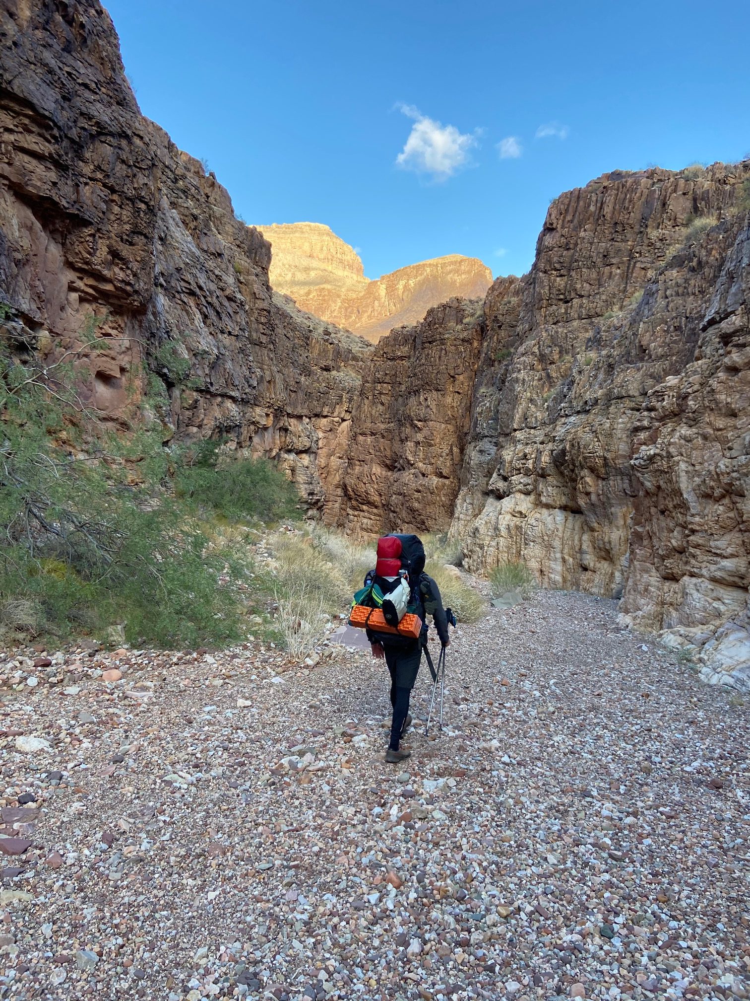
The day started out “Beachy”
The day started out just as it would on any other day of hiking, mostly straight along the Colorado in a flat valley as we enjoyed some great views and sounds of the river.
We all wanted to take a dip but anytime we tried, the sun would go away and weather would threaten.
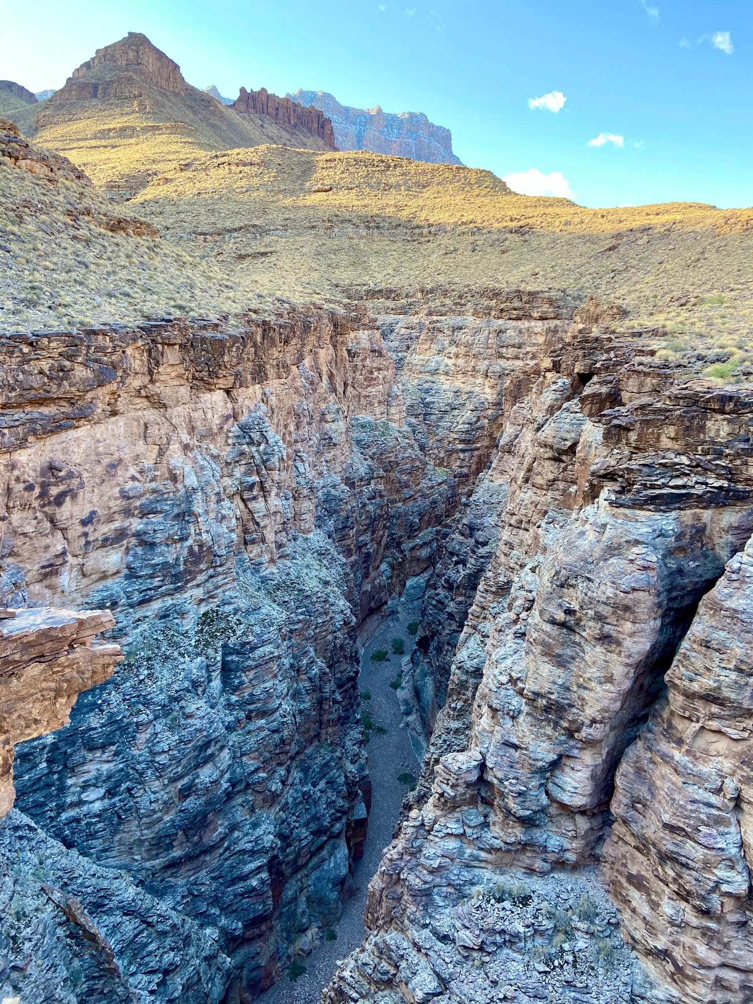
We spent the majority of the morning along the Colorado, until we reached our first intro to Grand Canyon travel when we arrived at Cardenas Creek. Basically what you do is you see down valley where you need to go, which is generally a couple miles as the crow flies. But in order to get to that destination, you have to zig zag through numerous deeply inset canyons along the way, which although adds to the allure of the Canyon, by day 4 got old.
One benefit of this type of terrain was the constant display of incredible viewpoints – like these….
About 10 feet in front of me is an 800 foot sheer drop off.
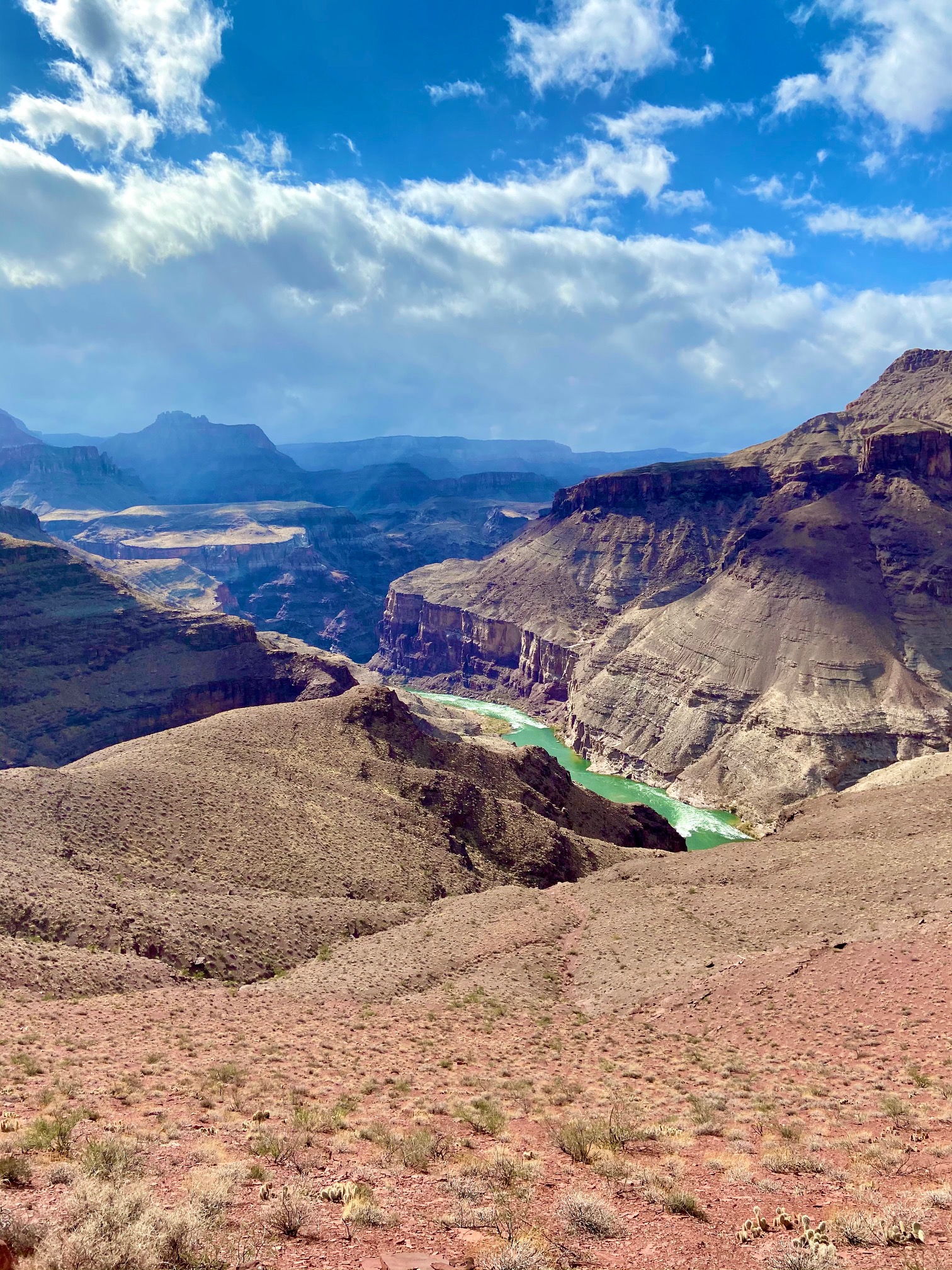
The closer we got to Escalante Beach, the better the views.
We passed our friends from Cali at some point. I could see the looks on their faces that they weren’t going to get their pick of the litter regarding campsites. I figured the river was technically ours and CA drivers have done enough damage to CO highways that it was a fair trade off. Anyways, after another handful of weaving in and out of deep, incredibly scenic basins and canyons, we finally arrived at Escalante Beach. This place was, hands down, the top campsite I have enjoyed to date.
View from our campsite. Just out of view to the left was a full on beach.
Not a bad spot to filter water
Kickin’ back
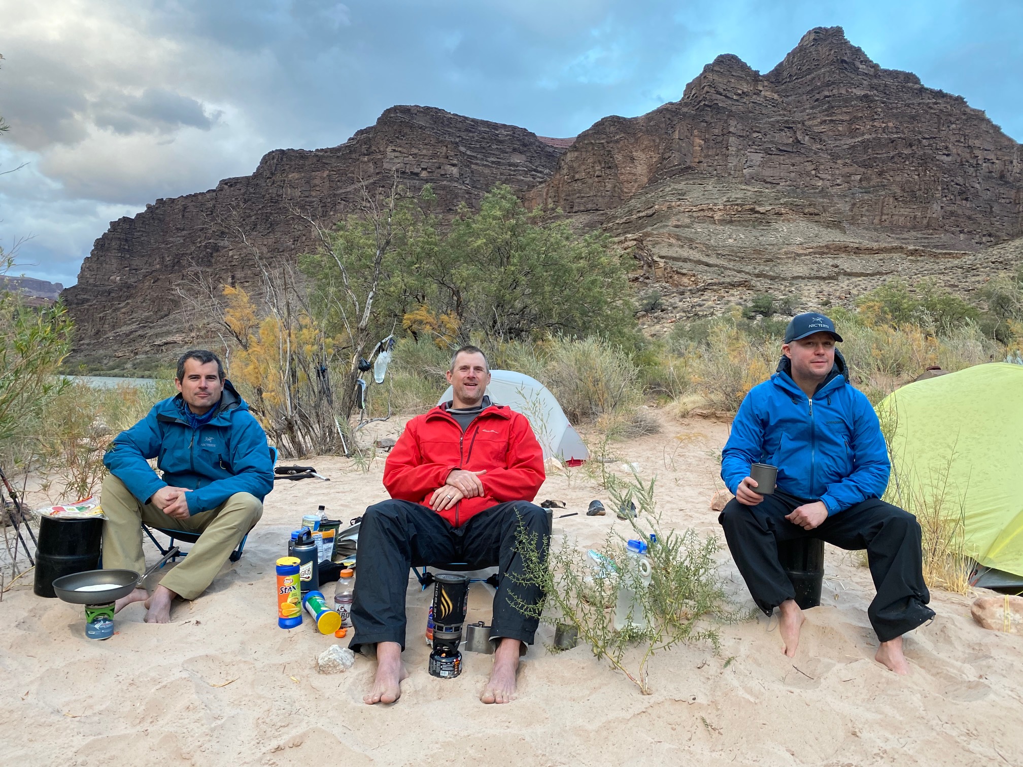
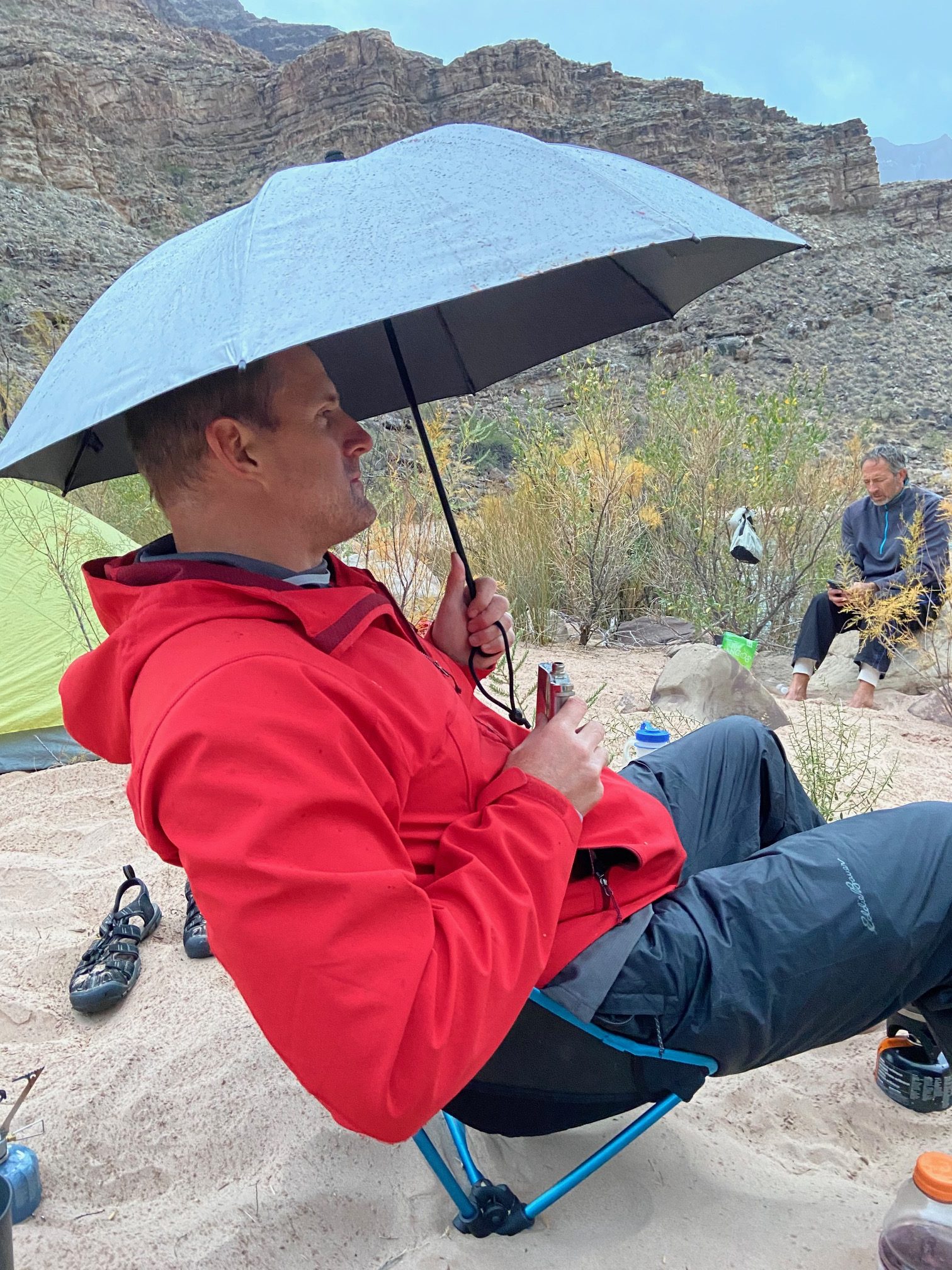
We finished off the majority of the dried mango and jerky, and feasted again with more Mountain Houses with enough sodium to fill the Pacific Ocean, round 2 of quesadillas for me and spiked hot apple cider for Scot. Later in the evening, we were introduced to the obvious downsides of beach camping when it started to rain. I brought at least a couple pounds of sand back with me to Colorado after this trip. It also served as seasoning for dinner. It even made its way in to the whiskey.
Scot Osbourne – international man o’ leisure.
You might notice 2 chairs in these pictures. Jeff brought along some Helinox foldup chairs that are incredibly lightweight and versatile. They were enjoyed by all throughout the trip. With probably 1500ml of Bulleit total, Quesadillas, 2 camp chairs, umbrellas – we clearly spared no expense on this trip.
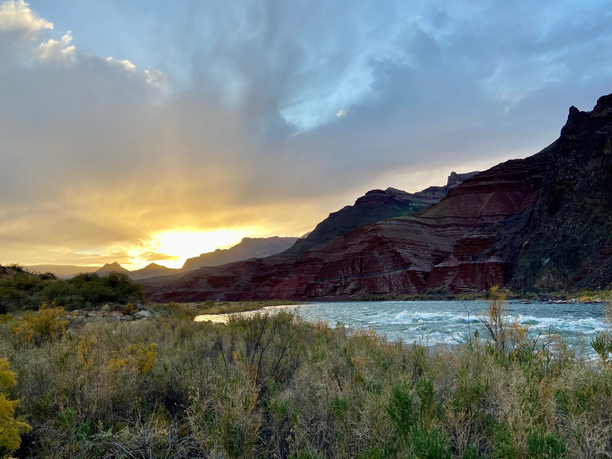
It poured pretty hard for a few hours that evening, but we all passed out pretty hard with soft sand as a natural sleeping pad and the roaring sound of the Colorado 10 feet away. We woke up early the next morning to a starry morning. Once again, our friends from The Golden State, tried to get a head start on us. I watched them from the comforts of my tent, sipping hot coffee with a smile on my face, knowing full well I’d catch them and watch the color on their faces fade as they realize we snagged yet another prime camping spot from them.
Don & Kevin with our camping inlet in the background. What a place.
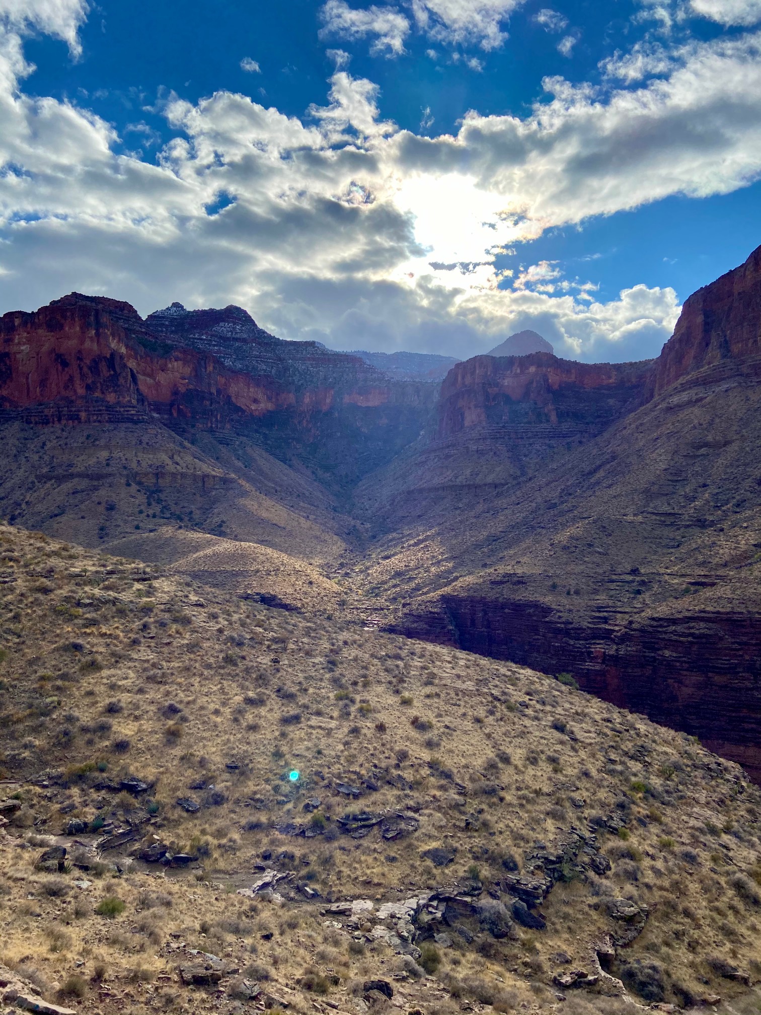
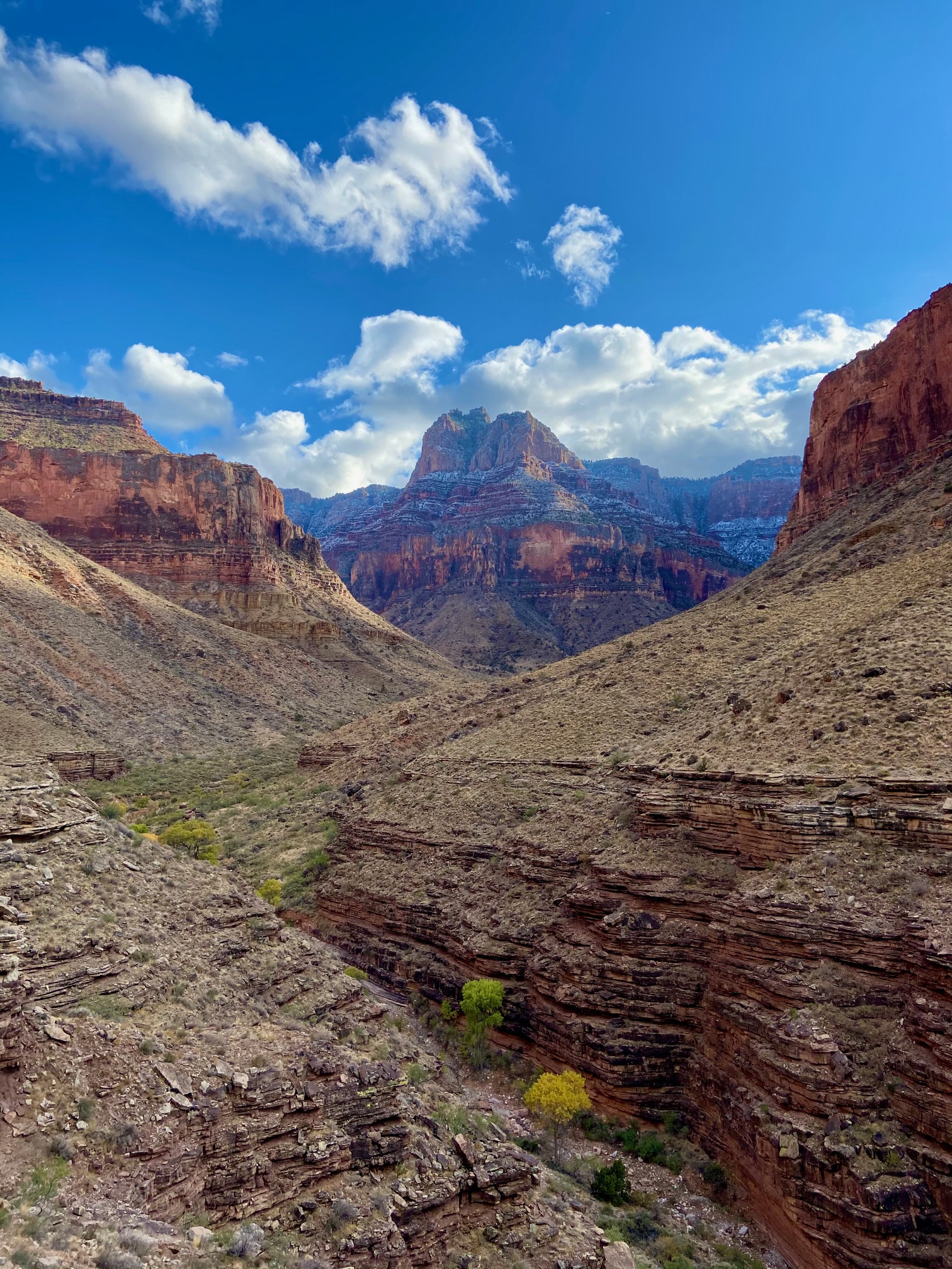
Day 3 – Escalante Beach to Hance Creek – 12.08 miles, 2610ft
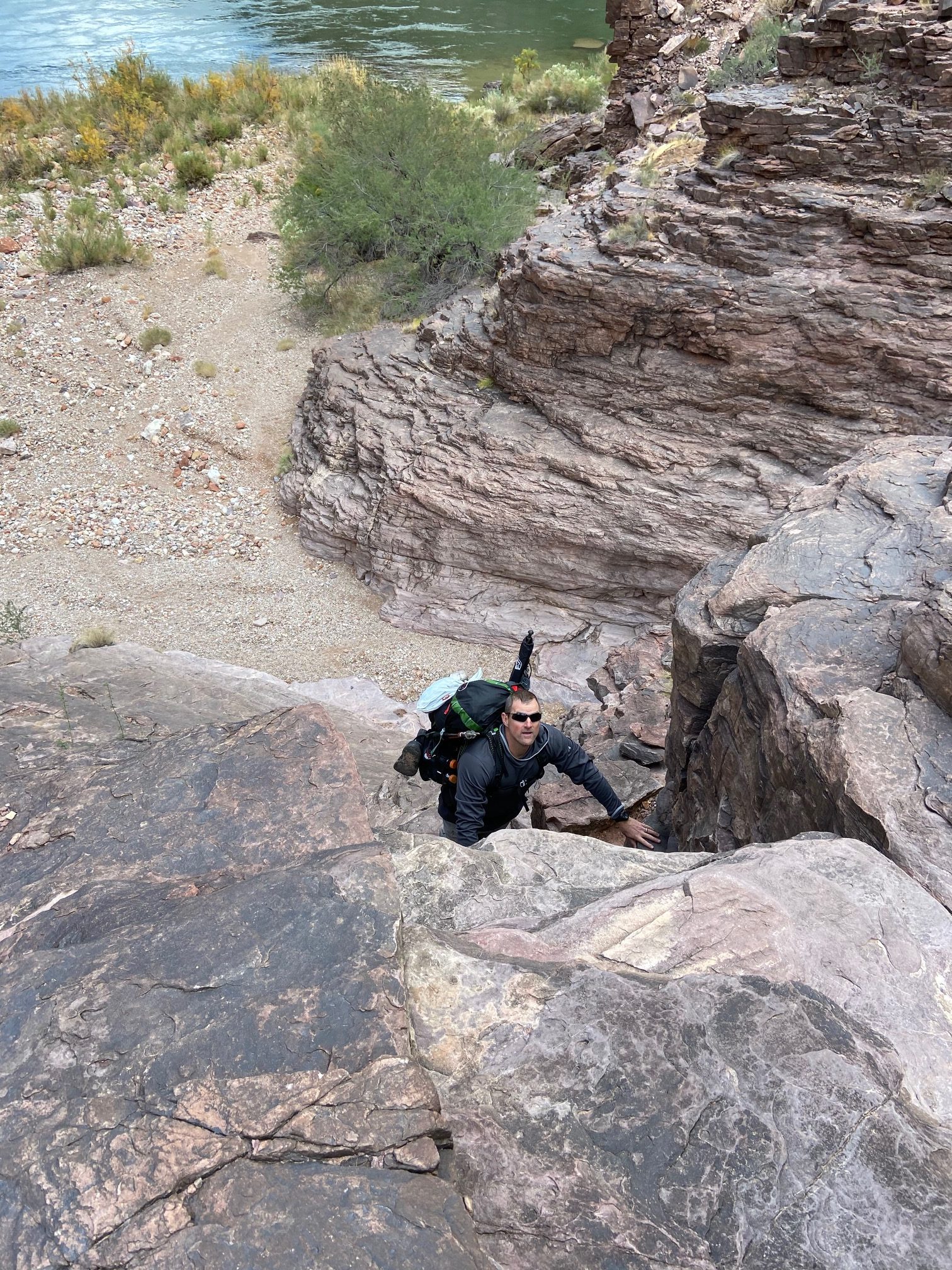
If day 1 was a nice intro to the Canyon in general and day 2 was a nice intro to the weaving nature of the trail system in and around the many side canyons – day 3 was an intro in to how unbelievably amazing this place really is. It reminded me of the feeling of reaching the summit of a Peak 15, Coxcomb, Pilot Knob or Longs except you experienced that euphoria constantly throughout the entire day. Each bend you rounded offered a mind altering view of a new canyon with the mighty green Colorado cutting through it. There were 3 prominent highlights of the day. First was 75 Mile Canyon, which was an incredibly narrow, deep canyon we had to traverse around early in the morning. Next was Papago Wall, which is a mandatory class 4, semi exposed 70-80′ wall you have to climb over (with a full pack on) to continue on. Immediately after the Wall, is the Papago Slide, which is a couple hundred foot scree slope (think the worst of the San Juans, with a full pack on). Lastly is the long ascending traverse up and around Mineral Canyon with a finale that looks straight down in to Hance Creek, a hell of a dramatic chasm that reminds you of something straight out of Lord of the Rings. The trail, at times, would be mere inches away from a 2000′ straight drop. We were glad the wind wasn’t going along this section.
Anyways, some highlights (in order)
75 Mile Canyon. Kind of an ominous jaw dropping section of the loop. You hike around the corner to the left and eventually the canyon meets the trail, and you hike through that narrow inset canyon back to the River.
In 75 Mile Canyon
Scot climbing up the Papago. He requested one of us take the “last known picture of him alive”. I took on the honors.
Heading down “The Slide”
Our first glimpse of Hance Creek. Grandview parking lot is somewhere out of view in the top right. This would be our slog out on the last day.
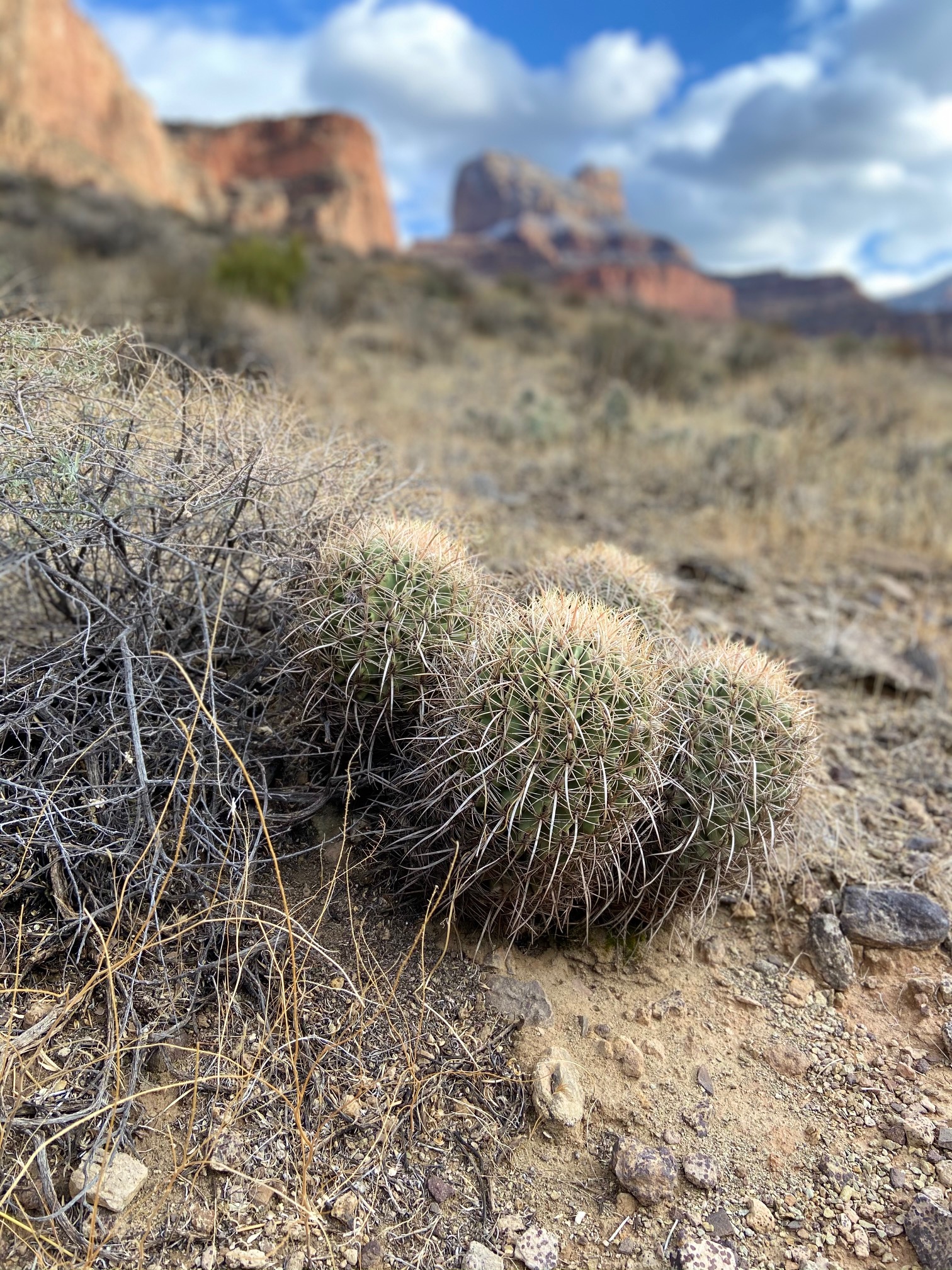
Some local flora
Our final campsite was in that canyon near those groves of trees. There was still a trickle from the creek, enough to pump water, which was a god send, cause the only other source in the area was a few miles and couple thousand feet further up the trail.
One final sunset from camp
Scot, Kevin & Don brought up the rear, but enjoyed Hance Canyon at sunset. I believe that’s Sheba and Solomon Temple’s in the background and quite a chasm in between.
We polished off the rest of our meals essentially. I was sufficiently sick of sand seasoned quesadillas and most of the bourbon was depleted. This was easily the quietest evening of the trip, which in turn became a Blazing Saddles ass ripping musical symphony, with deep snoring providing the bass.
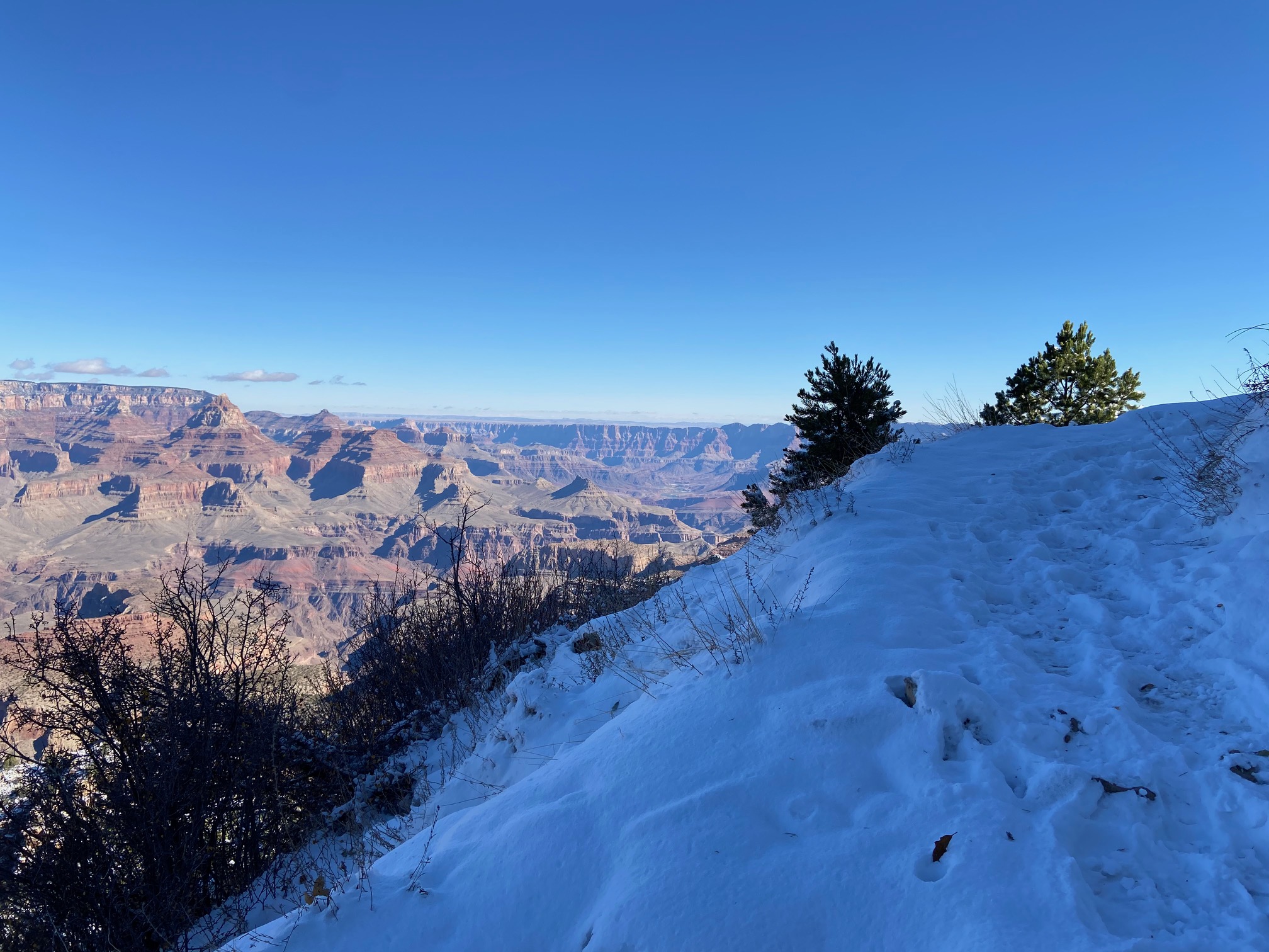
Day 4 – Hance Creek to Grandview Point – 5.63 miles, 4474 feet
The final day was the largest vertical gain as we were ascending out of this massive ditch. It was definitely a slog, but a historic one at that, as we passed through the remnants of the Last Chance Mine. This mine couldn’t have been situated in a more beautiful area, but what made it so aesthetic, also doomed the mine. Only in operation for 15 years, it was a Copper Ore site which was blessed with pure copper, cursed with a wretched location. For 10 years they methodically hauled Ore deposits out via mule, never turned a profit and was eventually just sold to the park service as a historic site. The Grand Canyon is one of the first places I’ve ever seen where I couldn’t believe my eyes when looking at it, not only the aesthetics, but just how it came to be. I can only imagine what people at the turn of the century thought over 100 years ago. To envision mining operations being conducted here borders on science fiction.
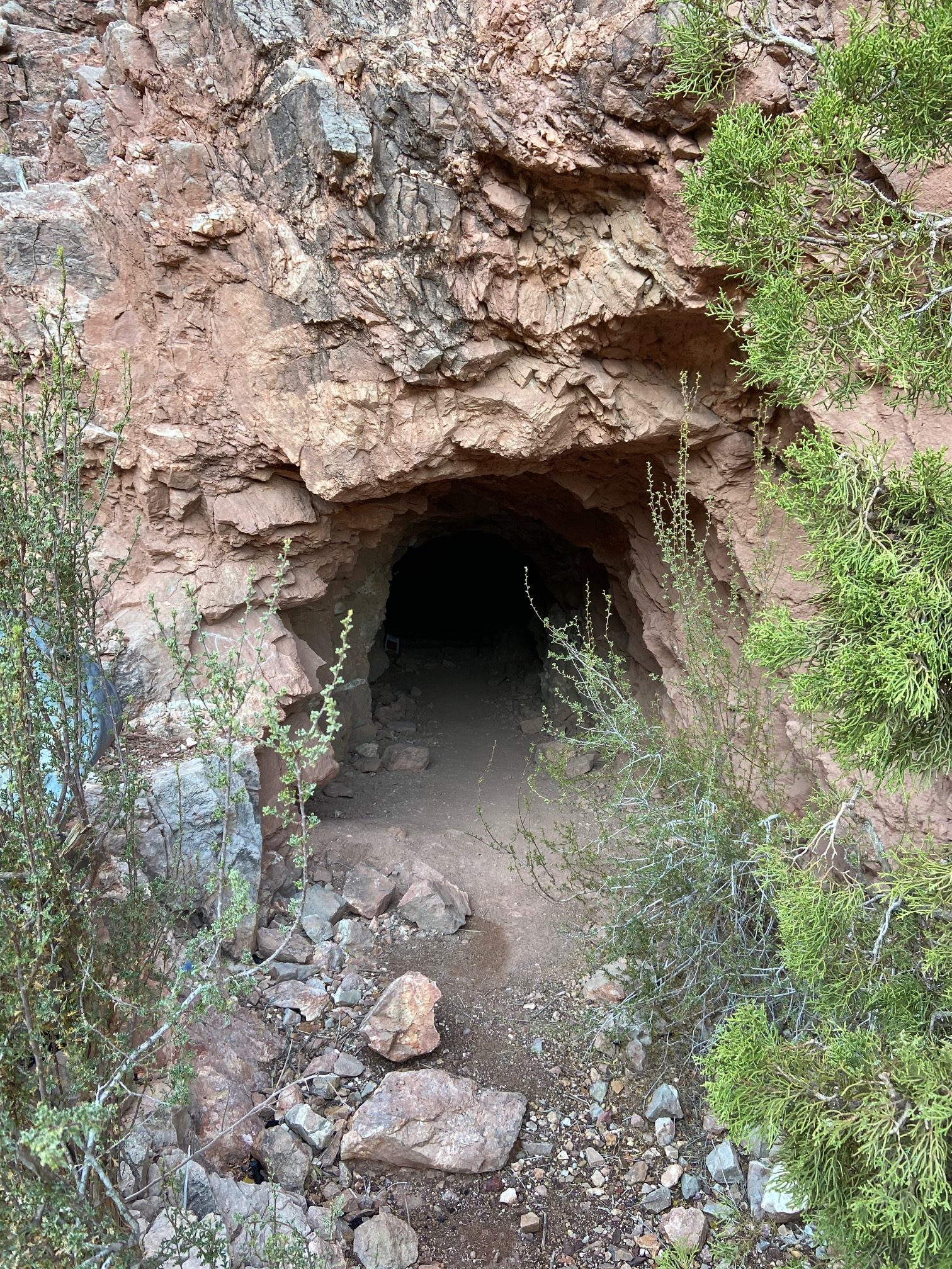
The main mine shaft
On the top of the mine near Horseshoe Mesa with still a couple thousand feet of slogging remained to reach the parking lot
Our final destination. It took hours for this to actually feel close
Quite the juxtaposition
Anyways, the hike out of the Grand Canyon sucks no matter how you slice it. But you have no other choice and we obviously all survived. After figuring out the car shuttle and exiting the park, we bought a room at the classiest hotel in Flagstaff – the Rodeway Inn – in order to take a shower before hopping on a plane home. Don, who drove, was staying in whatever we found and his only request was “something that doesn’t have a railroad near it”. As we arrived, not only was it directly on the busiest road in all of Flagstaff, but it was right across the street from the main train depot. And on top of that, the shower hot/cold settings were not working, so it was either freezing cold, or scolding hot. I personally opted for scolding hot and would just dunk my head under until I felt degree burns setting in, but I had to wash the sand off.
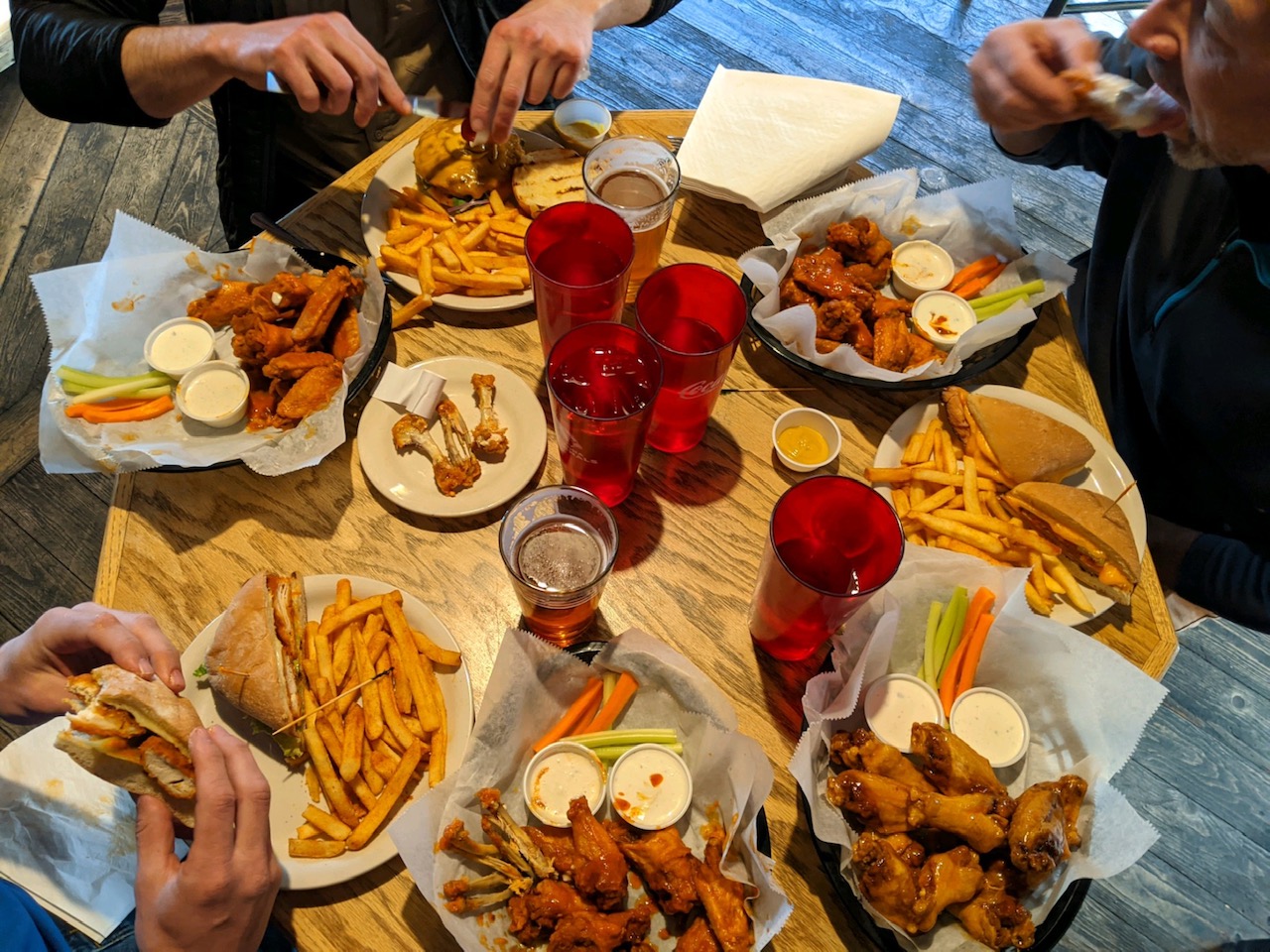
Flagstaff Brewery
Escalante Route is a fine intro in to non-gaped out backpacking in the Grand Canyon. From what I’ve read, your adventures can be as tame and as wild as you want them to be. Escalante was definitely wild, but it had a pretty defined trail for the majority of the loop, 2 very easy trailheads to access that were only 12 miles apart and plenty of information about it online. November is hands down the best time of the year to go. We were blessed with clean water along the Colorado. That’s not always the case as it can get silty and difficult to filter. I can’t imagine doing this loop in the middle of the summer, unless you woke up well before sunlight and pounded out 10 miles before noon and then relaxed on the beach, which I guess is doable. I can see why Scot has been so fixated on this area last couple years. It’s completely different than anything you get used to in Colorado. Its a lot of slogging, but with a purpose, the campsites are incredible, the physical effort is more moderate, you don’t have to deal as much with high altitudes and the views are unlike anything else maybe on planet Earth. It’s a very welcomed change of pace.
Thanks again to Scot for putting this together. It was great meeting Kevin and Don and getting to slog around with my ole gaper friend Jeff. We didn’t discover any ballots floating around, but we did discover a new part of the world and all better off for it.
Day drinking, mini vans, car shuttles, flying vs. driving, right-wing political conspiracies….this trip sounds like an old man’s dream! Still, I’m proud of you for graduating past the Mountain House. Stuff’s not fit for human consumption.
Looks like an amazing time in there. Coming back from our own little journey to the desert, I share all the sentiment about how incredible this area is. It feels very refreshing, and surprising, to come across something that’s every bit as good as the mountains, yet completely different. Need to get more time in there this year.
Good work on an awesome trip.
Thanks David. Correct on desert “life resets”. I had MH 1x in my life in Chicago Basin in 2007 and that was the first/last time. I felt even bad for the goats!
Wow, you hit some of my personal favorites in Flag–I’m ashamed to have stayed at that Rodeway Inn more than once, but stoked that you hit up Flagstaff Brewing.
Besides that, the trip looks amazing and full of good memories. Zambo covered most of what I enjoyed
Props!
Thanks Matt. It had been 11 years since I had last been to Flag and its namesake brewery. The DeadHookerWay Inn barely served its purpose. Thanks for the comment.
Great report! Really enjoyed the read, the humor, and the gorgeous pics.
Just stumbled across this write-up. Loved reading it, as I did this exact hike in early May 2011 – brought back a lot of great memories!