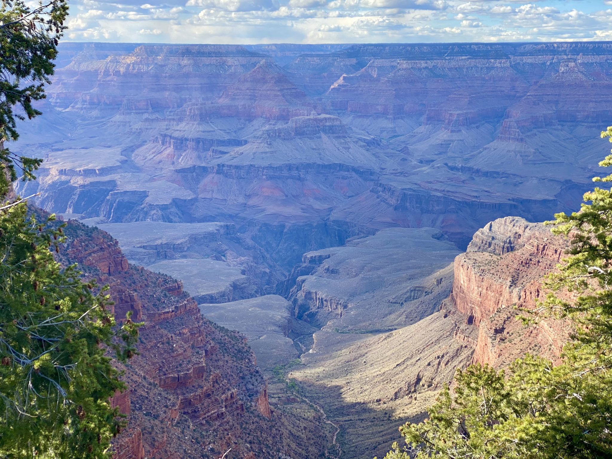
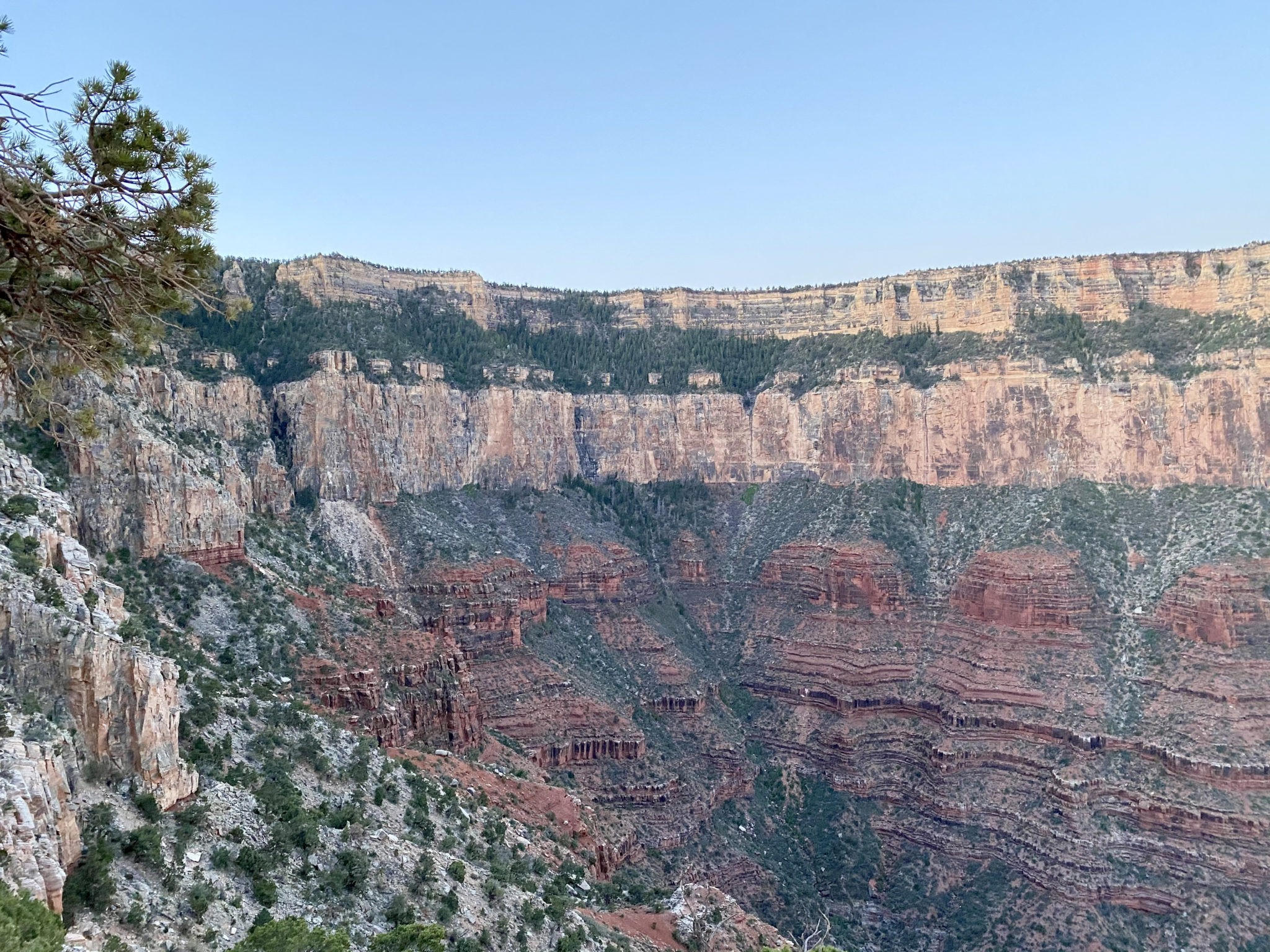
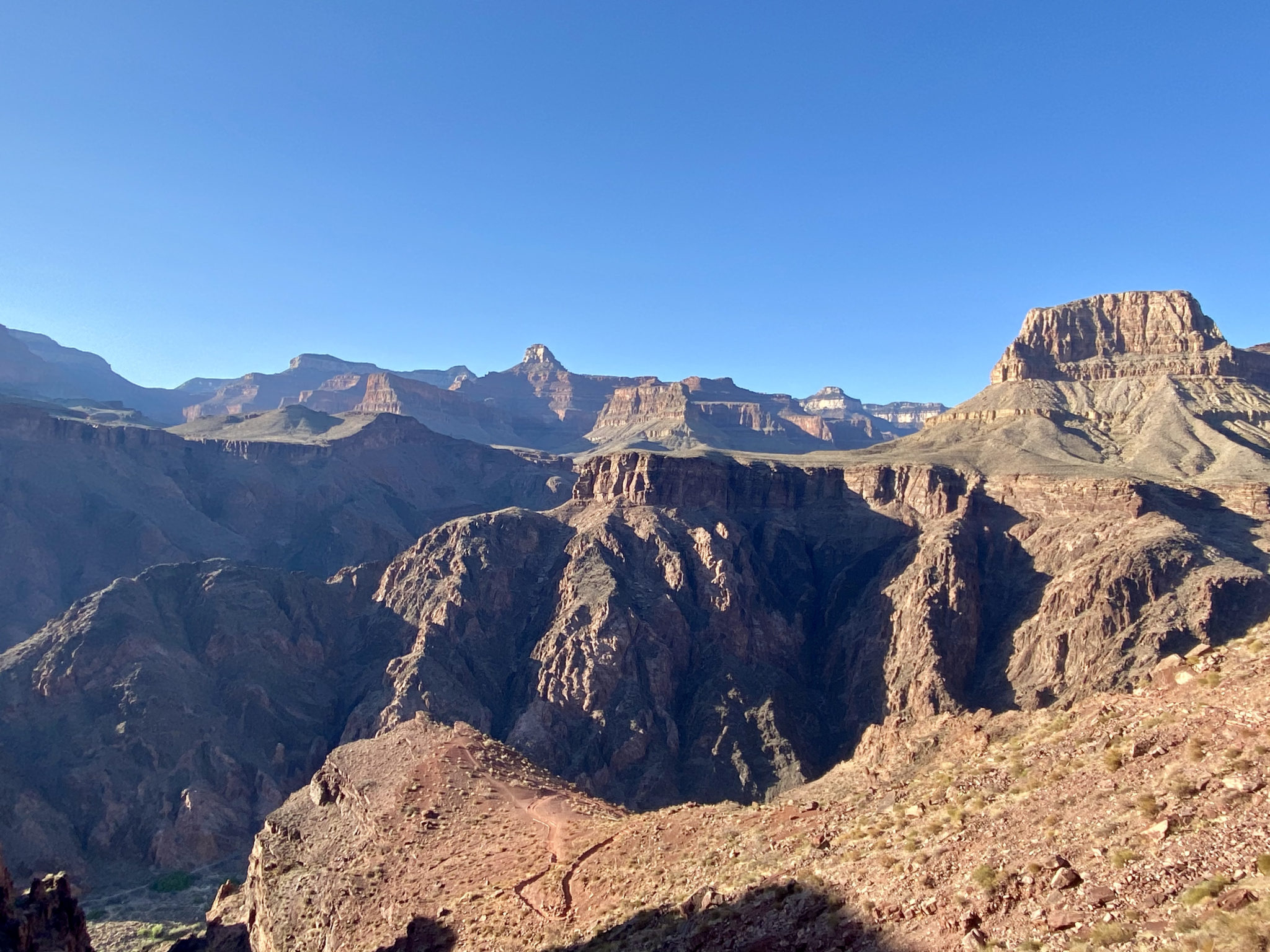
The Grand Canyon, as seen on the ascent of the South Kaibab Trail during our Rim to Rim to Rim trail run.
- Route: R2R2R Run via South Kaibab Trailhead > Colorado River > North Kaibab Trailhead > Colorado River > South Kaibab Trailhead
- Distance: ~42 miles
- Vertical Gain: ~11,100 feet
- Time: 12 hours for Jason, 15 for Brian & Zambo
- Route Track: https://www.strava.com/activities/5153842022 (GPS canyon bounce made this ~10 miles longer than it should be)
- Runners: Zambo, Jason Blyth, Brian Lich
- Date: Sunday, April 18, 2021
This trip report is dedicated to Patrick, the Grand Canyon Conservancy “ranger” who was unashamedly condescending, full of 100% incorrect route info, and didn’t believe we could do it.
Introduction – A Most Remarkable Canyon
The Grand Canyon is a funny place.
On the one hand, its reputation precedes itself. Everyone knows what it is. Everyone has seen incredible photos of it. Everyone knows it to be one of the great natural wonders of the world. And just about every other canyon, gorge, valley, ditch, ravine, or similar gouge in the earth has been compared to it at some point. It is the standard.
As such, the fame and renown of the Canyon is about as close to a truly global attraction as you can get. That is patently clear on any normal year visit to the South Rim, which is bound to be filled with American and international visitors alike. (I have yet to see an elk at the Canyon which wasn’t semi-surrounded by at least a few camera-wielding international tourists).
But what makes the Grand Canyon so uncommon is its ability to transcend even the highest preconceived notions about itself. Stand just about anywhere on the South Rim and it is bound to stir something deep inside. The views, the colors, the scale, the uniqueness, the boundless possibilities….all of it eclipses everything you might have come to expect. It outpaces even the highest expectations, leaving behind the purest feelings of awe and joy.
My dad is fond of telling people that the unique thing about the Canyon is that “your brain just can’t comprehend how big it really is.” I think that is also true of the heart. And that ability to transcend just about everything is what makes it so special.
Prior to this trip, I read a recent trip report from Anton Krupicka about his latest Rim to Rim to Rim crossing. I think he captured this sentiment well.
“I find that this accessibility helps to accord the Grand Canyon a kind of universal emotional experience—one of wonder and irrepressible awe. Everyone knows, at least conceptually, that love is the point, right? Everyone knows that love is a higher ideal than hate. This concept is so universal, so well-accepted, that only the most hardened cynics will deny it, even though it should be easy to write off as a hackneyed trope. I find that the Grand Canyon has the same effect. Despite its grandeur being so on-the-nose obvious, so self-evident, experiencing that grandeur—and expressing wonder at it—somehow manages to transcend the cliché, every single time. It’s a truly unique place.”
Crossing the beating heart of the Canyon and back again highlighted these feelings all the more. This is our story; an almost perfect day in a most remarkable place.
Remarkable indeed.
R2R2R Route Details
The Rim to Rim to Rim running route (Aka the R2R2R, or the Grand Canyon Double Crossing, or simply, R3) has become something of a fad and an icon over the past few years. And with good reason. Thanks to a number of different factors, this could very well be the finest trail run on the entire planet.
The overall ‘gist’ of the route is as straightforward as it is challenging: start at the top of the South Rim of the Grand Canyon > descend to the Colorado River > run all the way to the top of the North Rim > turn around and do it all again on the way back. Depending on the chosen route, the stats come in at anywhere between 41-45 miles and 11,100′ of vertical gain.
Mentally and logistically, I found it helpful to break up the run into the following sections:
- South Rim to Phantom Ranch: The day begins with a huge downhill and speedy descent down to the river and Phantom Ranch just beyond. The views, the precipitous downhill, the excellent trail, and the fact that the day is just beginning, make this section world-class. The descent to the river can be done via two different options: The Bright Angel Trail is a bit longer, but more gradual, while the South Kaibab Trail is shorter and steeper:
- Via South Kaibab Trailhead = 7 miles, 4,700′ of descent (plus ~.75 miles at the top to run from adequate parking)
- Via Bright Angel Trailhead= 9.4 miles; 4,600′ of descent
- Phantom Ranch to North Rim (13.4 miles; 6,000′ gain): This section departs from the bottom of the Canyon and climbs at a barely perceptible incline over the first 8.7 miles. This initial stretch begins with a few narrow miles through the lower canyon, before opening up considerably as it goes along on a very runnable part of the route. That all changes past the Manzanita campground, where a tough 5 mile stretch climbs all the way up the final 3,800′ to finally reach the North Rim.
- North Rim > Phantom Ranch (13.4 miles; 6,000′ of descent; + 300′ of intermittent gain): Reversing the last section, this section begins with the rewards of going back down all the tough elevation recently gained. Back past Manzanita, the final 8.7 miles is likely to feel a bit tougher this go around. Despite going downhill this time, the temperature will inevitably be much warmer, or even downright hot through here, depending on the day.
- Phantom Ranch to Trailhead: There is no way around the big hurt. It’s 4,600′ of gain and a long way to go from the River back to the top of the South Rim. Thankfully, the excellent trail and numerous steps makes for better speed vs. a more typical mountain trail. But make no mistake, the climb out takes no prisoners.
- Via South Kaibab Trail: 7 miles, 4,700′ climb
- Via Bright Angel Trail: 9.4 miles, 4,600′ climb
The route has been described a “reverse mountain range”, which I found to be a very apt description. Considering you descend 4,700 feet right off the bat, and then have to climb up the exact same amount to finish it off, that’s pretty much right on.
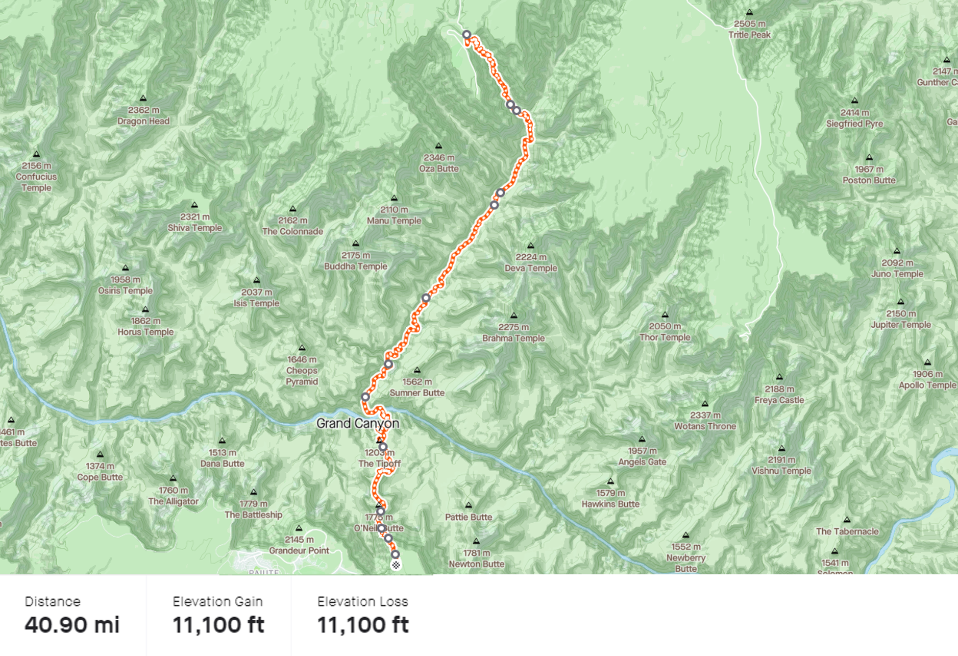
The full Grand Canyon Double Crossing route via South Kaibab in detail + stats, according to Strava’s route creation tool. Click for full details. (Not included: the short sections from wherever you park to the South Kaibab Trailhead).
Our Weekend Plans at the Big Ditch
When Jason and Becky’s R2R2R Strava track popped up on my feed last November, I was jealous. So, when Jason approached me early this year about repeating the effort in the spring, I was immediately in. Thankfully I had just barely enough time to adequately train for it. Before I knew it, Brian had joined the group, we had landed in Phoenix, and we were well on our way to experience some of the Canyon for ourselves.
After thoroughly enjoying the long, ever-changing landscapes on the drive up from Phoenix, we decided to swing by the South Rim before dark and before everything closed for the day. The keys to this route are: A) Where the water is turned on, and B) If there are any noteworthy conditions to be aware of. We figured checking in with the rangers would get us good beta on both those questions before setting out the following morning.
Enjoying some views along the South Rim on the eve of our adventure.
Being just a few minutes before closing time, Jason dropped off Brian and I near the main visitor center while he went to park. We hustled over to look for any rangers who could key us in to the details we needed. In the era of COVID national park visitor centers are closed, so we looked for a tent set up outside with rangers helping folks instead.
We saw a big “Grand Canyon Nature Conservancy” banner and hustled over. Standing underneath the tent were two “rangers”, which really amounted to volunteers with the non-profit organization. A stocky, bearded boomer fellow was available, so we started asking some questions to get at our much needed beta.
The conversation went a little something like this:
Me: “Hey there, we’re trying to figure out what water spigots are turned on in the lower canyon. Do you know what’s operational past Phantom Ranch?”
Patrick: “The only one is Indian Garden. That’s 3 miles and about 3,000 feet below the rim, via the Bright Angel…”
Me: (Interrupting) “Oh, thanks. But actually, we’re trying to figure out the ones AFTER Phantom Ranch. Are any of those on?”
Patrick: “And why would you want to know about those?”
Me: “We’re trying to use them tomorrow.”
Patrick: “You know those are on the north side of the river, right?”
Me: “Yes we do. So, do you know what’s turned on?
Patrick: “Nothing. Everything is closed past Phantom Ranch. It’s still winter season after all; don’t you know that??” (Condescending looks begin).
Jason: (Who just walked up, panting): “Right. We know the North Rim is closed, but we’re trying to figure out about the water. Are you say it’s all off?” Manzanita? Cottonwood? North Rim? All of it?”
Patrick: “Like I said, they are ALL off. There are NO services past Phantom Ranch. All the campsites are closed, too. What exactly are you boys trying to do?” (condescending looks and tone intensify)
Brian: (Laughing in the nervous, peacekeeping way that only Brian can) “Haha…ya we are some of those crazy people who are trying to run across it.”
Patrick: (pause) “Ooookay. You do know that it is over 20 miles to the North Rim? And that no services are open over there, right? And that there is no water on past Phantom Ranch? And that there is snow and ice on the North Kaibab trail? And that they are supposed to get 1-2 inches of snow over there tonight? And you know that in order to do this, you’re going to need a backcountry permit?”
Me: “Really? Even if we’re not staying overnight? I don’t think that’s right…”
Patrick: “You’re trying to do this in a day!?!?”
Me: (looking dead into his eyes) “Yes.”
Patrick: “Wow. You’re trying to go Rim to Rim to Rim. Ok. Well, you should know, I think we have had one guy do that this season. And I need to tell you, it took him over 12 hours. Without any help. And lemme tell you boys, it is an expensive helicopter ride out of there if something goes wrong…”
Me: “All good to know. Thanks for all the help. By the way, what was your name?”
Patrick: “Patrick”
Me: “Thanks, Patrick.” (Me, storing that name away for some special motivation later)
Needless to say, our chat left us both annoyed and a little nervous.
Annoyed for obvious reasons (the tone of this dude would be enough to inflame just about any self-respecting runner), but also because virtually every piece of his advice was suspect. It hadn’t snowed in weeks. There was no snow in the forecast. The website said the water was on. We were 99% sure people were camping down there right now. And there was a 100% chance more than one person had done the R2R2R this season. Heck, Jim Walmsley does it like once a week.
But we were still a bit nervous too because of the water situation. If there really weren’t any spigots on past Phantom Ranch, that represented a full 28 mile stretch where we would not have reliable, easily accessed water. We’d have to filter as we went instead – not ideal.
Jason didn’t believe a word of any of it. The water situation in the Canyon itself is notoriously unreliable and fickle. On the one hand, the numerous campsites can make for an awesome source of consistent water along the way – an absolute necessity for our purposes. But on the other hand, very old pipes, the remoteness, and the risk of freezing means that the pipes get turned off and/or don’t work with some regularity. When Jason and Becky did this in the fall, the beta they received turn out to be all wrong, with plenty of options turned on once they got down into the Canyon.
So, we went to bed hoping that Patrick was wrong about just about every piece of info he’d given us, like we suspected he was. We had some eight year old iodine tables as a backup just in case….
Segment #1: South Rim to River (via South Kaibab Trail)
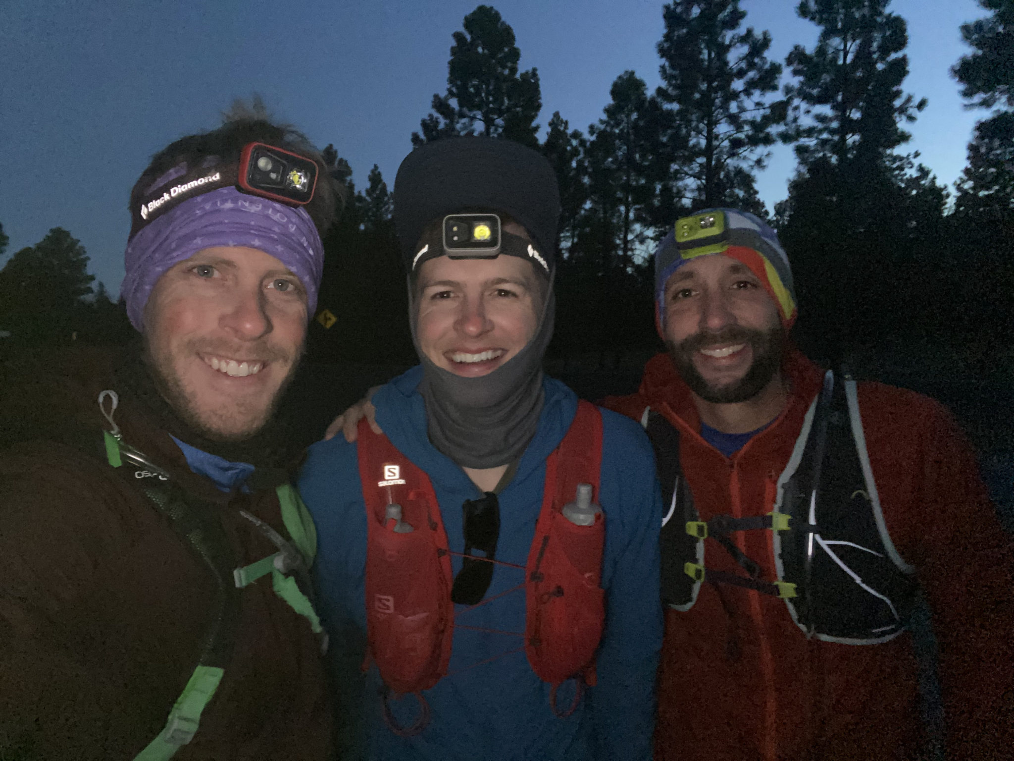
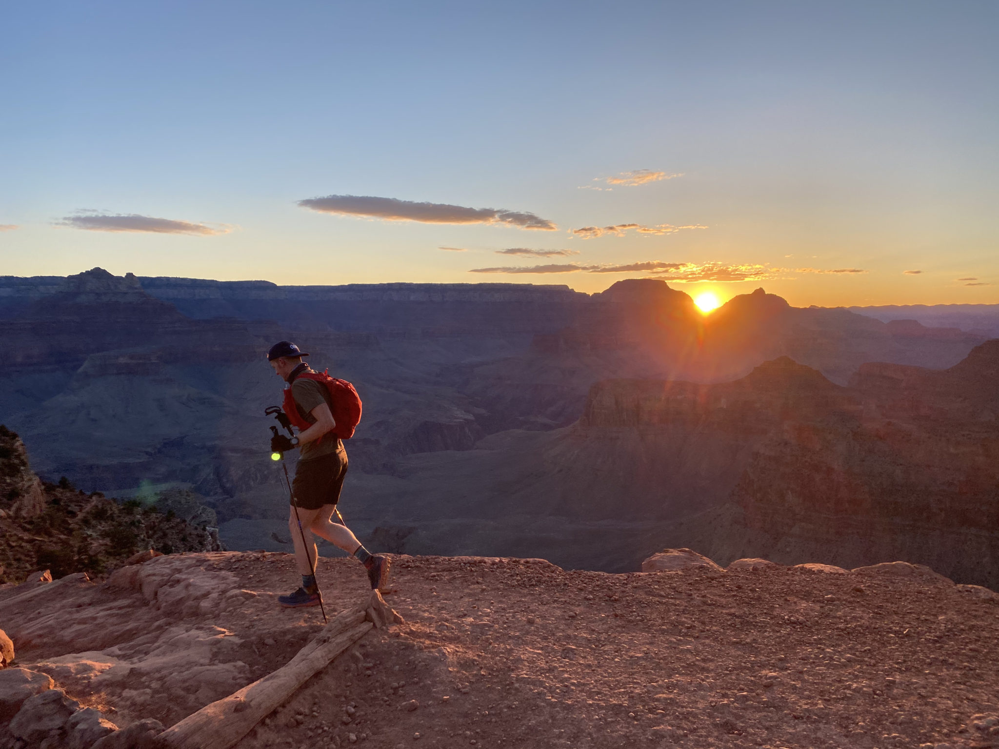
We started our day right on schedule. After the mandatory colon-blow at the parking lot restroom, it was all systems full ahead as we departed the lot at 5:25. It is not possible to actually park at the South Kaibab Trailhead, so we ran the flat, 3/4 miles from the car to the start in a flash. We paused at the top, taking a deep breath and gawking at the pre-dawn views before plunging in, excited to see what the day held.
The morning was chilly at 28 degrees, but we all knew we would warm up quickly once the sun came up and we descended down into the Canyon. Such is the nature of the ecosystem in there. The temps rise considerably as you descend. Jason reassured us we would not need our hats, gloves, or jackets for long. He was right.
“Blyth looks like he is about to lose control of his bowels. LOL.” – Brian Miller
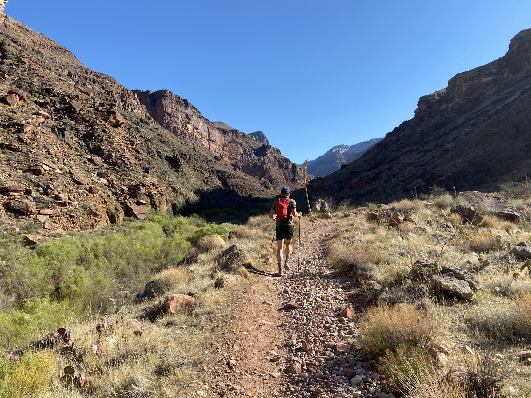
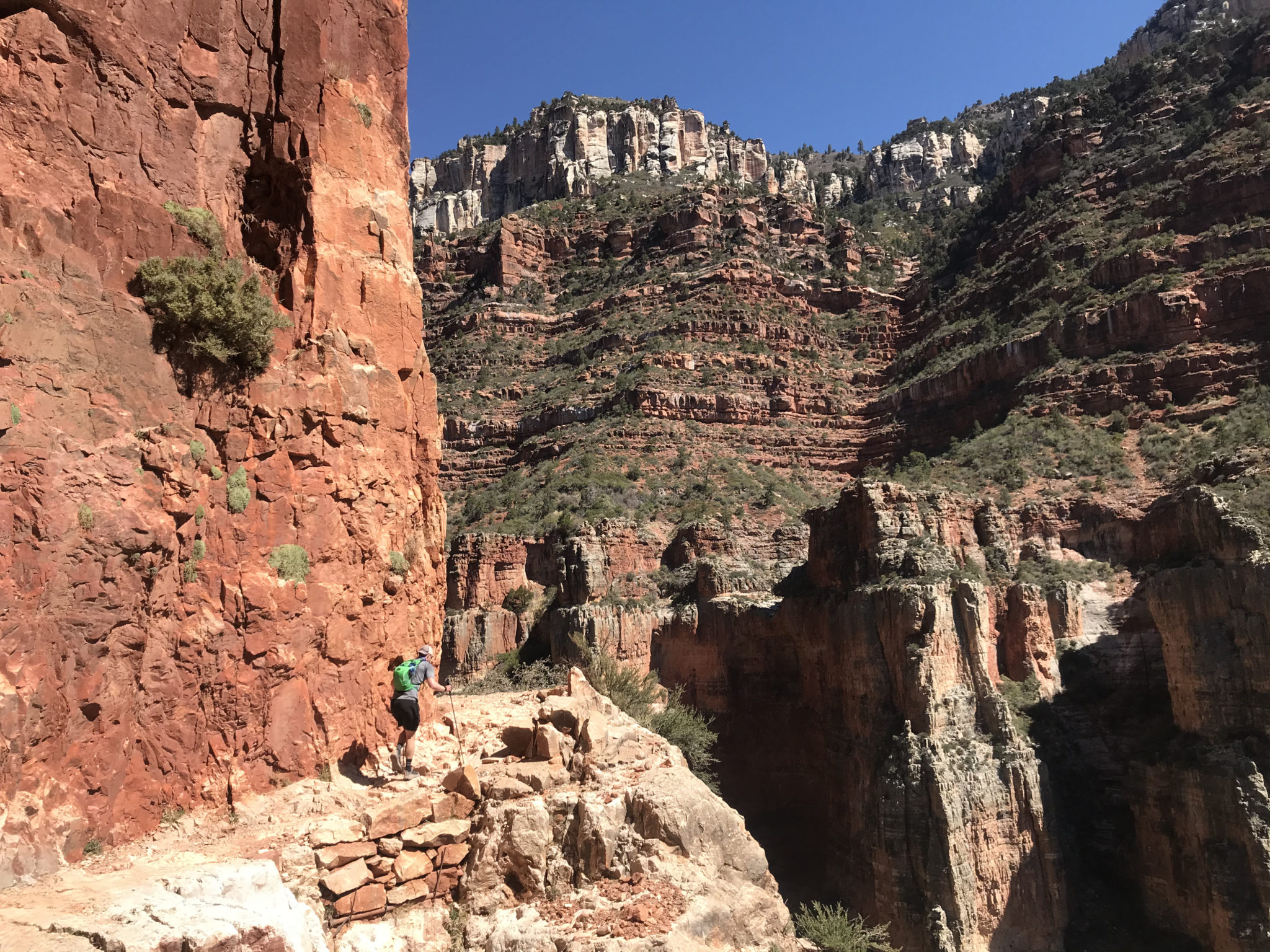
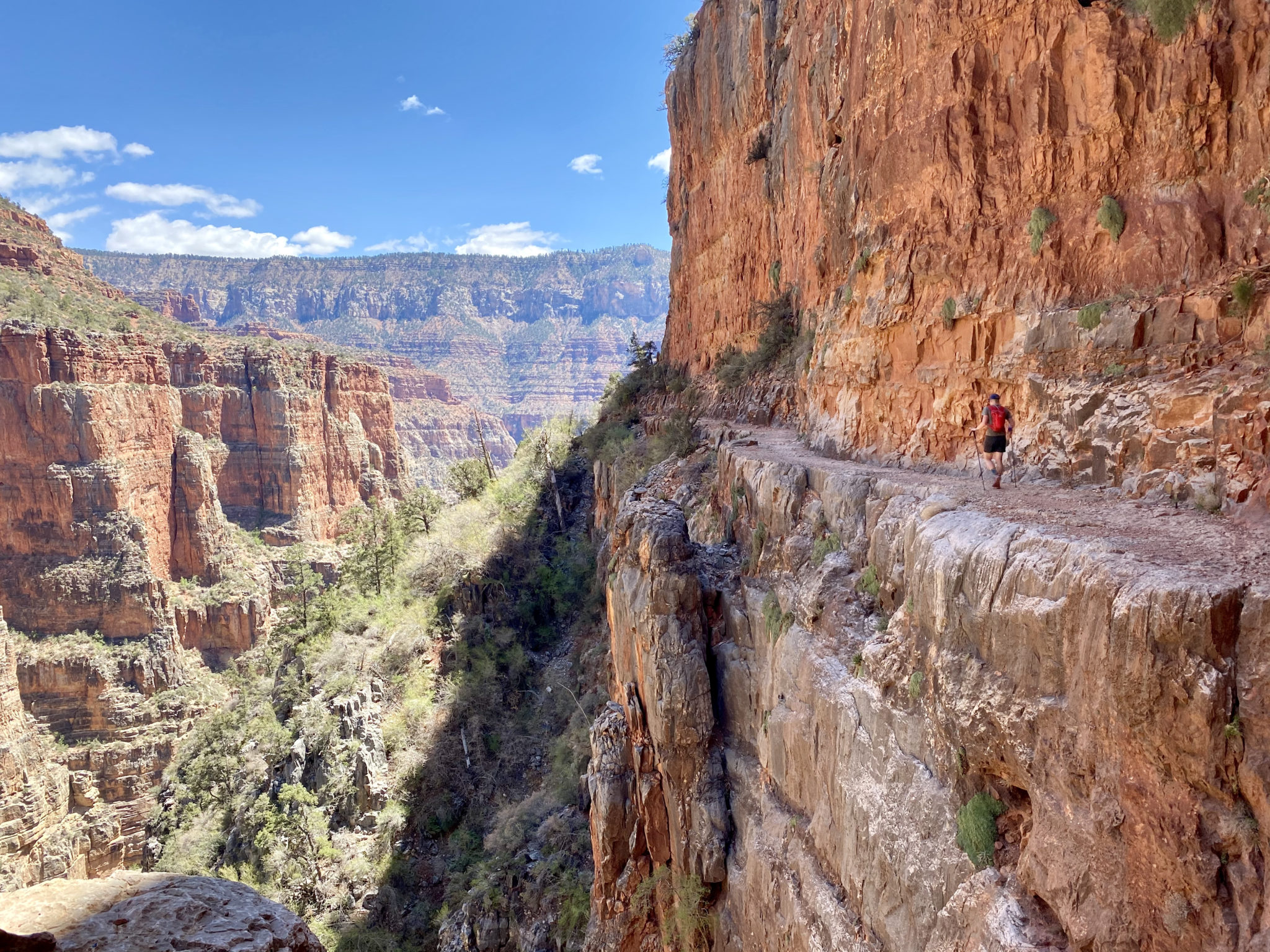
It’s essentially impossible to put the beauty of the views from the South Kaibab Trail into words, so I won’t even try. Suffice it to say, the only problem we had on this stretch was Brian and I slowing down to take pictures and gape at the views around just about every single turn. The steep decline, excellent trail, rising sun, and essence of the canyon made this one of, if not the best, running descents I’ve ever done.
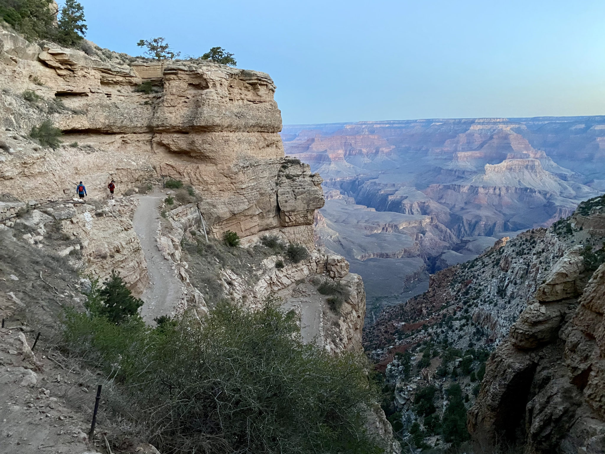
Switchbacks after switchbacks on the A+ trail descending into the canyon. The only difficulty was dodging the numerous midwestern families who were hiking to catch the sunrise. That, and not falling off a cliff due to our own personal gaping.
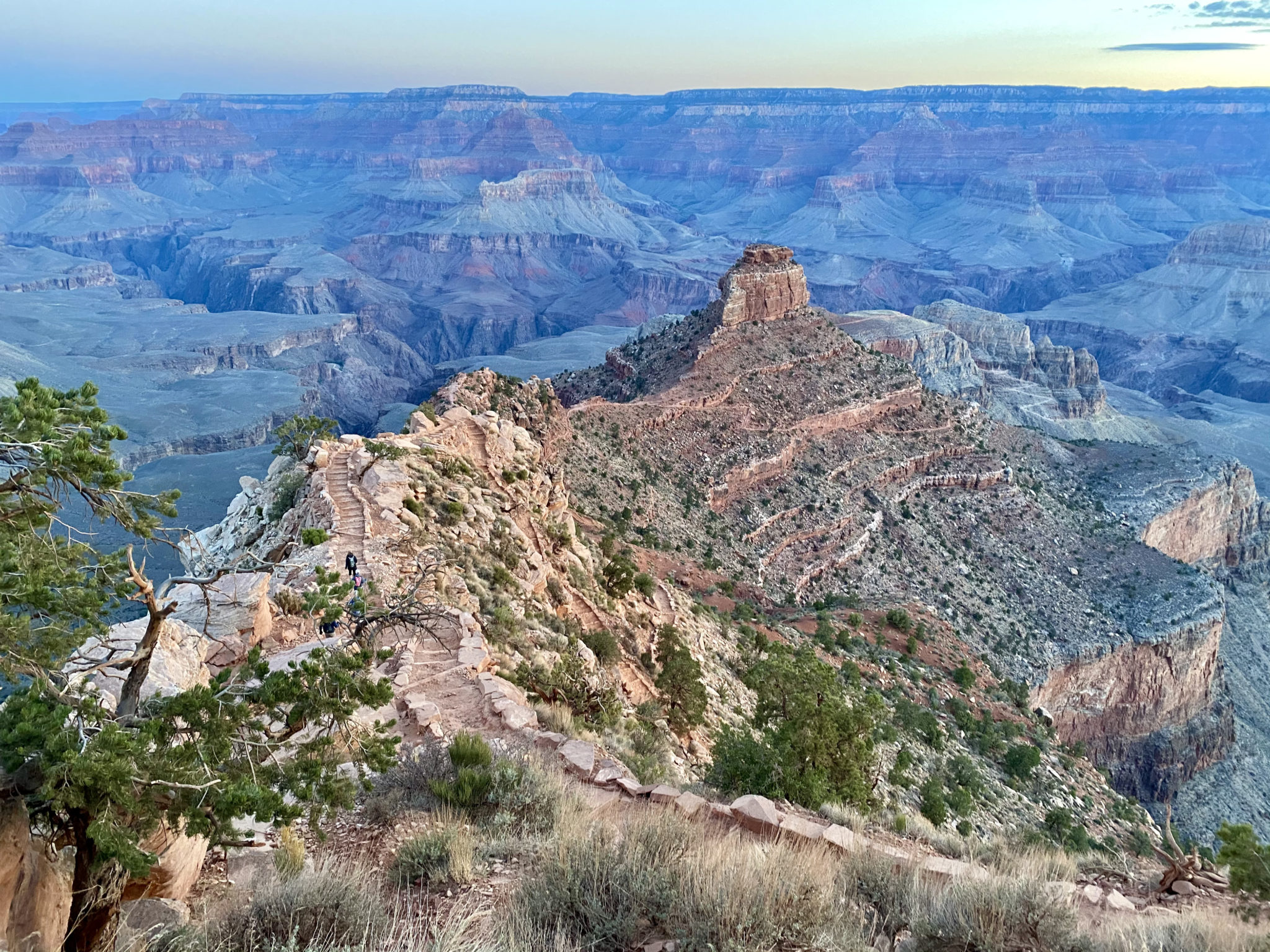
After a quick opening mile, we reached the aptly named “Ooh Ahh” point just in time.
Looking back up at the South Kaibab Trailhead. It was best to completely ignore the fact that we would need to climb up all this again in some 40 miles…
Good morning.
Just a lil’ thigh meat.
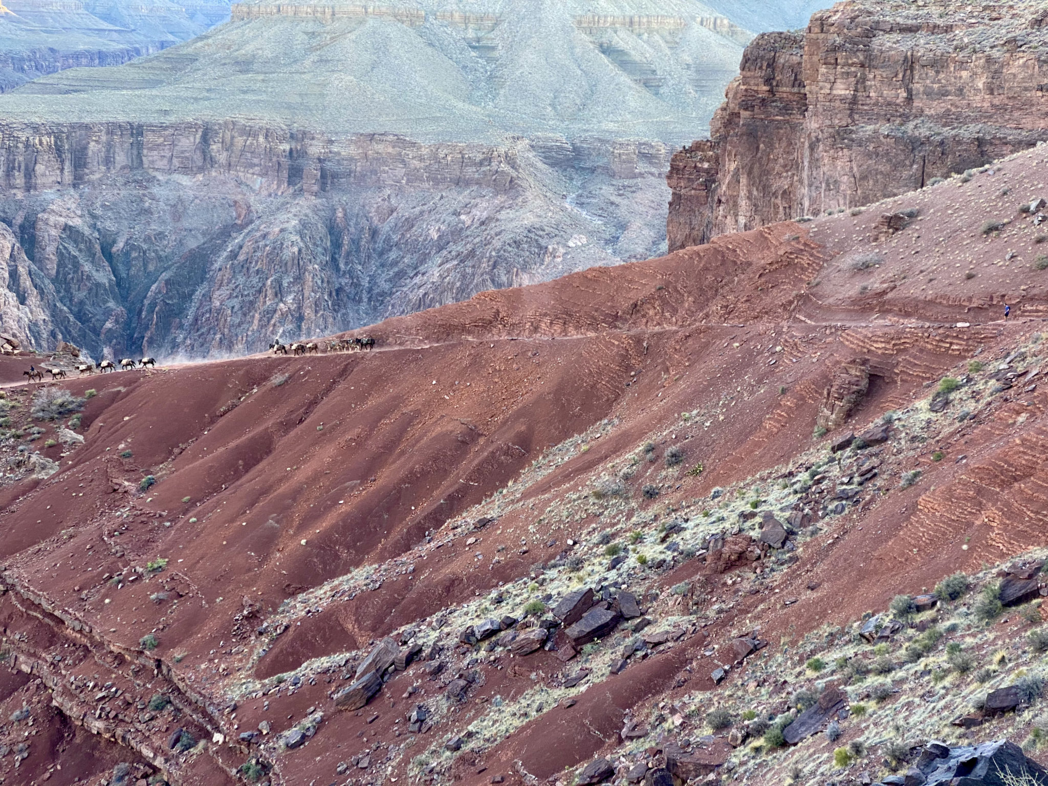
We’d heard burro trains can be a logistical issue on these trails, but we only passed one all day. I’m pretty sure we made the passing far more complicated than it needed to be. The cowboys looked at us with exasperated expressions as we scrambled on the rocks to the side of the train, vs, passing right next to them on the trail. “You guys don’t need to climb all over – just walk past” the lead cowboy called out. As correct as I’m sure he was, the prospect of trusting my own scrambling skills vs a wild donkey not kicking me in the face felt better to me.
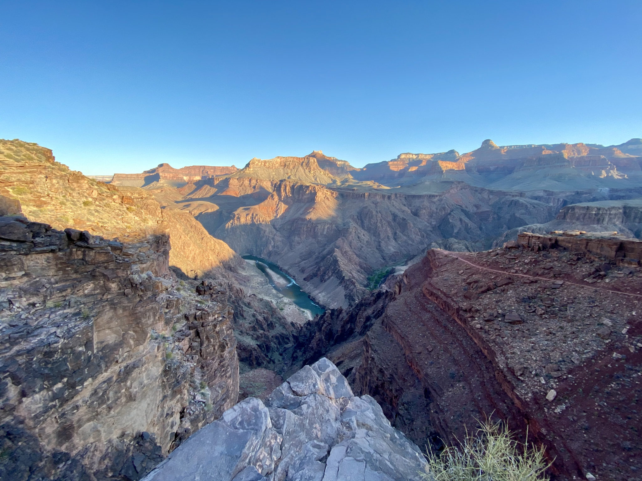
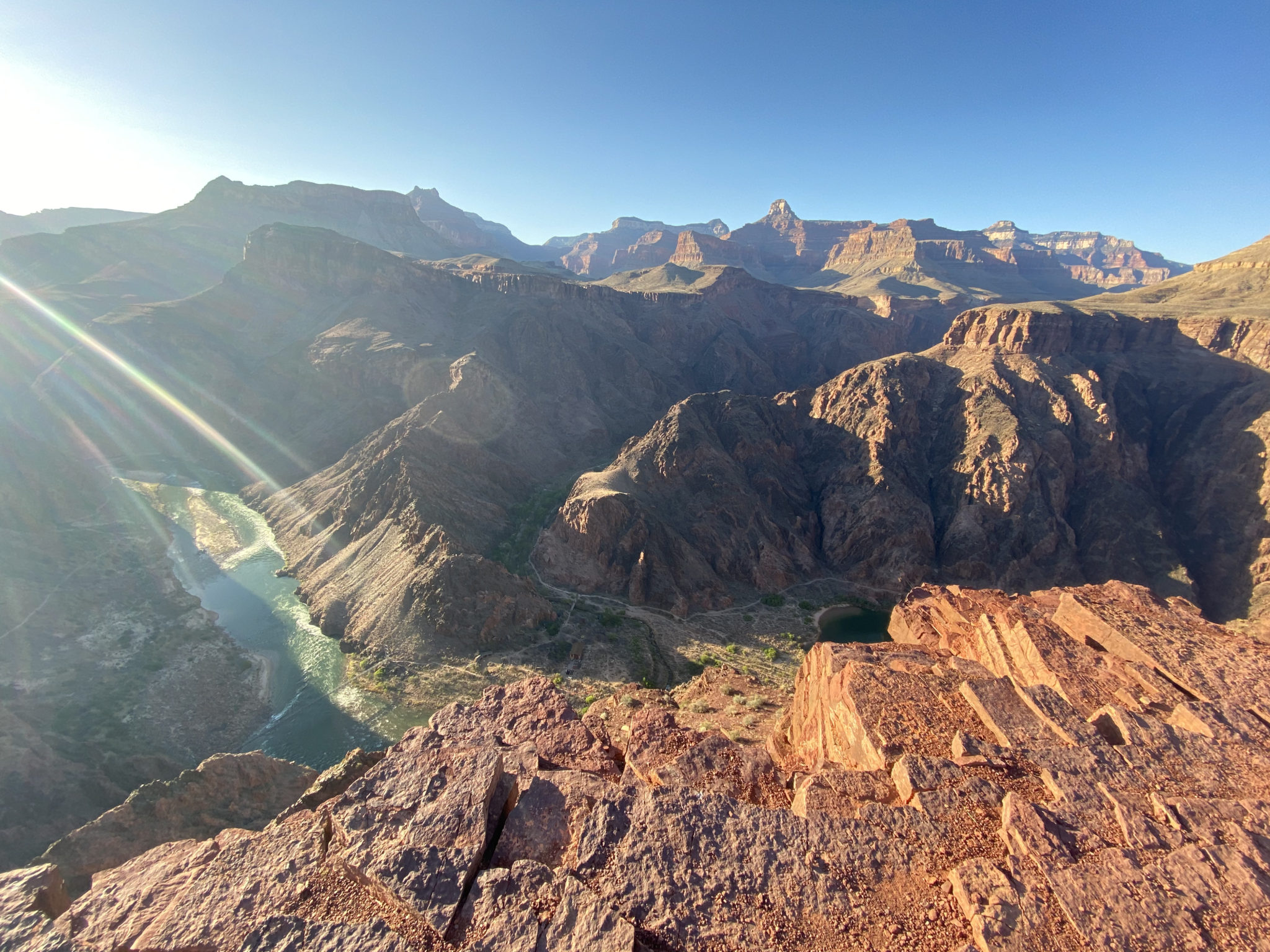
The emerald Colorado River finally comes into view.
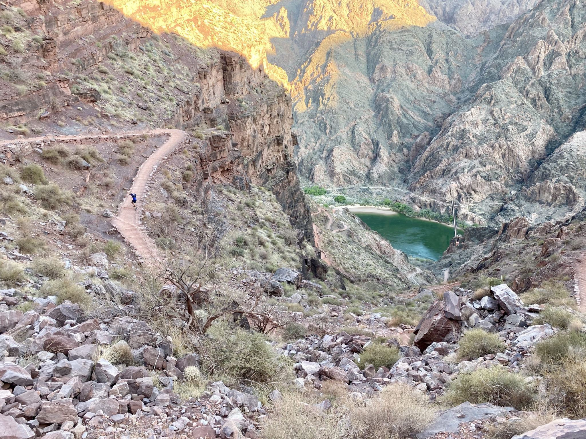
Much closer to the bottom now. Just a dozen or so switchbacks remain.
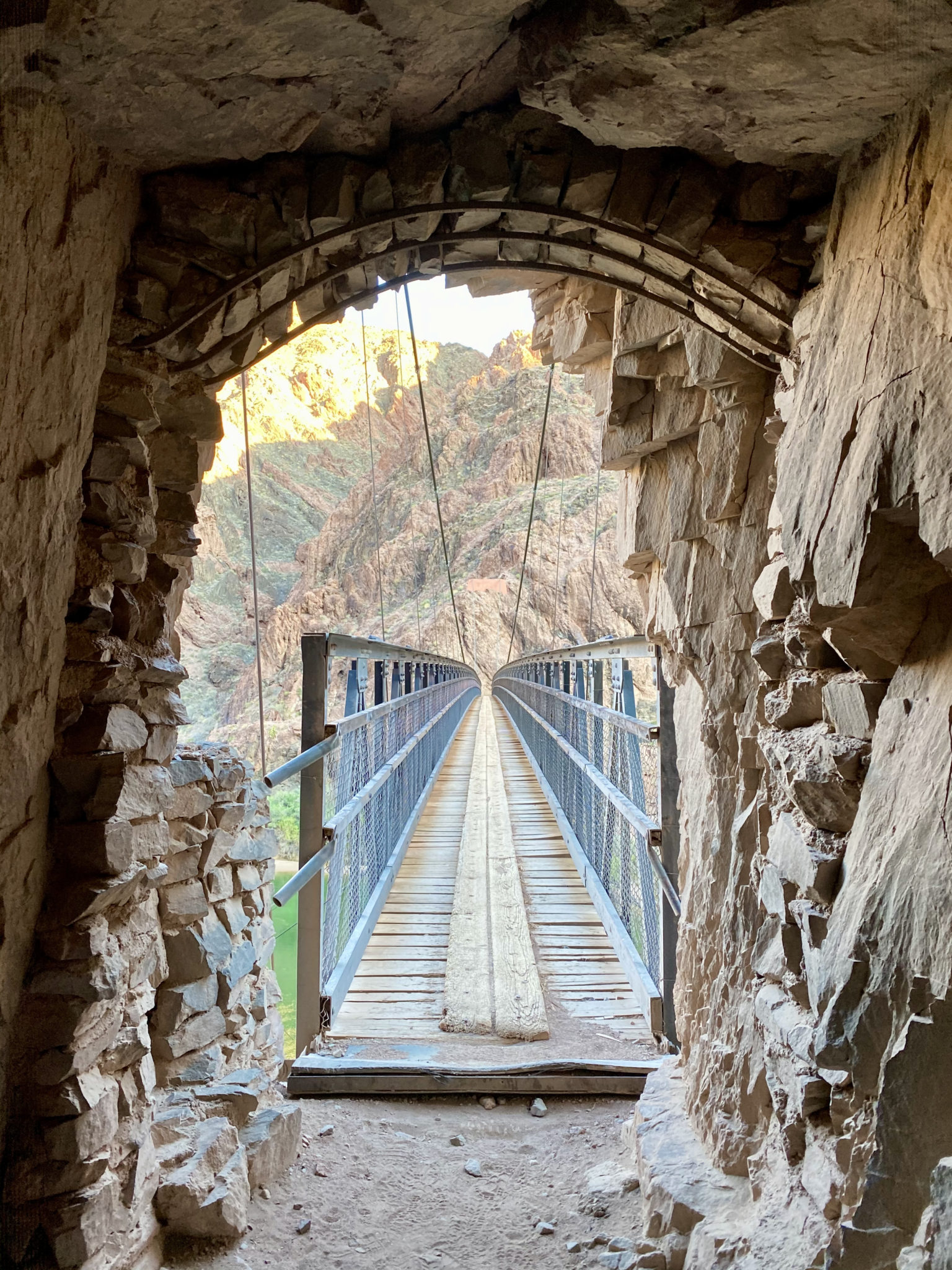
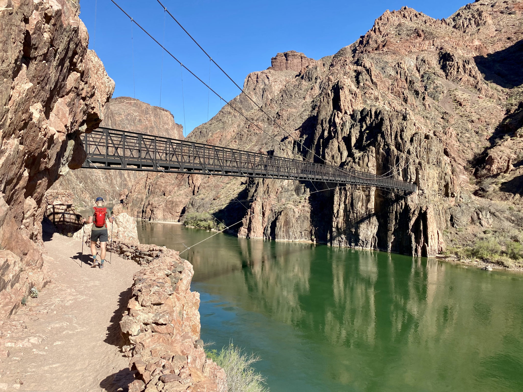
Passing through the tunnel and walking onto Black Bridge. This would be the low point of entire day and some 4,600′ below where we had started just over an hour prior.
All smiles down here.
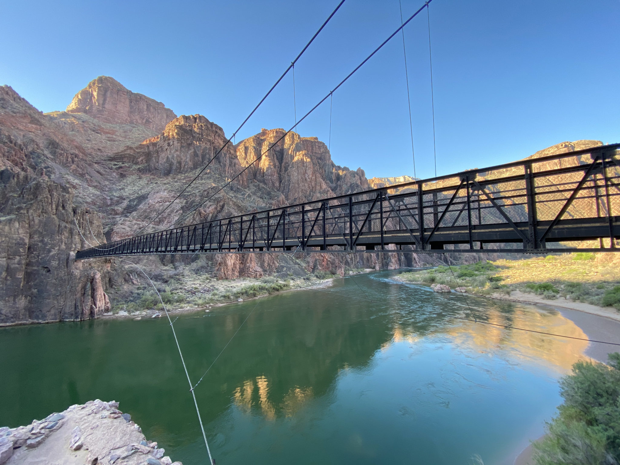
The South Kaibab Trail suspension bridge, aka the Black Bridge. A plaque overlooking it reads, “Constructed in 1928, the Kaibab Trail Suspension Bridge was the only crossing of the Colorado River in a distance of 754 miles from Moab, Utah to Needles, California. Built in a remote location with incredibly difficult access through rugged terrain, the 440 feet long bridge was designed to carry foot traffic, horses, and mules and was made of components that could be carried down into the Grand Canyon by man or mule. 42 men, mostly members of the Havesupai Tribe, carried each 550 feet long, 2,300 pond suspension cables 7 miles down the twisting and torturous South Kaibab Trial – Dedication Date: February 23, 2019.“
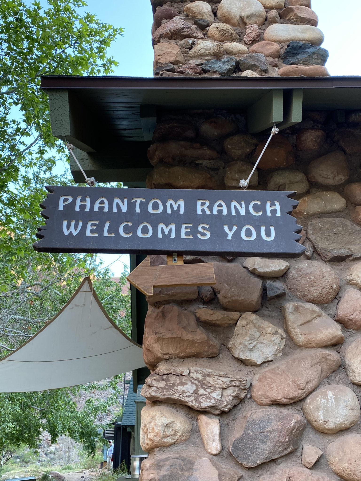
A short way past the river crossing was the 99 year old Phantom Ranch. This facility serves as a campsite, lodge, shop, ranger station, educational amphitheater, and even a cafeteria for those lodging at the ranch’s cabins. Rangers and volunteers live here year round to help support hikers and explorers within the canyon. But staying here isn’t easy, as this hotel is one of the hardest reservations to get in the entire country, or so I’m told. Planning happens years in advance.
Prior to the trip I was really looking forward to checking out this area. I was not disappointed. The infrastructure, history, and unique location of the ranch is second to none. It was very cool to see it firsthand. This was also our first water stop; a true oasis in an otherwise desolate place.
And also to you.
Segment #2: River to North Rim (via North Kaibab Trail)
Phantom Ranch also happened to be the first place we could get ‘in the field’ info about the water situation. As we suspected, Patrick was whiffing on all his pronouncements. The signs and hikers at the ranch confirmed that the water was on 8.7 miles ahead at the Manzanita campground. Perfect. This spigot was perfectly placed to allow us to fill up before the big climb up the North Rim, as well as again on the return. We could not have chosen a better location to refill if we had tried.
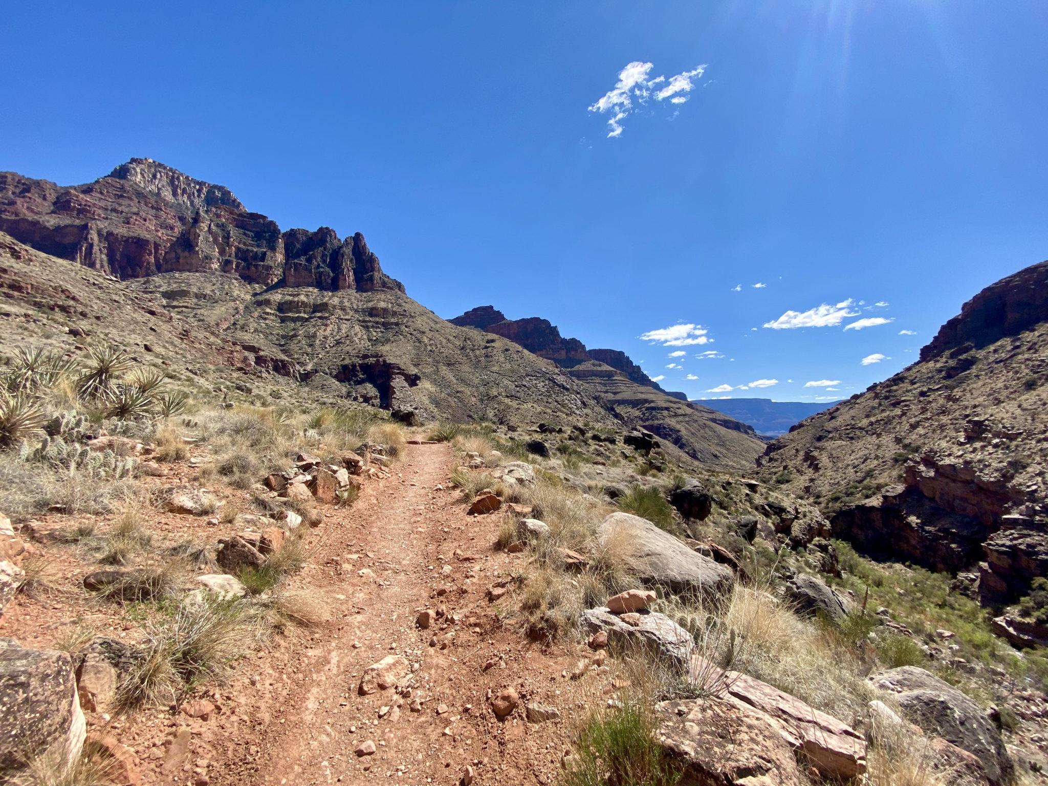
With that knowledge in hand, we started up segment #2. Jason was in a real groove this day and Brian was preferring a more slow and steady pace. No issue whatsoever. Not wanting to leave anyone behind, we let Jason cruise on ahead while I hung back with Brian. He set a nice, relaxed pace for the next 8.7 miles as we cruised up the gentle incline and ever-widening canyon that goes up Bright Angel Creek.
This was another favorite section of the day. The easy grade and continuing excellent trail made this section exceedingly runnable. The cool temps and course along the river only added to the charm.
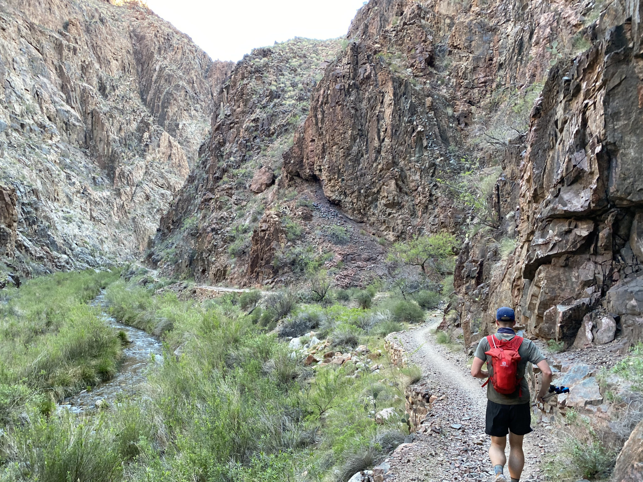
The initial miles past Phantom Ranch were narrow and pleasant. Parts of this stretch even reminded me of Waterton Canyon.
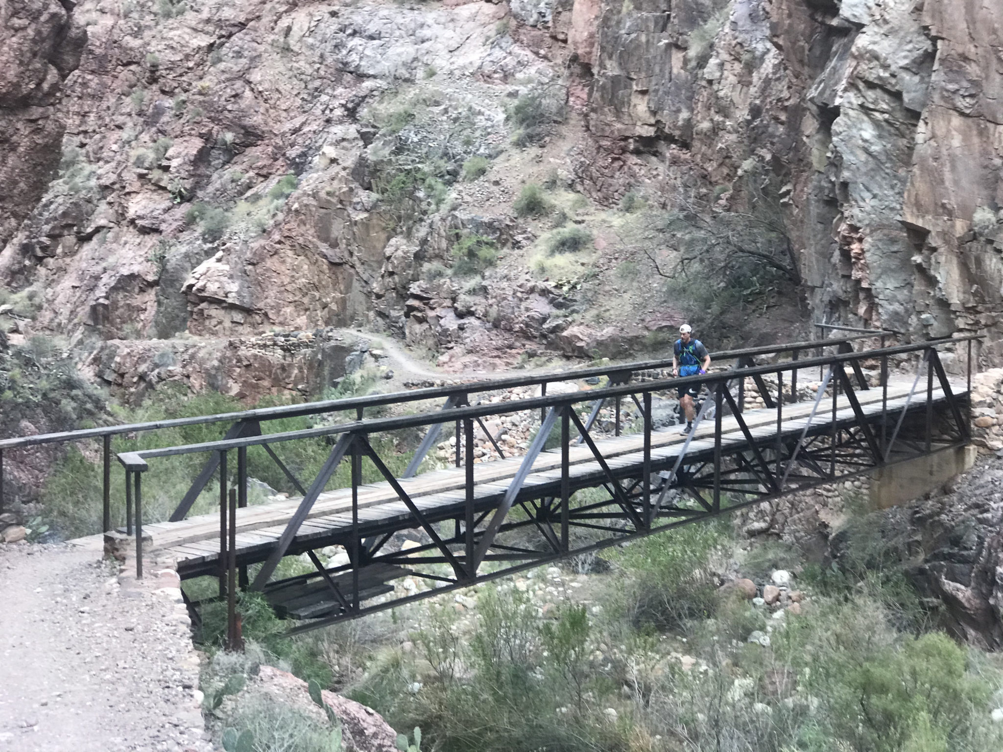
The infrastructure in the canyon continued to amaze. Bridges, retaining walls, steps, water piping…it was fun to gawk at what 100+ years of tourism to the canyon has wrought. Impressive to say the very least. And it made for an amazing surface to run on.
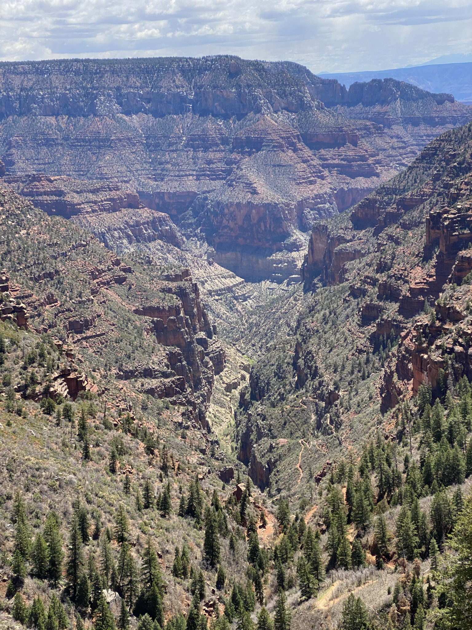
Past the narrow stretches and out into the open again. Soaring towers, sheer cliffs, and endless views abounded.
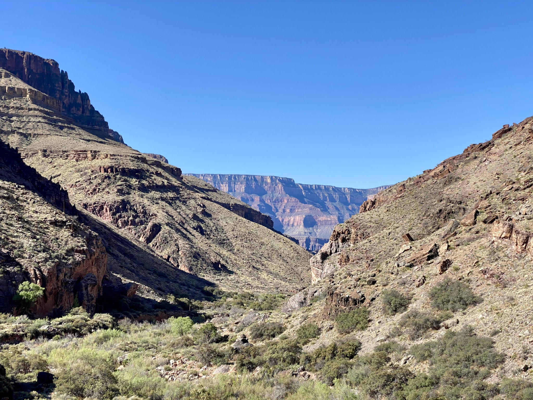
Looking back from where we came, both down this canyon, and alllll the way up to South Kaibab.
This section was also real a treat because it gave a firsthand experience of a completely different ecosystem. Thousands of feet below the pines of either rim, the land transformed itself into a high desert before our very eyes. This is one of the major characteristics of the Canyon not noticeable from the rims. Going down and back up opened our eyes to all the wildly different landscapes, plant life, temperatures, and biomes that changed like clockwork with the differences in elevation.
By the time Brian and I reached the Manzanita campground, it was obvious that the water was on. It was also clear that at least some of the campgrounds were open, since we had chatted with numerous backpackers who had just slept there along the way. This was all good news as Manzanita is somewhat of a do-or-die point. If we were going to go all the way up to the North Rim, we needed to decide right here, as it was 10 miles and 3,800′ of gain before we’d be back at Manzanita again. The alternative was to turn back now and save all that effort of the big climb out and back down.
I checked in to confirm how Brian was feeling and if he wanted to commit to the climb. He felt pretty good, and noted, “Well, I kinda came all this way to have an experience. So let’s do it.” That was plenty good enough for me. Time to do this thing. Five miles to the top!
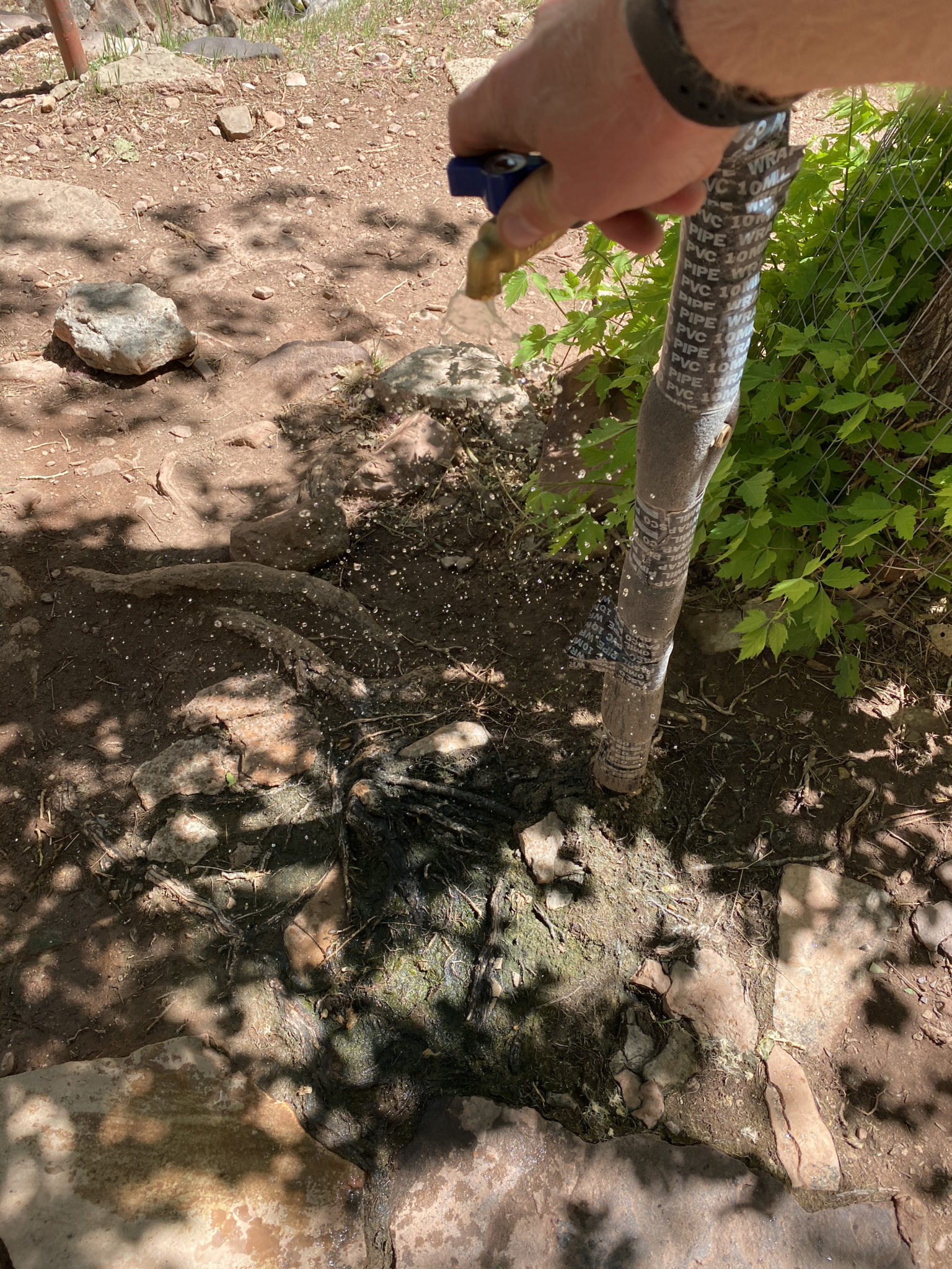
“There is NO water turned on past Phantom Ranch.”
Departing the Manzanita Campground. Our destination was all the way at the top of this photo.
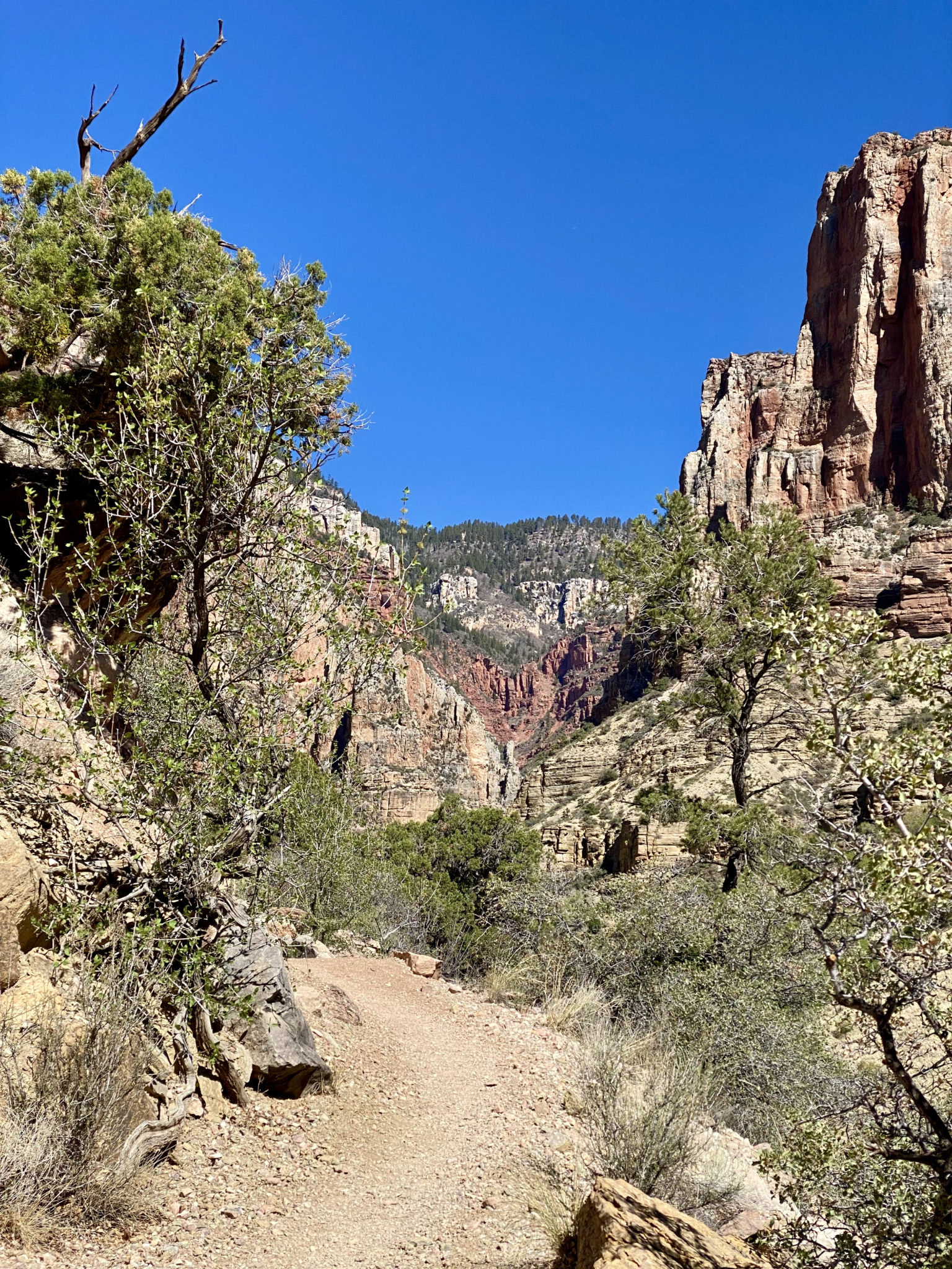
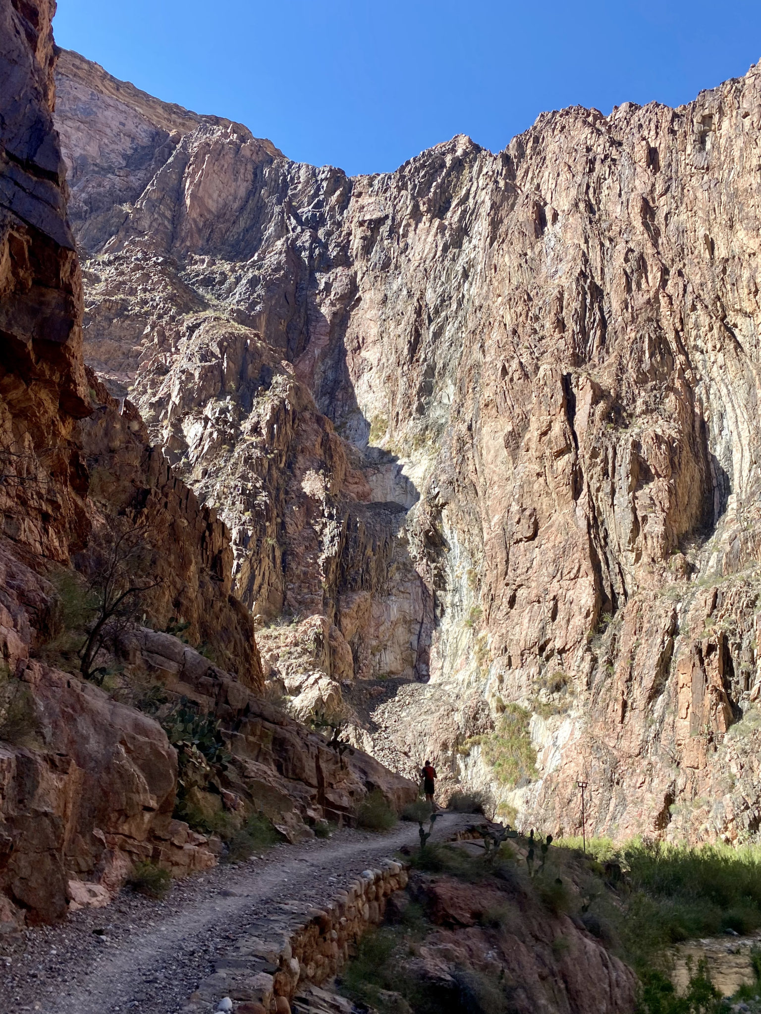
The climb up the North Rim offered some of the most techy sections of the whole day. The improbable trail snaked its way up, over, around, and through one obstacle after another. The route was a master class in careful planning. I’m not sure I have ever experienced a more meticulous, clever trail.

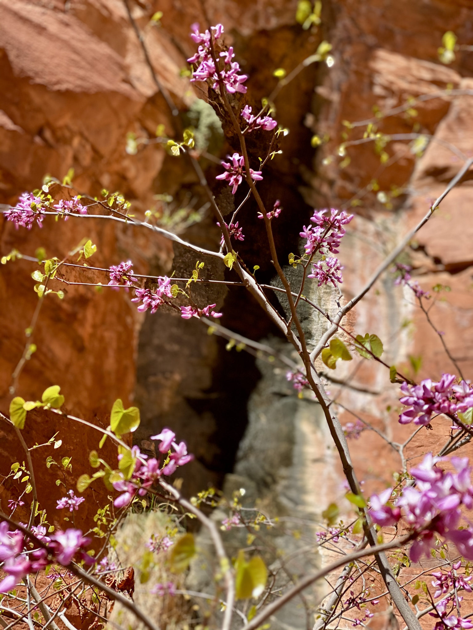
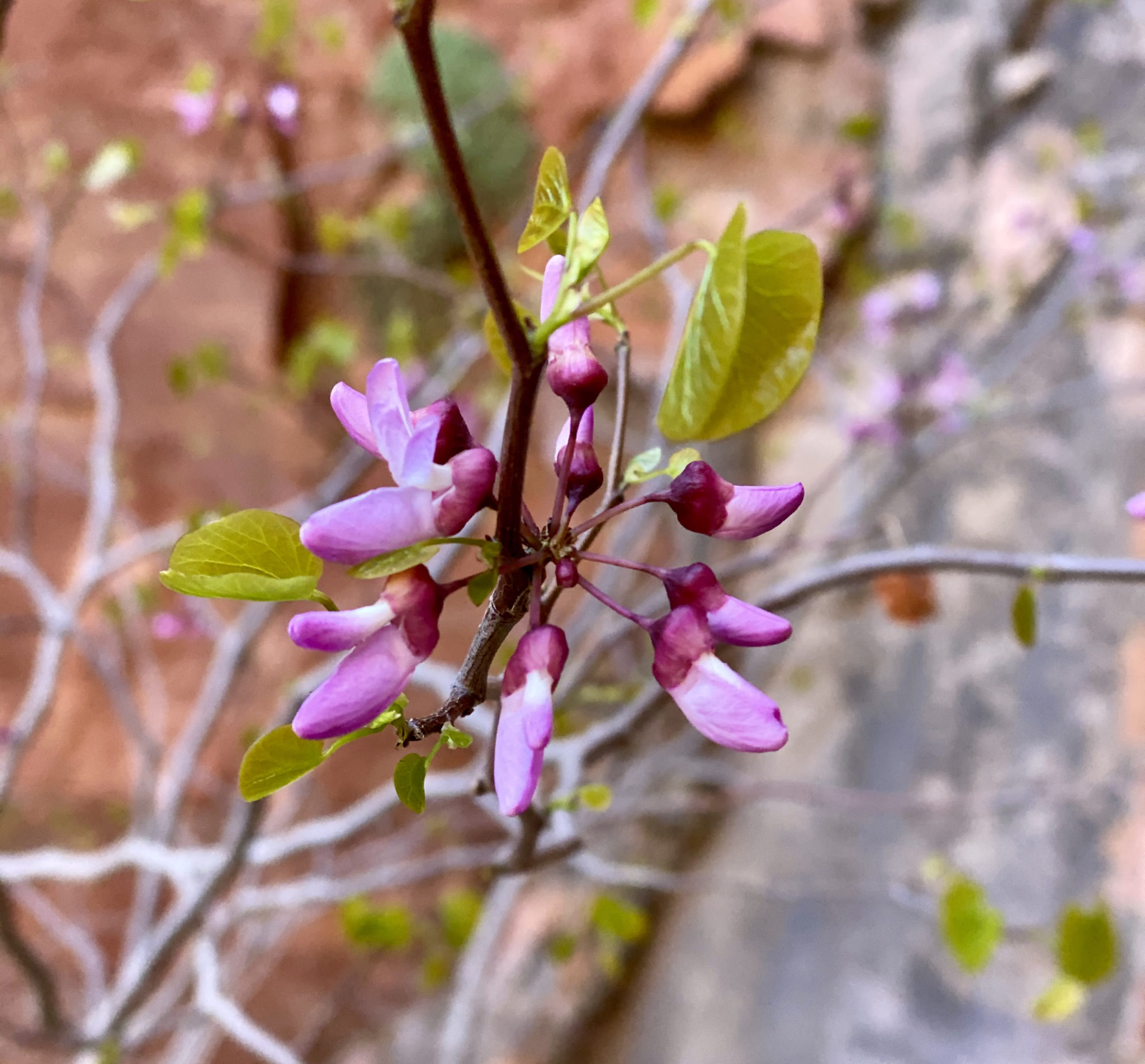
Speaking of improbable, this might have been my favorite living thing we saw all day. Sitting underneath an 8 foot+ overhang, and growing out of the sheer rock face, life, uh, found a way…
We ran into Jason again about a mile from the top. He was still looking really good and gave us some much appreciated encouragement about the remainder of the climb. After snagging some sunscreen from him, he was off in a flash, mumbling something to himself about stolen french fries as he tore off back down the canyon.
Brian and I soldiered on, passing a number of work crews on the trail as we neared the top. We also crisscrossed with some backpackers and a number of other R2R2R runners on this stretch. It was real nice to chit chat a bit with a few of them. By our count, we were one of six parties who completed the whole thing that day. Given the time of year, excellent conditions, and the perfect temps (high of 70 degrees all day), we determined this might be one of the best weekends all year to give this a go. It seems a few others agreed.
Looking back down the North Kaibab Trail from Coconino Point, less than 3/4 of a mile to go to the top.
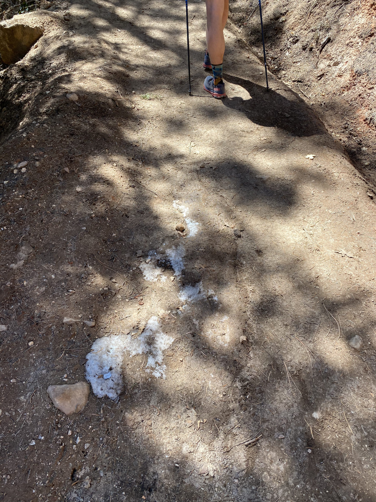
If you look carefully, you can see the dreaded ice and snow on the North Rim we had been so grimly warned about. This picture represents 100% of the ice along the trail we saw during our day.
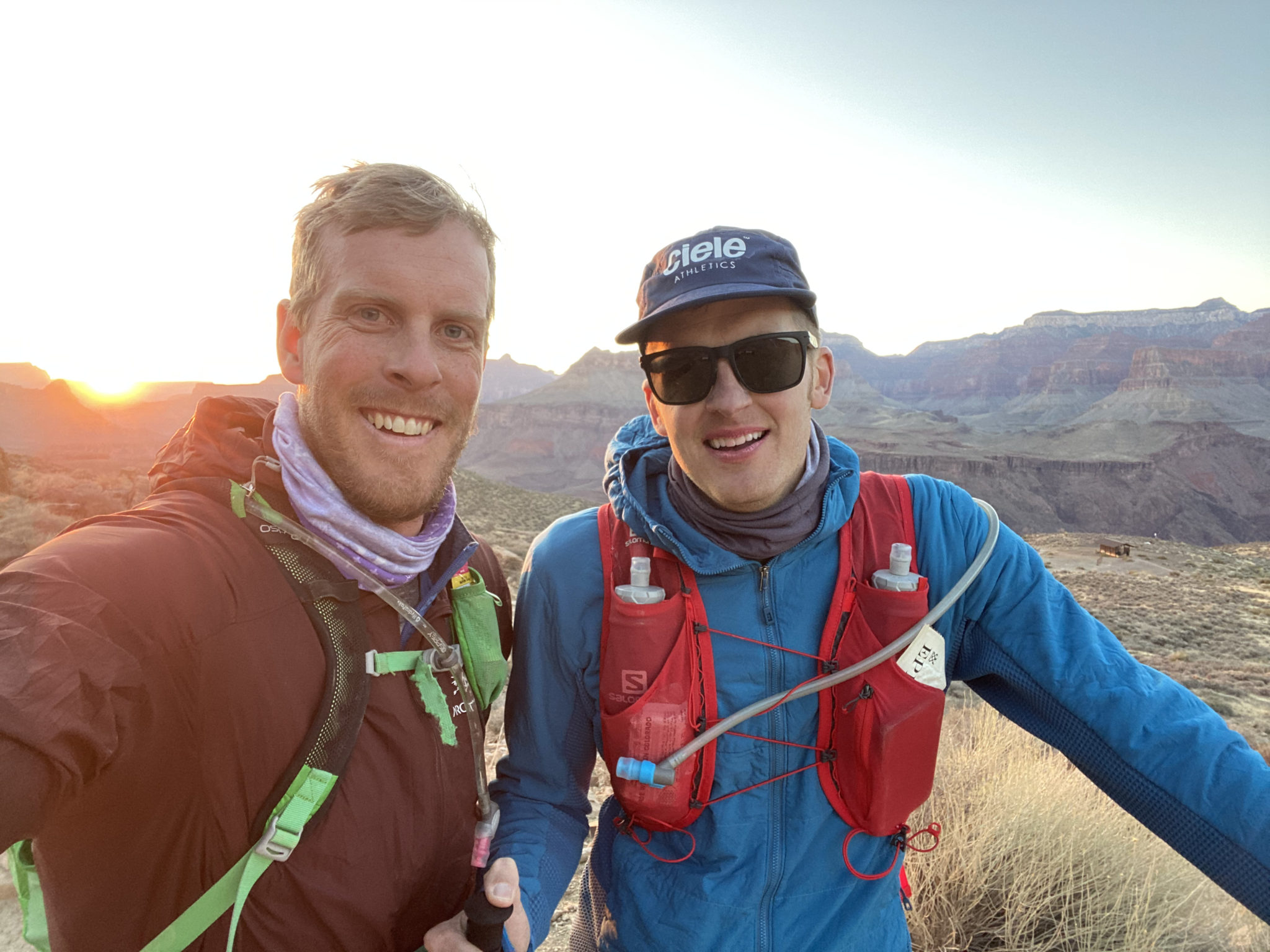
Triumphant atop the North Rim. We even had cell service.
Segment #3: North Rim to Phantom Ranch (via North Kaibab Trail Again)
21 miles and 6,000 feet later, we had made it….halfway. We had a long way to go back.
I chuckled to myself thinking about the reversal of the old Ed Viesturs quote that this route represents, “Getting down is optional. Getting to the top is mandatory.” Time to experience that firsthand. Thankfully, the start of ‘segment #3’ is a nice jog down all that elevation we had just work so hard to gain.
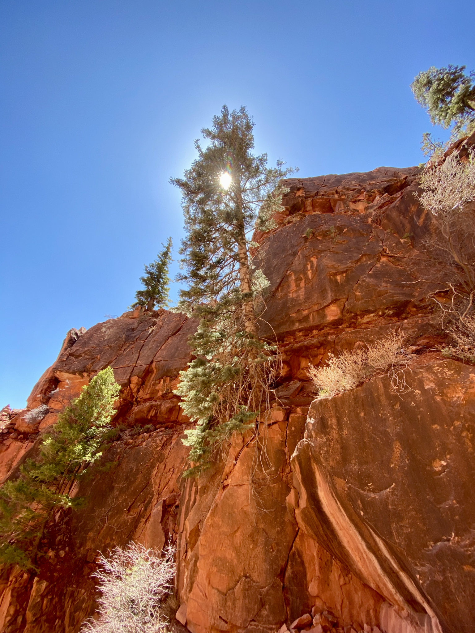
And the good news is, I have always found that being free from the tyrant of gravity allows you to appreciate the things around you that much more. The flora within the canyon never ceased to amaze.
“Upon this rock I will build my church.”
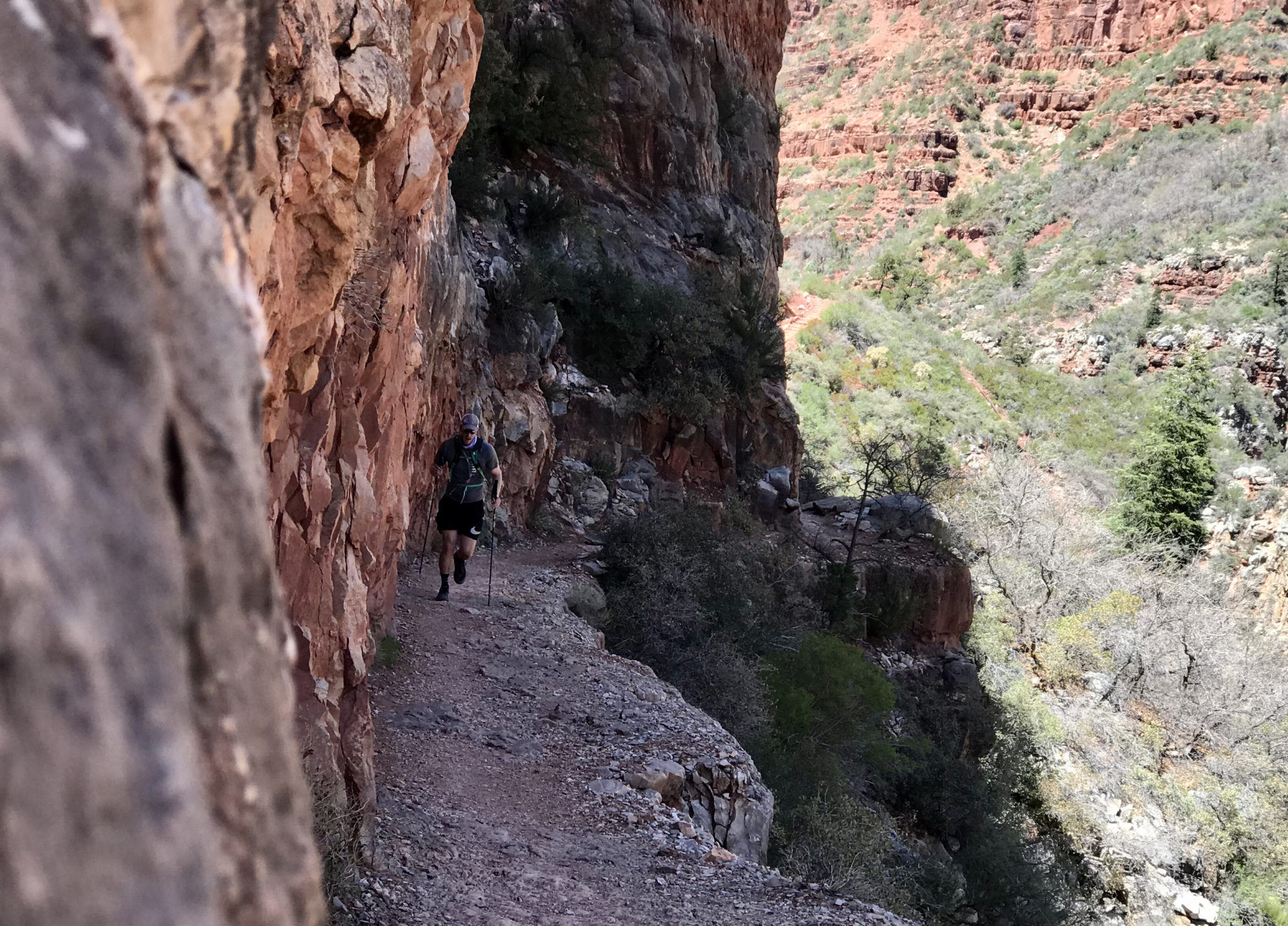
Back through the low-key technical sections again.
To say we felt ‘small’ all day would be quite the understatement.
Back at Manzanita, we refilled waters and girded our loins for the next 8.7 mile stretch. Although it was mostly downhill, the easy grade meant we would still have to put some good effort in to keep the pace up. And it was hot. I tried to offer up some sort of sentiment about mental toughness before we departed, but I am not sure it counted for much. The only way to do it was to just do it.
Even though this was the heat of the day, we each agreed that the 7-8 degrees warmer the next day was forecasted to be sounded much, much worse.

We passed more work crews in the lower canyon, but this batch had a decidedly cooler method of entry and egress. Although I hear the ride is expensive.
The narrow sections near Phantom Ranch finally offered some much welcome shade.
We rolled into Phantom Ranch a bit before 4:00. Just enough time for me to snag a ridiculously overpriced (but highly coveted – no regrets) buff from the general store. They even accepted Apple Pay!
In retrospect, the preceeding miles had taken a lot out of us, water and electrolyte wise. We took a longer break this time at Phantom to replenish food and water. Brian downed two full bottles as a result. This turned out to be a mistake. But more on that in a bit.
For the moment, we had run 35 miles with the final 7 to go. And the 4,600′ of gain. I had told Brian all day, “All tips are useless for the final climb. It’s just gonna suck.” Turns out, that was true.
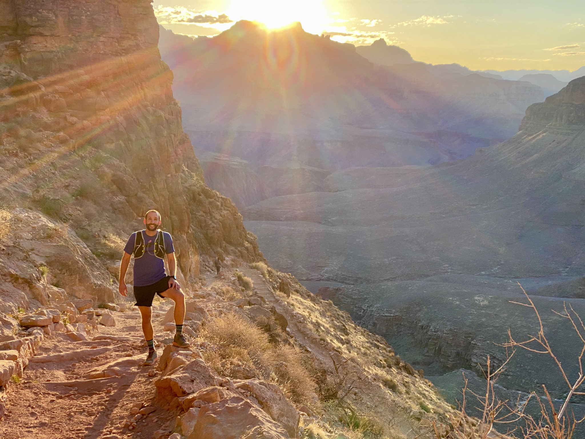
Segment #4: Phantom Ranch to South Rim (via South Kaibab Trail. Aka: The Big Hurt)
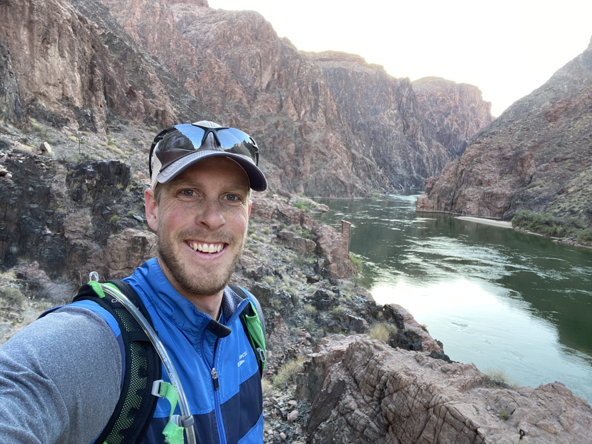
Back at The Black Bridge. All uphill from here. The Colorado looked fine as ever though, completely indifferent to our efforts.
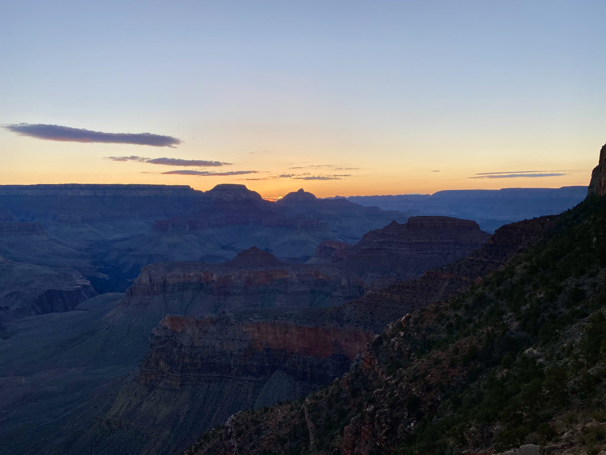
Lengthening shadows creep in on a glorious day.
As we began the long ascent back to civilization, the full effect of the long day + the dehydration + chugging the two water bottles hit Brian like a train, unfortunately. He was dealing with some excruciating nausea that set in on the first thousand or so feet up the canyon. Walking became plodding; plodding became slow stepping. He really wasn’t feeling good. I was trying my best to skirt the line between encouragement and hard-assing the push to keep going. We had a long, long way still to go. I’m not really sure how good of a job I did.
Finally, we hit ‘The Tip Off’, a bit of an overlook with a pavilion, some ~2.5ish miles and 1,500′ from Phantom Ranch. But the effort had taken a toll. Poor Brian still felt miserable. And we were moving super slow. Thankfully, the pavilion had some benches and he was able to lie down for a bit to rest. Taking a queue from the surprisingly helpful info signs adorning the walls of the structure, we determine the best step was to give him 30-60 minutes or so to rest, and then we would revaluate.
As Brian crashed out for a bit, I fired off some GPS texts to all our contacts to let them know we would be late. With that done, I leaned back and just enjoyed the views as the sun was slowly slipping down to meet the horizon of the Canyon off in the distant west. Part of me was worried about the situation and trying to determine the next best steps. Part of me was kicking myself for tempting the gods of karma all day by trashing Patrick’s warnings in my mind. But the biggest part of me felt a sense of reassurance that we’d be alright. After all, we had the gear, we had done just fine all day to this point, we had access to an SOS if needed, and we weren’t really all that remote. But ultimately I believed in Brian. I knew he could rally.
And rally he did.
With a partial thanks to the rest and a partial thanks to some prayers of support sent up on our behalf, Brian turned it around like a champ. After resting for 30 minutes, he emerged from that pavilion a man re-born. We were still moving slow, but no one moves fast at that point of this route anyway. It was a 100% turn around from just a few minutes prior. The nausea was gone and Brian knew he could finish. I can’t speak for how he felt inside, but I’m damn proud of the effort he put in to get back to the top.
As absolutely miserable as it was in the moment, I made us take this picture to look back on. May it always be a small reminder of the capacity to overcome, to endure, and to press on to finish the goal. Key aspects of what the R2R2R is all about.
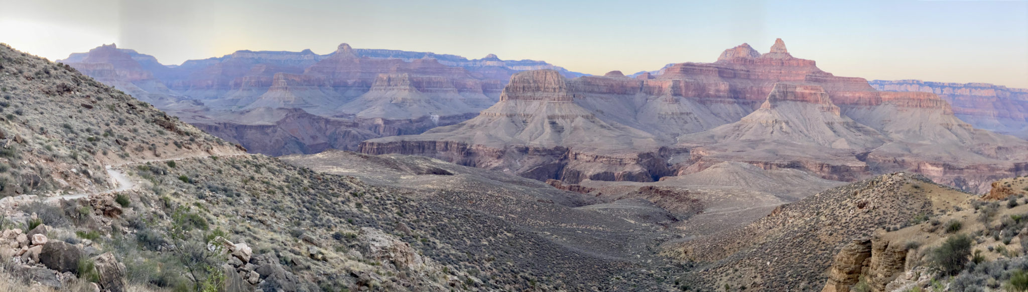
Dusk panorama overlooking the route of a very full day. (click to enlarge)
The best part about finishing after dark and after Jason was that he could drive to the trailhead to pick us up. And we could put in a burrito order. I have never been more happy to see him – or a burrito – than when he rolled up a few minutes after we had crested the final steps of the South Kaibab Trail. We still owe him big time for that one, not to mention all the other planning he did so well to allow us to have success. Thanks, brotha!
The full day in view, via the Relive app.
Parting Thoughts
There is so much more that could be said about the wonders of the Canyon. But this trip report is plenty long enough already. I suppose if I had to sum it all up, I would say that the Canyon surprised and delighted me with its depth. And I don’t mean just the physical side, but the things it represents.
Standing on the rim and gazing out over it’s depths is an experience all to itself. But as iconic as that moment is, it belies the true wonders of the Canyon. Those can only really be known by going within. Getting to travel there and back again across this wonderful place showed me that truth. And I am very grateful for it.
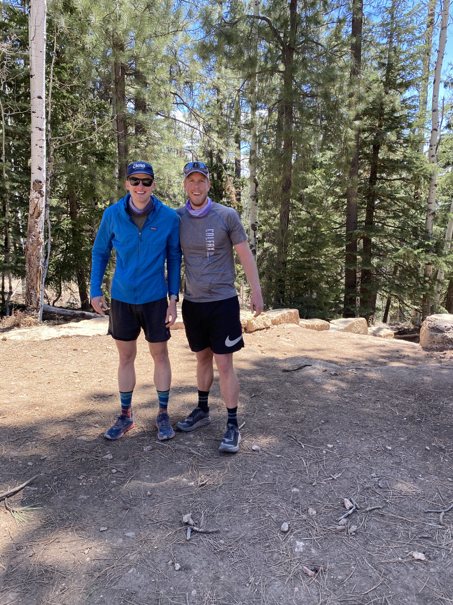
That, and two awesome partners. I can’t say enough about how great it was to do this with Brian and Jason. I would go back there with either one of those guys any time. Thank you both for all the great effort, conversation, laughs, and support. Really good stuff.
Thanks for reading if you did. Happy running!
Such a great read, Zambo. Thanks for sharing!
Also I’m fairly certain those french fries were laced with Arsenic.
Thanks. Brian! Whatever they were laced with, it seemed they sure tasted good…. 😉
B Lich – You foiled my plan! I needed to poison you two so my old ass could keep up!
Zambo – Awesome TR, great job capturing an incredible experience. Patrick and negative Nancy attitude will never be forgotten.
Thanks JB! If he ever reads it, we’re banned for life! Thanks for organizing and inspiring this one. Excited to see what the next winds up being.
What a time to be in the park! As we discussed, GC is a great place to trail run and sounds like you’ll be drooling over 30-40 mile loops for years to come, as well as a place to camp with the kids in the future. Such an unbelievable, unique part of the planet and what a way to experience it. Nothing like ending a long day with the lengthening shadows blanketing the ancient landscape. On the last night on Escalante, my buddy and I had been experiencing an overcast, intermittent rainy day for the majority of the afternoon and then the sun fired its rays through the clouds around the golden hour, we were hiking along a section of trail with a sheer 3000 foot drop mere inches to our right with the emerald roaring Colorado below and I was just like holy shit this place is something else.
Haha….well said on all fronts! Those shadows and sun beams really do hit like nowhere else. Now we just need to plan the next crossing, but this time with you in tow!
Nice work on an uber classic, gents! Way to push through the tough spots and finish off undoubtedly one of the better experiences one can have in the GC. Cheers 🙂
Thanks, Ben! It has indeed become a classic in a hurry, hasn’t it? Some Boomer even tried to give us grief at Phantom Ranch about that, actually.
“You guys know, back in the 80’s NO ONE would ever run through the canyon. Now people do it all the time. What’s with that? Har, har, har!”
Go figure. Well, the joke’s on him as this is easily one of the coolest ways to do it!
Very enjoyable read. Great job! Completed R2R2R in August 2012 and plan to do the same in early November this year. Cheers!
Thanks for the kind words, Bill. Good luck on your attempt this year!