Below the Mýrdalsjökull Glacier along the Fimmvörðuháls route in southern Iceland.
At the beginning of July Anna-Lisa and I spent 9 days playing tourist in Iceland. It was a whirlwind of a trip but we had a blast exploring a place that was totally new and unique to us. Iceland is known for its impressive diversity of landscapes and natural wonders that are all packed into a relatively small area. From rolling green pastures and waterfalls to black sand beaches, glacial valleys and mountain volcanoes, the island is brimming with a vast array of different colors and scenery. If you like nature, Iceland should be on your bucket list.
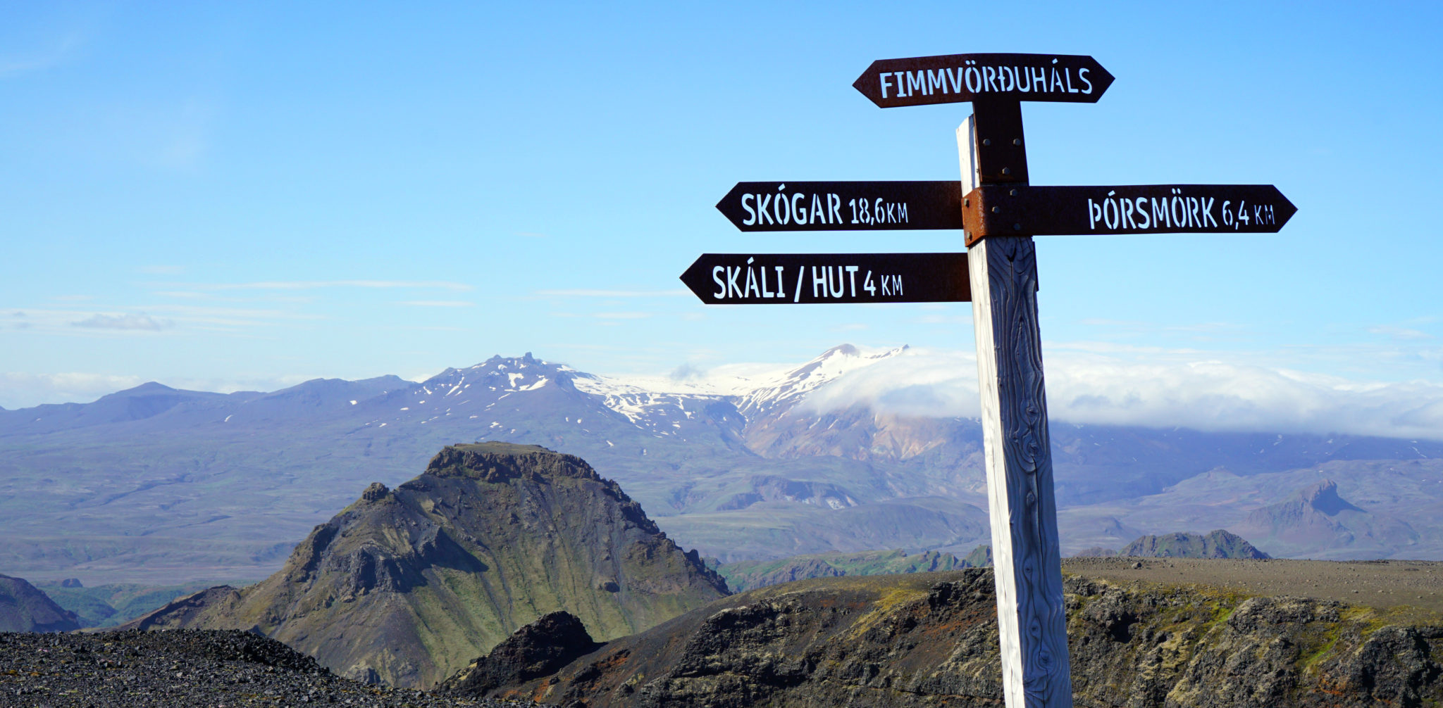
One way to experience the diversity Iceland has to offer is to complete the Fimmvörðuháls trekking route that connects the village of Skógar to Thórsmörk. It’s a 17 mile point-to-point trail that starts on the southern coast of the island and climbs up and over one of the youngest mountain ranges in the world. The route sneaks between a pair of glaciers and finishes with a descent into a glacial valley to the north known as the “Valley of Thor”. The only real potential issue with the route is the weather, as the area gets a lot of rainfall and fog that can detract from the views and overall experience if you catch it on a bad day.
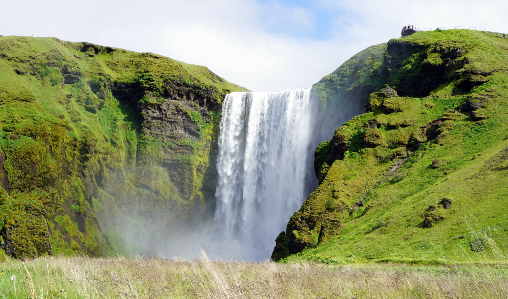
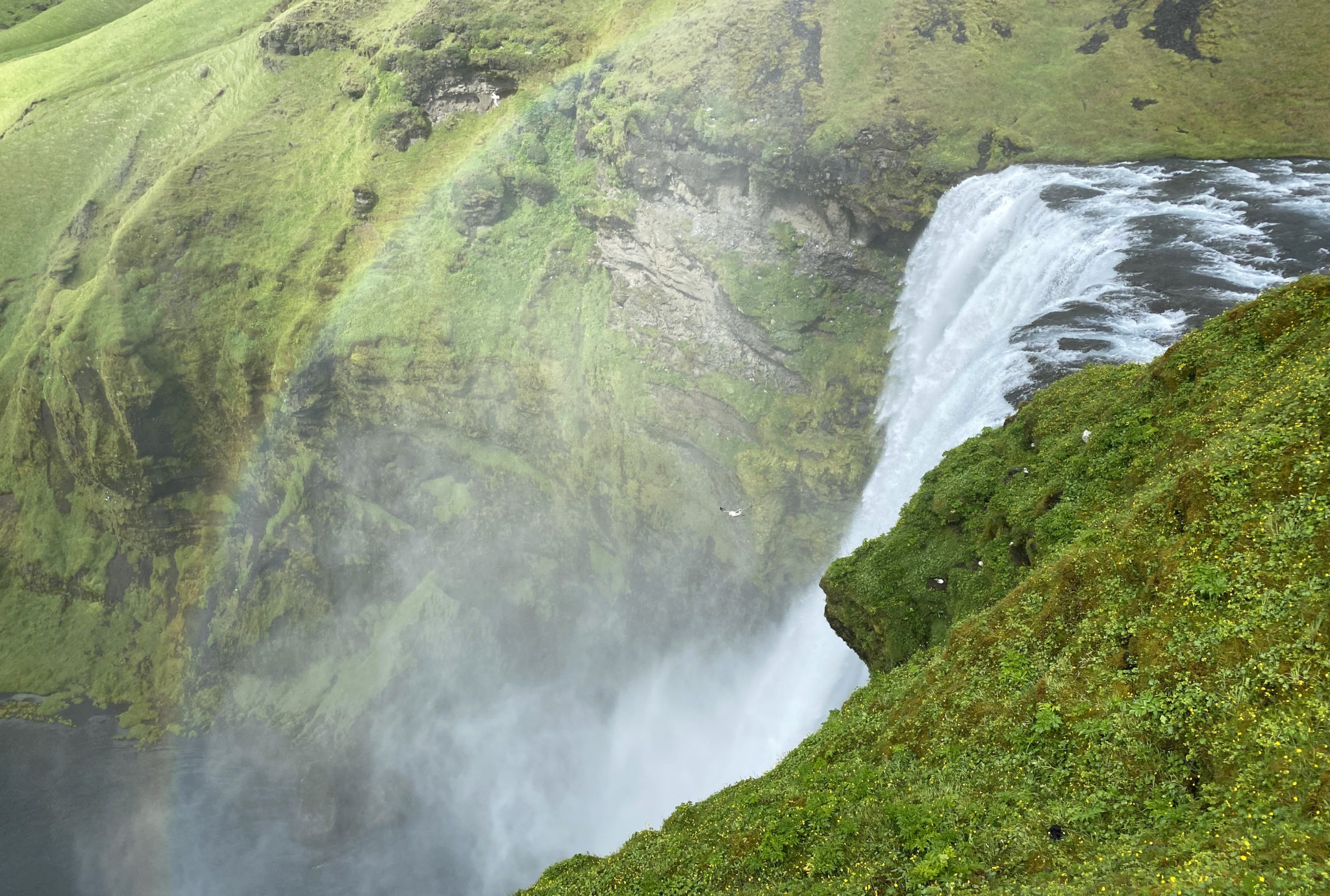
The trail starts just north of the ocean at the parking area for the Skógafoss Waterfall, which is a sight to behold in and of itself. Click to enlarge.
Luckily Anna-Lisa and I wound up with near-perfect weather for the day. Just a little rain in the morning that allowed us to sleep in and enjoy a solid breakfast at the farm we were staying at near Vik, a 15-minute drive from Skógar and the trailhead.
Past Skógafoss the crowds quickly diminished and we were mostly on our own.
The first several miles of the route features 26, yes 26 waterfalls adjacent to the trail as it parallels the Skógá River. This section is aptly called “Waterfall Way”. You might also run into some Icelandic sheep grazing through here if you’re lucky.
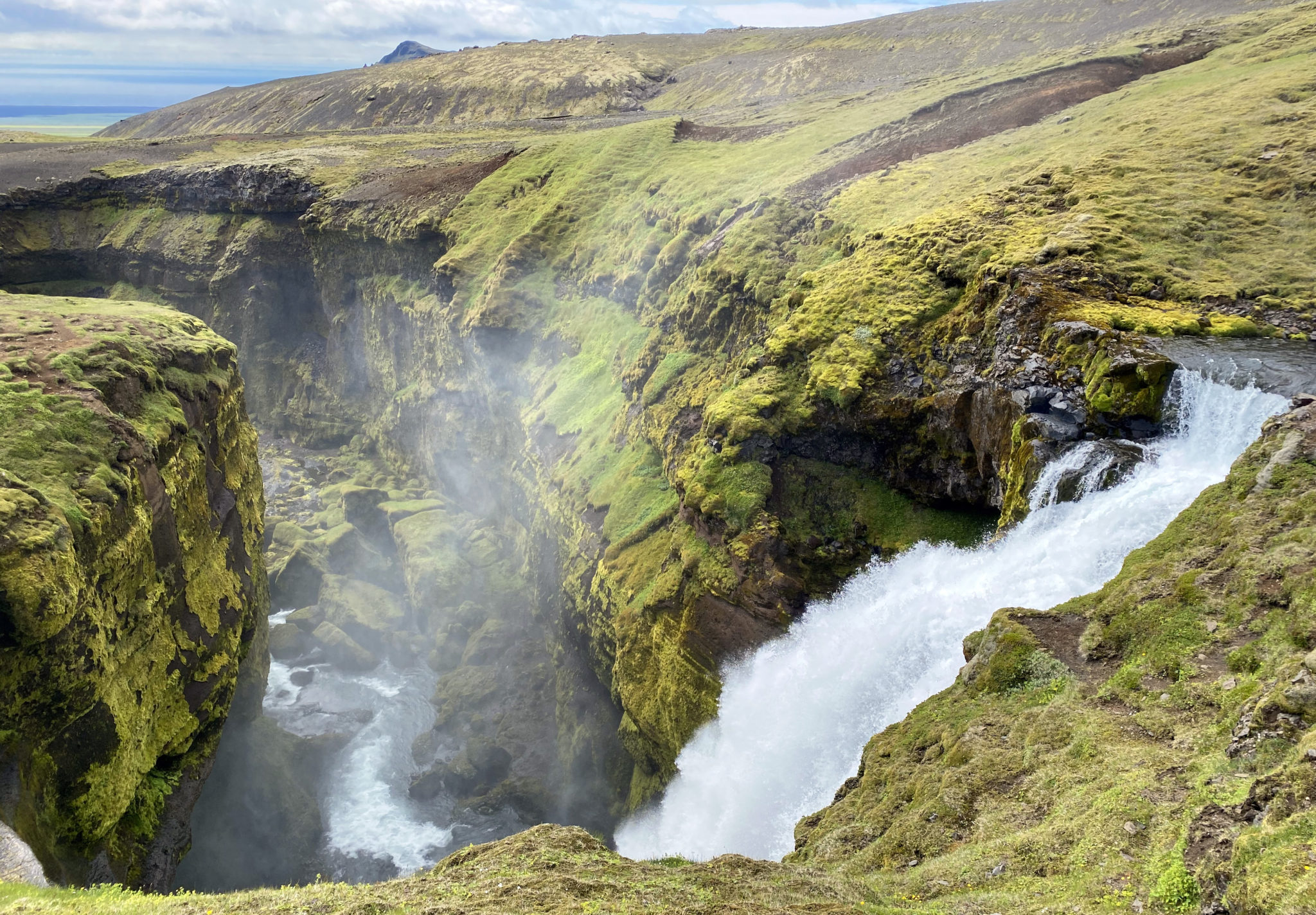
Another nice one.
After 6 or 7 miles the green, lush terrain gives way to more of a volcanic moonscape at the toe of the Eyjafjallajökull and Mýrdalsjökull glaciers. Dark volcanic rock with sparse vegetation for as far as the eye could see. We eventually crossed the Skógá River via a narrow bridge and then arrived at the Fimmvörðuháls mountain hut not long after.
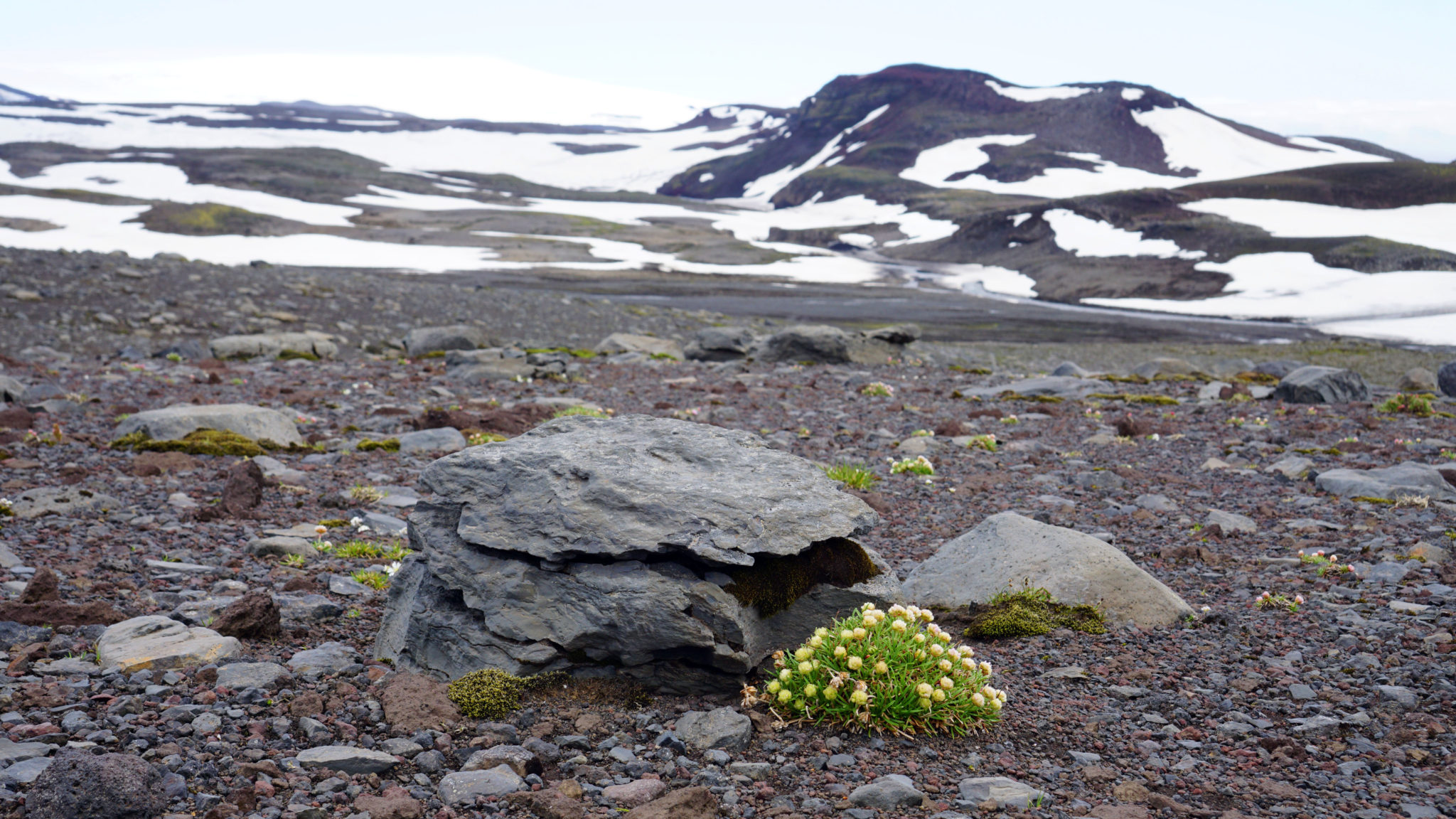
In the lava field. Click to enlarge.
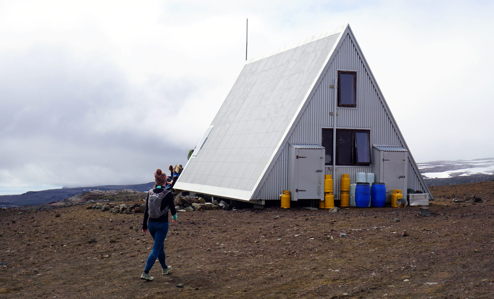
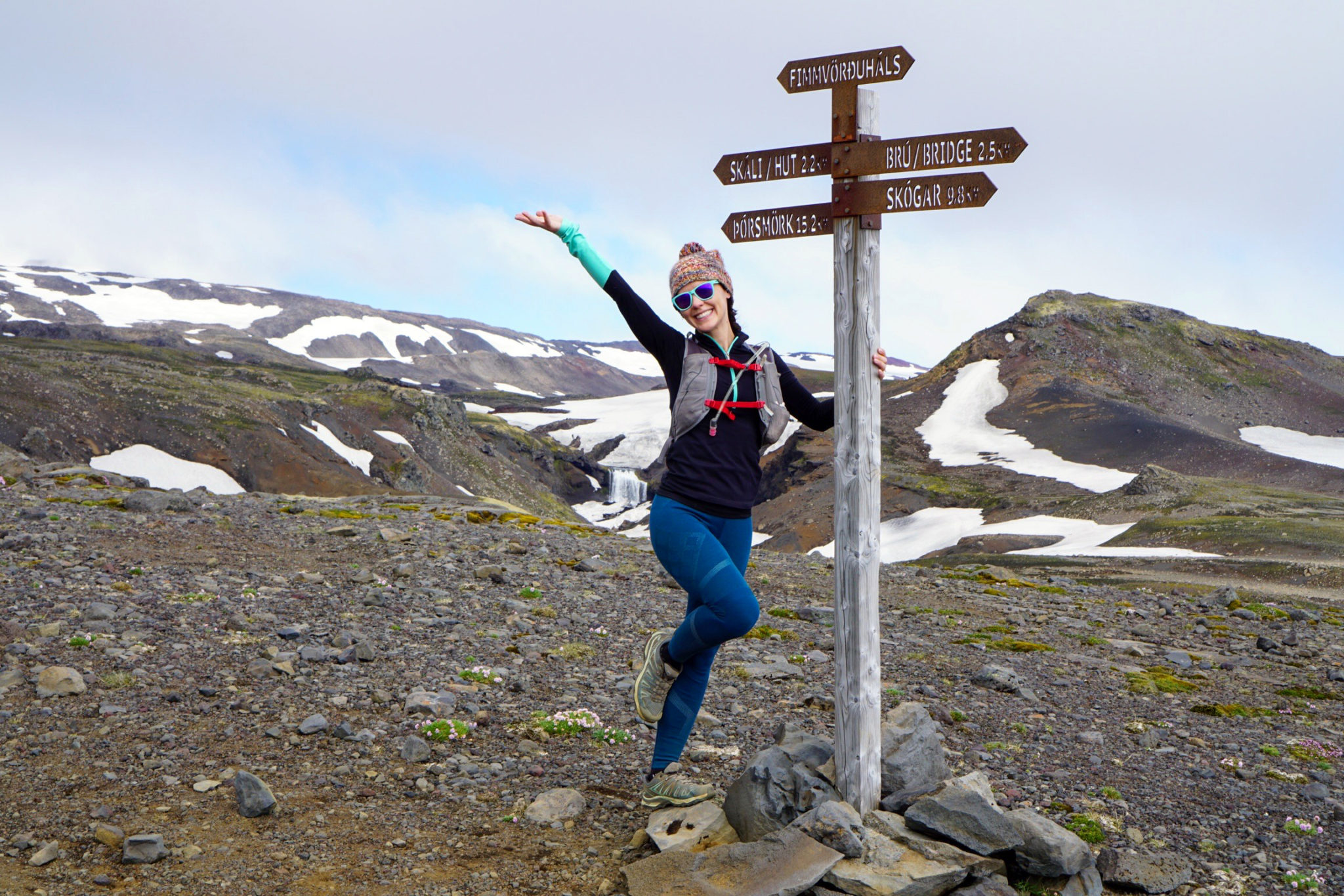
The Fimmvörðuháls mountain hut, a refuge used by hikers and backpackers wanting to break the route up into multiple days.
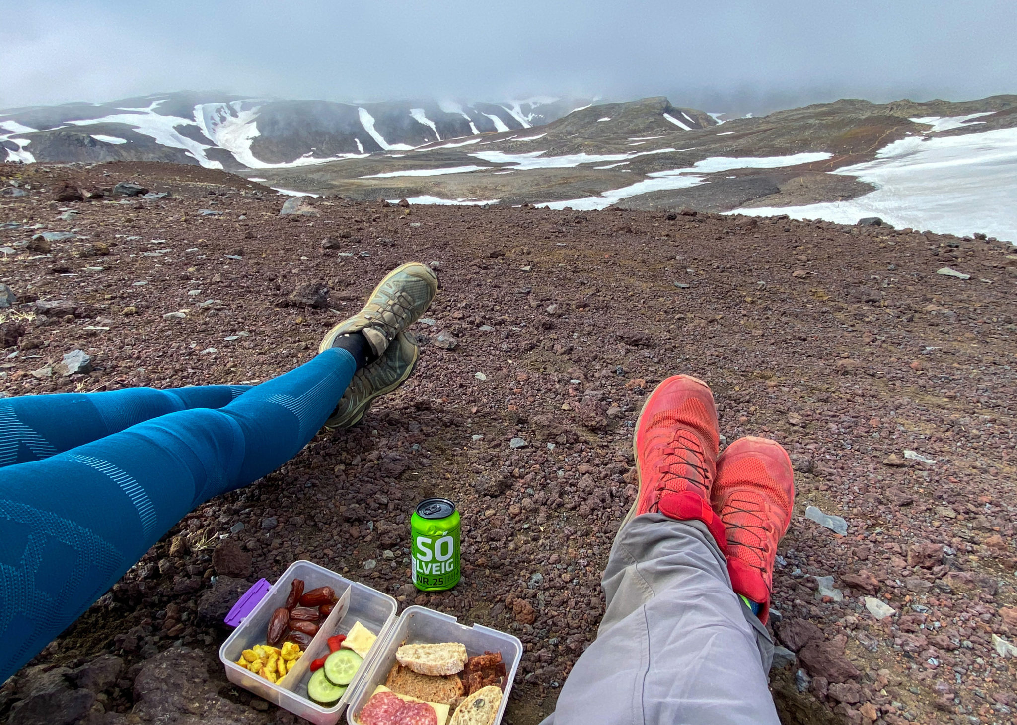
It also makes for a nice lunch spot.
Past the hut we continued to gain elevation and crossed several snowfields en route to the route’s highpoint, a small peak called “Móði” which was created during the most recent Eyjafjallajökull volcanic eruption in 2010. I say most recent because the volcano has erupted many times since the “Last Glacial Period” and has continued to form the surrounding mountain range with each subsequent eruption. The March 2010 eruption threw enough volcanic ash into the atmosphere to shut down air travel in northwest Europe for several week-long periods.
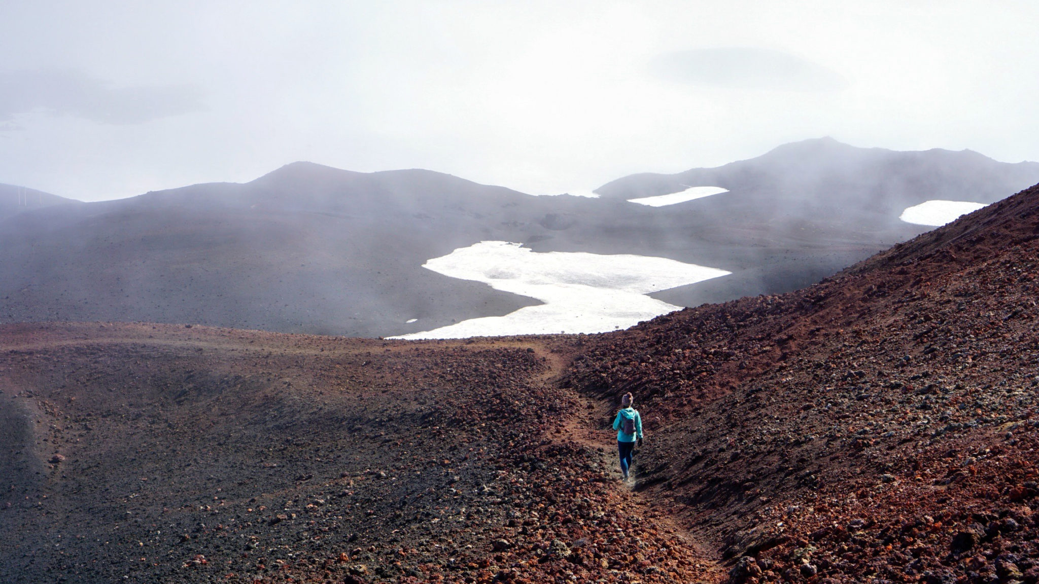
A faint trail leading the way through the pumice fields. Click to enlarge.
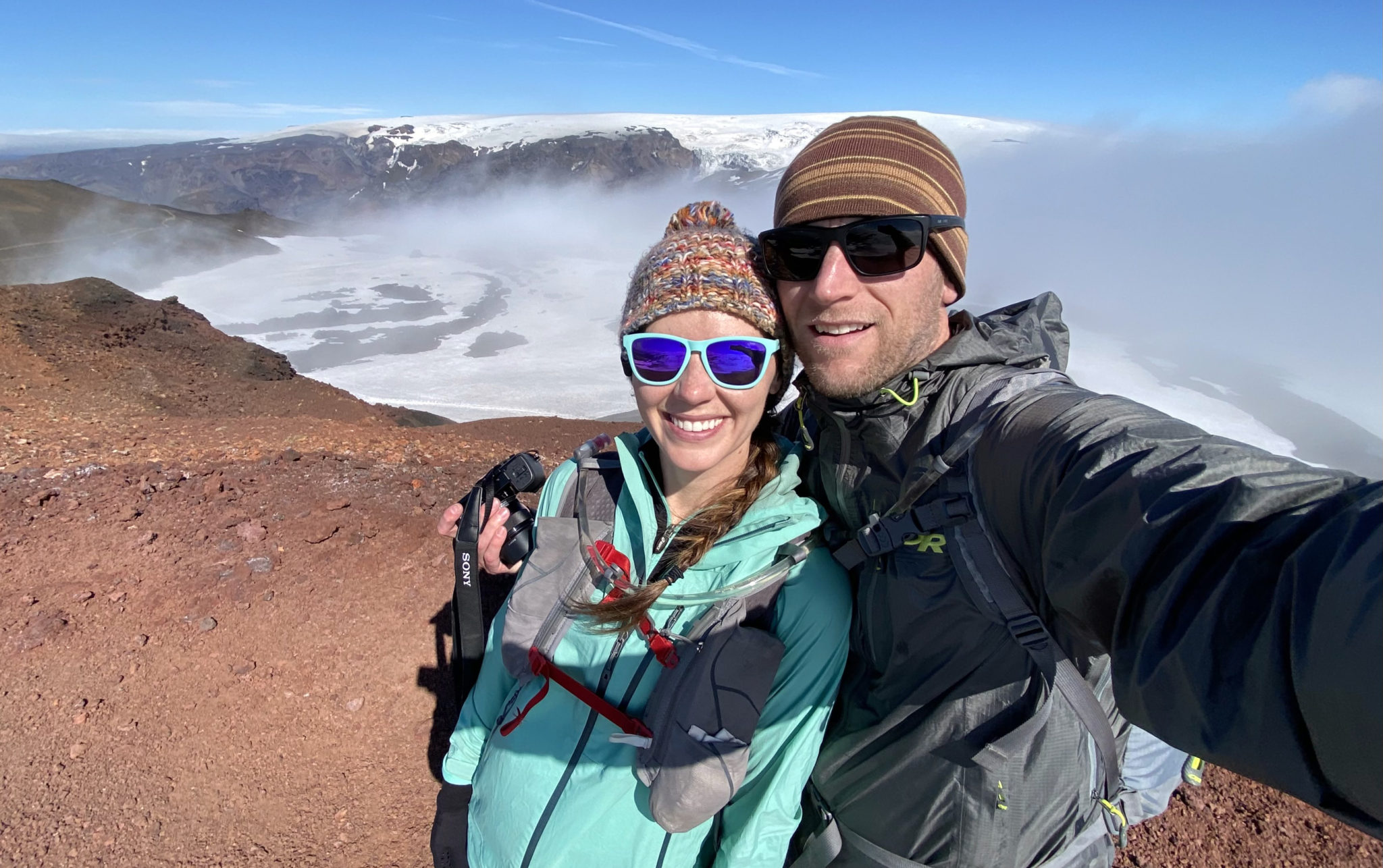
We made the summit of Móði (3,707 ft) just as the fog cleared and sun came out, revealing views of the surrounding volcanic ice caps and glaciers. Cool to be standing on a peak that’s only 11 years old.
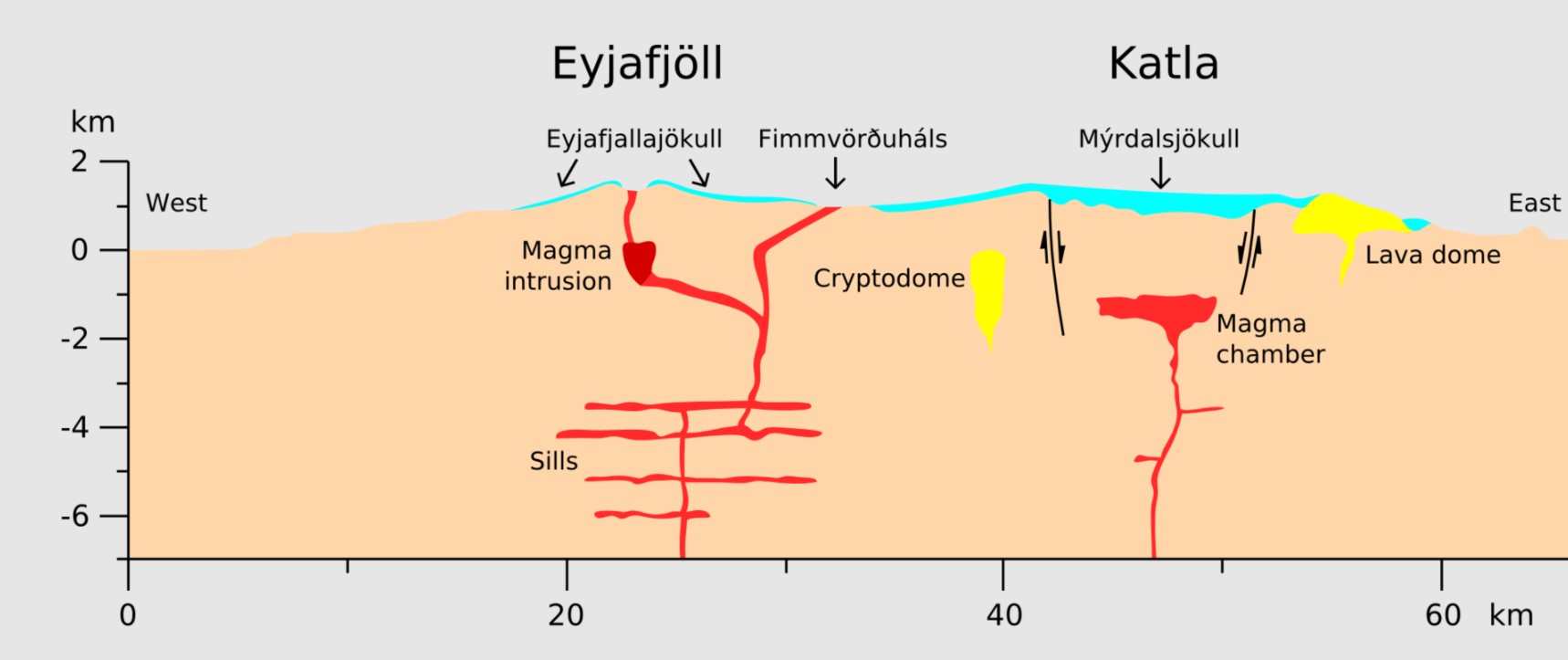
A diagram showing the Fimmvörðuháls route in relation to the two volcanoes, as well as “Katla”, another volcano which last erupted in 1918 and was featured in a recent Netflix series.
Past the volcanoes we began the long descent into the Valley of Thor. The trail flattens out across several long plateaus and we were fortunate to have bluebird weather through this section as the views of the glaciers were unreal.
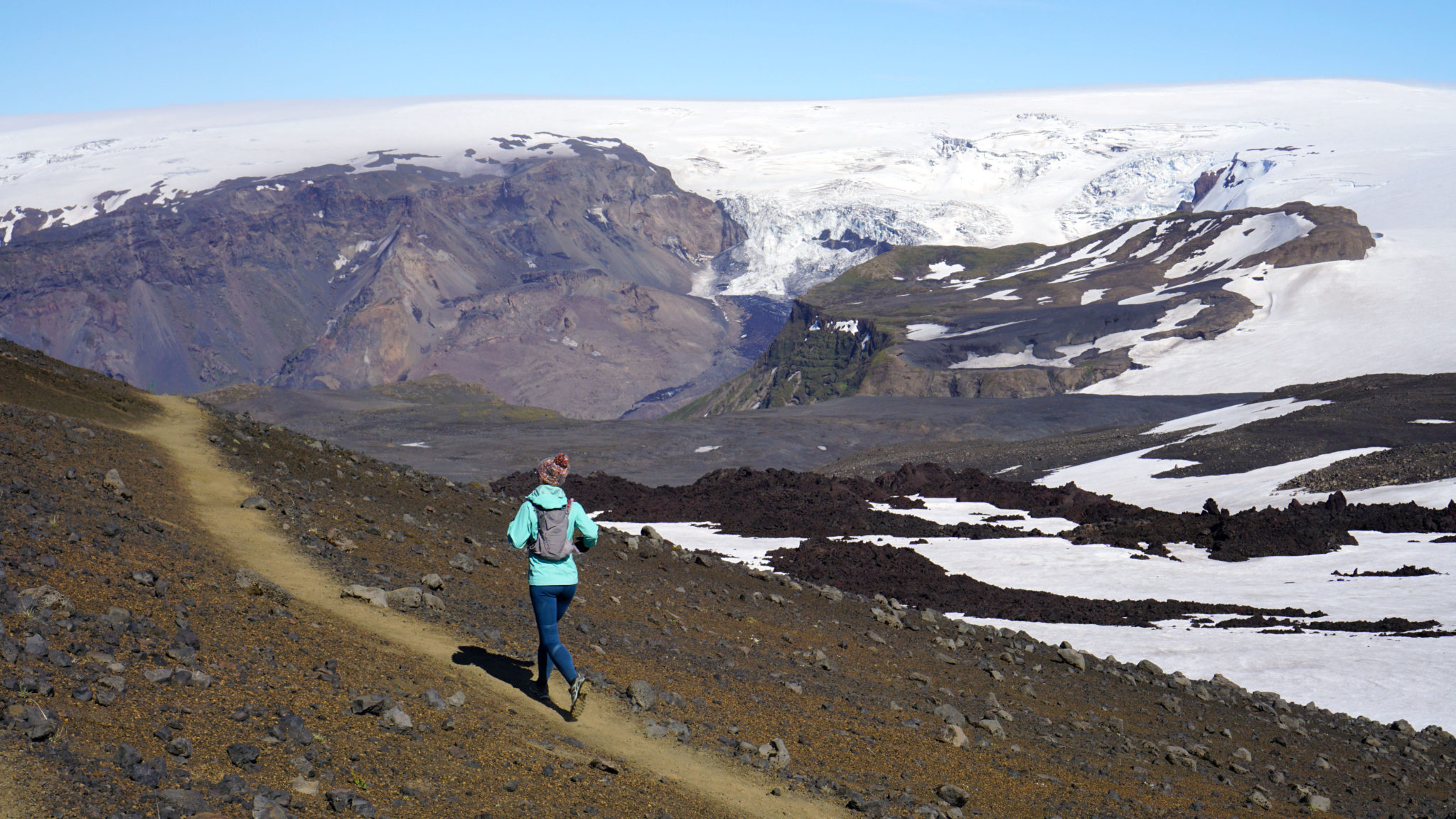
Trying to pick up the pace a little. Click to enlarge.
Our destination coming into view far lower left.
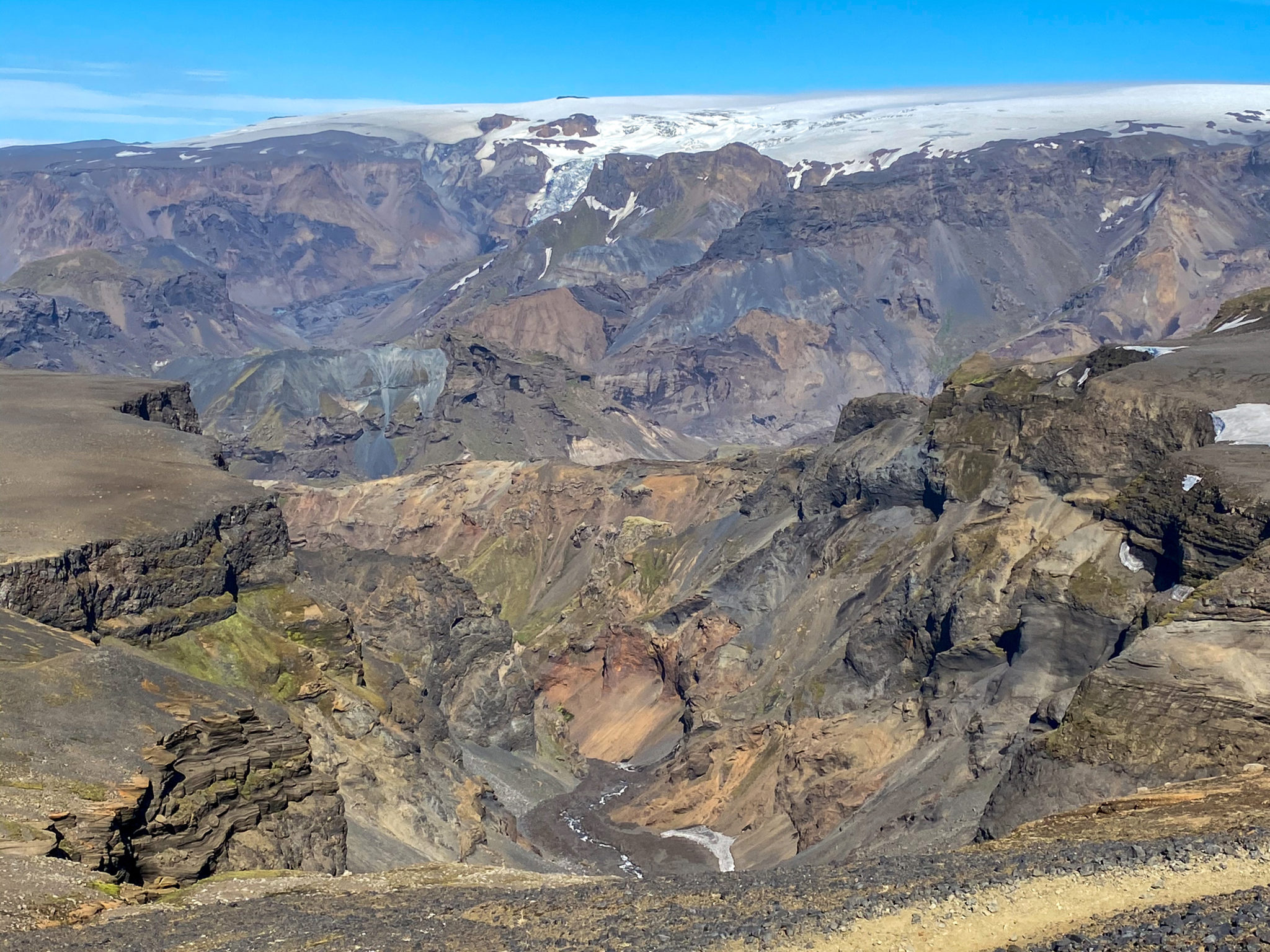
Rugged glacial valleys surrounded us on all sides through here.
Beyond the plateaus the trail descends steeply down into the valley, including a few short scramble sections with fixed chains to hold on to. Thankfully by the time we got to these sections the trail had mostly dried out in the afternoon sun.
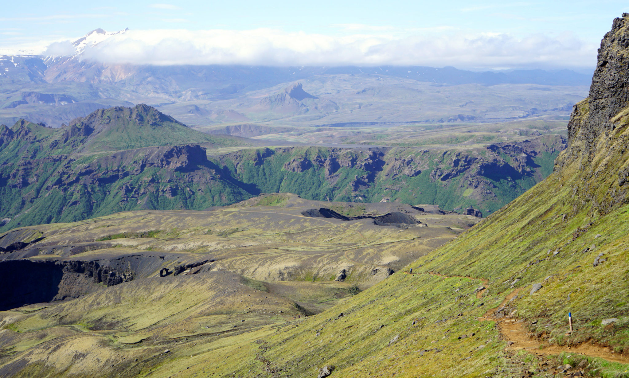
The Valley of Thor. Click to enlarge.
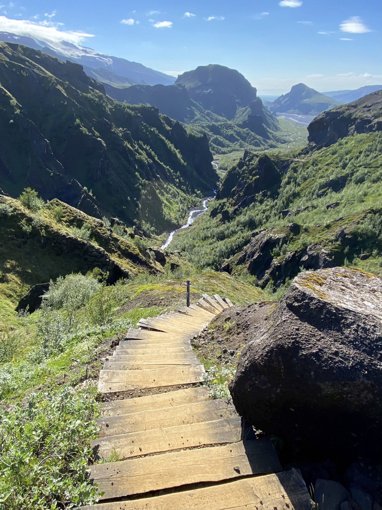
Final descent down into the Krossá River valley.
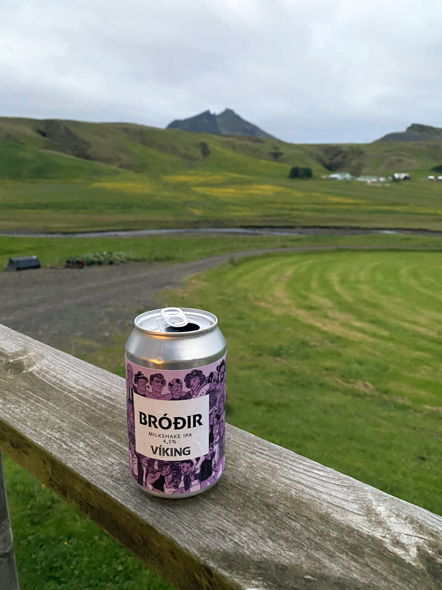
After a fun final few miles through one of the only actual forests we saw during our entire time in Iceland, we arrived in Básar a little shy of 6 hours after setting out from Skógar. With a few hours to spare we decided to continue on to Thórsmörk to buy some beer and chocolate. Then back to Básar, the day’s stats came in at around 19 miles and 4,100 ft.
Don’t forget that unless you intend to reverse the entire route back to Skógar or continue on for 30 more miles to Landmannalaugar, you’ll need to arrange for some kind of transportation back to the trailhead. The Reykjavik Excursions shuttle worked well for us.
Overall this is an incredible route to hike, backpack or even run, although I wouldn’t recommend running too much as there’s simply too much to look at along the way. I’m not sure I’ve ever hiked a more diverse trail in my life and it’ll probably be hard to beat by that metric I’m guessing. If you’re ever in Iceland and looking for a long day, be sure to check it out.
Back at the ranch later that night (pic taken at 12:15am).
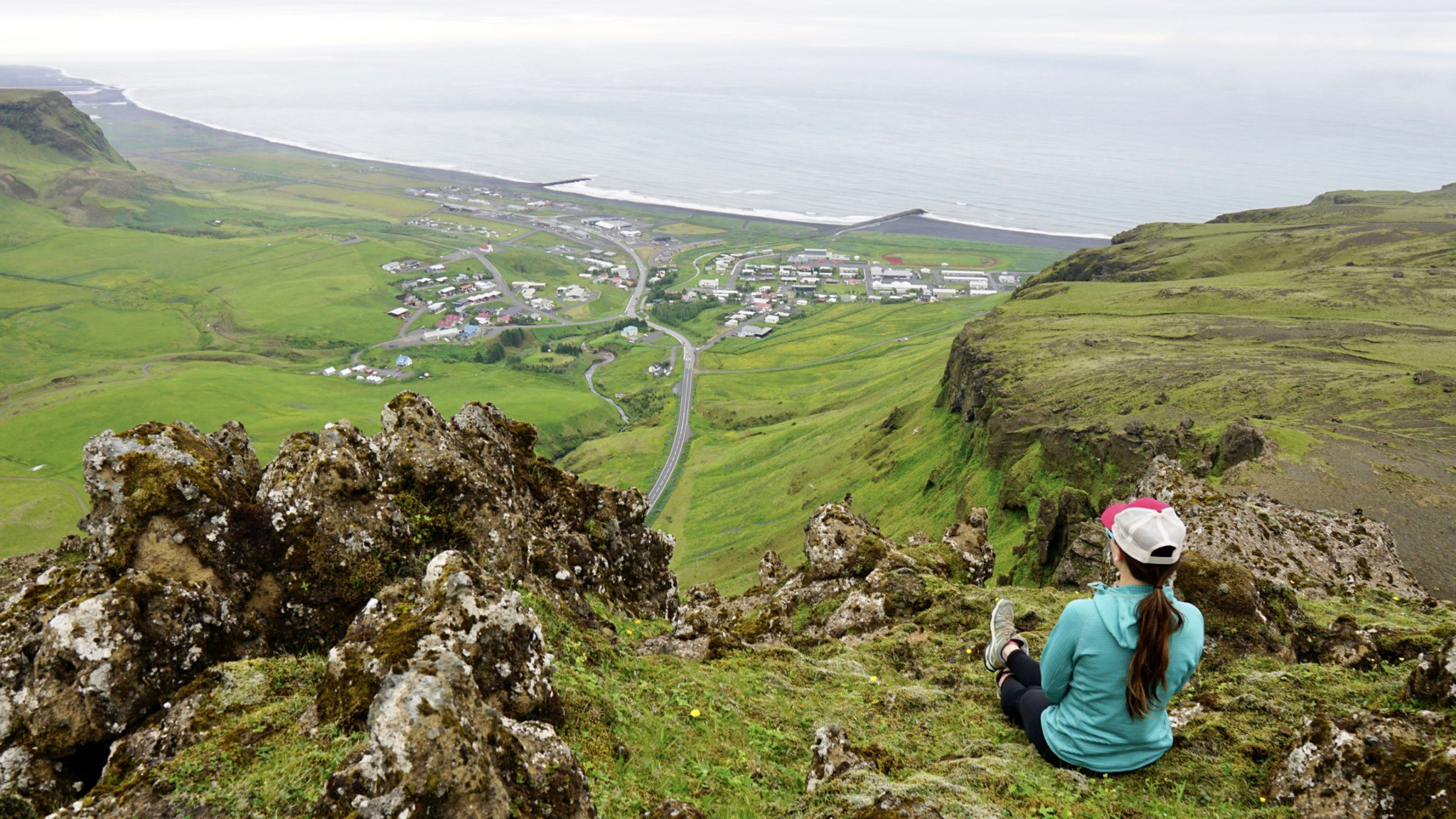
And the next morning near the farm, overlooking the small town of Vik on the shore of the North Atlantic.
Thanks for reading 🙂
What can we say, guys? This is one of the most amazing trail runs on the whole planet. I’m super jealous, as I’ve only gotten to do the first 2 miles of this! The rest looks incredible.
I’m so thankful you both got to do it, and in such amazing conditions too. Iceland is a special place. Maybe one of the most special out there. To get to run through it like this is just such a cool thing. So happy we all got to sneak it in there this summer!
Agreed man! It’s a special place for sure and getting to do this route with the weather we had was a real blessing.
It’d be fun to do the next leg from Thorsmork to Landmannalaugar sometime 🙂