As the holiday weekend for the Rev Martin Luther King, Jr. approached, I decided to take PTO the Friday leading up to it and enjoy some freedom and solitude in the desert. I’d mountain biked portions of Canyonlands near Moab before, but had never visited the Needles District until this trip.
The Needles campgrounds lie well over an hour from Moab, as you have to drive through equally gorgeous Indian Creek area and I arrived after sunset. In the thin desert air, the heat dissipates quickly with the last ray of sun and I put on my layers and my down pants, before pitching the tent and enjoying a quick stroll on some slick rock by the campsite while my pasta cooked. Turning in prior to nine that night, I rose with the first predawn glimmer the next morning.
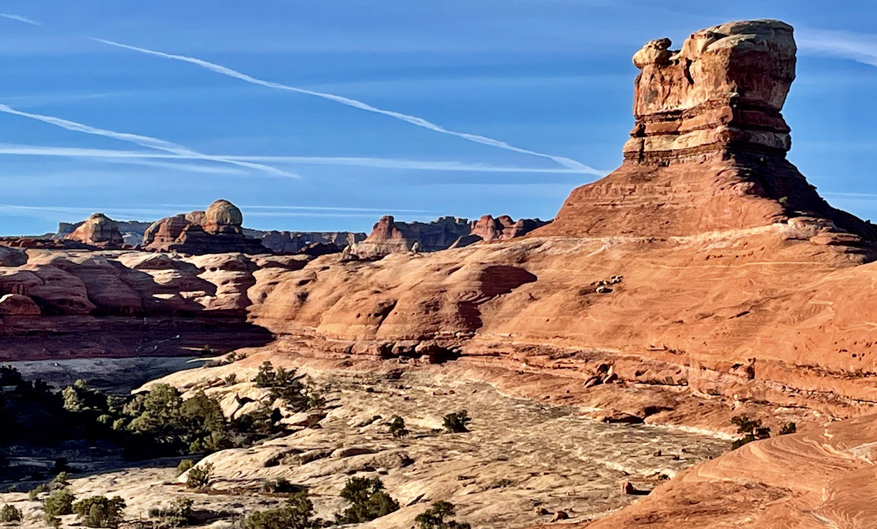
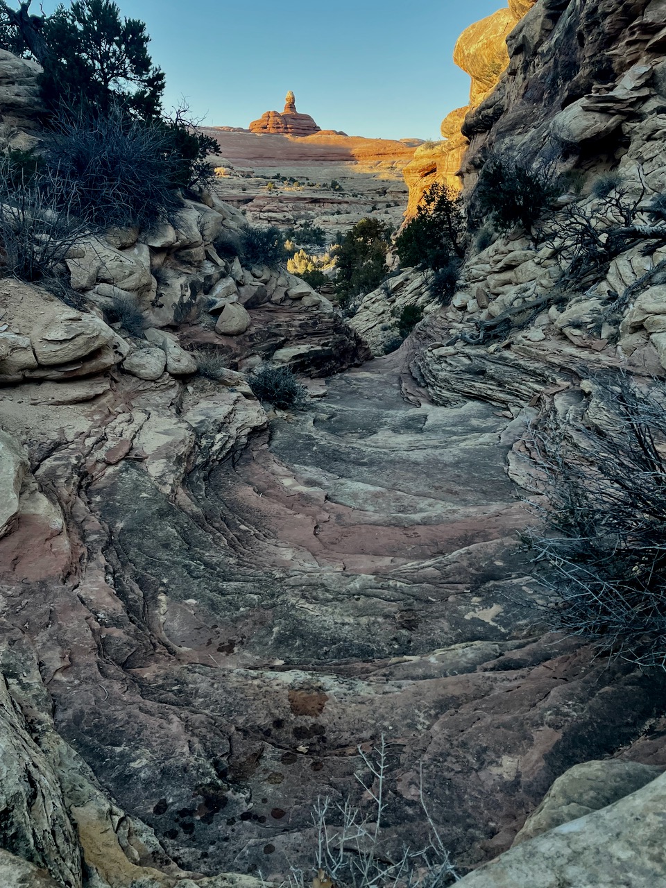
Taking the Squaw Creek trail, I followed the junction to the left for Peekaboo Spring. This superb trail forsakes the sand for the slick rock, sinuously wrapping between the amphitheaters and slot canyons below and the monolithic formations above.
While the cairned route mostly made a serpentine path to curve around the vertical upper portions of the rock, the way passed through the rock in a couple places. Also, fixed ladders afford passage in two crux spots.
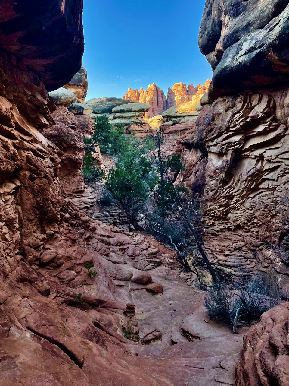
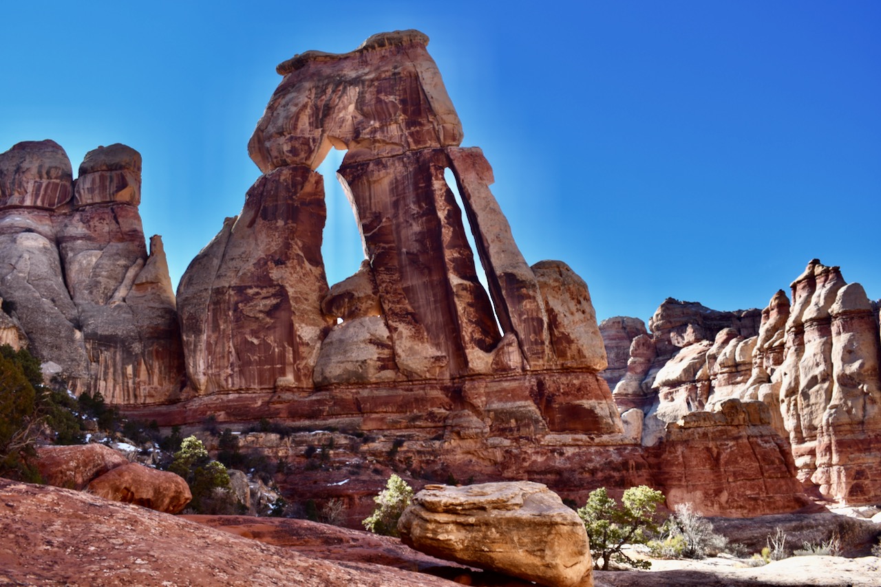
Passing through what I thought of as the “star doorway” on the way back.
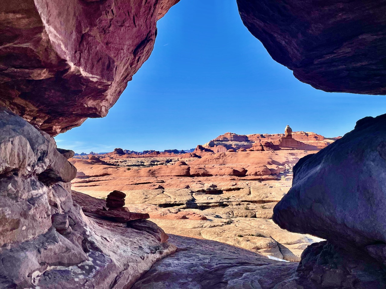
The Peekaboo trail ends by a petroglyph, so I turned back around and reversed my route to the junction of the Peekaboo and Lost Canyon trails. (After, of course, passing through another rock passage near it and walking on a steadily worsening trail for a few miles, just from some inexplicable urge. If you do venture through the neat hole in the rock just beyond the petroglyphs, take a picture and come back.)
The terrain began scrubby and unremarkable, but soon the Lost Canyon trail turned into a narrowing wash that then became a twisting, appealing path through a mixture of rocky and riparian terrain. The trail culminated with a climb into a broad amphitheater to then negotiate a slick rock pass. Because I had dallied a great deal throughout the day, I was able to enjoy this spot with low afternoon sun.
From here, it was several easy miles back to camp, and the best part, of course, was descending the slick rock to reach the desert floor. The walk was magical in the dwindling light.
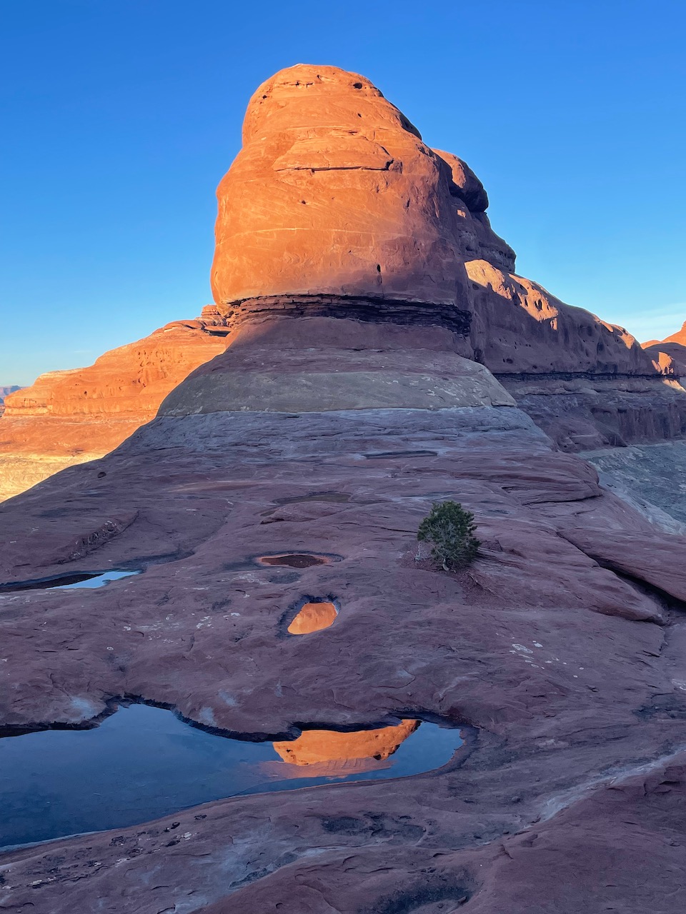
I got back to camp just before dark, started a campfire and started my dinner. I’d been alone the night before, but now I had neighbors at the adjacent campsite. A tall, robust guy with red cheeks and a bushy brown beard beneath a Utah Jazz beanie walked over. He introduced himself as Jeb, and we talked about the day and I showed him my pictures. He grinned widely when he saw this last photo.
“That’s GPS 287!”
“What?” I asked. Jeb put a hand on my shoulder, and educated me on another outdoor pursuit, one with much more stringent requirements than peak bagging.
GPS stands for “geological phallic symbol.” That formation was GPS 287, meaning that it was ranked 287 by prominence out of the 1,000 ranked GPS’s in Utah. Jeb had not yet climbed GPS 287, but he’d got the top 100 and then a dozen other or so of the top 500.
Besides the fact that most of these rock dongs are towers and require rope, perhaps even aid climbing, there are strict rules for ranking them. The first rule: size matters. Each GPS must have at least 300 feet of vertical rise on all sides. The second rule, Jeb said, is called “penis envy” by some and “no circle jerk” by others. It stipulates that each ranked GPS must have a quarter mile of separation from the nearest other GPS, so where phallic formations cluster, the biggest dick wins.
After this elucidating conversation and many other bits of nonsense over the campfire, I went to bed. The low was 22 and even the fire and Jeb’s hot air could no longer keep me warm.
Sunday morning, I awoke with crisp, chilly daylight once again. I skipped the camp coffee and drove the 3 miles or so from Needles Campsite A to the Elephant Rock trailhead. This dirt road makes tight, blind curves in a couple places, but is an easy road otherwise and does not require four-wheel drive.
This trail climbs up to a slick rock pass and then drops by a sudden constriction on the other side. In the light of morning, it was a gateway to splendor.
One defect of my route the prior day was that hiking Peekaboo in the morning, I walked into the glare of the sun. The first junction offered the Druid Arch out and back to the left, or straight for Chesler Park. I continued straight. Another junction presented a left to venture into the interior of the broad, flat grassland of Chesler Park or forward toward a trailhead. I kept on toward that trailhead, and kept the sun behind me. This loop led closer to the spires and rounded formations on the northwest edge of Chesler Park, and alternated between grassy or sandy flats and steps over and down the rounded slick rock bastions that jutted from the ground.
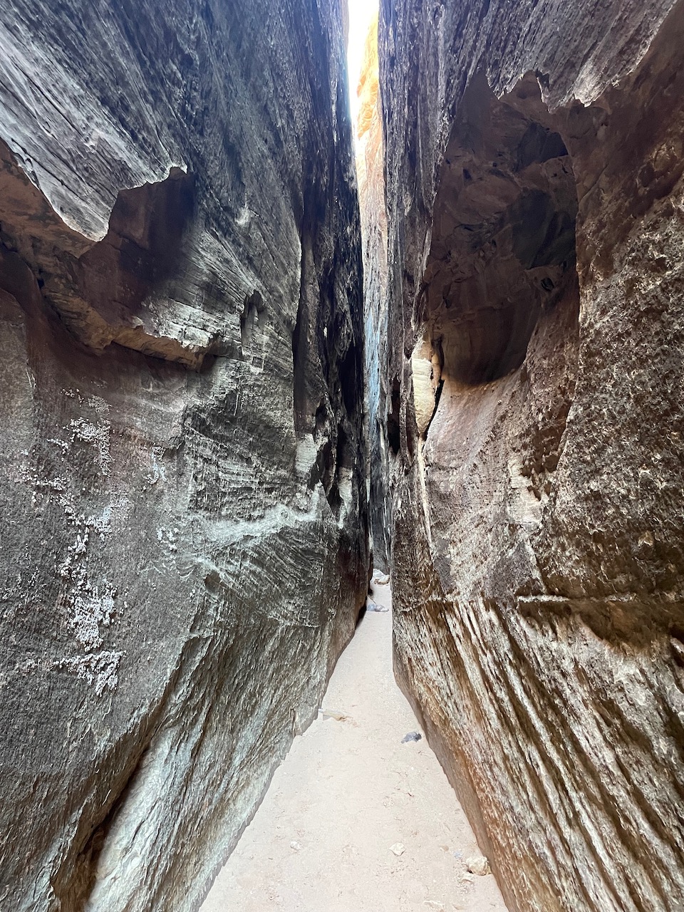
Another trail junction presented a left turn to hit a jeep road and after walking a 3/4 mile length of that scenic road, I found myself at the start of the Joint Trail. Joint, because it leads to a grand cluster of monoliths that form a system of pseudo caves, short tunnels, and a 200-foot-long slot only shoulder-width across.
It got pretty windy through here.
Steps on the far side of the slot led up and then I took a quick signed detour to the right for an overlook of Chesler Park. A quick scramble up some carved steps in the slick rock led to a vista of the northern area I had traversed earlier, pictured below, as well as views east which were not good, due to the position of the sun.
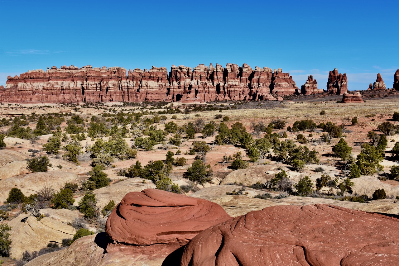
A nice vista.
After returning to the emergence from the slot and taking the trail on its course northeast, I moved faster to cross the flat, uninspiring grassland. (I read it’s better in spring, with wildflowers, but also more people.) After a mile and a half or so, the trail reached more interesting terrain, and began to wind underneath cliffs. Soon enough, I came to a turn for the out-and-back to Druid Arch. Only two miles, up a dry wash with a floor made of the same purple and gray rock that forms the Maroon Bells. The Park Service built tiny trails that jut here and there from the wash, only to rejoin it, and I found it most expedient to just follow the wash. That can be done on the way down, but I don’t recommend it for the way up, as the way became blocked by a tangled maze of pools and bushes. A cairn on the left marks an important departure from the wash to a path above it, which leads to a steep and winding way up broken rock, and then just a short walk to Druid Arch.
Druid Arch.
I took in the view of the arch for a few minutes and then descended back the way I had come. Beautiful as today and the prior day were, I did not relish a third frosty night, and I had decided to at least start the 7 hour journey home tonight.
As with my drive into Canyonlands, I found myself racing daylight on the way out.
Dang, Steve. Really got me missing the desert over here. Looks like an awesome trip (sand Jeb’s verbal ejaculations). We’ve never been over to that side of Canyonlands, but it looks stunning to say the very least. This is inspiring me to plan our next Moab outing. Thanks for sharing!
Steve,
I was rolling in Sunday afternoon to the campground after leaving Bluff for the Ballon Festiva.. Hiked just to Chesler Park and back on Monday, but plan to be back. Really want to hike Druid Arch and take my motorcycle up the Elephant Hill 4wd trail.
Cool, Lloyd. I imagine that 4×4 road would be fun on the bike. When you do it, you can ride to the joint trailhead and get a quick out and back through the joint to the overlook-or a long put and back to Druid arch from there.