I think Ben and I changed plans 4 times for this trip, because of the vagaries of mountain weather forecasting, and barely finalized our itinerary before it was time to start it. This was the right weekend to visit Crested Butte – after wildflower season, after Labor Day, and before Leaf Peepery. Riding with me from Denver to meet Ben in Crested Butte was my adopted son, Carmine, who had turned 16 in the last couple of weeks.
(A note on pictures: most are Ben’s and a few are mine.)
The Whites, September 9th
The approach began very easily, as we proceeded up the excellent Copper Creek trail. After an hour, however, we had to find the place to leave it and nothing looked great – we just found a way up the steep forested slopes that overhung there road to get up to Queen’s Basin.
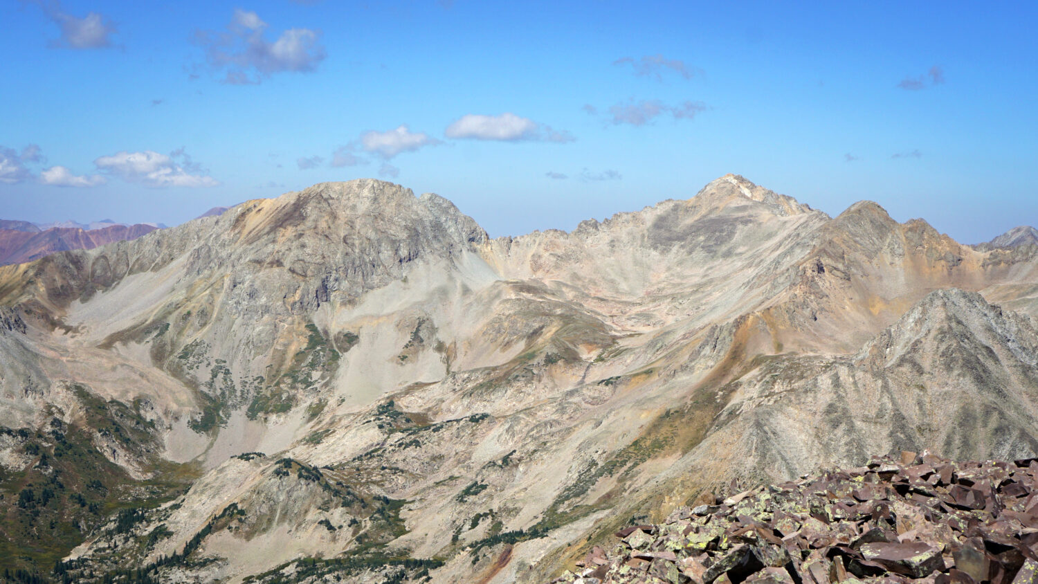
After the trees thinned, we followed a dry watercourse to the alpine grassland of upper Queen’s Basin. Here it is from Ben’s view looking back and then mine a bit further up, scanning the way to White Rock Mountain.
White Rock approach.
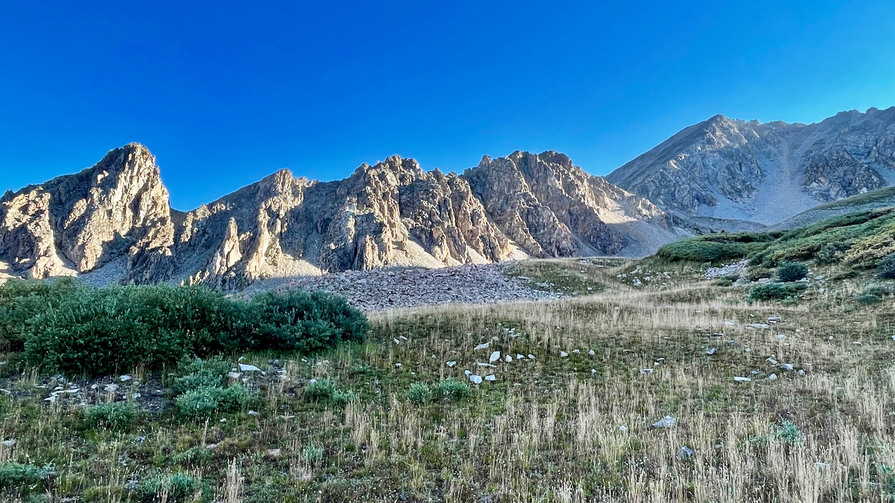
Upper Queen’s Basin and White Rock Mountain (back right, left of the gully).
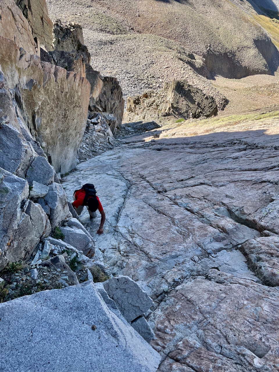
As we neared the ridge, the grass began to give way to talus, and we took a break on a small green grassy triangle. Carmine pointed to the connecting ridge from White Rock to White BM, saying we should traverse it. I said that would not be our route, as the rock was reported to be terribly loose, and Ben patiently explained how he’d worked for years with me to restrain my POMRainian tendencies.(POMR=path of most resistance) While I agreed readily to all Ben said, I also pointed out our path to gain the west ridge: instead of a left angle up some tedious-looking scree, we’d go up some solid rock to the right to gain the ridge – nothing more than class 3 scrambling, maybe a touch of 4.
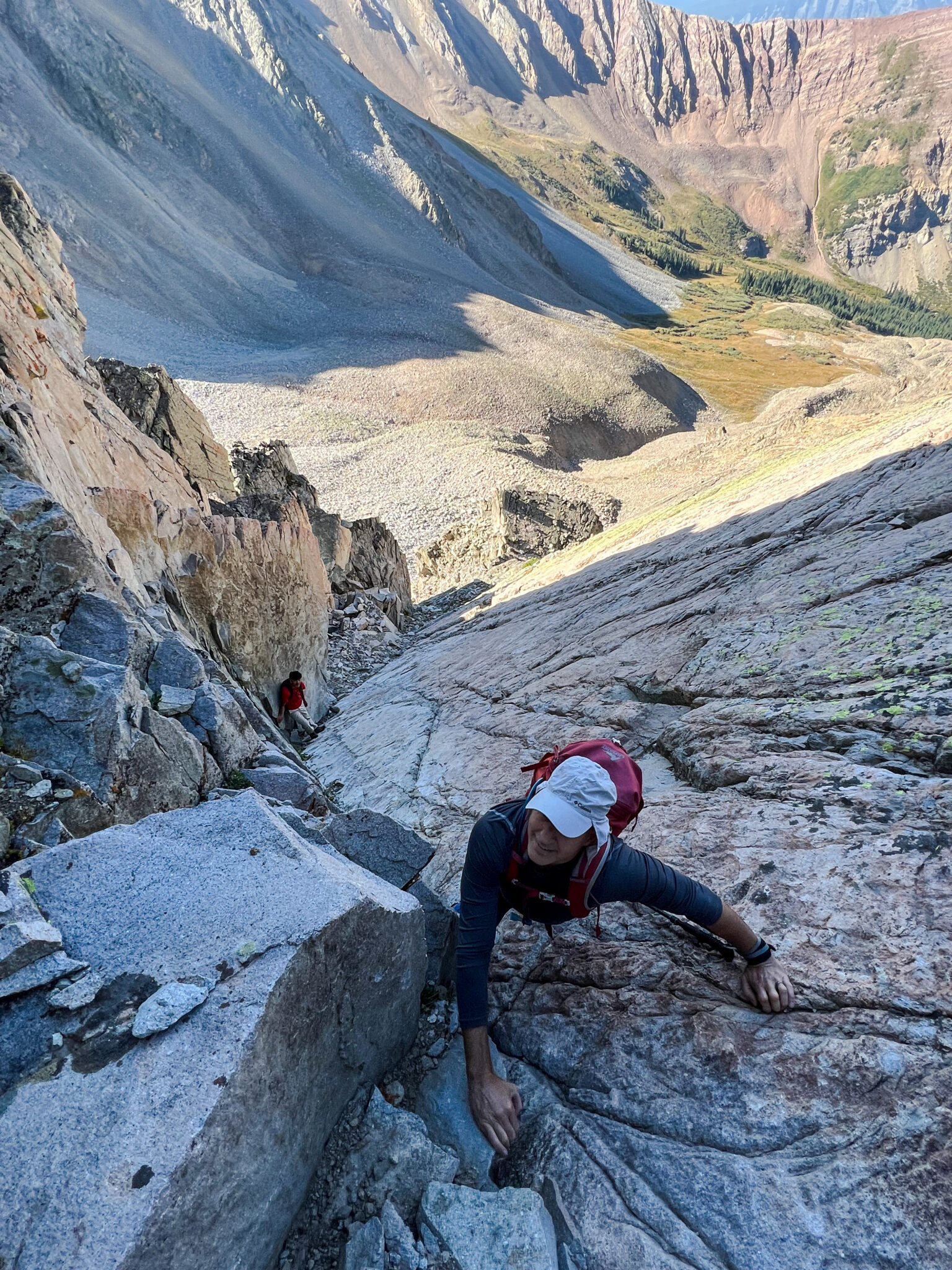
Me on the slabs to the lower west ridge of White Rock.
Ben didn’t complain, but opined that we likely hit some class 5 easy, instead of only 3 or 4. I had to agree as a couple places required me to make extensive use of the convenient crack along the right edge of the slab, and I negotiated one spot with an undercling hold with the rock wall at the right. But we all agreed that it was both fun and put us in a better spot along the ridge than if we had gained it lower down.
Carmine on the slabs to the lower west ridge of White Rock.
That was the only excitement to the summit of White Rock, and then we enjoyed the views of its familiar and more famous neighbors to the north. Carmine and I just gazed around, while Ben captured a couple panoramas.
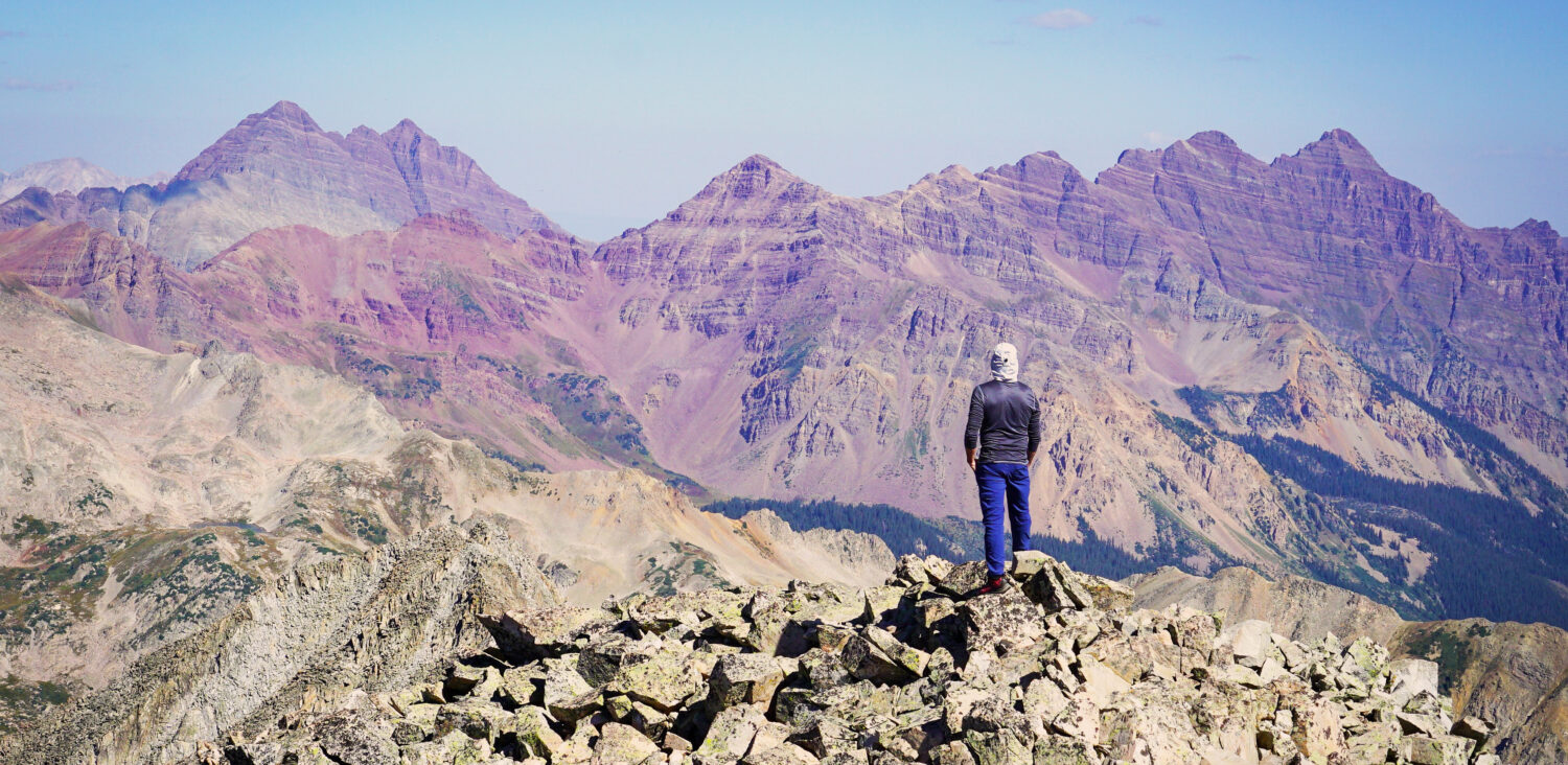
Great view of the Maroon Bells far left, as well as the long ridge of triangles leading to Pyramid Peak far right.
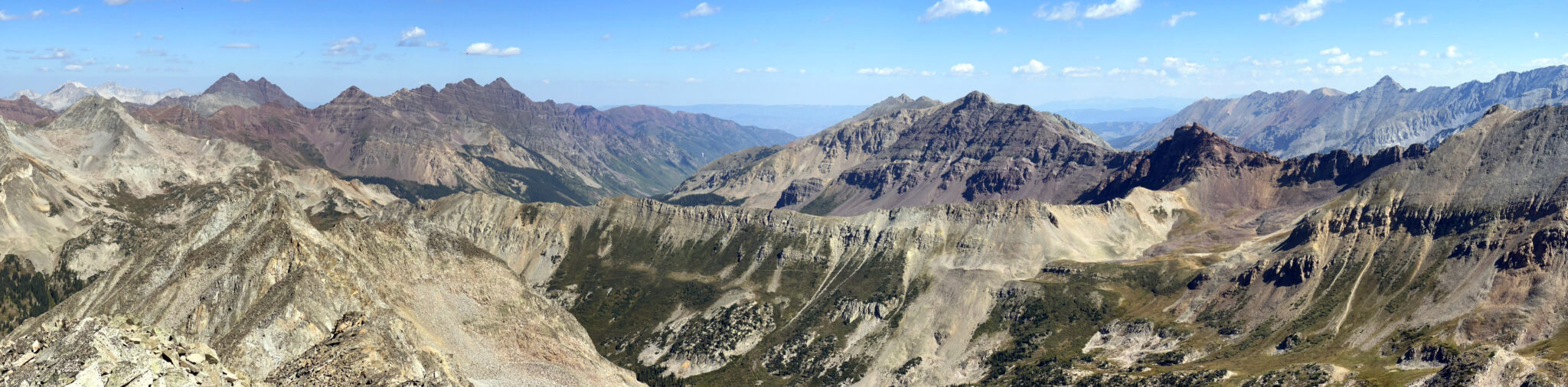
White Rock summit pano. Click to enlarge.
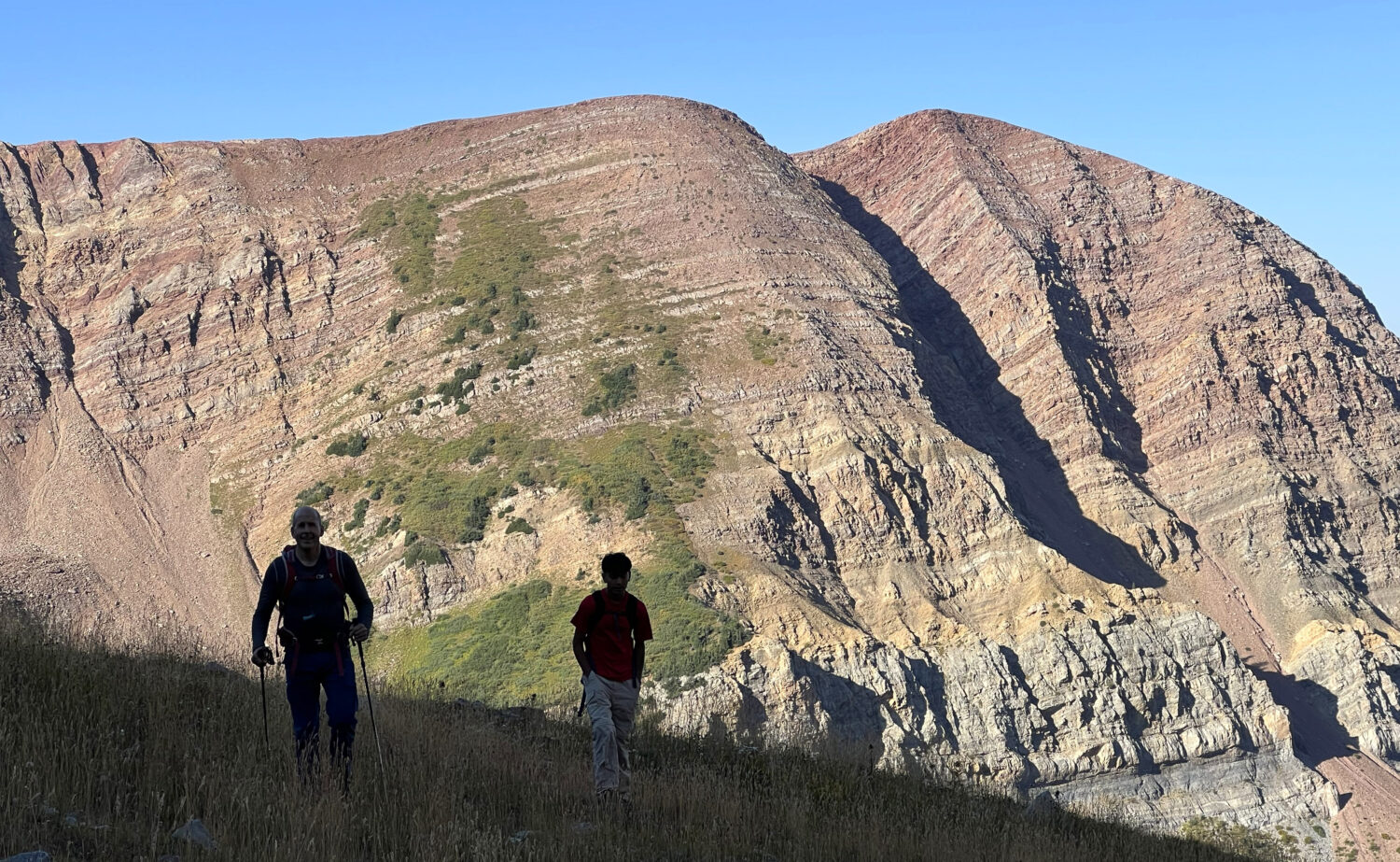
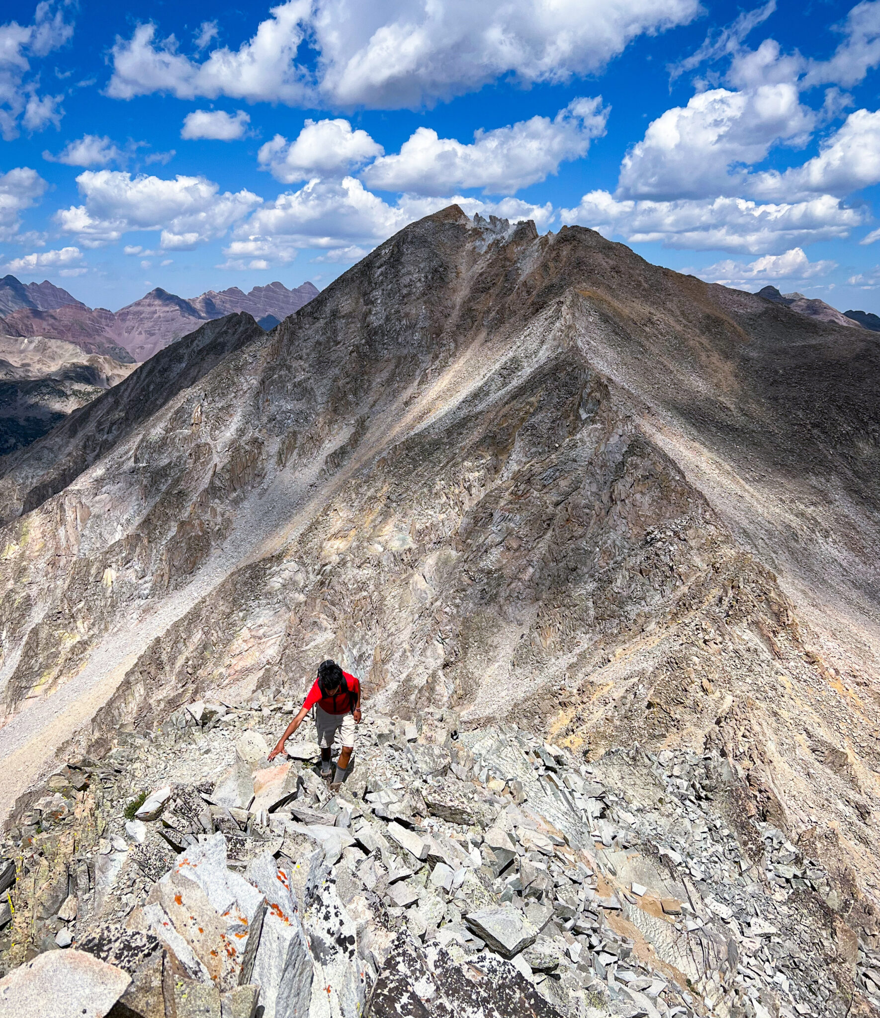
After enjoying the sunshine and scenery, we continued to White Benchmark. Yielding to Carmine’s suggestion to stay to the ridge, we decided we would proceed cautiously and backtrack or descend as needed for safety. Before this day, Carmine had only hiked one thirteener with me and a half dozen twelvers with a wilderness program. Our first task lay in finding our way around the crumbly white pinnacles that may as well be made of chalk. This part was my least favorite, for sure.
Carmine (lower center) and Ben (right of center) enjoying the side-hilling across the shifting detritus. I think I called it Beezlebub.
After this and to our great surprise, the ridge turned out to be more solid than we expected, although you would not tell that by looking at it. We were able to stay on the crest for the most part, and some minor towers were either taken on directly or bypassed the left just (east).
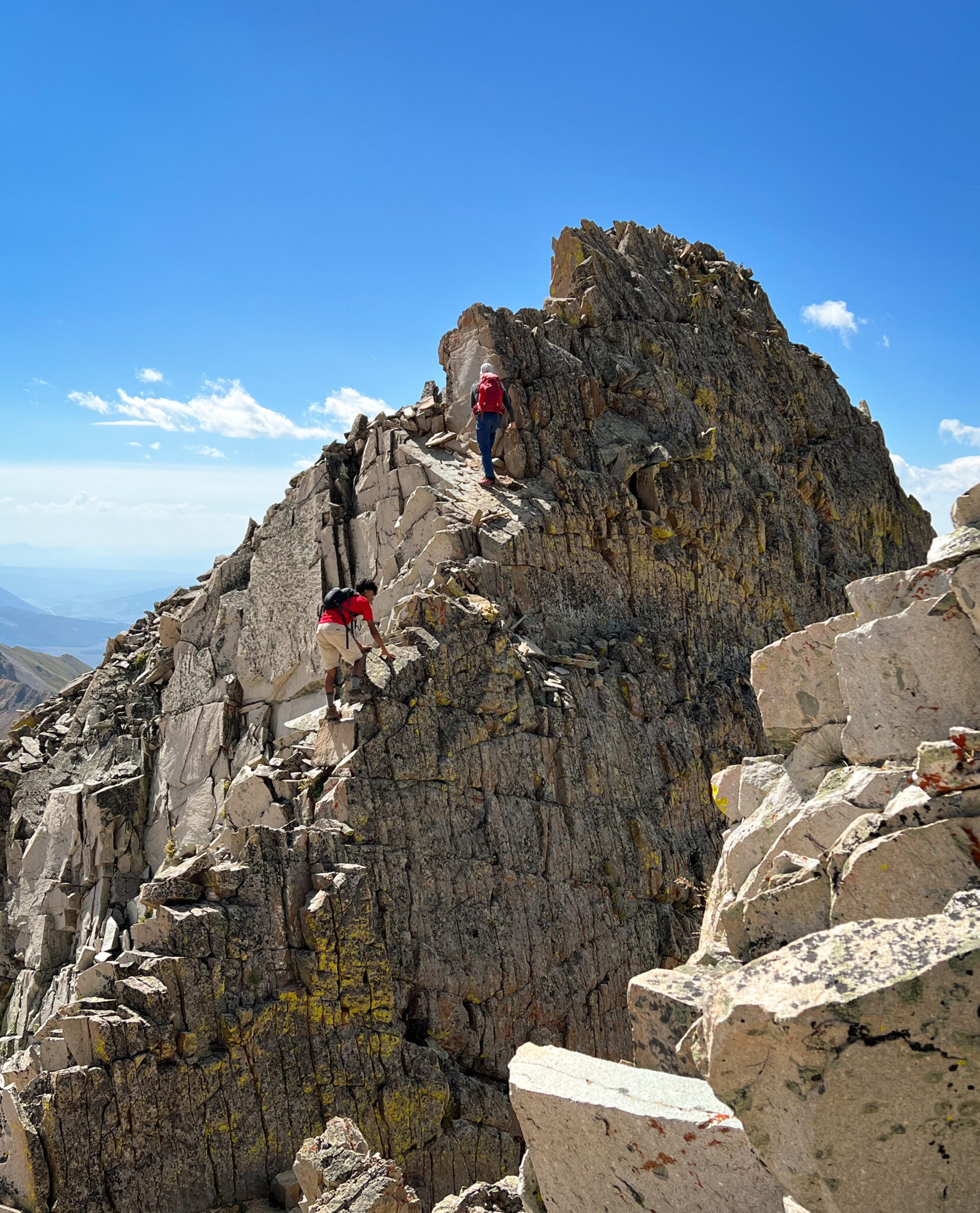
Perhaps the most fun tower was this class 2+ staircase.
After feeling pretty good about the fairly quick and easy progress to this point, we studied the way ahead with unease as White Benchmark came into view. It’s a BM and, while pretty, it still looked shitty. Nonetheless, we persisted – when you gotta go, you gotta go.
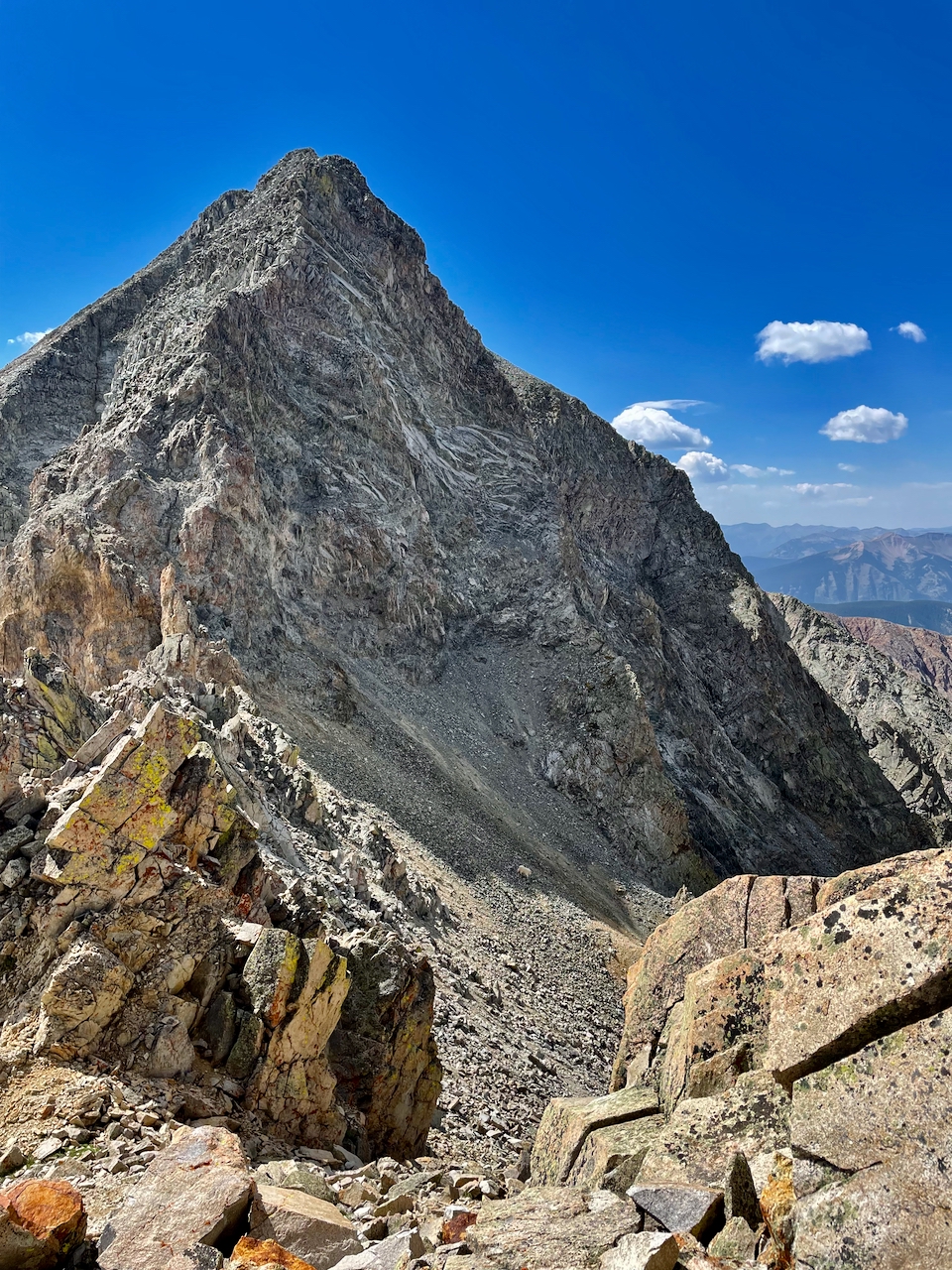
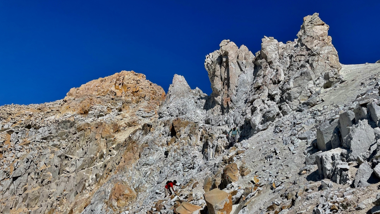
The introduction is over? The final pitch up White Rock BM looms ahead.This section represents the only time we veered right, to go around a pinnacle, to then traverse back left.
We spent a lot of time with route finding and also positioning to avoid rockfall. It had taken only 50 minutes to this point from the summit of White Rock, and it took us 2 hours to reach the summit of BM.
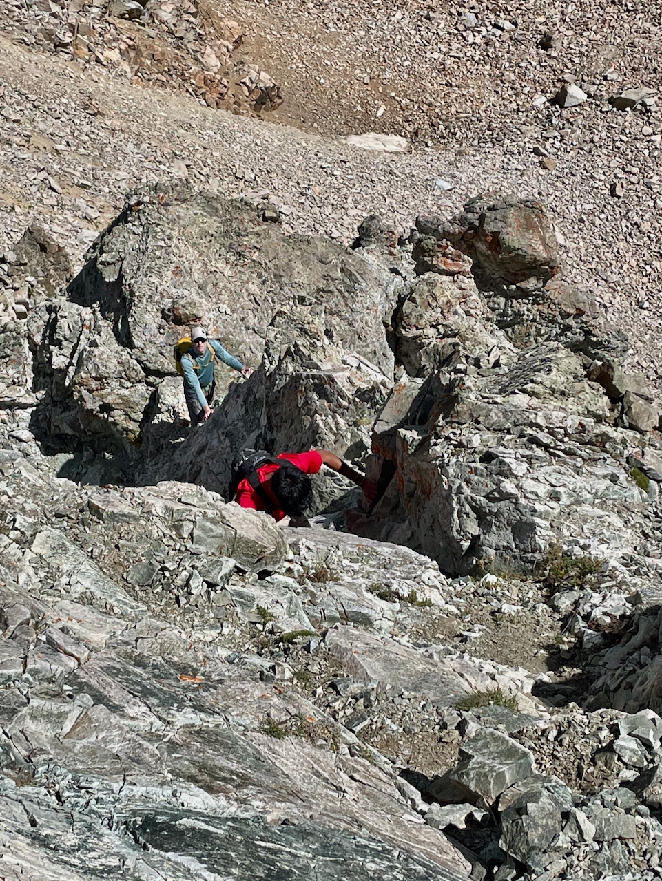
A little class 3 gully filled with mountain shrapnel.
Loose, exposed scrambling.
Near White BM’s summit.
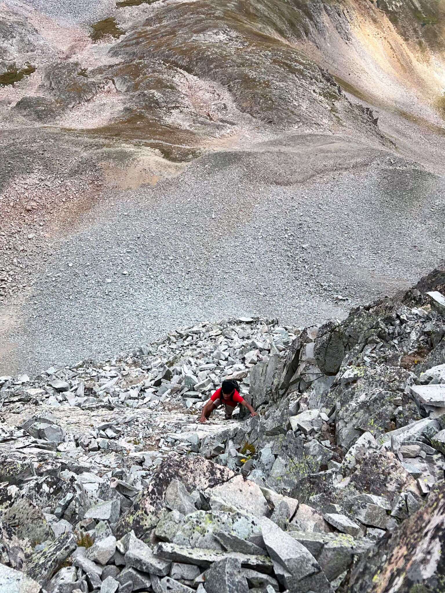
It was only about 50 feet from the summit when I had my most fearsome experience: I nearly killed Carmine. I had been in lead for most of the traverse and not found it hard to avoid dislodging rocks, and I also had found the rock on ridge crest to be usually more solid than the ledges to either side. I put my hand on this large rock that looked to be part of the mountain and exerted downward pressure to pull myself up. The whole thing dislodged. Frozen in terror, I watched the slab nearly as tall as myself teeter downward at Carmine. Carmine moved quickly out of the way and the boulder broke into two before smashing and clattering down the mountain. Ben had moved outward on ledges on the west face, and we followed him up to the summit.
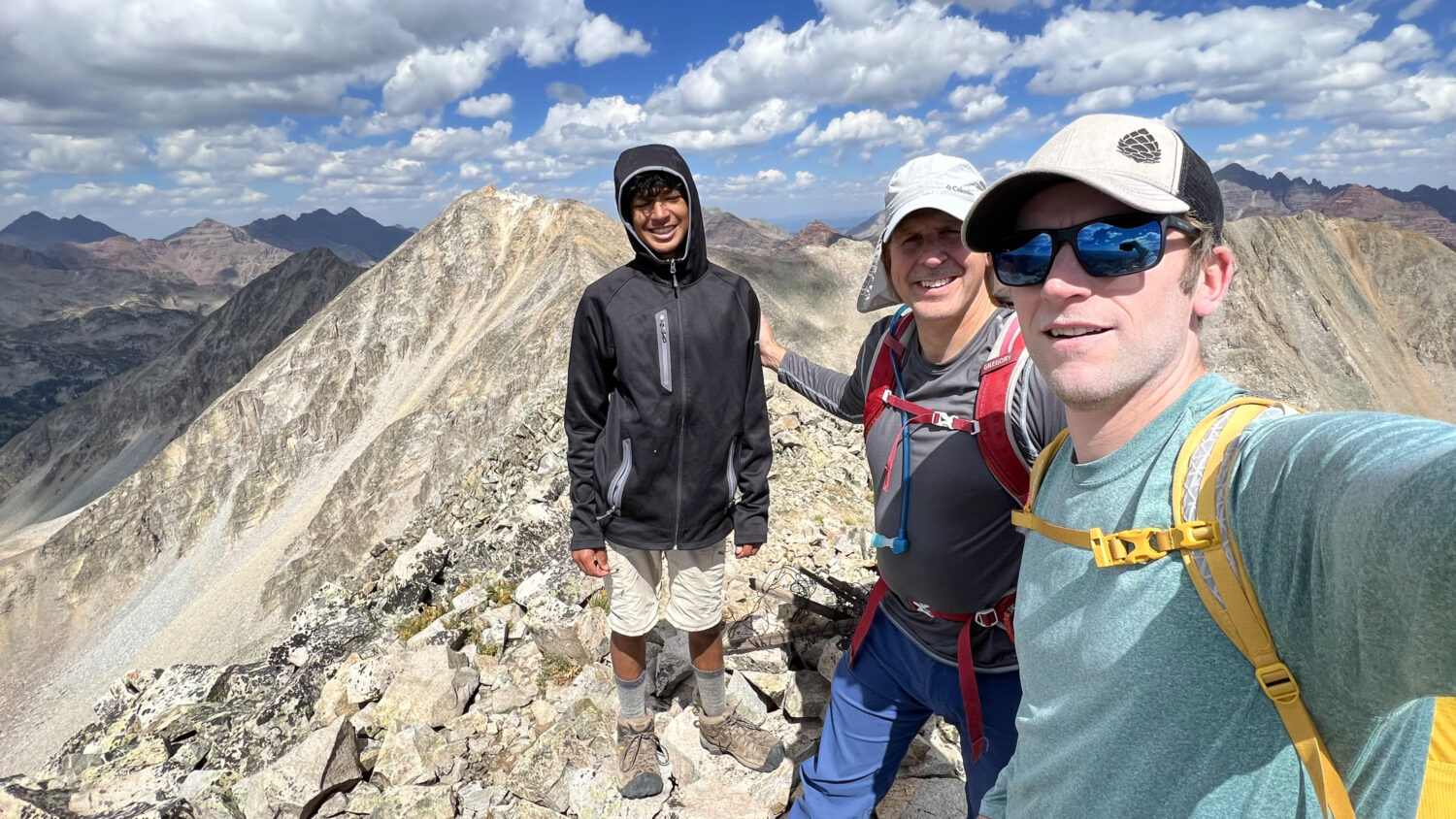
Summit of white BM group shot.
All’s well that ends well, but never underestimate the Elks!
Teocalli, September 10th
This was the easy day – a trail hike most of the way. It began less easy, with a flat tire. That along with a late start from having to drive from Gothic over to the Brush Creek road meant we started hiking late. Ben and I agreed that the West Brush Creek road was not as bad as advertised, and we parked in his Forester at a small spot for 2 or 3 cars right before the stream crossing. We agreed we could have made it beyond that part, after hiking it – but walking back in the stream to cool our feet was nice at the end of the day.
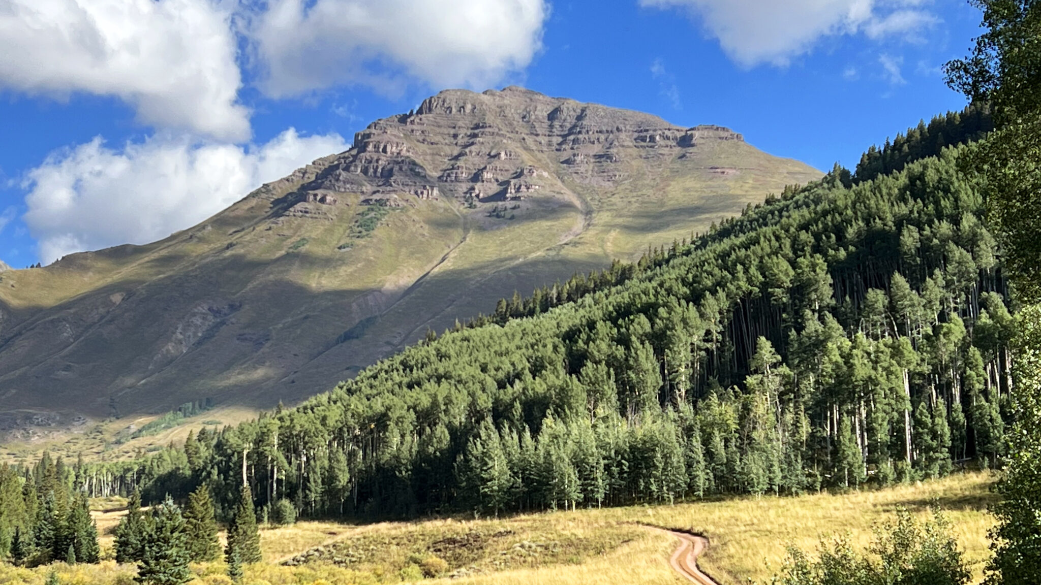
Teocalli on the approach.
Although one of the shorter 13ers, Teocalli is a broad mountain and the route circumnavigates it. After following the road beneath the entire southwest face, we then took the Teocallii Trail, which feels almost like reversing direction, as it cuts across that whole face on it’s moderate climb upward. On the south ridge, a trail junction marks where the main trail loops back to meet the road much farther down, and a climber’s trail that quickly emerges from the trees and declines. “This isn’t a trail, Steve,” Carmine exclaimed. “It’s just where the water runs when it rains.” I believe he is correct.
After climbing steeply directly north, the trail then contours along Teocalli’s southeast flank, to avoid the upper cliff band. After that, it was time for more uphill work as the terrain that had remained grassy and amenable up to this point abruptly terminated in a creased ridge with a sheer drop on the north side. This spot afforded a splendid view into the upper Middle Brush Creek basin.
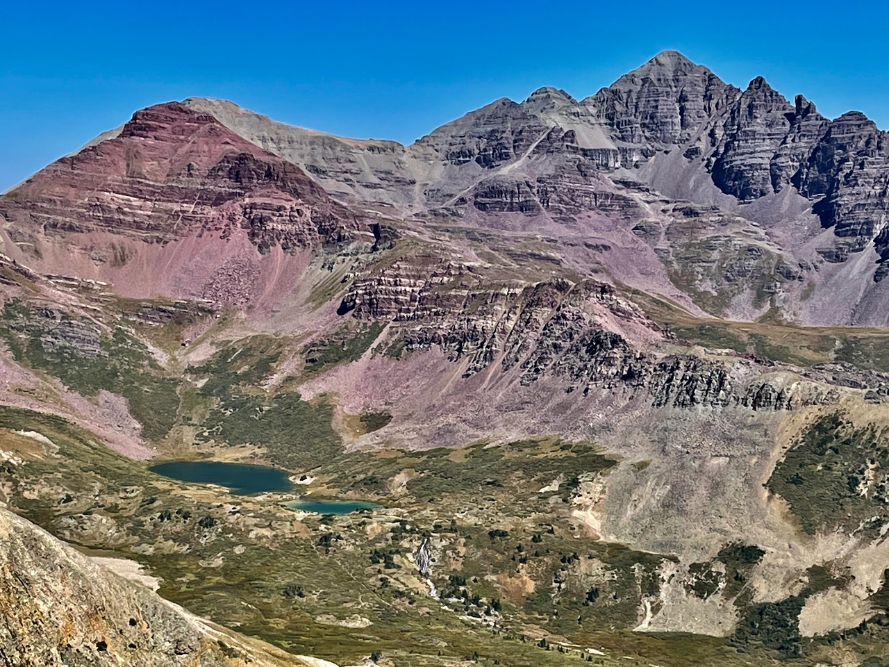
View of Twin Lakes and Castle from Teocalli’s shoulder.
While the approach and lower portion of Teocalli had been more pedestrian, this upper part was fun. While still nearly all class 2, some minor scrambling and winding among the cliffs made for an interesting finish. Ben had been waiting at the top for so long for Carmine and me, that he had already taken all of his pictures.
White Rock Duo from Teocalli’s summit.
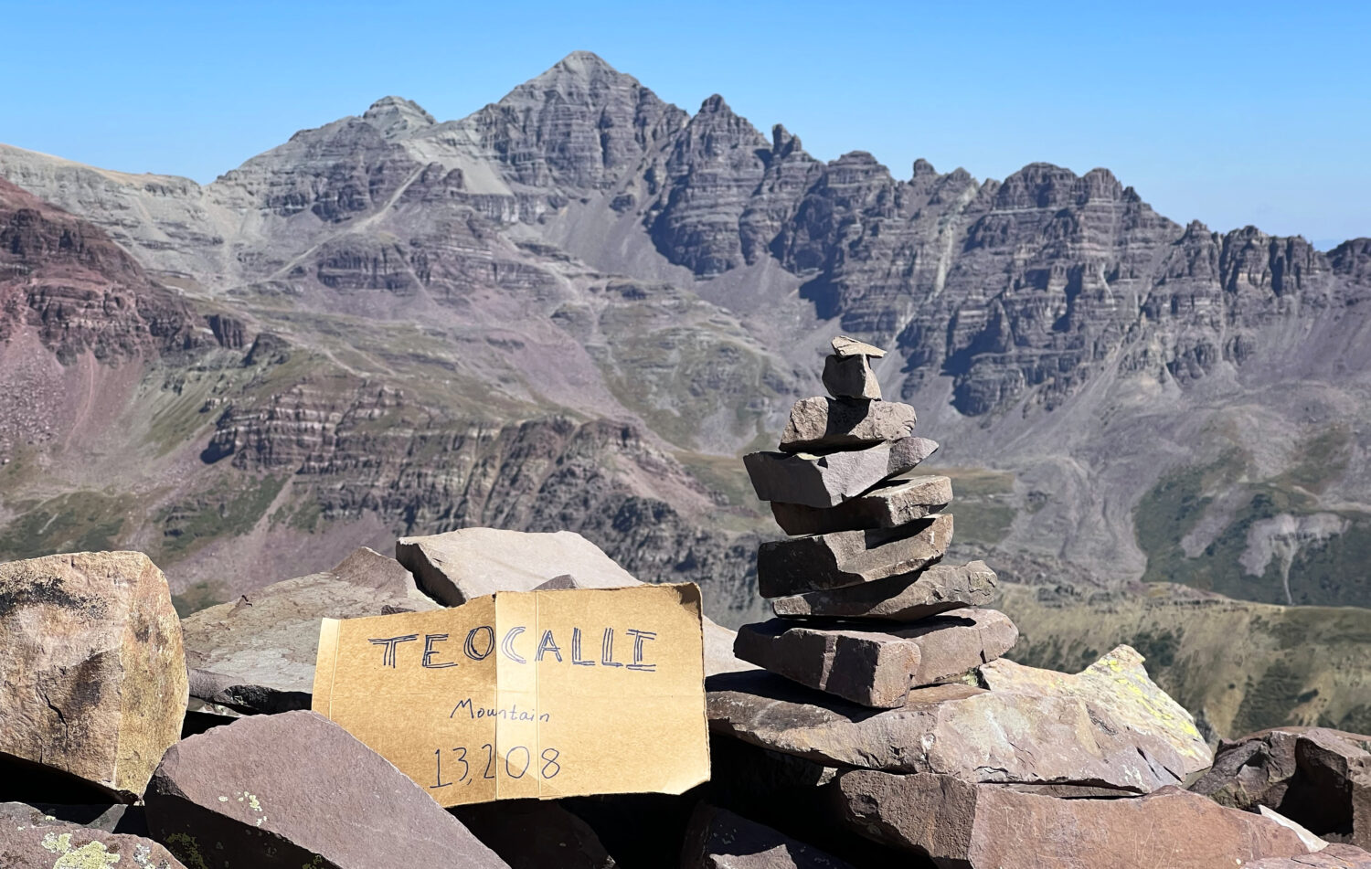
Teocalli’s summit looking at Castle.
Teocalli means “great treasure” in the Quechuan language spoken by indigenous people of South America (in Peru and Bolivia, and I’m not sure where else). I will treasure these two days, among many other mountain memories I have collected. Thanks for reading.
Looks…..fun?? Haha, nice write up, Steve. I’m glad to see that Carmine seems to have a head for POLR tendencies already. I think you owe him a trip up some Sawatch 14ers next. 🙂 But glad you all had a good outing on some obscure peaks. Looks like some sweet solitude!
Nice writeup Steve. Thanks for getting me out on some of the only real scrambling I’ve done all summer. Glad you didn’t kill Carmine and we got to enjoy some solid rock, nice views, and solitude. All that said, I think I’ll be skiing the Precarious Trio instead of hiking it 🙂