The Gore Range Grand Traverse, taken in October, 2012.
Route: Ascent of “North Traverse Peak” from Bighorn Creek, traverse to “Grand Traverse Peak”, descent of Deluge Creek to car shuttle
Stats: 11 miles, 5,700′ vertical, 12 hours
Partner: Brian Miller
In my opinion, the two most rugged mountain ranges in Colorado are the Gore Range northwest of Dillon Reservoir and the Needles Range in the remote San Juan Mountains.
-John Fielder
I owe a thank you to my buddy Brian for introducing me to the Gore Range over the past several months. As John Fielder alludes to in the above quote, this range, while relatively small and close to Denver, is remote, rugged, and challenging compared to other ranges in Colorado. Long, tiring approaches, the absence of established trails up many of the peaks, and a general lack of information on routes/drainages necessitates somewhat of a pioneering mindset on behalf of those wishing to climb a Gore peak. I have heard the Gore Range referred to as Colorado’s last frontier as well as Colorado’s best kept secret. Regardless of how real or accurate either of these references are, there’s one thing I can be sure of: getting into the Gores has certainly been refreshing.
For our second trip into this range in as many weekends, Brian and I decided on tackling the traverse between North Traverse (13,041′) and Grand Traverse (13,079′) peaks. This classic ridge, better known as The Grand Traverse, lies at the head of the Vail Valley, and marks the dividing line between Eagle and Summit Counties. I lived in Vail for thirteen years growing up, and my Dad still resides there, so needless to say I have gazed up at these peaks many, many times. I was excited to finally check them out up close.
We pulled into the TH at 3:30am and started hiking shortly after. The trail gains a lot of elevation right from the parking lot at the mouth of the Bighorn Creek drainage. Before long we came over a rise and the lights of East Vail and I-70 could no longer be seen below. We hiked under the predawn starlight for quite awhile, winding up and around various knolls and benches. Just after sunrise, we finally arrived at the old cabin that marks the lower boundary of upper Bighorn Creek. Whenever I see a cabin like this it always blows my mind that some miner, trapper, or explorer from a past era actually built it and used it as their primary residence.
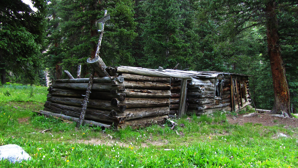
Cabin.
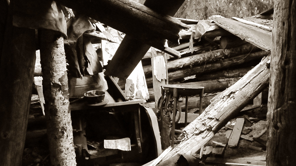
Relics of the past.
Past the cabin we made our way through a lush meadow, trying our best not be eaten alive by mosquitoes. The sun was just beginning to light the tips of the peaks as we broke above treeline.
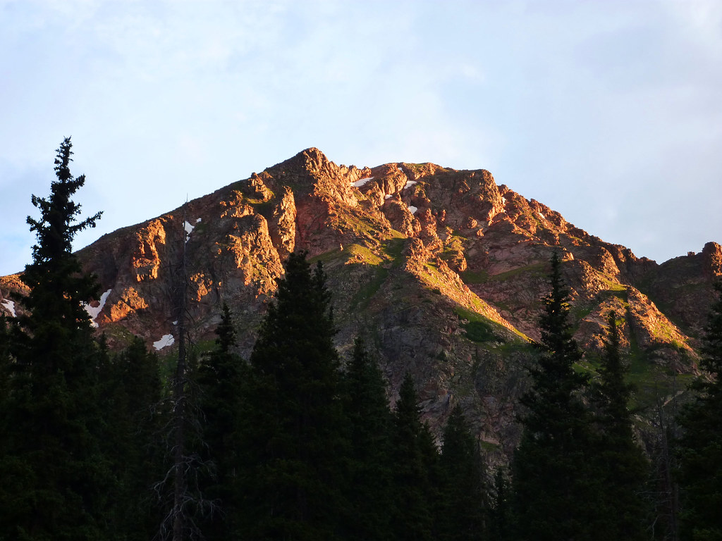
Alpenglow on a Gore Range 12er, anyone know if it has a name?
Above treeline the valley opens up and lends views of the west side of North Traverse Peak. The North Traverse/Keller Saddle is still a long way away though. We crisscrossed through the basin, meticulously picking or way through the complex network of streams and pools that make up the valley floor. After gaining the rock moraines higher up in the valley, we started making better time.
After a fairly typical Gore grunt up what is best described as a class 3 grass slope, we topped out onto the Keller/North Traverse Saddle. We took a long break here and admired the views to the north. Peaks Q, L, U, V, and others make for a sweet panorama from this vantage point.
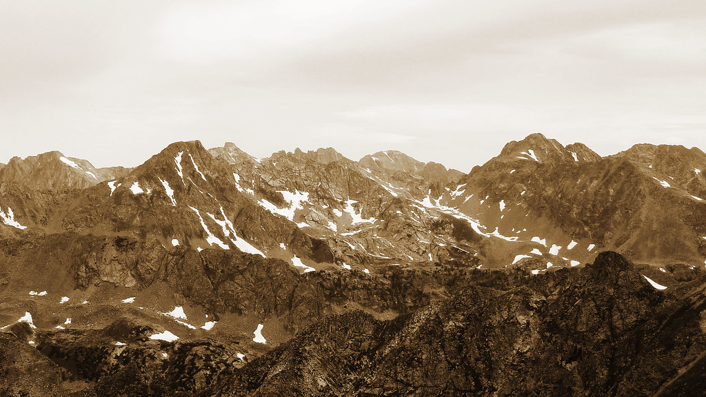
Looking north into the heart of the Gores. Photo by Brian.
Initially we had hopes of hitting more than just North and Grand (Keller was on the list as well), but the weather seemed to have a different plan for us. A low hanging cloud ceiling loomed over the Gores, and it appeared as though thunderheads were already building to our south. We decided it would be in our best interest to cut Keller from the schedule and head directly for North Traverse. So up the north ridge we went.
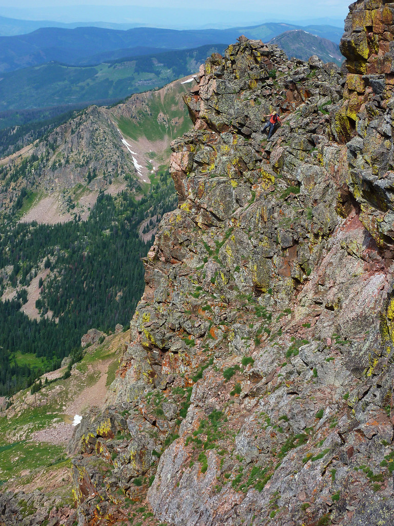
Brian on the final part of the ascent up “North Traverse Peak”.
Some fun, introductory scrambling led to the summit. We took a break and snacked on Pringles, Kroger Brand Ju Ju Fish, and Canada Dry.
North Traverse summit.
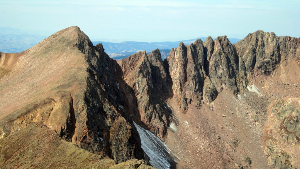
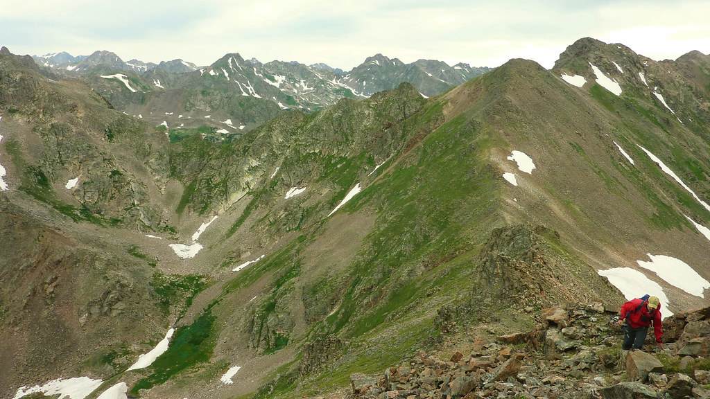
It was a near 100% certainty that rain was in the forecast, but we knew it would likely hold for a few more hours so we committed to the traverse. The first quarter mile is an easy class 2+ to class 3 balancing act on solid, aesthetic rock. Here the ridge is more of a defined spine than anywhere else along the traverse. Off the west side of the spine you have a steep slope of boulders and talus running 1,500′ down into Bighorn Creek, and on the east side you have a sheer, 900′ granite face that acts as the headwall of the North Rock Creek drainage.
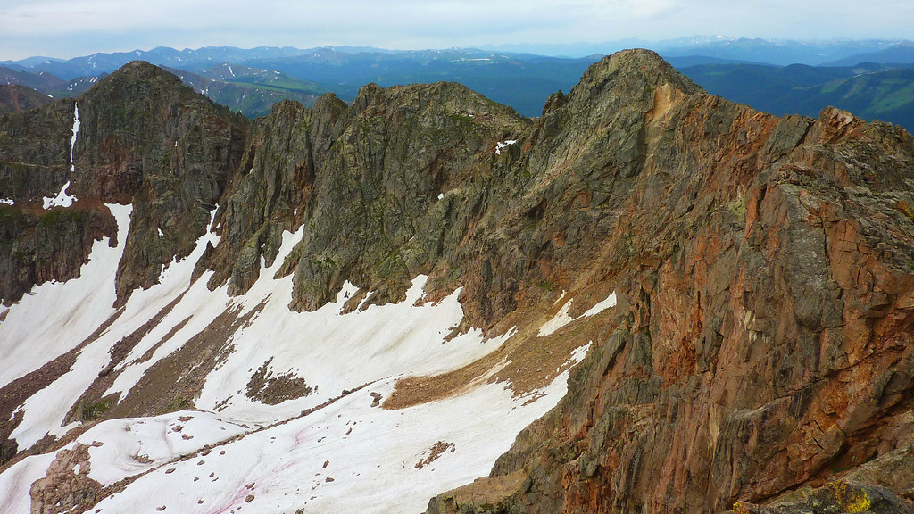
The task ahead. Photo by Brian.
Only once or twice did we feel the need to drop slightly below the ridge line to the west, for the most part you can stay right on top. A third of the way across the traverse, you come to a few towers which can be climbed directly and down climbed off the back side.
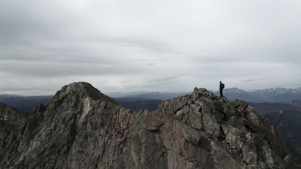
Standing atop one of these towers. Photo by Brian.
Interesting terrain early on.
Halfway to Grand Traverse, you come upon what is arguably the crux of the traverse: a steep tower with a low class 5 downclimb off the backside. Initially we headed to the summit of this tower and quickly realized there was no feasible way off the south side of it. We then backtracked and contoured around to the west where we found a route that looked a lot better, albeit still somewhat challenging.
Brian working the crux section.
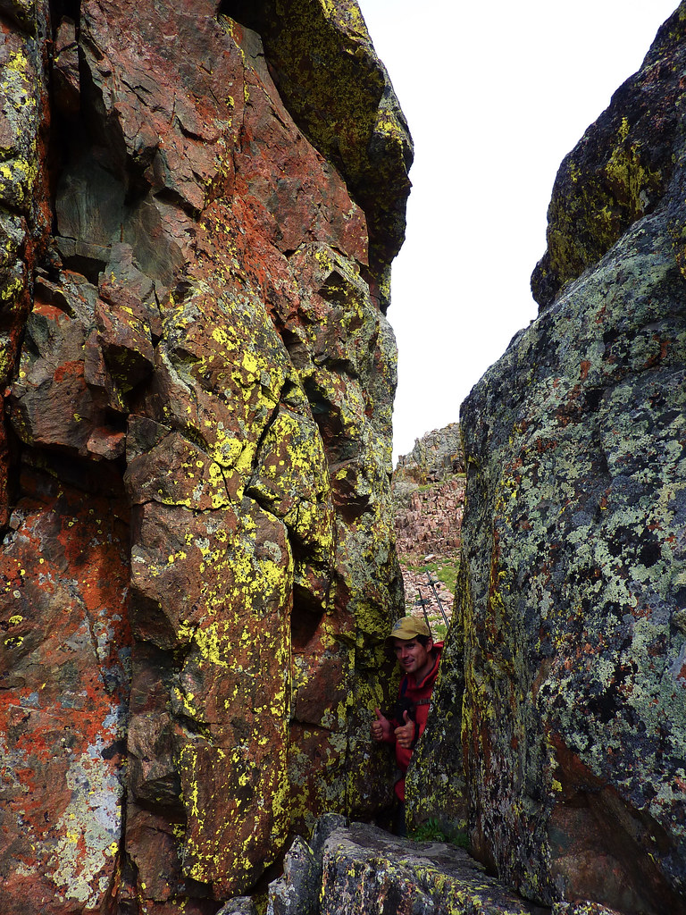
Back on the ridge proper, we scrambled along and eventually came to another tower with a narrow v notch with appeared to provide a passageway to the other side. It was a tight squeeze, but it worked out. If it hadn’t, the alternative would have been losing and regaining a hundred feet of elevation to the west.
Brian’s happy.
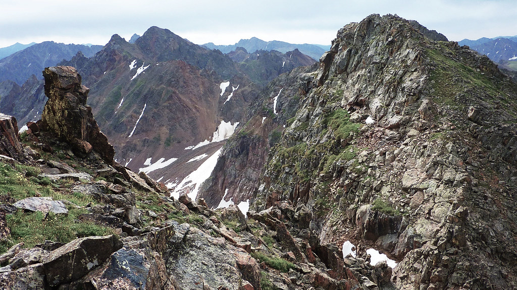
Once past the notch, we only had one or two more obstacles in between us and the summit of “Grand Traverse Peak”.
Another tower, another downclimb.
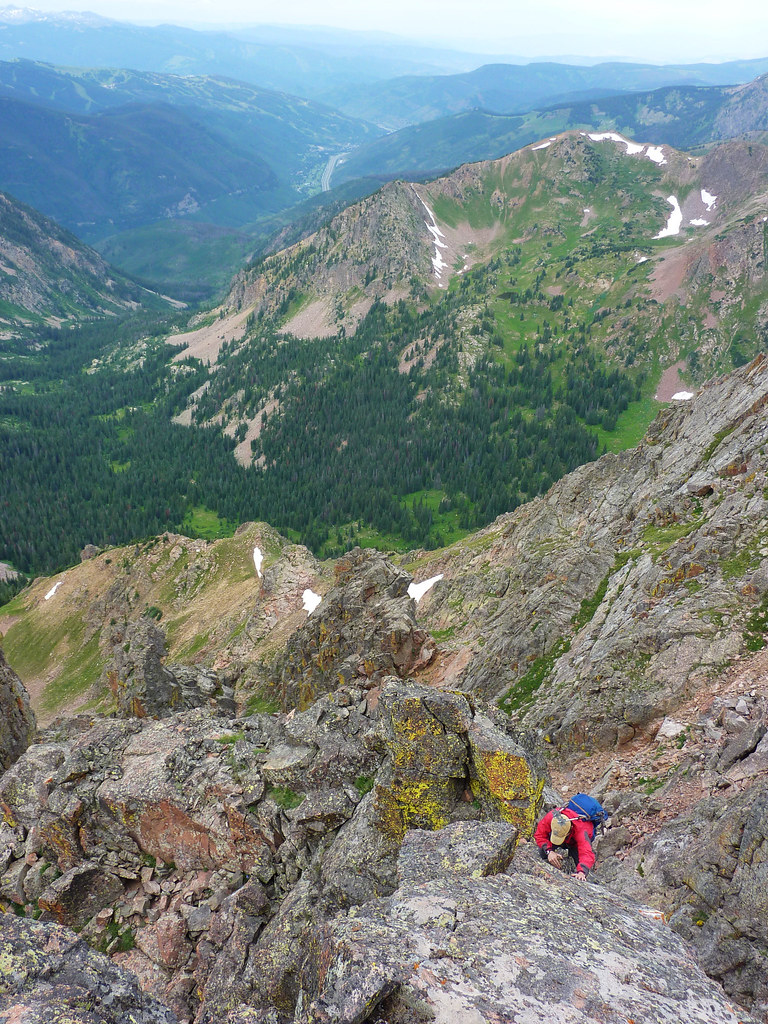
We came to the base of the final upclimb on the north side of Grand Traverse Peak. At first it appeared as though this was going to be a tough pitch, at least mid class 5 in difficulty, but then we found an easy class 4 gully to the east that solved the problem.
Brian ascending a gully near the summit of Grand Traverse.
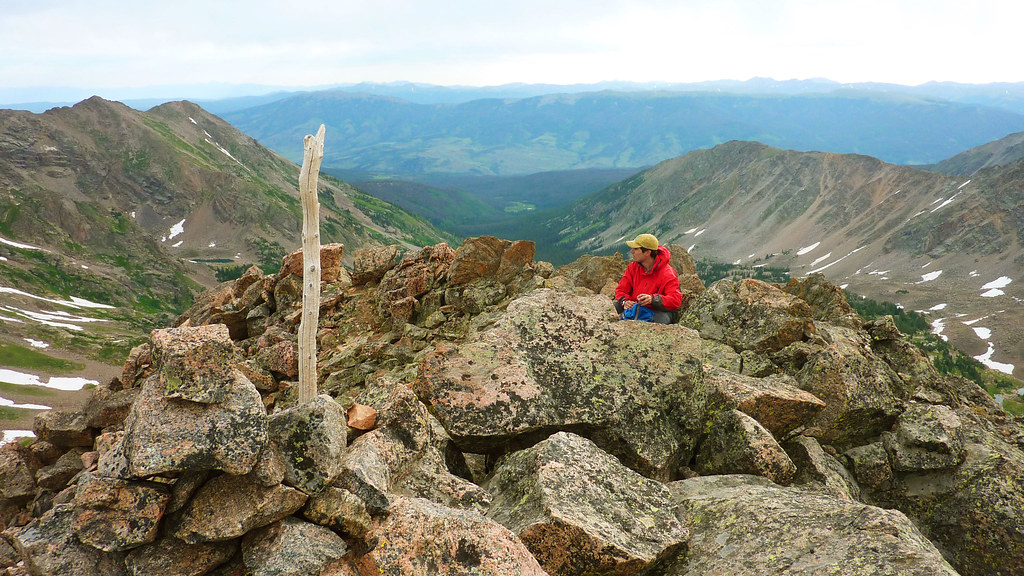
We topped out on Grand Traverse around 11:30am.
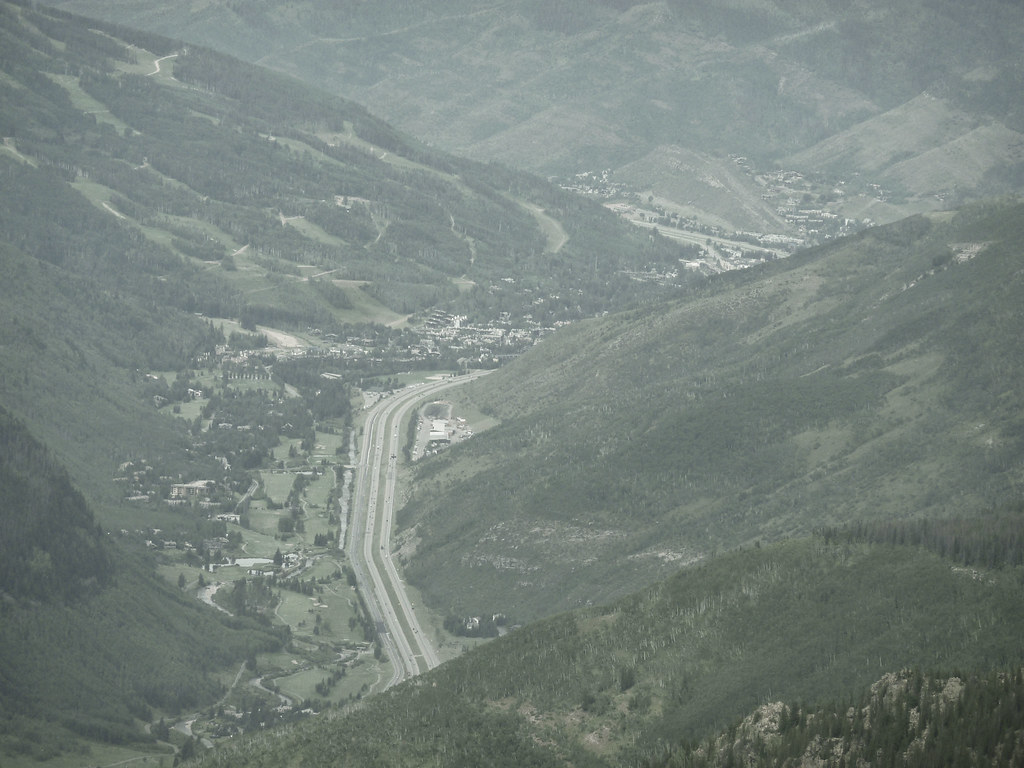
Looking back at the Vail Valley, from where I’d looked up at Grand Traverse so many times over the years.
I knew my Dad was playing golf, so I gave him a ring and told him to look up at Grand Traverse Peak. Turned out he was actually playing golf in Singletree, but hey, it was a nice idea. Brian and I didn’t stay for long as we were hoping to try the traverse to Valhalla, though our hopes weren’t high as we could see rain over the HCW.
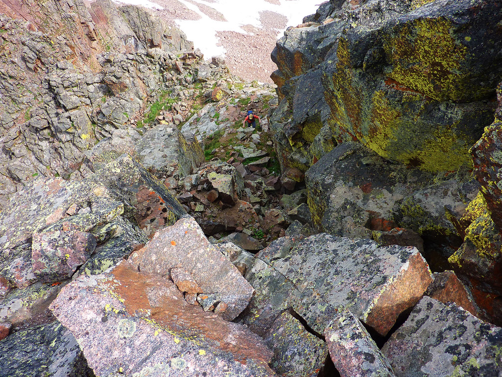
We didn’t even make it to the low point of the Grand Traverse/Valhalla saddle before we called it off. It just wasn’t worth it to push things high on an alpine ridge with thunderheads in the area. We descended down into the Deluge drainage and past the lake, towards a small hut we were hoping would provide shelter from the oncoming rain.
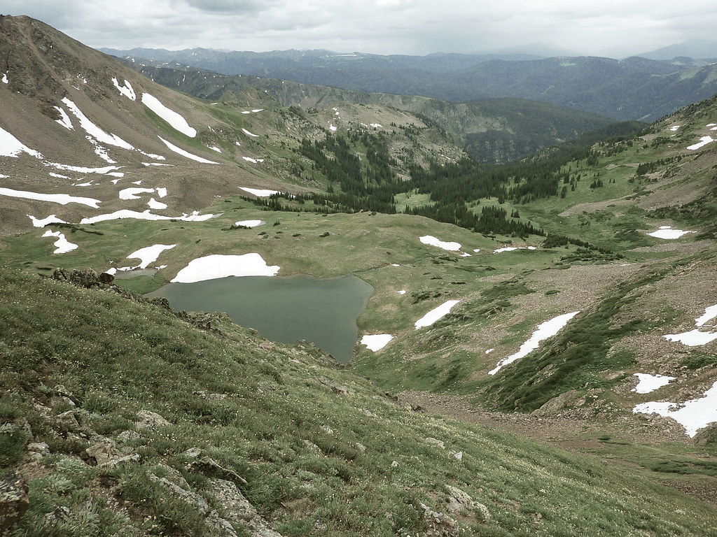
Looking down into the Deluge Creek drainage, our intended exit.
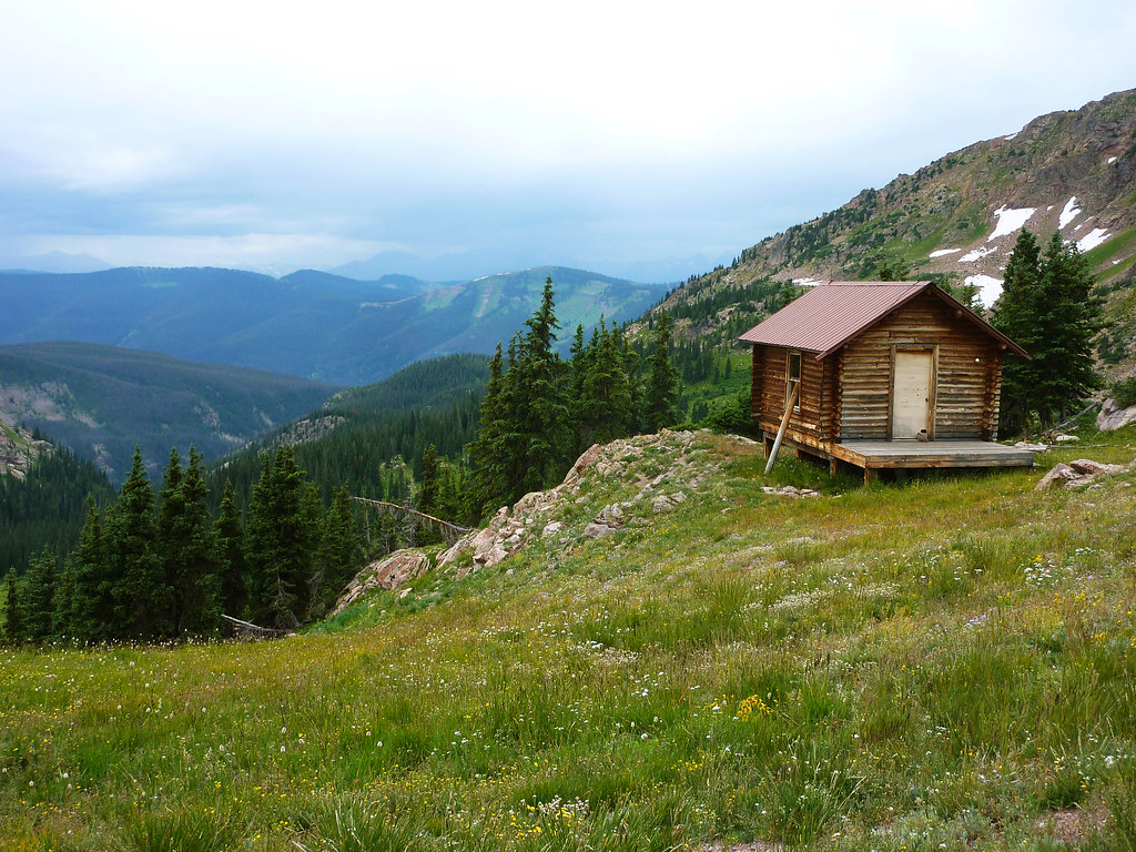
This hut looked to make for a good rain shelter.
The hut featured a box full of tools and two foam sleeping pads, perfect for an afternoon nap. We just crawled into the hut and conked out for an hour and a half while the rain pounded outside. Although we were a tad disappointed about missing Valhalla and Snow, this nap was a pretty worthwhile alternative.
Once the rain stopped around 2pm we began the long hike out of Deluge. My Dad picked us up from the TH at quarter to five and we headed into town for some food. After devouring a large Vendetta’s pepperoni pizza, Brian and I said our goodbyes and headed back to the city.
All in all this is an incredibly worthwhile traverse between two icons of the Vail Valley, go check it out sometime!
Some sweet photos right there….looks like a fun day out!
Hey Jason! Still in the process of getting the site updated with old trip reports. Thanks for the comment!
What type of footwear do you recommend for a backpacking trip to deluge lake and gore lake or anywhere in the gore range? Full boots or would non gore-tex trail runners work? Thanks…sweet trip report
Sean, I wear approach shoes for just about everything in summer. The past few years I’ve used the Camp Four from Five Ten as they have some decent ankle stability for a shoe and do great on scrambles and alpine rock routes. In the summer months I think you could get away with trail runners for sure. That said I know others on this site are fans of full on hiking boots, especially for backpacking. It just comes down to personal preference really.
Cool report! I did this last summer but opted to go from Grand Traverse Peak to North Traverse Peak since it seemed most of the cruxes from the standard north to south route were downclimbs. On a side note, there is was a TV show about the family that owns that old cabin in upper Bighorn Creek restoring it. When we were coming down the valley we ran into them along with a TV crew filming the entire project. The show is called “Building Off the Grid” if you want to take a look at it!
Hey Scott, I’m thinking about base camping at Deluge Lake and doing the Traverse from south to north. As a fit hiker/climber, you think that way isn’t too sketchy? And do you think there’s a way to loop back to Deluge Lake, or would you just have to do the Traverse in reverse to come back to camp? Thanks!
Hey Chris, it’s been a few years since I did it, but i don’t remember any parts being too difficult south to north. The initial downclimb was the worst but from what I recall it was all solid rock, mostly class 3 with a couple class 4 moves.
I dont think there is a way to loop back to Deluge, there is a long steep ridge between the two drainages. I did it as a day trip coming down Bighorn Creek.