Mount Rainier Fuhrer Finger Attempt 6.2.12 and 6.3.12
Brian, Rick, Marc, Alex, Clay, myself
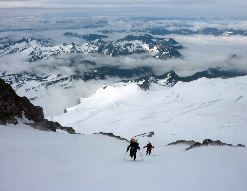
Lower Nisqually -> camp at 9,000′ on Kautz Ridge -> Fuhrer Finger, turnaround elevation 12,000′
7,000′ climbed, 4,000′ skied, ~8 miles RT from Paradise
Six of us pulled into the Paradise parking lot on June 2nd, eager to gear up and approach Mount Rainier for a ski attempt on the 3rd. The previous night we had sat on the porch of the Whittaker Bunk House contemplating our future as rain pelted the roof over our heads for hours on end. Skeptical moods were only reinforced when we arrived at a socked in Rainier Rainier Ranger Station and received reports of heavy weather/precipitation over the previous week. That said, the weekend forecast was looking slightly better, and with the typically rapid settling of new snow in the PNW likely resulting in relatively low avy danger, we decided to move forward and give the Finger a shot.
This trip had been in the works for a long time. I think Brian and I started talking about it in November or December, and began planning in January/February. The million dollar question was which dates to go with as (like many have found out the hard way before us) the weather in May/June is typically unsettled in the PNW. Going off previous trip reports as well as local opinions, it seemed May was too early for a decent shot at good weather, and July was too late for a decent shot at good skiing. We ended up locking in June 1st through the 10th, reasoning that these dates seemed like a good middle ground between the snow and wind of May and the sun cups and exposed crevasses of late June/July.
We figured that although we would likely have to eat some weather days, there would be enough stability by June to provide a few settled windows over a ten day stretch. Well, this turned out to be true, kind of. As many have said regarding weather windows in the PNW, It’s a total crap shoot. In the end this fact turned out to be more painfully obvious to us than we would have hoped. Suffice it to say if we were indeed gambling as opposed to skiing, the house would have ended up taking us on this trip. But, like any venture in life that involves some aspect of risk, you win some and you lose some.
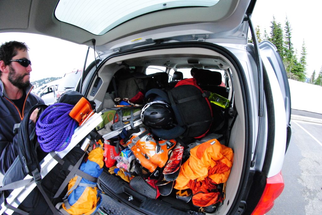
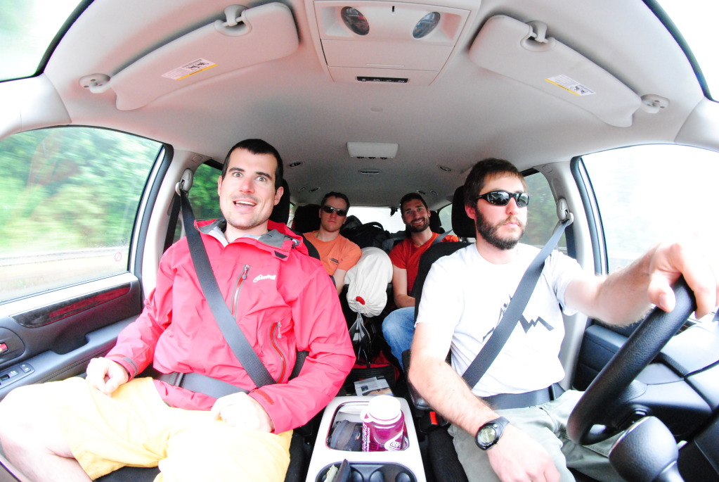
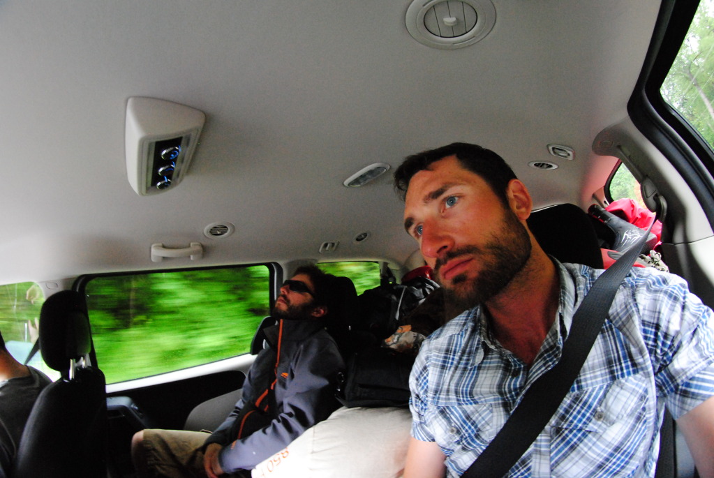
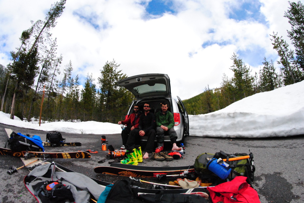
Rick throwing the last of the gear into our Dodge Grand Caravan, June 2nd . Photo by Alex.
Something we learned while on this trip is that, despite being covered in snow year round, Rainier is more of a climber’s mountain than a skier’s. Glaciers, while certainly passable with skis, are better crossed on foot with crampons and axe in hand unless you really know what you’re doing. The physics of arresting a crevasse fall with skis on are funky at best in my opinion, and realistically if a skier were to fall into a crevasse they would very likely lose a ski if not both to the icy depths. Knowing all of this, skiers seem to naturally gravitate towards the glaciers of Rainier during snow bridge season (i.e. early season) which unfortunately coincides with more unpredictable, generally more intense weather. Lots of sun chased by days on end of overcast skies and freezing temps can result in slopes turning to sheer ice in May/June. More so, because Rainier has such a large vertical relief, micro climate changes between the summit and the mountain’s base make it nearly impossible to have good snow from summit to car. There is just too much variation to have good skiing for the entire 9,500′ of the mountain’s vert.
All that said, these are only general rules that I’ve picked up on from reading lots of trip reports as well as my own recent experience, and on a perfect day, skiing good snow on Rainier from summit to car would and could be an incredible experience. It has certainly happened before, I just feel it’s very rare and very difficult to nail, especially for out of towners with a fixed schedule. On the contrary if your goal is to climb Rainier, July and August are generally much more weather friendly, and snow quality is obviously not much of a concern.
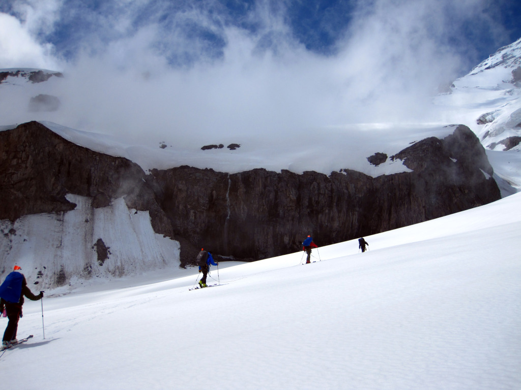
Our group crossing the Lower Nisqually Glacier, June 2nd. Photo by Alex.
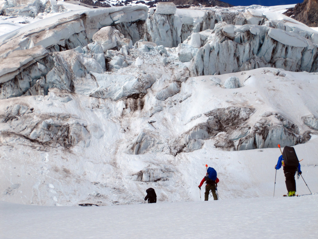
Spectacular glacial features. Photo by Rick.
The Lower Nisqually went very quickly as we encountered only one or two small crevasses along the route to the Kautz Ridge. Though I understand cracks open up more in this area as the season progresses, for us it was a no brainer. We roped up as two teams of three on thirty meter, 8.0mm ropes and crossed the glacier as the afternoon visibility began to clear. While proving to be reclusive for the majority of this trip, Rainier did show itself in full view for a short period of time…
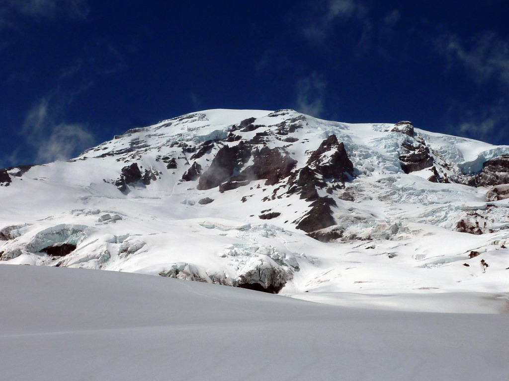
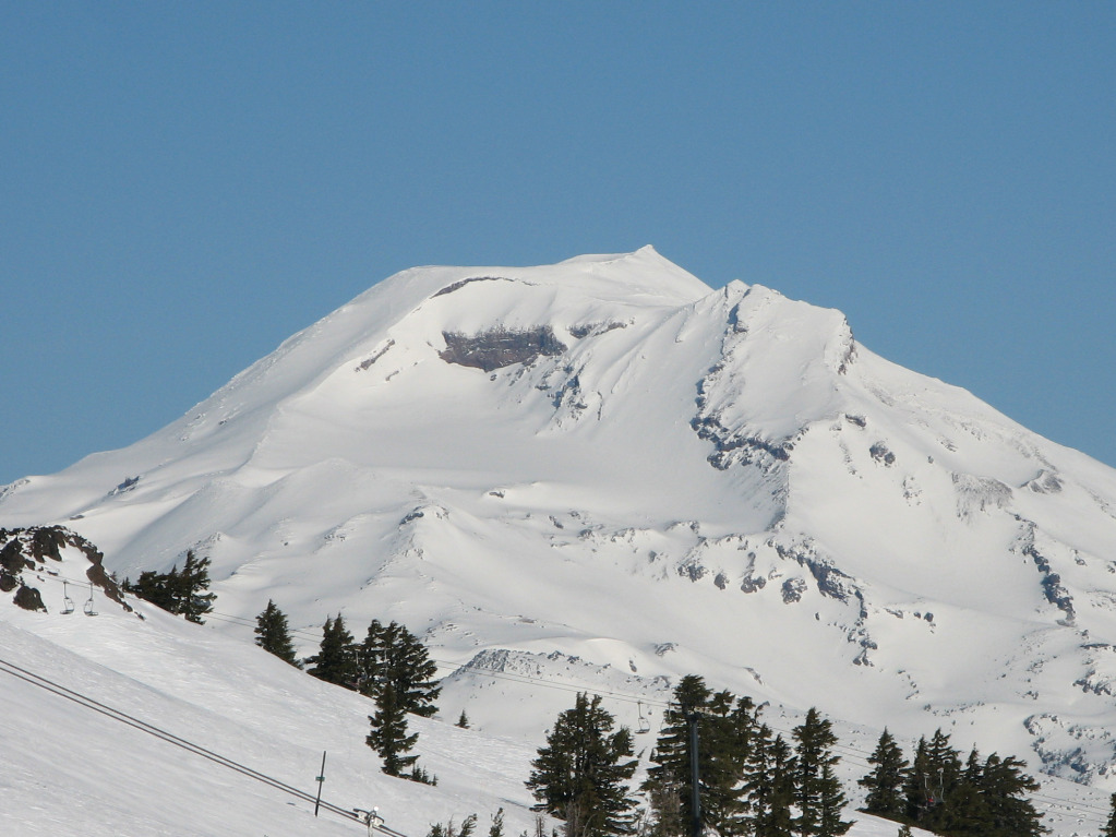
Mount Rainier’s South Side.
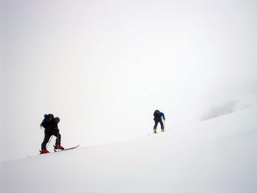
We gained the Kautz Ridge and traversed across to the base of the numerous rock outcroppings west of the Wilson Glacier. This seems to be where most parties splitting the Fuhrer into two days decide to camp. It makes sense, as the area is decently protected from rock fall as well as wind, and the walk to the base of the Finger only takes about an hour from this location.
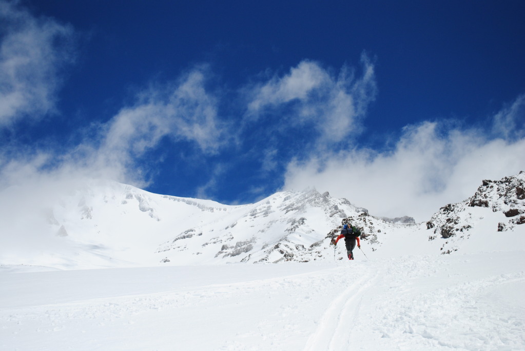
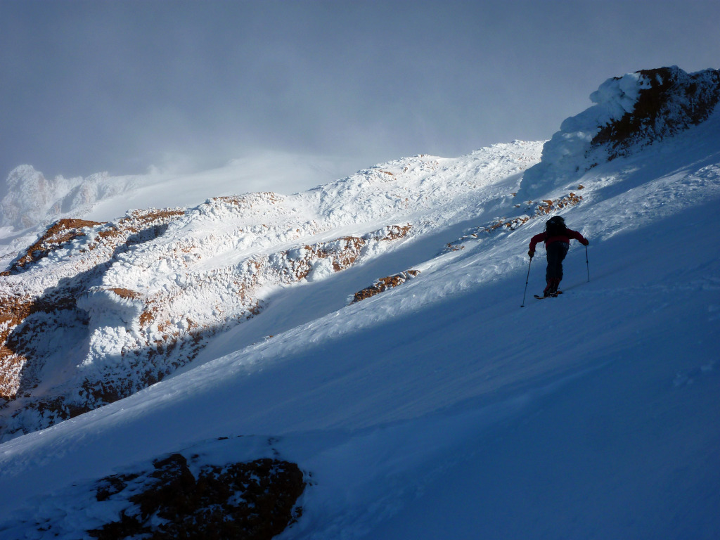
Rick, Alex, and Clay skinning up the Kautz Ridge.
We pulled in a little late at 6pm but made up for lost time by establishing camp in an efficient manner. We had a clear view across the Wilson to the entrance of the Finger, and the skies to the south seemed to be clearing. It appeared as though Rainier was granting us just the window we needed for a summit bid.
Marc and I nearing our camp site. Photo by Brian.
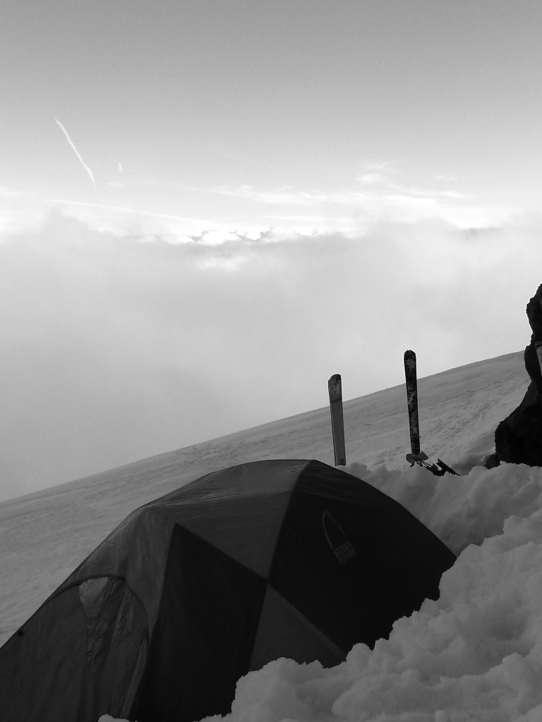
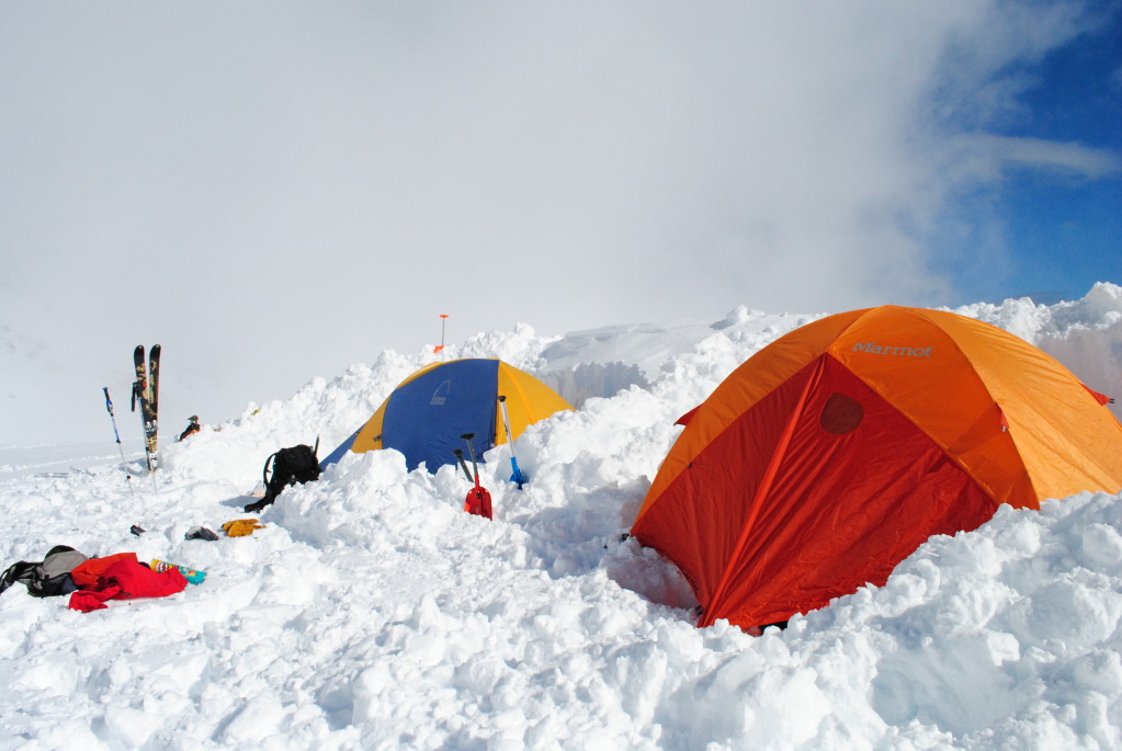
Camp at 9,000′ near Turtle Rock.
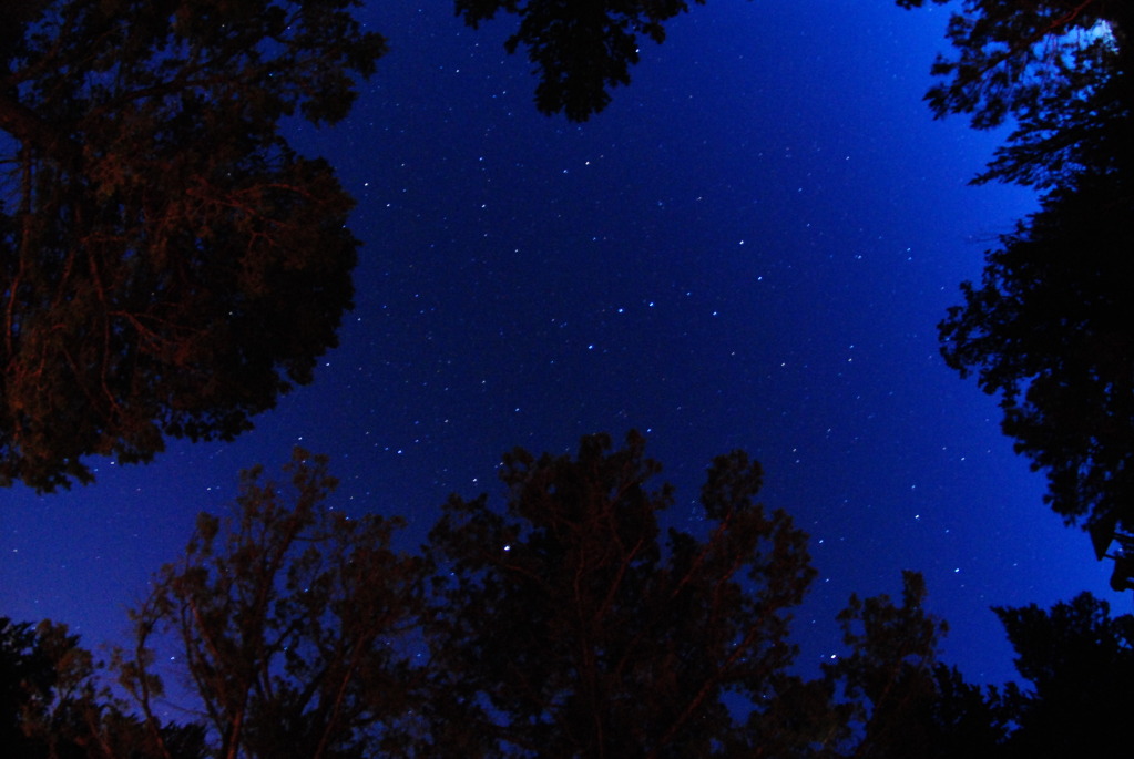
We spent a good portion of the evening eating dinner and melting snow. The views of the full moon over a cloud floor bathed in orange were spectacular. Being in the tent with Brian and Marc provided a more than satisfactory amount of comic relief, needless to say to those who know them. In general we felt good about our chances at this point, and were in position for what would undoubtedly be a great day of climbing and skiing given the weather held.
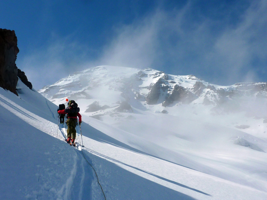
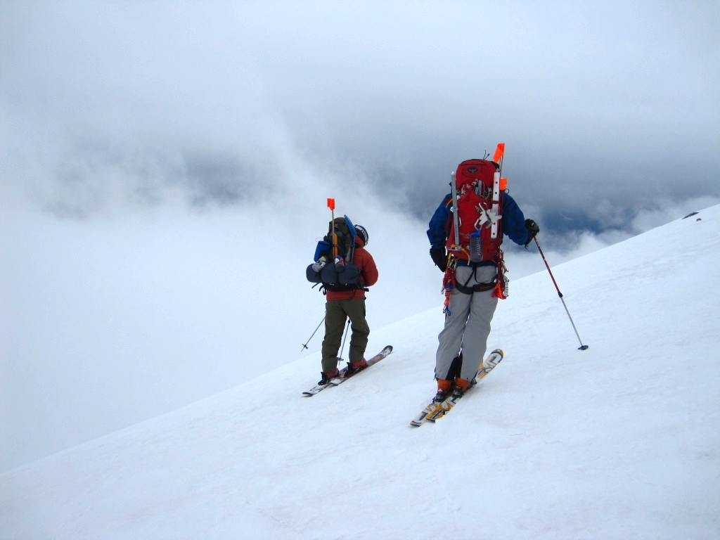
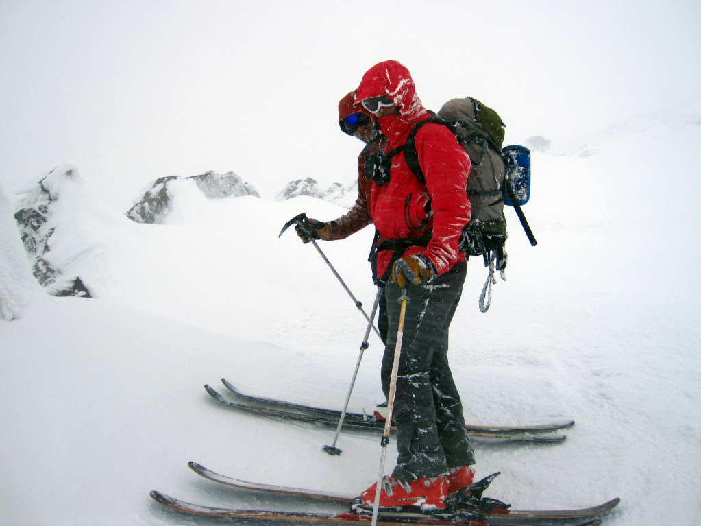
We departed camp the next morning around 4:30am under darker skies than we would have hoped for. At some point during the night another front rolled in, obscuring the summits of Rainier and Adams across the way. It brought some wind and blowing snow along with it, and was threatening to further reduce visibility. Clay, Rick, and Alex, upon unzipping the tent and looking at the weather, decided to call it a day and sleep in. Marc, Brian, and I however were determined to call the weather’s bluff and give it a shot anyway. After all we had come this far. On a rope of three, we spent the better portion of an hour crossing the Wilson, which featured some larger, more menacing crevasses than we were anticipating. A few of the crossings had us on our guard to say the least, however we eventually made it across without issue and threw on crampons for the ascent of the Finger.
Marc and Brian at 10,000′ in the couloir, the Wilson Glacier can be seen 1,000′ below, June 3rd.
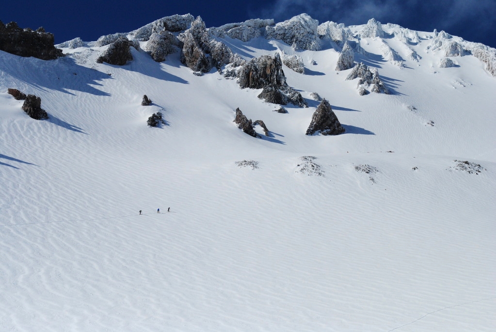
The Fuhrer Finger, based on the research I’ve done, is the best option for a ski descent from a safety perspective combined with an aesthetics perspective. Though ski descents of Emmons and the DC Route are very doable and rewarding in their own right, both routes are home to more crevasses than the Finger and lack the two thousand foot aesthetic couloir that gives the Finger its name. The couloir itself is more or less just a big version of a Colorado chute; crevasse free, moderately steep between thirty and forty degrees, and some good vertical dropping down to the Wilson. Navigation along the Kautz Ridge is fairly simple provided you have good visibility, and the top portion of the route near the summit appears to be fairly simple as well. The most difficult portions of the route are the three glacier crossings; the Lower Nisqually, the Wilson, and the upper Nisqually, and none of them are incredibly intricate glaciers compared to others on the mountain.
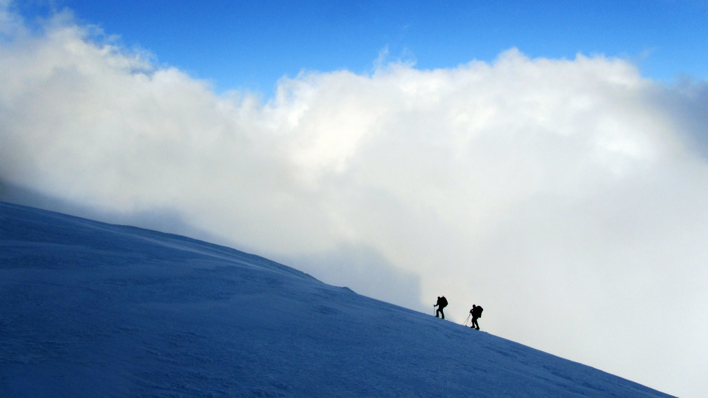
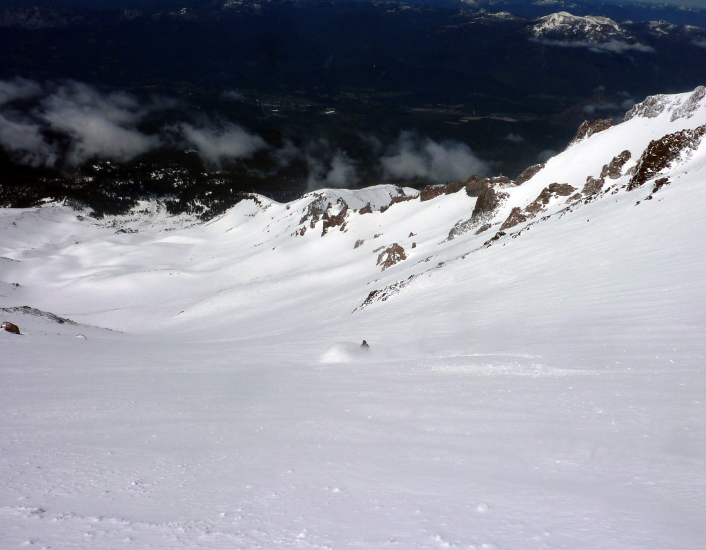
Back to the story, we made surprisingly good time to the top of the Finger and took a long break to assess the situation. All morning we had reserved hope in the back of our minds that the clouds would lift and bring sun and visibility to the top of the mountain. Had that happened, we would have been able to navigate the final portion of the Upper Nisqually and skin up gentle slopes to the summit. The mountain had other ideas on this day however. Just as we resumed our climb, visibility dropped and winds increased substantially. Another twenty minutes of climbing had us to 12,000′ where we sought refuge from the storm to discuss our options.
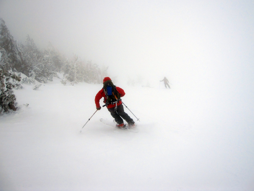
We still had 2,400′ to go, essentially zero visibility, and the winds and low temps were slowly turning the slopes beneath us to ice. After another few minutes of getting hammered by wind with our hands and toes starting to get cold on top of it all, we decided to turn around. There were just too many factors telling us to get the hell out of there. Ultimately the mountain decides who can climb it and who can’t, and this experience was a stark reminder of that fact. The descent in the steadily worsening weather entailed nothing less than an icy 3,000′ down climb/survival ski in whiteout conditions. The following photo describes the experience much better than I could hope to using words:
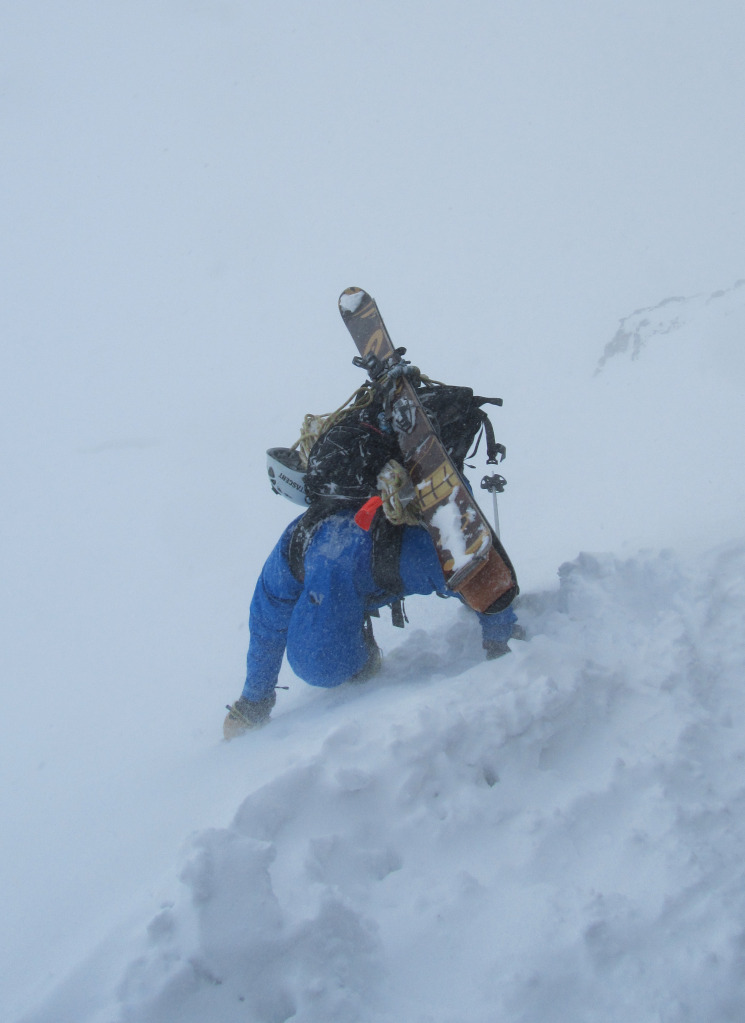
Whiteout in the Fuhrer Finger. Photo by Brian.
Upon arriving at camp, knowing we didn’t have a chance for a window the next day either (weather forecast called for high winds and nine to twelve inches on the 4th) we elected to pack up and ship out. For four of us Rainier was only the first leg of the trip, and we had other peaks to explore. The skiing on the way down from the Kautz Ridge varied between icy hard pack and good pockets of softening corn snow, the latter became more the norm the lower we dropped. Across the Lower Nisqually the snow turned to complete mush, quite the difference between the rock hard ice 5,000′ above and just another reminder of the varying climates this mountain creates. All in all we had a fun ski out though, with generally good turns. Despite not getting a summit, skiing on Rainier was an experience I won’t forget anytime soon.
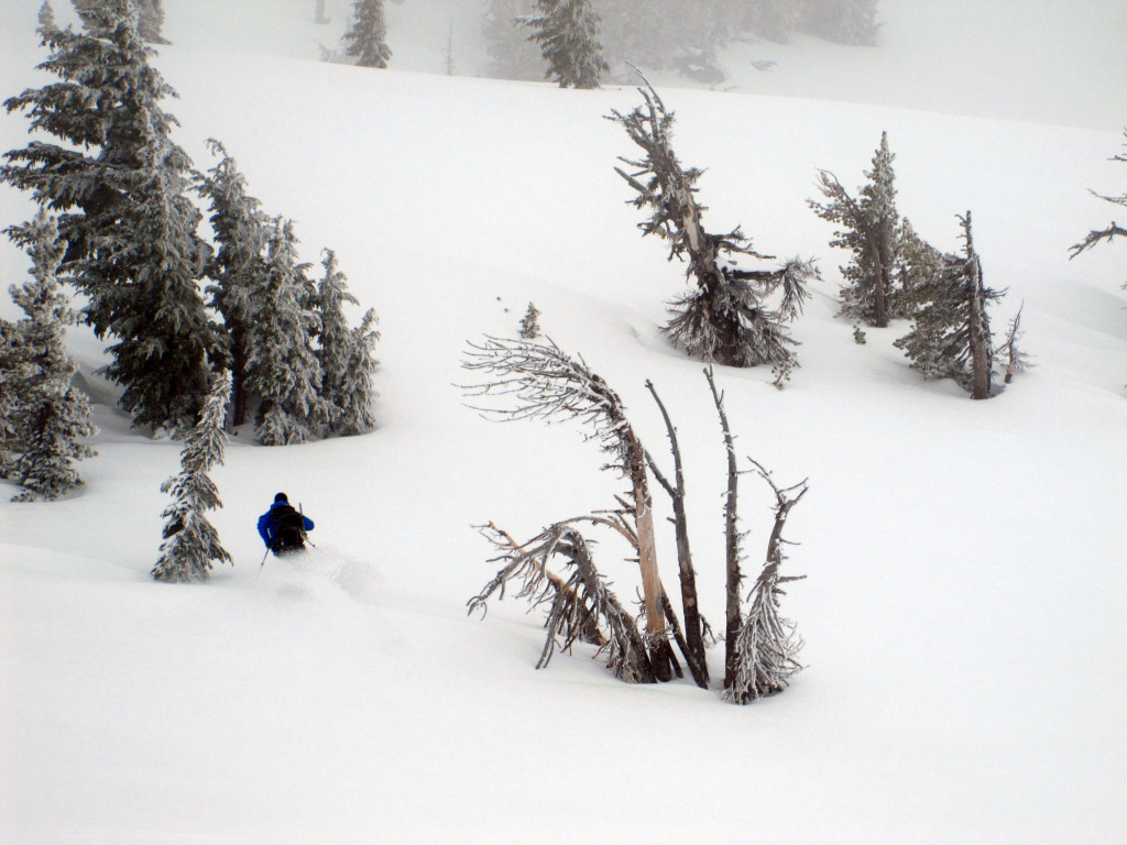
Clay and Brian making methodical turns through the fog. Photo by Alex.
Back at the car in Paradise we loaded up and drove down the road for a burger and beers at the Copper Creek Inn. One of the great aspects of our trip was exploring numerous breweries and hole-in-the-wall food hot spots up and down the West Coast.
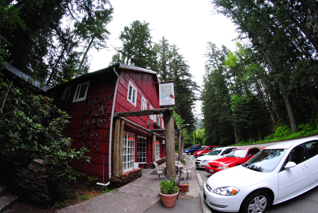
The Copper Creek Inn. Photo by Alex.
Overall, despite what I said before, I do view skiing Rainier as a prize to be sought after. The aspects which happen to make skiing this peak so tricky also make its accomplishment that much more fulfilling. If (or more accurately, when) I attempt to ski Rainier again, I’d go about it in the following manner: A fixed dates trip in May/June is more or less folly in my opinion (unless you happen to be Chris Davenport, or else just very fortunate). The fluctuations in the weather are just too common to rely on a strength in numbers approach as well, since the weather can literally be bad for weeks on end. I think the only way to go about it (short of just trying many times and finally getting lucky) is going with flexible dates and closely studying the weather trends/forecasts, then heading up there on a whim when things look good. Also, going later in June or July and having greater chances for good weather may be worth the lower snow quality/crevasses you’d encounter, especially considering the glaciers you cross along the Fuhrer Finger route are fairly manageable. Regardless, it’s clear that skiing Rainier takes numerous attempts for many, and is definitely tough to get with good weather and in good condition.
Salvaging the Trip: Mount Shasta’s Avalanche Gulch 6.5.12 and 6.6.12
Brian, Rick, Alex, myself
Avalanche Gulch via Bunny Flat TH, ski descent of Left of Heart Variation
8,000′ climbed and skied (including an afternoon exploratory run from camp), ~11 miles RT
Brian laid out this portion of the trip in a much more creative and colorful way than I ever could, so for details check out his trip report. I will just say a few words followed by throwing up a few of our better photos that didn’t make it into the first round. Despite the fact that heading to northern California meant a departure from our goals and several months of logistical planning, we knew there was something to be said for flexibility and listening to where the mountains were telling us to go. We were indeed rewarded for this, as Shasta was a much welcomed and pleasant surprise to all of us.
Driving the 8 hours and 495 miles from Ashford, WA to Mount Shasta City, CA, June 4th. Photo by Brian.
Entering the grand amphitheater that is Avalanche Gulch, June 5th. Photo by Alex.
Dug in at camp, June 5th. Photo by Alex.
Heading up for some afternoon turns, June 5th. Photo by Rick.
Heading for the summit, June 6th. Photo by Alex.
The best northern California has to offer, June 6th.
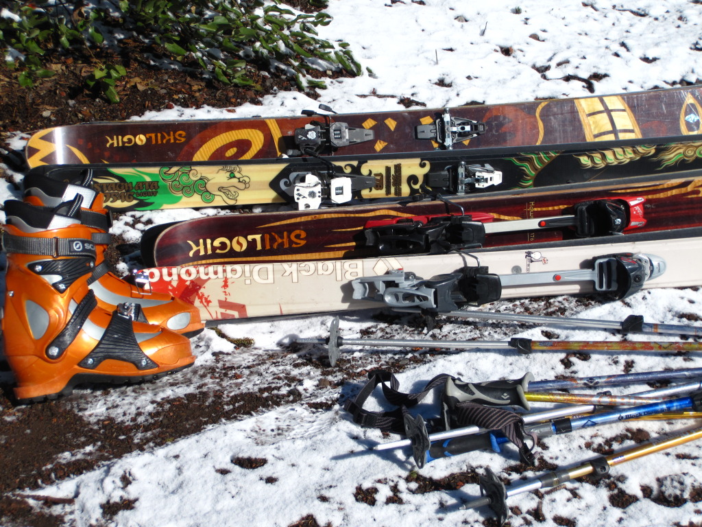
Skis ready to load at the Bunny Flat TH. Photo by Alex.
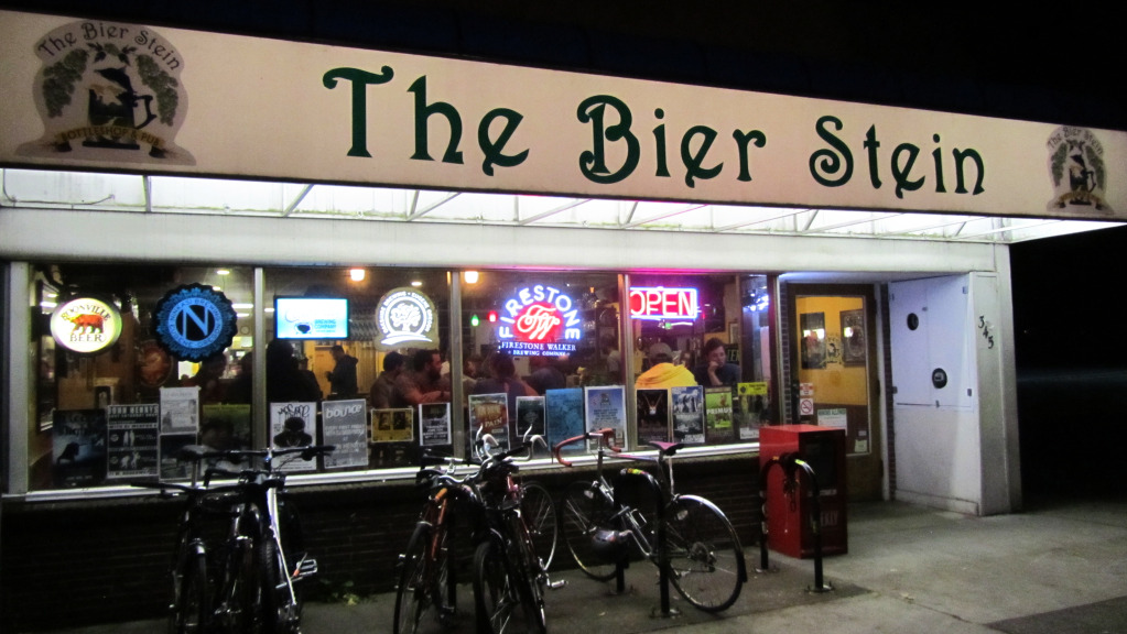
The Bier Stein in Eugene, Oregon, our post Shasta celebration spot. Photo by Brian.
A few words on the peak itself: If Rainier is the monarch of the Cascades from a climbing perspective, Shasta has to be the monarch from a skier’s perspective. Granted I haven’t skied many of the peaks in the region and am therefore completely unqualified to make that claim, if there’s another mountain up there that boasts the skiable vertical, the number of classic routes, and the quality of snow in combination then I’d like to know what it is. I have a feeling Shasta is in a world of its own. I’d also like to add a quick note about the Bier Stein. This place had incredible food and a serve yourself beer cooler that rivals Tipsy’s Liquor World off of C470 and Bowles. I’d highly recommend checking it out if you’re in the area.
Skiing in the Oregon Cascades: South Sister’s South Face 6.8.12
Brian, Rick, Alex, myself
South Ridge/Face from Devil’s Lake, ski descent of ascent route
5,000′ climbed and skied, ~11.5 miles RT
After Shasta, we were all excited about doing some skiing in Oregon, even if it weren’t necessarily on a volcano. We took the next day off to make the drive from Eugene to Bend, with the intent of checking out the Mount Bachelor/Three Sisters region. After a stop in Sisters, we continued on to Bend and found a great camp site near the outskirts of the town. Here we were able to pile out of the car, throw a tent down, make a fire, and enjoy the outdoors in relative comfort compared to our other recent camping experiences.
Alex takes us back on the road, June 7th. Photo by Alex.
A clear night at our camp site, would this translate to the mountains as well? Photo by Alex.
An early wake up the morning of the 8th had us packed into the van once again and heading up to Devil’s Lake for an attempt on South Sister. The weather which we had hoped would have improved somewhat since we headed south on the 4th just continued to sock in the area. As we came around a bend in the road around 6am we could see the lower half of Mount Bachelor (the ski area) was visible, the upper half however was enveloped by clouds. This meant South Sister was going to be as well, but we figured even with remotely decent visibility we’d be able to grunt through and hopefully find some turns in the process.
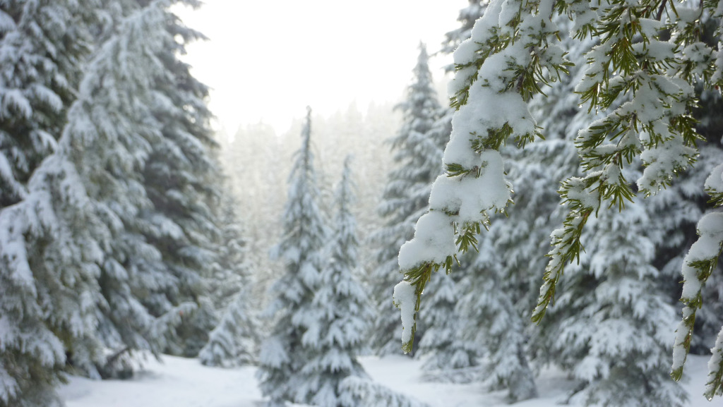
A winter scene in the Oregon Cascades, June 8th.
We slowly but surely skinned up through the trees, looking for a break in cloud cover and temporarily getting one as we broke treeline. This momentary lapse allowed us to view the surrounding terrain and get our bearings. Before long however, it was back to blind travel.
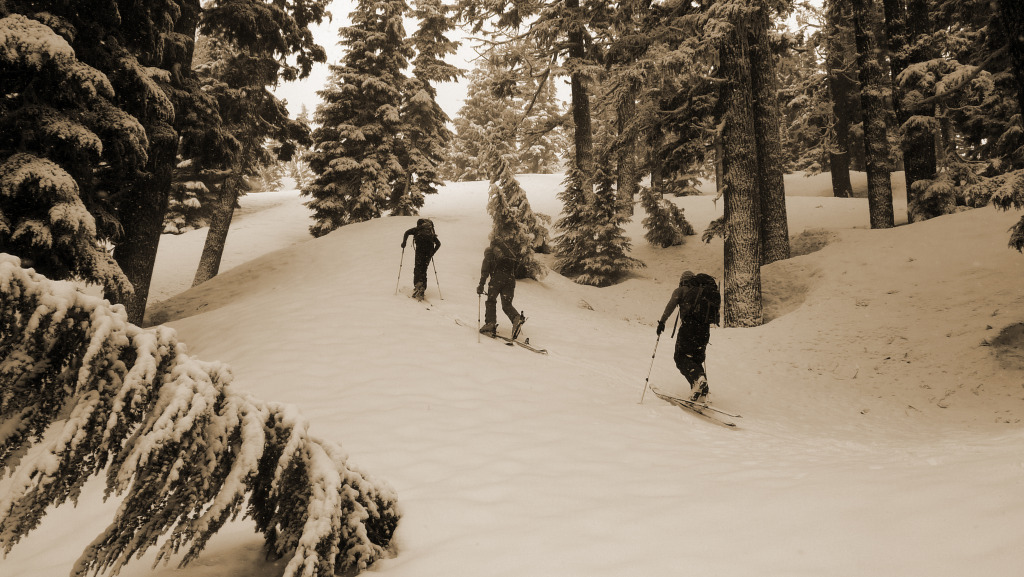
Brian, Rick, and Alex skinning through the forest.
On the peak proper, not far to the summit now. Photo by Rick.
The higher we skinned the more the winds picked up, though none of us were ever very cold so we just continued putting one foot in front of the other until we reached the summit cone. Skinning through a blizzard at 8,000′ in June felt strange indeed.
A frozen Brian and Rick near the top. Photo by Alex.
Navigating primarily by GPS, we topped out on the Sister roughly six hours after we set out from the car. A quick turnaround had us back down to the good snow in a matter of minutes. Though we had almost zero visibility, the turns were very enjoyable for roughly 4,000′.
On descent. Photo by Alex.
Oregon Cascades POW. Photo by Alex.
Back at treeline, we had one of the best backcountry tree runs any of us had ever experienced. Wide open trees with a mixture of powder and corn down lower, we skied right back to the road within a fourth a mile of the car. Overall South Sister reminded me of the Cascades’ version of Mount Quandary (i.e. straightforward route and access), and I hear in summer the crowds it draws are remarkably similar as well. Even still, we got some great turns, and skiing on our third volcano in three states was a great way to round out the trip.
South Sister on a clear day from Mount Bachelor, the line goes down the looker’s left ridge line. Photo courtesy of wendmag.com.
Loading up the van, a great day of skiing under our belts.
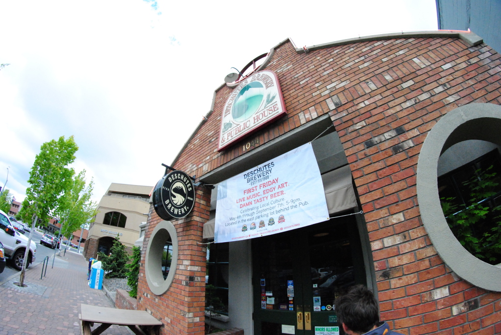
A parting shot of the Deschutes Brewery, post food and brews, June 7th. Photo by Alex.
One June 9th we drove up to the Timberline Lodge on Hood in hopes of making an attempt on the peak if the weather happened to be remotely manageable. Though I don’t have a photo to describe the scene up there, our hopes of even setting foot on the Palmer were immediately dashed. Visibility was so terrible an axe wielding Jack Nicholson could have been lurking ten yards away and we wouldn’t have been able to see him. We took the heavy blowing snow and whiteout in the parking lot at 6am as a final “your time here is done, go back to Colorado assholes” from Mother Nature. All we managed to do up there was run into the lodge, watch a few minutes of the historical video detailing the lodge’s construction in the 1930’s, play a few rounds of ping pong, and pile back into the van to continue our drive to Seattle. That night we checked out a few Seattle breweries in celebration of a fine trip, and prepared our bags for the flight home.
Although indeed disappointing when compared to what we hoped to accomplish up there, I would never go so far as to say our trip was not a success. Given the great company we got to enjoy, the lessons we learned, and the blissful turns we had, it would be a crime for me to view this trip as anything but a success. Competing with the self, abandoning original goals/plans in situations that require malleability, as well as a good old fashioned lesson in turning back when the mountain is telling you no were all aspects of the trip that made for a humbling learning experience. This was the type of trip that reminds you that it’s not all about the objective, that mountaineering is about much more. Without some form of internalization however, these lessons can easily be missed, and a trip chalked up to nothing a waste of time and money that would have been better spent working or going out for drinks with friends. Personally I am glad I have partners that understand this and are willing and able to internalize experiences, and move forward with a changed outlook. Maybe this is ultimately the most useful aspect of mountaineering as, in the absence of internalization and being open to learning things about ourselves we are really doing nothing more than stubbornly walking up massive piles of rock (and for some of us, skiing back down).
Thanks for reading!