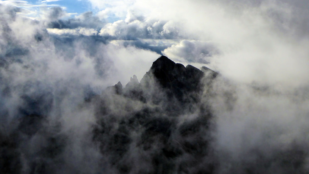
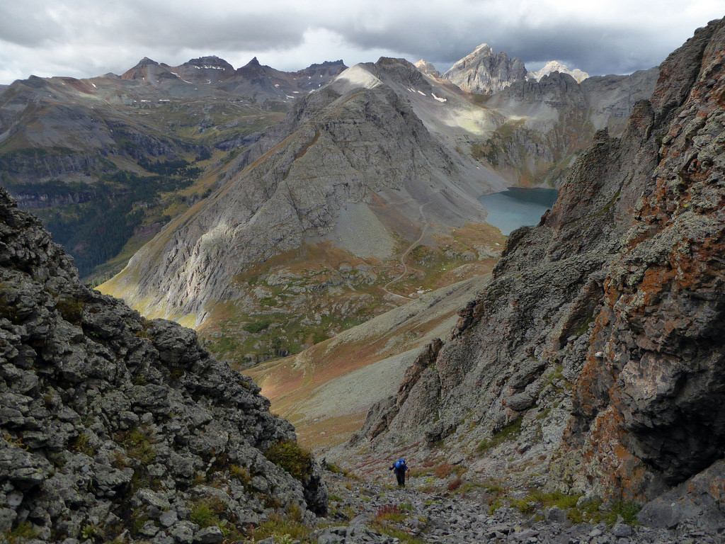
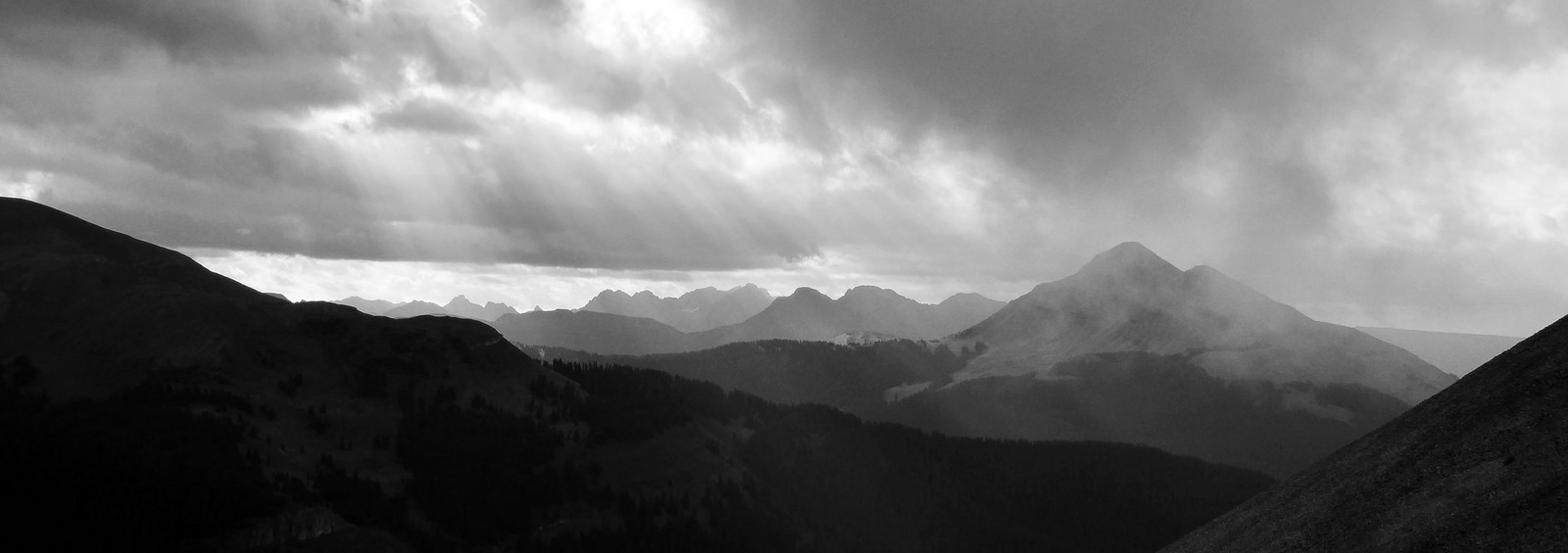
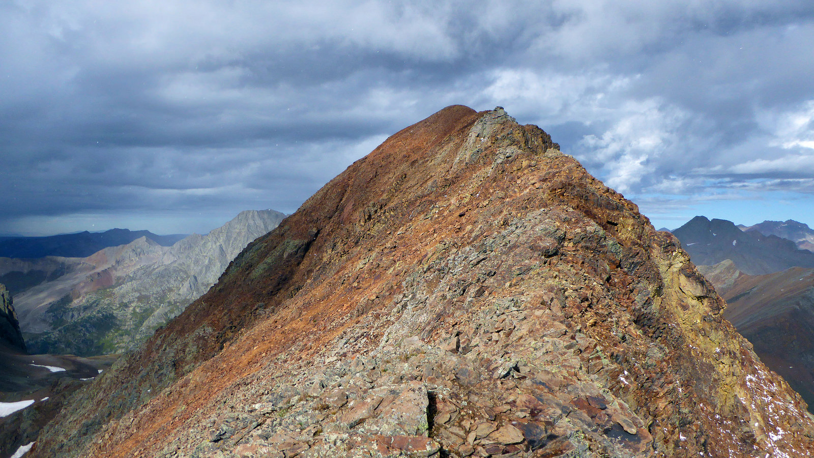
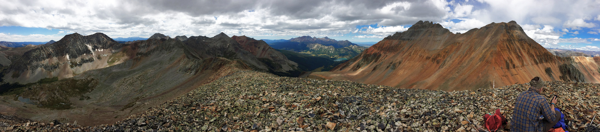
Summit of Pilot Knob, looking south towards Vermillion Peak, September 5th, 2016.
Peaks
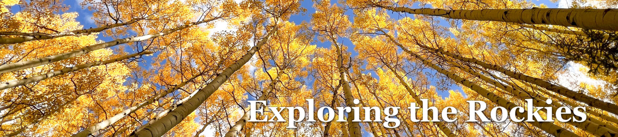
South Lookout Peak (Ranked, 13,380′, #334)
“V 5” (Ranked, 13,156′, #518)
Grizzly Peak B (Ranked, 13,738′, #130)
“V 10” (Ranked, 13,475′, #271)
Pilot Knob A (Ranked, 13,738′, #132)
“V 4” (Ranked, 13,540′, #228)
US Grant Peak (Ranked, 13,767′, #119)
“V 2” (Ranked, 13,309′, #387)
Rolling Mountain (Ranked, 13,693′, #150)
“V 9” (Ranked, 13,260′, #435)
“V 8” (Ranked, 13,300′, #402)
Beattie Peak (Ranked, 13,342′, #358)
Trip Info
~30 miles
~20,000 feet
September 3rd – 6th, 2016
At the beginning of September, Kyle Knutson and I headed south for a four day peakbagging romp in the San Juans. Our plan – hit as many 13ers as we could, focusing on the mini-range to the west of Silverton and south of Ophir. We had spent a little bit of time in this range previously, both having climbed Vermillion and Golden Horn, but beyond that would be new terrain. This area of the San Juans is notorious for bad rock and loose scrambling. Throw in a handful of lesser traveled routes and we knew we were in for an interesting one.
For weeks we had planned on a multi-day pack in to Rock Lake to hit the Oso group, but impromptu knee issues for Steve had us changing our plan to something more car-camp friendly. In typical fashion we watched the weather forecast deteriorate from all sun to clouds, rain, and fog mere days prior to our departure. Then came the news that Steve wouldn’t be joining us at all (further knee complications), so we decided to condense the trip in favor of a more weather-friendly itinerary on the back end of Labor Day. As it turned out, the first day of our trip was to be the wettest, so we decided to go for the shortest day in South Lookout and “V 5” from Clear Lake.
Kyle’s modified 4 Runner (the primary vehicle used for Andrew Hamilton’s 14er speed record) made quick work of the Clear Lake Road (as it would on every other road as well, the thing is a beast). We made camp at the lake and set off the next morning under cloudy skies for the summit of South Lookout Peak.
South Lookout’s soft ranked summit and US Grant seen to the south.
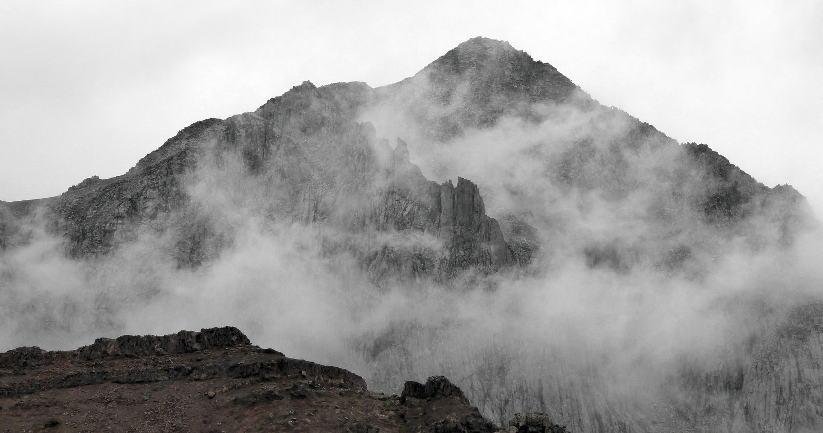
During our planning it was tough to get a good read on South Lookout. Some have lumped it in with the other class 5 13ers, calling it one of the most difficult summits to reach in the state. Others have called it mostly a walkup with some class 3 and 4 thrown in. How exposed is it? What’s the best route to the top? We weren’t really sure, so we kind of just decided to wing it.
South Lookout Peak. We worked our way through those gullies on the right to gain the grassy bench below the true summit.
In the gullies we were treated with our first loose rock of the trip. I found myself on a few unnecessarily difficult moves while Kyle took a higher/better route. Eventually we met back up at the base of the summit block. From there we made the short climb to the summit up a fun dihedral. This aptly named peak is perfectly positioned for some prime time views so we made sure to enjoy them.
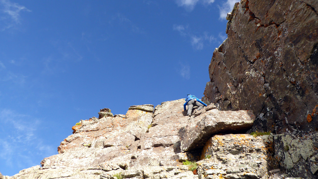
Fun class 4, perhaps low 5 in the dihedral just below the summit. The nice thing is there’s almost no exposure.
Looking down the same pitch. Photo by Kyle.
South Lookout’s summit and views towards the Ice Lakes group. That’s US Grant on the right.
Overall I won’t confirm the hype that this is a class 5 peak by its easiest route. Not to sandbag a peak that is no doubt in the toughest 10 or 15% of all peaks above 13k. I just don’t think it deserves to be regarded as highly as Peak Fifteen, Jagged, Lizard Head, etc. It’s a loose class 3 peak with a few harder moves in a part of the range that is well-known to be loose.
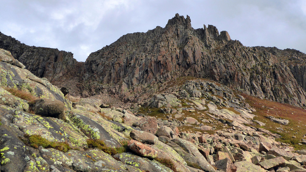
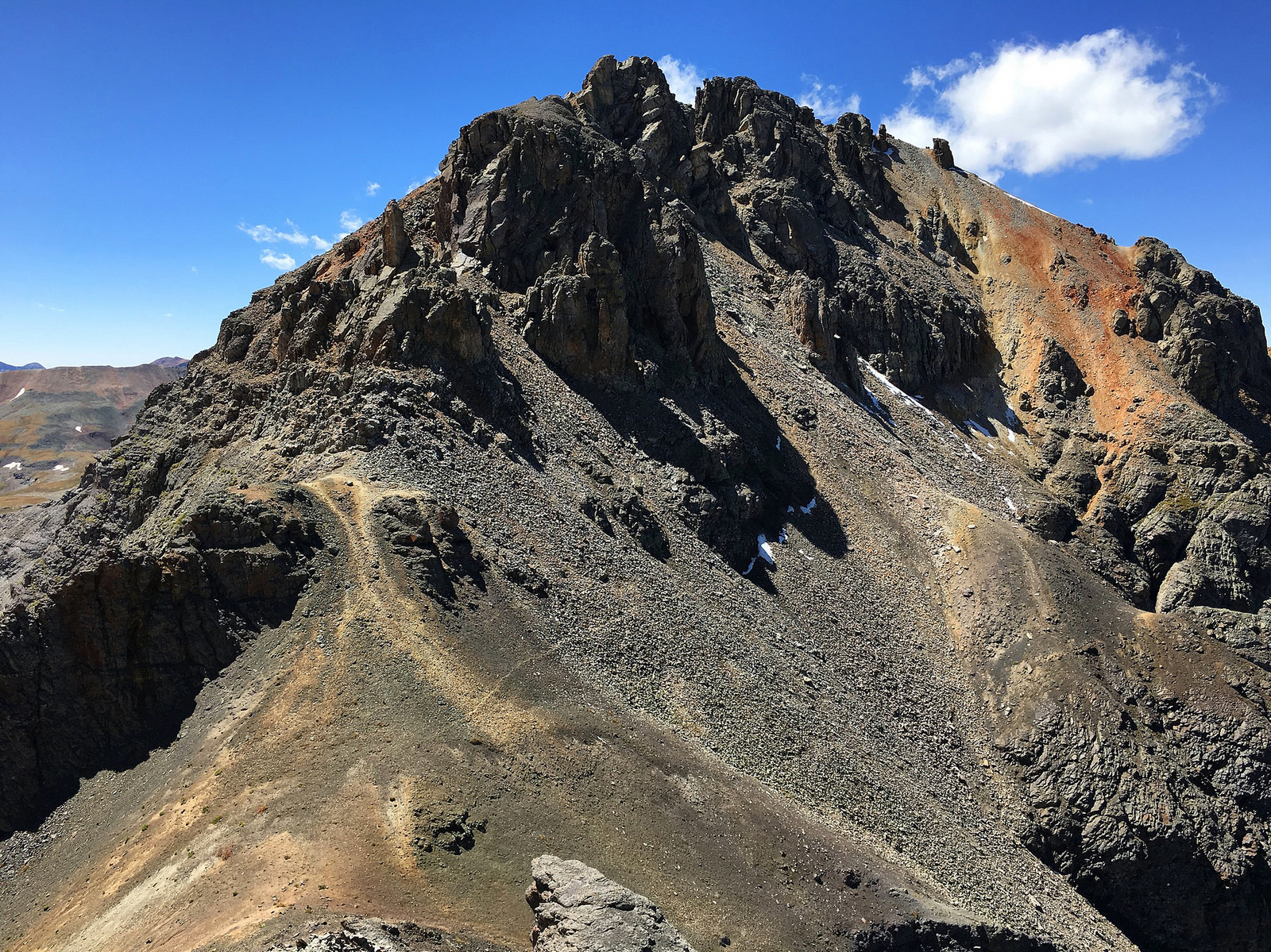
Next up on the agenda was neighboring 13er “V 5”. This one seems to always be combined with South Lookout and we soon found out why. After reversing our route back down towards the lake we traversed across the basin and “V 5” was staring us right in the face.
“V 5” emerging from the gloom across the way, taken from high on South Lookout.
Switchbacking up an old mining road aided our progress up “V 5”. Eventually we broke off the road and ascended steep grass to the base of the gully east of the summit.
Ascent gully we used to get up “V 5”. Clear Lake and South Mineral Creek can be seen below.
We headed up the loose but efficient gully, and then ran west along the summit ridge to the top of the second peak of the trip. The views from this one aren’t too shabby either…
“V 5” summit with storms approaching. South Lookout is far right. This was right about when I realized I left my sunglasses on top of South Lookout’s summit. Son of a….
After Kyle successfully talked me out of going back up South Lookout to retrieve my glasses, we headed on down to Silverton for pizza and beer at the Avalanche.
From Silverton we motored south along 550 to Purgatory and up the twelve mile long Cascade Divide Road, the staging point for the following day’s goals. Once again Kyle was able to maintain a good speed up the road and we arrived in under an hour (I could see this road taking two hours for a slower driver). Brats on the grill, a few beers, and a little whiskey rounded out the evening nicely. We traded in a little early in preparation for the next day.
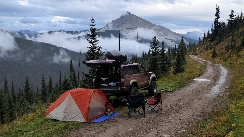
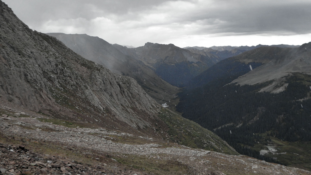
Accommodations at the end of the road were scarce, so we made do with what we had. That’s the backside of Engineer Mountain in the distance.
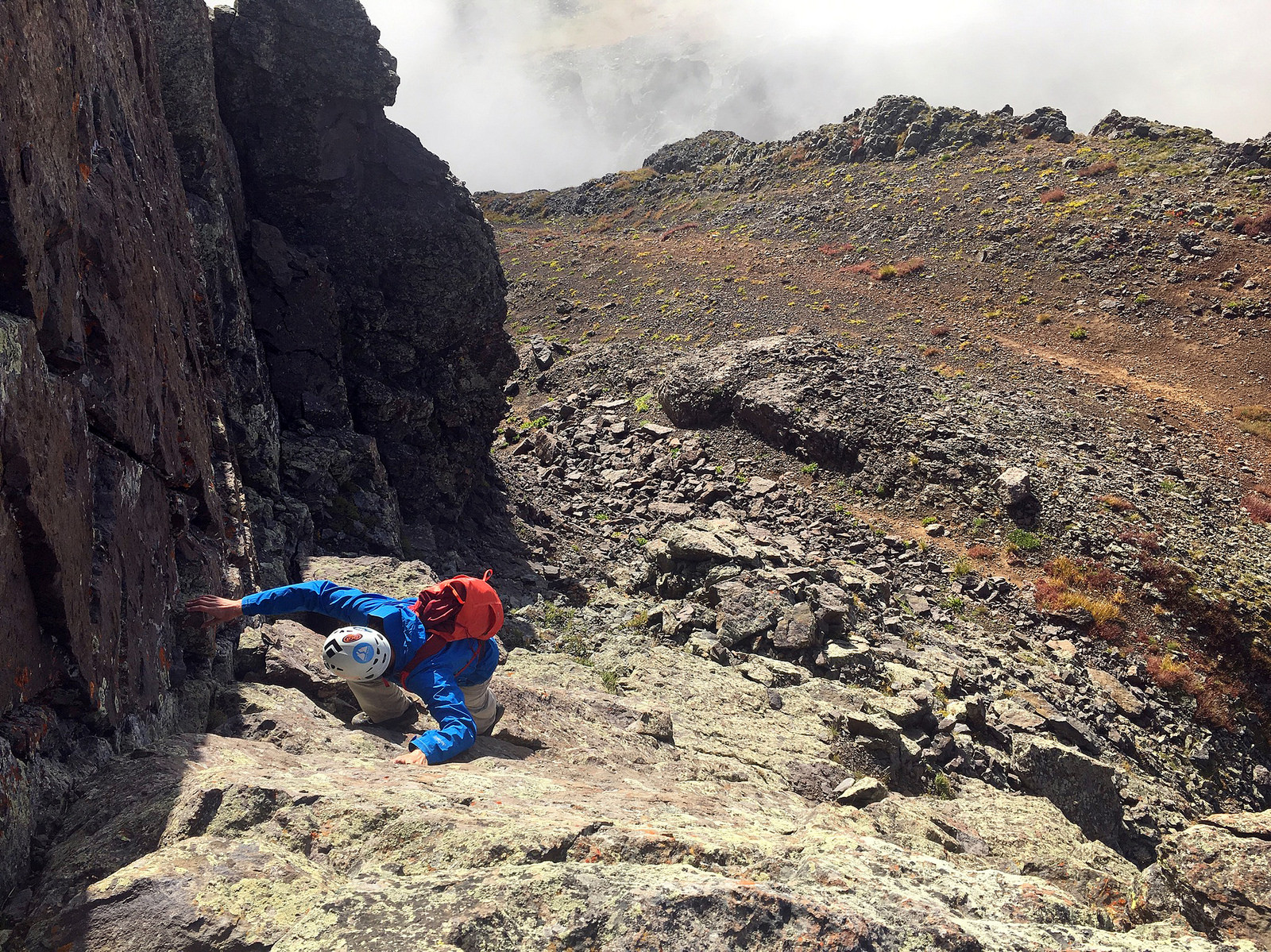
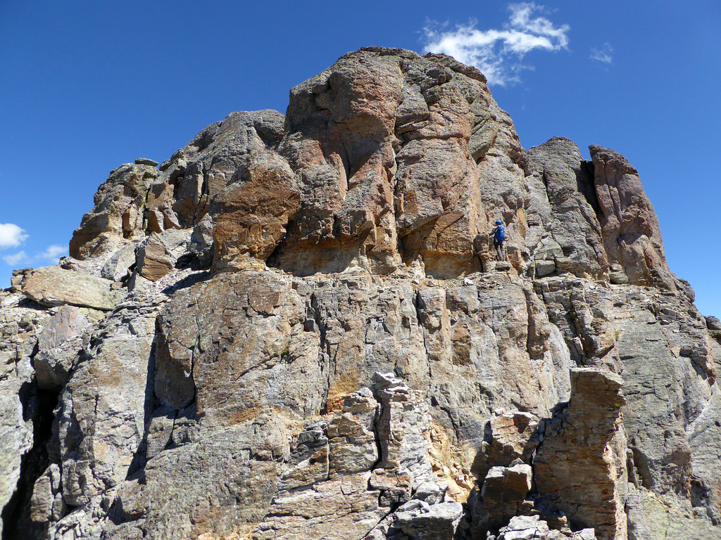
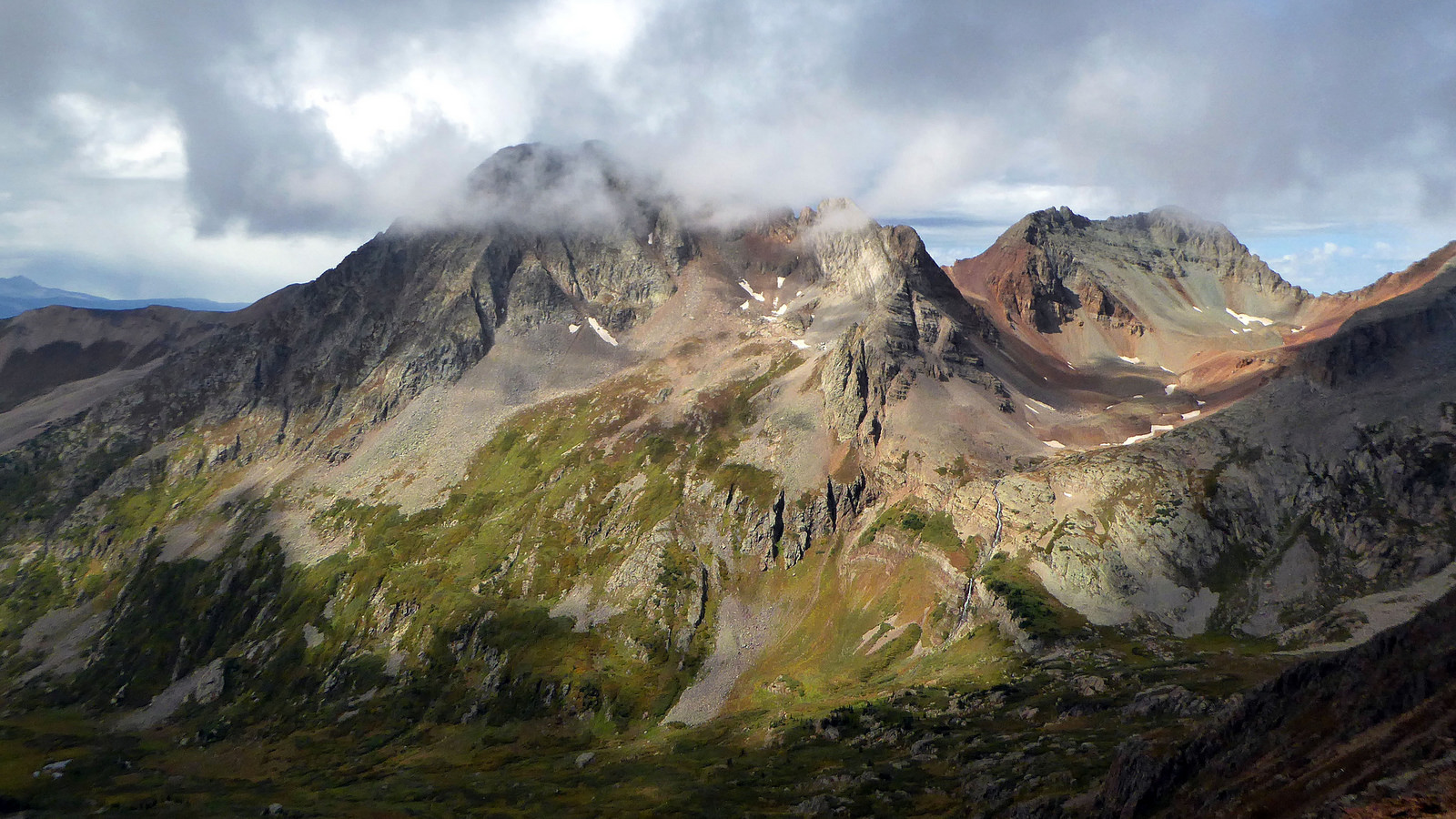
This was the day I was looking forward to the least (yet ironically it turned out to be my favorite). Grizzly Peak B and “V 10” are two of the more obscure 13ers I’ve done to date. Looking at the topo and photos from prior trip reports just didn’t instill much of an expectation of “fun” to be had. A lack of defined routes/trails, loose rock, and a feeling of isolation up a pretty remote drainage all contributed to my lack of enthusiasm. But as per usual, once Kyle and I started up the trail in the morning, all doubt was cleared from my mind and replaced with the excitement of just being out there.
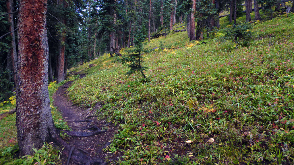
Lush forest along the Colorado Trail. It rained much of the night prior and didn’t stop until 6am, so things were pretty dang wet.
After a mile or so we left the trail and traversed upwards along the east side of Grizzly B’s long south ridge. Tundra eventually gave way to rolling moraines and loose talus fields below the peak’s southern ramparts.
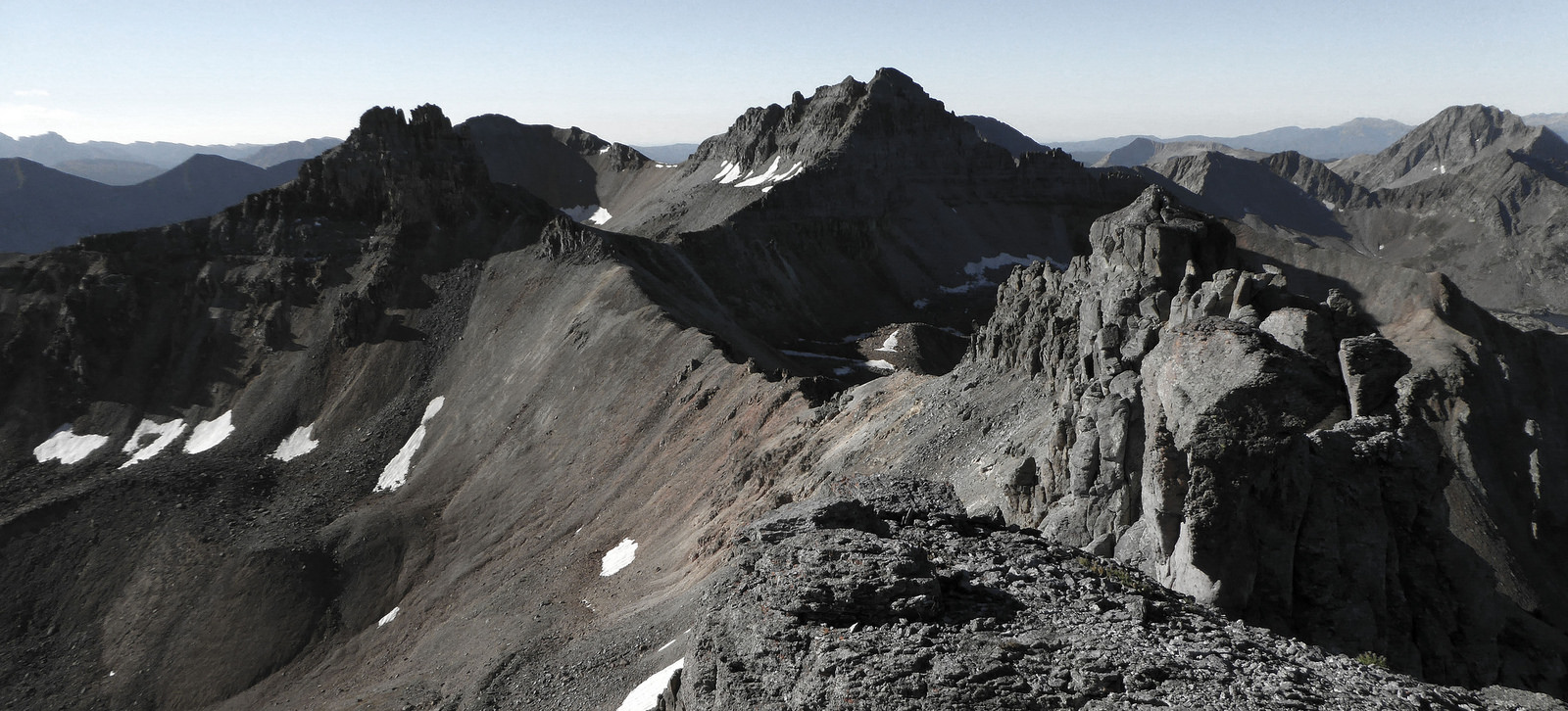
Grizzly Peak B emerging from the morning fog.
We aimed for the ascent gully others have used in the past and it wound up working great. It’s a wide chute packed with large, stable boulders. We were able to make good time up Grizzly once we finally made it to the chute’s base.
Grizzly looking slightly more friendly. The ascent gully is on the left, ending in the obvious notch.
We hopped up Grizzly’s summit ridge and were greeted by stiff, cold winds on the summit. It was much more reminiscent of October in the mountains than early-September. What we found on the summit however had us both thinking about the ocean…
Summit seashell!
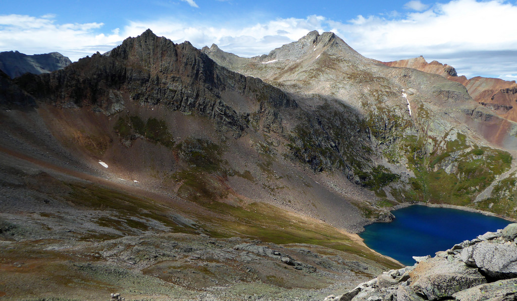
After a short summit stay we reversed our route down the south ridge of Grizzly and looked for a viable place to drop west off the ridge down into South Twin Creek (the Grizz B/”V 10″ direct traverse doesn’t go, so dropping into the drainage to the west and contouring underneath Grizzly over to the saddle is the next best option). We found a gully that worked well until it cliffed out at the very bottom. A short traverse to the north and some interesting downclimbing had us to the basin proper. From there we were free and clear with the “V 10″/Grizzly saddle in our sights.
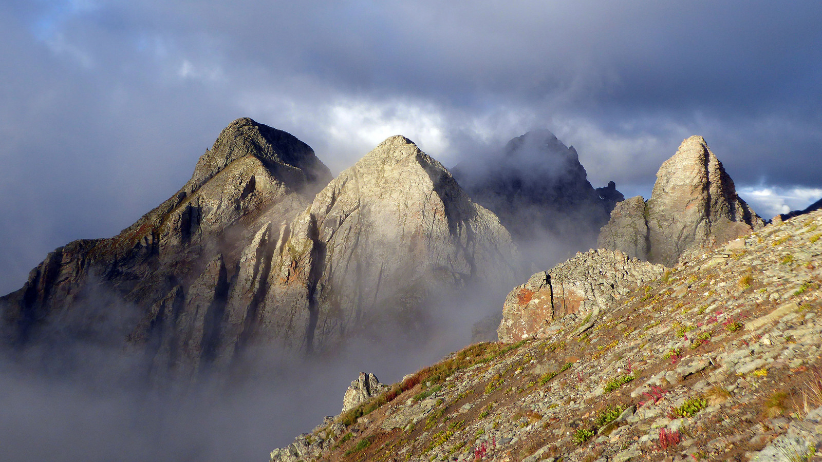
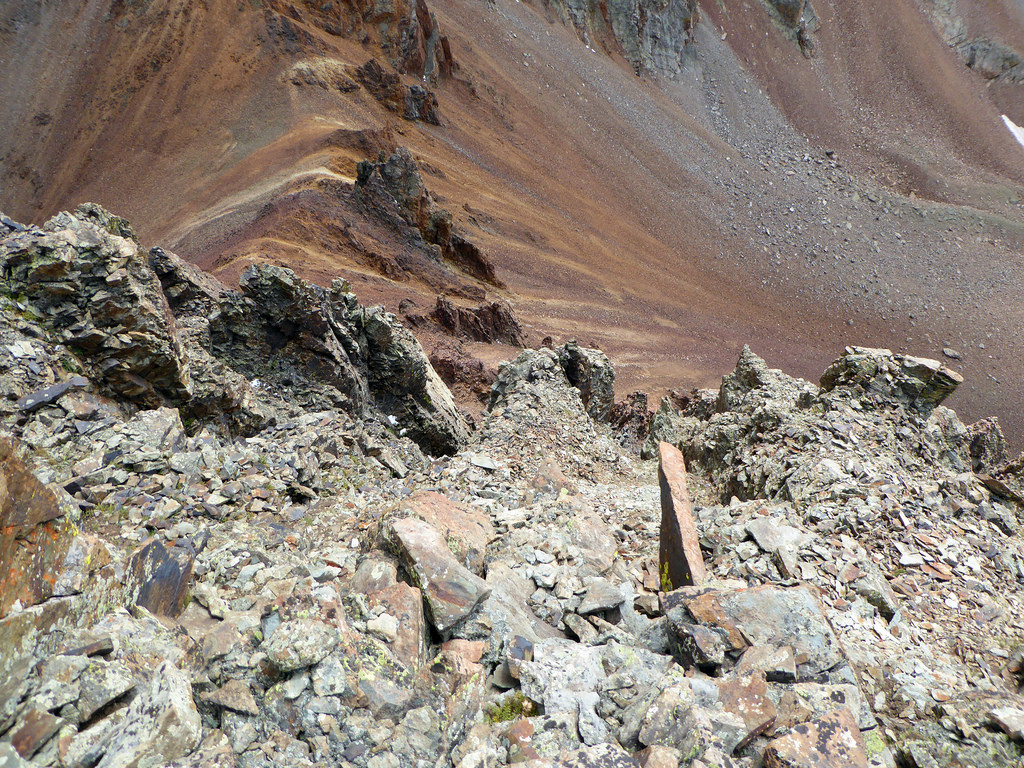
“V 10” and its impenetrable looking south side cliffs. The route goes up to the saddle with Grizzly and then takes a nasty traverse below the ridge line above those red cliffs to bypass the obvious towers, then gains the ridge closer to the summit.
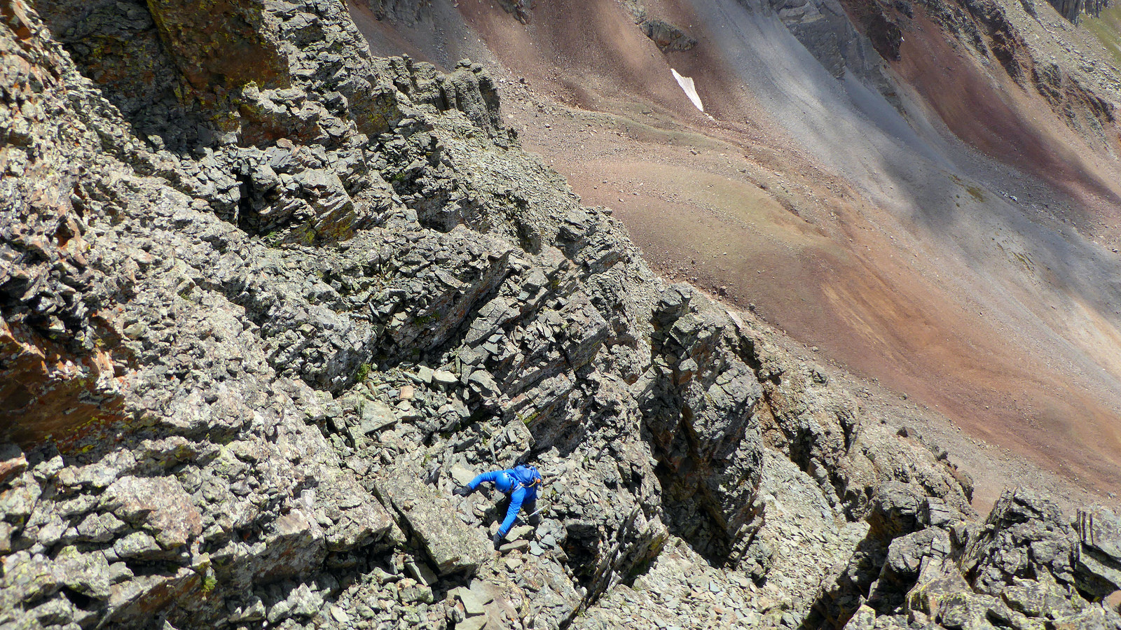
Loose rock. Talus. Choss. Oh my. The slope leading up to the Grizzly/”V 10″ saddle was without a doubt the worst talus I’ve ever come across. It was so loose we probably climbed 1,000 ft in the process of gaining 300 ft to the saddle. I’ll say no more. Once at the saddle, we scrambled up the ridge and soon after committed to the rotten traverse across the south face of “V 10”.
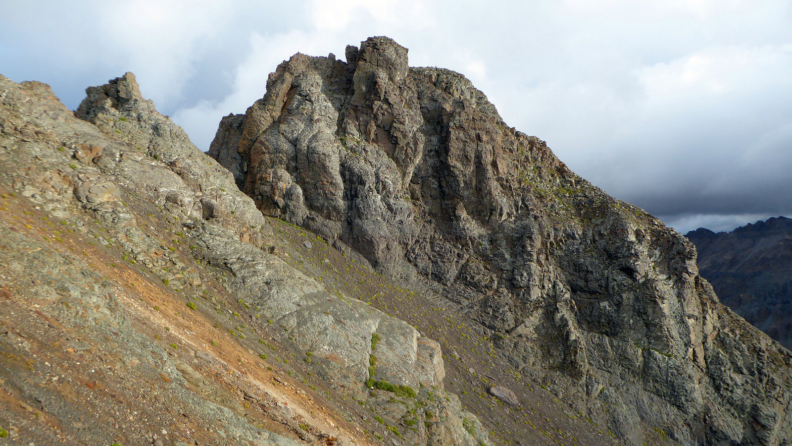
Typical terrain and exposure on “V 10”. The saddle can be seen below.
We followed scarce but sufficient cairns in and out of several gullies across the south face. The route is kind of self-evident in that you can’t really ascend or descend too early or too late without finding yourself completely cliffed out. Anything that feels like more than class 3/4 means you’re likely off route.
Just look at this mess. Photo by Kyle.
We finally hit a point where traversing laterally was simply no longer an option, so we figured that meant it was time to head upwards. A glance out across the terrain to the west reminded me of the asteroid scenes from Armageddon with all those gnarly looking rock features and gasses randomly spewing out of the ground.
Nearing the summit ridge.
Once on the ridge proper things got less tedious and we were able to make good time across to the true summit of “V 10”. The register had a grand total of 3 entries since being places by Roger Linfield in September of 2014.
‘V 10″ summit. It felt good to get this one checked off the list. Photo by Kyle.
We backtracked and eventually found a suitable descent route off the summit ridge to the north. A 2,000 ft talus descent landed us in upper-Cascade Creek. From there a fairly involved bushwhack through numerous willow fields and stream beds eventually led us back to the Colorado trail.
Good times. Photo by Kyle.
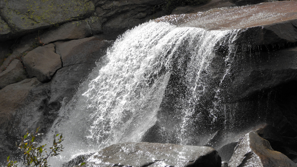
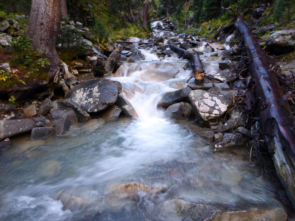
A cascading creek in Cascade Creek.
We capped off the day around 5pm and noted that even though the stats only came in around 10 miles, 5,000 ft, it sure felt like a lot more than that. This was a tough tour to get two peaks, but one Kyle and I both enjoyed in the end for some reason. I think the solitude and obscurity factor wound up being a positive thing, once the day was behind us of course.
A parting shot of Engineer from Cascade Creek drainage.
After dinner at Handlebars we found a free campsite at Anvil Campground and promptly hit the sack.
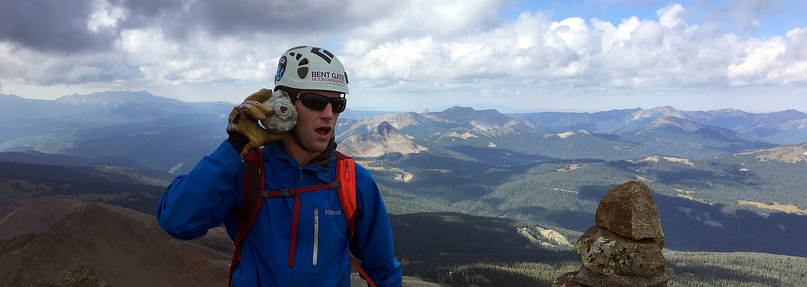
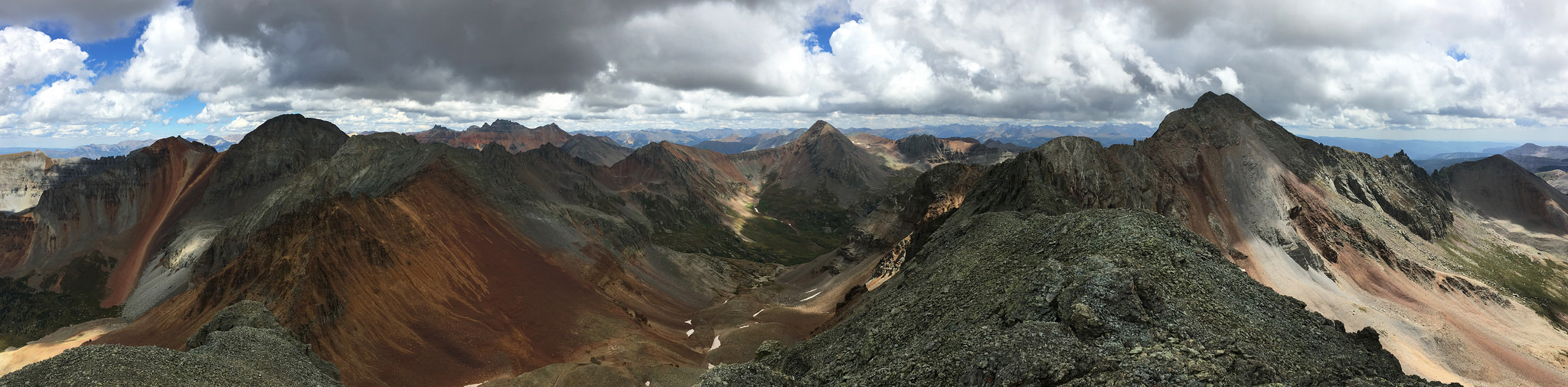
The next day we woke up with the most anticipated loop of the trip on the docket – an Ice Lakes Basin cleanup. We had both been to this magical place once before to climb Vermillion and Golden Horn, but the more interesting peaks, namely Pilot Knob and US Grant, had long been on both our wish lists. With a bluebird forecast (the only one of the entire trip) we made our way into the alpine and soon had Pilot Knob in our sights.
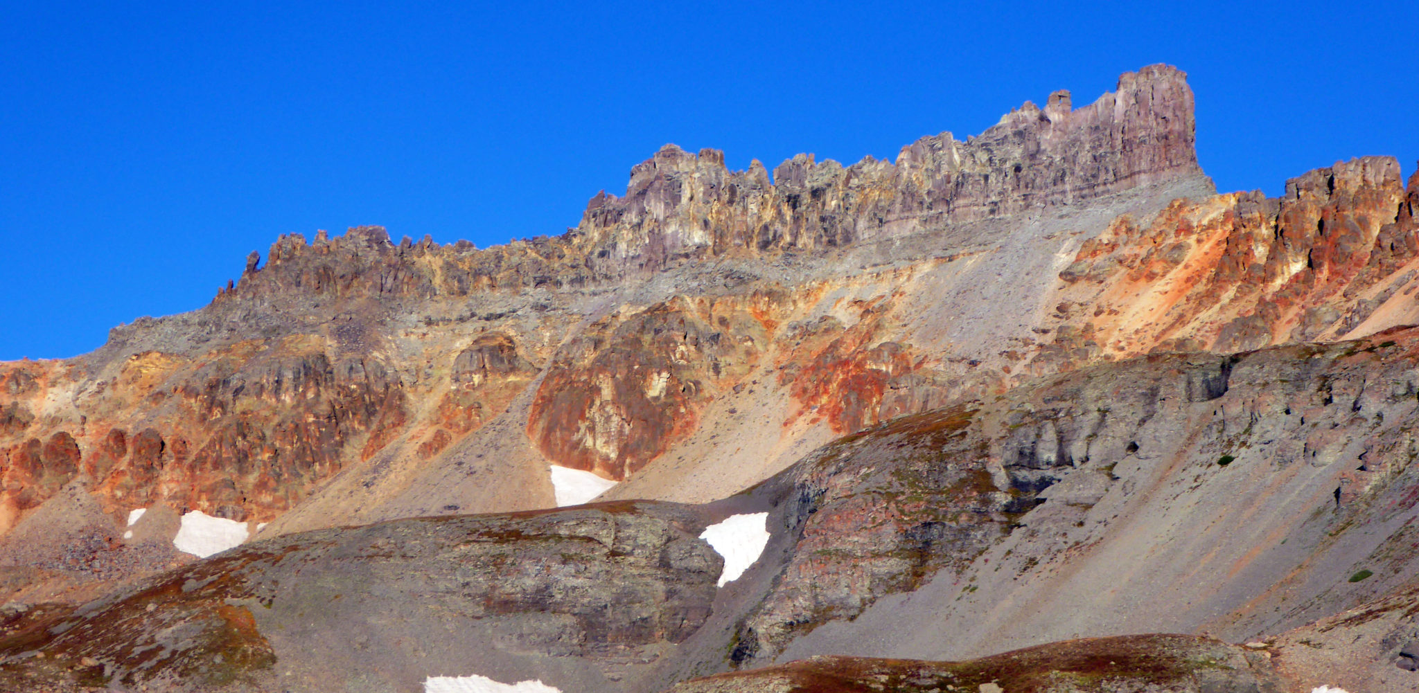
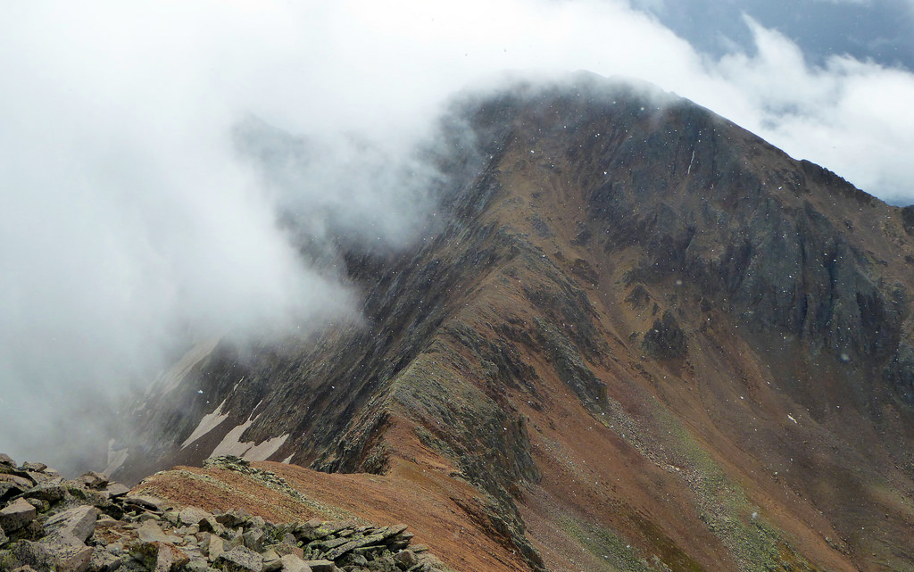
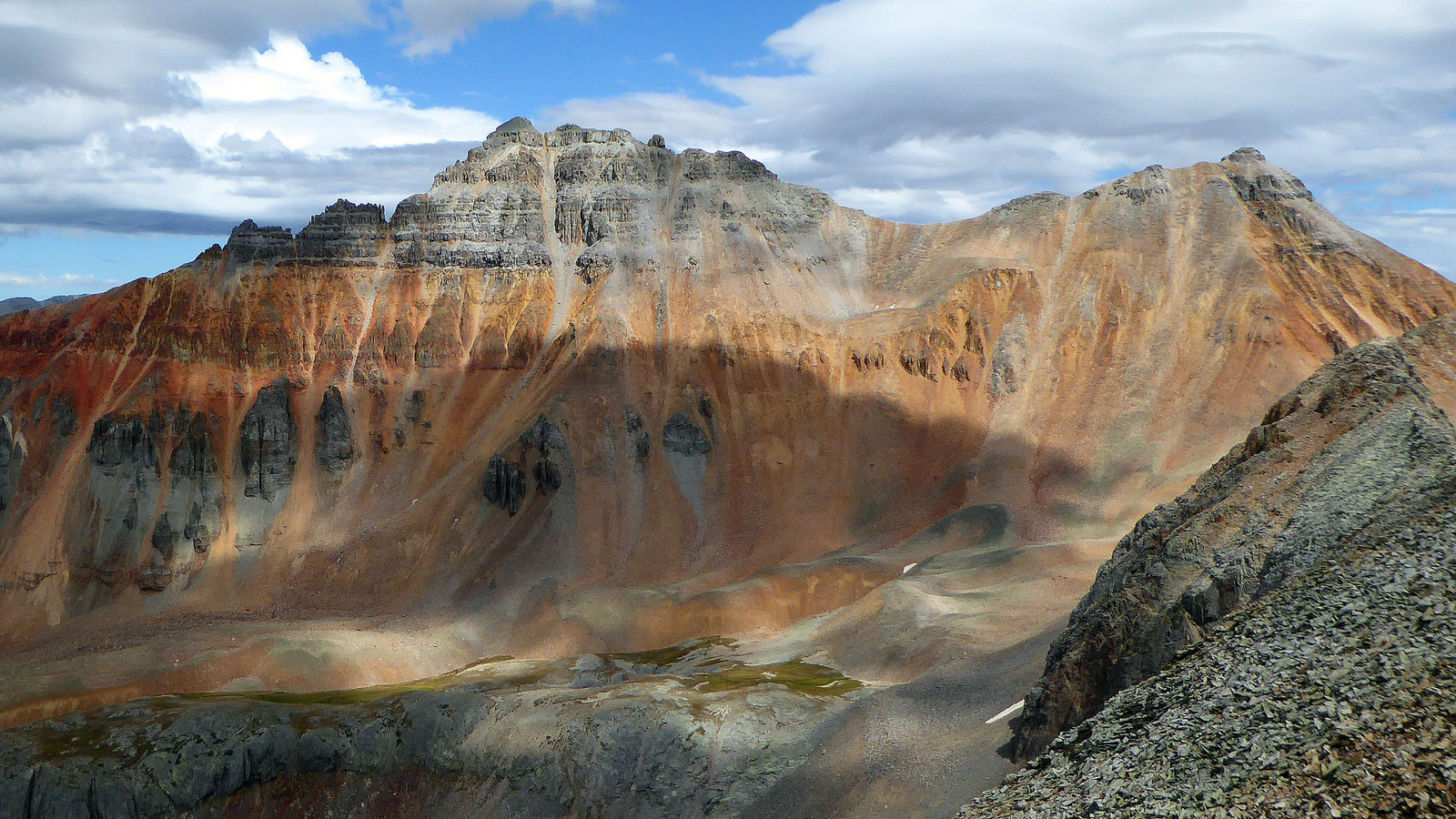
Pilot Knob’s awesome colors.
The route on this one has been documented many times before so I won’t go into much detail. We both felt it to be a short, fun, classic scramble on solid rock. As per usual on peaks that tend to receive lots of hype, we found Pilot Knob to be straightforward.
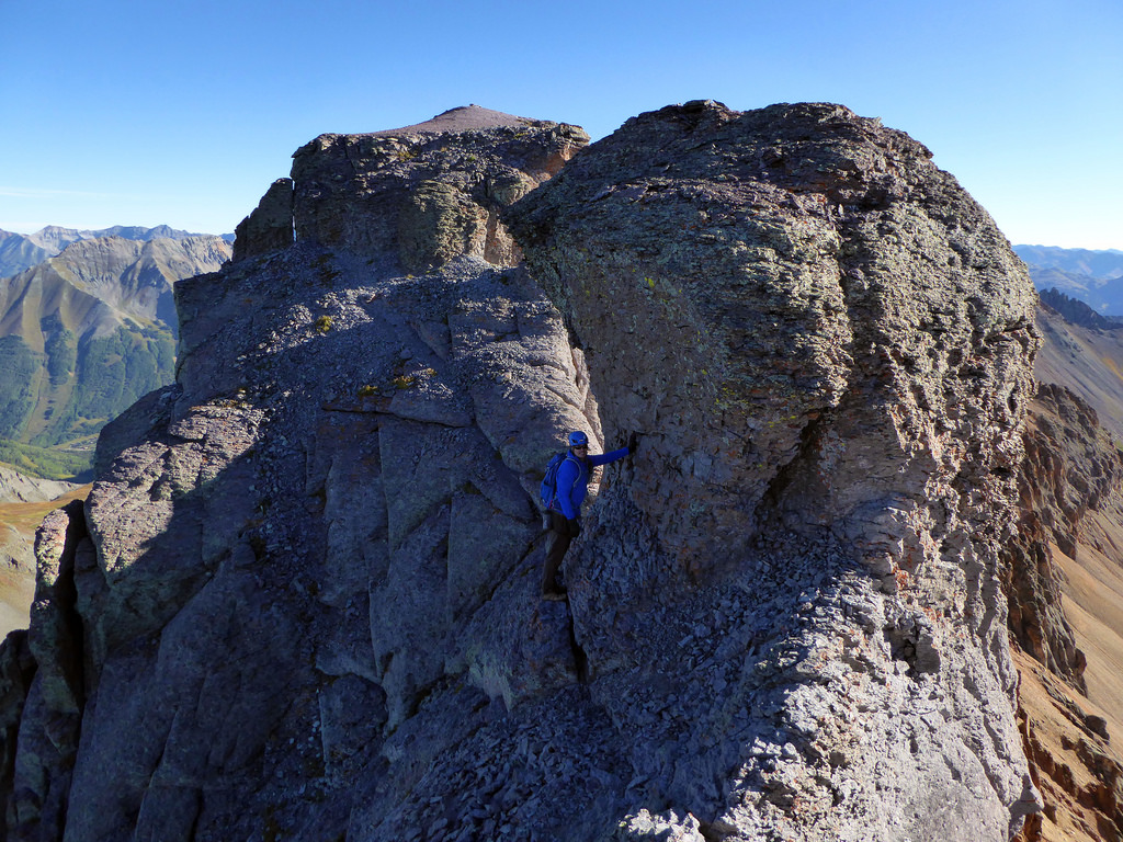
Scrambling along Pilot Knob’s ridge with the summit in back.
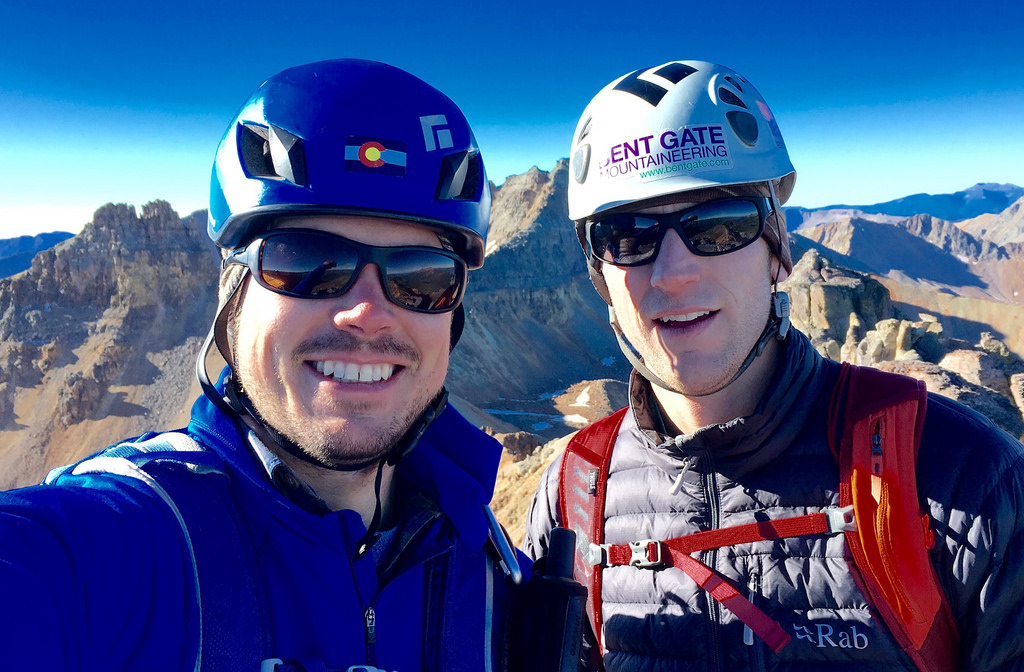
Summit of Pilot Knob. Those are newly acquired gas station sunglasses.
Next up was the Island Lake trio – ‘V 4″, US Grant, and “V 2”. These three peaks make for a logical loop especially when not combined with an outlier like Pilot Knob or Vermillion. Little did we know our friends Kelle and Bob and Kate Finn were hiking this loop on the same day. We would wind up catching up with them near the summit of “V 2”.
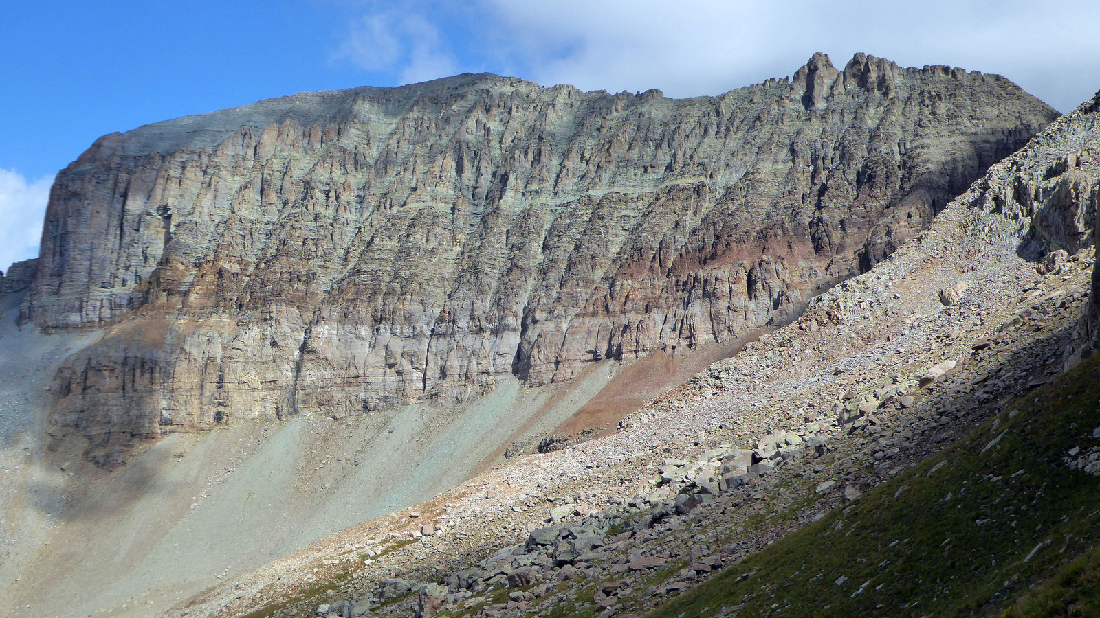
US Grant towering above Island Lake.
We made our way up to the “V 4″/Grant saddle and headed west around the towers at the base of the northeast ridge of “V 4”. Above the loose talus field we hit a small saddle and then finished off the remaining vert to the summit.
On the summit ridge of “V 4” with US Grant and its standard route visible in the background.
A look at the route up “V 4” from US Grant. Note the faint climber’s trail down below and the mini-saddle higher up. From that mini-saddle it’s a short hike around to the left. The true summit is the northernmost pinnacle. Photo by Kyle.
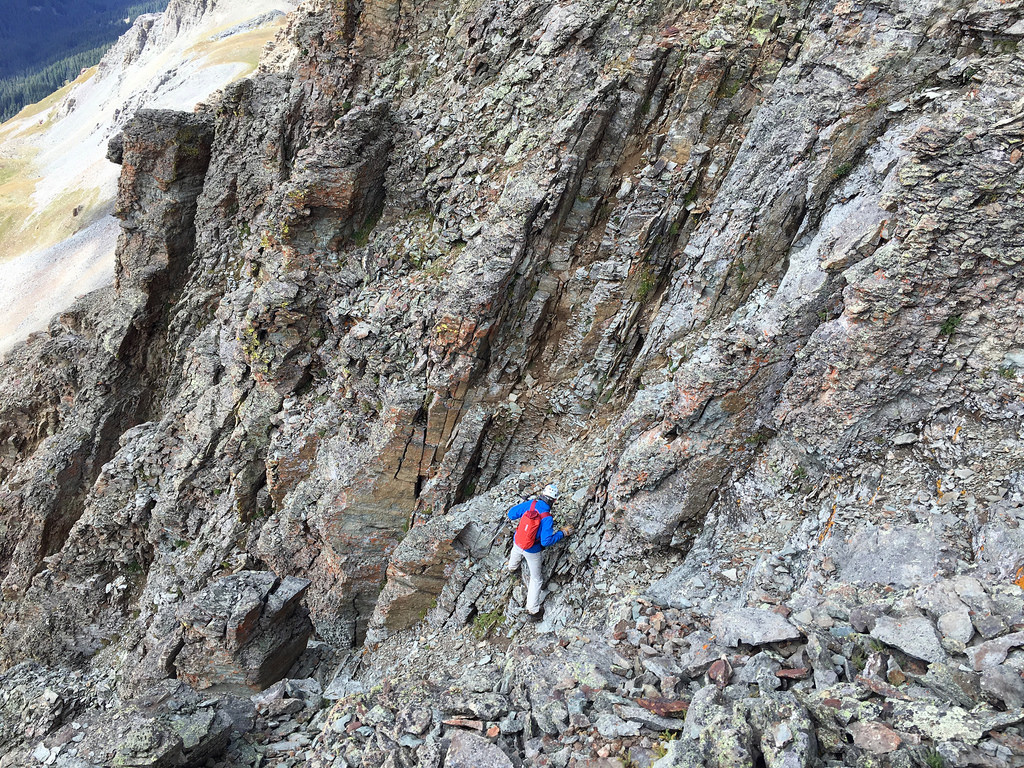
With “V 4” in the bag we made quick time back down to the saddle and started up US Grant. Not long after we found ourselves at the base of the crux headwall, which went down smoothly. Ten minutes later we were standing on top of the peak named after the 18th president of the United States.
US Grant crux. A small class 4 climb down low, followed by a traverse across a ledge to the south and then a short gully climb to the summit ridge and then the summit.
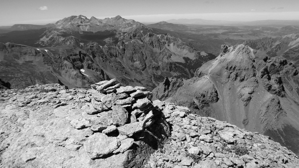
US Grant summit looking out at the Wilson Group and “V 3” in the foreground.
Apparently there is a relatively straightforward way to traverse from US Grant over to “V 2”. If such a way exists, I tip my cap to those who have found it. Suffice it to say that Kyle and I did not find it. Thankfully we are both pretty stubborn and aren’t deterred easily, attributes which eventually got us down to the Grant/”V 2″ saddle in one piece. I’m not even going to bother trying to describe what we did. Moving on…
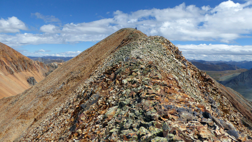
The gentle ridge and summit of “V 2”, our last peak of the day and 8th of the trip.
We made quick work of “V 2” and after chatting with the Finns and Kelle for the better part of half an hour, we descended the Island Lake spur trail back to the car and motored back over to Anvil for an awesome Bertolli tortellini and pesto dinner.
Rain fell intermittently throughout the night. At 6am the next morning we sat at the Rico-Silverton TH, once again hunkered down in the car to wait out the morning squalls. I can recall many Labor Day dry spells in the San Juans that entailed Indian summer’esque stretches of bluebird and unobstructed peakbagging. This trip was simply not one of those. But we were happy with how we had managed the weather to this point and stacked our days in the correct order to maximize success. This last day was the wildcard. Sometimes you don’t know ’til you go.
Stream crossing en route to the grassy meadows below Rolling Mountain.
After maybe two miles we broke off the trail and ascended the east bowl of Rolling Mountain, eventually gaining the peak’s east ridge. The weather was doing some wacky stuff. Clouds would roll in quickly, drop some graupel, then it’d be sunny and warm for a few minutes, then clouds again.
A bout of graupel from higher up on Rolling. The approach up Mineral Creek can be seen down below.
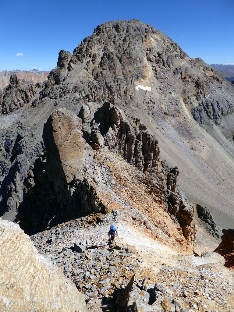
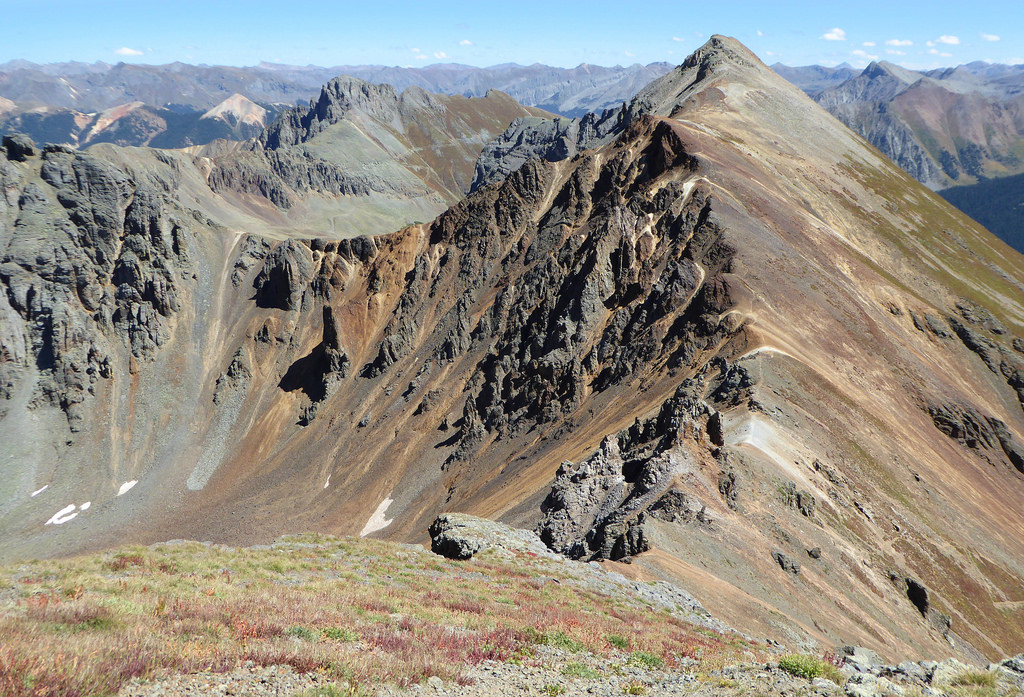
Rolling’s summit from the east ridge.
We topped out on Rolling just as a dense fog engulfed the entire peak. Graupel continued to come down and then we both felt some static electricity tugging at our zippers. We quickly descended and headed up and over Rolling’s western false summit. ‘V 9″ wasn’t far away and on our way up it, to our delight, the weather started to improve.
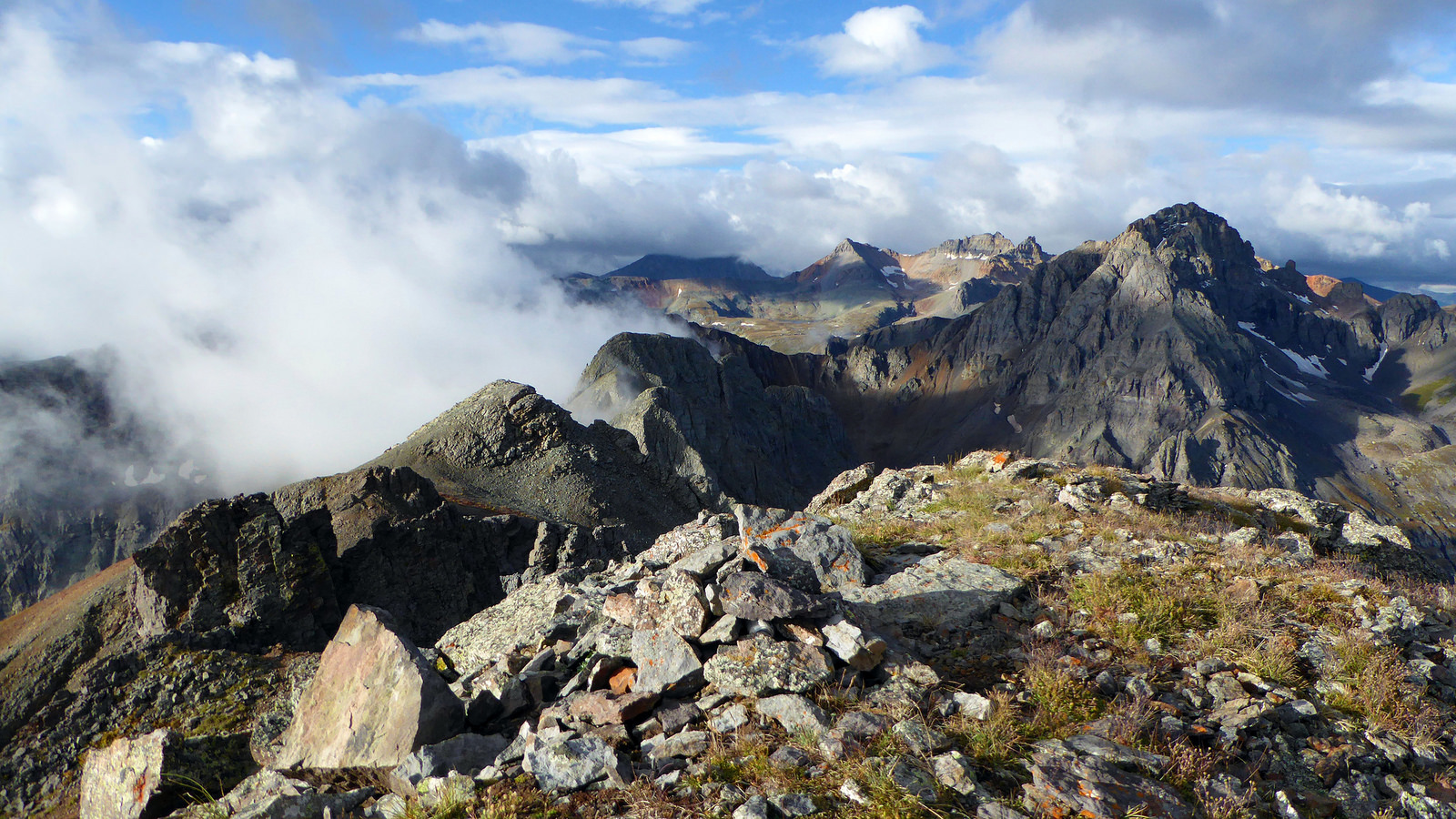
Looking back at Rolling Mountain and the storm from “V 9”.
Grizzly and “V 10” (right) seen from the summit of “V 9”. That’s Cascade Creek down and to the left.
We had originally planned on adding San Miguel to the set, but because we were forced to move the biggest loop of the trip to the last day, it would have meant getting back to Denver around 3am. Neither of us were very interested in that at that stage, so we elected to leave San Miguel for another trip.
Lake Hope from “V 8”. San Miguel (the one that got away) is the double summit in the background.
Ready to slog out the remaining two peaks and be done, we picked our way down loose talus to Hope Pass, then ascended a field of large boulders up to the summit of “V 8”. We continued out along narrow but surprisingly solid ridge line to Beattie, enjoying superb views of the backside of Vermillion along the way.
Vermillion and Fuller from the back.
Beattie’s summit ridge and the 12th and final peak of the trip.
Beattie summit, September 6th.
As it began to rain again we worked our way down to the Big Three Mine. From there we followed the overgrown mining road back down to Rico-Silverton and the car. The drive home was a long one, but free of traffic and full of entertaining conversation.
Parting shot of Rolling Mountain framed by mining ruins.
Kyle man, it was great to get out with you on these. Thanks for an awesome trip. Hopefully this TR will help preserve some memories. And to anyone else who has managed to read this far, thanks a lot for reading. Cheers 😉
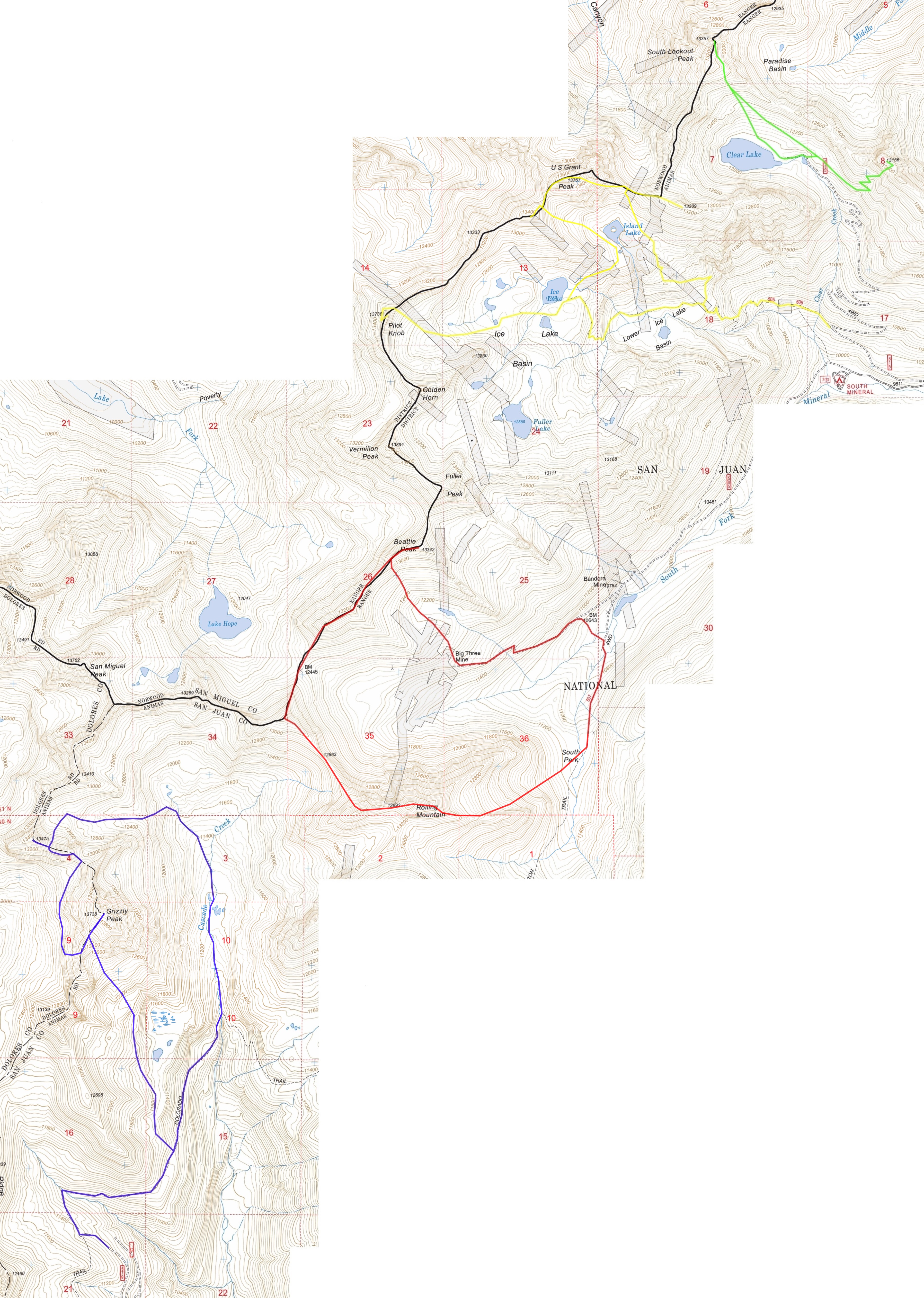
Map of the days. Day 1: Green, Day 2: Blue, Day 3: Yellow, Day 4: Red
What a sweet trip, Conners! Man, you have gotten into some remote areas, buddy. Really cool. Have a great time at Miller’s wedding manana! So wish we could attend. Heading to Kauai Saturday for a week and its just too much to incorporate right now.
Brando, it sure feels like it re: remote areas. San Juans are fun to explore. Thanks, Miller’s wedding was a blast. And have fun in Kauai!
Sweet trip! You really captured some wonderful pictures, Ben, and I know I will ask you more when I get to doing V10.. I thought V8’s west ridge was one of the worst talus heaps, but once past that, the ridge over to Beattie is quick and delightful as you gaze over to Vermillion. From Grant, you must have dropped off the ridge early. Staying high, I found a fun scramble down to the v2 saddle. But you guys probably made as good time, despite the difficulties. Looking forward to new trips now that this knee is mending!
Steve, yeah V8 was pretty loose. I think you’ll like V10 when you get around to it. It’s loose but really cool. I’m glad to hear the knee is ready to go. Let’s go test it out tomorrow 🙂