- Climbers: Zambo & Josh
- Peak: Lone Eagle Peak (11,919 feet)
- Route:
- Approach: Via Monarch Lake Trailhead (8,345 feet)
- Ascent: North Face Route (5.7)
- Descent: Solo Flight Route (4th class)
- Distance: ~17-18 miles
- Vertical Gain: ~3,900 feet
- Round Trip Time: 15 hours, 20 minutes
- Date Climbed: Sunday, August 18, 2019
The Big Summer Outing – 2019 Version
Josh and I always seem to whip up at least one huge outing every summer season. But when he suggested Lone Eagle Peak for the 2019 version, I didn’t really know much about it. I knew it was a cool looking mountain deep in the heart of the Indian Peaks Wilderness. I knew it wasn’t even a 12er. And I knew that it had a sweet name. But that was about it. As it turns out, I wasn’t exactly wrong about any of those things, I just didn’t have the full appreciation of how great this mountain really is.
And so, I agreed to another summer epic, with essentially zero knowledge of what I was getting into. But in retrospect, I’m sure glad I did…..

I can relate…
A Bit About Lone Eagle Peak
As I mentioned, Lone Eagle sits in the middle of the beautiful Indian Peaks Wilderness. There are a few different ways to get to it and both of them take a significant effort (more on that later). But that, of course, is part of the appeal. Despite being just a few short miles (in a straight line) from the human-infested Front Range, being back there feels like a world apart. A tall surrounding cirque further ensures that this mountain is reserved for only those willing to hoof it into the wilderness.
The primary appeal to Lone Eagle is the stunning relief and view of its Northwest Face. It has been described as one of “the most awe inspiring peaks in Colorado” and this wall is a good part of the reason for that.. The sheer relief and rise looks like something straight out of the alps. All of that rock makes for some really choice climbing options as well.
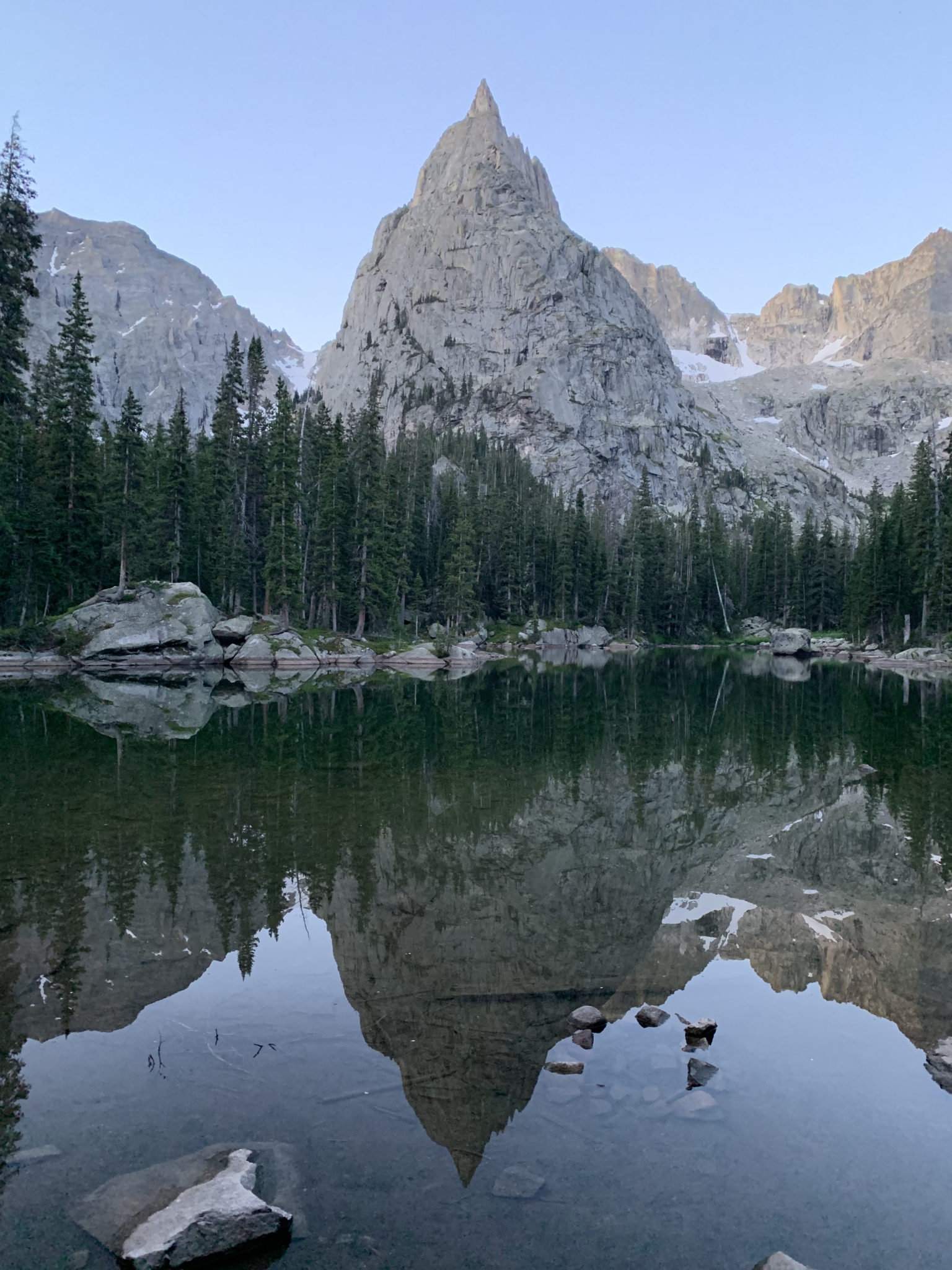
The “classic” Lone Eagle Peak photo. This view from the aptly named Mirror Lake is included in just about every mention of this area, which I found out as I started my research. And with good reason. This has to be a top 10 Colorado view, no contest. (Josh)
Predictably, what Josh had in mind was one of the sweetest / hardest / longest ways up the mountain – the North Face Route. This 5.7 climb promised a pretty healthy mix of all the best Colorado Mountaineering has to offer: long scrambling, alpine climbing pitches on excellent rock, out of this world exposure, and one of the coolest summits around. Our plan was to descend the Class 4 Solo Flight Route (<— to me, one of the coolest names for a route in the state), which would make for a nice cirque of the peak.
Interesting Side Note – How this one got it’s name
Lone Eagle Peak is named after the Lone Eagle himself, Charles Lindbergh. Apparently he visited Boulder four years before the transatlantic flight that made him famous. The Denver & Interurban Railroad was offering a $1,000 prize to any pilot who could land a plan on St. Vrain Glacier at the time. After several other pilots backed out of the attempt, Lindbergh came to town, took one look and remarked, “Sure, I’ll land on the glacier. I know I can do it, and I certainly could use that $1,000.”
His confidence only took him so far. After the main benefactor of the prize inspected his “suicide crate,” he promptly turned Lindbergh down. He also rightly suspected that Lindbergh had no plans to actually take off again once he landed.
Leaving Colorado empty handed, Lindbergh’s adventurous spirit would obviously serve him well a few short years later when he became one of the most famous people of the 20th century. This was a fact not lost on the old prize sponsors, who decided to name an unnamed spire in the IPW “Lindbergh Peak” in his honor. After the U.S. Board on geographic names nixed that idea – not allowing a mountain to be named after a living person – “Lone Eagle Peak” (one of Charles’s nicknames) was selected as nice consolation prize.
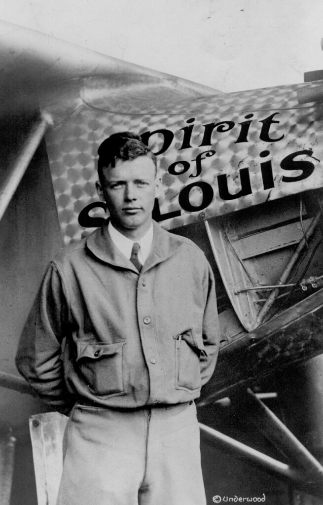
The original Lone Eagle. I never knew he made it to Colorado until researching this climb.
Approach
Anyway, as great as the history of the mountain is, the downside of today is the approach. Lone Eagle is reserved for those willing to walk. In this case, it was a solid ~7-8 miles to the lake and then another 1/2 to even get to the base of the first pitch. As Josh and I drove the long stretch of shoreline along Lake Granby the night before, I was silently complaining to myself the whole way, thinking about this upcoming hoof.
We arrived at the Monarch Lake Trailhead at dusk, with just enough time to set up our sleeping gear and marvel at the number of cars parked at the trailhead. We got to bed early enough (~8:00 PM for a scheduled 2:00 AM wake up), but our beauty sleep was interrupted around 10:00 to the sounds of gapers screaming in the wilderness. From my vantage point inside of my car, it went a little something like this:
Shuffling feet and distant noises of hikers arriving at the trailhead
Multiple people walk directly past Josh’s tent, apparently thinking this was THE best place to walk through in the acre+ sized parking lot
Angry Bro’s Voice (from a few cars away): “GUYS HE’S HERE!!!”
Loud banging on a car door
Indiscriminate female screaming from the other side of the parking lot
Angry Bro: “HE’S HEEEERE!! HE’S SLEEPING!!!”
Car door opens. Muffled, indescribable words from a Sleeping Bro in the truck.
Angry Bro: “We’ve been looking for HOURS!!!”
Sleeping Bro: Dejected mumbling sounds
Angry Bro: “Because you never leave your hiking partner on the trail….. No, you just DON’T do it!”
More dejected mumbling; rapidly approaching female whining noises
Angry Bro: “It’s 10:00. Pack up your shit and let’s go to camp.”
10-15 minutes of disheveled stuffing of a backpack
Commotion ceases as the whole crew walks off into the night
All of this happened while I was in a sleepy haze. Josh relayed the clearer version of the events to me in the morning. As best as we can tell, Sleeping Bro had gotten separated on the trail from his party on the evening walk in. Rather that continuing on, he felt it best to walk the 3-5 miles BACK to the car and take a nap. Fearing bears (apparently), his party decided to come all the way back to the parking lot to try to find him. Upon doing so, they promptly cussed him out, told him to come back to camp, left him behind (again!), and hiked all the way back to their camp, wherever that was.
Gotta love the Front Range….
Anyway, despite the interruptions, we still managed a solid 6 hours or so of sleep before hitting the trail at 3:00.
Despite my internal grumblings, the approach in the dark was uneventful, mostly forgotten among the dark pines and ever-winding trail. We were careful to take the correct turns, as the Monarch Lake TH is home to a number of different trail systems. Each offers its own unique passageway into the IPW, and I could quickly see why this is such a hot-bed for camping: beautiful scenery + relaxed trails + an abundance of nice lakes makes for a good combo. The gently rising trails were an especially nice treat. The approach gains ~2,000 feet, but spreads it out over the whole 8 mile distance before finally arriving at Mirror Lake.
We stopped there to snap the requisite pics, eat some breakfast, fill up waters, and make final prep for the day.
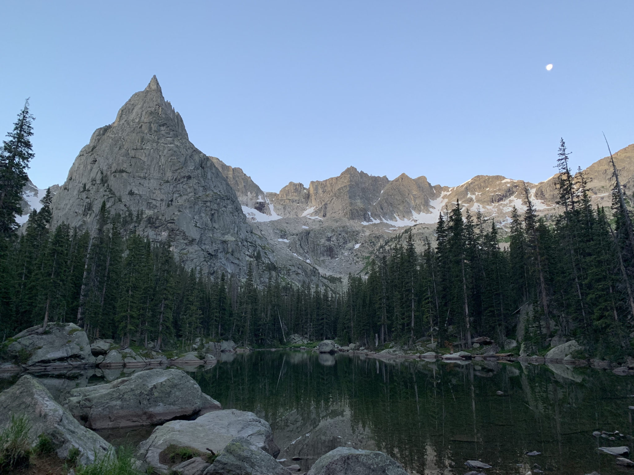
The beautiful setting moon that kept things bright all morning on the walk in. When daylight finally broke, we got a taste of just how impressive this cirque of surrounding peaks is. (Josh)
I’ll admit I wasn’t exactly feeling it at this point. A long week of work, an accelerating head cold, and the stress of leaving on a 6 week international trip in just 7 days was taking its toll. Given all of that, I wasn’t overly thrilled to go dangle off the side of a cliff all day. As we hurriedly filtered water and prepared for the next phase, I was feeling generally miserable and sorry for myself. Not a good attitude to have before the task ahead. I contemplated throwing in the towel right then and there, but something held me back.
Maybe it was the effort already expended. Maybe it was Josh’s ever-increasing excitement for the route ahead. Maybe it was the really good poop I just took. Or maybe I just really didn’t want to be in the same category of tool as Angry Bro & Sleeping Bro. Whatever the case, I made the choice right then and there to just suck it up, gut it out, and go enjoy the day. Sometimes you gotta embrace the suck by just deciding to not let it get to you, if you know what I mean.
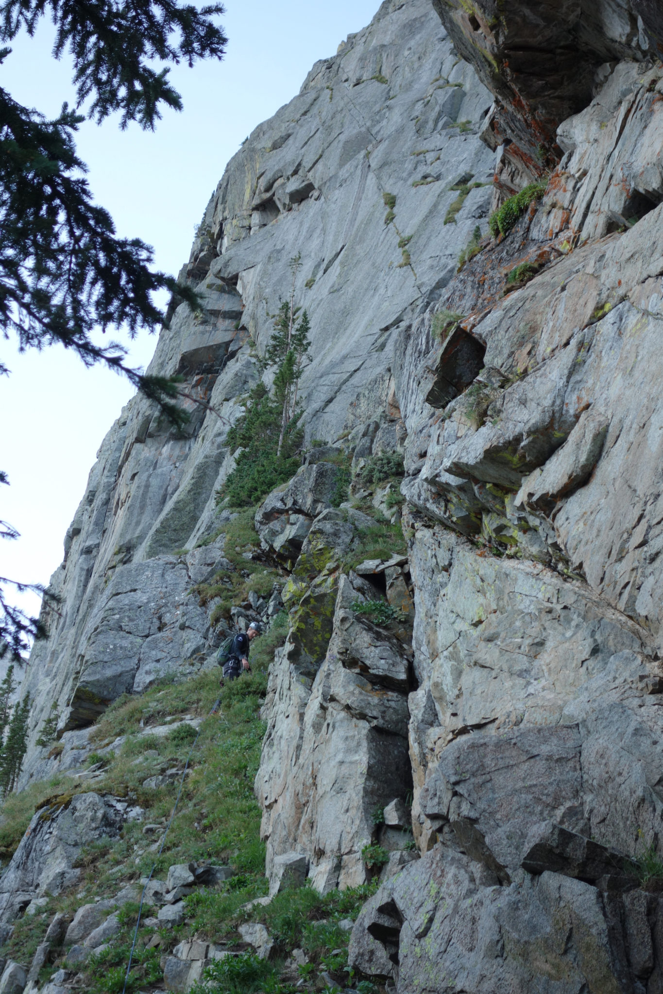
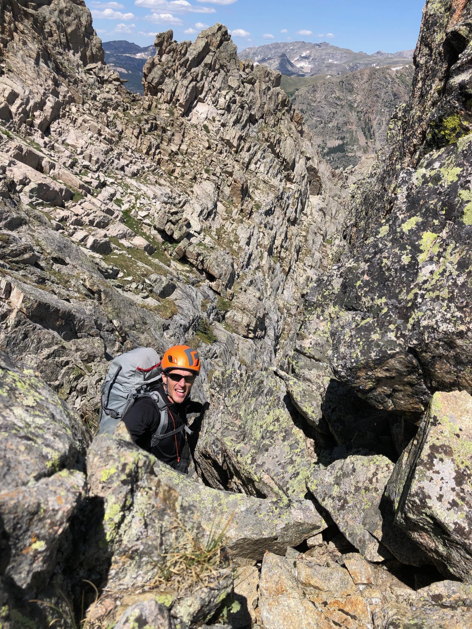
So, as I shut off the internal whining as we packed up and made the short bushwhack up to the base of pitch #1.
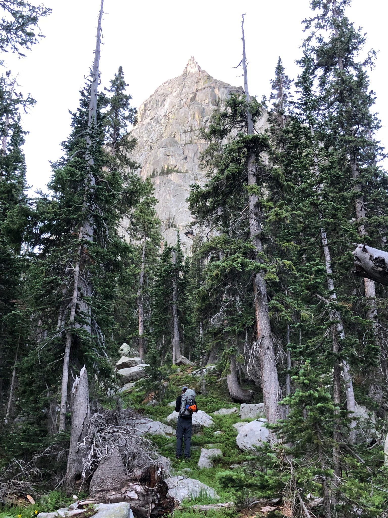
A series of feint climbers’ trails ascend towards the sweeping Northwest Face beyond Mirror Lake. I’m not sure we found any on the way in, but the general idea was pretty hard to mess up. (David)
North Face Ascent
The North Face Route is a super cool mix of scrambling, gully climbing, and alpine rock. There are 10-11 pitches (depending on how you count), each with their own interesting flavor. I’m not sure a pure rock hound would really love this route (since only a few of the pitches are truly sustained climbing), but the mix felt like a perfect Colorado Mountaineer’s route to me.
I’ll just share highlights for this report, but both the Mountain Project and Summit Post route descriptions were our guide. We found each to be pretty much spot-on in terms of beta.
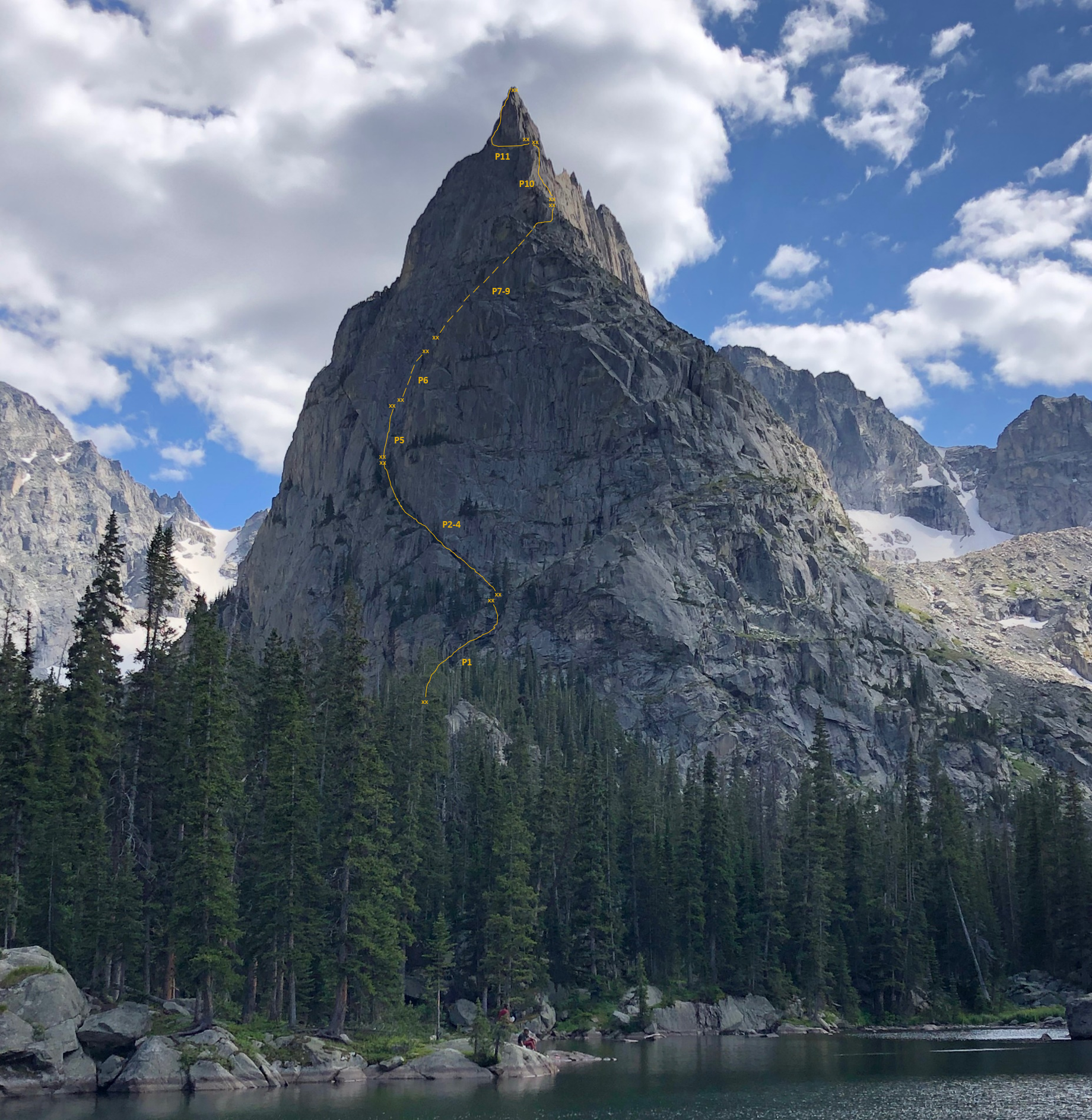
The North Face Route of Lone Eagle Peak drawn in full. (Zambo)
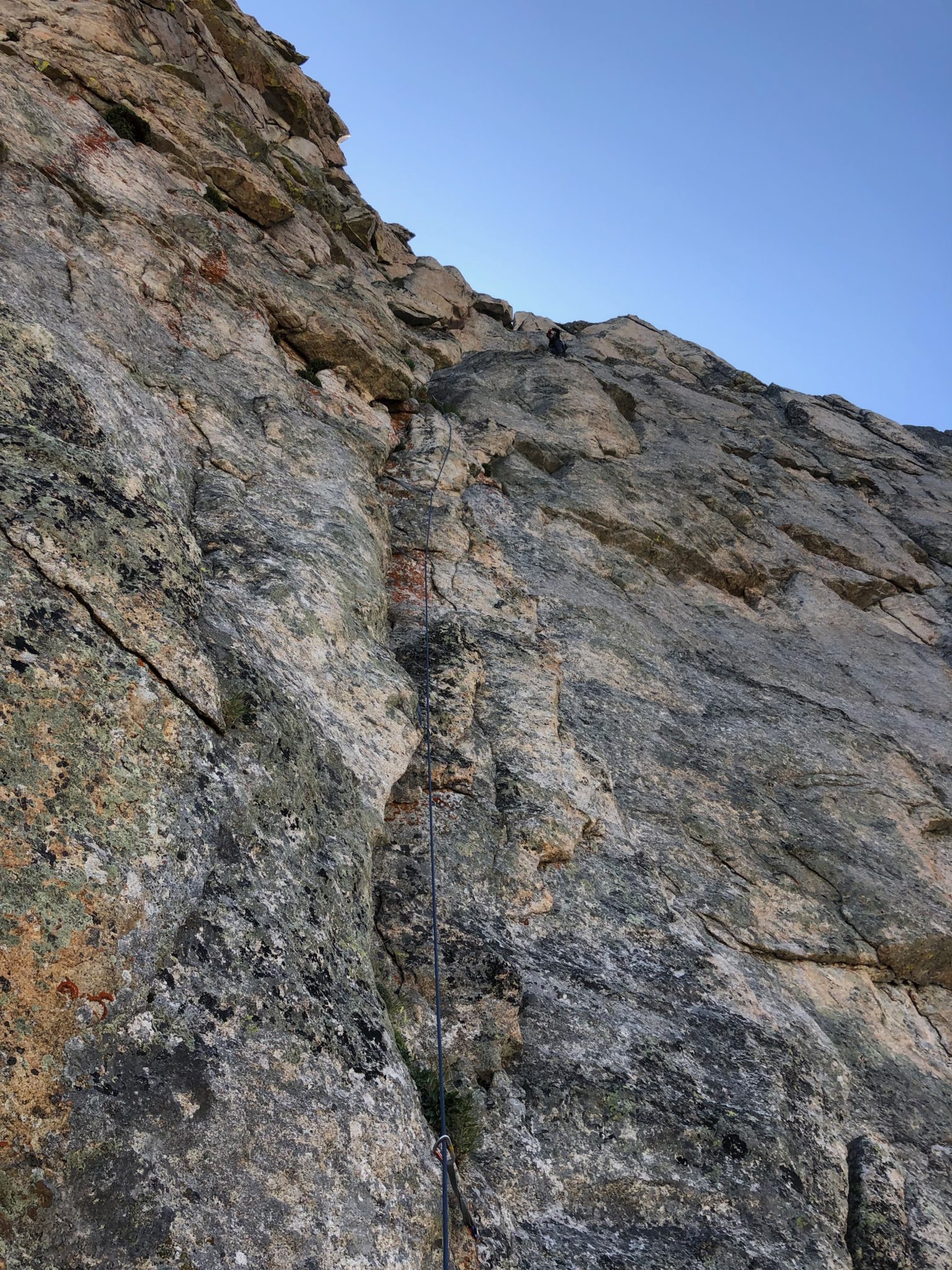
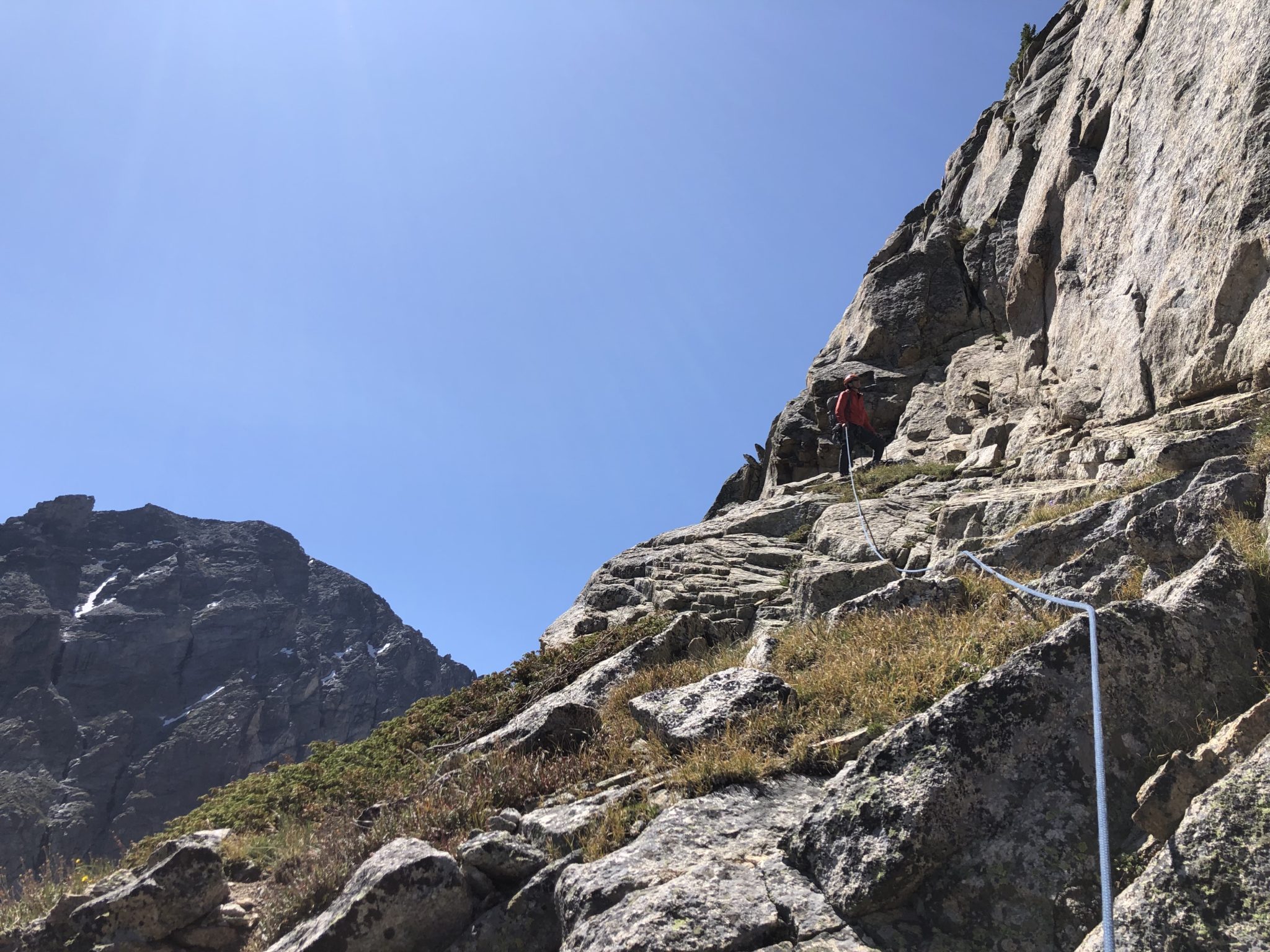
Pitch #1
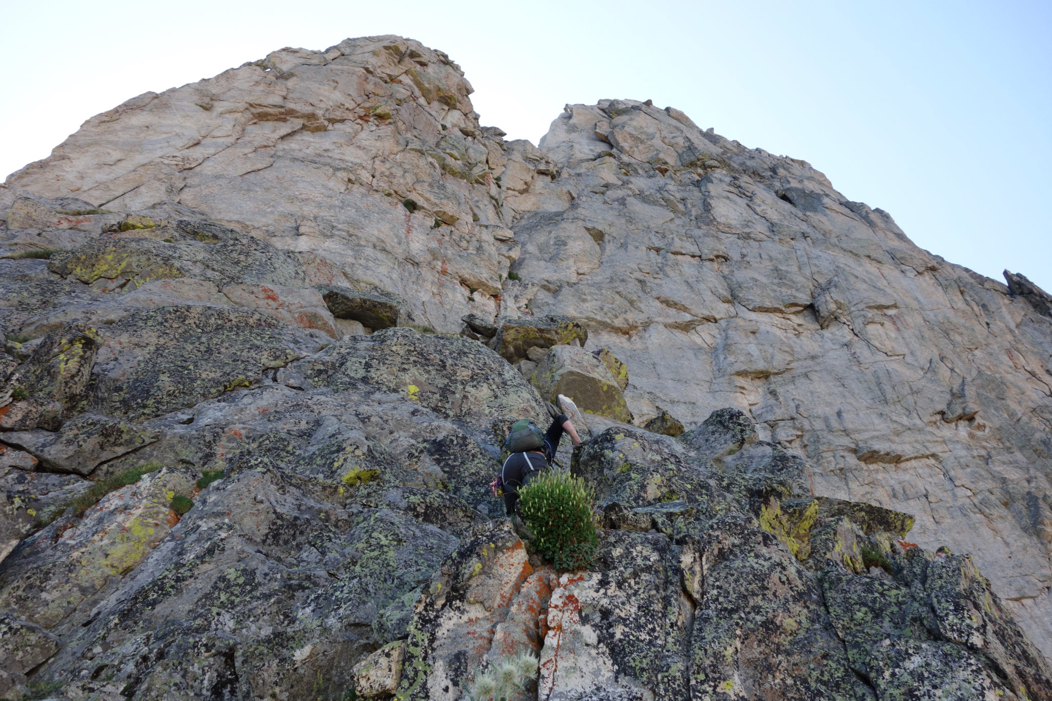
The first pitch required a rope-up to tackle a short, wet 5.4 head-wall to get up onto the face itself.
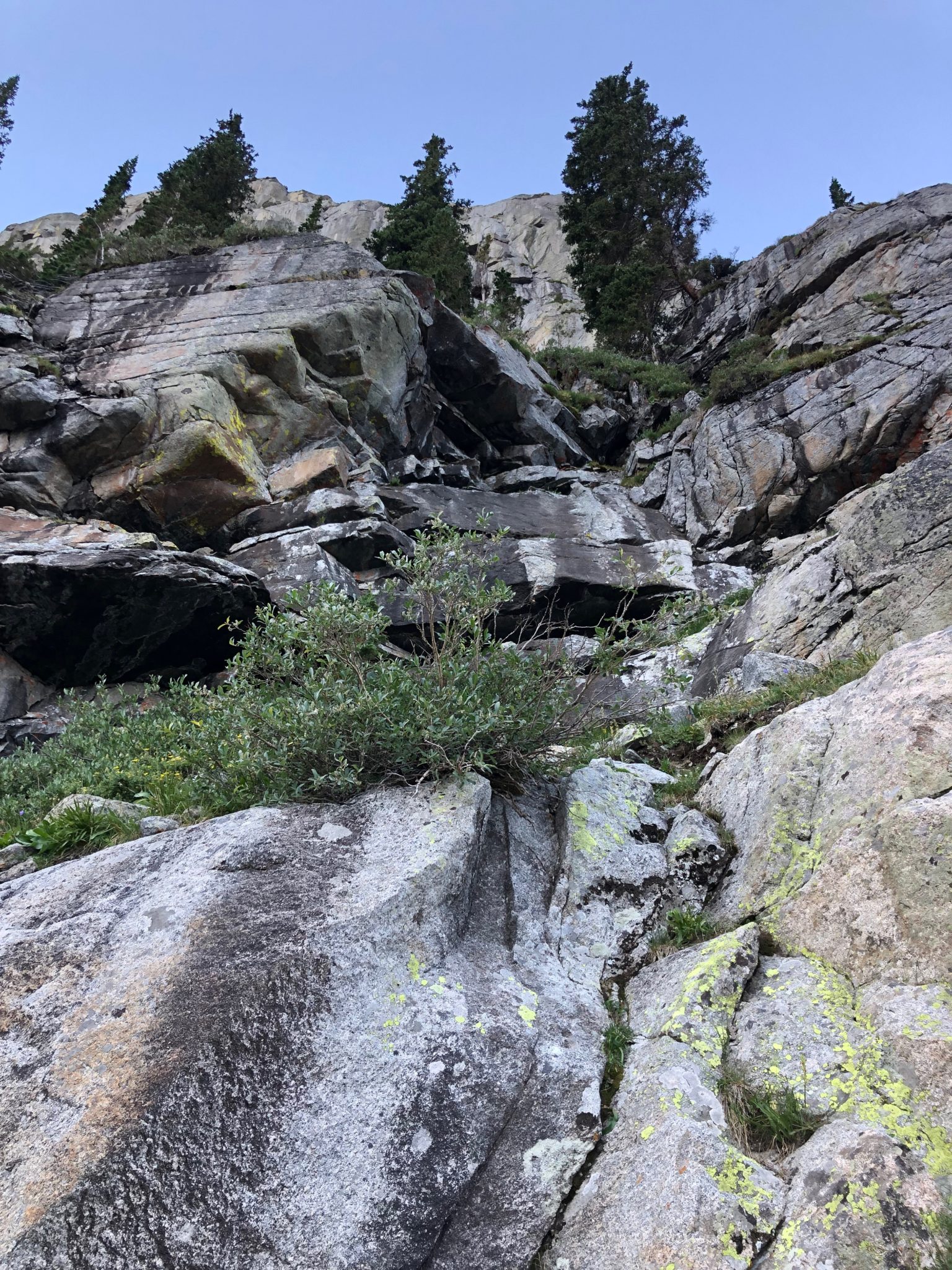
Looking up pitch #1. (Zambo)
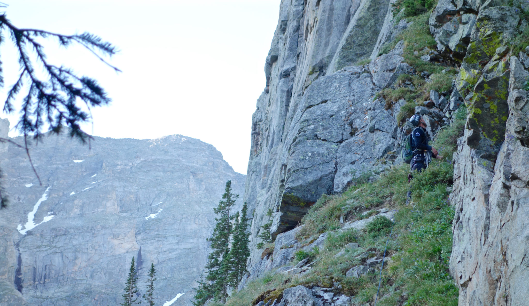
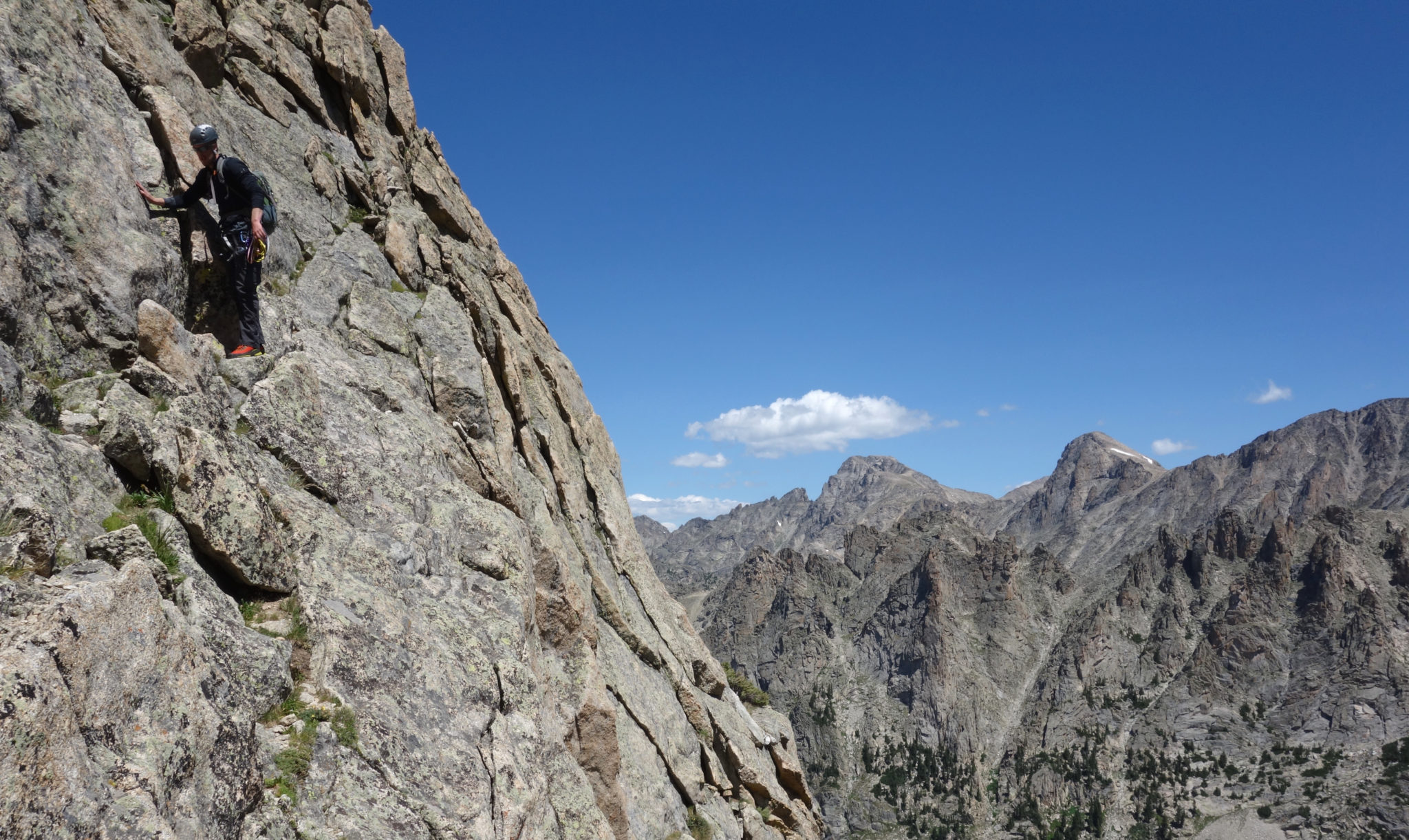
Pitches #2-4
Upon topping out of the first pitch, the route ascended a narrow ramp on the face. This was mainly walking, with occasionally 4th class or low 5th class sections along the way to make it fun. We elected to simul climb this section as the climbing was easy and offered plenty of natural anchors along the way. We were also happy to keep the rock shoes stowed away the whole time, which made for quick passage.
Josh leading the ramp. Fully stretched out, this is worth 3 “pitches”. But simul climbing made it very easy to just breeze through as quickly as possible. (Zambo)
My turn now. As the ramp ascended, it gradually narrowed and steepened, eventually relenting to the sheer rock above. All the while, the exposure below grew considerably. (Josh)
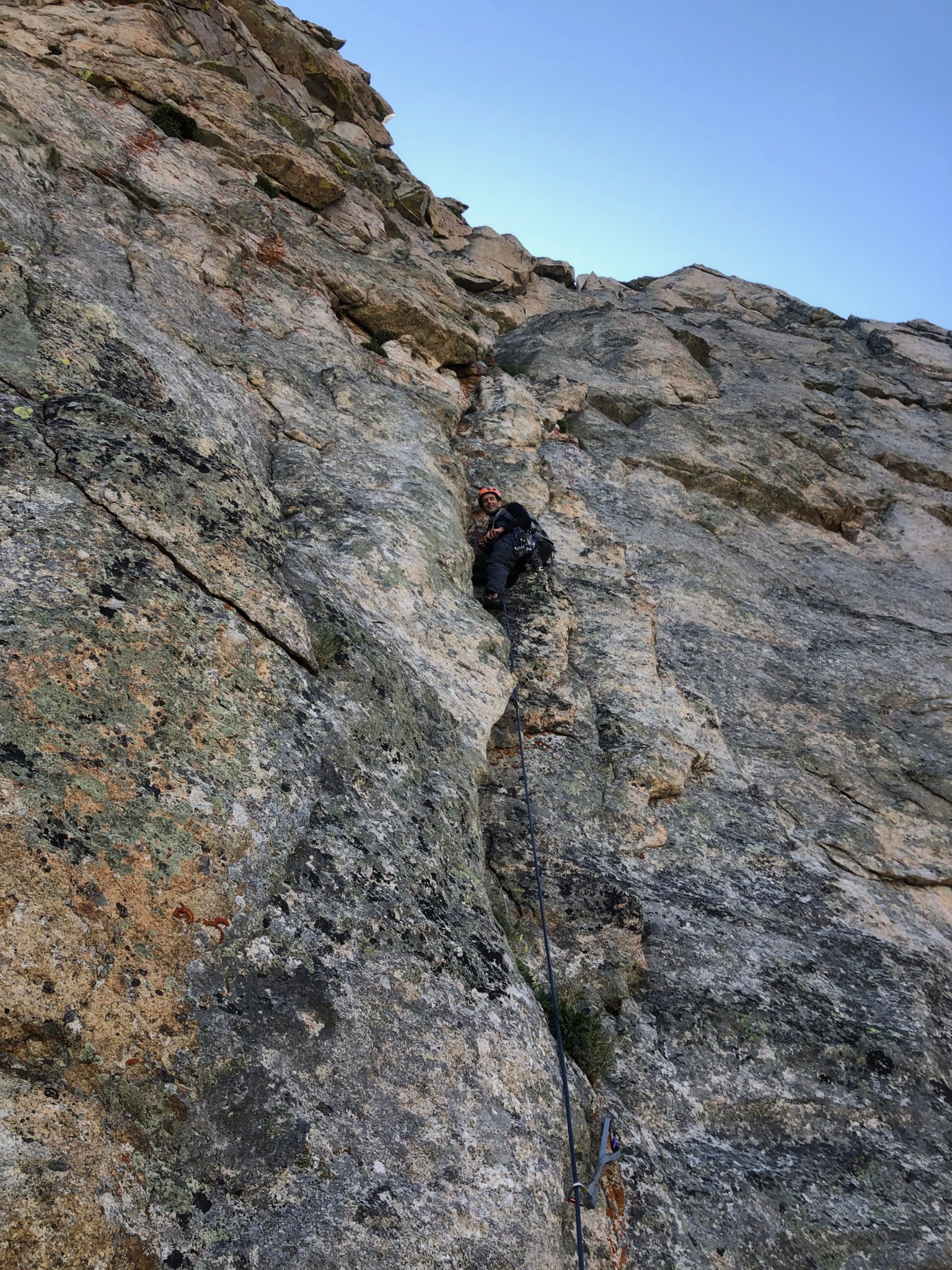
Pitch #5
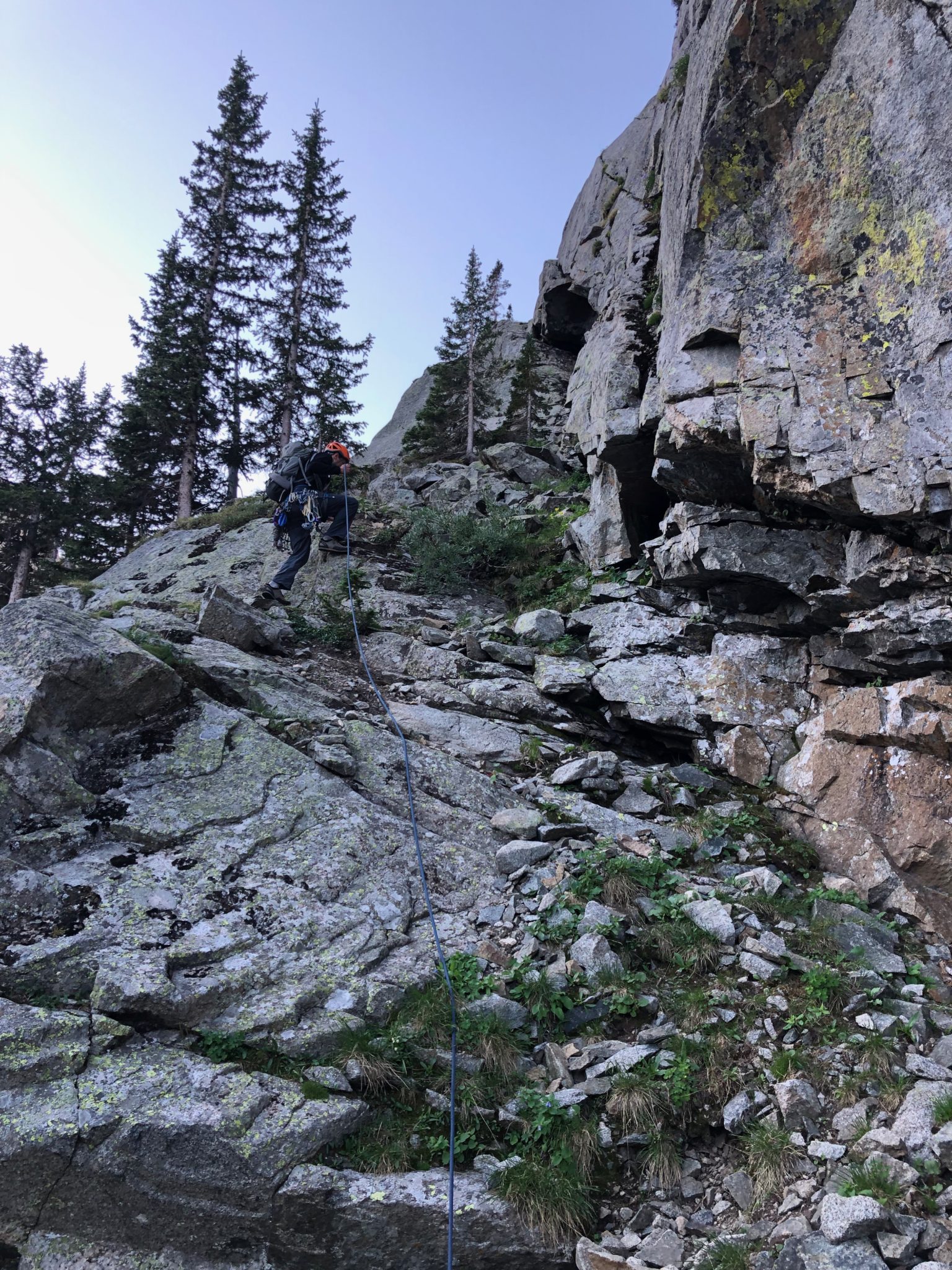
The fifth pitch was a short ‘connector’ of sorts. The goal was to reach a prominent chimney for the 6th pitch. But before that, some short 5.3 slabs had to be overcome to reach the base of the chimney.
Setting up the belay at the base of pitch #5. (Josh)
Looking back down #5. A bit more air now. (Josh)
Pitch #6
This is where the fun began. As I mentioned, the face climbing ran out as it transitioned to a 5.5-5.6 chimney to reach a prominent gully above. We opted to switch into our rock shoes at this point, perfectly timing the first real rock moves with the sun cresting onto the rocks.
Josh leading the 6th pitch. An interesting lean and the occasional off-width required some thoughtful moves, but overall, a fun wedge-and-go chimney for the most part.
Looking back down the 5.5 chimney.
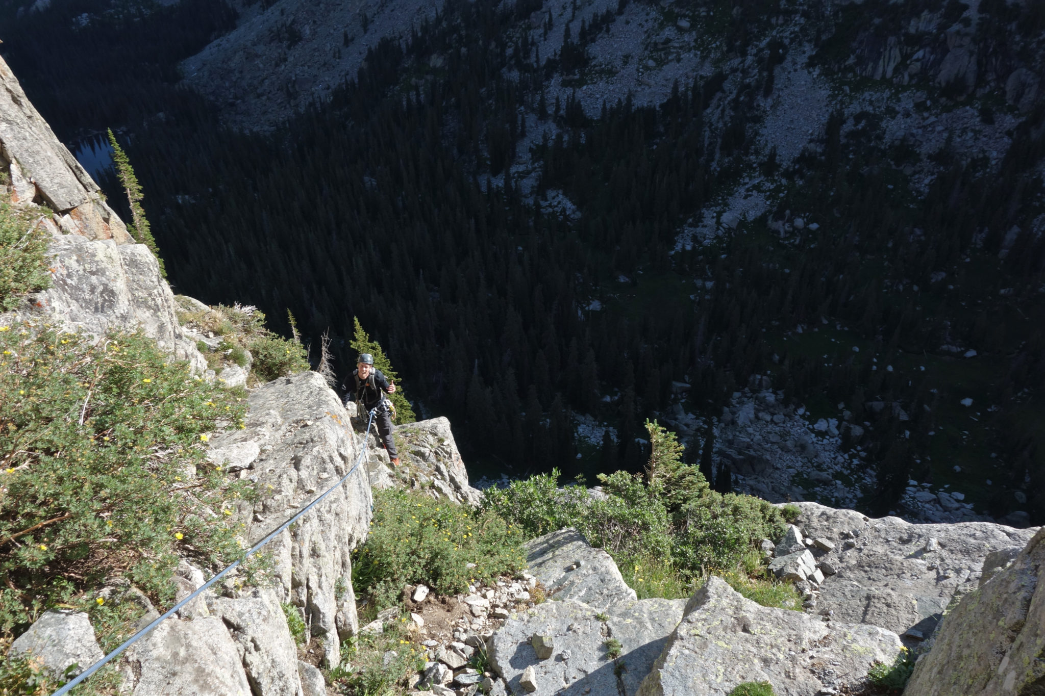
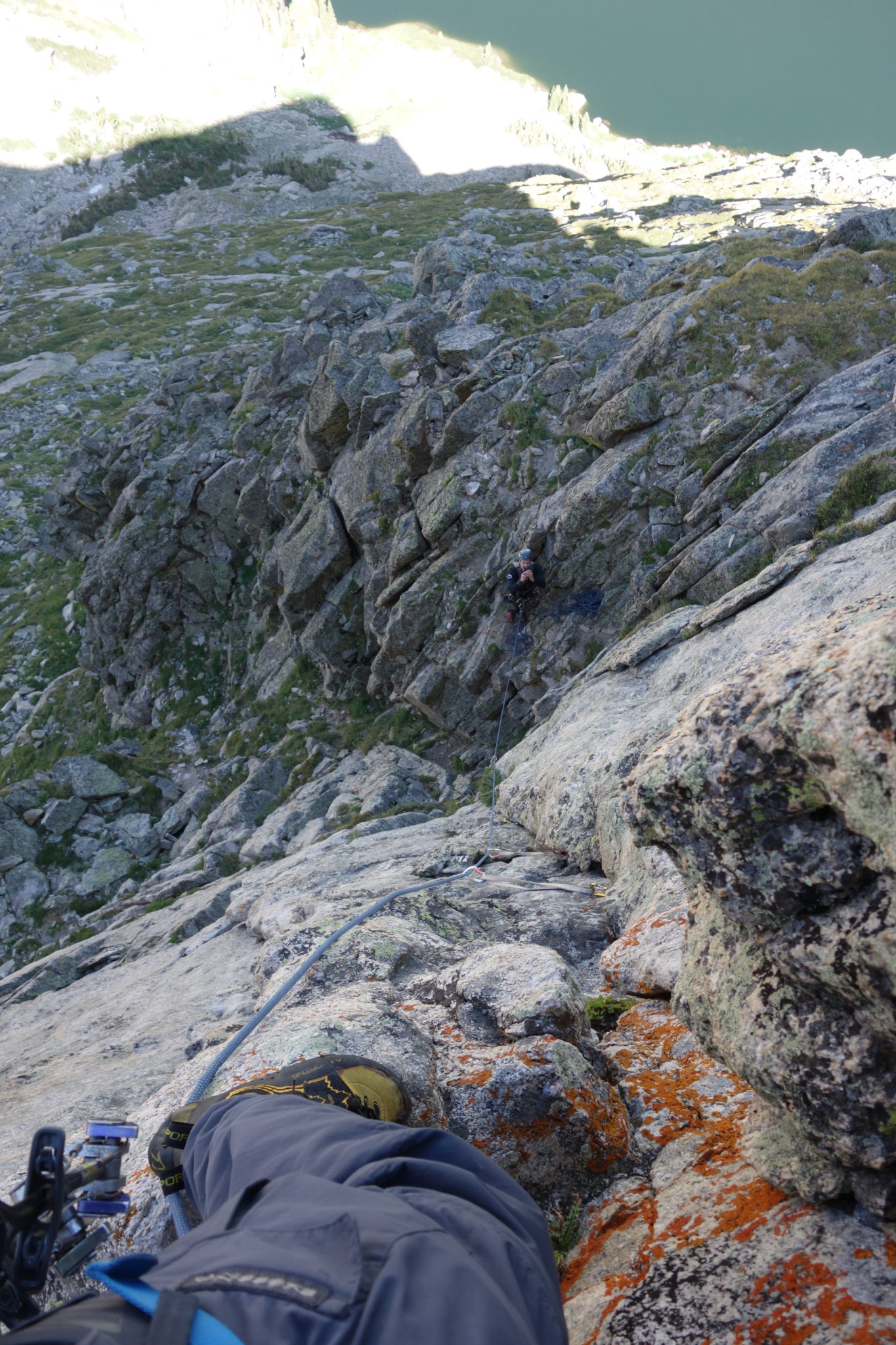
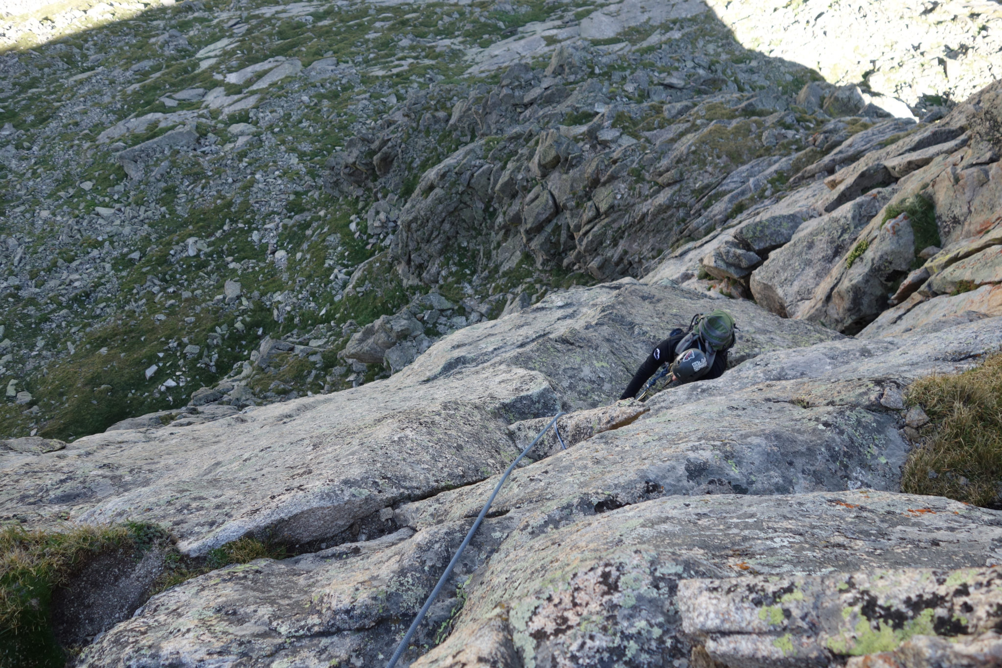
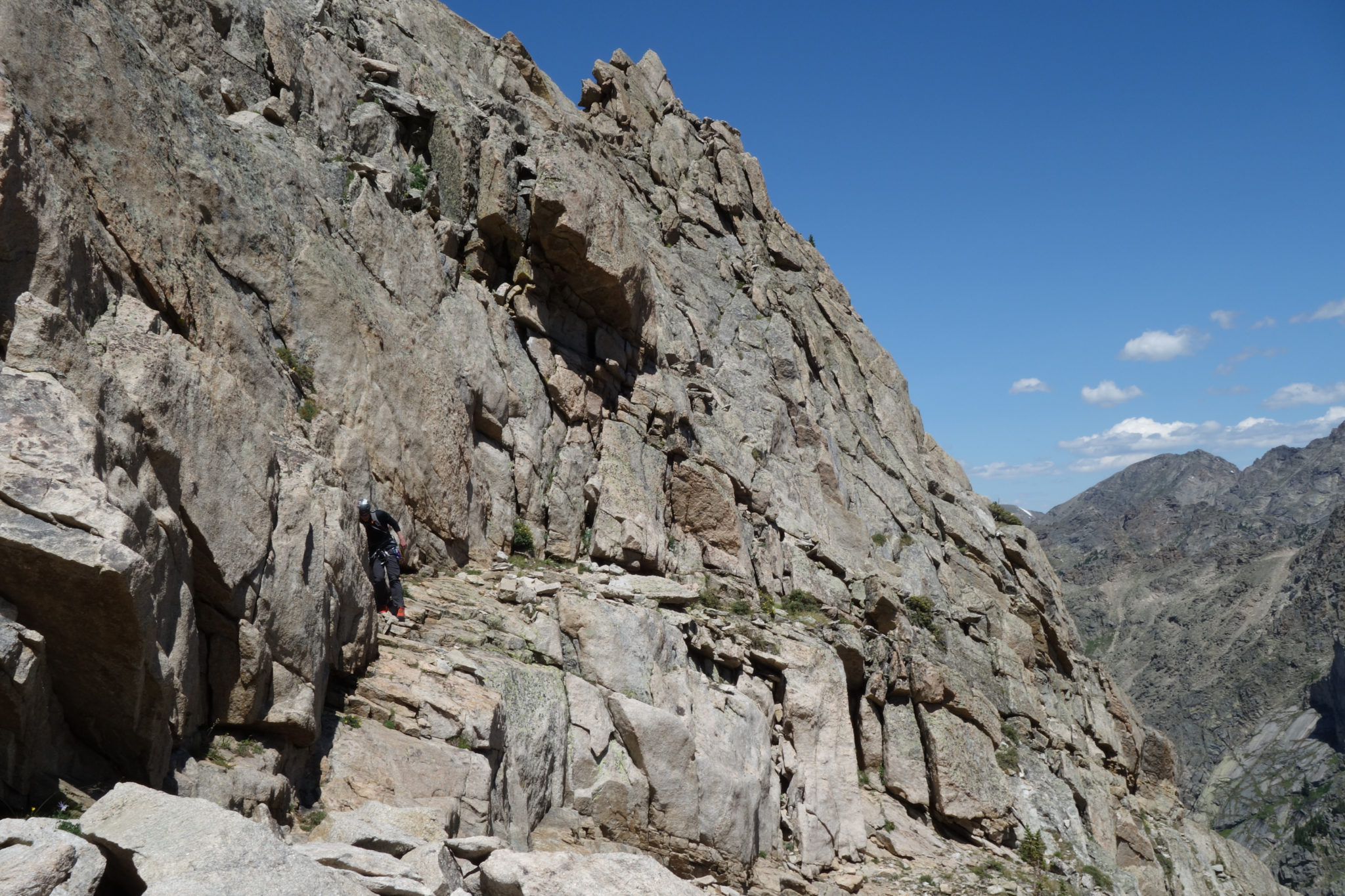
Pitches #7-9
The rock relented above the chimney, giving way to a gully with steep grassy slopes, occasional scree, and a series of intersecting rock bands of low-to-mid 5th class climbing. We had been caught by another party just as I started the chimney, so we opted to simul climb this section in an effort to move fast and mitigate rock fall potential. This turned out to be a good decision, as we did not see them again for the remainder of the day.
There seemed to be multiple ways to go through this section, and I could see some parties choosing to rope up for some of the rock steps. The final step in particular seemed to be a lengthier, more committing wall than anything below it.
A great idea of the composition of pitches #7 & 8. Route finding was easy here, as the only realistic option was to go straight up the gully. Although still steep, this was a nice mental break from the exposure of what was below (and to come). (Josh)
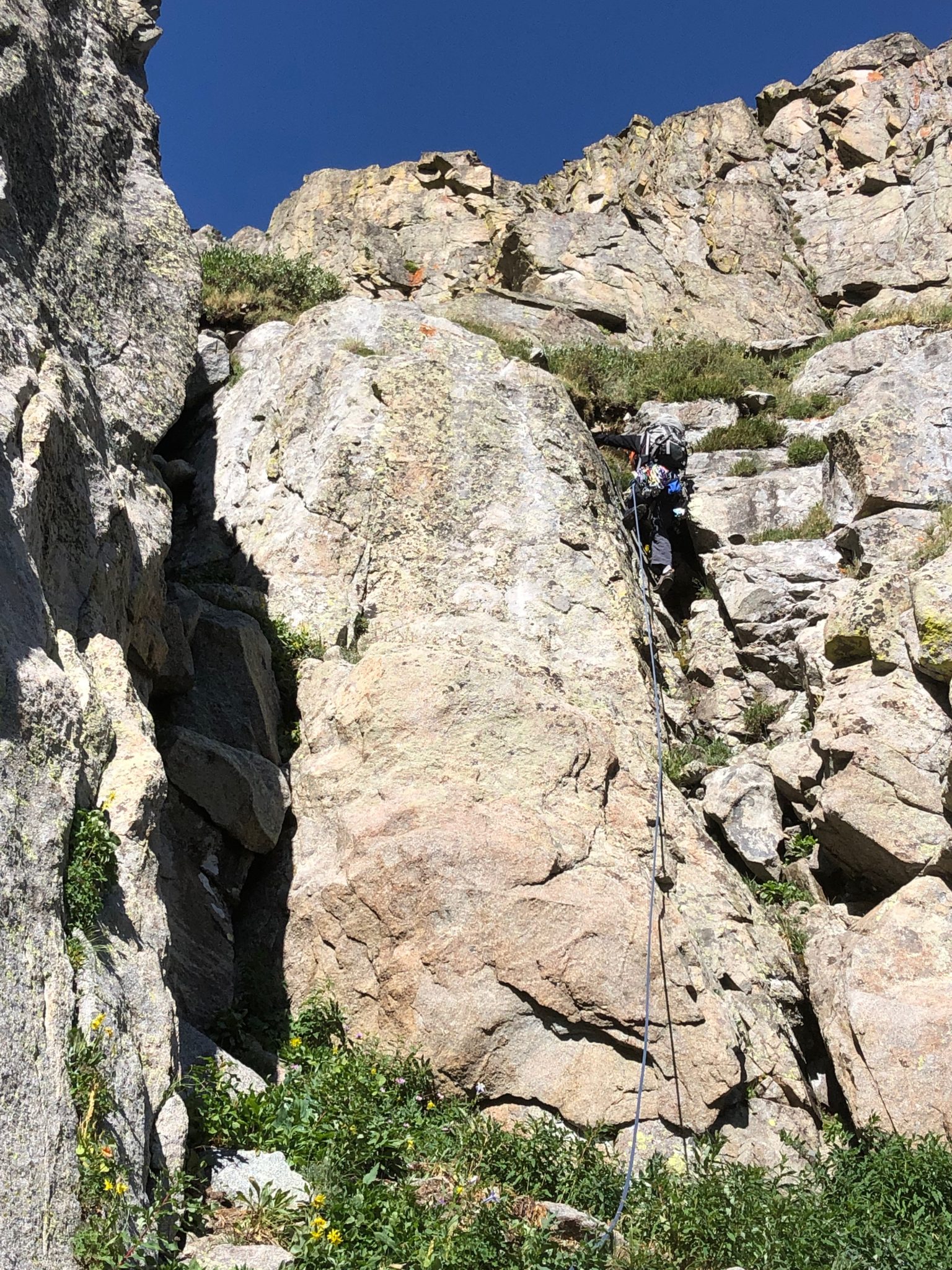
Josh leading one of the rock steps in pitches 7 & 8. We crossed maybe 4-5 of these, of varying difficulty and length. (Zambo)
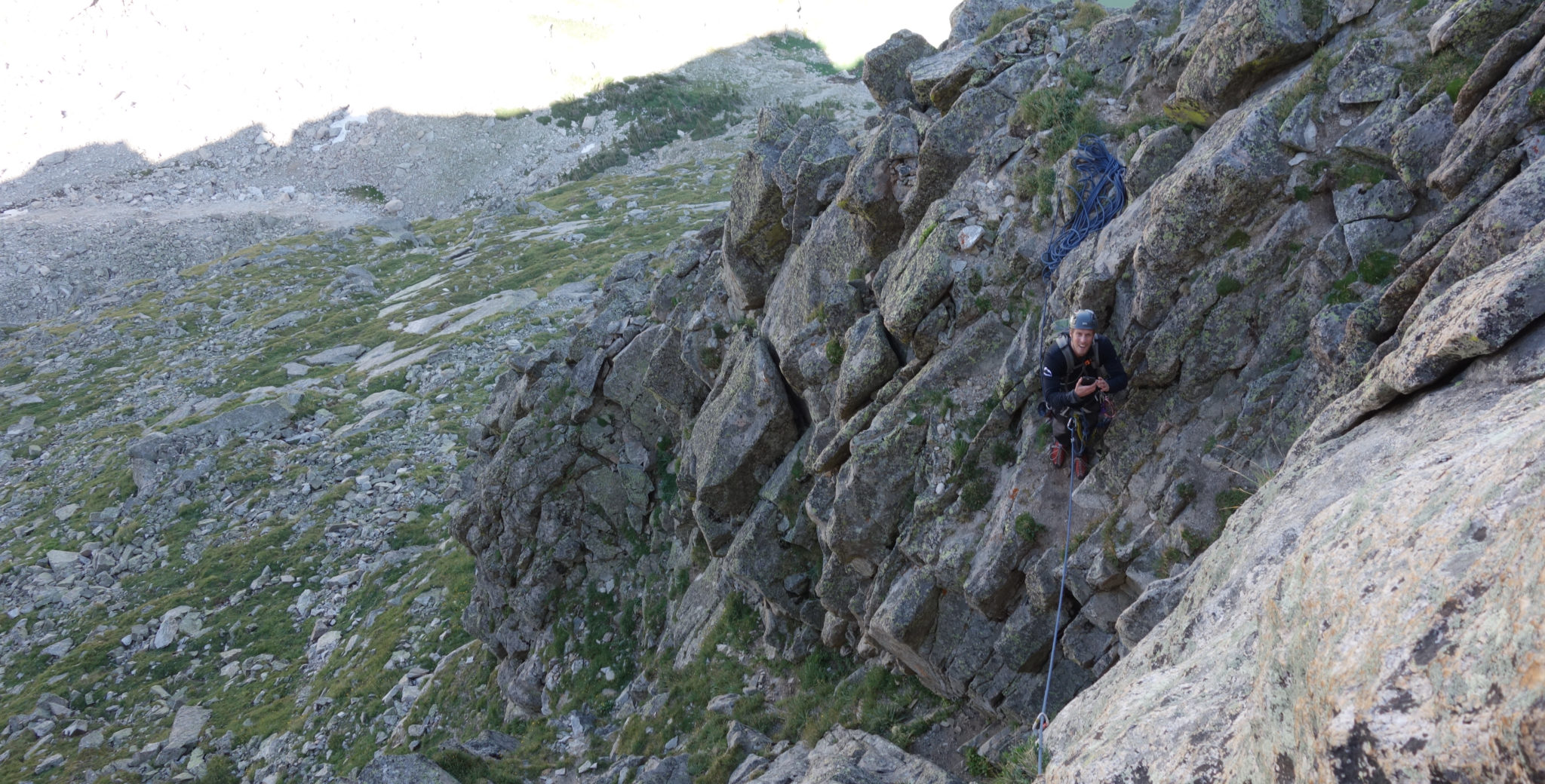
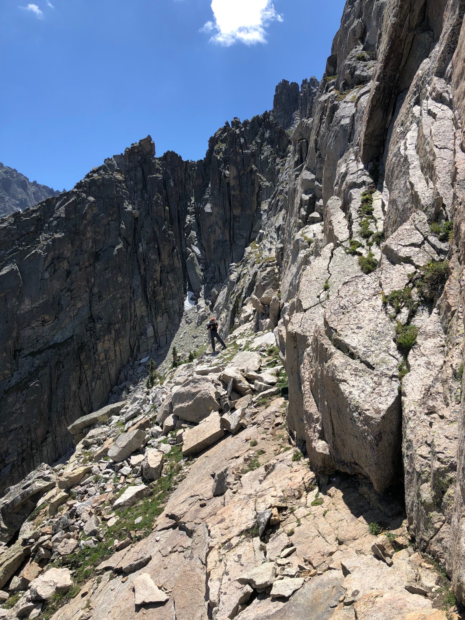
Beyond the final head-wall of pitch #8, the route deposited us on a cleft at the top of the gully. Turning left to round the corner on 3th & 4th class scrambling (technically, pitch #9), we eventually reached the huge ledge system beneath the summit cliff bands. The crux pitch awaited.
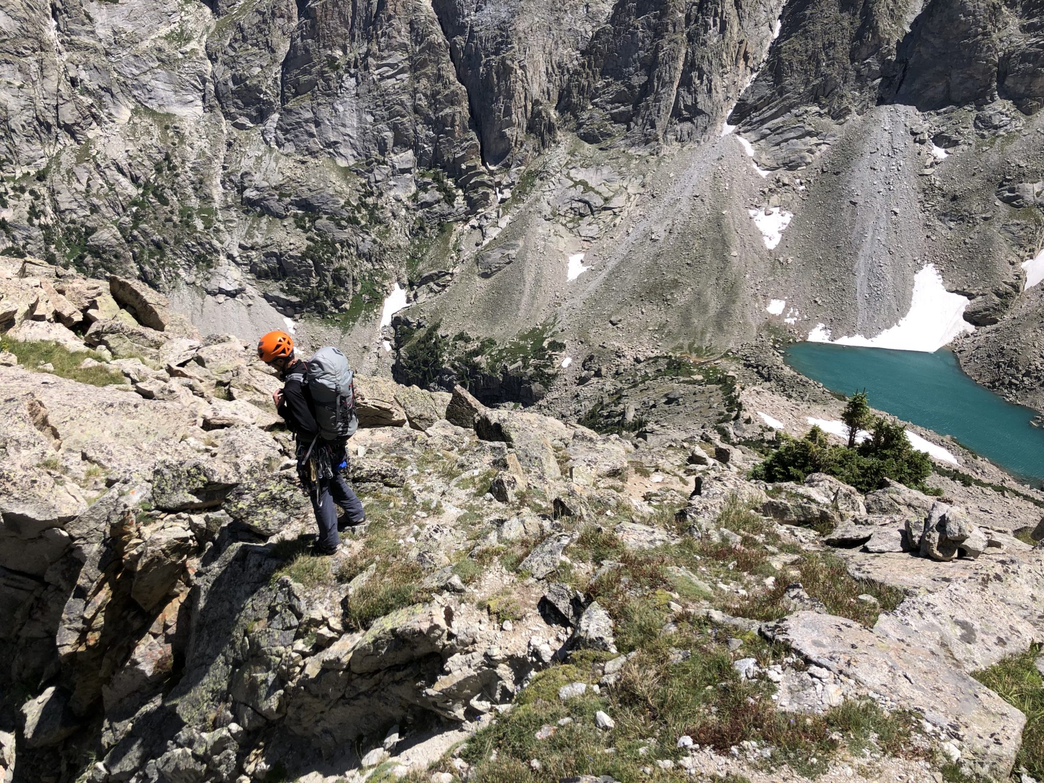
Topping out on the gully atop pitch #8. Crater Lake and Mirror Lake come into view far below. (Josh)
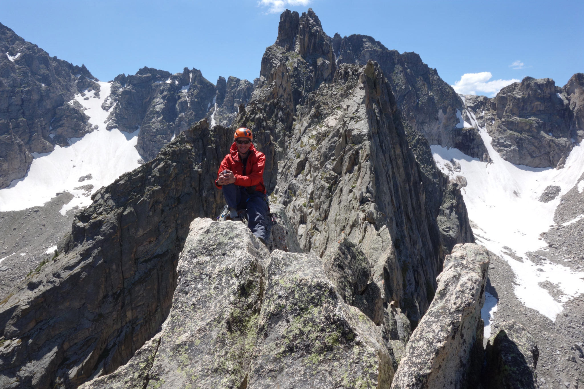
Zambo moving along the 3rd & 4th class scrambling of the 9th pitch, on the way to the crux belay. (Josh)
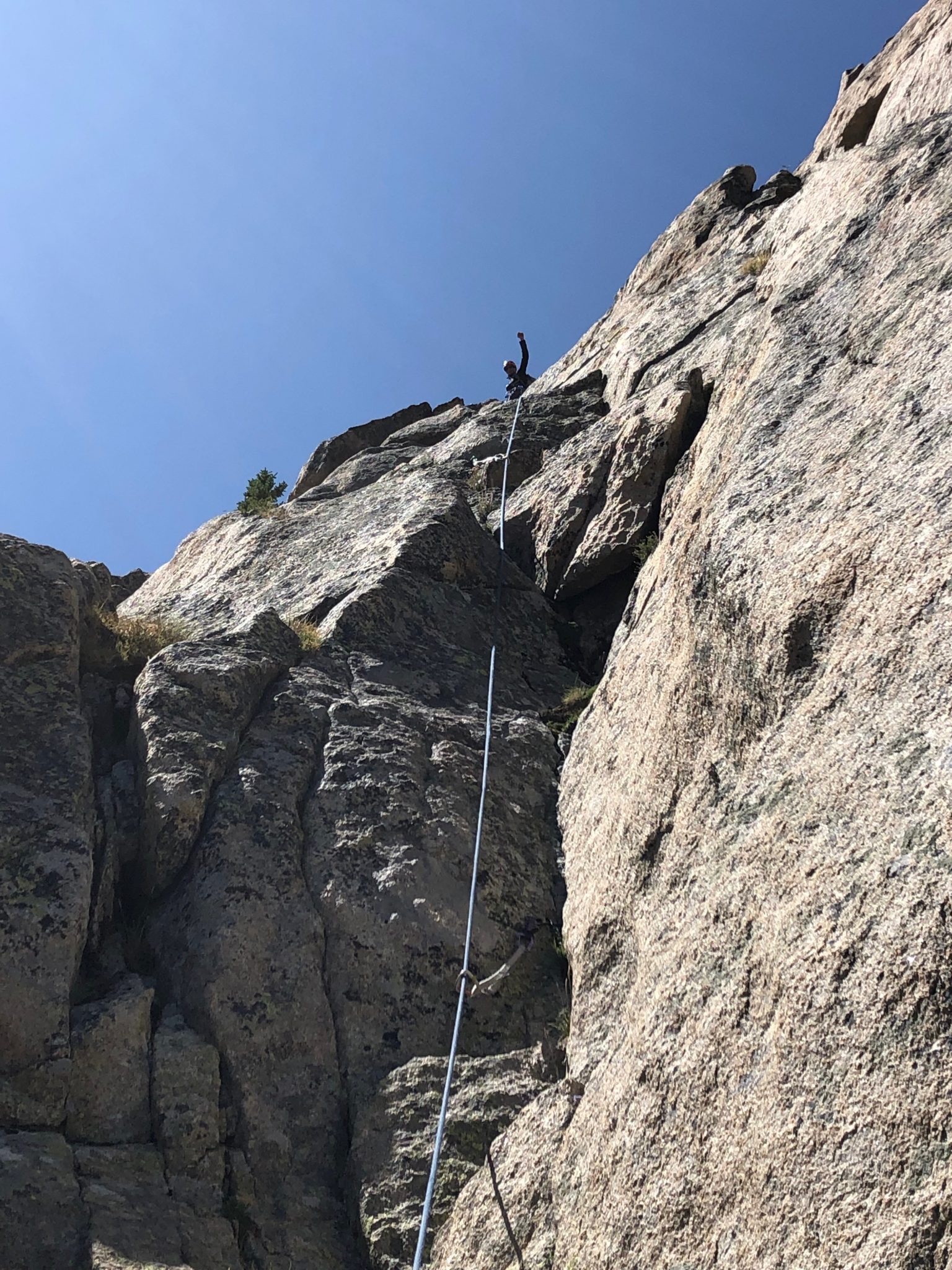
Pitch #10 – The Crux Pitch
The 10th pitch was the crux. Dual crack systems ran up the vertical cliff band below the summit. At a glance these looked stiffer than 5.7. But as we ascended, we found the grade to be spot-on. Josh led up the left crack, which always seemed to have a nice jug or perfect foot placement pretty much wherever we needed it. The only real issue was dodging the prickly plants nestled along each step. All in all, a very fun wall with really fun moves, excellent pro, and great exposure.
NOTE: It’s also worth pointing out that this is the most feasible bail-out point along the whole route. A short down-climb (or more likely, rappel) from the crux belay led to some steep grassy slopes above Crater Lake. With careful route finding, it looked reasonable to descend this way should weather or other difficulties push a party off the crux.
Josh leading the 5.7 crux pitch. (Zambo)
Looking back down from Josh’s perspective. (Josh)
Another good view down to the belay. This also highlights the potential bail-off options below should they become necessary. (Josh)
Josh nearing the top of the 10th pitch. (Zambo)
The super-solid rock, position, and sustained climbing on #10 made for an awesome pitch. (Josh)
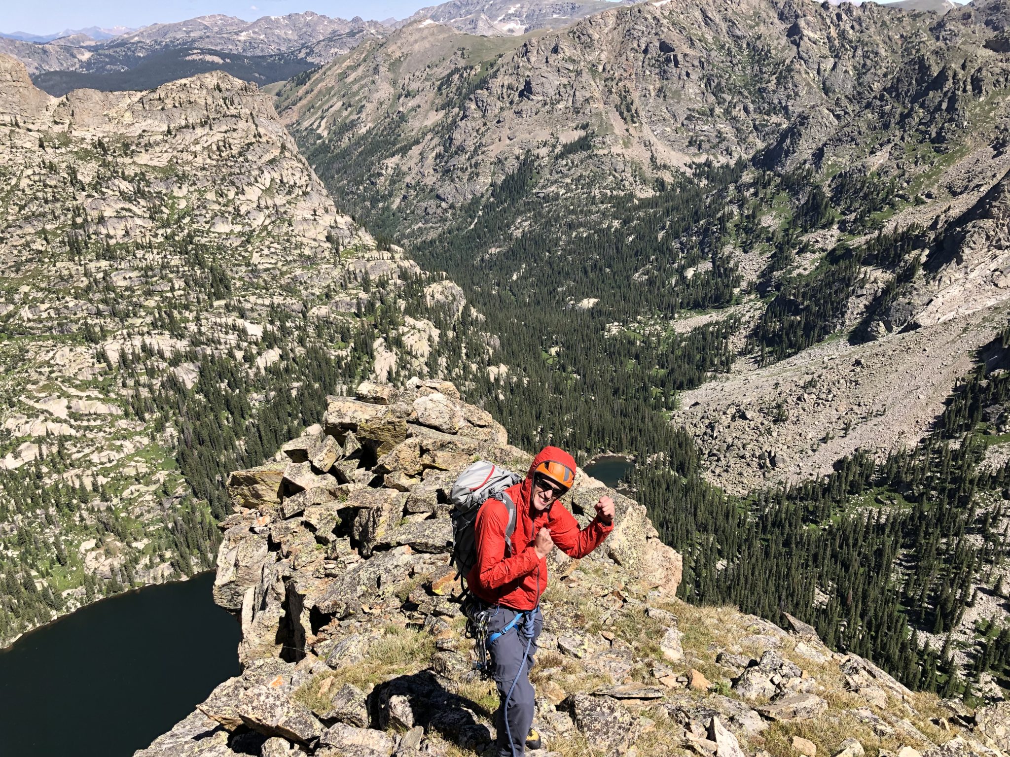
Made it! (Zambo)
Views toward the Shoshone-Apache Connecting wall. (Zambo)
Pitch #11 & Summit
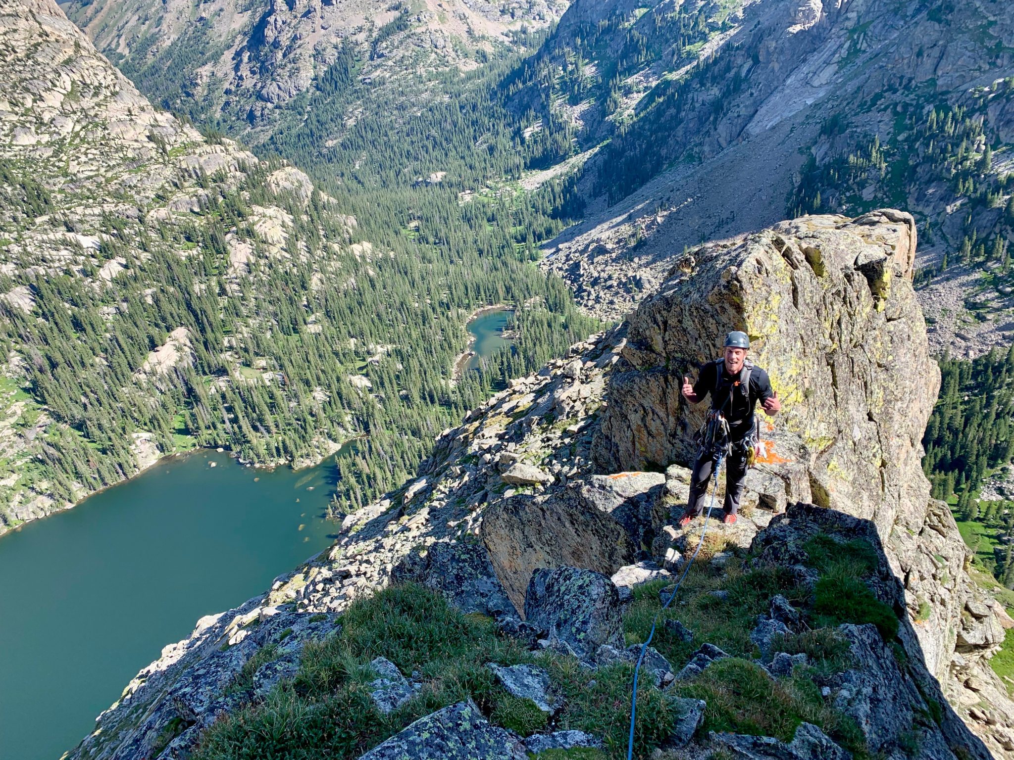
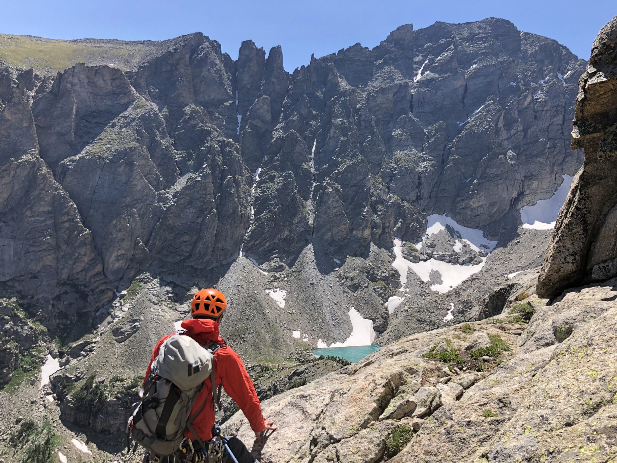
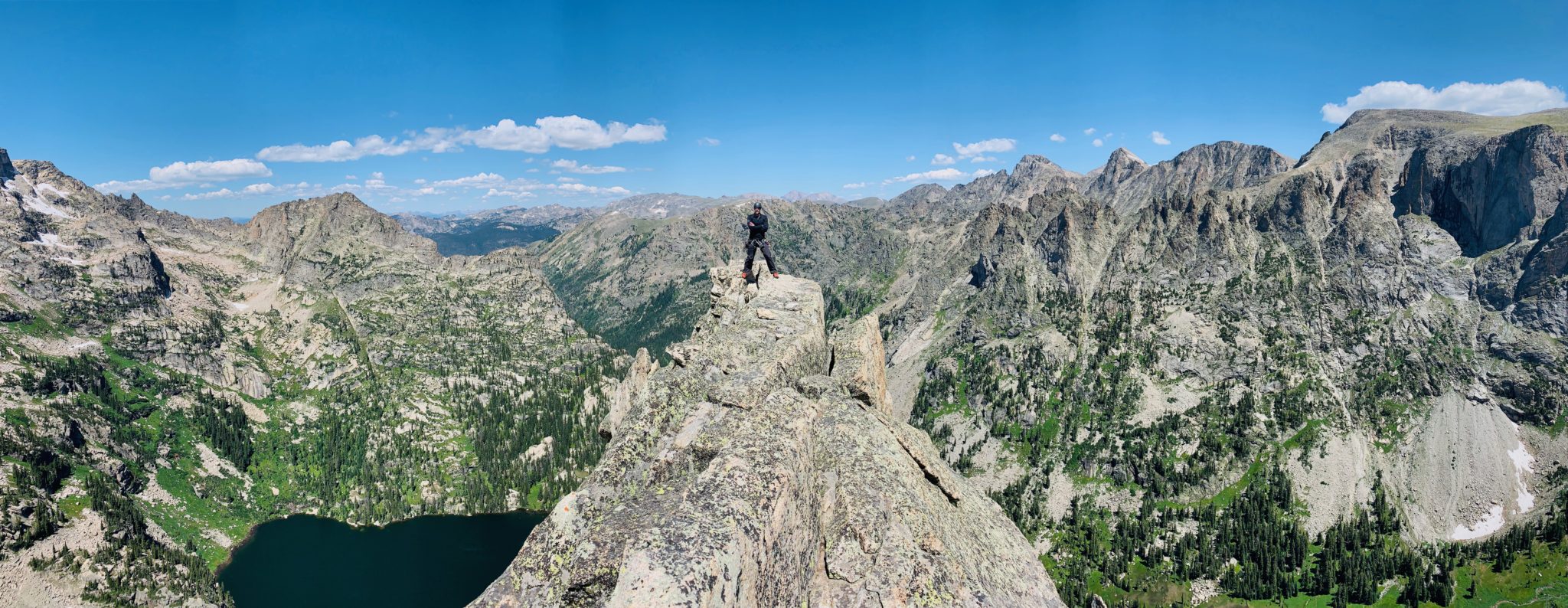
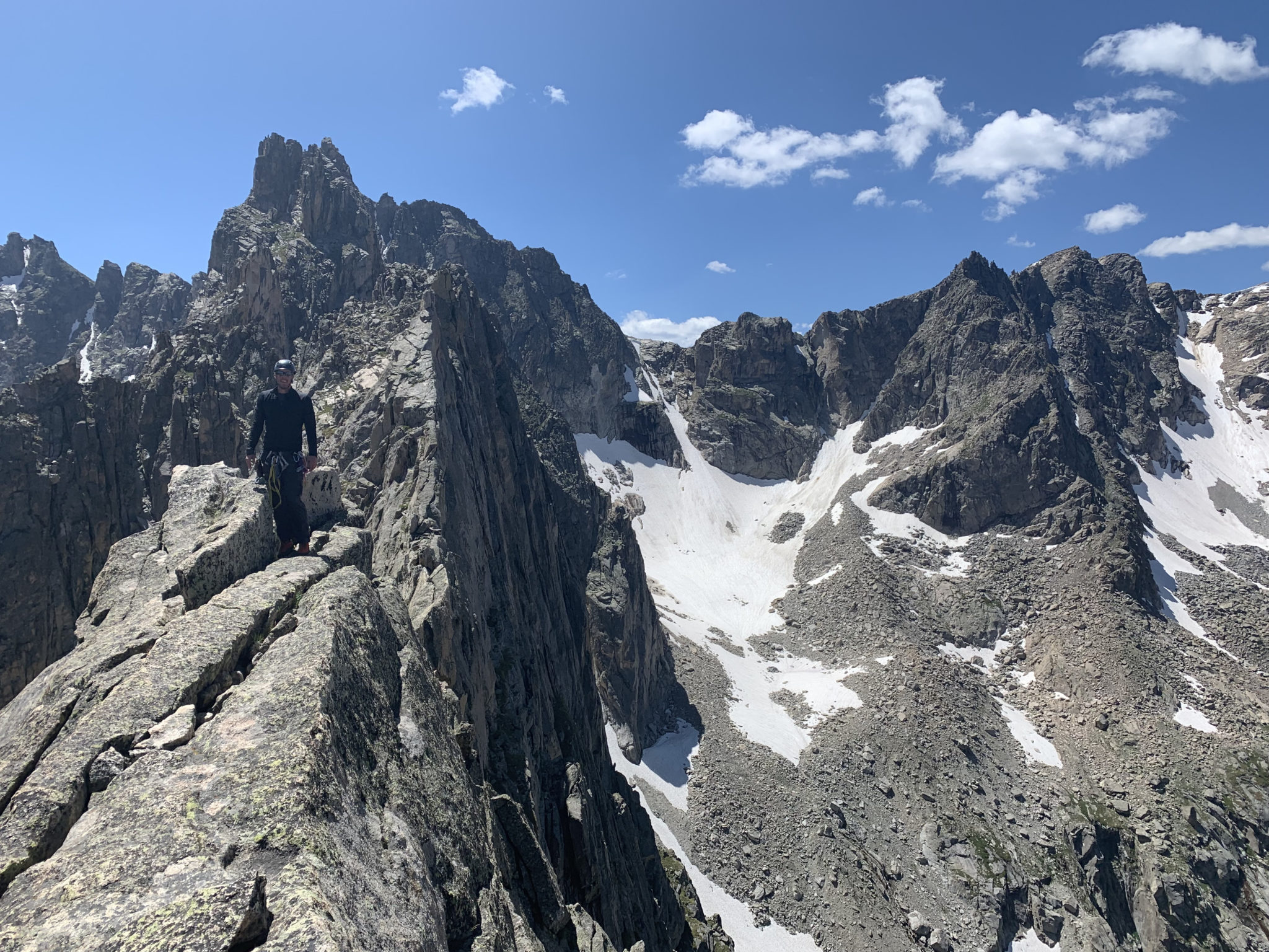
Topping out on the crux rewarded us with panoramic views of the surrounding area. Up to this point, the route was an interesting mix of both claustrophobic passages and big exposure, but with somewhat limited views. But below the final summit cliff bands, a wide bench of flat rocks and grass finally gave us the chance to look around and enjoy the surroundings. Views from here were beautiful.
There were a few variations on how to reach the final summit, and I’m not 100% sure we found the correct one. It didn’t matter. After topping out on pitch #10, we moved clock-wise around the summit cliffs to the Eastern side. From there, we picked a line that looked good and just went for it. A final pitch of low 5th class climbing led us to the absolutely spectacular summit block.
We spent a good bit of time up there. The temps were perfect, the winds were a bit blustery, the views were A++. It had taken a whole lot of effort to get atop this bad boy, so we were keen to chill out and enjoy it.
Looking up the final summit wall. (Zambo)
Made it! (Zambo)
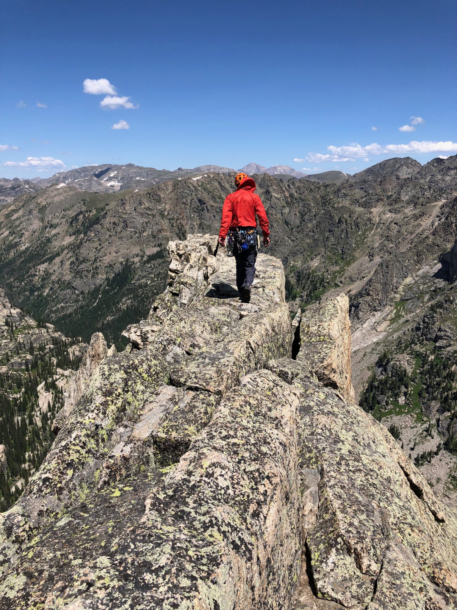
The summit of Lone Eagle is one of a kind. A narrow bench has incredible exposure on either side, with unreal views down to the lake and the surrounding area. (Zambo)
Tough guy. (Josh)
The views back to Iroquois (12,799′) were just as impressive. Apparently the connecting ridge goes. Looked fun, albeit pretty crazy exposed. Another trip, perhaps. (Zambo)
One more for the road. (Josh)
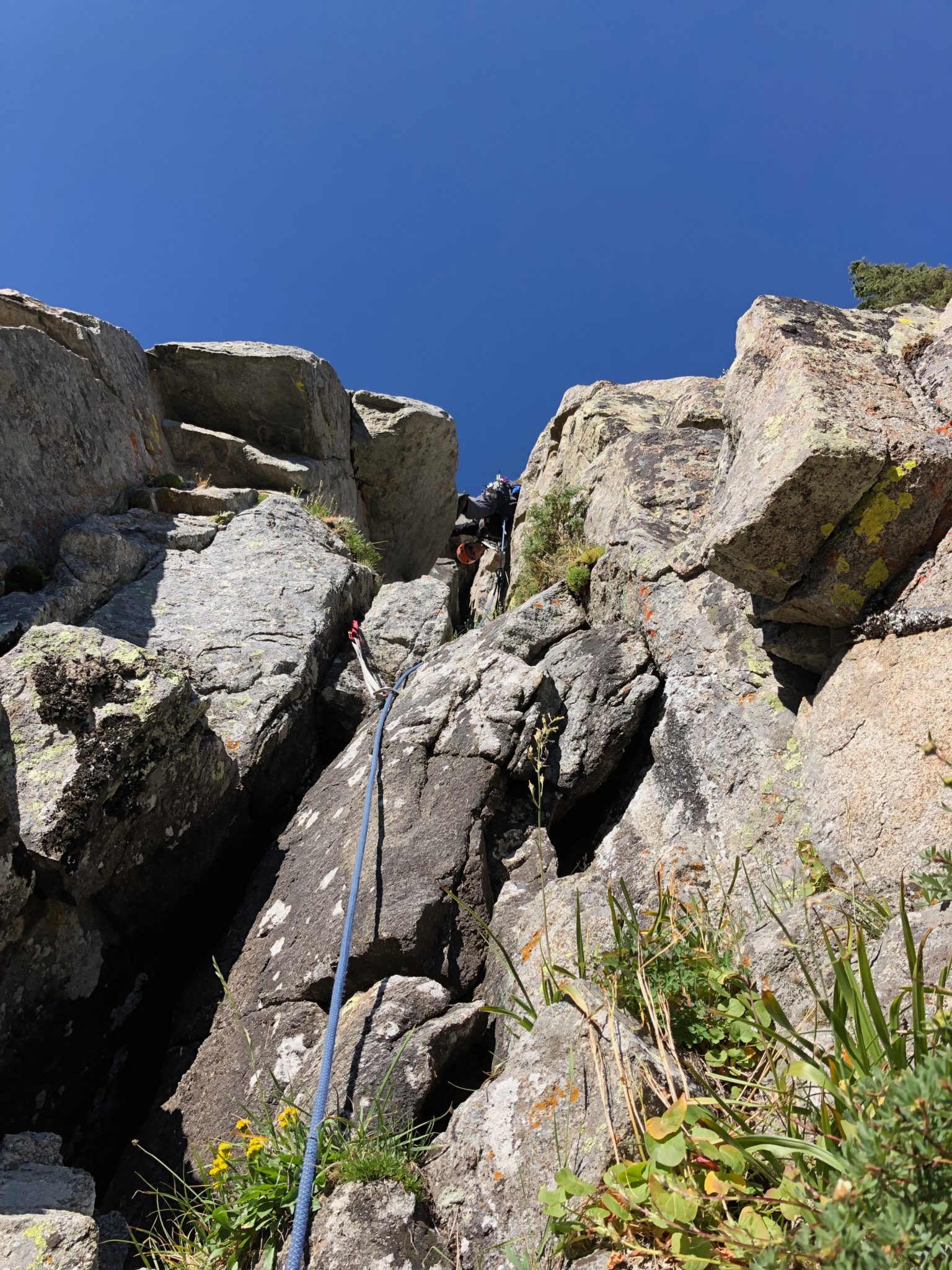
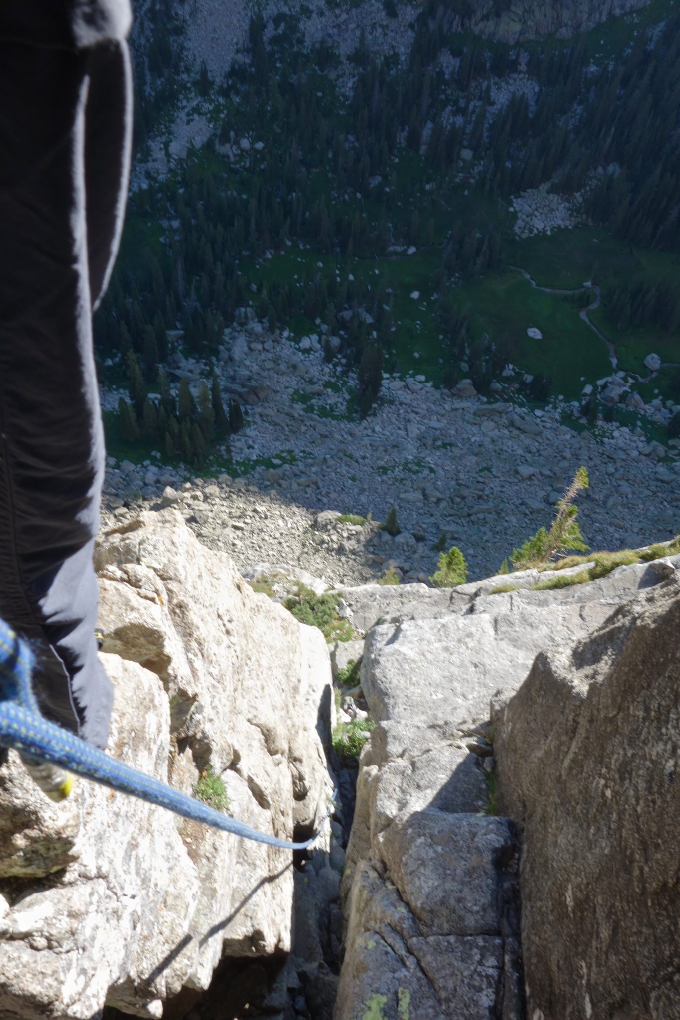
Solo Flight Descent
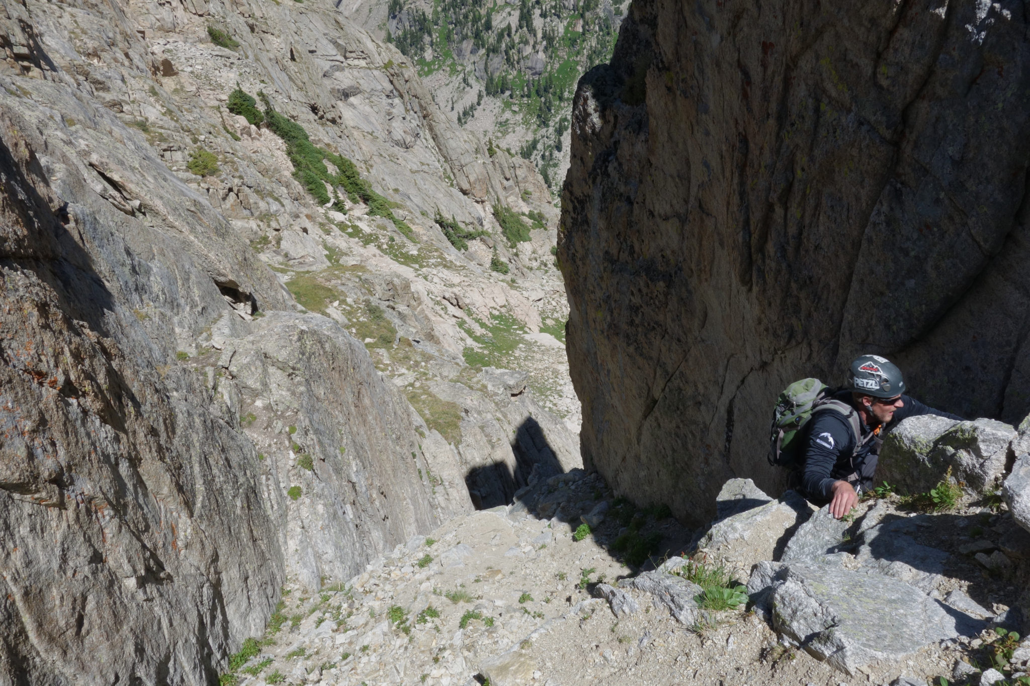
One of the bigger question marks of our planning was the way down. The most feasible descent option was to take the 4th class Solo Flight Route to get back to the lake. The tricky part was the route finding. The interwebs had quite a bit of discussion about route finding on this particular section. Considering we had not ascended it, we took a lot of time studying online beta to make sure we got it right. I think this was valuable as we were able to make it down more or less directly on route. Here are my recollections on the finer details for future beta purposes for anyone else:
- Scramble southeast off the summit block on very exposed 4th class ledges, making your way generally down and to the south towards Iroquois.
- A short way off the summit, the scrambling difficulty slowly eases as you make a level / at times ascending traverse to the south towards Iroquois. Although the exposure is still high, we were able to keep all this at 4th class.
- As you move south, do NOT descend the enticing looking gully that heads downwards to the east. This cliffs out, apparently. The goal is to find to series of 4th / low 5th class gullyies heading up a prominent notch.
- Climb the dirty gullies. There are a couple of these, and I think any could be reasonable. We approached from the northwest. Ours had a few 5.0 moves I’d say, plus the rock was loose. I know for a fact that we were very glad we did not have to down climb these (i.e. if we had done only the Solo Flight Route). So, a rap rope could be prudent for this section for anyone only climbing up the Solo Flight Route.
- Topping out on the gullies, descend steep grassy slopes, eventually wrapping back around to the north. Cairns were helpful in this area, and the route eventually wound its way directly beneath the North Face.
Josh’s Solo Flight Descent Notes
“We descended east of the southern end of the summit and then trending down and south about 100 feet to the highest and most obvious north-south ledge system (there are other possible ledge systems lower down but we knew we needed to stay high). This ledge system ended at a tricky, short downclimb into the large gully system that descends east off the mountain. This is the gully system that many other parties have been duped into descending, and it eventually cliffs out requiring around 5 sketchy rappels to get down. An east-trending ridge (or shoulder) blocks easy passage to the easier descent slopes beyond. We ascended the right of two north facing, loose gullies leading to the crest of this east ridge. Apparently, we missed a better route that climbs back directly up to the Lone Eagle Peak north-south ridgeline, briefly drops onto the west side of the ridge and climbs back up to the point where the eastern ridge meets the main north-south ridgeline. Our chosen gully had a 5th class move in it and we took turns as we climbed to protect ourselves from inadvertent rock fall. Down climbing either of these two loose, north-facing gullies would be difficult and dangerous if attempting the Solo Flight route to the summit.”
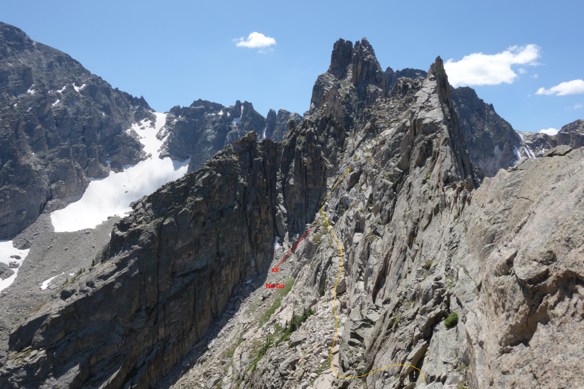
The general direction of the descent route. Basically, just traverse on exposed ledges to the notch, find a gully, go up, then come out on steep grassy ledges on the other side. Click for full size. (Zambo)
The first few moves off the summit block got our attention. (Josh)
Lots of air below. (Josh)
The difficulty eventually relented, giving way to the rocky bench that cuts across the face of this area. (Josh)
Looking ahead now. We climbed up the cleft on the right, making our way to a northwest facing gully to gain the notch. (Zambo)
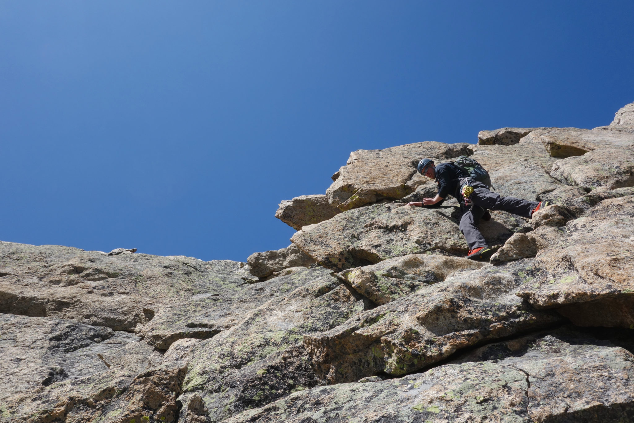
Mid-way up the dirty gully to gain the notch. We felt this was, by far, the loosest section of the day. As I mentioned, I’m not sure I would have wanted to get down this without a rap. (Josh)
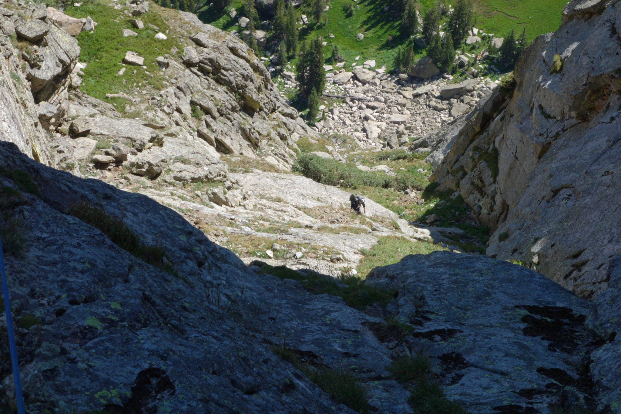
Making it to the top of the gully – the final real scrambling of the day. Just steep grass and a long, long trail to go from here. (Zambo)
Once we went made it through the notch we took a big sigh of relief. As much fun as this route was, I find it’s always a nice moment when you are officially off of no-fall terrain. The day continued to be bluebird, and we were in no hurry to get back to the lake. That would just mean we had to walk the long way home. So, we were content to take our time, relax, and enjoy the beautiful cirque.
Atop the notch, inspecting one of the other possible gullies on the Solo Flight Route. (Zambo)
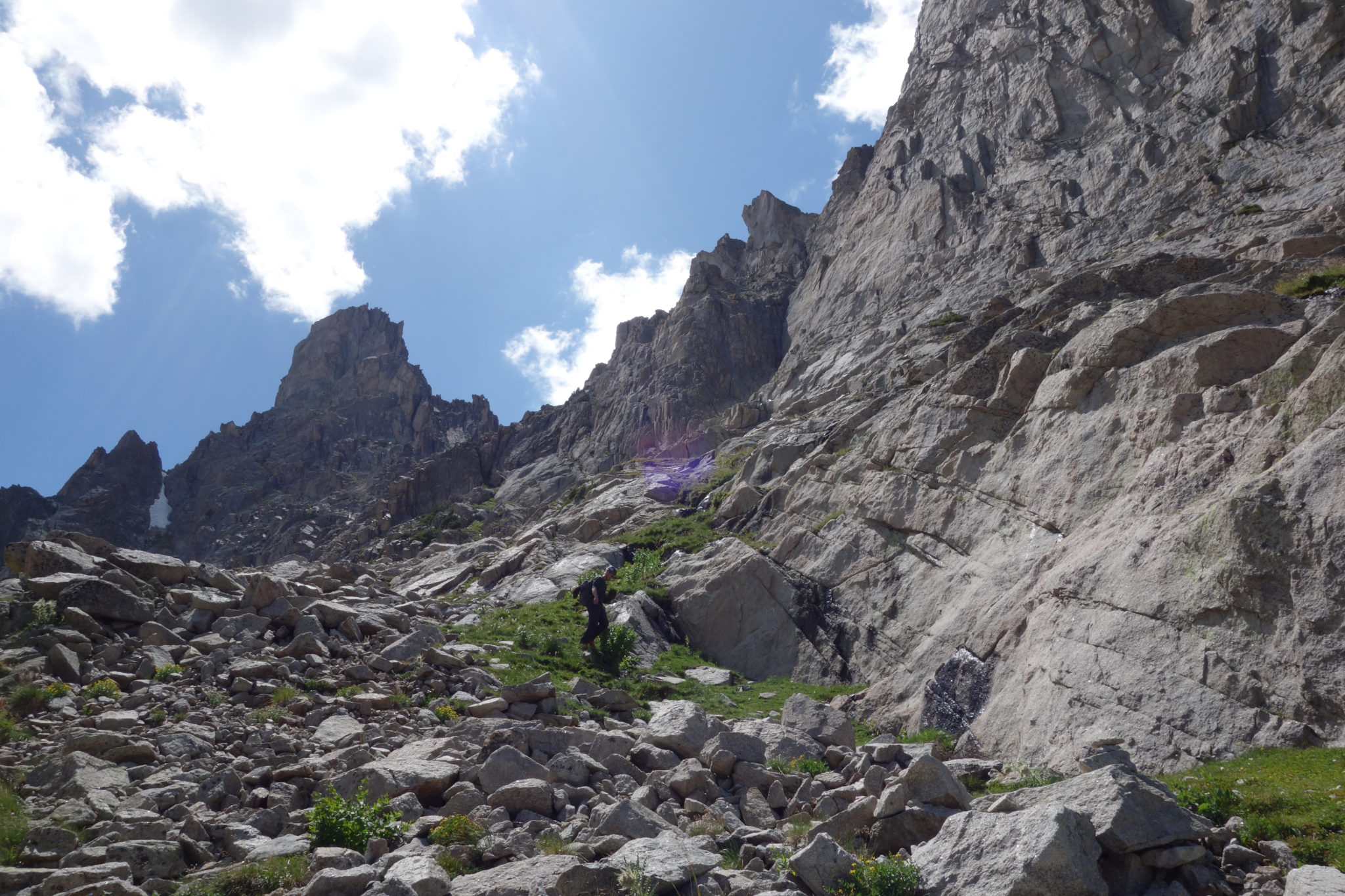
Meandering down the long grassy slopes back towards the lakes. (Josh)
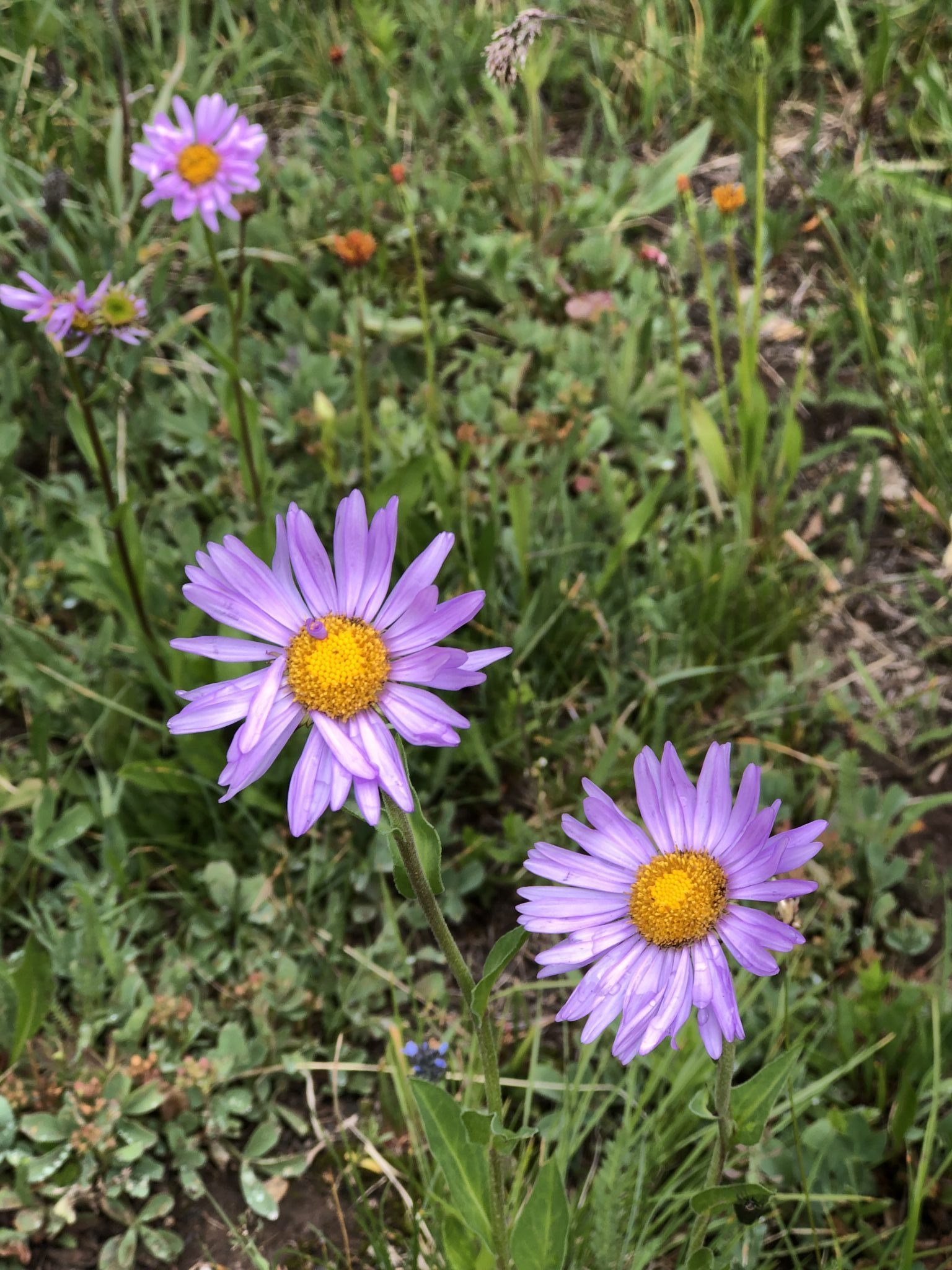
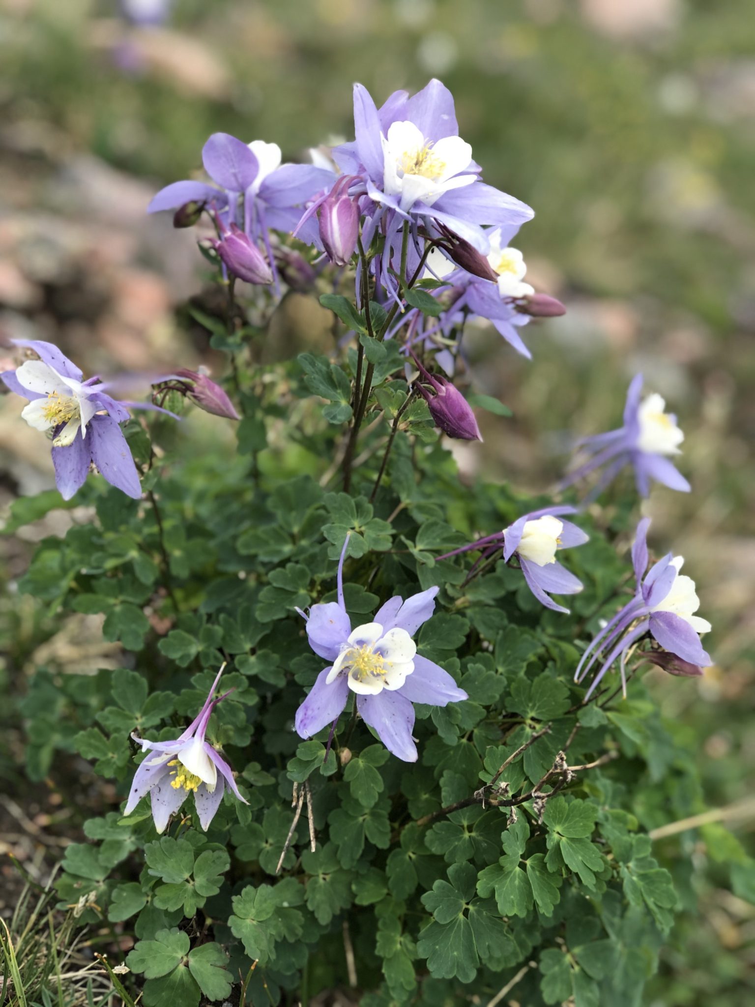
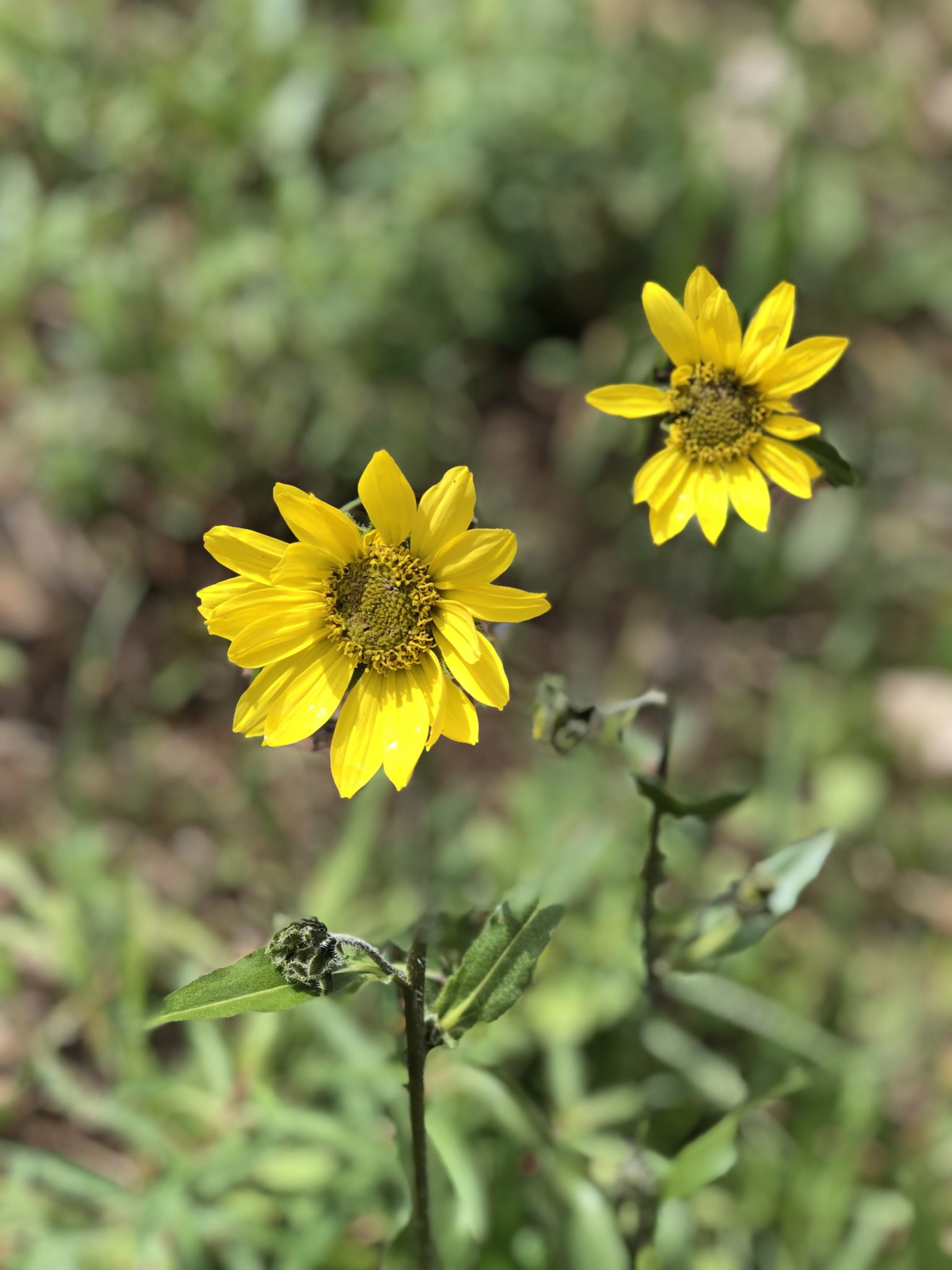
As a side-note, in the fall of 2019, the wildflowers were off the chain in Colorado. I’m not sure I had ever seen such a display before in the high country. That was really fun to walk down through. (Josh)
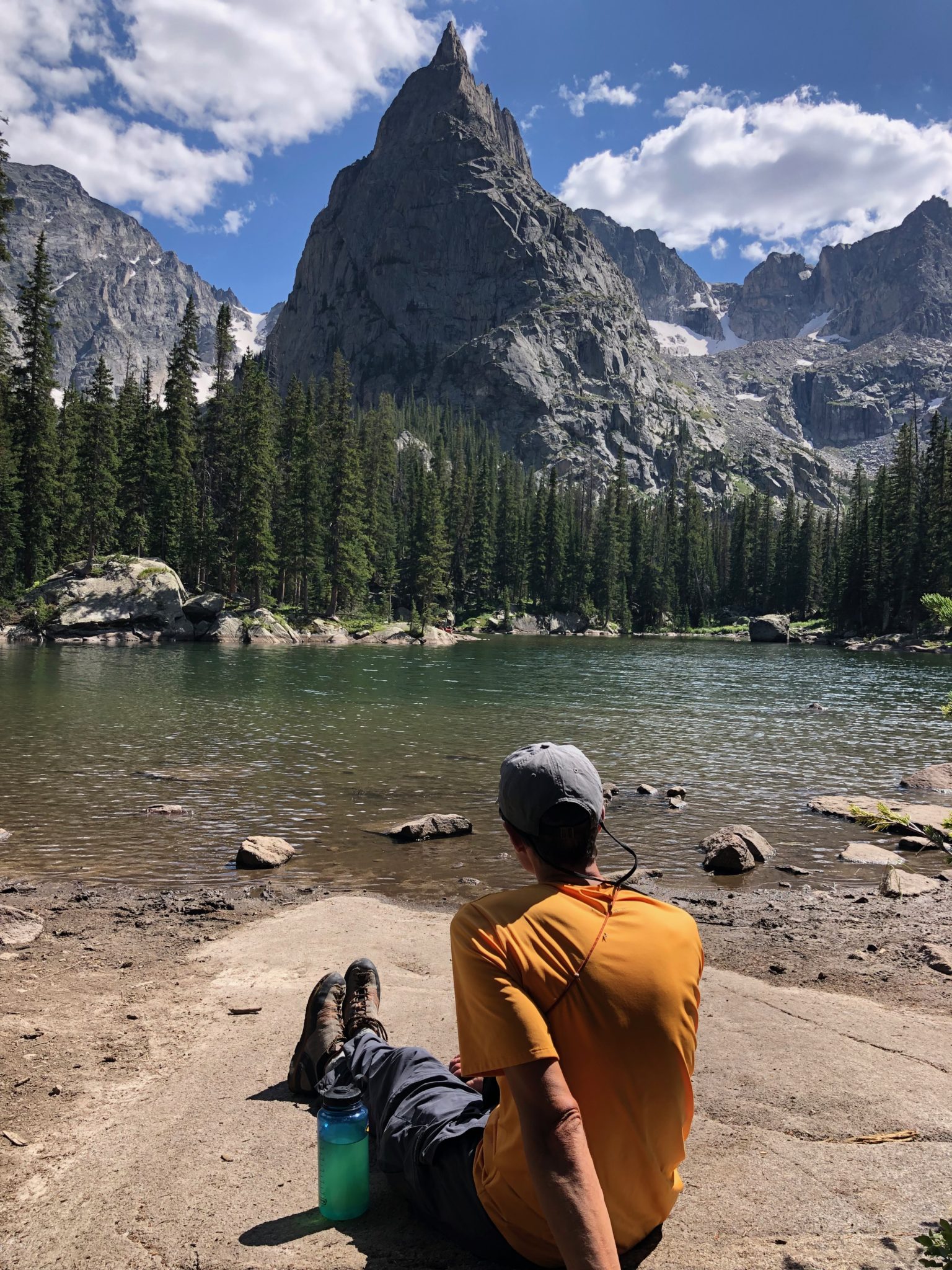
Finally reaching Mirror Lake again, we enjoyed one of the best picnic spots in Colorado. A perfect place to take it all in. I really want to come back here and camp. The whole area is just stunning. It’s worth the trip.
Or at least, that’s what I tried to tell myself on the hike out. It was a long one. At least we got to enjoy new views as all of it had been in the dark on the way in. And as usual, great conversation among friends always helps speed these things along.
As we drove back around the shores of Lake Granby later that evening, we felt tired, but not exhausted. We were content with a successful day on a very cool peak. Reflecting back now, I really think this is one of the best hidden gem spots I’ve been to in these parts. It’s so close to Denver, but the ruggedness and remoteness makes it feel a million miles away. The whole area has a ton of possibilities, and Lone Eagle has to be the very best one. Definitely a summer destination worth returning to.
As I said at the beginning, I’m sure glad I did it. All credit and thanks goes to Josh for the inspiration of this one. And also, his persistence for making it happen at each step of the way.
Thanks for reading if you did. Happy climbing!
Until next time. (Zambo)
Climbing Beta & Notes
Rack:
- 10 shoulder-length alpine draws
- 3 double shoulder-length draws
- 1 cordelette
- Several loose biners and lockers
- 1 set of stoppers
- 11 cams of various sizes up to BD Camalot #3 (doubles of Camalot sizes #0.5 to 1)
- 1 nut tool
Climb Times
- Monarch Lake Trailhead: 3:00 a.m.
- Mirror Lake: 6:05 a.m.
- Start of North Face Route: 7:10 a.m.
- Lone Eagle Summit: 12:10 p.m.
- Left Summit: 12:55 p.m.
- Mirror Lake: 3:00 p.m.
- Left Mirror Lake: 3:25 p.m.
- Monarch Lake Trailhead: 6:20 p.m.
- Total: 3:00 a.m. – 6:20 p.m. = 15 hours & 20 minutes
Conditions
- Gorgeous, blue bird day – no threat of storms
- Fairly gusty at times, but warm being at lower alpine elevations; crux pitch was in the shade and fairly exposed to wind, so it was the coldest pitch of the day
- No recent rain, so the “vega-neering” sections of the climb were dry
- An abundance of loose rock on pitches 5, 7 & 8. Our “ascent gully” along the Solo Flight route to reach the grassy ramp descent was very loose as well.
- No real snow to contend with, although there was still quite a lot of residual snow fields lining this north-facing cirque
Hell of a write up with great photos to add. Looks like an amazing day.
Need to check this area out!
Thanks Brian! Ya I think you’d really like this area. I kept thinking how easy & fun it would be to run up to the lake. Super runnable on an awesome trail the whole way.
Nice work! Thanks for the write up, it was a good read.
Thanks Dave. Glad you enjoyed it!
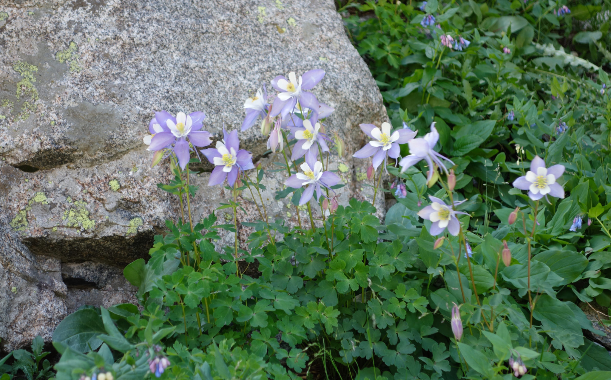
Man, it’s quite a treat to re-live the memories through your exquisite story-telling. Well done again. I can’t think of a better person to share this stout challenge with. Solid team-work up there. The “jungle-neering” on several of those pitches made for a super-unique alpine experience. We may have a couple of fines coming our way for defacing the vegetation and certain unavoidable state flowers en route. That cirque is mythic. Oh, and thanks for not leaving your partner up there…
Thanks man! Incredible day back there indeed. Really fun to re-live it, albeit two months later. (!) And yes…..many a Columbine may or may not have been crunched in the making of this TR..
Epic climb and awesome summary! Thanks for sharing.
Thanks John! Ad thanks for letting me ‘borrow’ Josh. 🙂
Awesome guys! Looks like a fun day. I forget how aesthetic the IPW can be. Maybe in this life or the next, the 3 of us will get a climb in together 🙂
Thanks man. Ya, it’s a really cool area, for sure. I kept thinking about the running opportunities as well. Lots that could be explored and done. Here’s hoping for a threesome sometime soon. Bigger winter outing???
Nice recap Dave. That cirque has gotta be top 5 in CO, top 2 in Frange (behind Longs/Meeker). IPW has so many moderate 5th class gems, it’s a nice way to put some distance between yourself and the sleepy/angry brovilles. That’s hilarious in that shot with the red arrow “no go”. Scot almost killed himself in that gully and then I almost killed him later that day on the traverse to Iroquois. Solo Flight definitely a deceiving route. Congrats on a classic climb in an amazing setting!
Thanks Brian! I gotta hear the gully story sometime. It does indeed look appealing. Glad to know we weren’t being lied to online.
And I want to learn about the ridge to Iroquois too. That’s gotta be one of the best hidden ridges in the state. Looks gnarly as anything.
Great route! It’s been several years since I did Lone Eagle and our ascent route was the same as the descent….fun to live vacariously through you and Josh on this climb. Looks like you enjoyed a spectacular day on one of the finer peaks in the state.
Thanks, Steve! I had no idea so many others had been up this way before. Apparently I was way behind on the party, and it was with good reason. This one is worth getting back to for sure, as everyone else already figured out! 🙂