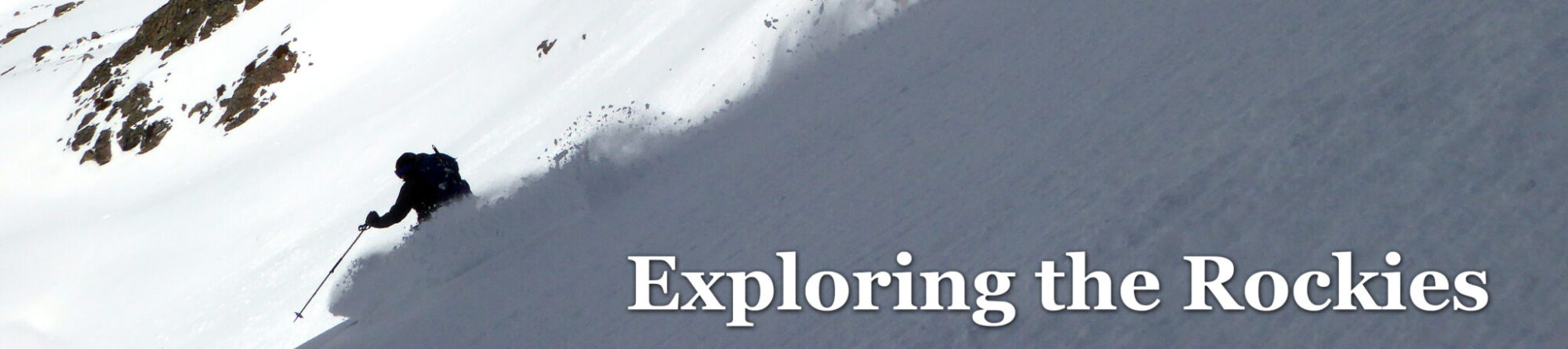
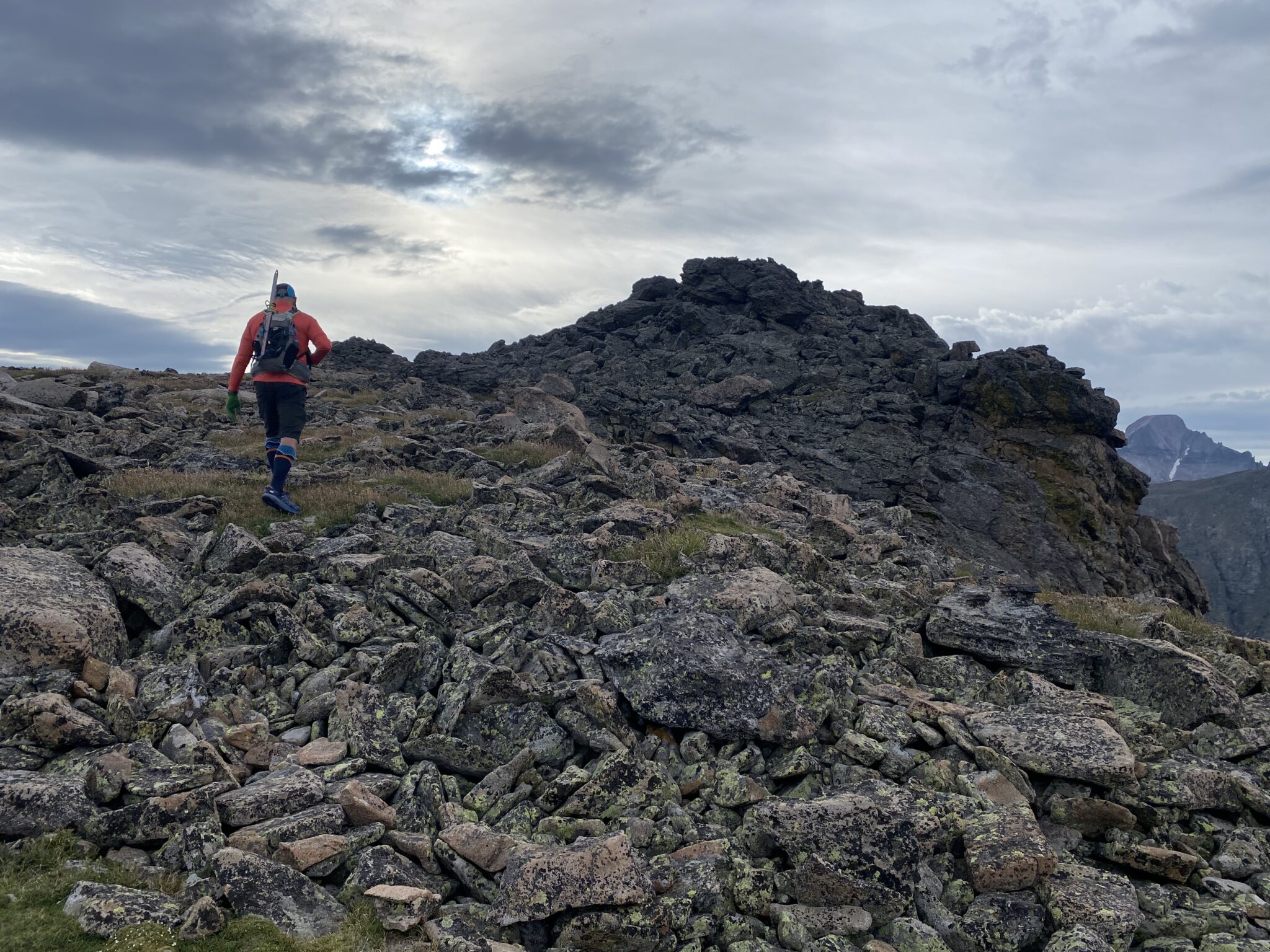
Longs keeps a watchful eye as Steve descends after a sensational day on the (partial) Glacier Gorge Traverse.
- Peaks:
- Flattop Mountain – 12,324′ (unranked)
- Skipped: Hallett Peak – 12,720′
- Otis Peak – 12,486′
- Taylor Peak B – 13,153′
- Powell Peak – 13,208′
- McHenry Peaks – 13,327′
- Route:
- Bear Lake > Flattop
- Flattop > Powell, via the Continental Divide
- Powell > McHenrys, via McHenrys Notch
- McHenrys > Bear Lake, via Stone Man Pass
- Climbers: Zambo & Steve Cummins
- Distance: 16.36 miles
- Vertical Gain: 6,253′
- Date: 8/12/23
- Strava Track: https://www.strava.com/activities/9635619953
Glacier Gorge is about as iconic as it gets in Colorado. This sweeping cirque contains enough high peaks, lakes, trails, and precipices to serve as a front range ‘home base’ for a lifetime. It’s little wonder that this was the spot chosen long ago to serve as the beating heart of Rocky Mountain National Park.
I’ve lost track of the number of times I’ve been here. Encompassing anything from thrilling rock climbs up The Sharkstooth to family walks around Bear Lake, there’s enough variety to easily justify coming back time and time again.
But in spite of all those trips, I still had a bit of unfinished business along the divide. I hadn’t yet climbed half of the 13ers in the cirque; Taylor, Powell, and McHenrys had eluded me. In reflecting on why, I guess it makes sense. These three peaks aren’t the most straightforward to stand on top of. To get at any one of them requires a long day. To get all three means a very long day. Not to mention all the technical challenges required to do McHenrys. It’s a scramble from either direction and an especially challenging one when coming from Powell. Or to reverse the route from Powell requires a (pretty much) mandatory rappel.
You could easily split up these peaks into two trips, I suppose. In fact, Steve and I originally planned to just do Taylor and Powell, leaving McHenrys and its famous notch for another day. As prodigious of a mountaineer as is he is, he still hadn’t climbed Taylor or Powell either. Those two were all he needed. I was just happy to get out get out with an old climbing buddy on some peaks neither of us had done less than two hours from Denver. That scenario seems almost an impossibility these days.
And so, we set out from the Bear Lake parking lot just before 5:00 on a summer Saturday. Our primary goal was to get to Powell along the Continental Divide and then see where conditions, endurance, and weather would lead us from there.
Part 1: A Magnificent Walk on the Divide (Flattop to Powell)
Another sunrise in the park. These don’t come nearly as often as they used to, so I was sure to stop and enjoy it for a moment.
We could feel it early: it was going to be a great day.
We made quick work of the excellent, gentle trail to the top of our first summit of the day: Flattop Mountain (12,324′). The biggest surprise (although it probably shouldn’t have been) so far was dodging the sheer number of hikers at the Bear Lake parking lot. We were in an 8-12 car conga line all the way to the trailhead. When we arrived we joined the estimated 50+ vehicles already parked for the morning.
We marveled, wondering where exactly all these people were going. I suspect they were mostly just trying to dodge the park’s new timed entry system. Anyone into Bear Lake before 5:00 didn’t need a reservation. But sheesh, there were a whole lot of very early risers just to hike Bear Lake or Emerald Lake.
Once we left the parking lot, we encountered only six parties (five of whom were soloists) all day along the divide. I guess some things never change in Rocky.
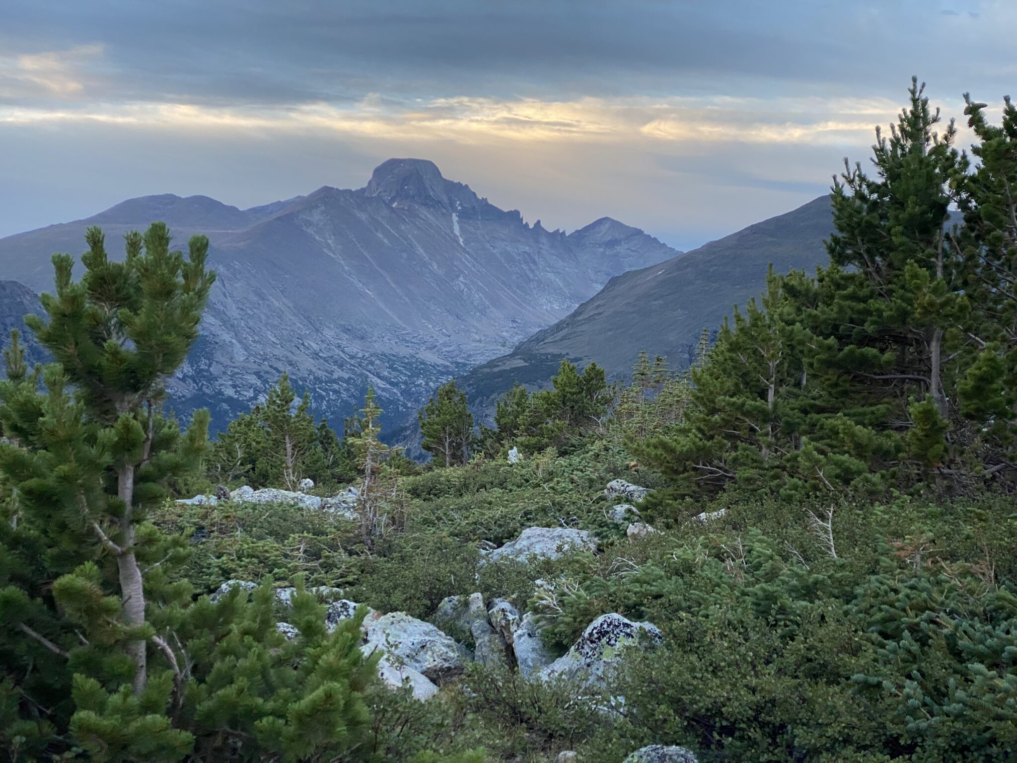
First light on the monarch of the park himself.
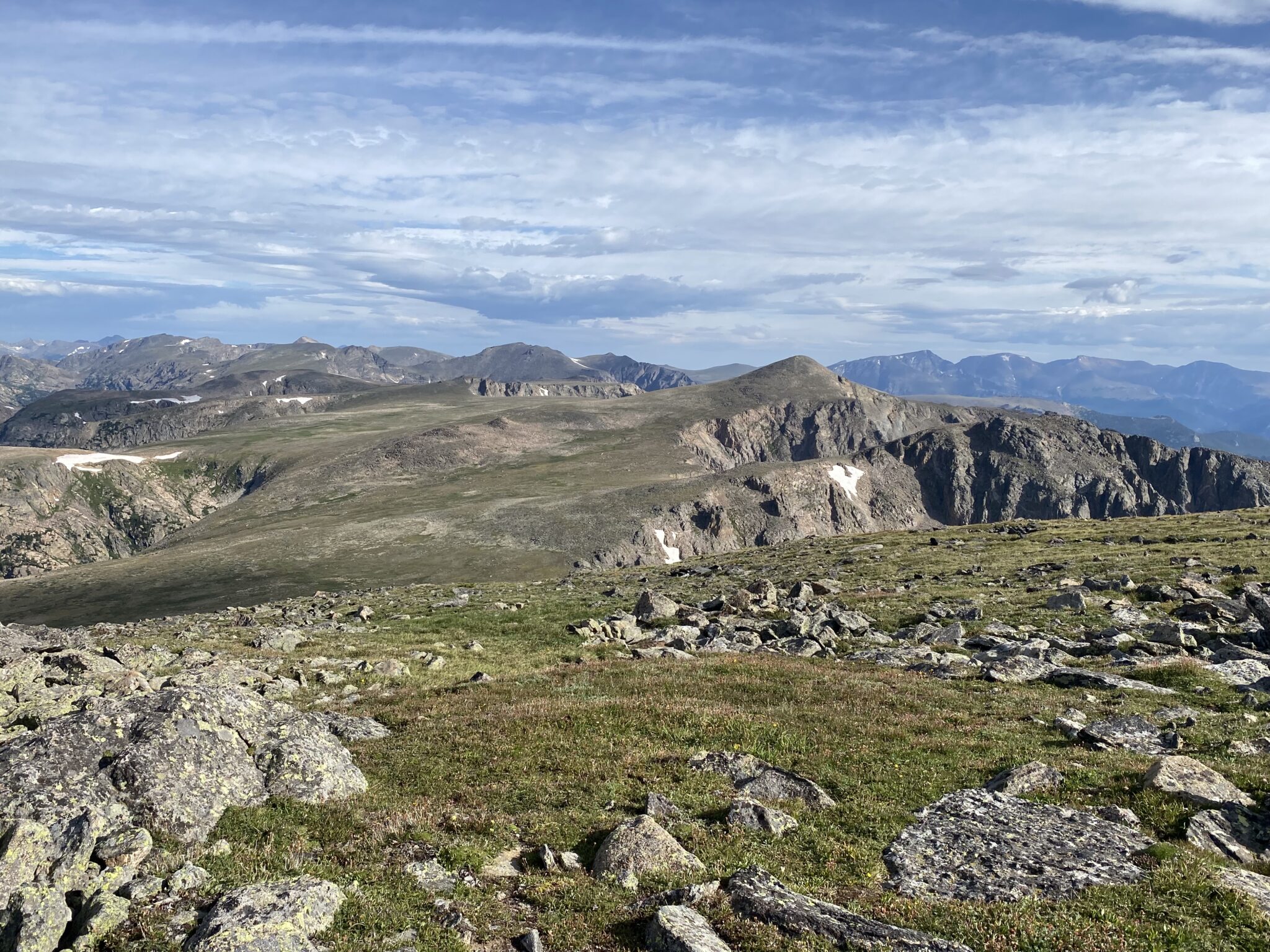
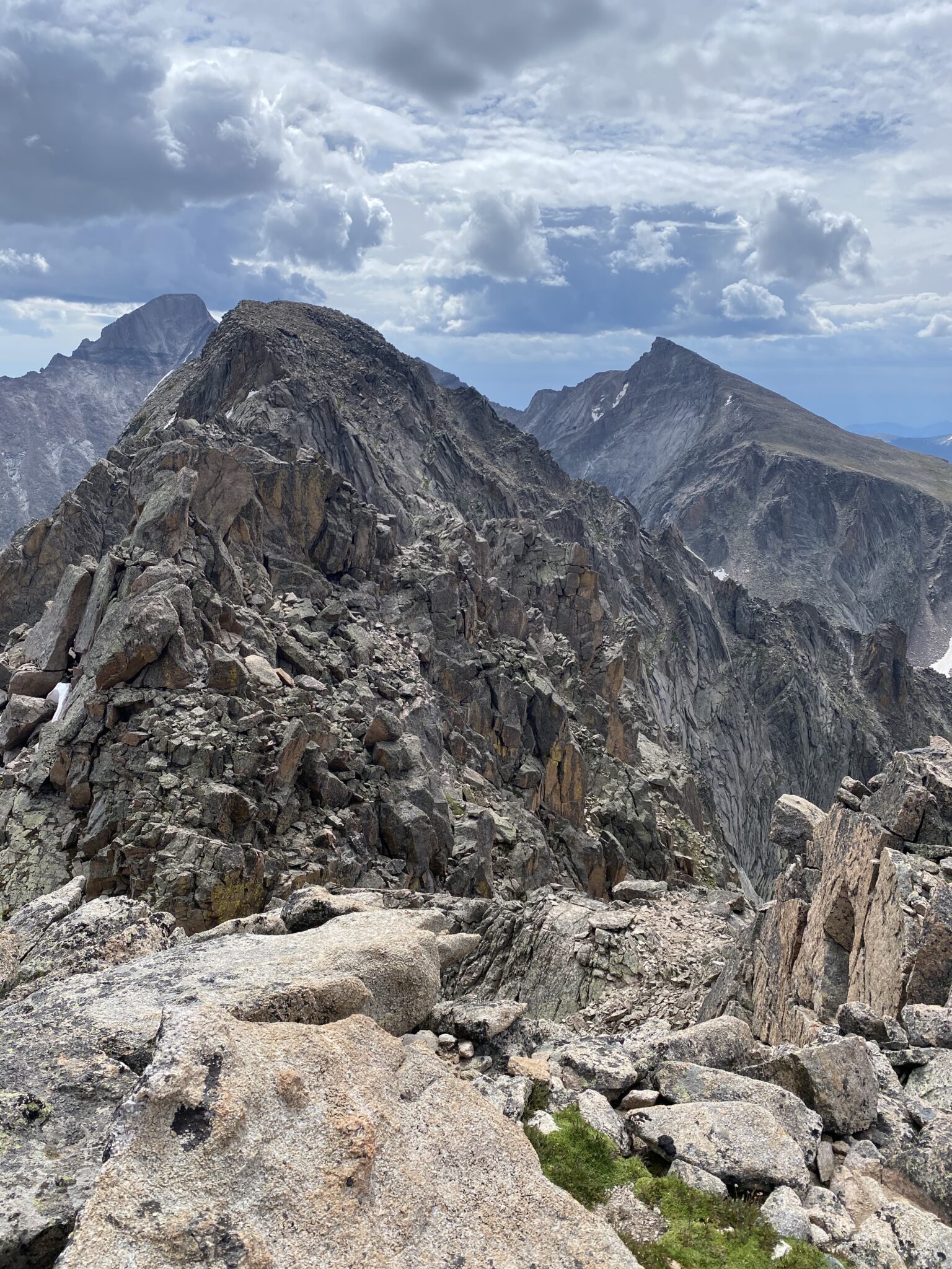
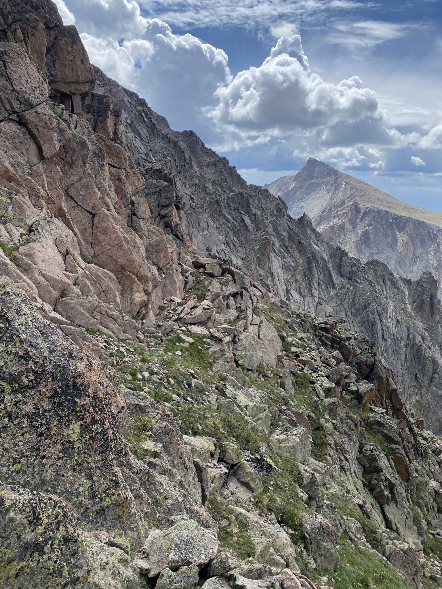
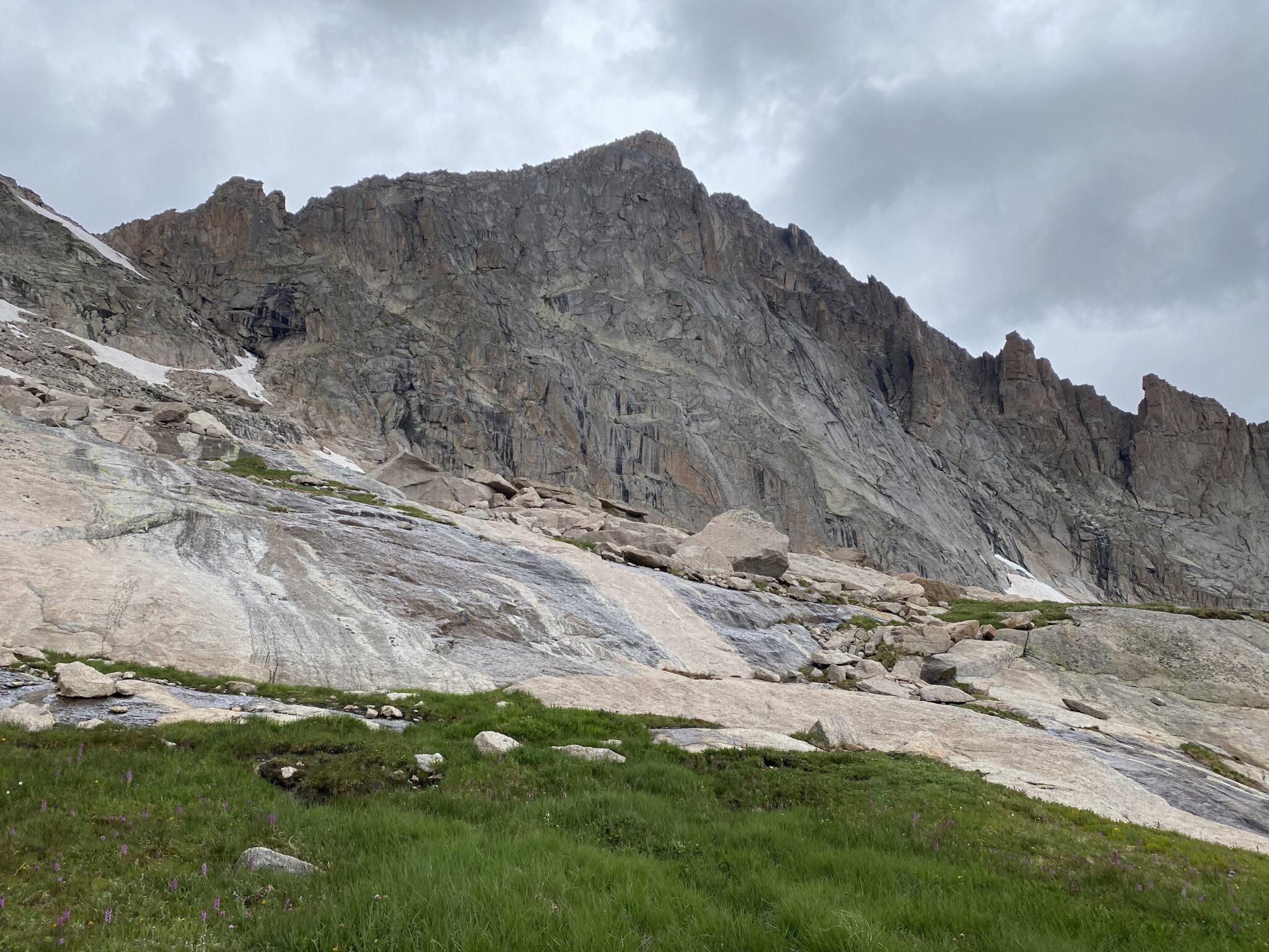
Views looking south from the Emerald Lake Overlook along the excellent Flattop Mountain Trail. The vast majority of our day would be spent above 12,000 feet high along the divide on most of the peaks in this photo.
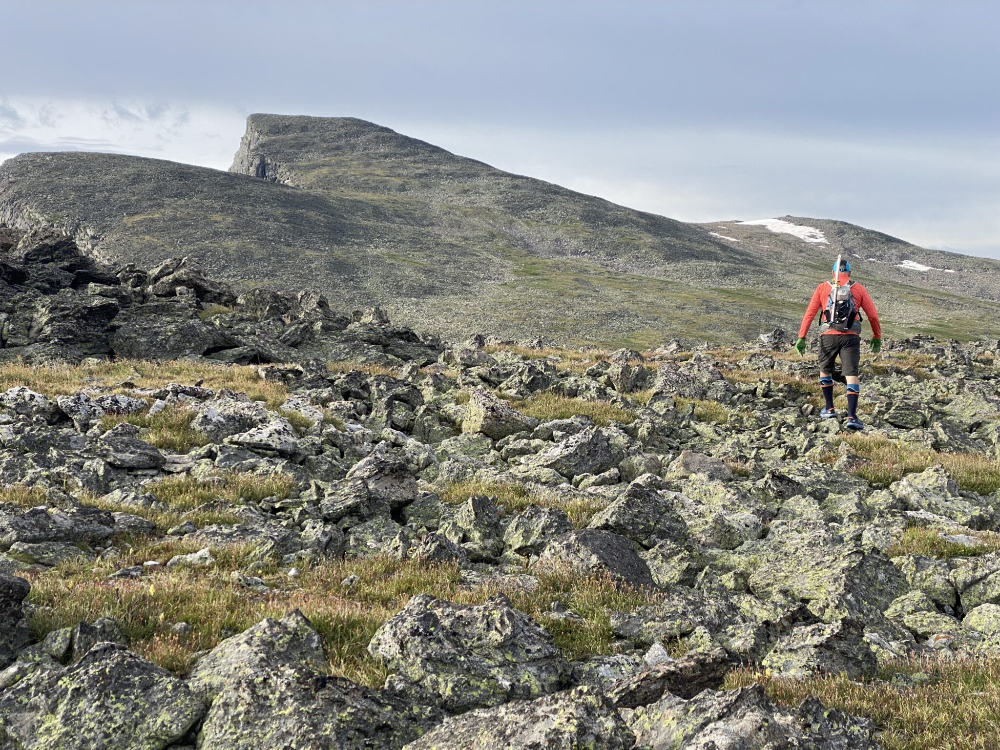
The walk to Flattop had the aforementioned excellent trail. This would make for a really nice trail run. Beyond this summit, however, the terrain switched to a mix of grassy / rocky tundra for a long way along the Divide. Powell was 4 1/2 miles away. And McHenrys beyond that further still.
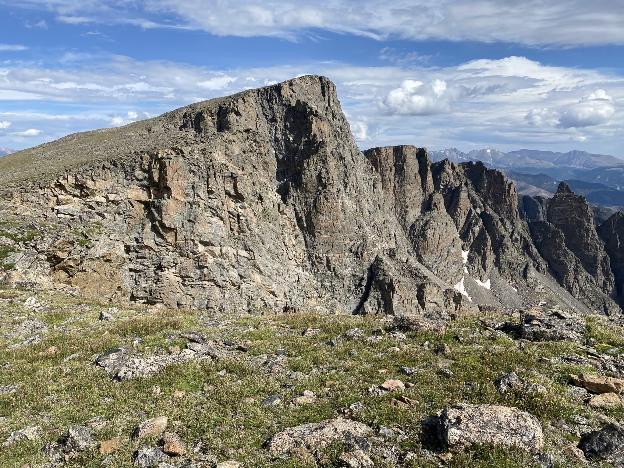
The next stop of a ‘pure’ cirque of Glacier Gorge ought to have been Hallett Peak (12,720′). But since both of us had done that one multiple times before, we opted to skip it and simply press on to Otis Peak (12,486′) instead. We didn’t miss the extra vertical gain, nor did we miss the prospect of hiking up a mountain that is actively shedding billions and billions of cubic meters of rock lately.
Peeking down at Tyndall Gorge between Hallett and Flattop. Hallet was looking much too crumbly and much too far away to be bothered with.
Steve picking his way up the final few steps to the summit of Otis Peak.
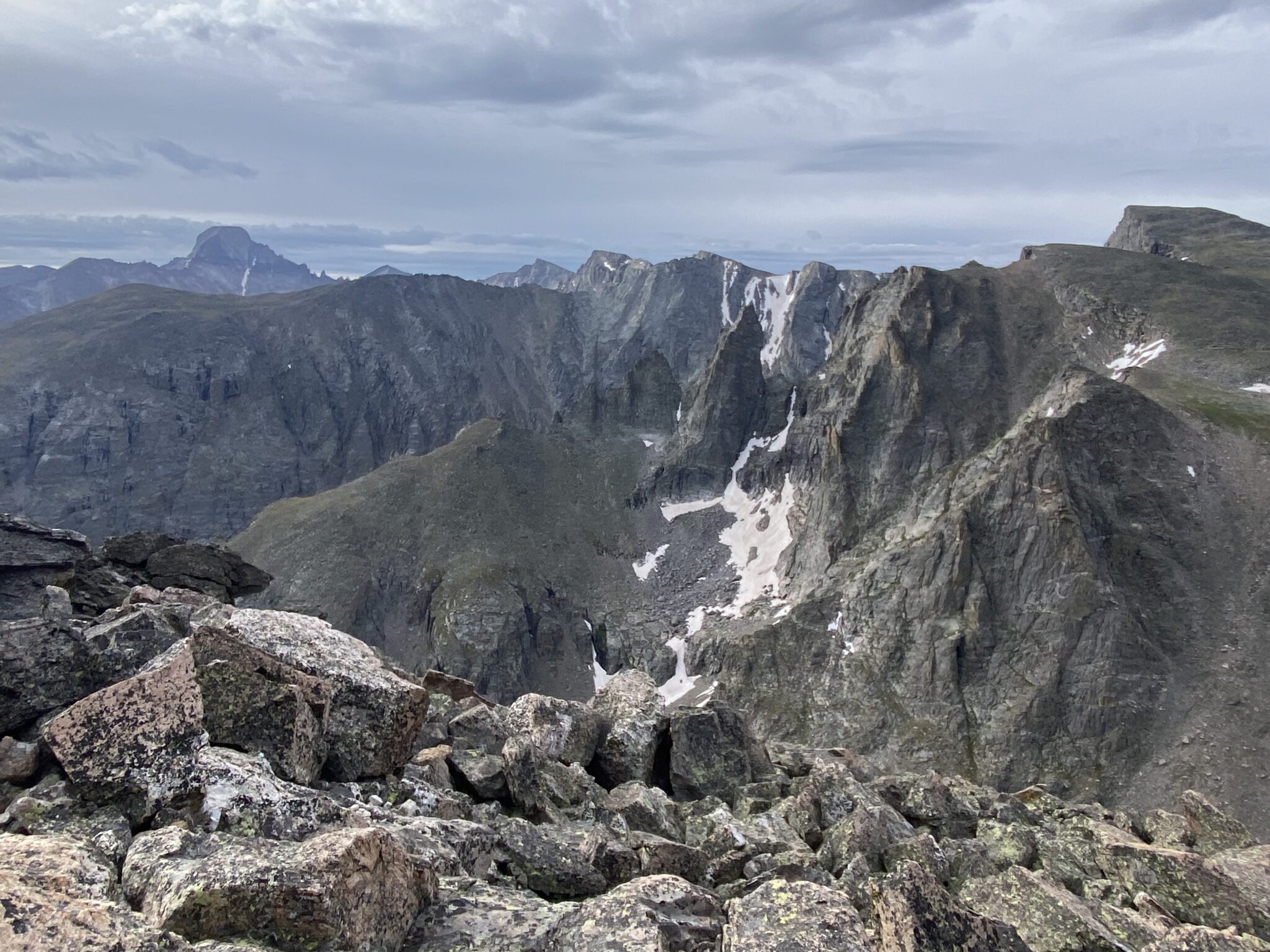
Looking south from the summit of Otis towards the peaks to come. It’s pretty much impossible to find a summit in Glacier Gorge with bad views. Otis was no exception.
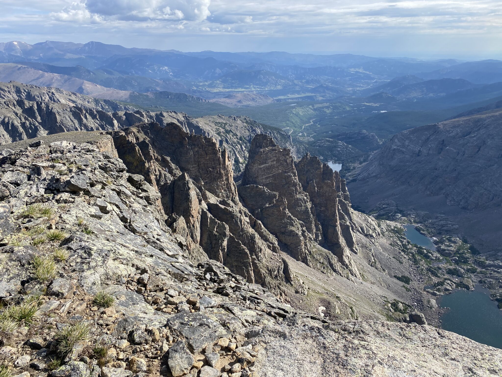
One of the best parts about this cirque is the constant views down to the many magnificent spires and ridges of Glacier Gorge. The Sharkstooth is at the top of those lists. Hard to believe I had the chance to stand on top of that thing eight summers ago.
Looking back on Otis and Hallett.
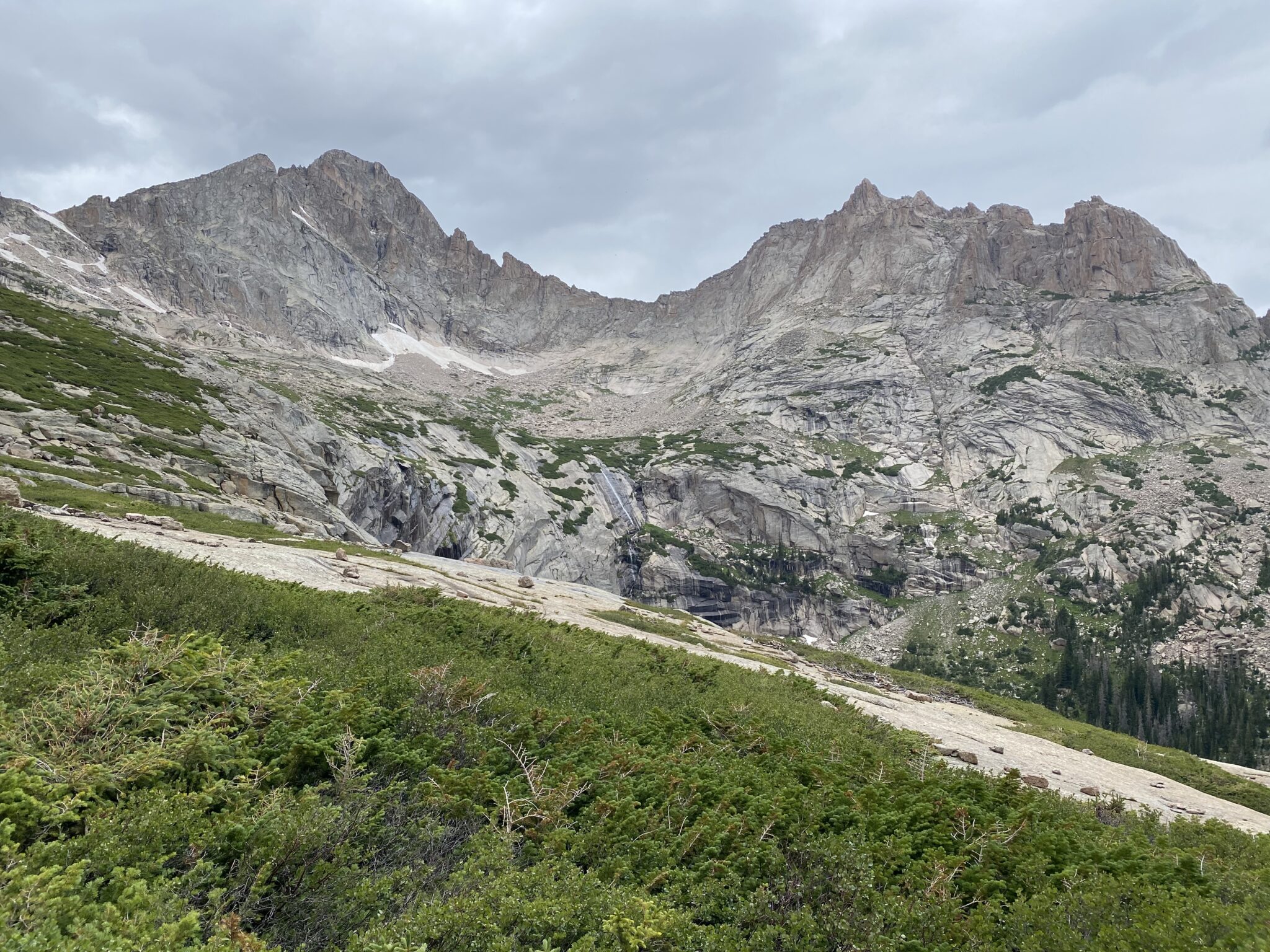
When we reached the Otis-Taylor saddle we were eager to check out Andrews Glacier. Steve and I had both recently read Brian’s iconic old trip report from this area, in which they used it for their descent. They had reversed our direction, going counter clockwise from Stone Man Pass to Andrews Glacier and then descending the glacier itself. Our plan was to potentially hike back to this point after summiting Powell and then likewise descend Andrews to save some time on the egress. But we wanted to check it out first.
Brian, in a way only he can, had made quite a point that Andrews Glacier is much steeper and more stout that the purported 20 degrees. That was in alignment with most of the beta I found online too. Most report it to be a steep, dangerous snow climb. While others say the low angle makes it a walk in the park.
Not knowing what to believe, and wanting to have options, we threw microspikes and axes/whippets in our packs. The extra weight seemed like a small tradeoff to potentially save a few miles of hiking at the end of a long day.
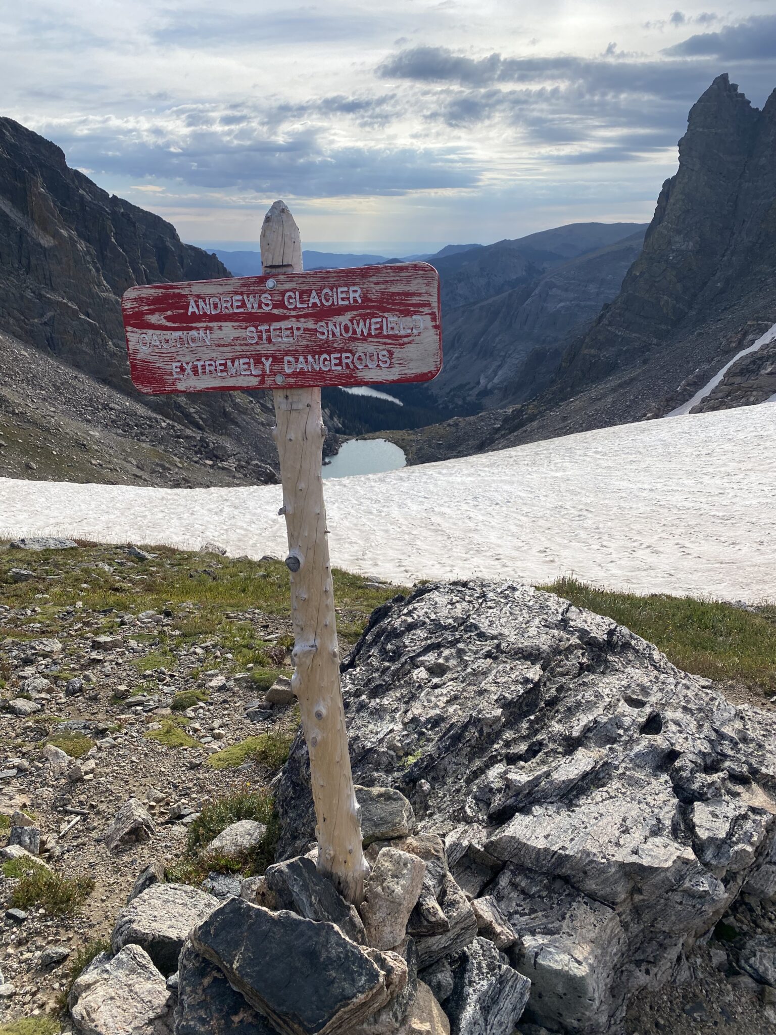
Regardless of what the internet thinks, the park makes their feelings about Andrews Glacier quite clear.
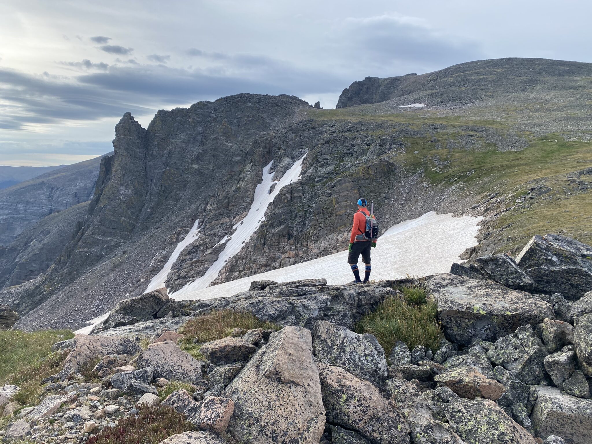
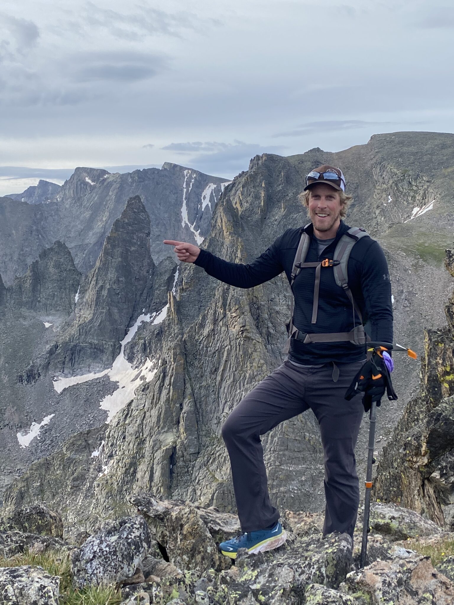
Steve checking things out whilst simultaneously enjoying the freedom of the hills.
Upon inspection, we determined the glacier definitely goes. The entrance was a non-factor, the angle was low (maybe 25 at the mandatory steepest, I’m guessing??), and there appeared to be a nice rib on the right side that would be easily descendible. Especially with our lite snow gear. Like anything on snow, I’m sure the difficulty varies dramatically depending on time of year and conditions. And if things were frozen solid I wouldn’t have done it without some kind of friction. But given the conditions we found + some lite gear, we felt more than confident in taking this exit later (had we needed to).
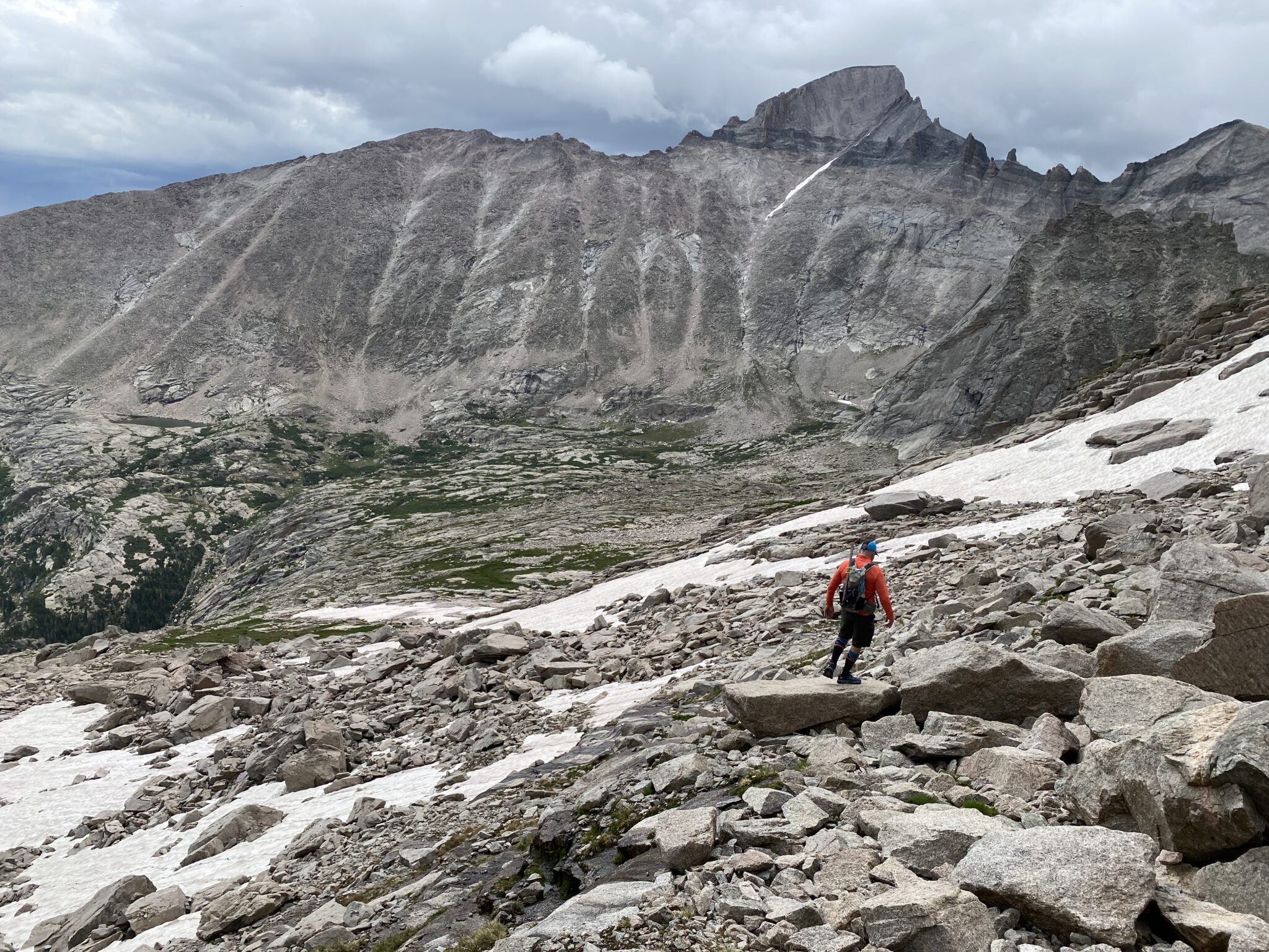
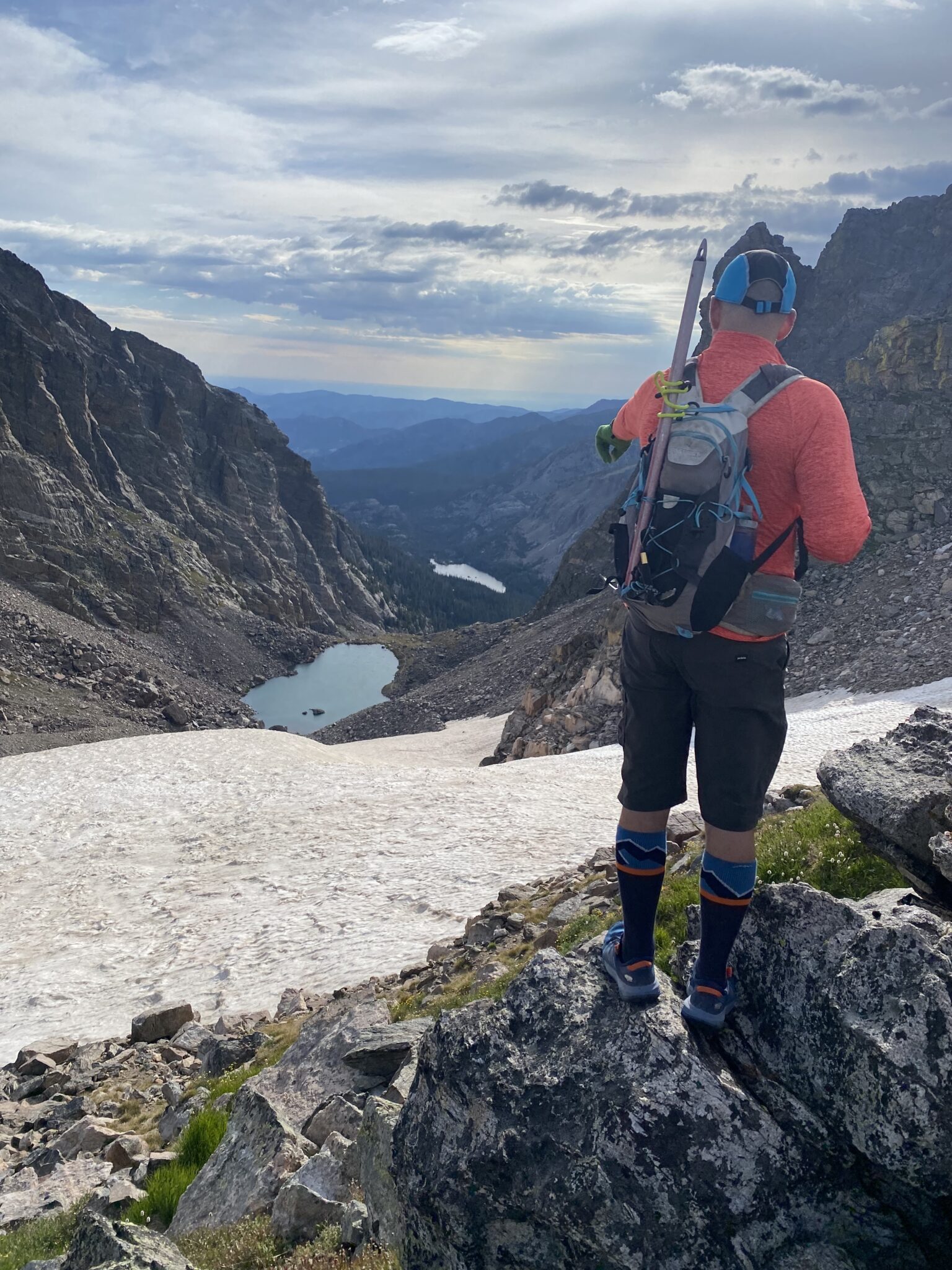
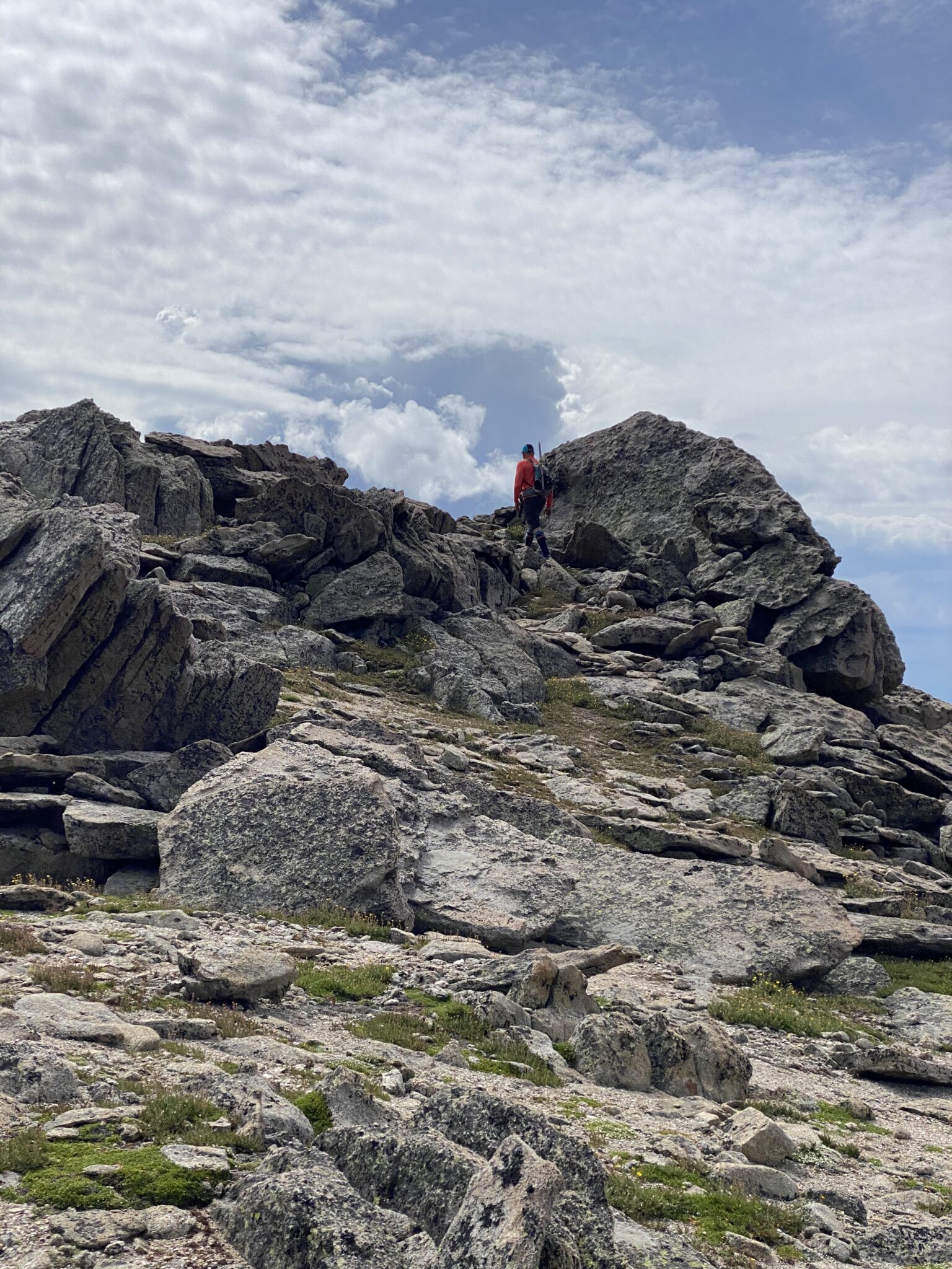
Knowing that we had the prospect of a shorter egress all buttoned up, we set off with renewed optimism towards our third summit, and first 13er, of the day – Taylor Peak (13,153′).
Steve heading off towards Taylor on classic divide tundra. Taylor ended up being a bit higher and further away than it looked, which really just speaks to the scale of things in Glacier gorge. It’s a big place.
We took just a brief respite on Taylor’s summit. It was still early and the weather was holding for the time being, but we could see it building. So, we allowed ourselves just enough time to do all requisite gaping at the magnificence around us, then we pressed on ahead towards Powell.
Standing atop Taylor Peak, with views looking back towards our starting point and Estes Park beyond. Tough to get enough of those ridge views.
ABOVE: Taylor summit views. (Apologies to any desktop viewers for the vertical video.)
The view of Powell from the summit of Taylor. It was a nearly 1.5 mile walk away.
Looking back at Taylor from the Taylor-Powell saddle. Word to the wise, the descent off Taylor does not need to follow the ridge line direct. Although the views were incredible from the ridge, much of that can be cut off to save a bit of time, if one chooses to do so.
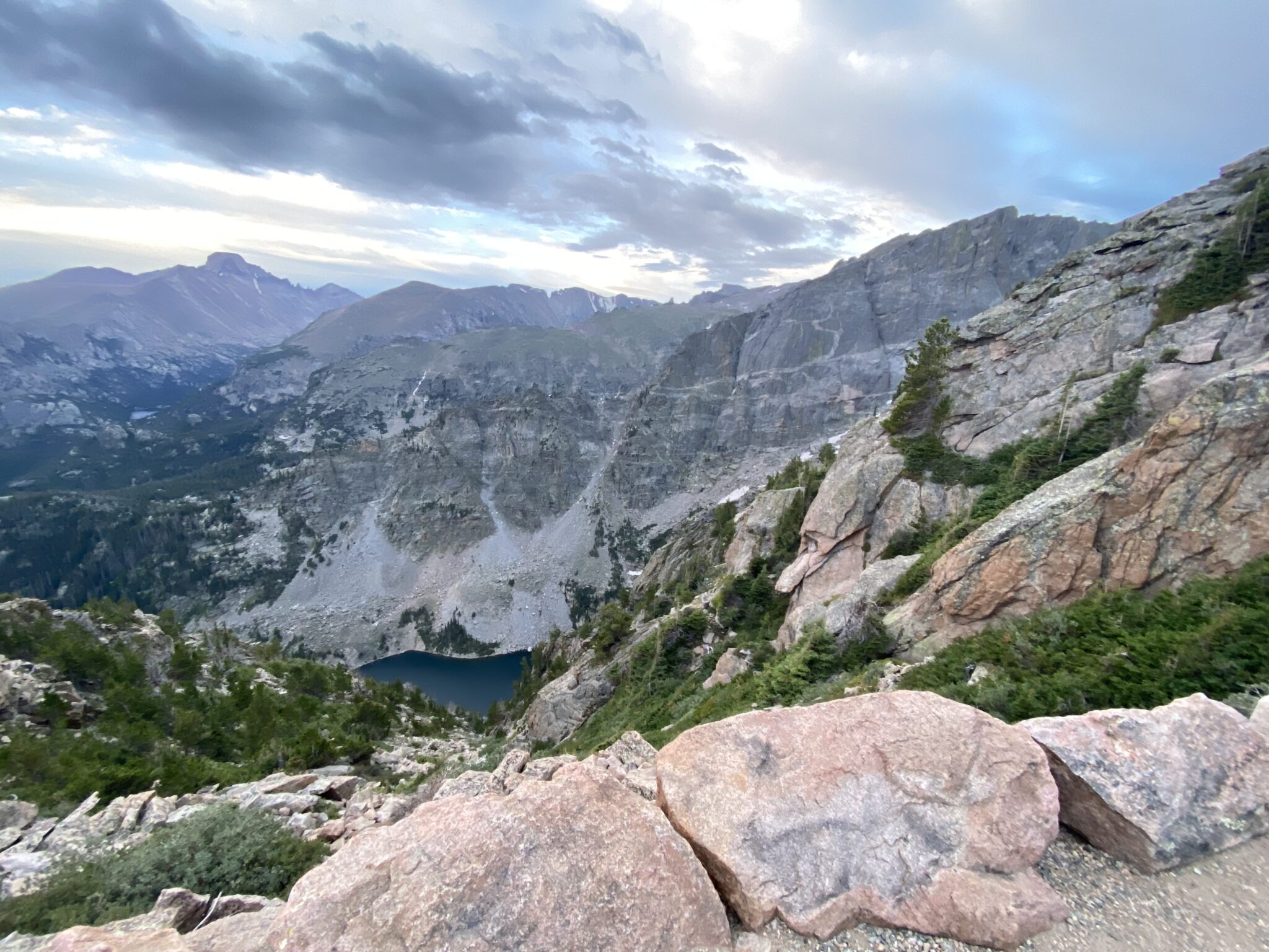
Lake views down towards Sky Pond, Lake of Glass, and The Loch. And of course, The Sharkstooth looms as proudly as ever.
After what felt like a whole lot of horizontal effort, we finally reached the summit of Powell Peak. This would be the end of our class 2 hiking for quite some time.
ABOVE: Powell summit views this time.
When we reached Powell we had a decision to make: would we turn back and descend Andrews Glacier, or would we press on into the much more challenging terrain leading us to the top of McHenrys? In retrospect, I’m not sure it was actually much of a debate. The further and further we got from Andrews, the more and more I knew I didn’t want to backtrack all that way. Moreover, I equally felt the strain of all the miles; I wasn’t too keen to come back all this way again just to get an orphaned McHenrys.
Although Steve had already done McHenrys, he was feeling more or less the same. Not to mention the fact that he’s never met a scramble he didn’t like. So, we resolved to climb down into The Notch and check things out. If it looked passable we would simply continue on through to McHenrys and then descend Stone Man Pass. Here goes nothin.
Part 2: Marvelous Scrambling and an All-time Basin (Powell > Stone Man Pass > Bear Lake)
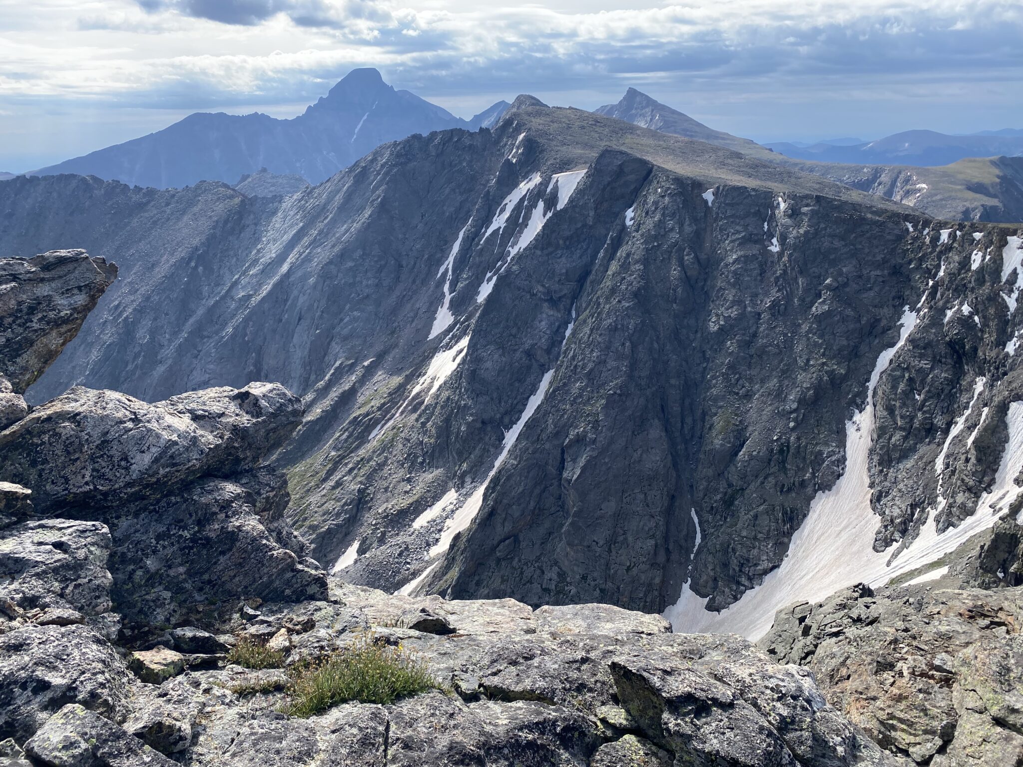
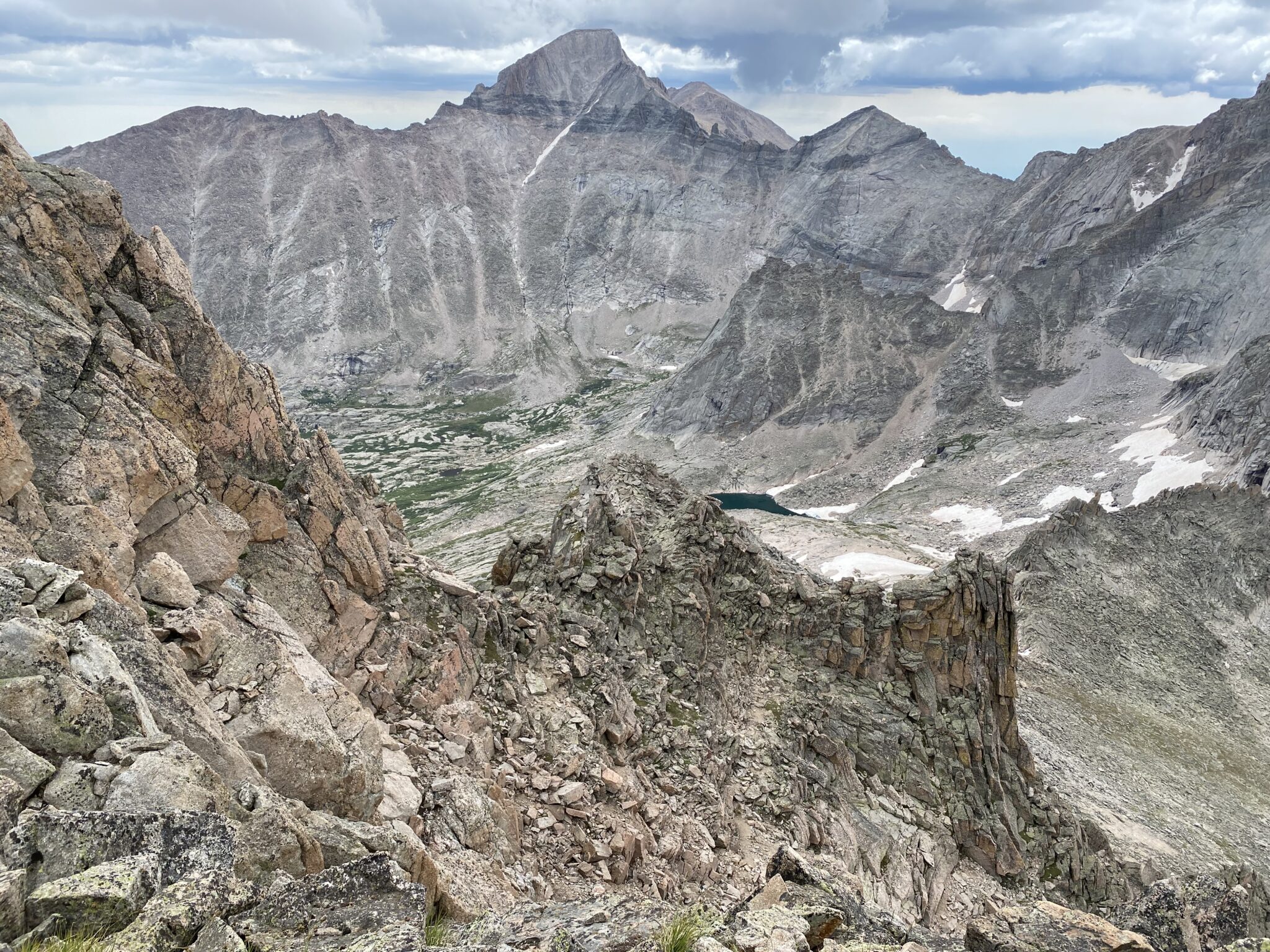
The view over to McHenrys from the summit of Powell. McHenrys has a very prominent notch that cuts the Continental Divide in half. Our day had been easy talus hopping to this point. But as soon as we departed Powell, the terrain flipped to much more challenging, loose, and exposed class 3+ terrain.
Our first obstacle was to find and descend the loose gully off of Powell’s summit. Although the climbing was easy class 3, the route finding was key as big cliffs and sheer drops surrounded in all directions. Plus it was just nasty loose.
After descending maybe ~200 ish feet down the gulley, we eventually migrated laterally onto a series of grassy benches. These brought us across the face towards the bottom of The Notch itself.
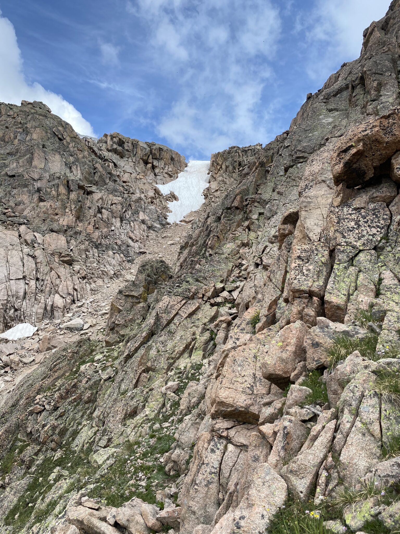
Looking back towards Powell. From its summit, we walked towards Alice before finding an entrance to the gulley seen here. We gained it to looker’s right of the snowfield (not in frame), then picked our way down until we hit these grassy benches. I’m not 100% sure if that was exactly the right way, but it all went pretty easily at nothing more difficult than loose, class 3 climbing.
Looking ahead now on the grassy benches that would lead us to McHenrys Notch. We tried to move as horizontally as we could through here, giving up as little elevation as possible. Sections of this reminded me of The Crestones Traverse. It has similar benches for the entire first half.
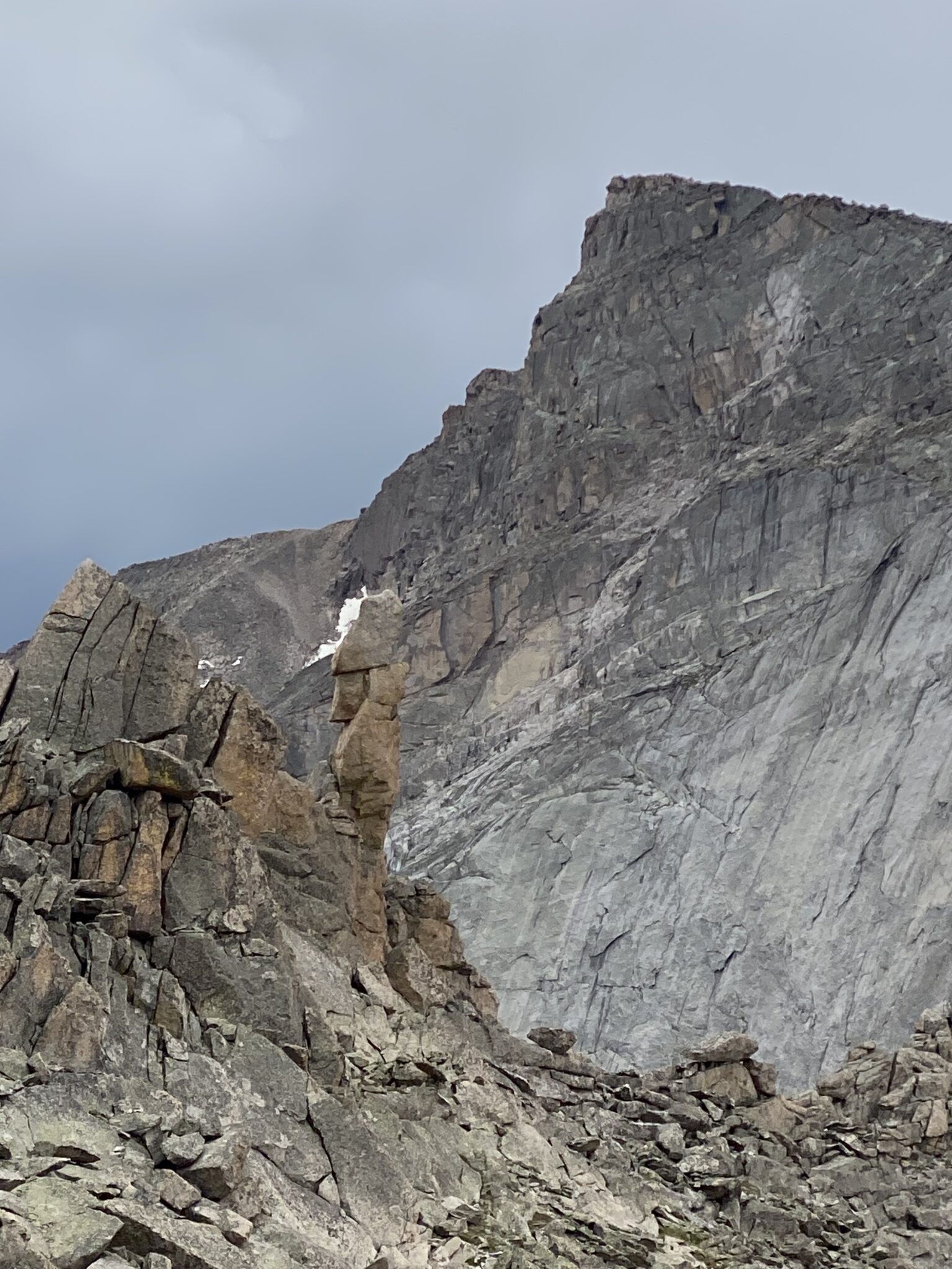
The undisputed crux of this route is the ascent up McHenrys Notch. This massive, steep, and exposed cut in the divide poses a stout challenge from either direction.
We probably didn’t do as much homework as we should have in prepping for this, but that was nothing that a little trip report browsing on the summit of Powell couldn’t help remedy. We knew the gist of the route was to ascend up a series of steep, consistent class 4 ledges, with a class 5 crux wall thrown in somewhere along the way. Seemed straightforward enough.
What we did not anticipate, however, was being confused about which gulley to ascend. When we could finally see The Notch in full, there were three massive gullies going up. Each looked like it might go. None looked super obvious. Or easy. I didn’t recall anyone else mentioning these three features, so we were somewhat confused. We figured we could climb up closer and see for ourselves. Overall I knew that:
- All other reports seemed to go as close to the ridge direct as possible.
- Everyone comments on the very steep nature of this area. So, we knew at least some class 5 climbing was in store. The steepness was to be anticipated.
- We could look for the rap rings to assure us of our way.
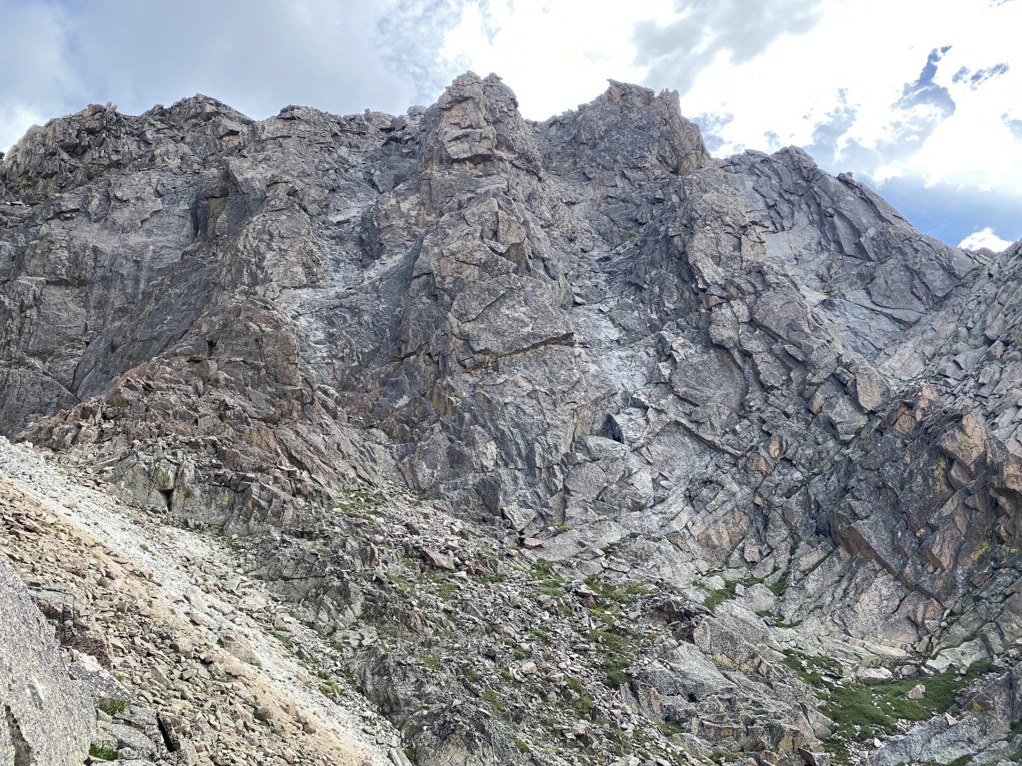
Looking at route options up from the bottom of McHenrys notch. From here, it looked like any one of these gullies might have gone. But in retrospect, it seems certain that the one on the left was the correct choice.
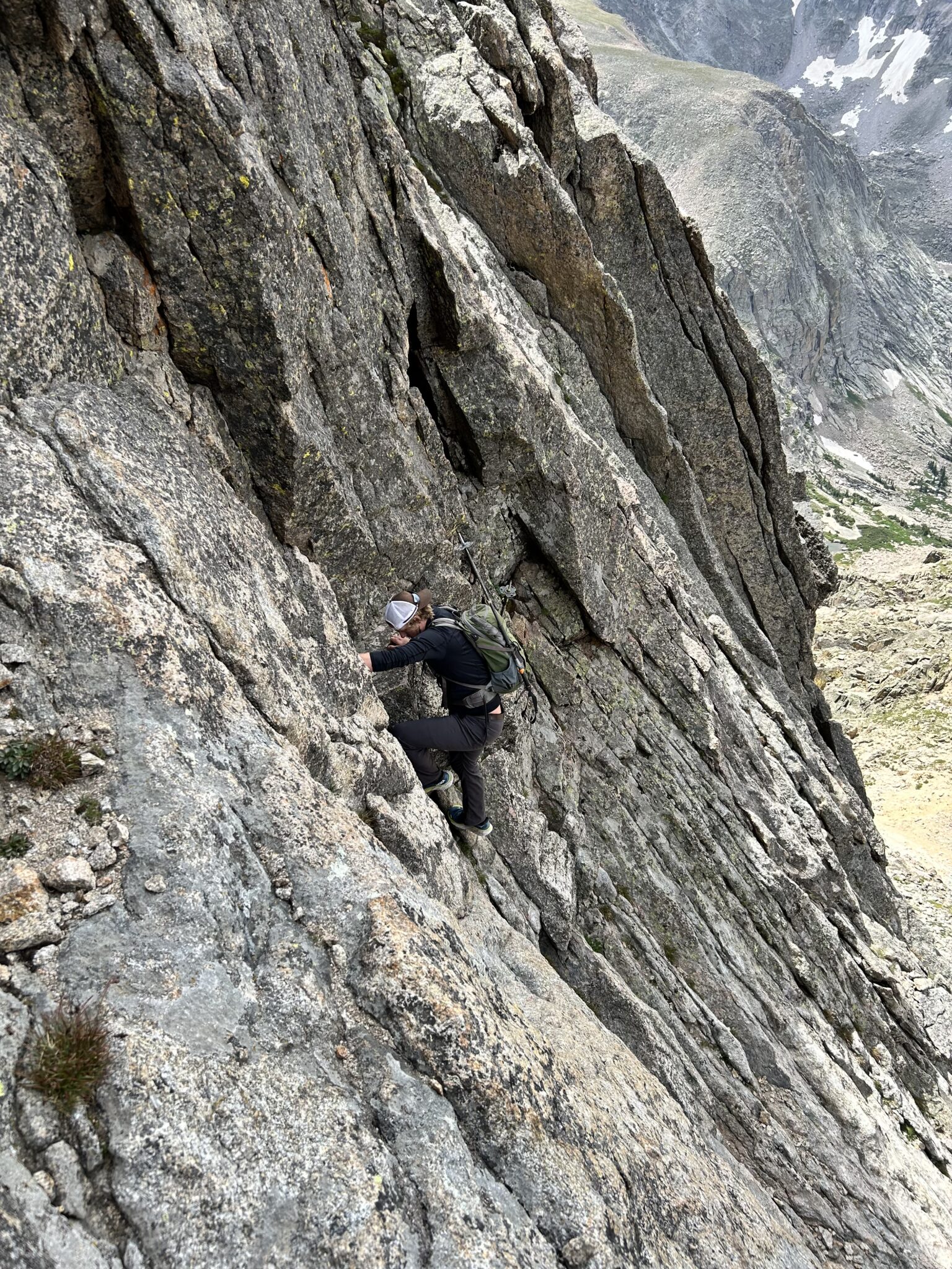
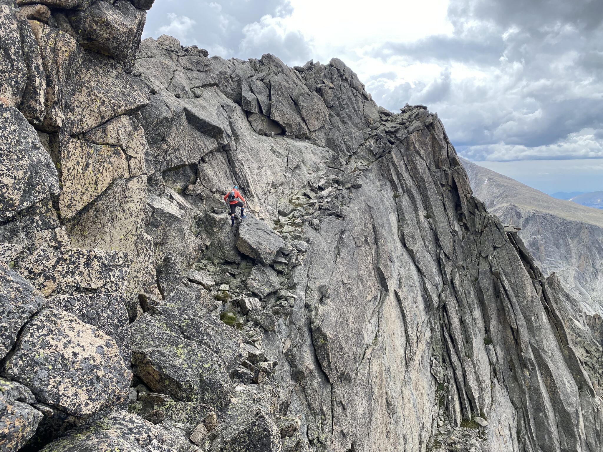
We aimed for the left gulley to begin. This is where we got our first taste of the scrambling to come. A mini headwall awaited us. I don’t really know where the exact cut off is from high 4th class to low 5th class terrain (I’m not sure anyone does), but that’s exactly what this first 50-75 feet was. The exposure started in a big way and only increased as we ascended.
Heading up the initial high 4th/low 5th headwall. There was a nice bench at the top to further evaluate the next moves.
Upon reaching the top of the first wall, things didn’t look too promising. If we continued straight ahead, there was a very steep wall directly in front of us. It looked kind of freaky. So, we took a look at a crack system leading over towards the next gulley. We thought that gulley maybe looked easiest from afar. Or at the very least, to to see if it looked any easier than the wall directly ahead.
After some pretty suspect class 5 corner moves, we could see some great benches in the next gully over. They looked like they would offer easier passage. The only problem was there was a very challenging series of lateral moves to get there. And they were incredibly exposed. I haven’t had that much un-roped air under me in quite some time. Steve putsed around with it for a minute or two, seeing it if might go. But things didn’t look good.
I’m not ashamed to say I lost my cool for a quick 20 seconds or so. Dangling on a wicked exposed ledge system, unsure of the correct route, with the prospect of a sketchy downclimb and/or a horrifically exposed lateral move ahead was not a happy feeling. A hurtled a few profanities into the air to ease the tension. But the mini wig-out was a good thing. As I watched Steve ponder the lateral move I made a decision: there was no way I was doing that. It just looked too gnarly. And it didn’t feel right. I was 99% sure we were off route.
I told Steve I wasn’t doing it. I was going to climb back to the headwall and take another look around. He agreed and followed behind.
At our turn around point. This was the lateral series of moves we decided just weren’t in the cards for us today.
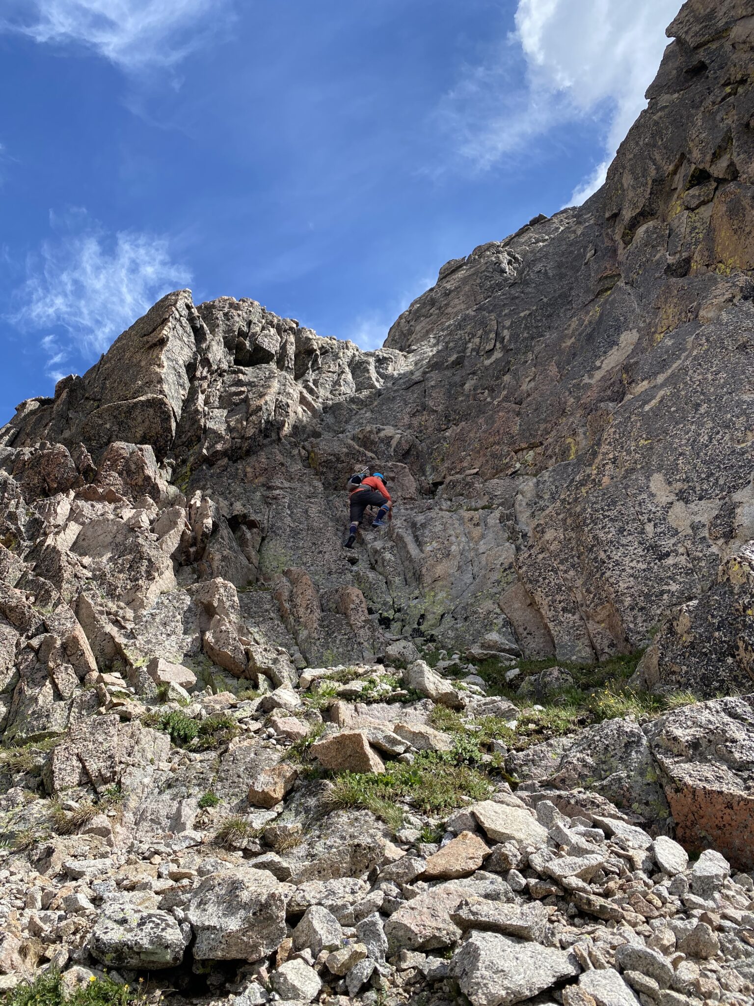
After working our way back down the scary downclimb corner, we regrouped at the ledge. I took another look up at the steep wall. It was indeed steep and exposed, but it appeared to be low 5th class. Moreover, the more I looked, the more obvious the way up seemed. There were some bomber holds and foot placements on climber’s right, followed by some excellent ledges above. I suspected that if we could just climb the lower ~40 foot section, we would then be in good shape.
Steve agreed to try it, putting in a spectacular lead up the wall. As suspected, once he was at the top he shouted down that it looked much, much better beyond. It went!
Me heading up the the crux pitch in McHenry’s Notch. Another trip report rated this as 5.3, which felt about right to me. All lower class 5 terrain is fairly subjective, but I think it was definitely harder than the easiest class 5 moves I’ve ever done. And there was a series of them. Thus, I think 5.3 is what I’d rate this pitch at as well.
Hey, buddy.
ABOVE: Video capture from just above the crux pitch.
In retrospect, I think we made a very good partnership. The combination Steve’s fearless climbing and my caution/desire to strictly stay on route led to success. I helped push us to stick to what we thought was the true route and Steve helped push us boldly upwards. I think these kind of complimentary styles are essential in a partner. I was really glad to have Steve there in the midst of some pretty sketchy moments. This section is one I’ll look back on fondly and with some good lessons learned along the way.
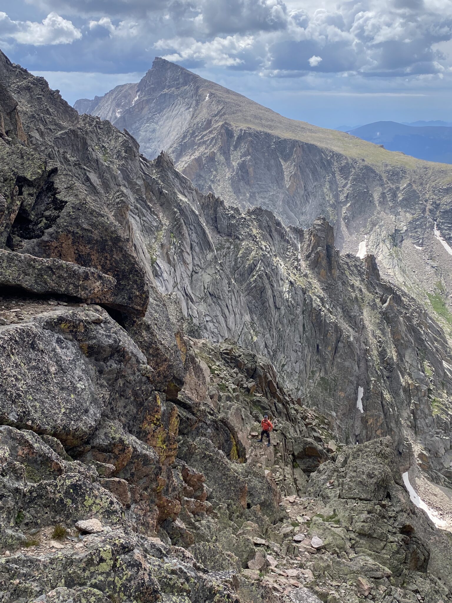
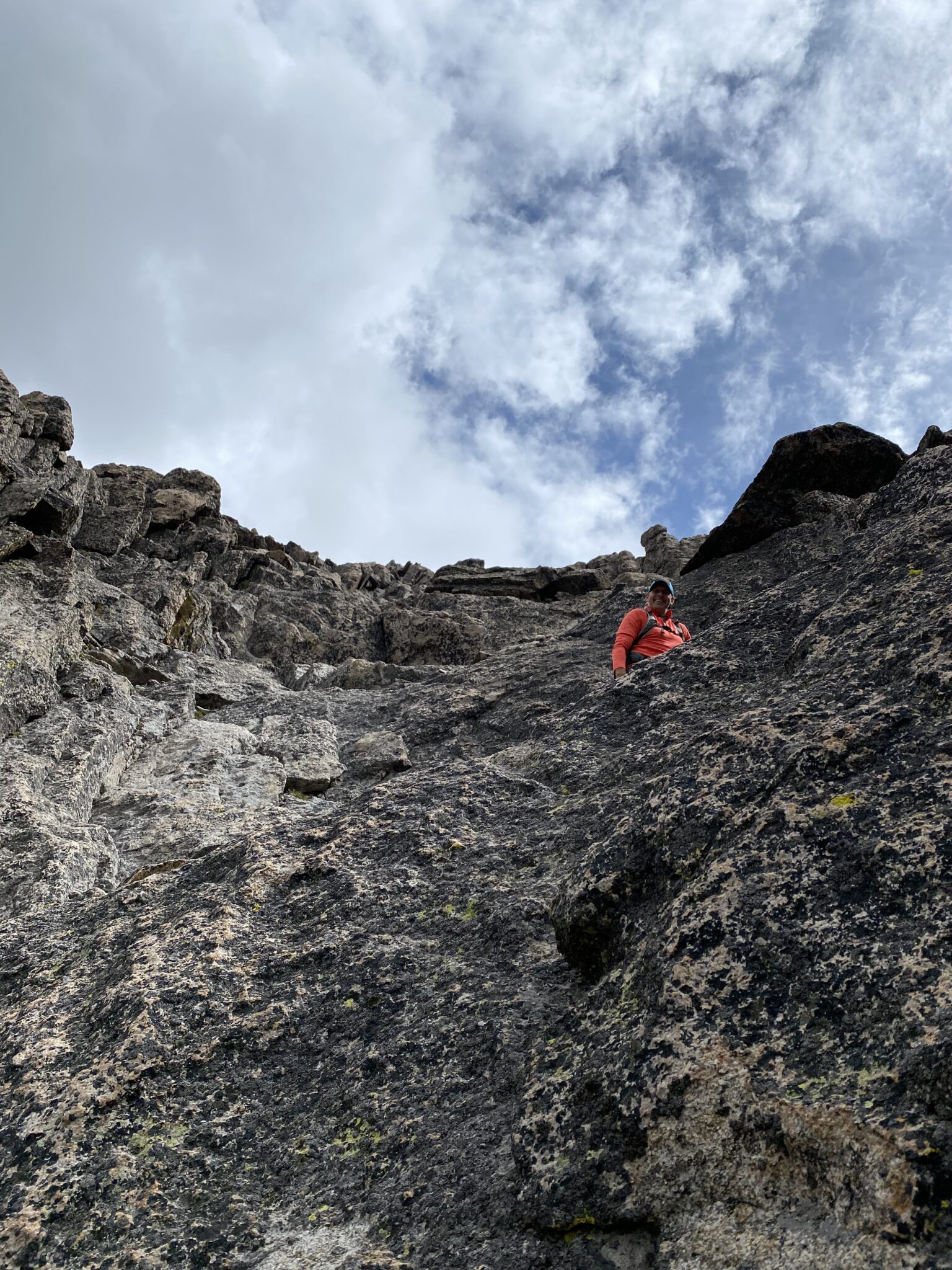
Anyway, after we got on top of the class 5 headwall the situation improved dramatically. The upper route laid back just enough that it pretty much instantly went from a terrorizing no-fall zone to a super fun zone of excellent class 4 scrambling. There was still plenty of spice to be found, but the lower angle and ample benches meant the exposure was far, far less. We never did find the rap rings, but it didn’t matter. The route became obvious. This was fun.
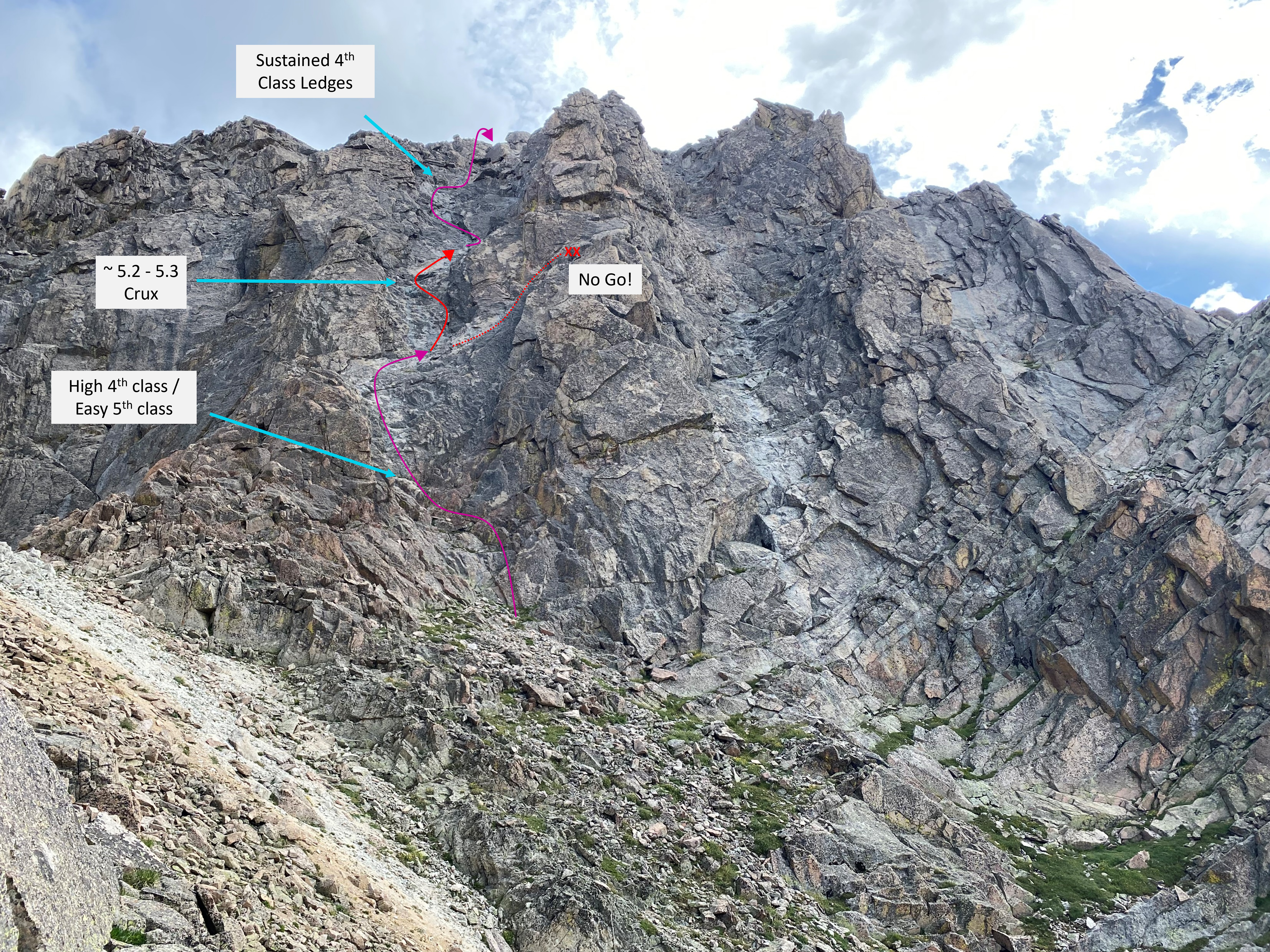
The same photo of The Notch as before, but with our route mapped in as best I can recall. (click to enlarge)
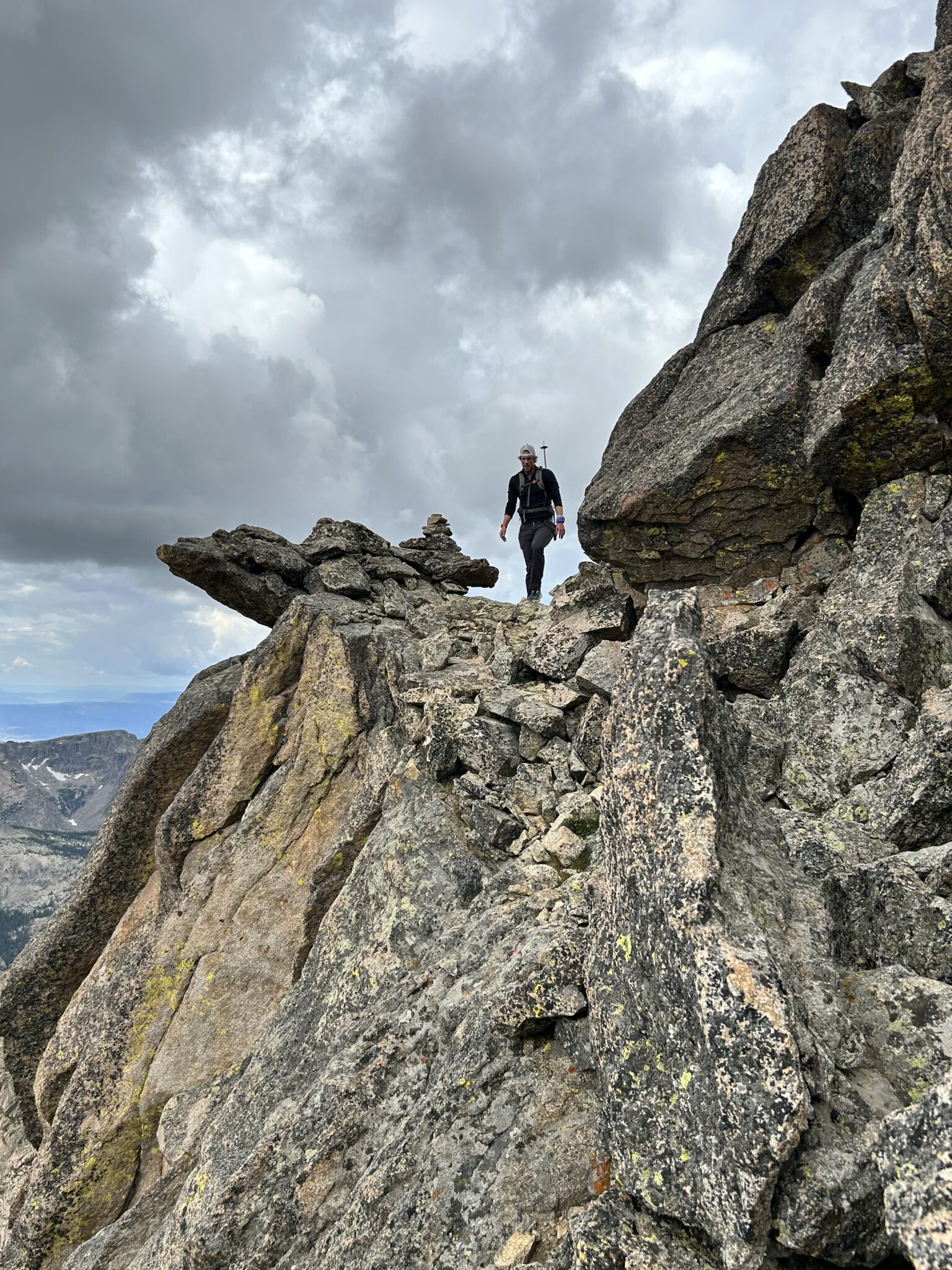
Steve modeling some of the class 4 ledges above the crux section. Although still challenging, exposed climbing, this section felt infinitely more fun and relaxed compared to what was just below. I think all this would be downclimb able too. The bottom ~125 feet of The Notch, not so much. At least, not for me.
Things culminated in dramatic fashion. We soon made our way to the long ledge that grants passage to the summit of McHenrys. This sweeping bench offered a wide, easy route to the summit with hundreds and hundreds of feet of air below. It is one of the coolest features I’ve done on a peak in a long time.
Steve modeling the incredible ramp that provides access to McHenrys summit.
ABOVE: Video capture of the magnificent walkway in the sky.
My turn on the bench now. Someone once remarked that the Broadway ledge on Longs is “neither broad, nor a way.” McHenrys ledge, on the other hand, was exactly both of those things. Passage came easy.
McHenrys had a summit register and everything.
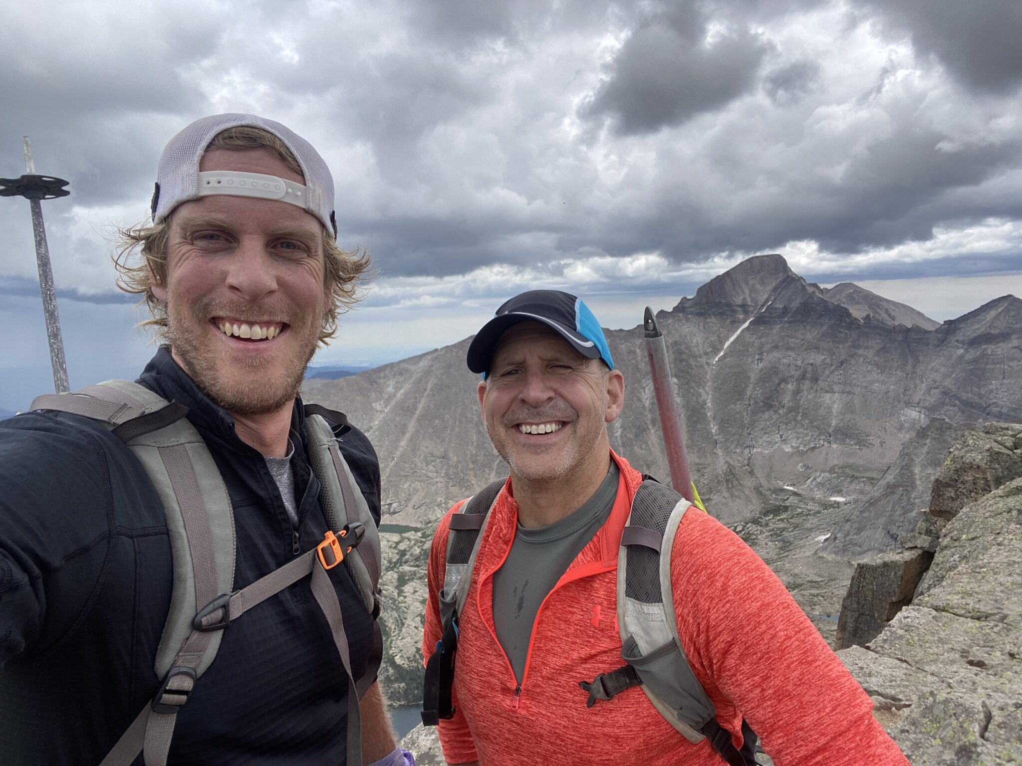
Great job, buddy!
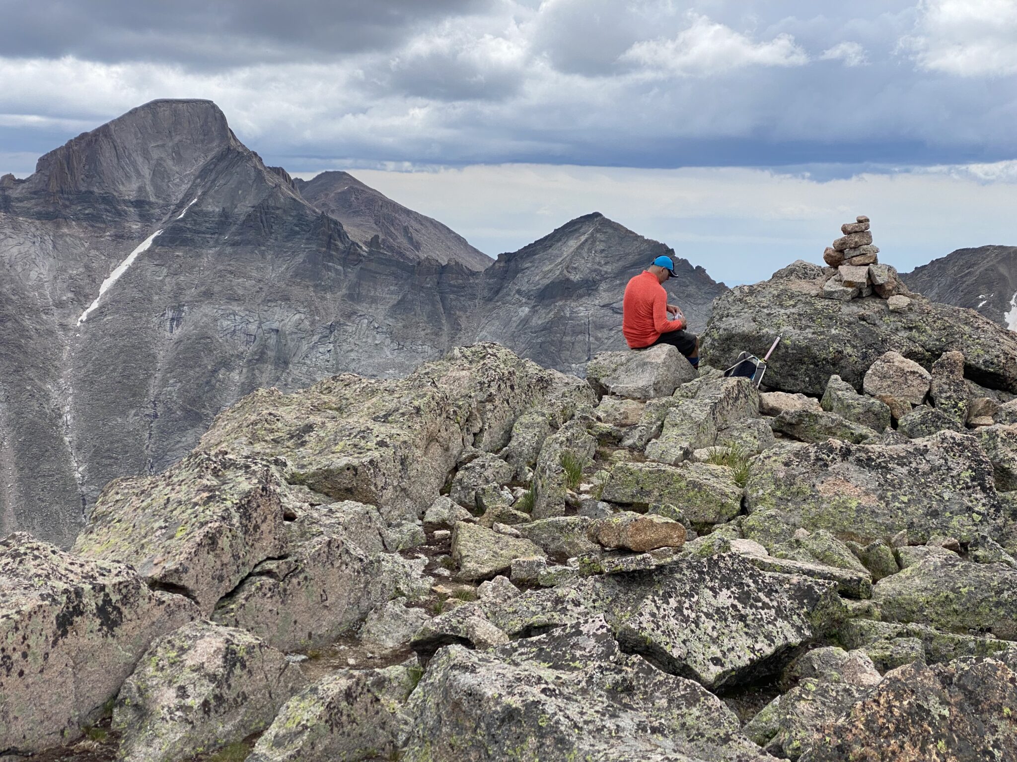
The views from McHenrys were the best of the day. The sweeping cirque beneath its sheer east face were stunning. Longs loomed large across the way. Although we still had a ways to go, the major difficulties were all behind us. We could finally take a breath and relax. The weather was holding off just enough so that we could enjoy it.
ABOVE: Final video, this time from the summit of McHenrys. The basin below is world-class.
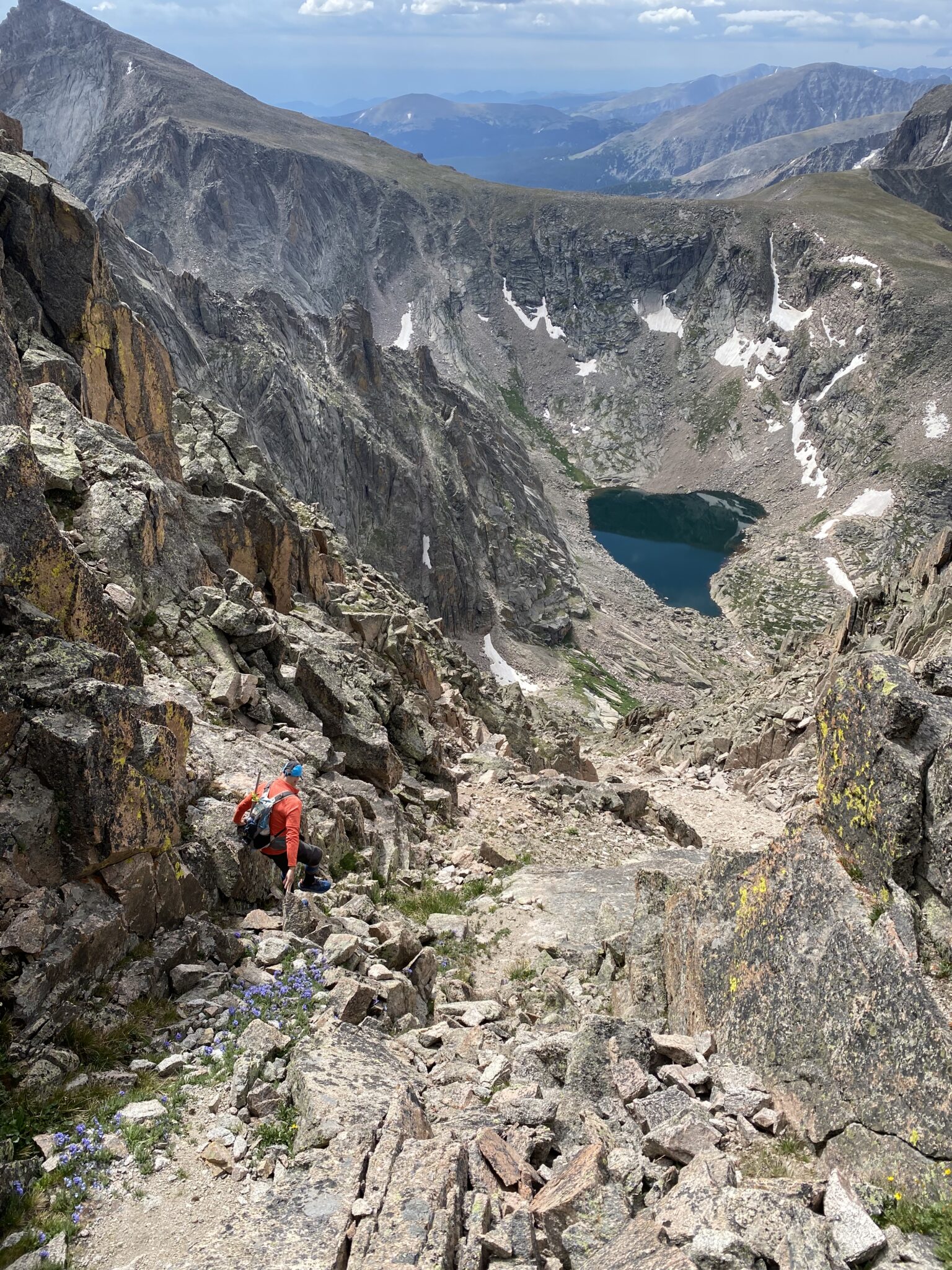
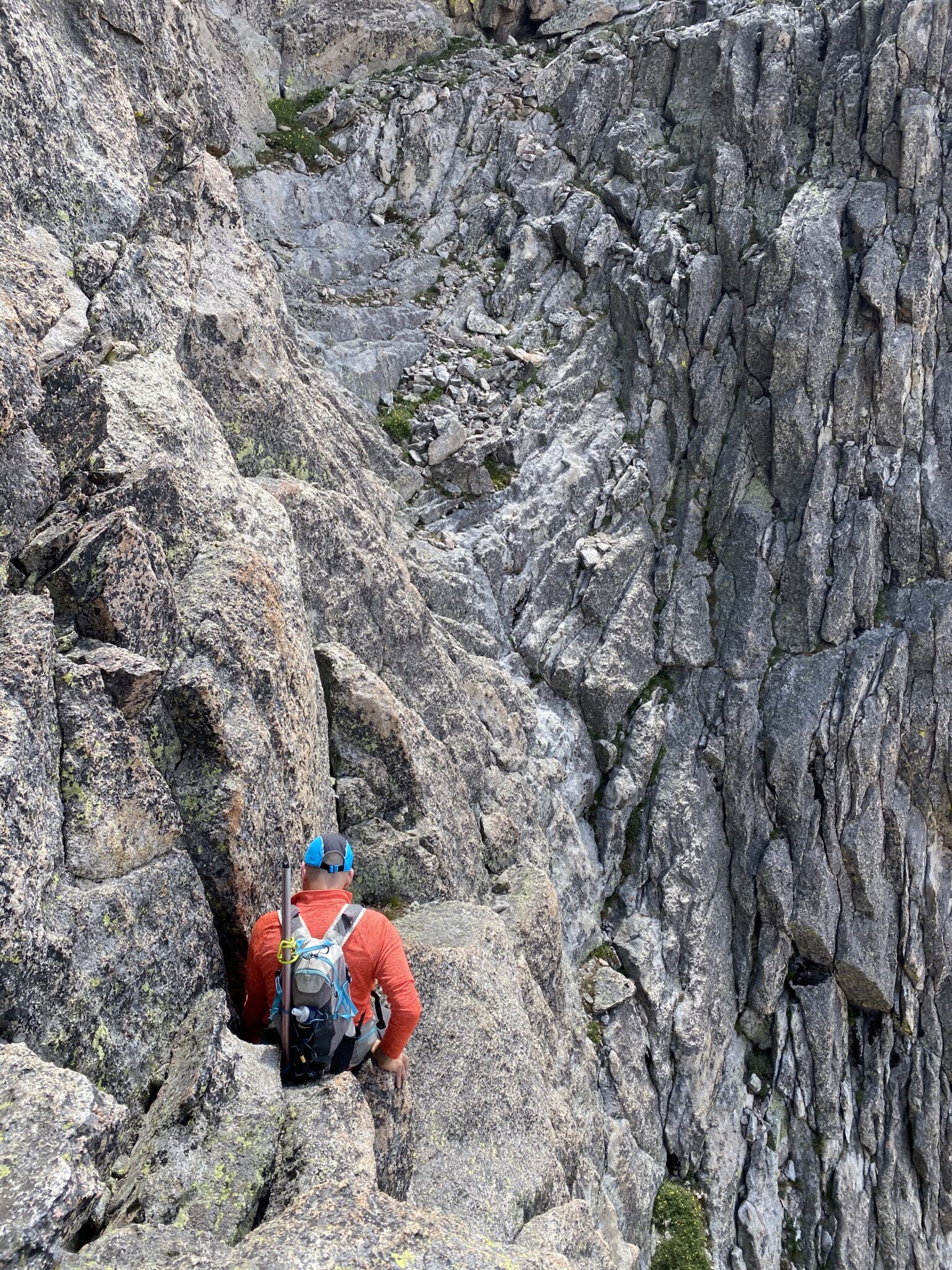
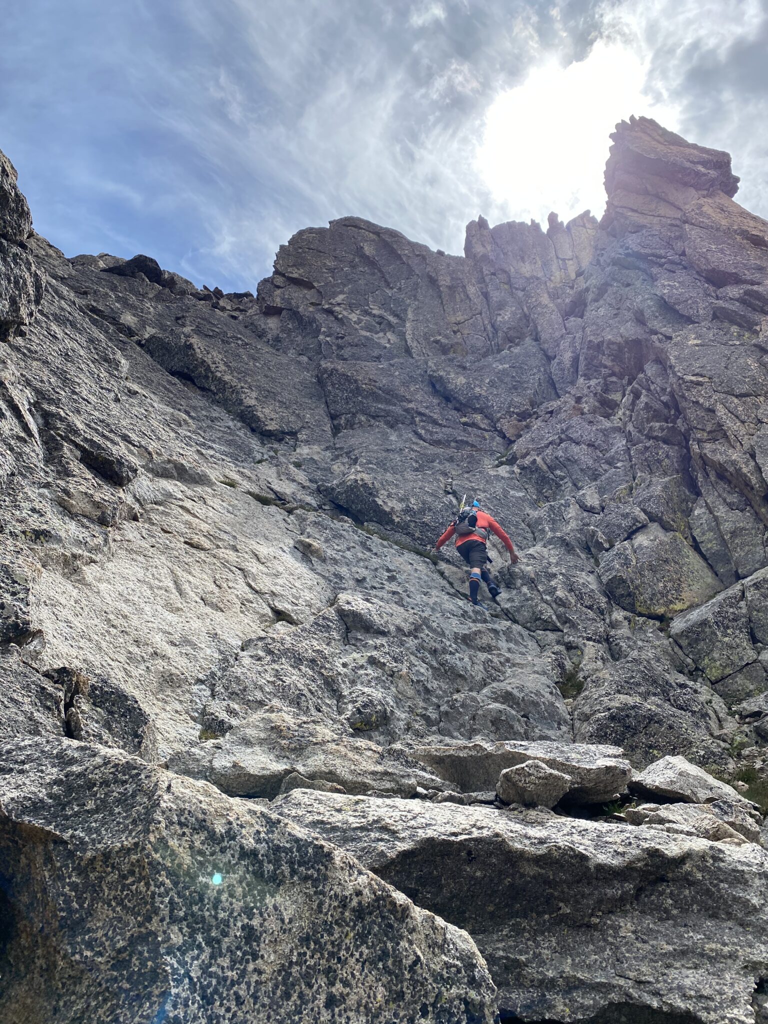
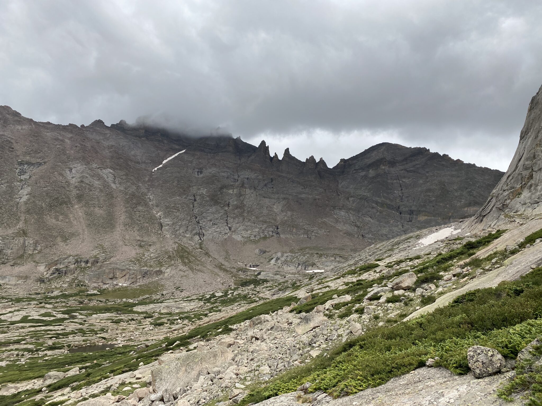
The next challenge was to descend down to Stone Man Pass. Steve had done this way back in 2005. So, although we knew it went fairly easily, we were more or less figuring out the route as we went. Thankfully there were many cairns and a pretty obvious line to get us down. The climbing continued at sustained class 3 and a bit looser now. There were plenty of choose-your-own-difficulty options along the way. This made things somewhat tedious.
But eventually we saw the profile of the stone man himself, meaning there was just one more “nasty” gulley Steve remembered to get down.
Pretty typical terrain from the summit of McHenrys down to Stone Man pass. I’m not sure I have ever noticed that black rock streak across Longs, however. Geology is cool.
The stone man himself.
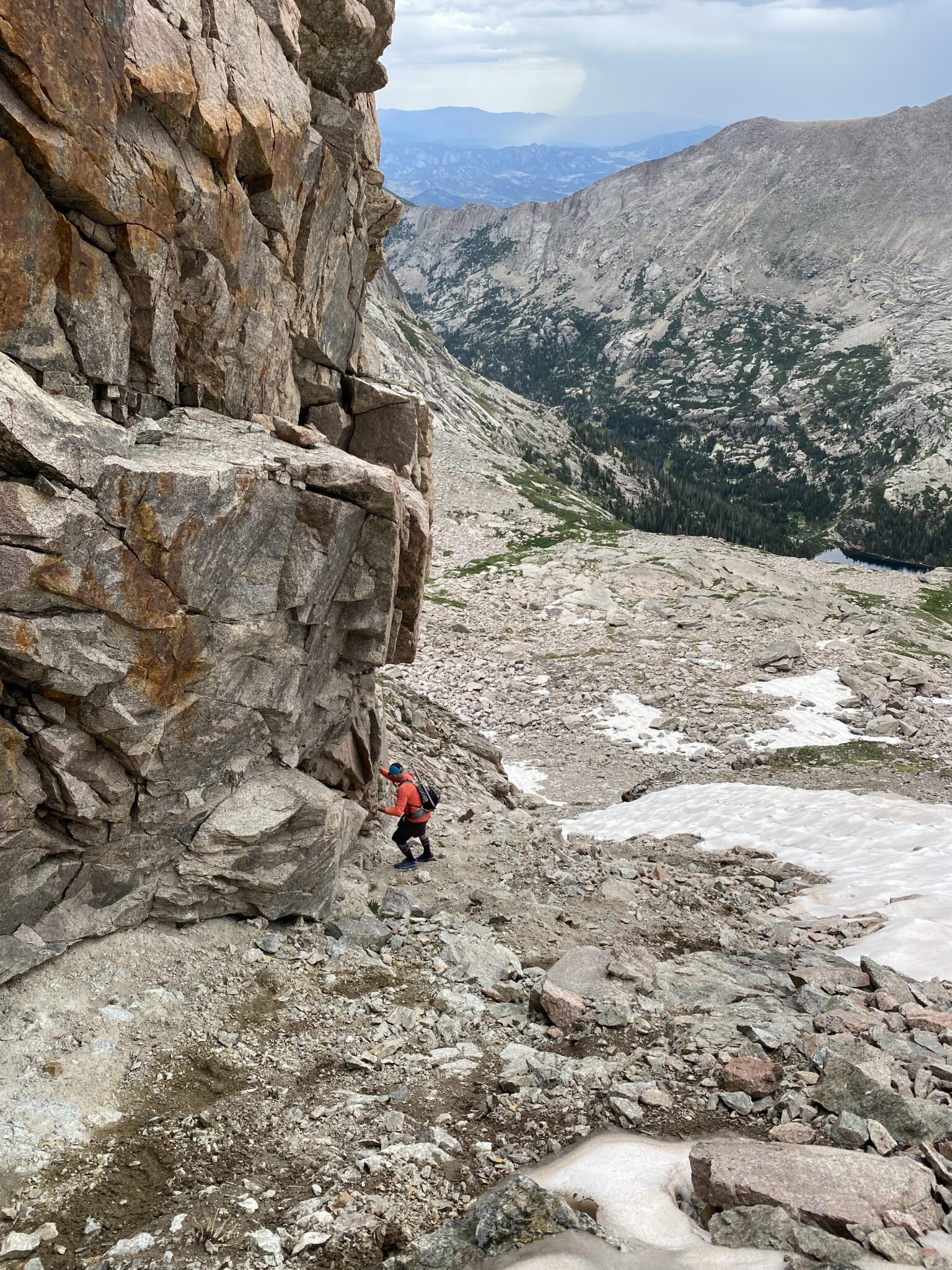
The descent gully off of Stone Man pass still had a lot of snow in it. And loose choss. We migrated climber’s left to hug the solid, dry rock in that direction. We had to be super careful to not knock anything on the soloist below. All this made for an annoyingly tedious passage to the bottom.
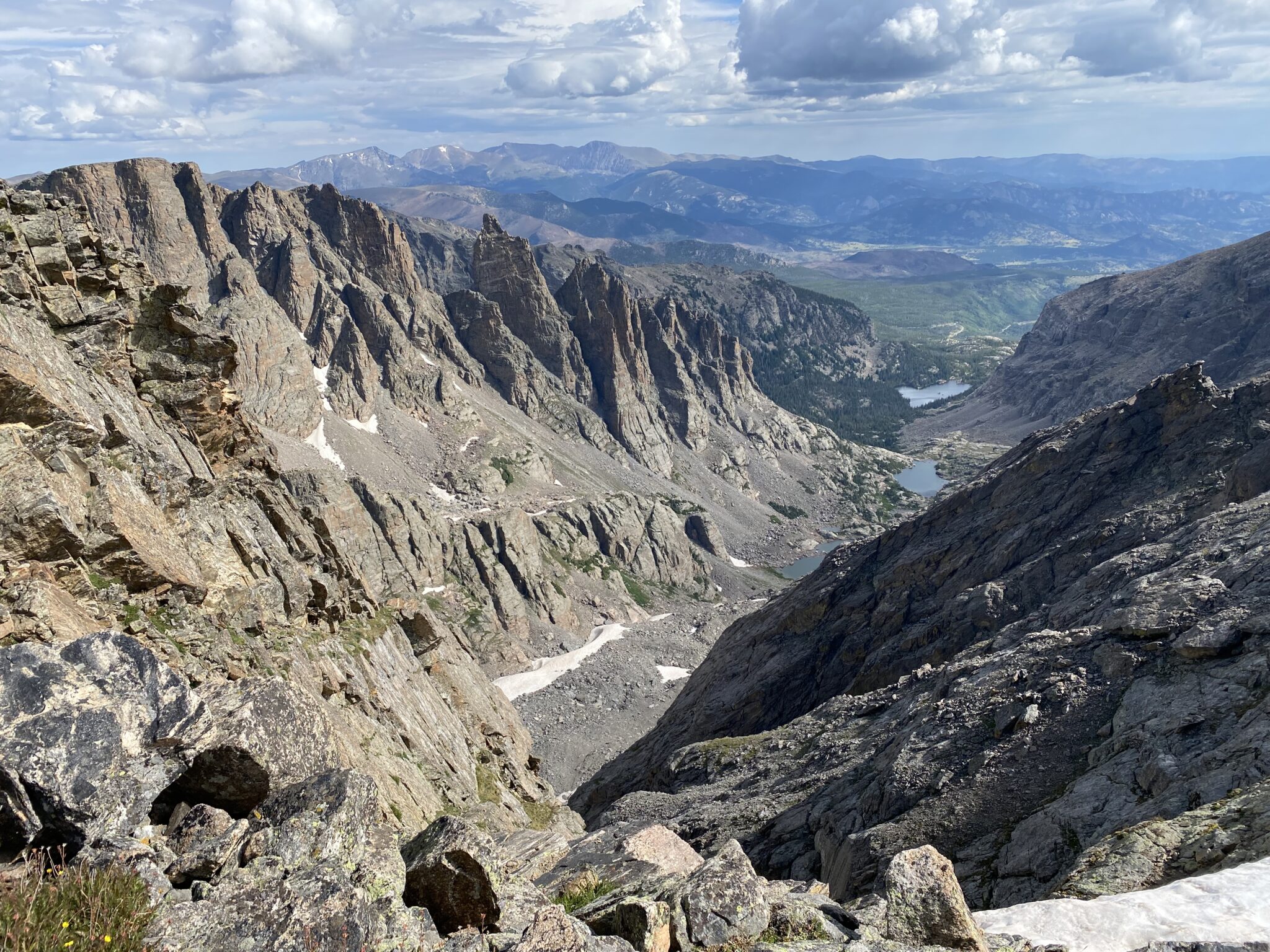
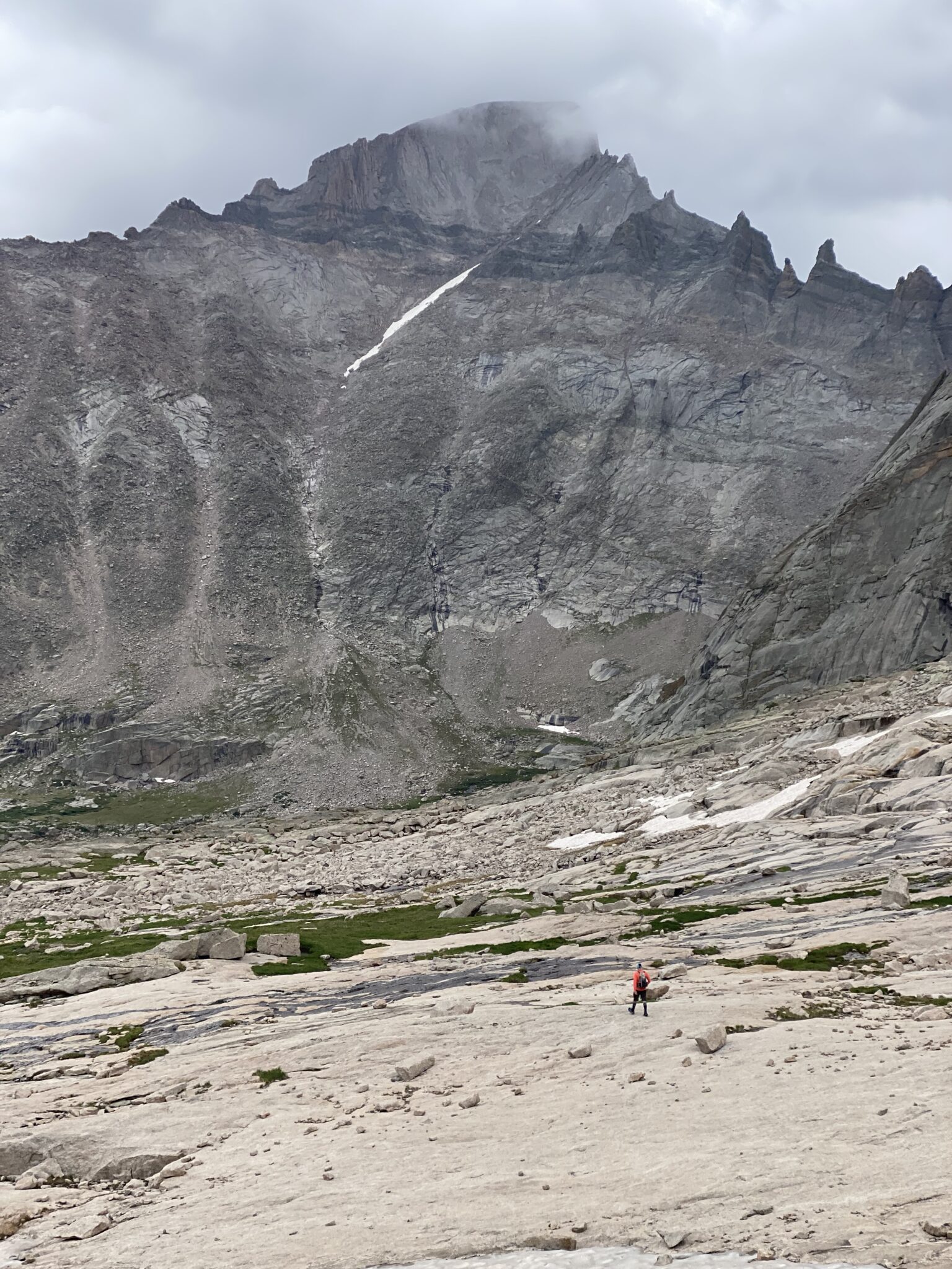
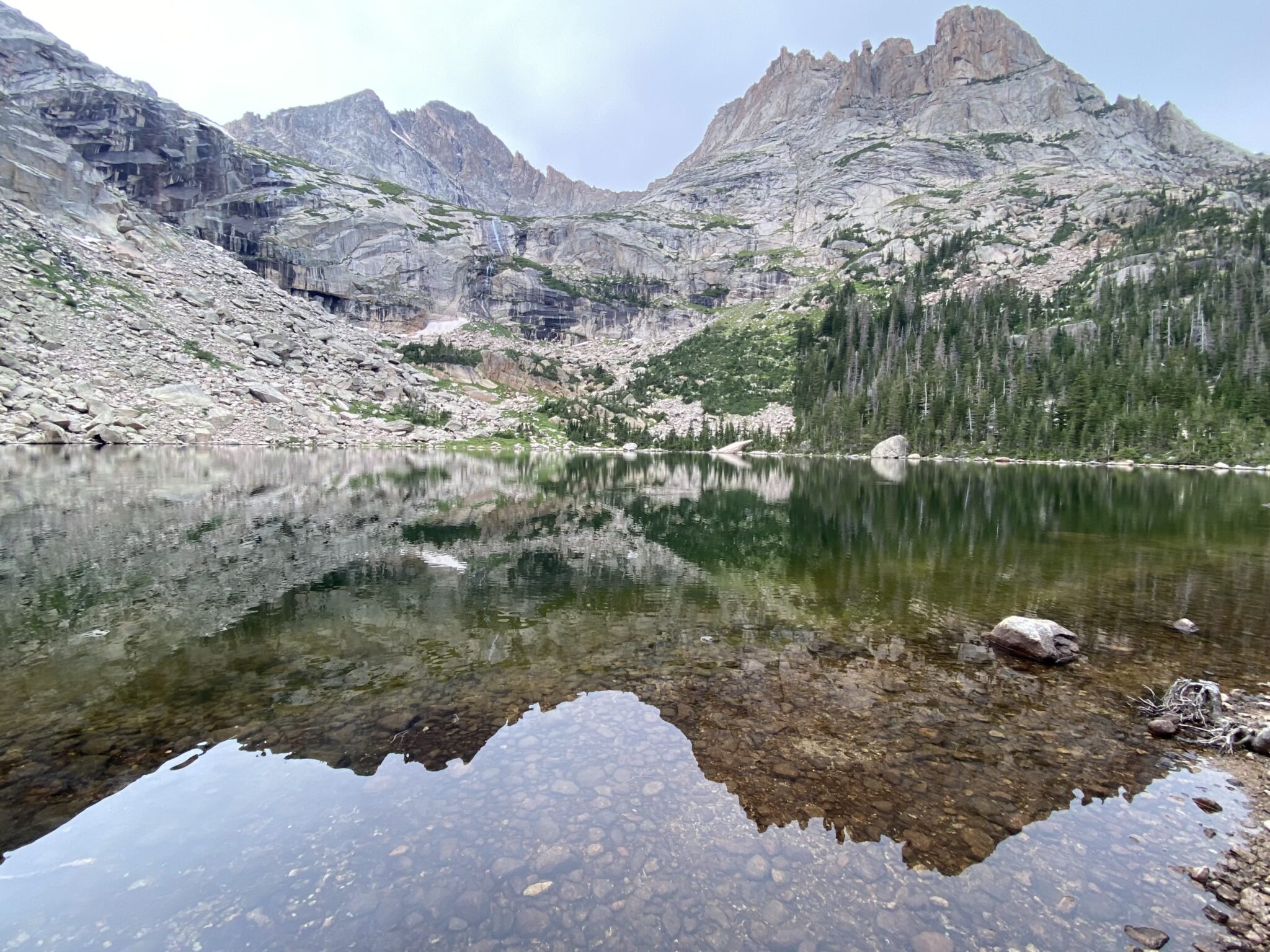
In a day full of pleasant surprises, the upper Black Lake Basin might have been the best. I didn’t really apricate how incredible the position was until I had walked for 10 minutes or so. After getting distracted by the relatively flat terrain of the upper basin, I eventually turned around. The views floored me. Sweeping cliffs and incredible vertical relief surrounded us in almost every direction. Surely this must be the best basin in the park, if not the entire state.
You probably know what that is.
McHenrys east face.
Mchenrys-Spearhead traverse. Sounds like that is a very worthwhile objective for another day.
We dodged weather all day, but not so for Longs, it seemed. Looked wet and rowdy.
Views aside, I’m glad I didn’t know what a zig zag it is to get from the upper basin back down to Black Lake. I’m 99% sure there’s a cliffy-er shortcut, but we didn’t bother to find it. Instead we just enjoyed the long reach around back to Black Lake. We were quite eager to filter waters and hit an actual trail again. Something we had not seen since Flattop many miles ago.
At Black Lake. Not pictured: the thousands of assaulting mosquitoes. Can’t imagine how some of those gapers we would soon pass felt when encountering these. Black Lake is like, the perfect spot for some random RMNP visitor to seriously over-extend themselves thanks to the prospect of a perfect lake at the top. I can only imagine the sheer horror of some random wife/girlfriend who had been forced up by her significant other, only to be attacked by the mosquitoes at the lake itself. Sounds pretty awful.
All that was left to do now was make quick work of the long trail home. Down low we took the climber’s trail shortcut to avoid Alberta Falls, further limiting the distance. Bear Lake was as bustling as ever, but we were quite content upon reaching the vehicle. I couldn’t help but chuckle at the parking attendant who asked us to, “please use the sidewalk for your safety.” Thanks for always watching out for us.
All in all its pretty much impossible to not find something to love about this partial Glacier Gorge traverse. It’s got a bit of everything: easy trail walking, talus hopping, sensational views, hours and hours above 12k, thrilling climbing, multiple summits, and sensational views the whole way.
I am very thankful for how our day worked out. Everything just sort of fell into place, making for a great outing. Spending time with Steve with the cherry on top. It had been far too long since we got out together. I’m guessing we’ll both look back and call this one a top trip from the whole year.
Thanks for reading if you did. Hope to see you next time out on the divide!
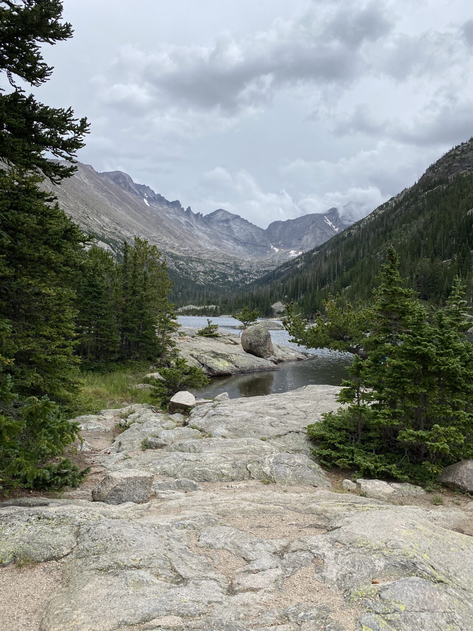
One last look all the way back up the gorge from Mills Lake.
Nice write up! This day and Middle Palisade were my only two “real mountaineering” days this summer. You captured the grand scale of the mountains we traversed and I’m impressed by the pic with our route up McHenry’s. That was a great bit of teamwork! Thanks for the company and the report.
Good teamworking indeed, Steve. Let’s make more of them happen. Thanks again for an awesome day out. Good luck with back to school shenanigans!
That climb up McHenrys look sweet! Have you done the Arrowhead to McHenrys route? That was spicy too.
I actually thought about you and that outing, JB. That’s the one where you hit real freaky ice, right?