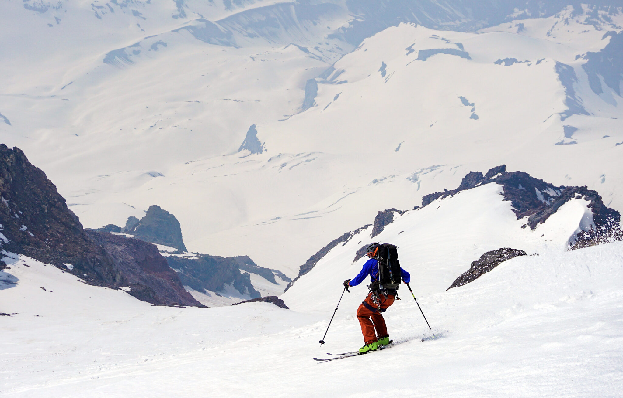
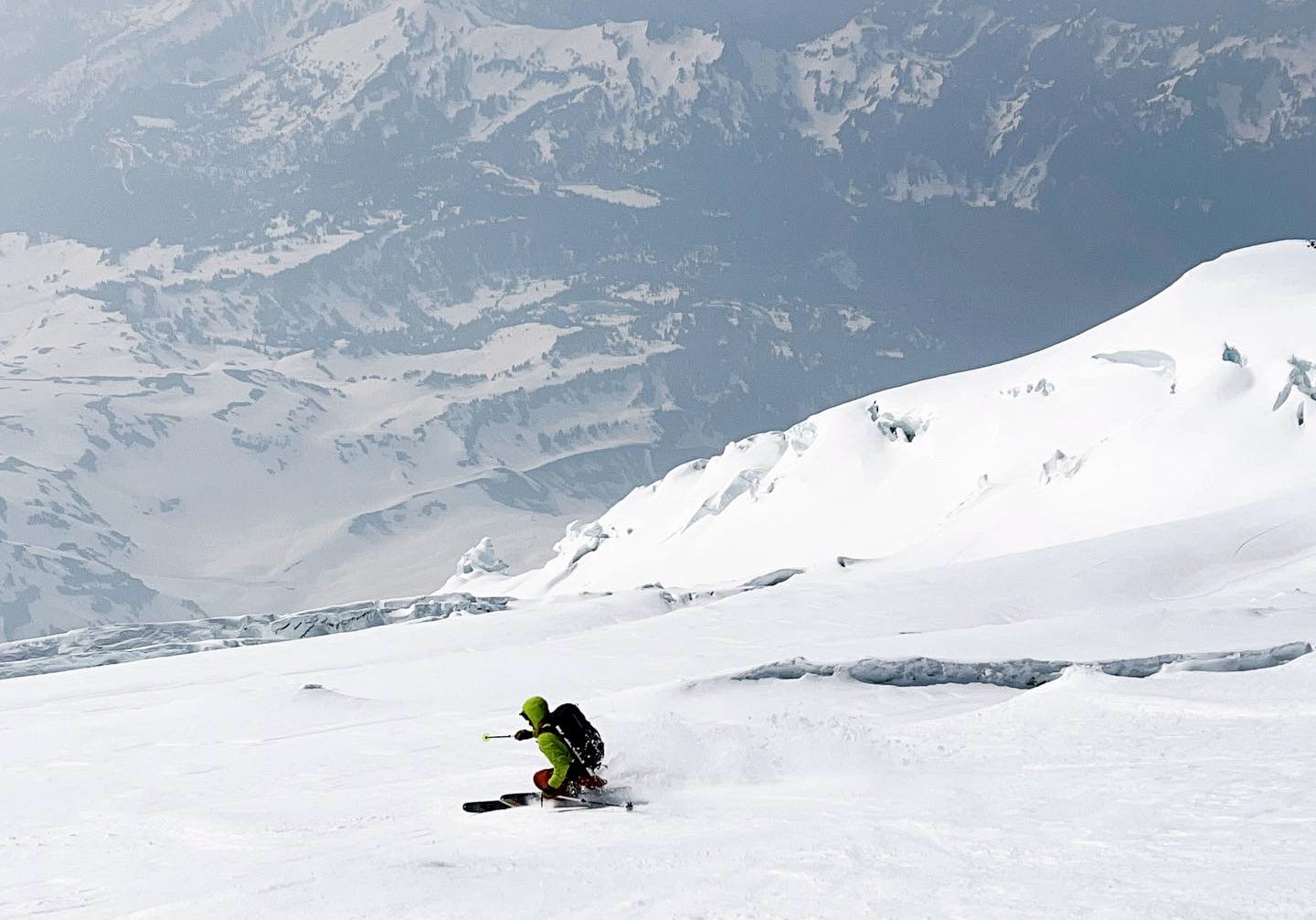
Skiing into the top of the Fuhrer Finger on May 18th. Click photos to enlarge.
In June of 2012 a few of us headed up to Washington and attempted a climb and ski of Mt. Rainer via the Fuhrer Finger. After spending the night camped halfway up the mountain we tried for the summit the next morning and soon found ourselves in a total whiteout. Not fancying the idea of being in glaciated terrain with zero visibility we turned around some 2,500 feet shy of the top and got out of there. Then with most of the Pacific Northwest socked in for the following 8+ days, we gave up on Rainier and headed south for greener pastures. Ever since I had always wanted to return and finish the job, and it finally came to fruition 2 weeks ago along with an awesome crew in Dylan Friday and Nolan Amos.
The Fuhrer Finger is about as classic as ski routes come, dropping south directly off the summit of Mt. Rainier down to the Paradise Trailhead 9,200 vertical feet below. The route gets its name from the ~3,000 foot, 40-degree couloir that connects the upper-Nisqually and Wilson Glaciers about halfway down the mountain. Some sources cite the route as the longest continuous ski descent in the lower forty-eight, and it was a shoe-in as one of the lines featured in “50 Classic Ski Descents of North America”.
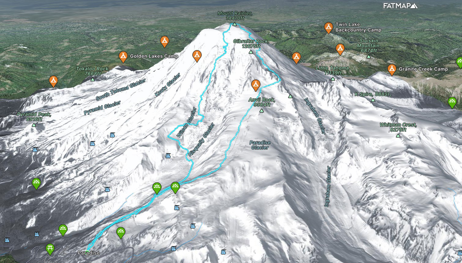
An overview of our route based on our GPX track.
Many parties prefer to break the climb up into 2 days and camp at the base of the Fuhrer Finger itself before a summit push the following day (as we tried to do in 2012). This method of attack has its advantages. First off, it’s hard to climb and ski 9,000+ feet in a single push and splitting it up into 2 days makes the effort more manageable. Second, it’s obviously nice to first climb up what you ski, especially in glaciated terrain.
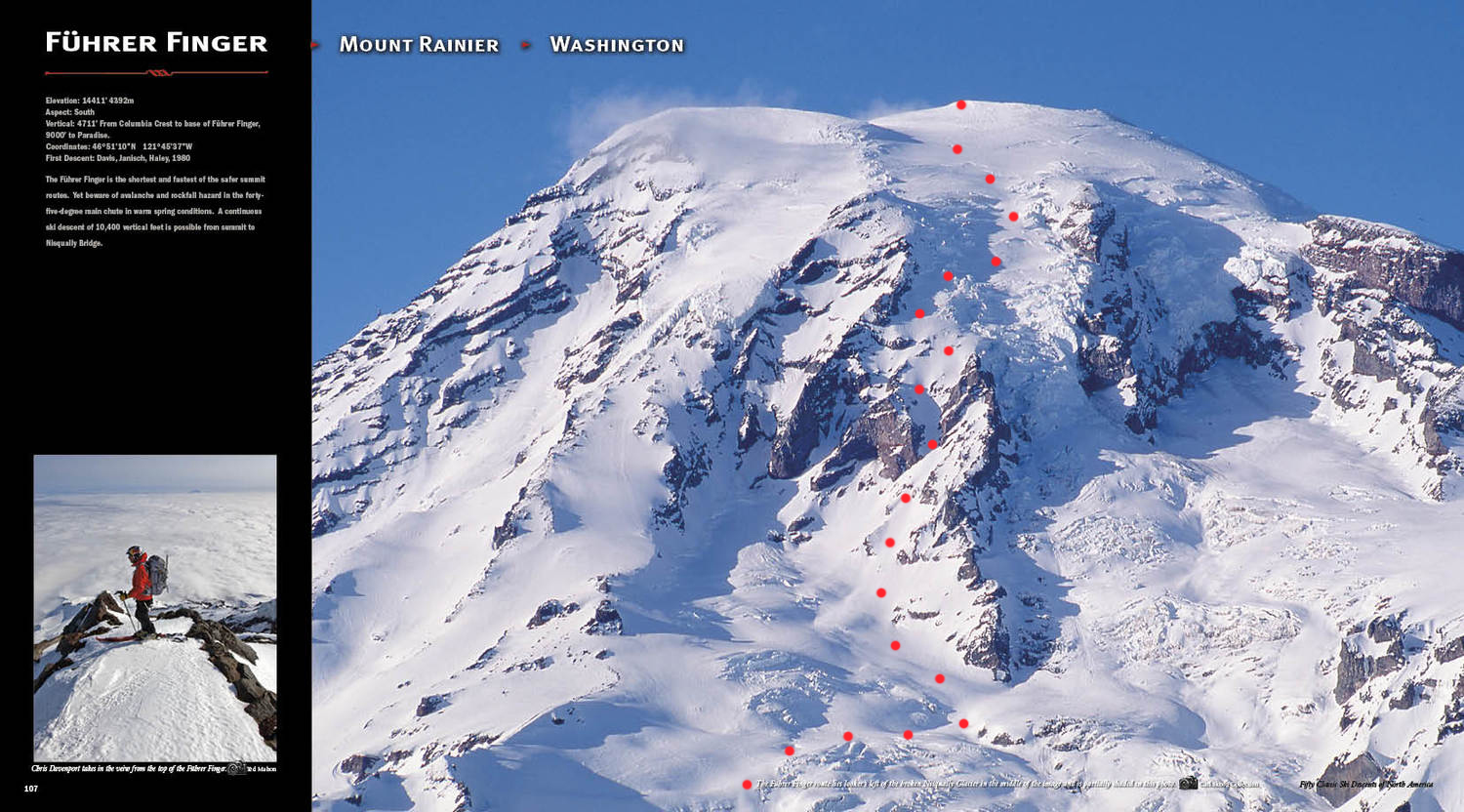
Rainier’s south side as seen in the 50 Classics book with the ski route marked.
Dylan, Nolan and I however were intrigued by the idea of a single day push. Ditching 15 pounds of food and camping gear sounded nice, and we were confident if we started early enough we could make it work. We also knew that the Ingraham Direct (the route used by most guided parties in April and May) was in great shape with all of the crevasses marked from Camp Muir to the summit. So we decided to start from Paradise at midnight, pack a little extra food and water, and go for the up-and-over in one shot.
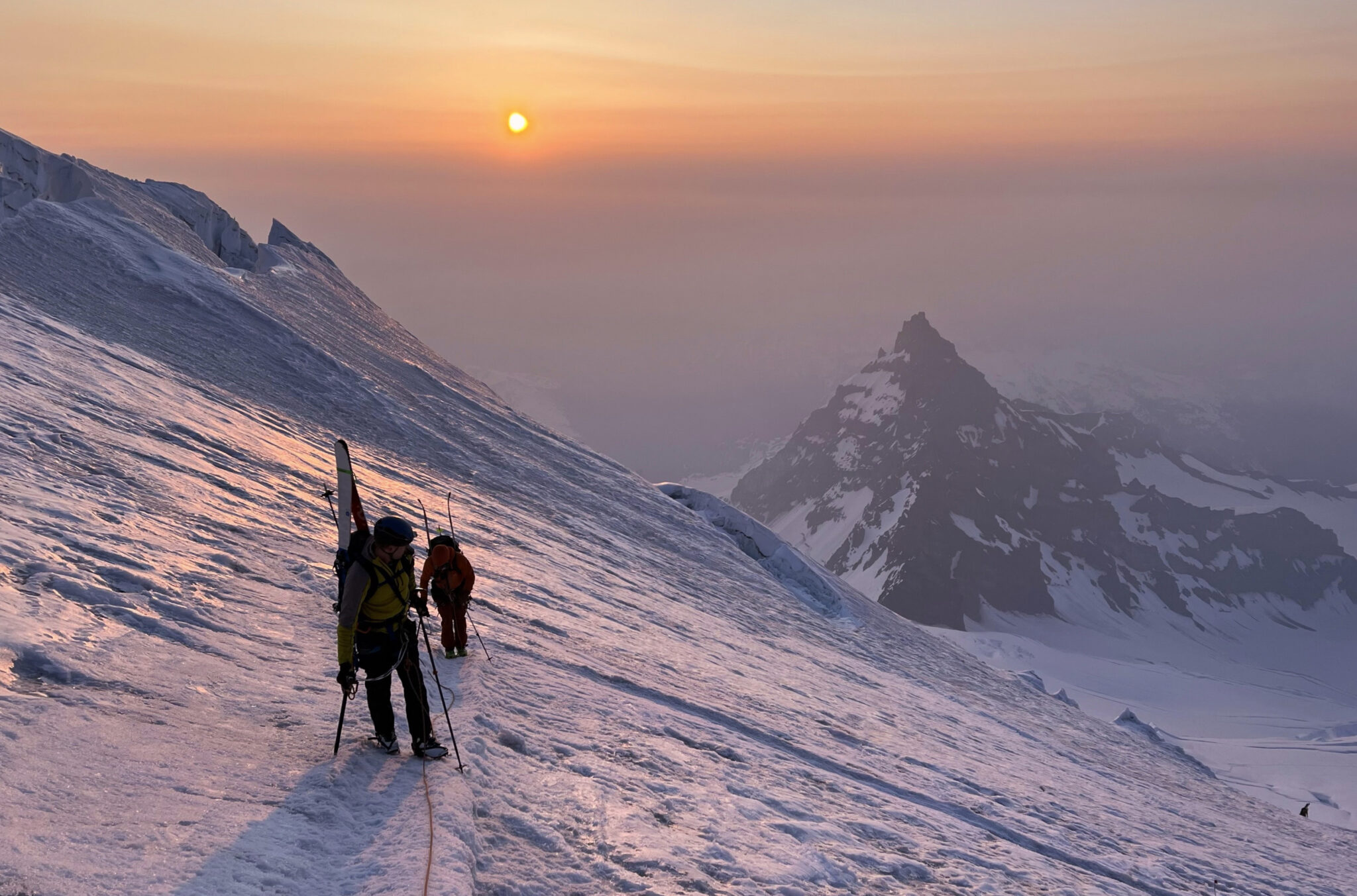
Just below Ingraham Flats about 5 hours into the climb. That’s “Little Tahoma” in back.
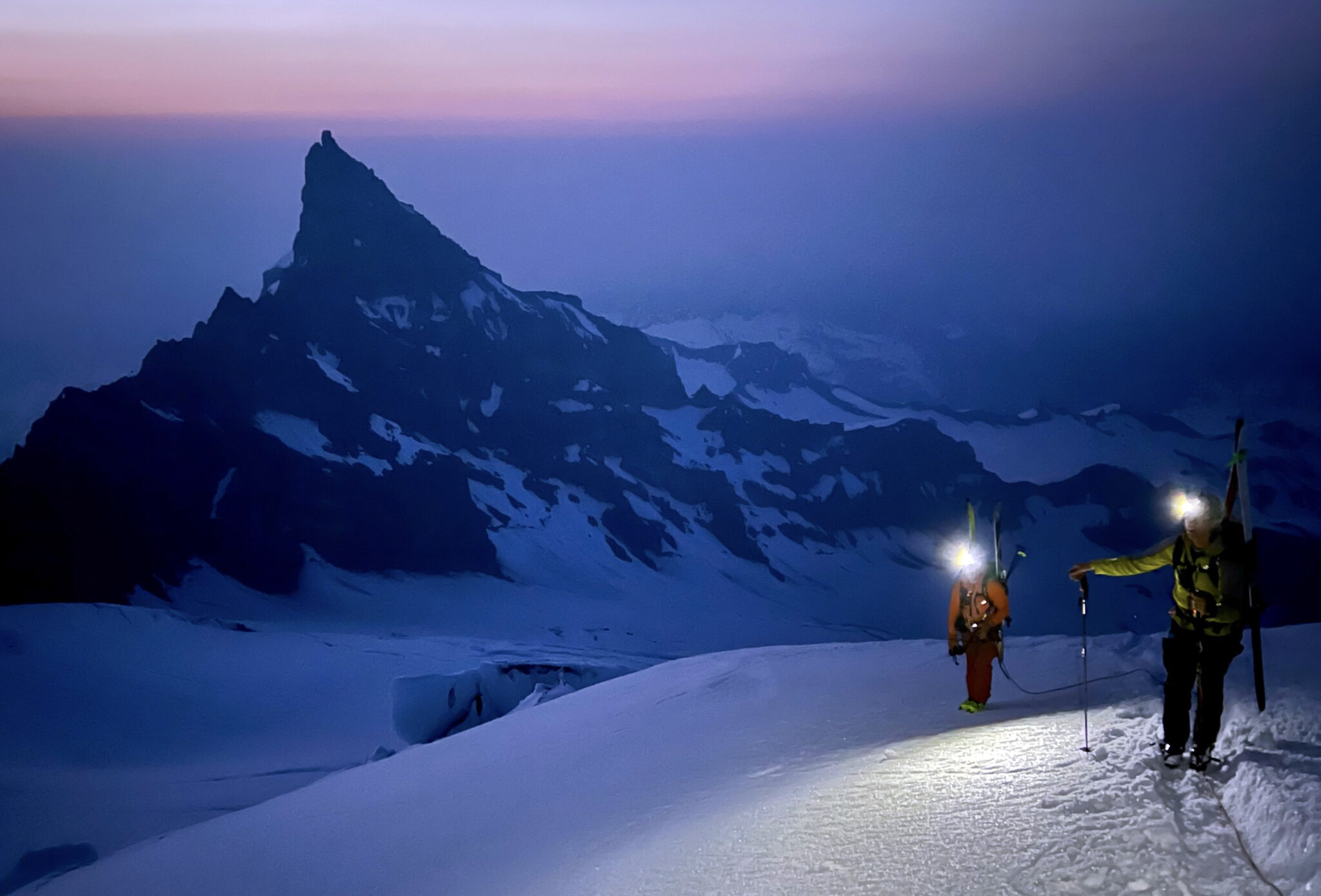
The first several hours from Paradise to Camp Muir went smoothly. It’s amazing how easy skinning uphill feels at 5,500 feet of elevation. Navigating entirely by GPS in the dark made the miles and vert go by quickly too, as we kept some light banter going and maintained a relaxed but focused pace upward into the night. With clear, starry skies it soon became obvious the mountain was getting a solid freeze above 9,000 feet or so.
Eventually the snowfield steepened and not long after we pulled into Camp Muir at 10,100 feet. It was 4am and a few guided parties had just set off for the summit as a few more groups were stirring around camp, getting their morning rolling. We transitioned from skins to crampons, roped up and switched the radios on. After crossing the Cowlitz Glacier we turned westward through Cathedral Gap and traversed up onto the Ingraham Glacier just as the sun was poking over the horizon.
Sunrise on the Ingraham.
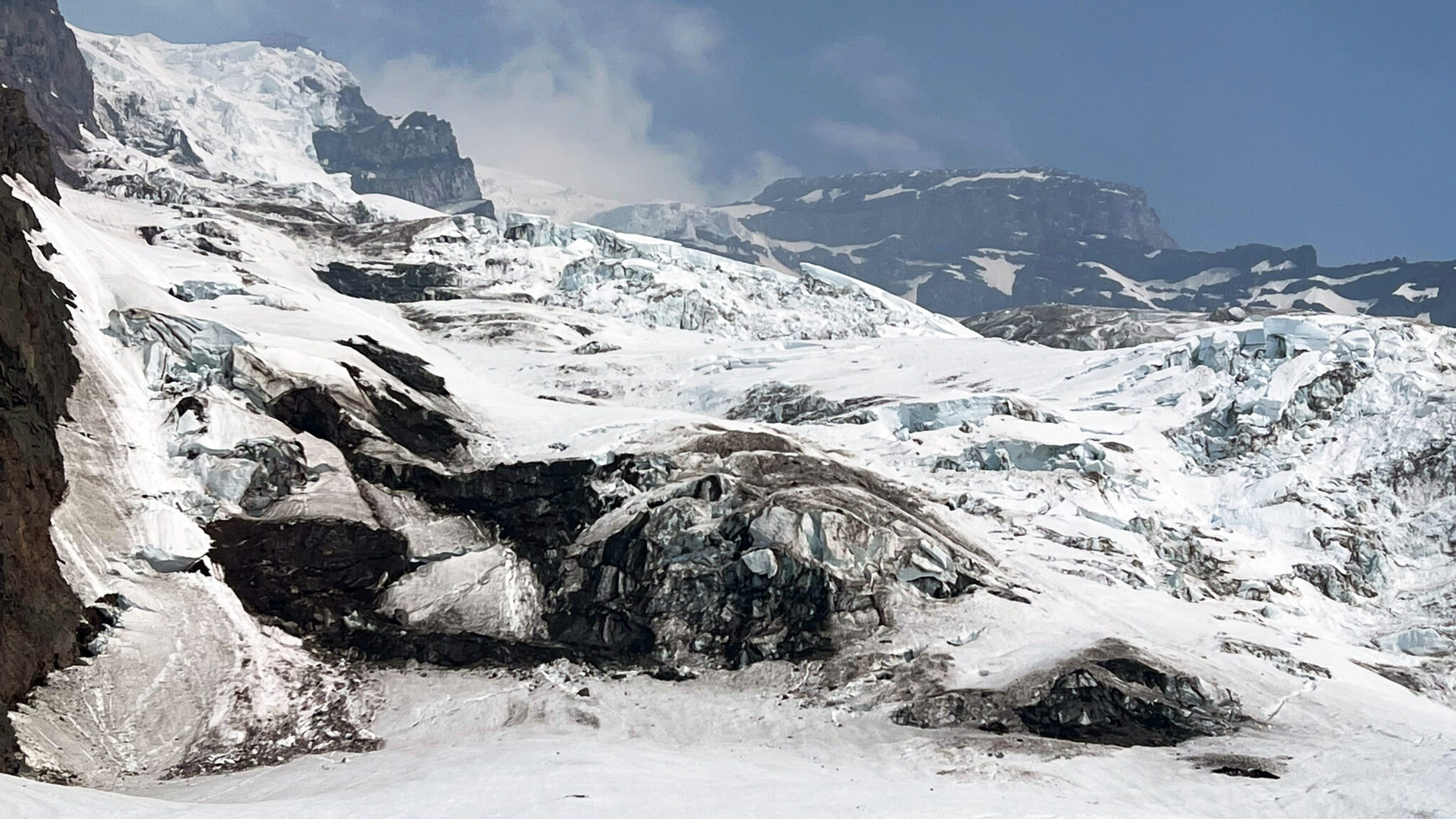
Morning light filled the sky just as we approached a series of crevasse crossings, which were nice to have some visibility for. Most of them were pretty small or had a ladder bridge spanning the gap, except for one crossing in particular which entailed walking over a precarious looking snow bridge on belay.
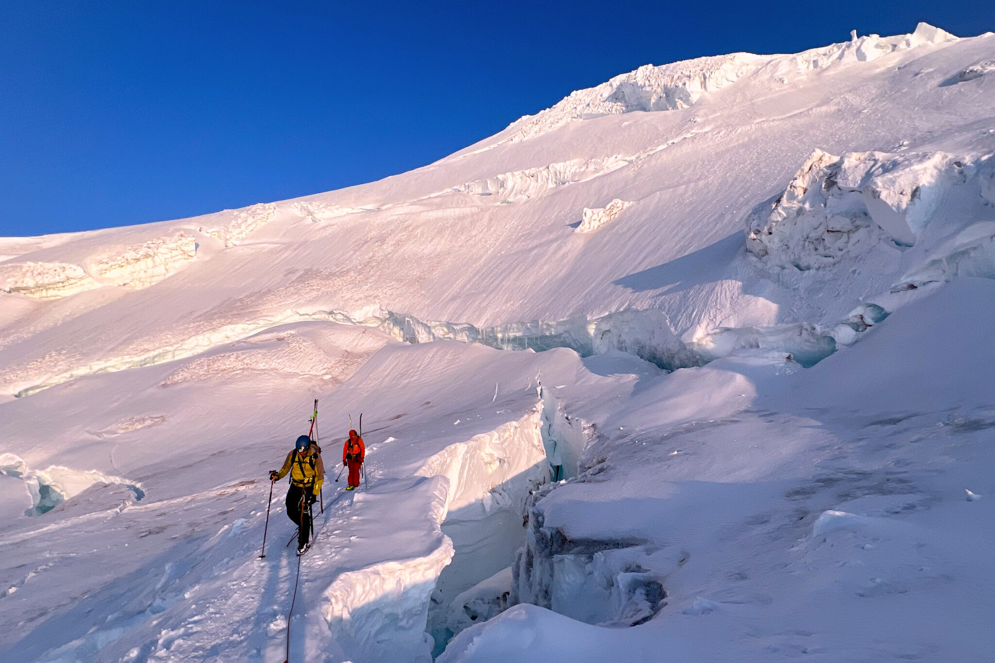
Crevasses on the upper-Ingraham preventing easy passage up onto the summit dome.
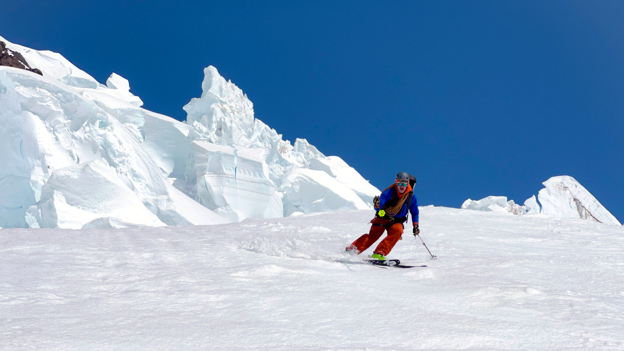
With more or less all the crevasse crossings in the rearview, we took a break in the sun to refuel a bit and take in the views. Rainier’s vertical relief over the surrounding landscape is pretty spectacular to say the least. It was also clear at that point we were in for a perfect day weather-wise, with minimal wind even above 13,000 feet and not a cloud in sight.
Crossing the summit crater just east of “Columbia Crest”, the true summit.
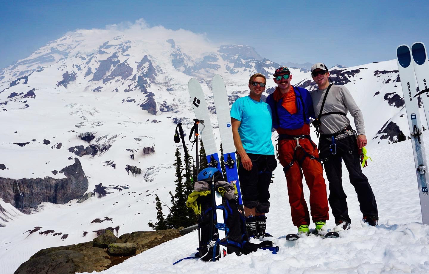
We pulled onto the summit at 8:30am and had it all to ourselves for over an hour. I think we were all wearing down a bit on the final thousand feet up to the summit but with plenty of time left before we needed to ski we were able to just take it slow and steady to the top. I was just blown away by how nice the weather was even at 14,410 feet. After a long break, downing some PB&J sandwiches and I think Dylan even took a nap, we clicked into our skis and pushed off the south side of the summit…
Off the top.
The initial turns were spectacular as the dome slowly rolled over to reveal just how big the descent in front of us looked. At about 13,000 feet the snow turned from hard pack to corn as we entered the Nisqually Glacier. We crossed paths with a group of 3 at the top of the crevasse field who had skinned up through it from the top of the Fuhrer Finger. So we knew the route went and had the luxury of following existing tracks down through the glaciated portion.
Into the upper-Nisqually. It was pretty surreal skiing corn through here.
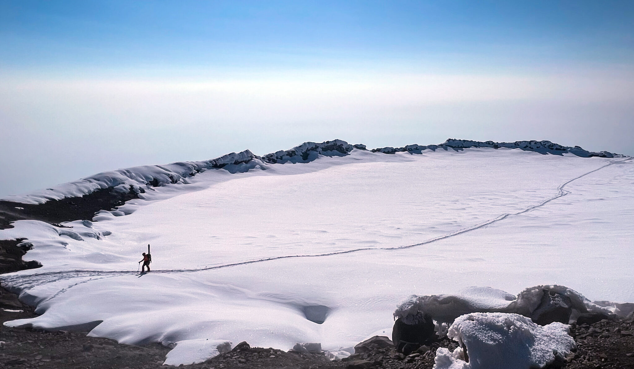
Nolan a bit lower down.
A short traverse to the west and we were into the Fuhrer…
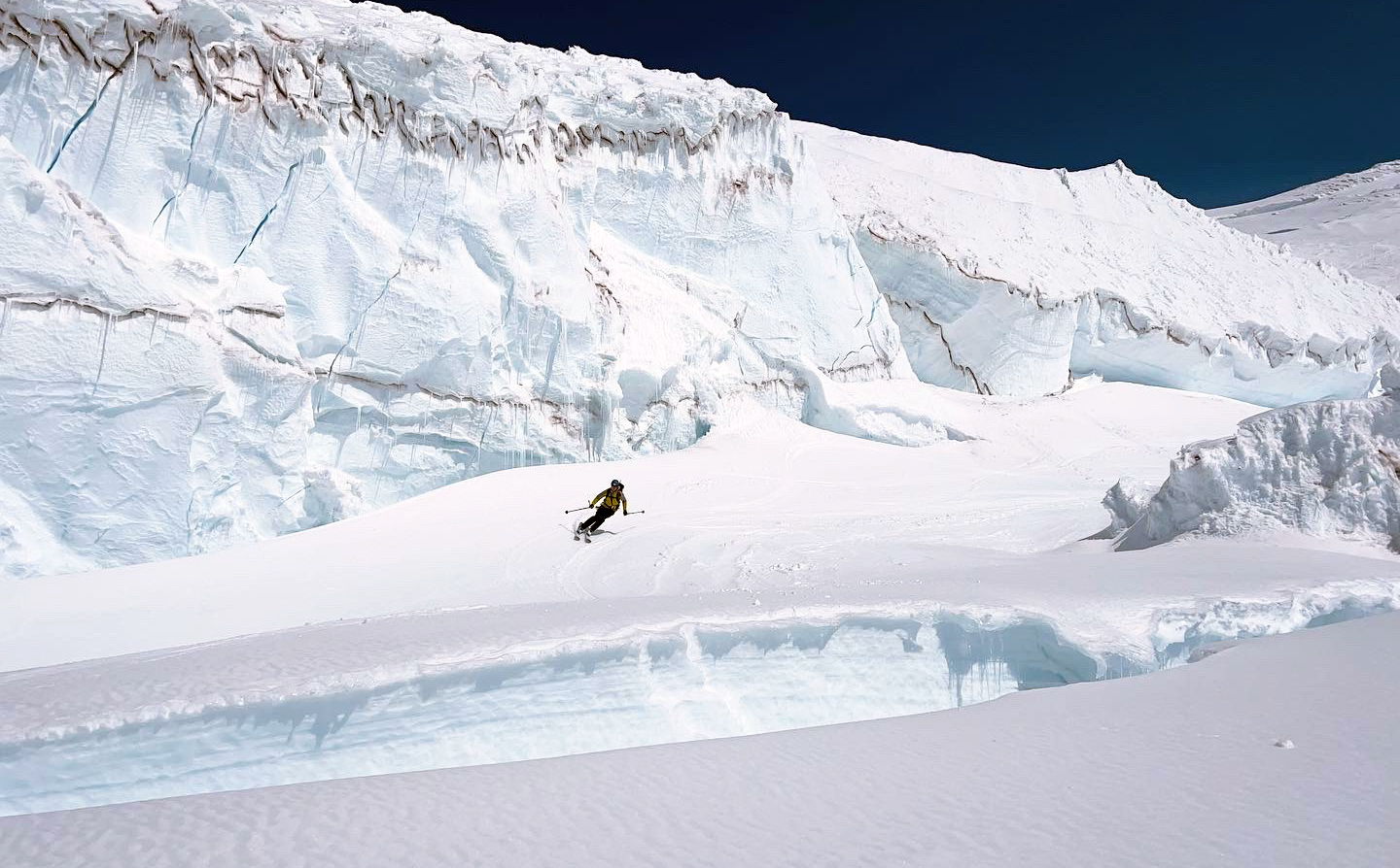
Top of the Fuhrer Finger, the least glaciated stretch of continuous snow on Mt. Rainier.
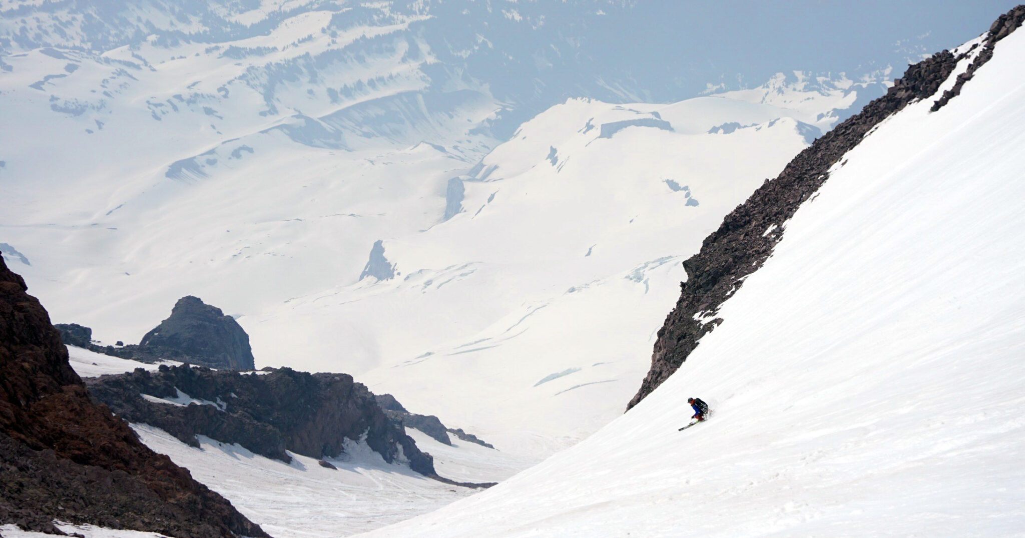
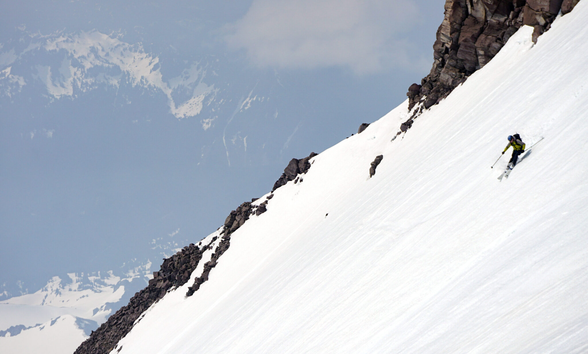
About halfway down. It’s a large couloir despite looking tiny when viewing Rainier from afar.
Once out of rockfall danger (the Fuhrer is pretty notorious for it in the spring) we stopped and took a long break to admire what we had just skied. It was absolutely scorching out, accentuated further by the giant oven that is the lower slopes of Rainier on a warm day. We headed down around the Wilson and after skiing about 6,000 feet of supportive corn, conditions finally turned to mush and our attention turned to just getting out of there in a timely fashion.
Looking up at the lower-Nisqually. Glacier awesomeness.
We surfed on down a few more thousand feet and after one final climb out of the Nisqually River Basin, it was a short ski down to the parking lot.
Done and done. What a day.
Back on down to Ashcroft we laid around on the grass outside the Whittaker Bunkhouse in 80 degree heat, pretty surprised to have actually pulled off our plan on the first day of the trip. We had gone up to Washington with Rainier as the only real objective for the 4 days, and with it behind us already we had 3 days left to do some more skiing.
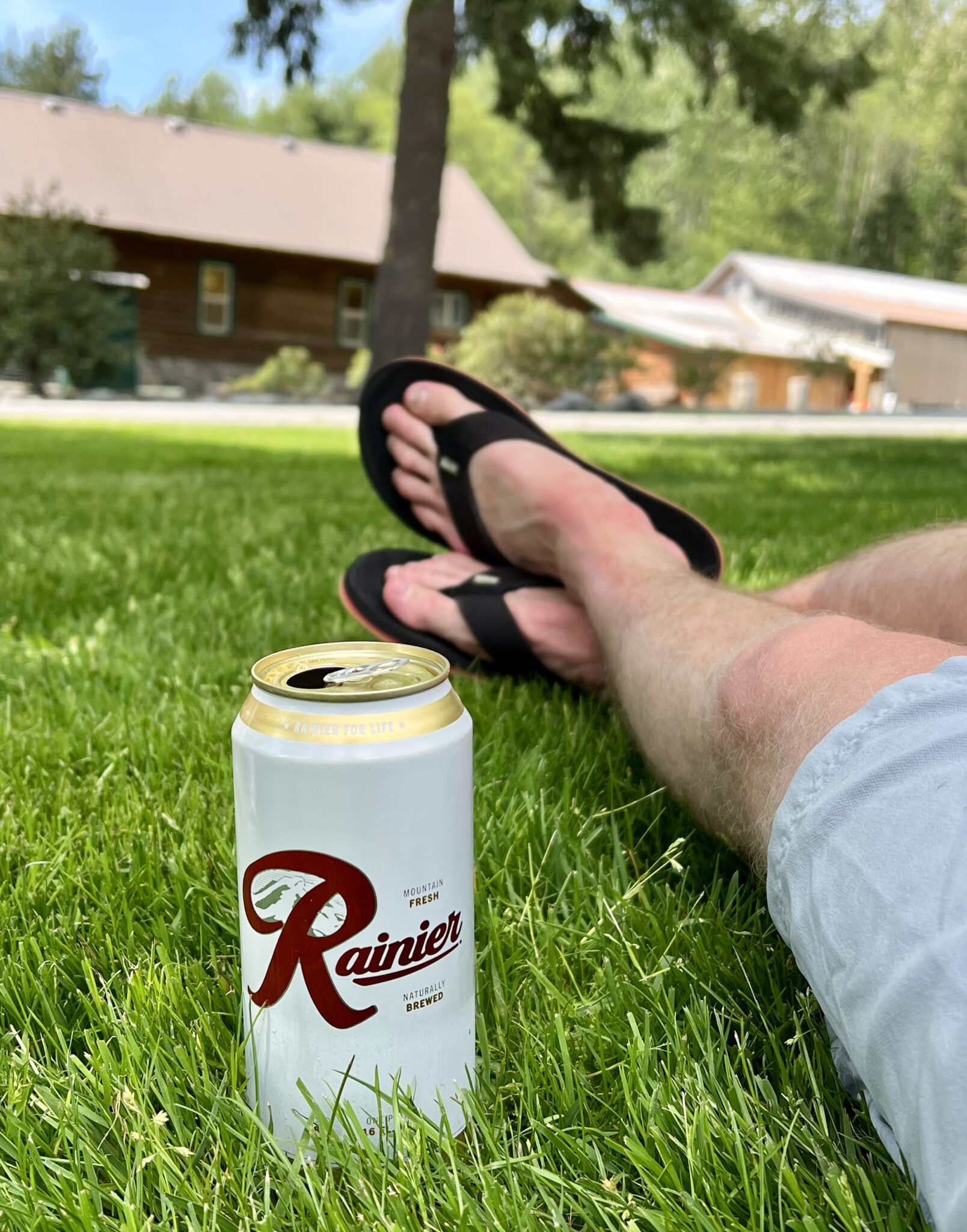
Time for a beer.
The next morning we loaded up and headed south with Mt. Adams next up on the docket. To be continued…
So rad, buddy! Congratulations!
Thanks buddy, and thanks again for the pickets and pulleys! Rainier sure is a special mountain.
Truly great stuff! You made great work on (what seems to be a rare) bluebird day on Rainier.
Ran into a guide in the summit crater who said in 80 some odd summits of the mountain, it was a top-5 day he’s had up there. Seems like most of May was bluebird in the PNW and rainy/overcast here in Colorado.
Nice work man. Happy for you and the redemption on this one. Amazing route and pics!
Thanks Zam! Felt good to get back up there and get it done 🙂